I had been thinking about pack rafting trips that might work in the upper area of the East or Middle fork of the Chena for most of the summer, and finally things came together. Our plan was to start from Chena Hotsprings, hike up to Far Mountain, then traverse down one of the many ridges down to the East Fork, then float out to Chena Hotsprings road and bike back to the hot springs. Ms Marsh, Tom, and I left the hot springs a little before lunch time and started hiking up the Far Mountain Trail towards Far Mountain. Alas, on our first try we missed the start of the trail and wandered around a bit before getting on the correct trail. The trail is surprisingly beautiful.
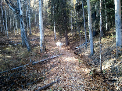
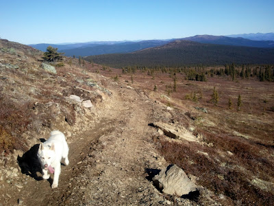
The trail started out on a ATV trail, but once it hits the ridge the ATV tracks die away and fine alpine hiking begins.
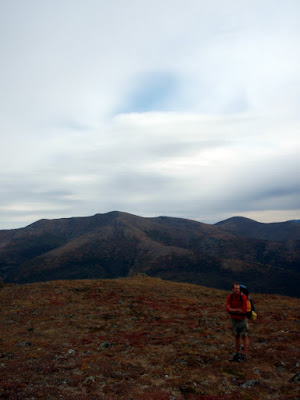
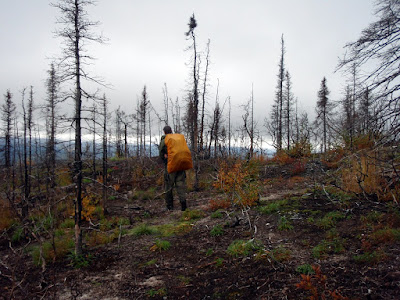
Weather was pretty nice for most of the first day, giving us superb views and wonderful hiking. The trail winds though some fairly recent burns and it was pretty neat to see how the alpine area was recovering.

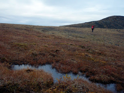
We expected to have a pretty dry hike and had packed quite a bit of extra water so we had enough water to make dinner but we were quite excited to find some tundra pools a little after half way to Far Mountain on the first day.
Hiking was amazingly – nice dry ridges with wonderful views.

After we reached mile nine or so, just before Far Mountain, we called it a day and made camp. Dinner was provide by Ms Marsh, and was a fantastic boil in a bag soup meal.
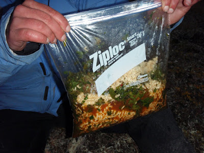
Lately my trips have switched to “just add hot water” meals which can be made plastic zip lock bags or by reusing the foil pouchs that freeze dried meals come in. It allows us to bring a smaller pot and saves fuel making for lighter packs. Light packs makes for happy packrafters!
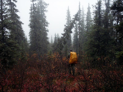
The next day the we awoke to less stellar views – it was totally socked in.
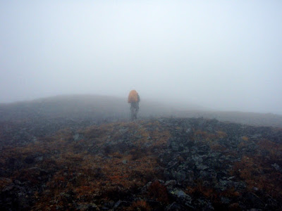
We spent most of the day hiking though the fog with limited visibility. Several of my last couple of trips had involved hiking though the fog in whiteout conditions, so I have been getting pretty good at it. This time I was quite prepared and had a route preloaded on the gps making it fairly easy to stay on course. I did get us circled around once and did a unnecessary horseshoe loop, but such is life.
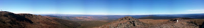
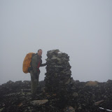
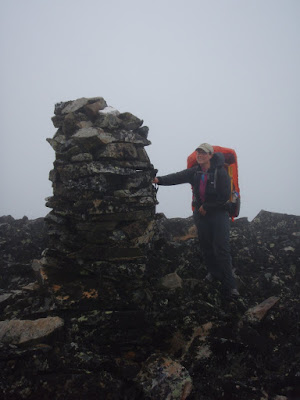
The view from the top of Far Mountain is supposed to be fantastic – alas we didn’t get to see much. There was an impressive cairn though, as well as a very large and loud communication complex on top though.
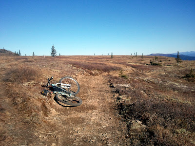
After going over Far Mountain we turned away from the trail and followed the borough boundary along a series of ridge tops heading down to the river. The hiking remained pretty good – lots of game trails and brush free hills.
I found two sets of caribou antlers that I picked up for the twins – I would have loved to have some antlers as a kid, and thought the twins would enjoy them. Alas, they were not the same size, so when I got back and handed them out, Molly noticed hers was smaller and immediately attempted to trade with Lizzy, who was having none of it.. Such is life…
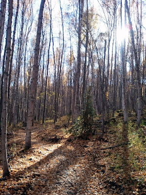
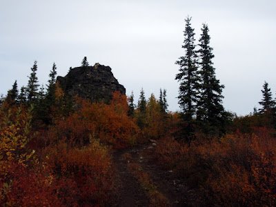
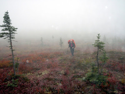
Just before we reached the river we passed though a recent burn, perhaps from last year. It was very fast hiking and it was quite interesting to see the plants moving in after the fire. There were a couple of sections with impressively thick knee high grass.
As we neared the river we also dropped below the clouds and the views opened back up, making route finding much easier. After the burn we hiked though a short section of fairly brushy black spruce forest, but eventually made it out to the river.
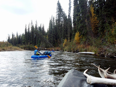
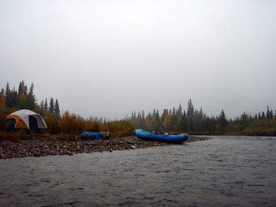
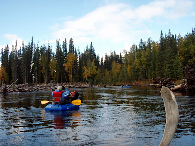
We made it to the East Fork at around 4pm, and were very, very happy to see it had lots of water and was going to be a good float. My big concern about this trip was the water levels on the East Fork – I had not been very far up it before and had no idea what to expect, and was a bit concerned we would hike all the way in just to discover it was too low to be float-able. Fortunately that was not the case – the water levels were great and made for great pack rafting. Since we arrived at the river mid afternoon we put in and floated for a couple of hours.
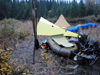
After two hours or so we called it a night and made camp. The East Fork was surprisingly scenic, with great views of the ridges hemming in the river and lots of interesting rock cliffs. The evening was fairly uneventful, besides the splashing beavers. We seemed to have set up camp near some sort of beaver meeting ground. On this trip I attempted to go without a tent, justing using a bivy and a tarp. It was mostly a success, though the bivy I used does not appear to breath all that well. On the second night, since I had my pack raft out and inflated I turned it over and slept on it – it was like heaven and very comfortable.
The next day we continued the float. Up to this point we had not seen any other floaters, but this changed about midday. We heard an air boat in the distance, and saw several pulled up on shore, as well as several parties of more traditional floaters with rafts and inflatable kayaks.
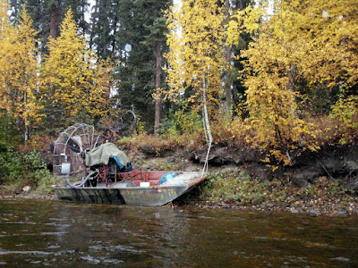
Strangely we saw lots of boats pulled up on shore but few people and no one on the river..
We passed one of the camps where a large jet boat was pulled up along with a jet ski and Ms Marsh talked to them a bit – they were completely flummoxed when they were told that we hiked in. One of them responded with a “Holy Sh**” and a completely incredulous look. More mind boggling for me was the jet ski – its fragile fiberglass bottom made it seem to me like the least useful motorized appliance ever for traveling in shallow rocky creeks.
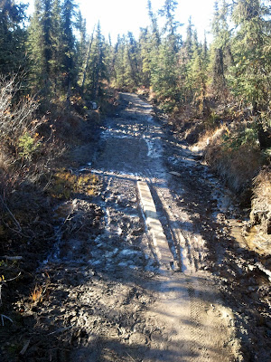
We did stop and talk to a guy with one of the groups of non-motorized floaters. He said he was on “Camp Duty” while the rest of his party hunted. They were dropped off at the landing strip at Van Curlers Bar, a old placer mine on the upper reaches of the East Fork. Apparently mining of some sort is in progress and the landing strip is open and usable. Some interesting details can be found online about some of the folks who prospected in this area, including Van Curler. Excepting the air boats and jet boats, the float felt pretty remote considering how close it is to town – there were not a lot of signs of other travelers, besides a large number of cut out sweepers. In the lower sections of the river there are a number of very large log jams that have been cut out, so this is probably a good thing – some of those log jams were pretty immense and would have been a bit of a pain to portage around.
Eventually we arrived at our take out, where Tom and I got on bikes and biked back to the hotsprings while Ms Marsh guarded our packs and hunted for cranberries. The bike ride was very fast and fun and before I knew it we were back at the truck.
This hike, float, and bike is highly recommended – the hiking was fantastic, the floating pretty fun (though mellow), and has a very remote feel considering how close this is to town.
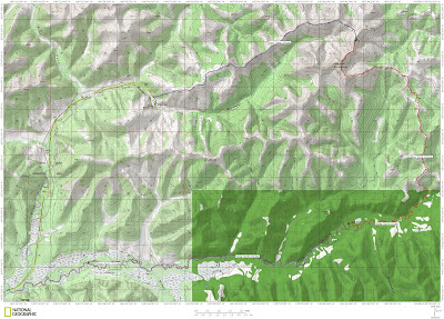
A Map.
More photos.