Archive for the ‘biking’ Category

Kotzebue to Kobuk – Fun on the Kobuk 440 trail!

Wednesday, April 30th, 2025

When we arrived in Kiana, there was only a faint trail out of town. After spending the night in the school we slept in late, hoping the dog race’s trail crew would leave before us and put in a trail.  As we rode out of town and down onto the Kobuk river, there was lath marking a trail out of town – yay!!  We puttered along slowly, grinding away on a soft trail across the main channel only to find the trail turned around – doh!  And back we went, slowly grinding back to town..  

Riding the KB440

In 2023, Bill F and I talked a bit about biking the Kobuk 440 route.  The Kobuk 440 is a dog sled race that goes from Kotzebue to Kobuk, then back, and is semi-legendary for bad weather.  

Kobuk440 route, from the Kobuk 440 website.

It is well above the Arctic Circle, and the temperatures can be quite cold, but by early April it should have lots of daylight..  We had tentative plans to ride the route in 2024, but those fell through. Which was possibly for the best, as the dog race was delayed a few days due to a big storm system coming in.   A friend was in Kotzebue teaching kids to ski for Skiku when the dog race was supposed to start.  The wind was so strong that school was canceled.   Kotzebue is a really windy place, so for school to be canceled, it must have been horrific!  

With that gloomy backdrop, this year we tried again and were joined by Spencer M.  We arrived in Kotzebue on the last day of March, and we flew right over the trail as we landed.  I had never been north of Nome on the coast, and spent the last part of the flight with my head pressed against the window looking out for the trail, which wasn’t to be seen.  The treeless alien wasteland was pretty intimidating, but I guess that is what the adventure is all about! 
After spending the rest of the day getting the bikes ready to go and doing a bit of exploring in Kotzebue, we left the following day, April 1st.

Riding the KB440

Riding the KB440

Leaving town was a bit confusing, but we were soon on the right trail and on our way – the start of a new adventure in a completely new place, hurrah!  

Riding the KB440

We spent most of the day biking to Noorvik, enjoying a wonderful sunny day with a brisk tailwind.  It felt a bit like being on the planet Hoth from Star Wars – snowy, treeless, and exposed. Crossing Kobuk Lake topped things off, and I could almost hear the Imperial walkers stomping in the distance.. 

Riding the KB440

Fortunately, as we got closer to Noorvik, trees started to return. 

Riding the KB440

Riding the KB440

We arrived in Noorvik in the early evening, when a regional basketball tournament was happening, and I enjoyed a healthy dinner of nachos and hot dogs from a stand the local kids were running.   Alas, I was thinking we would make it to Kiana, but we were going slower than anticipated – a bit of a theme for this adventure, hah!   

  • Day 1: 
    • Distance 47.88 mi
    • Elevation Gain 725 ft
    • Moving Time 9h 29m

The next day we headed out into a snowy morning and slowly rode to Kiana, where we found the trail ended. 

Riding the KB440

Riding the KB440

Riding the KB440

The folks in Noorvik had said that the trail from Kiana to Ambler doesn’t see much traffic, and I guess they were right.  There was a faint trail, but it was well covered with snow, and it would have been slow pushing..  We stopped by the school and they put us up for the night.  I was able to get pizza, pie, and other snacks from the store, hurrah!   We went to bed with plans to head out in the late morning in hopes the dog race would have someone putting in a trail.  

Riding the KB440 Riding the KB440
  • Day 2:
    • Distance 23.10 mi
    • Elevation Gain 285 ft
    • Moving Time 6h 1m

We packed up and headed out in the late morning, enjoying a leisurely morning in hopes there would be a trail when we left. On the way out of town we passed a group with the National Park Service who were heading out to staff the Portage / Tutasraq shelter cabin.  Things were looking good!  There was even a trail out of town marked by lath! 

Riding the KB440

Alas, it ended a quarter of a mile out of town, and we turned around and went back to hang out at the Blankenship store and eat snacks.  I looked out at every snow machine that passed by in hopes one would be the NPS heading out, but no luck.  Eventually, I walked down to the river and a group on big machines went by and parked out where the trail ended, chatted, then took off and headed out. We spent most of the day riding slowly on very soft trail, enjoying the sun and hoping for better trail. 

Riding the KB440

Riding the KB440

Riding the KB440

Riding the KB440

The trail slowly got better as the traffic increased, and got quite a bit better when a group went by pulling a big machine on a sled. 

Riding the KB440

Riding the KB440

Riding the KB440

Riding the KB440

Eventually, the trail went close to the bank and we found a good place to bivy for the night.   Just after sunset a group of snowmachines passed by with the dog race and stopped and chatted for a bit. 

Kobuk Ride

Photo complements of Bill Fleming.

Riding the KB440

I drifted off enjoying the northern lights, and in the early hours of the morning I was woken by dog teams passing, though I was too lazy to get up and cheer them on.  

  • Day 3: 
    • Distance 28.13 mi
    • Elevation Gain 292 ft
    • Moving Time 9h 50m

In the morning we packed up and enjoyed some nicer trail… until it started snowing again, and things slowed down.  We passed by the Portage or Tutasraq cabin where we ran into our first mushers, and chatted a bit with the NPS folks who were camped nearby and were keeping the cabin warm.   

Riding the KB440

Riding the KB440

Riding the KB440

Riding the KB440 Riding the KB440

Get all of me in the photo – Quince Mountain while taking photos of his mittens as booties cabin footwear. Mushers like Quince give me hope for humanity..

Riding the KB440

Riding the KB440

Riding the KB440

By evening our progress slowed down a fair bit in the new snow, and we camped in some bushes just off the trail a few miles from where the author Seth Kantner grew up. 

  • Day 4: 
    • Distance 40.29 mi
    • Elevation Gain 876 ft
    • Moving Time 10h 1m

In the morning the wind had died down, but it was still snowing lightly. 

Riding the KB440

So many ptarmigan!

Riding the KB440

Riding the KB440

We rode slowly the rest of the way into Ambler, where we were excited to hear there was a place that served food – yay! 

Riding the KB440
We stayed at the school, and given our slow progress, decided to see how the trail was to Kobuk – if we could make it there we would call it good.  

I was super amused by a poster with Iñupiaq seasons on it, with two springs – which seems very logical from my Fairbanks perspective.  In early spring it is sunny, with warm days and cold nights and the best part of the winter.   Late spring it is warm all day, mushy, and gross, and the worse part of the year. 

Riding the KB440
  • Day 5: 
    • Distance 18.61 mi
    • Elevation Gain 735 ft
    • Moving Time 6h 21m

We headed out of town after agreeing that if the trail was bad, we would turn back.  The trail started slow but ridable, but gradually switched to mostly walking with short sections of riding. 

Riding the KB440

There was lots of joking about the “well-used trail” the locals talked about.  We didn’t see anybody.  There were lots of clouds, and I couldn’t see the mountains and views the folks at the Noorvik basketball tournament told us about, alas.  However, I did enjoy a nice long walk with the bike.  Almost a marathon of pushing, hah! 

Riding the KB440

We spent the night in the Shungnak school, where the principal gave us Shungnak hoodies! 

  • Day 6: 
    • Distance 26.17 mi
    • Elevation Gain 404 ft
    • Moving Time 10h 50m


On our final day, we rode on a much better trail for the 9 miles to Kobuk. 

Riding the KB440

We had spent the afternoon and evening before in Shungnak talking to the kids and hanging out with locals.  Folks seemed pretty interested in chatting with us about our ride.  I learned that there are several Iñupiaq dialects in the area, and the language spoken by the folks in Noorvik (coastal Iñupiaq) is different enough from what is spoken in  Kobuk (inland Iñupiaq), the locals weren’t able to tell us pronounce place names in a dialect spoken in the other region.  I was super impressed how the local languages are apparently still in use!  Keeping a language alive that is only spoken in three villages with a total population of under 2k is an amazing achievement!  

  • Day 7: 
    • Distance 8.92 mi
    • Elevation Gain 223 ft
    • Moving Time 2h 31m

The following afternoon we flew back to Kotzebue (morning flights having been canceled due to weather), and I flew back to Fairbanks via Anchorage the day after that. 

Riding the KB440

Thanks for the adventure Bill and Spencer, it was great traveling with you! 

Notes: 

This trip was super fun, and it was great spending time with Bill and Spencer! 


Bill did most of the logistics for this trip, and contacted the schools in advance and got us permission to stay in them, and for Noorvik and Ambler, permission for us to send resupply boxes.  It was generally $150 a night per person, and the schools were all pretty friendly. 

The trail was very slow after Noorvik.  It didn’t appear to be getting much traffic between Kiana and Ambler.  We saw lots of traffic between Kotzebue and Noorvik, but otherwise we didn’t see many people on the trail.  

The riding was mostly slow, but we had pretty good weather.  It snowed most days, but we didn’t have any hard wind storms.  It is very exposed from Kotz to Noorvik, and could be miserable if a storm came in. 

The trail conditions were slow and soft for the most part.  The locals say that it generally snows when the Kobuk 440 is happening, so maybe this is normal for this time of year. 

The route was scenic, but it had a lot more river riding than I expected – which is my own fault, as I had a map. It was also very cloudy with limited visibility for a lot of the ride, so I had fewer views of the mountains than I would have liked, but such is life. 

Everyone was very friendly! 

There are flights twice a day from Kotz to all the villages on our route via Bering Air, as well as frequent flights from Kotz to Anchorage. Direct lights from Fairbanks to Kobuk, Shungnak, and a few other villages are available, although these are only offered a couple of times a week via Wright Air, and are not listed or advertised. Ryan Air handles freight (the bikes) in all these communities. 

The hotel in Kotzebue is super nice! 

The local native languages (Iñupiat dialects) were everywhere!  It was really exciting to see the local languages are alive.  The principal in Shungak said the students didn’t like going to their Inupiat classes, so maybe it is an uphill battle, but it is still very refreshing to see.  

Skiing this route later in the year might be fun.  Ned Rozell and Andy Sterns did that years ago and had a great time. 

For anyone thinking of doing this route, it isn’t a beginner’s trip. It is very remote, and can be extremely cold and windy, with little traffic. 

This was the first trip in a while where I wished for tires with more tread.  I had big tires, HD 4.8s on wide rims, but with low-profile tread, and I think something with a bit more bite to it in the front might have worked better.  And maybe an even bigger tire. We joked a bit about the new gearbox fat bike Surly is making, maybe that would have been ideal, or maybe not. 

The Iditarod Trail, 2023

Saturday, July 29th, 2023

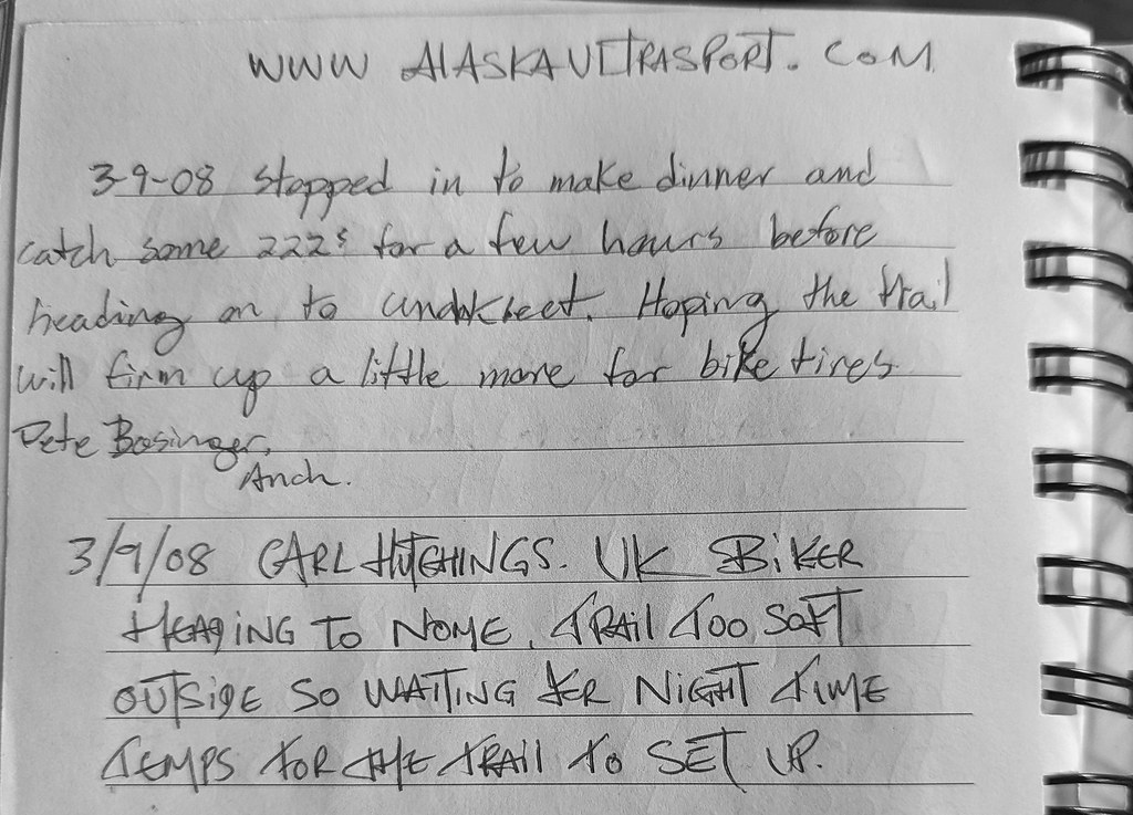
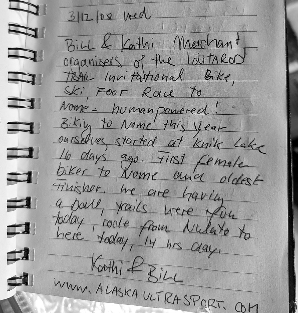
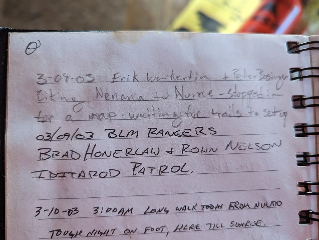
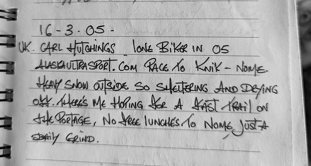
After riding and pushing our bikes from Ophir we finally arrived at Moose Creek cabin just as the drizzle started. Miron welcomed us in, and we tucked our bikes under the eaves to keep them dry. The day had been beautiful, warm with blue skies and sun, but much too warm for the new trail put in by the Iditarod Trail breakers to set up. As we dried off in the cabin and cleaned up the nests squirrels had made on the bunks, the drizzle turned up a notch into intermittent rain. Miron was planning on heading out at 2 am, but Jamie, Bill, and I agreed to get up at 7 am then head out – but to go back to bed if it was still raining. Morning came, and I could hear the rain on the metal roof of the cabin. I stuck my head outside, and it was raining. Not hard rain, but enough to be pretty miserable. Back to bed, we went, tucked back into our -40f bags.. The glorious life on the Iditarod trail!  

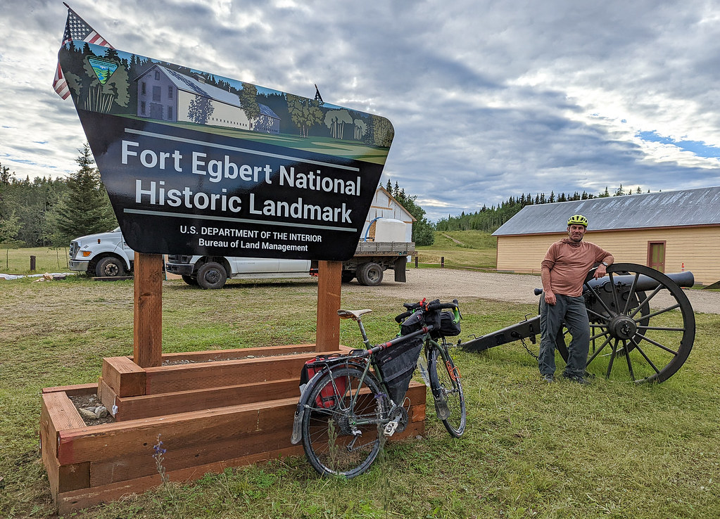
Like everyone, Covid had cramped my adventure time the last few years.  After riding my bike to Nome in 2018 I had thought I was done with the Iditarod trail.   I signed up in 2022 to go to McGrath as a spur-of-the-moment thing and really had a wonderful experience.  When signup time came up again I was feeling like I hadn’t had any “real adventures” lately, so signed up for Nome – if nothing else it would be a good, long adventure and I was sure to have fun at least! 

ITI 2023

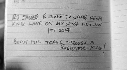
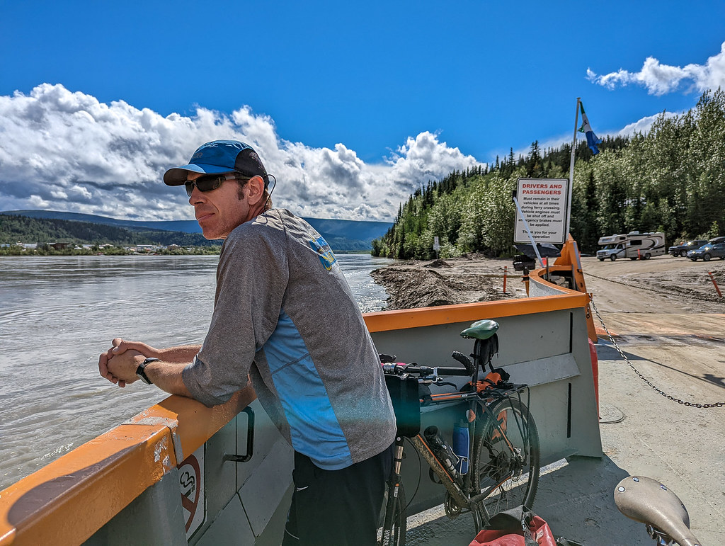
And so on a warm, sunny mid-afternoon, I found myself at Knik Lake with nearly a hundred other people.  The first part of the race is a bit of a maze, with so many options that mostly all look not very good, so after texting (aka bothering)  Andy P. of Seeing Double Sled Dog Racing about the best route (as he lives in trains in the area), I just decided to follow him.  He threatened to make me sign a waiver in case he got us all lost, but I escaped without any paperwork as Andy led a group of us to the first checkpoint.  As we neared the first checkpoint I noticed there was only one set of tire tracks ahead of us, and they were an unusual tread design – odd!  We arrived at the first checkpoint only to discover we were in the lead, with the fast guys Miron and Tyson right behind us.  I felt a bit bad being ahead of the fast guys, as they had taken a much longer and hillier route and ended up behind, alas.   Local knowledge for the win, thanks for getting us there Andy! 

ITI 2023 ITI 2023 ITI 2023 ITI 2023


After chatting a bit, and having some snacks we left and headed to Yentna Station where I had a grilled cheese sandwich and a bowl of soup, and then on to  Bentalit Lodge the official second checkpoint. 

ITI 2023 ITI 2023

I had never been to Bentalit before, and wow, that place is nice – and huge!  I got a room, a hamburger, and lots of other things to eat.  In the early hours of the morning, I headed out again, enjoying the fast firm trail to Skwenta, yay!  I said hi to Cindy at Skwenta, and lunch then moved on.  The trail stayed awesome, and I took a mix of the traditional route and the ice road, making a great time to Finger Lake.  Passing through Shell Lake was a bit sad, with a big empty hole where Shell Lake Lodge used to be.    

When I arrived at Finger Lake my insides were a bit unhappy, and I was very excited to go use the outhouse.  Yay for modern comforts, hah!    The very friendly volunteers were cleaning a very burned pan, it turns out they had only arrived recently, and had been delayed by the weather. 

ITI 2023

The leaders had passed through before they were there, missed their drop bags, and just had frozen burritos.  Fast people troubles, must be hard, hah! 

The trail was still awesome, so after restocking I headed out and had a great ride to Puntilla Lake with Tom M. and Peter D.   Puntilla was as nice as always, and the newish bunkhouse is so awesome.  As I arrived John “Faster than the dogs” L and Tim B were heading out and said something about staying ahead of the storm.  Hmm, “storm?” I thought, then I tried to get some sleep.   My insides didn’t cooperate, and I made lots and lots of visits to the outhouse.  My body was less than happy with something I ate, and that made it hard to sleep.  After one of the trips back from the outhouse it started to snow, and after noticing folks were awake, Justin, Spensor, Tom, Peter, and I headed out.  It was pretty calm, but I warned everyone it could be pretty windy up in the open area before Rainy Pass.  That turned out to be not true, the weather was great, warm, with a bit of wind.  The trail was a blown-in though.  My insides were still quite unhappy, and I spent most of the way to Rohn trying not to go the bathroom, though I had to twice in open areas in blowing snow which was super awkward.  Sigh.  Fortunately, the riding was pretty good as I was slow enough the rest of the group pulled away and disappeared into the distance, leaving me to ride in the nice trail they broke out for me.  And to jump off the trail when nature’s calls stopped going to voicemail and had to be answered. 

ITI 2023 ITI 2023


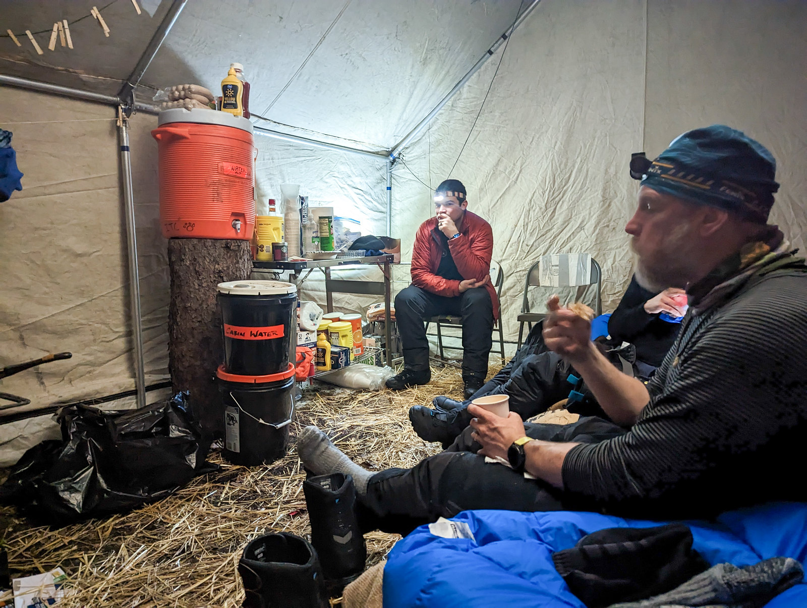
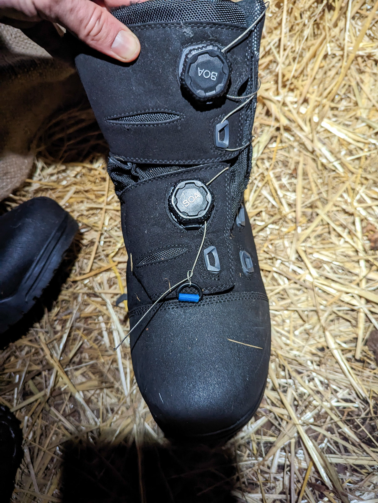
I arrived in Rohn, where my insides and I finally came to an agreement on how happy we should be (happy!) and I crashed and got nearly 8 hours of sleep.  The rest of the group I had been riding with headed out after a few hours, pushed on by Justin.   I was amused to hear Justin rallying folks by saying “I haven’t suffered enough” and pointing out it was pretty warm out so biving wasn’t a problem. Which was a good point, as it was in the 20s, so warm!  I had the whole place to myself until Harm and Jamie H. showed up.  Jamie alas, had broken one of his boa laces on his fancy boots, confirming all my fears about those laces. 

ITI 2023 ITI 2023 ITI 2023 ITI 2023 ITI 2023 ITI 2023

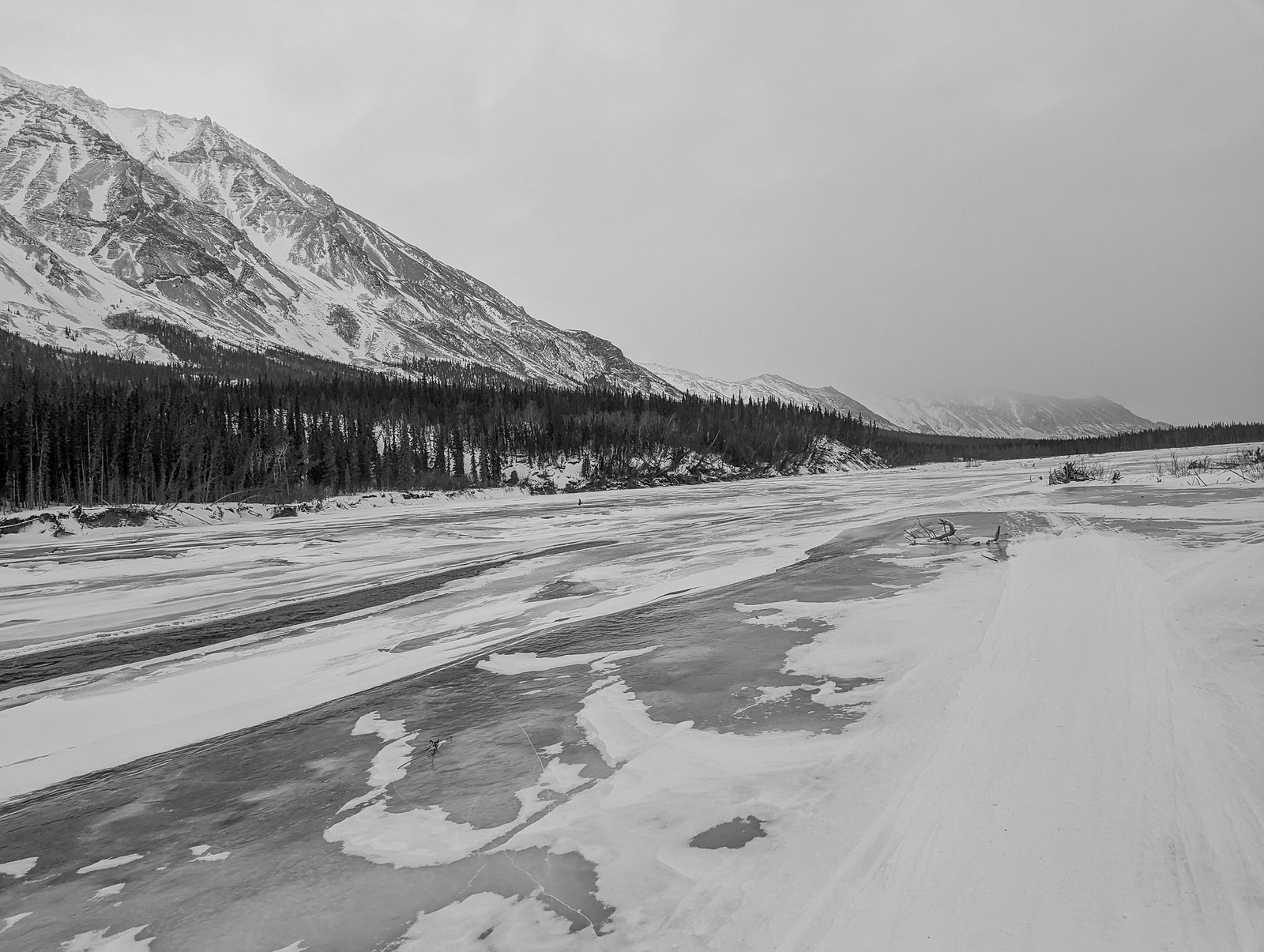
I left Rohn by myself, and had a wonderful ride, all invigorated by all the sleep I had gotten – so much sleep!  The trail was mostly good, though it was blown in sections, and I had been warned that the leaders were still not finished when I left Rohn, so obviously things were not fast.  

ITI 2023 ITI 2023 ITI 2023 ITI 2023


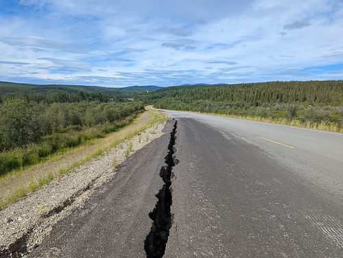
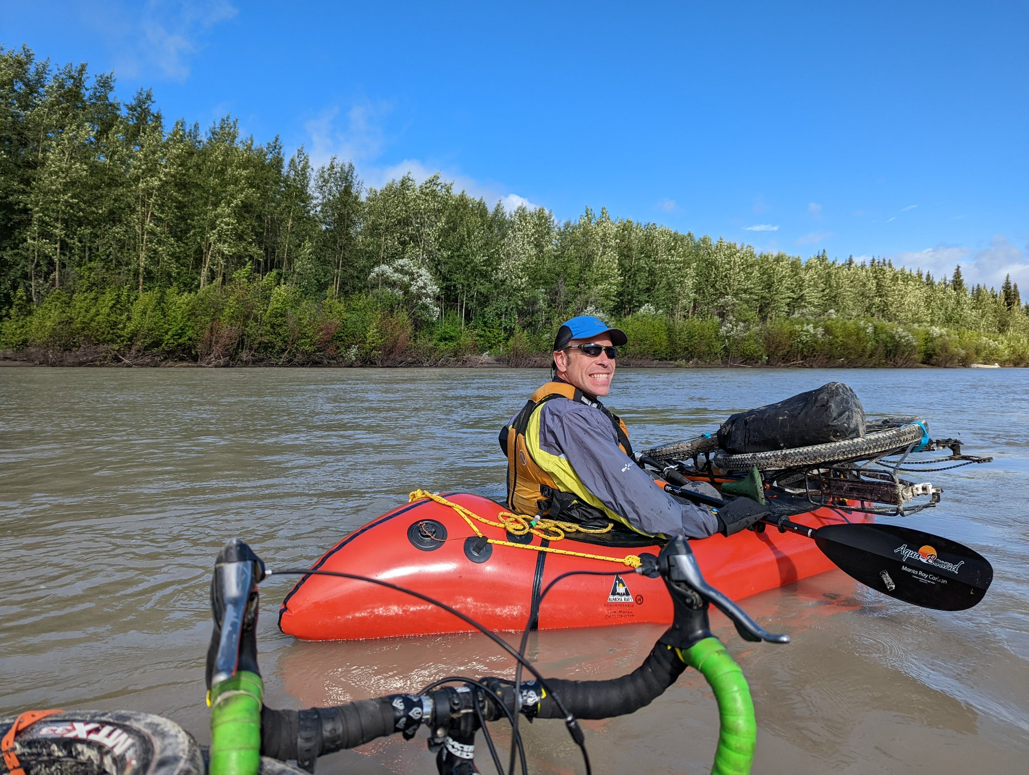
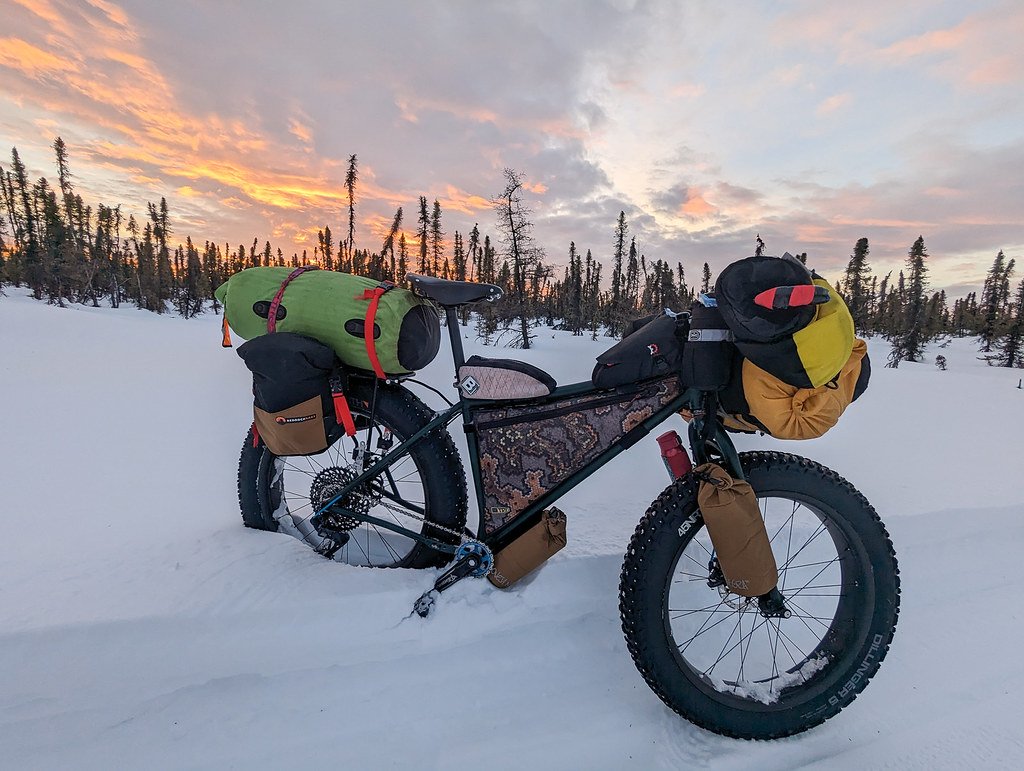
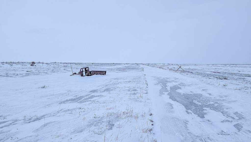
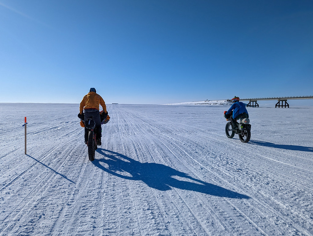
I was enjoying things right up until I broke my seat post near Bear Creek Cabin.  I had been using a suspension seatpost that was oh-so comfortable, and on one of the deeper ruts left by Irondog I came down a bit too hard, and the post snapped. 

ITI 2023

There was a bit of cursing, but then I made peace with it – obviously, it must get slow at some point ahead of me, so I can just walk, no big deal, right?   I texted my wife Nancy who started tracking down a new seatpost for me. 

Shortly after that Adrien D. and his helper, John (maybe?) came by on their way to Rohn and gave me some Fireball, and we chatted for a bit. 

ITI 2023

After that, it was a long slow walk with a bit of riding to Nikolai.

ITI 2023

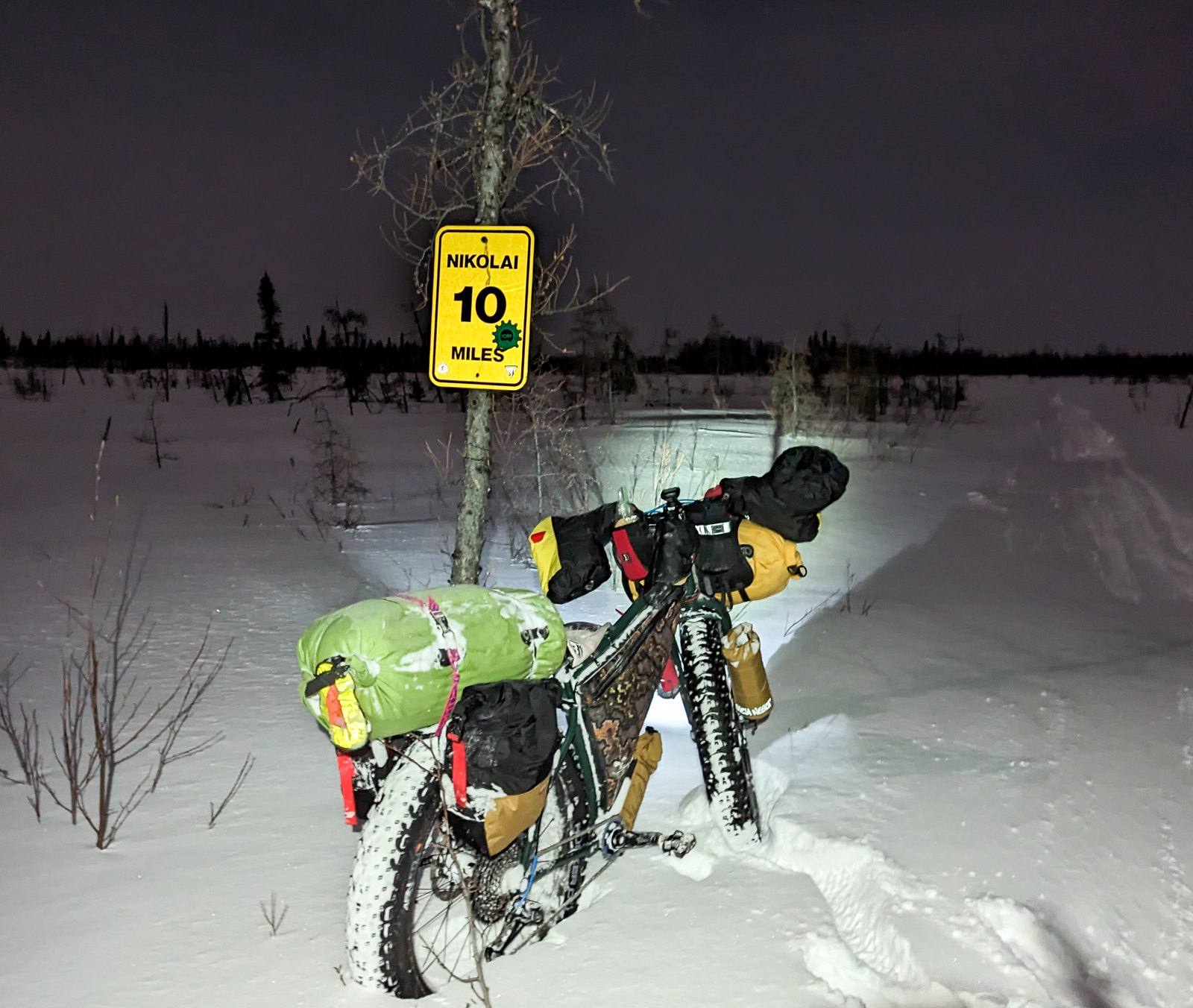
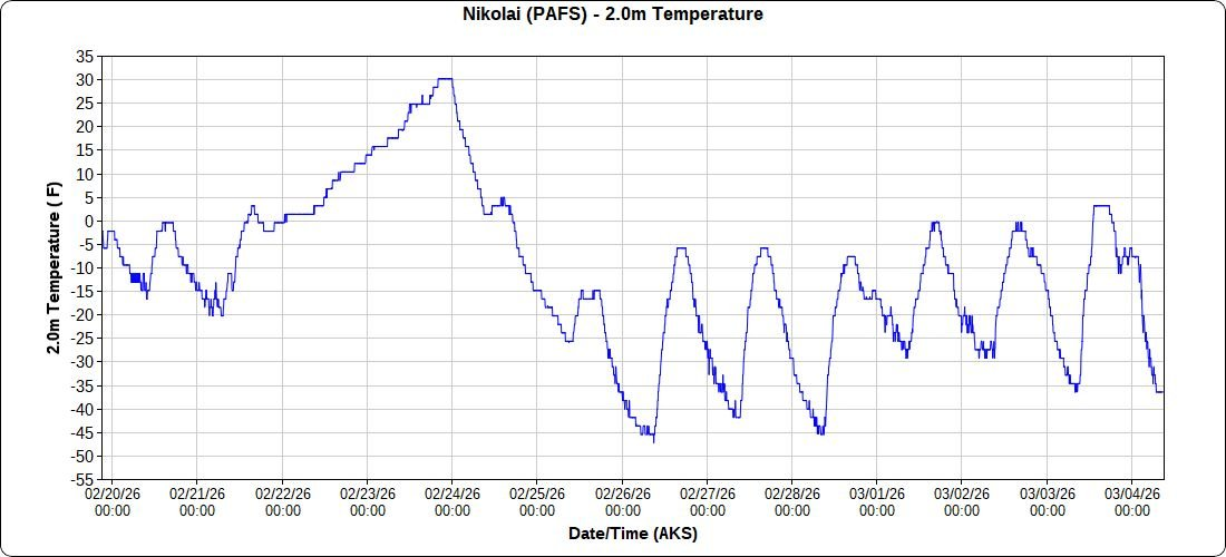
I stopped briefly to heat water and make dinner, but otherwise just kept moving.   I arrived in Nikolai just before Tom, Justin, Spenser, and Peter left.  I had the place to myself!  Since at this point, I was in no hurry, and not wanting to spend a week in McGrath I decided to get some sleep and head out in the evening.  I told myself since the checkpoint folks were saying it took Tyson (the winner of the short race) nearly 24 hours to get to the finish, it didn’t matter when I left, as I would be riding half it in the dark anyway.  

 **This turned out to be wrong, looking at the tracker now, Tyson left at 11 pm and arrived at 4 pm – way less than 24 hours11** 

After chatting a bunch with the folks staffing the Nikolai checkpoint, John and Brian (I think?), I crashed and got nearly 10 hours of sleep. 

ITI 2023

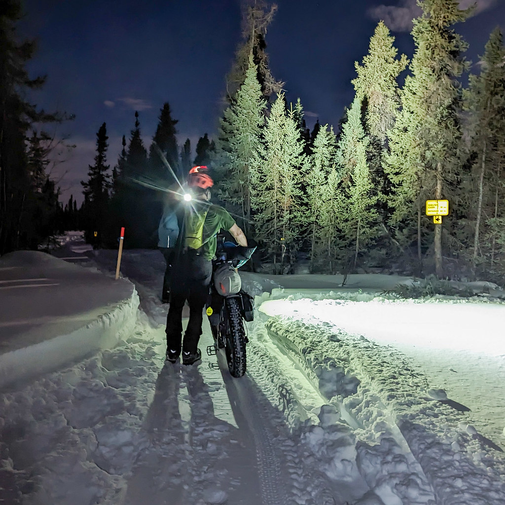
At 5 pm I headed out, and I arrived just before sunrise, riding and pushing mostly in the dark, hah!   The trail was a mix of ridable, and walking. It would have been much more ridable with a seatpost, but I wasn’t miserable and enjoyed the ride!

ITI 2023 ITI 2023

McGrath was a bit of a madhouse. The finish is now at an old lodge, and it is big, but there are so many people doing it these days so it gets very crowded. I had been worried that I would get stuck for a long time in McGrath, as the southern route doesn’t see any traffic normally outside the dog race.    The forced break was good in some ways, as it allowed my new seatpost to arrive, thanks to Nancy, Jeff O, and the wonderful folks at Speedway Cycles.  Thanks, guys! 

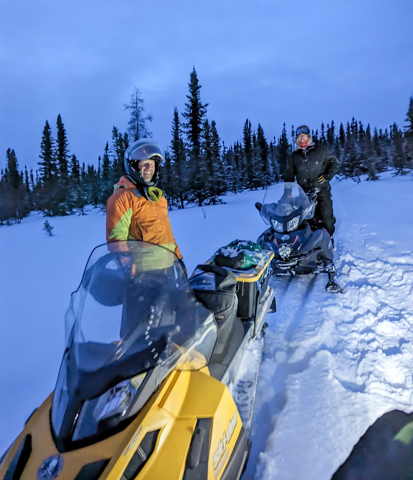
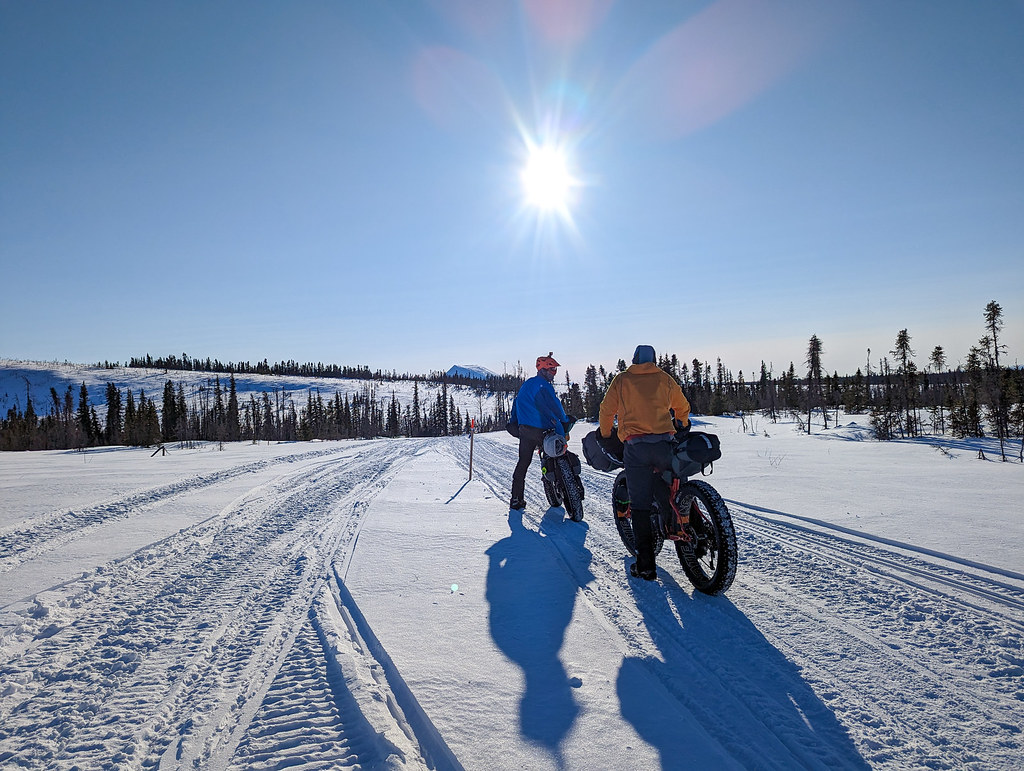
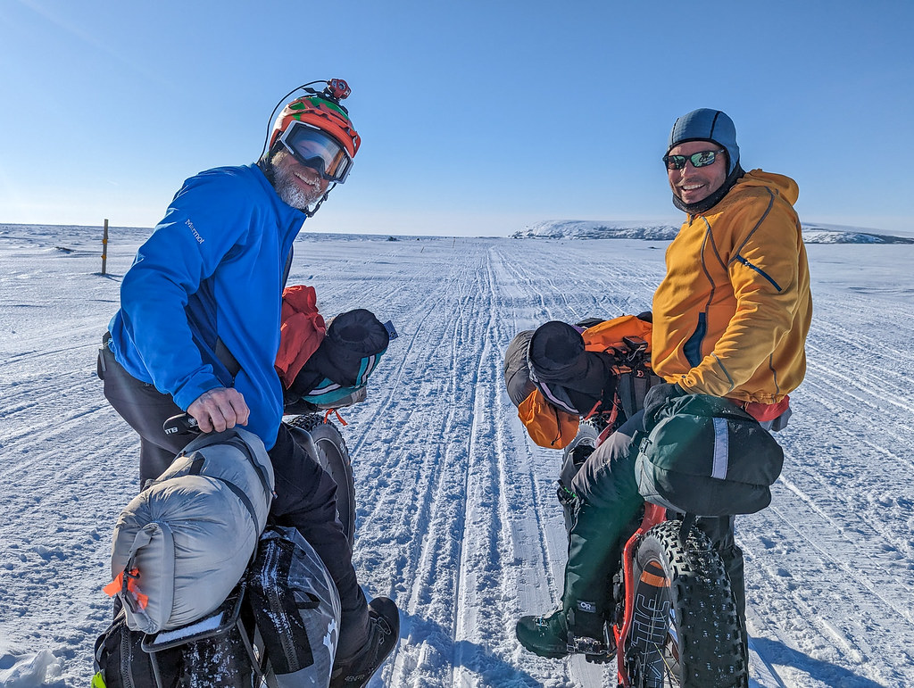
Three days later, Myron G, Bill F, Jamie H, and I headed out mid-day, with some assurance there was going to be a trail at least as far as Ophir.   Just as we are leaving McGrath we saw Chet F. unloading a plane, and we chatted for a bit. Chet is a skier who has done the ITI several times and was headed to Ophir to help run the checkpoint.   He was heading there later today, and we left with an extra bounce in our pedaling knowing a friendly face awaited us. 
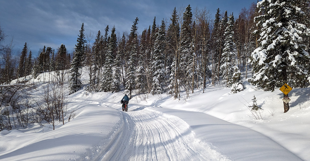
The ride to Ophir was fun, though things got a bit soft after the last house on the top of the hill after Takotna.  

ITI 2023

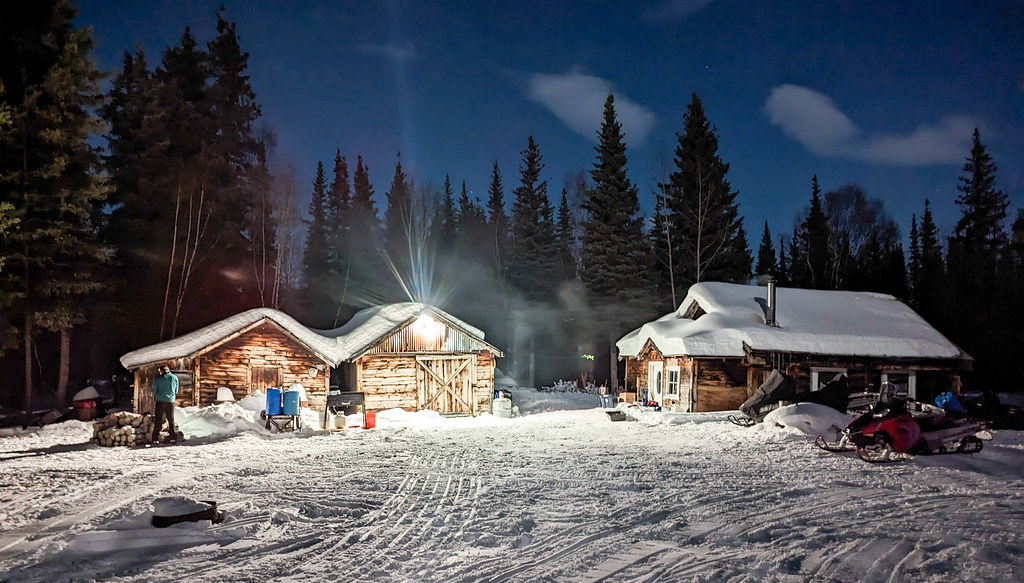
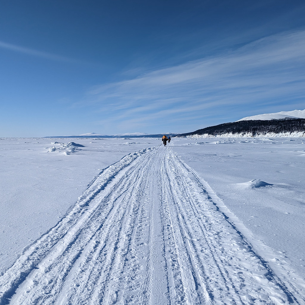
By 10 pm we were in Ophir, where we were welcomed in, fed, and enjoyed the heated wall tents set up for the mushers.  Alas, there was no trail after Ophir, so we spent the day helping the Iditarod checkpoint staff set things up.  It was great talking to everyone and getting a chance to catch up with Chet.  In the late afternoon, the Iditarod trail breakers passed though, and there was finally a trail! 

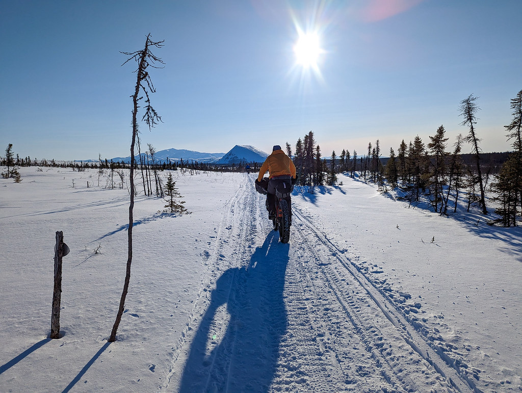
 In the evening they fed us again (BBQ, it was fantastic!), and the next morning we set out early.  Chet joined us for a brief ski, and we headed out into a warm morning, under clear skies and a bright moon.   Myron G zoomed off like the fast guy he is, and I didn’t expect to see him again.

ITI 2023 ITI 2023 ITI 2023 ITI 2023 ITI 2023 ITI 2023 ITI 2023 ITI 2023 ITI 2023

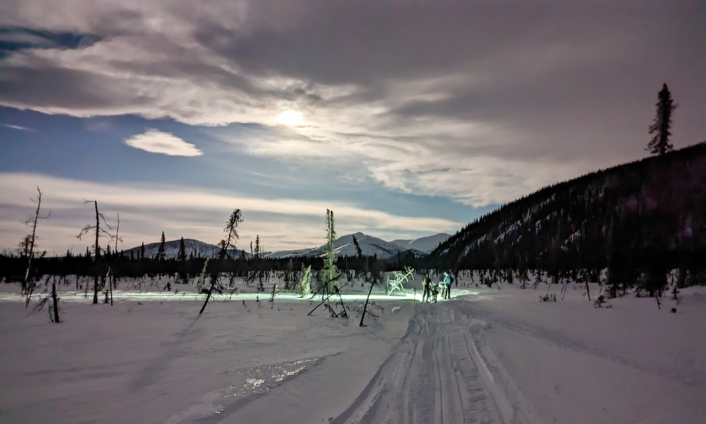
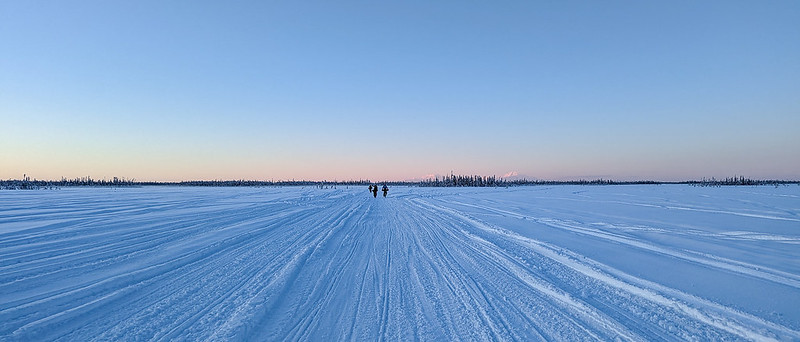
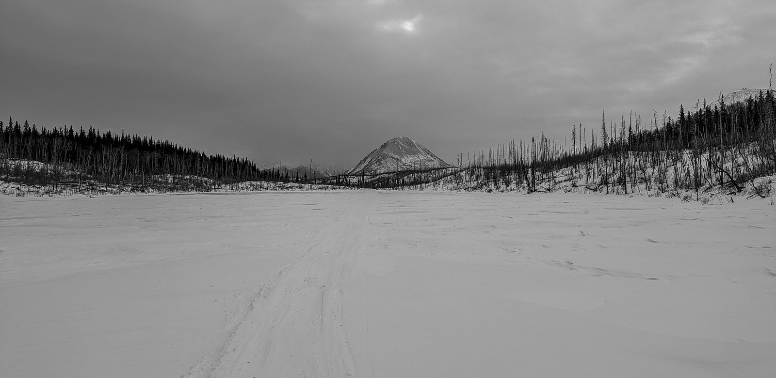
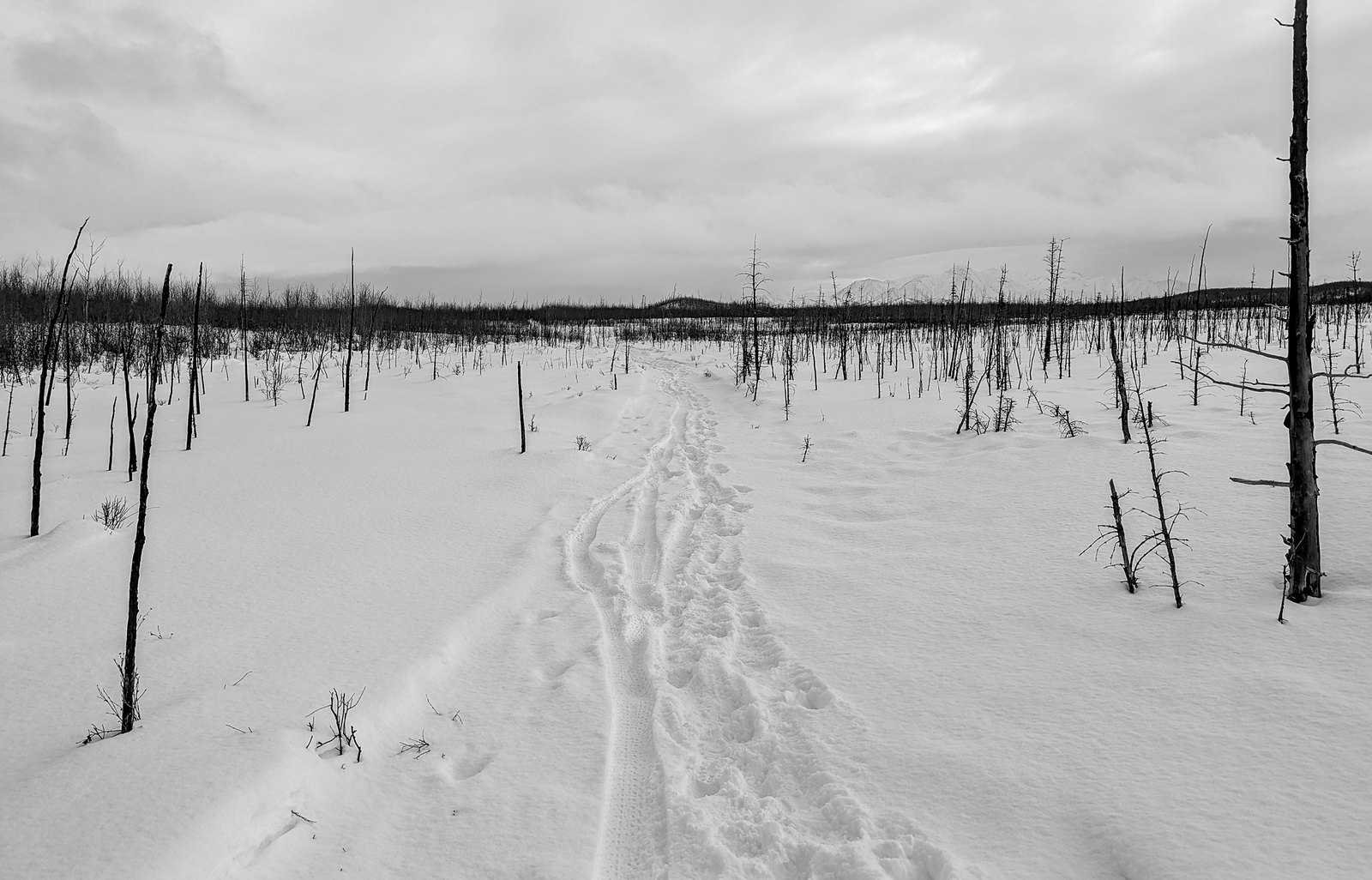
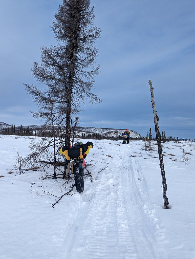
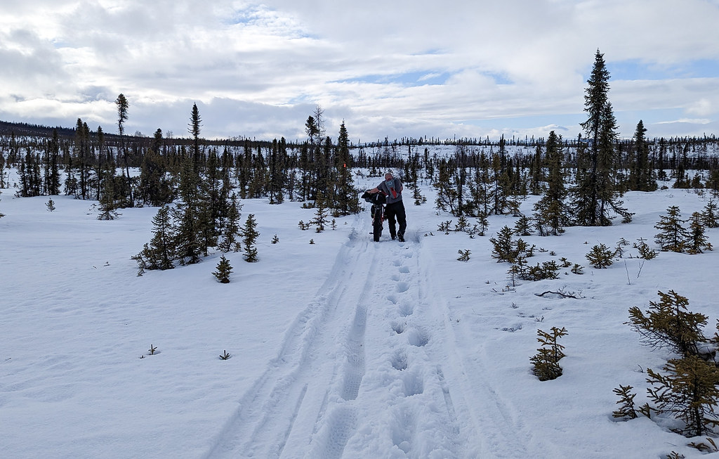
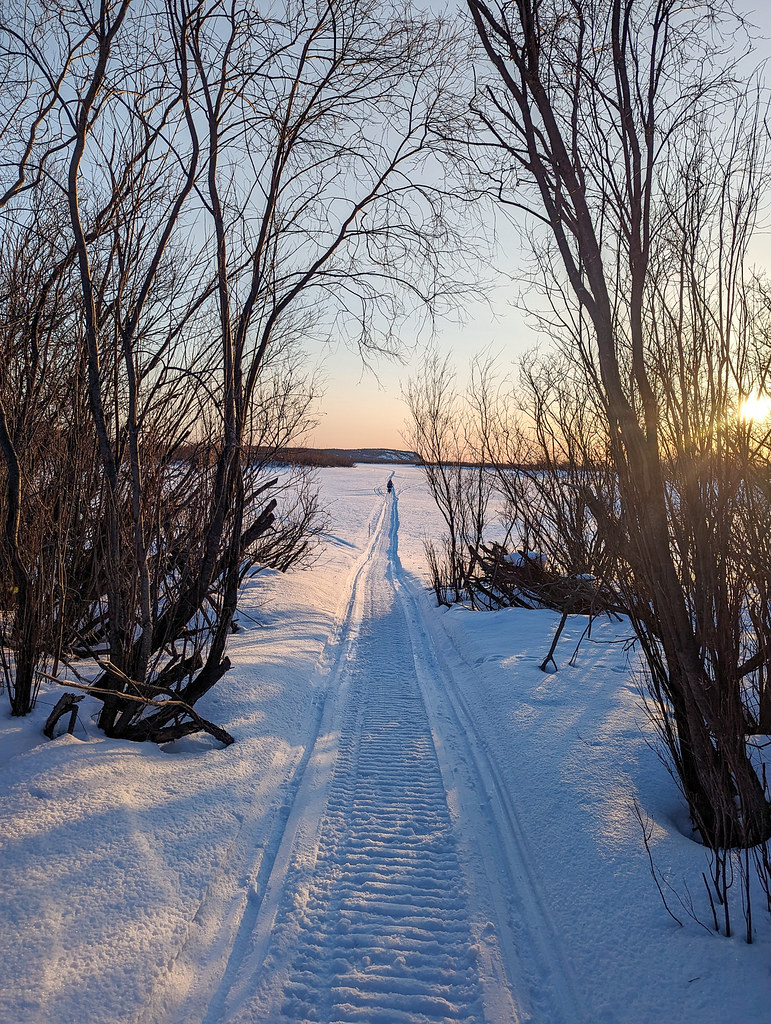
The trail was great, and we made good time to the first shelter cabin.. Then we were walking.  The temps had warmed up to near freezing, and the fresh trail was a soupy, unconsolidated mess.  So we walked, and for the rest of the day we rode a bit when the trail was in the trees, and sheltered from the sun, but in the open areas, it was soft and squishy.

ITI 2023 ITI 2023 ITI 2023

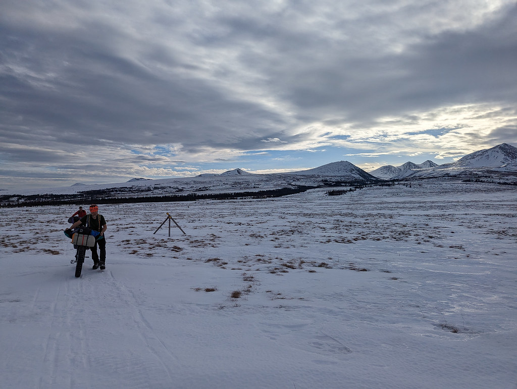
Mid-day Myron came by, apparently, he stopped at the first cabin hoping the trail would set up.   He was riding a lot more than we were, as we were pretty much not even trying when it was soft, and soon disappeared off into the distance.   We had several groups of snowmachiners pass by, including one couple on their way to Point Hope, which sounded like an amazing trip. 

ITI 2023 ITI 2023

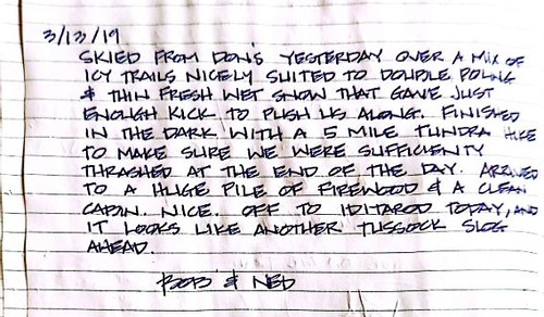
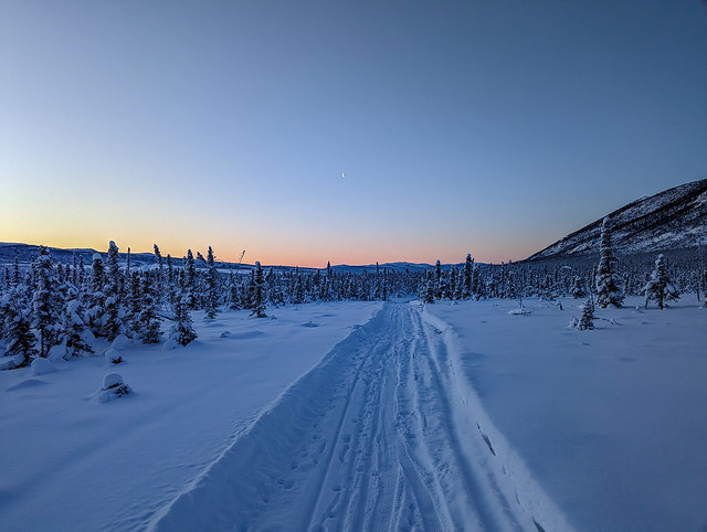
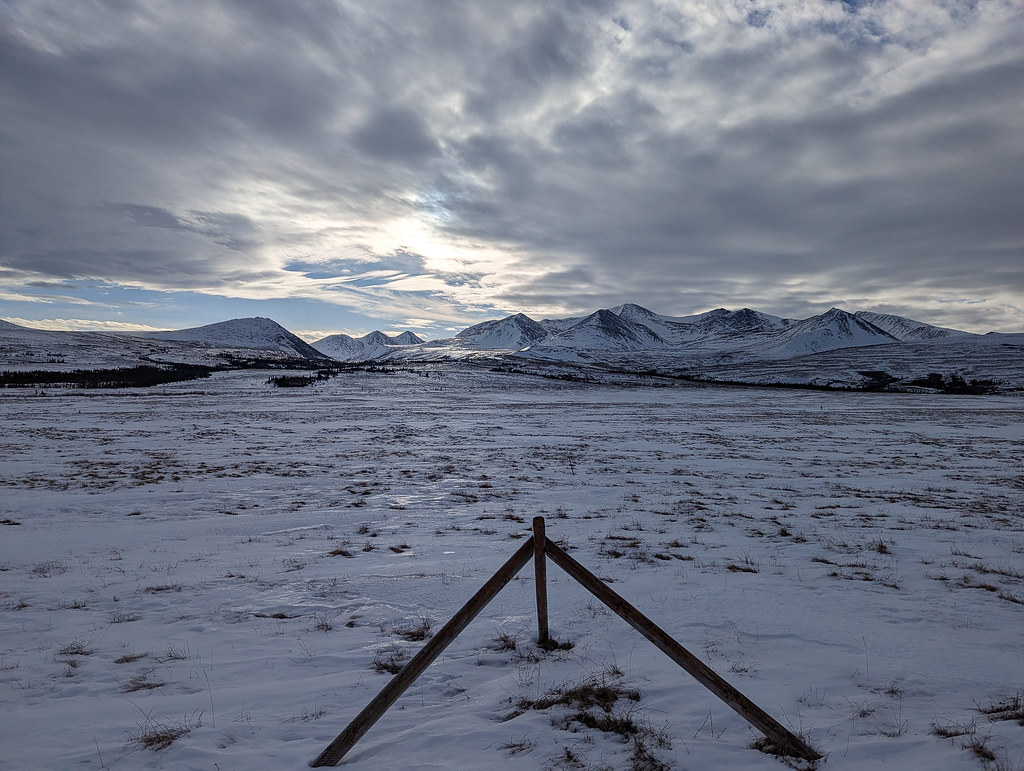
By evening it was lightly raining on and off, and we finally pulled into a very warm Moose Creek cabin and were welcomed by Myron.  After a bit of cleaning we settled in. I said we should get up at 7am and check to see if it was raining, as our weather forecasting friend, Ed Plumb, said rain was in the forecast.  Sure enough, just as I went to bed there was the sound of rain on the metal roof.. 

Myron took off in the early AM hours, and when we got up to check to see if it was raining, it was definitely raining, so we went back to bed.  It finally stopped raining mid-afternoon so we headed out for a bit of slog to Iditarod. 

ITI 2023 ITI 2023 ITI 2023 ITI 2023

We arrived in the early evening, having enjoyed a long walk pushing our bikes with the occasional post hole into knee-deep snow in temperatures slightly above freezing.  

ITI 2023

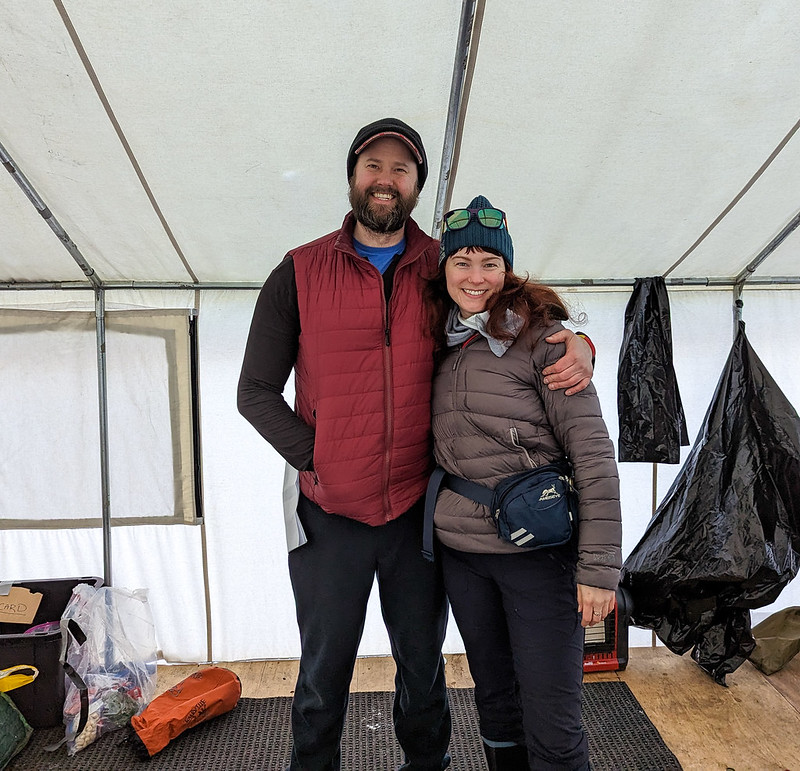
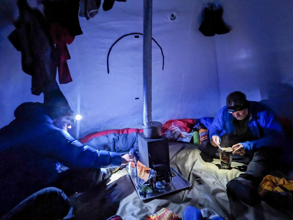
The Iditarod folks were welcoming, and set us up in a small arctic oven tent complete with a propane-powered heater – so deluxe!!

ITI 2023 ITI 2023

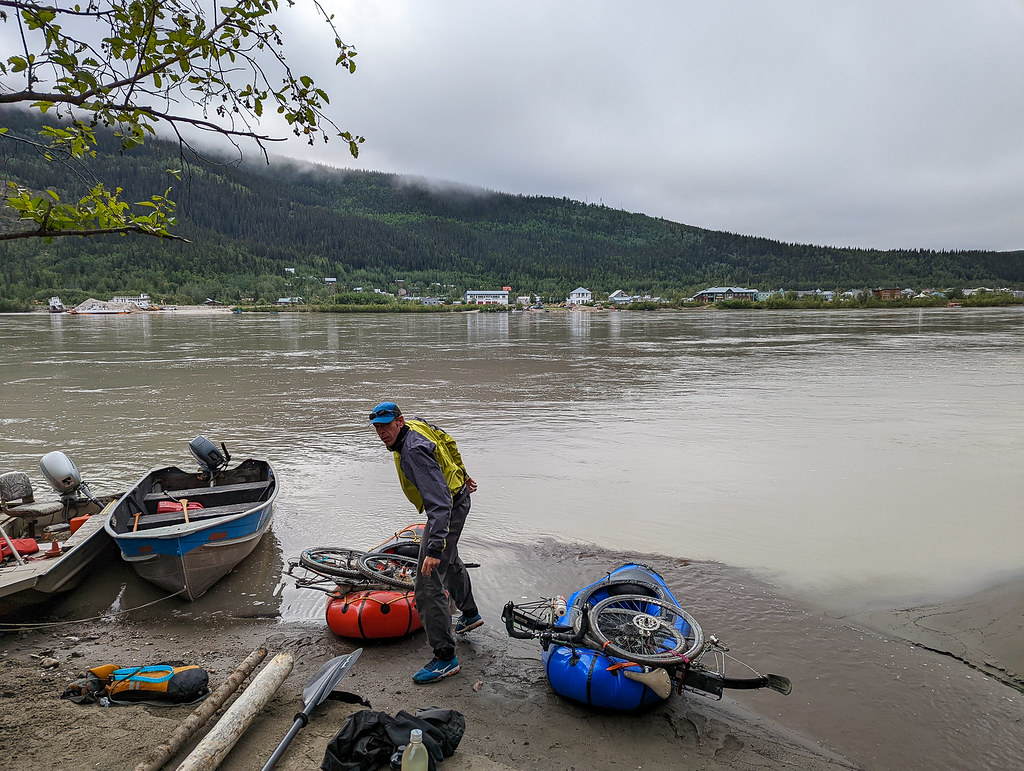
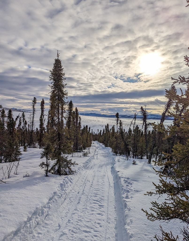
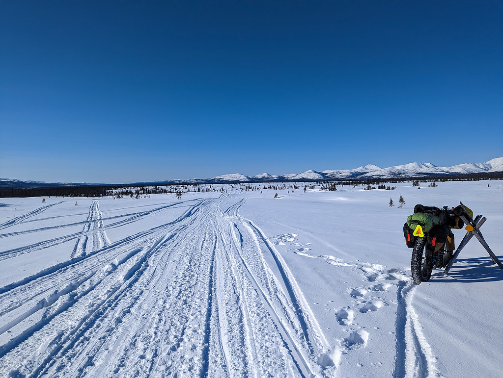
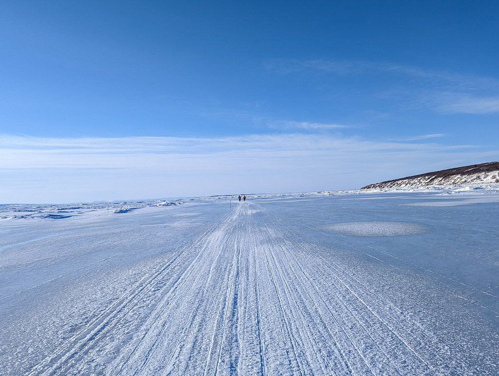
We resupplied, wading through the giant pile of huge trash bags the race organizers had left for us to find our stuff and hit the stack.  In the morning I had a cup of coffee from the Iditarod dog race staff, and we hit the road.  The trail was now an iron-hard sidewalk of fast riding – so hard, so fast! 

ITI 2023 ITI 2023 ITI 2023

All that wet snow had frozen super hard, and we had the best trail conditions I have ever seen – so firm, so fast! 

ITI 2023 ITI 2023 ITI 2023


We zoomed on to Shageluk, and were welcomed into town by Chevy Roach (https://www.facebook.com/roachfamilylbz/) and family, who opened their store where we got pizza, ice cream, and other stuff, then put us up in a small house, it was fantastic!  Later I learned they are famous, and have their own reality show as part of life below zero. In the morning we were on the trail again, heading through Anvik, Grayling, and eventually stopping for the night 20 miles down the trail past Grayling.   In Anvik I had pudding packs which Bill made fun of me for, but I love those things on the trail, and in Grayling there was a brief panic when I accidentally broke the Inreach app on my phone, requiring me to beg a wifi connection briefly.  We also stopped at Shirley Clarke’s and had lunch. Shirley is quite a character and an amazing cook! 

ITI 2023 ITI 2023 ITI 2023

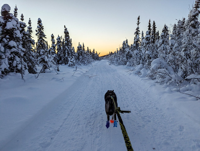
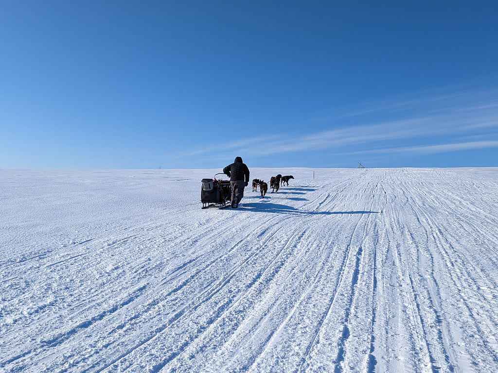
In the morning we zoomed on to Eagle Island, where we saw Dan of Dewclaw stopped with his dogs and I said hi to some of my dog Eddy’s siblings. 

ITI 2023 ITI 2023 ITI 2023 ITI 2023


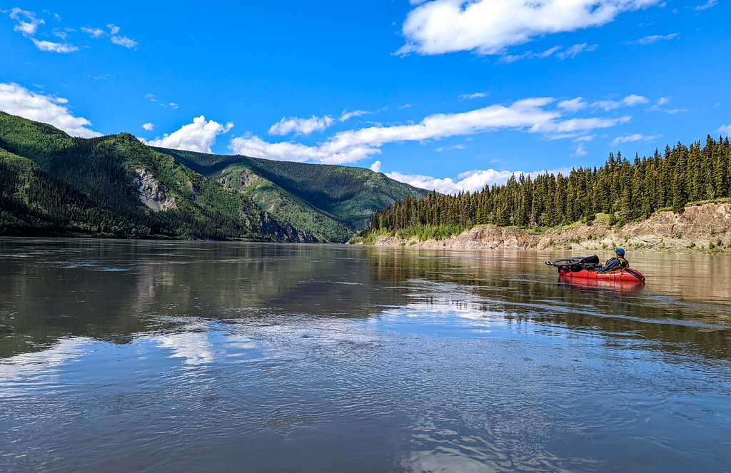
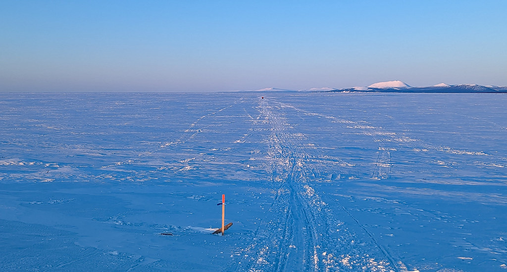
Dan looked happy, more so than some of the other mushers we saw.  We were now in the mix with the mushers and saw mushers nearly constantly until we arrived in Nome.  After Eagle Island we rode on to Kaltag, doing the whole section of the Yukon river in 32 hours, which is amazing. The next day we rode to Unalakleet. 

ITI 2023 ITI 2023ITI 2023 ITI 2023 ITI 2023 ITI 2023

I love that section of the trail, as the transition from Interior Alaska to the coast is so stark, and it really feels like I have gone from one world to another.  The people on the trail change as well, with a lot more locals using the trail system.  I bumped into a young man with a seal skin hat at Old Woman cabin, and when I complimented him on his great hat he said his grandma made it for him. 

ITI 2023

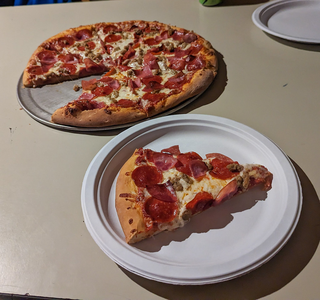
Such a different world, and it is so neat to share it with the locals!  We spent the night at Peace on Earth pizza, crashing on the floor after eating lots of pizza, and then having more Pizza for dinner. 

ITI 2023 ITI 2023 ITI 2023

Brent at Peace on Earth is a wonderful person!  The next day we were texted by Jeff O warning us about a big storm system coming in, so we pressed on to Kaltag, hoping to arrive just before the storm hit, but instead the storm hit when we were still a ways out, slowing us down to a crawl at a few points.  Otherwise, the conditions were fantastic though – so firm, so fast! 

ITI 2023


When we arrived at Kaltag we were let into the school, where we crashed for nearly 12 hours.  The next day we rode from Kaltag to White Mountain, stopping in Elim and in Golvin. 

ITI 2023 ITI 2023 ITI 2023 ITI 2023ITI 2023ITI 2023ITI 2023ITI 2023

We were met in Golvin by a small group who invited us into the school and served us dinner.  Grilled cheese sandwiches with moose – so yummy, and so welcoming!  I was really excited to meet folks from Golvin, as the other three times I have passed through there I have not seen anyone. 

The evening we spent with Jack and his family, with his son Liam cooking us a fantastic dinner.  Then the next day we rode into Nome, stopping briefly for burgers at Safety, then finished a few minutes before the musher Michael Williams Jr from Aniak.   

ITI 2023

Cute “dropped” dog at Safety who was living the best life, pets and hamburgers from a constant stream of Iditarod tour groups. He belongs to a Fairbanks musher, so it was great to see someone from home, ha!

We had a surprise encounter with Jeff O and Heather B in the hills outside Topkok  Jeff and Heather are friends from Fairbanks, and both current ITI record holders – Jeff for the northern route to Nome and Heather has the woman’s record to McGrath.   They are very good friends with Jamie and were super excited to see us.  And of course, us to see them. They had been planning to ride to Kaltag from Nome but the various storms had pinned them down, gradually reducing their goals to eventually Shagtoolik, where they flew back to Nome.   I thanked Jeff for helping me get a Seatpost, which he poh-pooped, but he was a huge help in Nancy getting me a new post.

ITI 2023 ITI 2023 ITI 2023 ITI 2023 ITI 2023


When we finished in Nome, Jodie Bailey of Dewclaw met us at the finish, handing me pizza, bananas, and a huge thing of M&Ms.  So appreciated!

Bill, Jamie, and I spent the next few days hanging out in Nome, enjoying the sights, and watching the last few mushers come in.  At that point, I was pretty worn out socially and needed some people free time, but I survived.  My friends Sue and Glen were out of town, but they generously allowed us to crash at their house with Egor “the very chatty” house sitter.  Sue is a very talkative person, so I was a bit worried about someone Sue would describe as ‘very chatty” but Egor turned out to be a very interested miner from the Lake Baikal region.   Thanks, Glen and Sue! 
I would like to thank my family Nancy, Molly, and Lizzy for letting me disappear on this adventure for nearly a month – you guys rock. Molly also edited this blog post, with lots of helpful and constructive criticism.  Better than Lizzy, at least, who told me I write in a very simplistic and childish manner -hah! 

I don’t think I am going to do the whole Nome route again – it is really time-consuming and only parts are worthwhile.  For segments I felt like I was holding the fast forward button, just burning time in the middle of no where with not much to gain. Spending life in “fast forward” spinning my wheels just to get to a place worth visiting doesn’t seem like a good use of my time… I might do sections again – Kaltag to Nome, and Ophir to Shageluk are really worth doing! 

To those that have come before – log books and cabin walls of the Iditarod Trail

Thursday, March 23rd, 2023

This spring I biked from Knik to Nome on the southern route. I will eventually post a write-up about that, but meanwhile, I wanted to say thanks to everyone who has come before me.

The Southern route passes through a bunch of shelter cabins and their walls and log books were fascinating reminders of everyone who has ridden, walked, mushed, skied, and snowmachined the trail before me. So many great adventures, and reading about these adventures inspired me to eventually ride my bike on the same trails so many years later. A big thank you, I wouldn’t have had this wonderful experience without you blazing the trail before me!

Highlights..


Andy Sterns, Frank, and Kevin biked Dawson to Nome in 2003 on normal mountain bikes way before fat bikes.

Log Book

They even have an old documentary about their ride, a total classic. Andy gets teased a lot in the video, however, it should be pointed out Andy doesn’t have full control of one of his legs from a skiing accident a long time ago, and seeing him push his bike all that way is nothing short of amazing. Andy is the world’s most cheerful human being.

Mike C whose blog details many stories of the trail, and who spent years trying (and eventually succeeding!) to ride to Nome unsupported. No time inside, no resupply, no fires. Amazing!

Log Book

There were a bunch of entries from 2008..

Log Book Log Book

And a few from 2003, the year the Iditarod started in Fairbanks, and the human-powered race also started in Fairbanks. The stories from that year are epic, with lots of snow and the human-powered travelers getting stuck for days in Kokrine Hills Bible Camp eating endless pancakes.. I clipped Tom Possert entry, alas, not noticing it until reviewing photos much later.

Log Book

And from 2005, when there were only two finishers in the human-powered race, Carl Hutching and Dimitri Kieffer.

Log Book Log Book

My friends Ned Rozell and Bobby G.

Log Book

Tracy and Jay Petervary.. I think that year Tracy won both the woman’s division of the McGrath and Nome race.

Log Book

RJ Sauer, wonderful person and the maker of the “Thin White Line”, one of the first films about the human-powered race…

Log Book

His film is available on Vimeo, and really worth watching.

A Thin White Line from Brüdder on Vimeo.

Plus lots of other notables..

Log Book Log Book Log Book Log Book Log Book Log Book Log Book

Thanks – I wouldn’t have been there without you!

Early Season Trips…

Tuesday, December 27th, 2022

I haven’t been very active on the blog lately, so I decided to post a few photos from the start of winter. I have had quite a few overnight bike trips, which have been fantastic!

New friends were made..

Early Season 22 Early Season 22

Sometimes the conditions were not great…

PXL_20221126_020806234 PXL_20221126_011727235.NIGHT Early Season 22

And sometimes they were awesome…

Early Season 22 Early Season 22 Early Season 22 Early Season 22

Yay for bikes, and yay for winter! I would also like to thank BLM for the beautiful trail system of the White Mountains NRA – you guys rock!

Tok to Tok via Dawson, the Yukon, and Eagle!

Monday, November 14th, 2022

Tom and I had been planning on doing the classic Nebesna to McCarthy trip, but as the time approached, it was looking more and more like it was going to be pretty horrible weather-wise.  The Nebesna Road washed out, then the Richardson highway washed out, and the forecast had more rain than I thought was fun.  Walking up Cooper and Geohenda at a near flood stage seemed less fun than it could be.  Eventually, we settled on the backup plan of biking Tok to Dawson, then packrafting to Eagle, and biking back to Tok.  It would be a loop, with some bike rafting, yay!   I hadn’t been to Eagle outside the winter, and I had never been on that section of the Yukon. 

So on a sunny early afternoon, Tom and I left Tok, heading to Taylor Highway. 

PXL_20220720_213226850

The first day was awesome, but oh so hilly. The road had also had its lines newly repainted, and DOT perhaps spent less time cleaning up than they should have…

Hmm..


We spent the night at the West Fork Campground, which is the nicest campground I have been at pretty much ever.  We camped in a biker spot that had a covered area with a nice view from a small bluff.

Best Campsite Ever!

In the evening I watched a muskrat or very small beaver swim back and forth in a little lake below the bluff.  It is a beautiful spot!  The campground host was a bit starved for human company and was super chatty.   

In the morning we left for Chicken and Canada.  A few minutes into our ride coming around a corner I startled a wolf, which gave the rest of the day a nice feel. 

Taylor Road Damage


We stopped to explore the various parts of Chicken, then moved on and camped in Canada across the border. 

A healthy mid-morning snack at Chicken. Photo compliments of Tom M.

The Chicken of Chicken!

Untitled

The Yukon!

The Top of the World

The Top of the World

We went to bed in the rain, and I had to get up in the middle of the night when the floor of my tent started floating – apparently, I had set up my tent in a puddle!  After I relocated it was much better.
The next day we made it to Dawson, and it started with a really long downhill – yay!

Long Downhill to Dawson

Ferry ride

Tom enjoying the ferry life..

We explored a bit, had dinner, resupplied, and even showered – yay!  Tom got some scanned copies of a Yukon river float guide with really wonderful maps and notes that I was later to by Yukon River (Dawson-Circle) by Mike Rourke .  

My resupply was a bit chaotic – the little Dawson store was crowded, I was overwhelmed by options, and I had not yet processed that the next 100 miles were by river not bike, so I could take almost anything with me. 

The guide was great, but I was amused by references to “overgrown” this, and “overgrown” that.  I got the feeling the author hated trees.   The next day we floated down the Yukon, putting in at a little tiny cove right above the ferry landing.

Getting ready to float!

It was an awesome launch spot, and the float was fantastic.  I had been worried a bit about floating the Yukon – it is a big river and moves fast, and the bike on the boat is a bit awkward but was all good, and a super fun float.  There were a few odd eddies called out as “Strong Eddy” in the guide, but otherwise, it was a fast and mellow float.

Steamboat Graveyard

Steamboat Graveyard

Cool rocks

Tom hamming it up.


We made Forty Mile (which is 50 miles from Dawson) in the late afternoon and made camp.  Forty Mile was awesome, and a super neat place to explore.

The "metal shop"


The buildings were neat to explore, and the campsite was top-notch.  We did find a few odd things though…

Odd..


Alas, I discovered in my confused shopping daze in Dawson that the “Wow Butter” I had purchased was soy butter, not peanut butter.  It was still good, just gave my “peanut butter” & bagel lunches an odd flavor.   When I got back the twins made fun of me for being such an idiot.  The peanut in the red circle with the cross should have clued me in…

In the morning we headed out and floated to Eagle.  We had the river entirely to ourselves besides seeing a dog on the river bank, and a single skiff headed upriver.  The driver of the skiff was too busy scanning the riverbanks to notice us, and I think didn’t even see us as he zoomed by.

Tom at one point accused me of being a weather doomsayer.  I was apparently always pointing at dark clouds and saying we were about to get rained on.  Fortunately, we didn’t get rained on much on the float.   I had been told stories of horrible headwinds on the Yukon, with big waves that come up quickly, but we didn’t see any sign of it, though it loomed ominously in my avid imagination. /

Old Man and Old Woman rocks

Yukon Floating

PXL_20220724_222612490


The views from the river were fantastic!   At one point Tom and I agreed the trees on the hillside above us looked just like a scene from a model train set – idealized trees, surrounded by green foliage.  There were also huge rock bluffs, and neat rock formations, not to mention a very curious seagull that followed us for miles.  The gull might have gotten some crackers from me…

Buddy

We arrived in Eagle too late for the store to be open but explored a bit.

Sunny morning..

Sign of things to come?

Portent of doom?

I was very worried about calling into customs, possibly overly concerned about it.  We had been told about a phone next to the dock, near the store.  After a bit of searching, we found it and called customs to report in.

The "special" phone

 Then camped at “Fort Egbert”, a place of some significance to me.  My middle name is Egbert, and I’ve always hated it. 

Fort Egbert!

In the morning we hit the store, arriving an hour before the opening time due to our not changing our clocks, but the guy running it didn’t mind and let us in.   We then headed out and biked to the  Walker Fork Campground. 

Taylor raspberries

American #1 Creek!

Untitled

Tom Zooming

Up, up, up!


The ride was fantastic, but again, oh, so hilly!  It was very, very scenic, and I really enjoyed the narrow road with almost no traffic.   The next day we completely loop back to Tok, stopping for a nice dinner at Fast Eddies, and were home in the late evening. 

This trip was very worth doing.  I had a blast.  Things to note:

  • All the float times I got for the Yukon were way off.  The water was hauling.  Going 6-8mph consistently. 
  • Getting to shore required work – the current was so fast often that the perfect spot would be way gone by the time we reached shore.  
  • Packrafts were fine but were not fast (See above.) 
  • The road surfaces were pretty good and not very muddy. 
  • Chicken has several gas station-type places with some basic snacks and several places to eat.  Otherwise, the only resupply options are Dawson (a big store) and Eagle (a small, but well-stocked store)
  • Check the expiration dates on anything you get from the Eagle store.  On a past trip, I got several years expired cheese, and on this trip Tom got a box of granola bars that were several years expired. 
  • Water worth drinking was a bit hard to find on the Yukon, but not impossible. 
  • The Yukon was so much more scenic than I expected! 
  • Eagle has a post office, with better planning I would have mailed my boat back to me in Fairbanks. 
  • The BLM campgrounds and the campground on the river at Dawson are fantastic! 
  • The highways are much, much hillier than I expected.  So many hills! 
  • Mileage Totals:
    Tok to Dawson – 190 Miles, 16kft of climbing
    Dawson to 40 Mile – 50 miles
    40 Mile to Eagle – 51 miles
    Eagle to Tok – 175 miles, 16k ft of climbing

I really want to float Eagle to Circle now.  I hope it is in my future! 

Empty Denali

Saturday, September 10th, 2022
Walking around the closure

Last year when the Denali NP road closed at the “Pretty Rocks” slump, I was very tempted to just haul my bike around the closure and bike the road after the slump. I assumed it wasn’t legal in the park to push or ride one’s bike around the slump. Roughly a year later and after my friend Tom suggested it was possible, I did some research and noticed it was not only legal (that is “allowed”) and appeared to biked somewhat frequently. Strava segments on the Park road after the closed bit showed a fair bit of traffic. So, on a overcast Saturday morning Tom and I meet up at the Denali NP’s Backcountry information center, got some permits, hopped a bus to the end of pavement, and started biking. I was somewhat bemused by the Denali staff, as just about every interaction could be summarized as some variation on “your not going to make it”, and constant reminders of how long it was to our selected backcountry units just past Toklat.
The ride to the road closure was fast and fun, though Tom got two flats in the first 25 miles, and there was one bus jam for a bear that we couldn’t see.

Neat Clouds


Soon we were dropping down the stairs to the East Fork of the Toklat river, after one last “that is a really long way to push that gravel bike” from a NPS staffer, and we were down riding then pushing up the river bed to go around the Pretty Rocks slump. The last NPS staffer said there were currently no NPS staff on the other side of the road, and the road was in bad shape. Our plan was just to go up the East fork of the Toklat, then head west towards the creeks draining down from Polychrome Glacier, then take a wash back up to the park road.

Pushing

Pretty Rocks Slump

Pretty Rocks Slump


That worked well, though the route was mostly a bit too rocky for me to bike on my touring tires in a safe manner. After a few creek crossings, and a little more than two hours of walking with the bikes we were back on the road, biking towards Toklat.

Empty roads


It was easy to find the right route, and there were lots of tracks to follow. Biking the road was an interesting experience – we had it entirely to ourselves, with no traffic besides three bikers and two people on foot. The road was mostly intact, though I was surprised by one unexpected drop-off around a corner, it wasn’t very deep and I made it over without going over my handlebars.

We camped in our unit as it started to get dark, and I fell asleep to rain the tent fly. In the morning we rode to Kantishna and back near the Eielson Visitor Center.

Neat clouds

Empty roads past Toklat

Eielson was creepily empty. On the way in we saw several Camp Denali buses there, with folks going for hikes, but the place was otherwise completely abandoned. Oddly, mechanical noises were coming from the building, and it looked like the heat was still on.

Empty Ellison

Empty Ellison

Folks can't read apparently

Toklat was also a ghost town with the bus schedule from a year ago still up.

Schedule from last years closure

Loved the LOTRs reference

A funny note left in the bear lockers at Toklat with a Lord of the Rings reference.

Kantishna still had stuff going on though, the outhouses at the runway were still open, and the lodges seemed to be all still in operation in one form or another.

Almost to Kantishna

The road near Kantishna, which is new to me, yay!

Extreme Danger!

The Kantishna airstrip signage is a bit over the top..

Our second night’s campsite was the best I have ever had in Denali, with a wonderful view of the Muldrow glacier. The sunset was fantastic.

Best Campsite Ever!

The following day we biked back out, running into a few more hikers, but otherwise didn’t see anyone else until walking around the closure, where we ran into a few hikers, and could see a few more in the distance.

The ride was a complete blast – the road is mostly in better shape than it is with buses. Almost no washboard and just a few short sections washed out. It is a like a 20ft wide bike path, though really scenic country.. so hard to beat!

Denali, from Stony Overlook

Denali, from Stony Overlook

Denali!

Wildlife wise we had a pretty busy trip – there were sheep on several ridges, but they were far away and only little white dots. We saw several groups of caribou in the distance, one quite close up, and several moose in the distance, and a bear on the bus ride. Just about all the megafauna besides a wolf!
We did have to detour around a bear near Stoney Dome on the way out. After waiting 15 minutes or so for a bear happily eating berries 20ft or so from the road, we pushed our bikes off the road and around the bear, well outside the suggested 300-yard safe zone, the NPS requires.

Walking around the bears

Untitled

Pearson's Cabin

Road damage

Leaving the road for the detour around the slump

Slump

Heading up back to the road

The climb back up the “civilaized part of the road..”


A few hours later we were back in civilization, wandering around looking for the employees-only bar Tom was fascinated with. Biking around the employee’s only area reminded me of working in Skagway in my late teens and early twenties, not the happiest time of my life, and I was made a bit melancholy, and left Tom to his devices and drove home, making it in time to see the twins before they were asleep.

The closed part of the Denali road is a pretty interesting experience. However, seeing Denali’s response to the closure was a bit odd – they seem to be operating like the closed area is just gone. There was very little sign of any motorized traffic from Eielson to Toklat. All the outhouses were closed and locked up outside Kantishna. A bit odd, as while the road is closed, the area beyond it is still quite accessible, and is going to see a fair bit of bike and foot traffic. The NPS staff seem to be discouraging anyone from biking or otherwise traveling past the closure. Perhaps that is understandable, but given we saw several Camp Denali buses, it is still quite possible to drive the road after the closure, and I would have hoped Denali would have moved to have some sort of reduced presence, not a complete abandonment. As one NPS wildlife person told me “As far as we are concerned no one is driving the road.” when I asked about traffic from the lodges.

Some notes for others interested in biking the road past the closure:

  • The route around the slump is 5 miles. It is possible to ride a bike through most of it, though my little tires made that hard. Staying closer to the hill seems to have firmer and a bit smoother surface than the more actively flooded area. On an unloaded mountain bike, it should be almost entirely ridable. There are at least two water crossings, so expect wet feet.
  • Riding your bike off the road in Denali is apparently fine so long as you are not causing “resource damage”, whatever that means.
  • The walk around the closed part took Tom and I a little over two hours each way. YMMV.
  • The Denali staff say you can camp 150ft from the road centerline, not the 1/4mile that normally is required.
  • A backcountry permit is required to camp, and you need to get a backcountry unit to camp in, and camp in that unit. Be prepared for the backcountry permit process to take a while, and have all the stuff required (bear canister/ursack etc)
  • Expect the Denali staff to be skeptical and tell you it will be much harder than expected.
  • Expect no assistance from the NPS past the closure. I would have enough food to walk my bike to Kantishna or back out.
    • Which really, wouldn’t be that big of a deal – if you push your bike 12 hours at 2.5 miles an hour that is 30 miles, you could make it from near Eielson back to the area served by the busses or Kantishna in less than a day. It wouldn’t be fun, but totally doable – I would just keep in mind you mind have to do that if something goes wrong, and be prepared.
  • Be prepared to have some long bear delays.
  • Have fun – it is a blast back there, and enjoy it, in a year or so (or 10 if the NPS decides to re-route all the way around the Polychrome area. ) it will be back to “normal” with busses of people driving out and back and only getting out to go the bathroom.

So… Get Out and Bike It!

(Before some idiot does something stupid, wrecks it, and it is closed to bikes. 🙂 )

PS: Does anyone know what this sign means? I thought it meant to wait 10 minutes if you see sheep, others thought it means the road is closed 10 minutes after the hour, any idea what the official meaning is?

Odd Sign