Posts Tagged ‘chena dome’

Angel Creek 50, the ultra walk

Monday, July 18th, 2016

Late this spring, in a moment of weakness, I signed up for a local 50 mile running race, the Angel Creek 50. It was a bit of an experiment for me – I don’t have any big biking plans this summer, and wanted to try something different. I run a fair bit, but don’t enter in to running races all that frequently, mainly only shorter races with the family.

Alas, despite my best intentions, my training up to the race was a bit spotty – I got several months of running in, trying to get lots of short runs in and a few longer (so like 12 miles) run in a week. My right hamstring started giving me issues though, and I got distracted by fun trips, and so my running died off a bit. Eventually race day arrived, and I showed up a bit under trained, but since my only goal was to make the mile 42, 13 hours, 30 minutes cut off time, which is slightly under my walking pace, I figured I should make the cutoff.

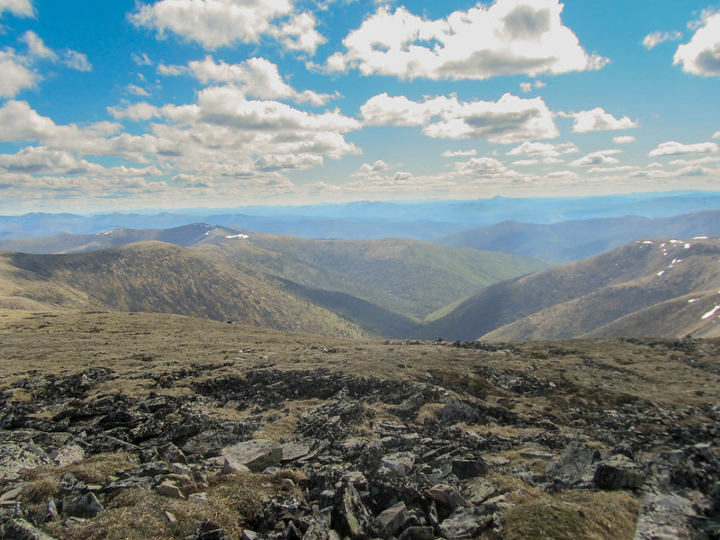
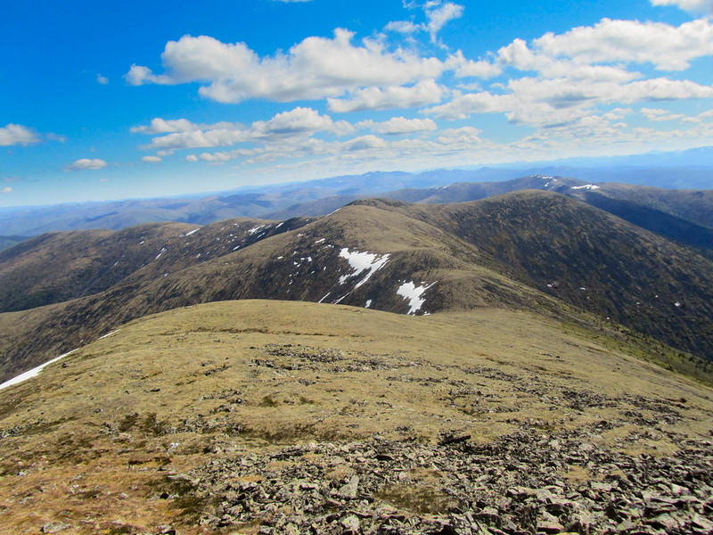
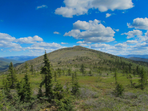
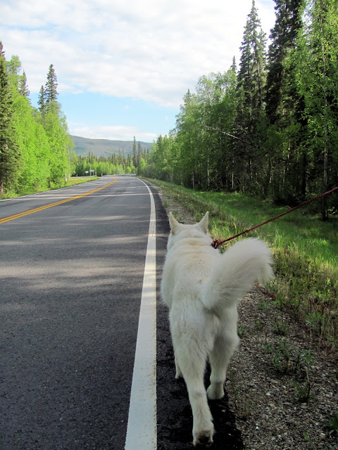
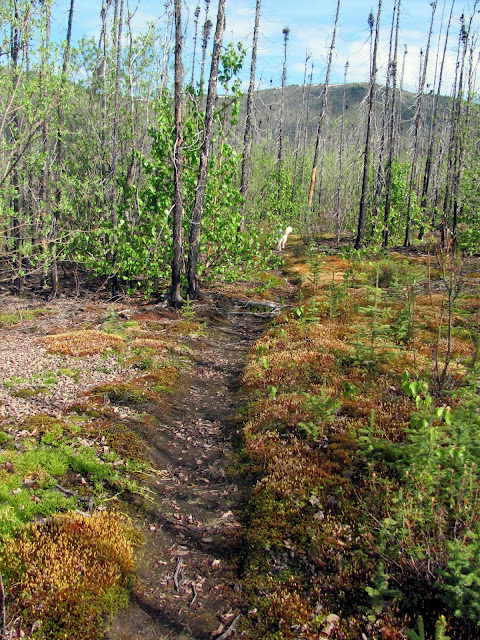
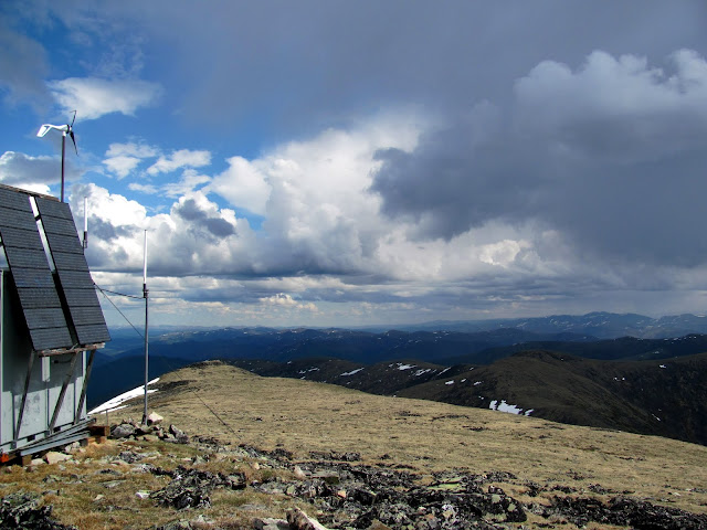
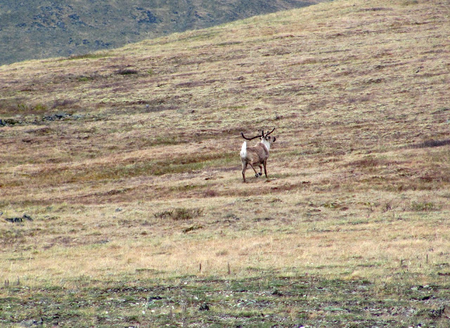
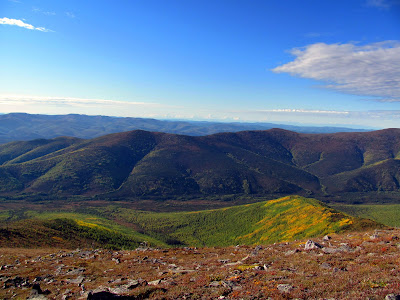
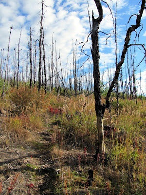
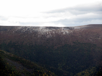
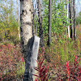
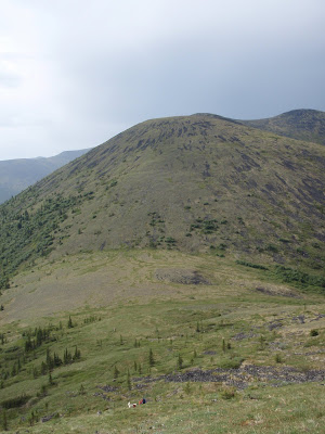
The race is in the Chena River State Recreation Area, on a mix of single track and atv trails. I have been on most of the trails before, but there are a few sections that I had never been on, and I was looking forward to it!

The race starts at Twin Bear Camp and ends Chena Hotsprings, which are a little over 20 miles apart, so I took advantage of the race’s shuttle the evening before the race start, and camped at the start. I had brought a tent, but Twin Bears turned out to have quite the facility, and I ended up staying in one of their bunk houses, with Ned. There were so many bunkhouses I think each racer could have had one to themselves. The race start was a nice and early 5am, so we got up at 4am, eating and getting ready. There was a brief pre-race meeting, and before I knew it we were off!

The race sort of went by in a blur.

I ran the first 10 miles or so, then slowly started walking more and more. I didn’t run more than a few miles after mile 25, as my quads were shot, and my right knee was super unhappy after the big downhills around mile 20.

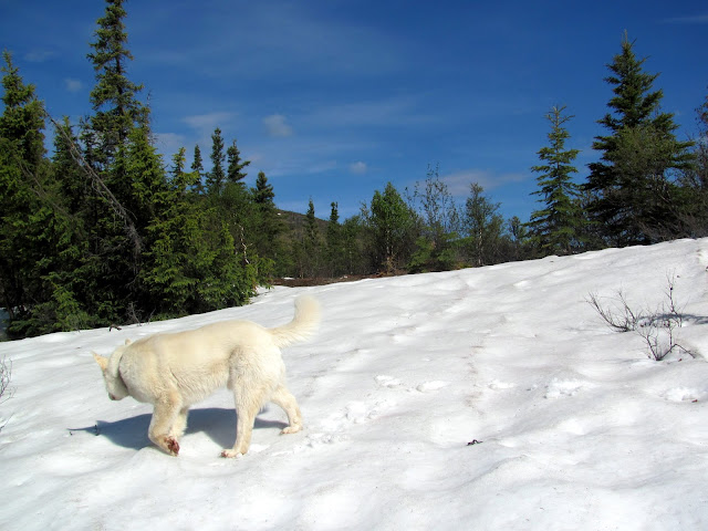
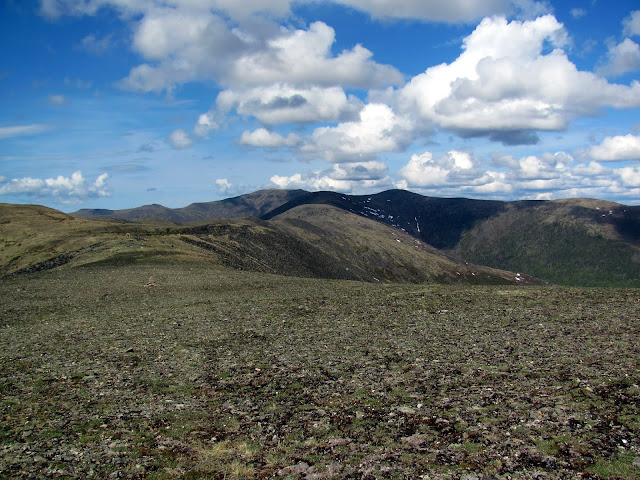
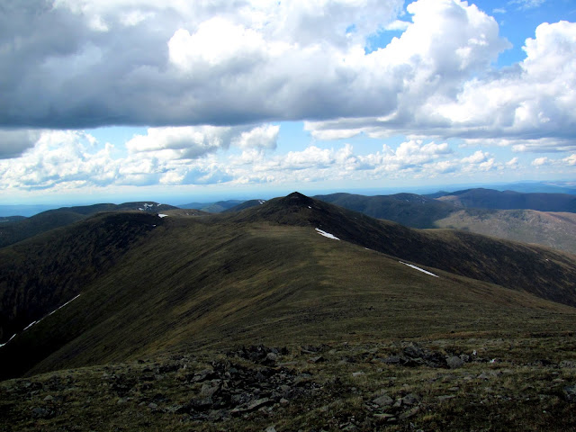
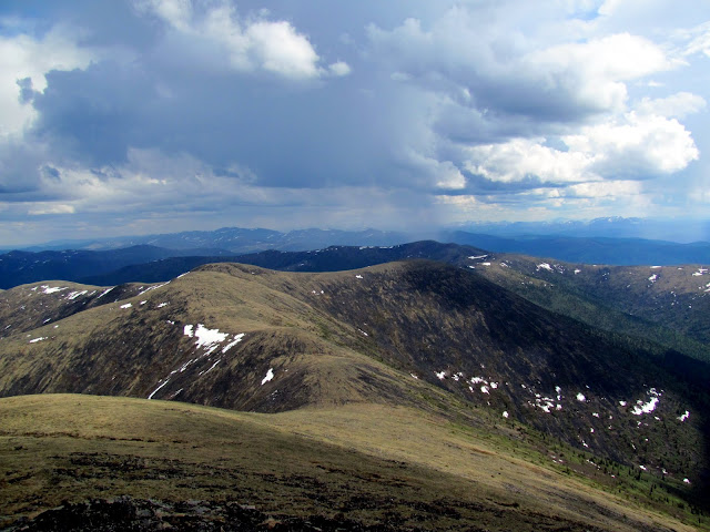
It was raining lightly at the start, then by mile 8 ish it started dumping. No big deal, the weather was not that cold, and I am almost always too hot. I tried to eat every hour or so, and drink every 10 minutes or so. That seemed to work, as I stayed hydrated for most of the race, and didn’t have energy issues. At mile 18 the climbing started, and I learned the hoka stinsons I was using had really poor grip on wet muddy rocks. No big deal, it just required a bit more care than I would have liked. The miles 18 – 20 ish were on trail I had never been on before, and I enjoyed it, though I was now mostly walking, with a few bits of running. The visibility on the ridges was pretty poor, but the trail was pretty easy to follow, in my opinion at least.

IMG_20160716_095148020

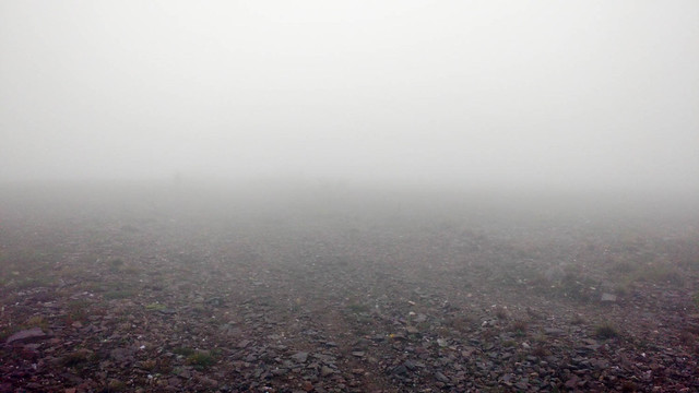
Folks made fun of me at the race finish for saying that, but I didn’t have any trouble finding my way. I had to stop a few times and look around for the next rock cairn, but that only took a few seconds, nothing major, but that might have only been because I was going so slow.

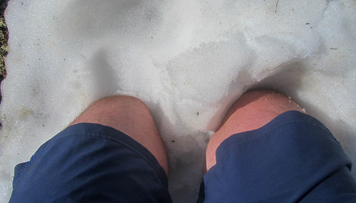
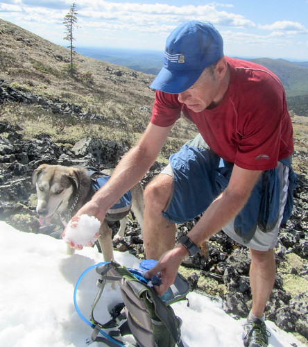
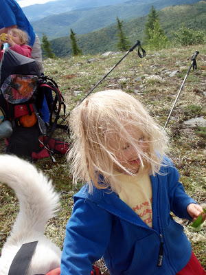
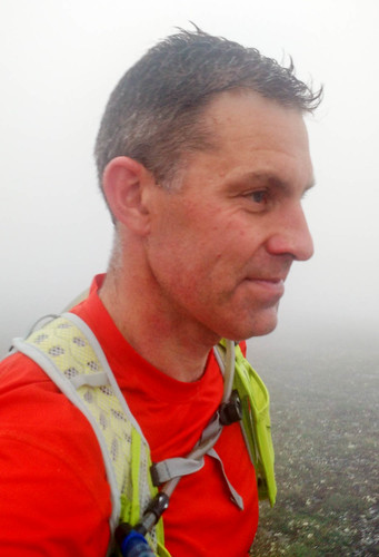
I didn’t take very many photos, as I only had my phone, but I did get a selfie..

IMG_20160716_095156120

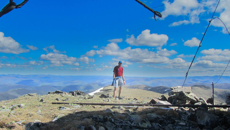
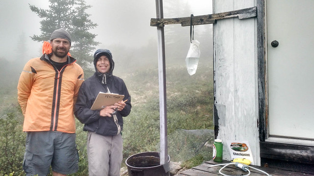
Andy and Chris were at the Chena Dome trail shelter, and Andy was as cheerful as ever.
IMG_20160716_102538256_HDR

I had been by myself for most of the race, but Andy said my friend Tom was only 10 minutes ahead, with a “big group”. Alas, I never caught up with them.

The rest of the race sort of zoomed by, and I walked the next 25 miles. I would have loved to have run more, but alas, my legs were not up for it.

I made the mile 42 cut off by an hour and a half, and finished at 14 hours, 20 minutes ish.

It was a super fun event, and I think I will try doing it again next year, though hopefully I will be able to run a lot more of it.

I used the Strava app on my phone during the race, and it worked great. It told me my pace every mile, which provided lots of motivation. The few times I was around other people I muted it, but since I was by myself for most of the race, it didn’t annoy anyone. When I finished I still had over 50% of the battery left, which was good news.

I walked/ran everything but the last 8 miles in some hoka stinsons, which was a mixed success. They are super comfortable, but they are hard to tighten down fully, and get next to no traction in mud or wet rocks. I have run a lot in them, but never in this much rain and wet. The left shoe started feeling funny after mile 25, and after the race I noticed it had “blew out” in a section.

IMG_20160718_090914333

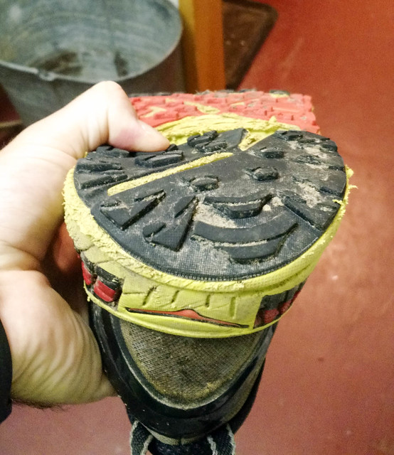
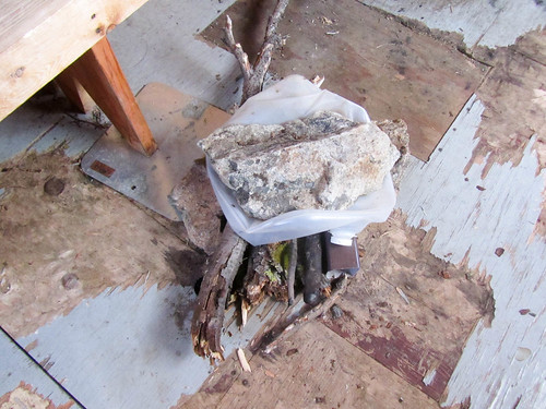
It is hard to tell from the photo, but there is big dent and soft spot where my thumb is.

The final 8 miles of the race I ran is some montrail road shoes, and they got much, much better grip.

A huge thank you to my family for letting me disappear for this race, and to the folks who put it on – Drew Harrington, Karen Taber, and George Berry. You guys rock, I really enjoyed it.

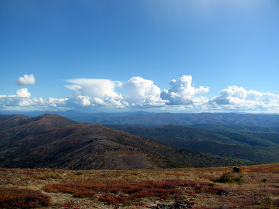
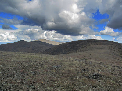
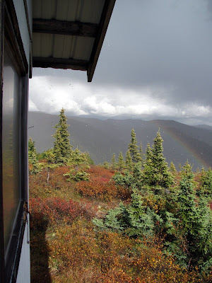
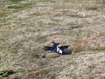
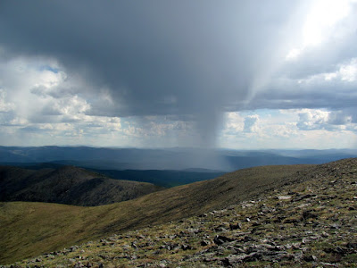
A few more photos can be found here:
Angel Creek 50

I learned a few things, mainly I walk at roughly a 17 minute mile pace, which is slightly slower than I would have expected.

An update: 5 days after the race, I am fully recovered, except my feet which are still a bit destroyed. I ended up with blisters on the ball of both feet, and they are taking a while to heal up completely.

Chena Dome..

Tuesday, May 31st, 2016

In a moment of weakness, I signed up for the Angel Creek 50, a local 50 mile foot race. The cut off for the race is 13.5 hours for the last checkpoint at mile 42, which is pretty close to my walking pace. To see if I could make it, Tom and I headed out to hike Chena Dome trail, a very hilly local 29 mile hike.

The weather was fantastic..

IMG_0051

I ran the easy bits, but alas, my knees didn’t enjoy the downhills.. fortunately there was still some snow, which felt so good on them..

IMG_0040

IMG_0043

The trail was in great shape, but it was baking hot. I am not really a hot weather person, so climbing up some of those hills nearly scrambled my brain.

There was a fair bit of water on the trail, and a bit of snow still. In a few weeks it might be hard to find any water besides what is in the catchment system at the shelter.

IMG_0054

The shelter at mile 17 was looking a bit beat up.. and, alas, the hole in the floor was a bit bigger than it was when I last visited, and lots more had been chewed on by porcupines…

IMG_0062

IMG_0059

IMG_0067

The last few hours were even hotter.. Fortunately a few hours before we finished we ran across a small clean snowfield, which we used to top off our water supplies. The cold water was heavenly.
IMG_0068

Tom, Shiloh, and I were very happy to reach the car, and headed off for a sock and dinner at the hotsprings.

In end, it took us 9 hours to do the 29 miles, which is just barely over the cutoff. I was beat when I finished! Hopefully I can run of more of the actual course than I can of Chena Dome!

This was the first time in a very long time I have done a hike without Remus. Remus is now 13, and getting a bit too old for long days. When I left in the morning with Shiloh, he started barking and was not happy to be left behind, but was consoled by being let into the house and being given a huge rawhide chew. Rumor has it when the twins woke up they gave him an old bagel with bacon and provolone. It is tough getting old..

Thanks for the company Tom!

Chena Dome..

Tuesday, June 5th, 2012

Remus and I spent a wonderful day hiking the Chena Dome trail. This is a classic hike I do every year, and it just seems to get better each time I hike it.


It has been a wet spring, bringing on the green in all its glory.


Someone has lost his tail..

This hike has lots and lots of climbing and decending. For some of the descents you can see the next climb which heads right back up to the same level you are just leaving. Up, down. Up down. Repeat. The rewards are wonderful ridge hiking and amazing views.

As usual I didn’t see any other humans, but I did see several other mammals.

Momma bear and her offspring had me a bit nervous, as they were heading my way. I stopped at the trail shelter briefly, and by the time I was on the next hill a quarter of a mile away I could see them sitting on its porch. I was a bit worried they were going to start following me, but they continued to along their way, which fortunately diverged from mine.

After the bears a small thunderstorm moved though, dropping the temperatures and making Remus happy.

Not a lot of words, but it was a wonderful day. A little under 11 hours and 30 miles I ended it sore and happy.

Chena Dome in a Day – the 2011 edition

Monday, August 29th, 2011

One of my favorite hikes in the greater Fairbanks area is Chena Dome. It is a wonderful 30 mile long ridge hike, with wonderful views and fantastic walking, and lots of climbing. I have made it a goal to hike it at least once a year. Lately I have been doing it as a long day hike, taking a little less than 12 hours to finish the loop. Doing it as a day hike means you don’t have to carry a heavy pack up and down all those hills. You can read about some of the other times I have hiked this trail with the family and as a day hike. It took us about 11.5 hours to hike the 30 miles and 8k to 14k feet of climbing (how much actual climbing there is is open to debate apparently) , which is about what it has taken me the other two times I have done it. Not nearly as fast as the rumored sub 7 hour times some of the local hot shot runners have done it in, but fast enough we got home at a reasonable hour.

My friend Tom, who joined me for this adventure, maintains that fall has yet to arrive, though I think the tree’s colorful display’s disagree with him.


The fireweed was in full color too.


The views from the ridges were, as always, fantastic.


Tom and I had fantastic weather for the hike for most of the day, though we had a brief and heavy rain storm while we were at the trail shelter at mile 17.


After the rain storm it appeared that a section of the ridge we had been on a hour or so before now a dusting of snow. It was nice to have missed that.


Near mile 8 there is a old plane crash.


The rubble and twisted plane parts has always been a pretty sad sight for me and a reminder of how dangerous air travel in Alaska was back in the day, and to some extent still is today. When I got back into town I decided to spend a bit of time looking for details on the crash. It appears the crash was a Curtiss C-46 operated by Transocean Airline on a flight from Umiat to Fairbanks. The plane crashed late in the evening on December 30, 1951. The details can be found here.

A photo of the plane, prior to the crash, complements of www.taloa.org .


I would love to know the full details of the crash if anyone has them. I found reference to a rescue attempt in -70f temperatures but was unable to find the CAB report on the accident – if anyone has it I would love to read it.

More photos can be found here.

Fun on the 4th – Hiking Chena Dome with the Family

Tuesday, July 6th, 2010

Chena Dome is one of the classic hikes of the interior. It is 30 miles long, with lots of ups and downs, but these are rewarded by great views and wonderful alpine hiking with very little brush or mud. Nancy and I decided this spring it would be a grand adventure to hike it with the Twins and see how well they handle it. As they are only four years old, they were not going to hike the whole thing and we expected to carry them at least two thirds of the time. The hike started off on a fine Saturday morning, though rain was in the forecast. As we started hiking up the trail, we were passed by someone hiking the other way. I talked to him a bit, and quickly learned that he had gone three miles and turned back because he “didn’t want to get wet” and turned back at the sight of black clouds moving in. This was somewhat ominous, but we pressed onwards. We were soon passed by two other parties, including a family with a six year old who was going to hike the whole trail without any help. This made quite an impression on our four year olds – hiking whole trail all by him self! The six year olds apparent lack of any whining made a more of an impression on Nancy and I – only six and already hard core! The twins walked the first three miles or so before being loaded up into the backpacks for nap time.


Alas, at about nap time the grade increased making for some fun uphills.

The first day of hiking was quite beautiful – while some very ominous black clouds blew though with a bit of thunder, the weather was quite nice.

After reaching mile seven or so the twins were pried out of their comfortable backpacks and started hiking again.

At a little after mile eight there is an airplane wreck, which provided a bit of excitement for the twins.

The airplane crash site is always a bit depressing, at least to me. Near the engine in the photo is the steering wheel – all smashed and bent.. it seems unlikely that anyone survived the crash. We camped in the next saddle.

Everyone enjoyed a fine dinner of rice, dried veggies, and cashew nuts. Yum, yum!

After dinner the twins and I wandered around, looking at the flowers…

And building some rock cairns.

During the cairn building processes Lizzy was very excited to find a rock shaped like the number one. The joys of being four..

The next morning things were a bit different – we awoke to a gentle rain on the tent.


When we finally made it outside, we found the ridge completely socked in, with about 100ft of visibility. The rest of the day the visibility ranged from 50ft to 1/4 mile until things cleared up in the evening. This made route finding a bit of a chore. In nice weather its it often feels like there are rock cairns every 10ft – in bad weather it feels like they are 10 miles apart. We never lost the trail, but it was quite hard to stay on the trail at several points.

The girls were quite the little troopers, and didn’t whine all that much, even though they spent most of the day wandering around in a white out in the rain.

They spent a bit more time in the backpack (must be nice to be able to retreat to the comfort of a rain proof covered self motorized transport that also provides food and drink on command) but otherwise seemed to enjoy themselves. Several times while Nancy and I were looking for the next cairn Lizzy would inject helpful advice like “You should look at the map” or “you didn’t loose the map did you”.
We also played the ever popular “Is that cairn taller than you?” game, in which the twins guessed if the next cairn would be shorter or taller then them. That game was a major hit.

Nancy also recited a version of Dorothy and the Wizard of Oz, the Hungry Caterpillar, and James and the Giant Peach from memory as hiking as rainy fog distractions.

Eventually we made it to the train shelter, were we made dinner and enjoyed some dryness.

The family with the six year old caught up with us at that point and we hung out for a while out of the rain. Eventually we took off and heading back out into the rain which was by this point slacking off and slowly turning into a partially cloudy evening.

The dogs enjoyed this section of the hike immensely – we were now out of the barren alpine rock fields and into mixed dwarf birch which they seem to enjoy a lot more. We took all three dogs, which included two 13 year olds and a 6 year old. The 13 year old dogs, Togiak and Polar, were quite the troopers, even though Togiak has a bit of arthritis.

By the end of the day the weather was quite nice, and the twins got some quality hiking time in.

We made camp just above a small saddle and eventually made it to bed when all the sugar the twins consumed wore off. The next morning arrived with a bit of rain but that quickly cleared off. Rain always sounds worse while in the tent.

Our final day turned out to be quite nice – the sun came out and it actually got reasonably hot and sunny.
The twins had a great time hiking in the fine weather.

With the nice weather, our little flying friends game out, alas.

Fortunately the hiking on the final day was a fairly fast 12 miles, and we made it out by 6, well in time to make it to Mia’s Cafe. The twins enjoyed vegetable yakisoba.


Mia’s food is always good. That little cafe is quite amazing – the burgers are great and at least the vegetable yakisoba is very good (better than any place in town actually). I am now hard pressed to decide weather to order a burger or noodles these days.. Life is hard!

Everyone had a great time on this trip, even though the weather is less than optimal. This bodes well for our Chilkoot plans later this summer, as the Chilkoot is a less strenuous hike (it has about half as much climbing).

Hope everyone is enjoying the summer!

Chena Dome In a Day

Thursday, May 27th, 2010

Last year I did Chena Dome as a day hike, and it was fun enough that I decided it should be a yearly ritual. This year it was hotter, dryer, and slightly slower. The trail is pretty dry right now, with a couple of tundra pools that had water but otherwise was very dry.

After about 1 pm (mile 9 or so) a thunder storm moved though the area, making this ridge hike a bit iffy. Storms blew though sporadically for the rest of the day, making things a bit fun.

Twice I felt a bit of static electricity that caused the hairs on my arms to feel funny, but this could be my imagination – regardless it let me to several mad “get off this ridge” dashes.

It was super hot, with highs in the mid 80’s. I drank a little over 2 gallons of water on the trail and was still quite dehydrated when I finished. My total time was a little under 12 hours.

This hike is fantastic and is well worth doing. Its a lot of work – there are only a couple of short flat sections, so you are either climbing or descending, but it makes up for this with superb views and wonderful ridge hiking. Its a bit mentally challenging at times as you are always either looking at the hill you are climbing or going down and looking at the climb you will be doing next. Such is life – trails this beautiful must have a price to pay in one form or another. Chena Dome does not get a lot of traffic – I seldom encounter other folks while hiking it.

I am going to try something a bit new with this trip – I took lots of pictures, geo-tagged them, and put in them in a Picasa Album so folks can get a feel for what the trail is like. You can find a click-able google map bellow with images – zoom in and click on one of the photos to get an idea what the trail is like at that point. Hopefully folks fine this useful – enjoy!


View Larger Map