Posts Tagged ‘day hike’

Hiking Kesugi..

Monday, July 16th, 2012

On the way back from the Fireweed, Tom and I decided to hike Kesugi Ridge, a wonderful ridge hike in Denali state park. It took us about 12 hours, and was a wonderful way to stretch the legs after all that time on the bike. The last bit of the trail is currently closed as a section of the trail has been washed out, so we only did the Little Coal Creek to Byers Lake section.

Things started with a climb..

But quickly transitioned to nice alpine hiking.


I had the camera out a lot, and I think it slowed us down a fair bit. The nice weather made it hard not to keep snapping photos..

It was a bit brushy at times.. but always manageable.

Near the middle of hike the trail climbed over some eroding granite outcrops – super scenic and very pretty.

Near the middle of the trail there was a mile or so with lots of downed trees. It looked like at least some of the trees had fallon this summer, and they were laying in the same direction. Perhaps a unusually hard windstorm? A mystery!

After the countless downed trees it was back to alpine hiking.

We ended the day with a short-ish (17mile) bike shuttle, and made it back to Fairbanks a little after 1am. This trail is fantastically beautiful, and well worth the drive.

There were several sets of tire tracks on the trail, making me wonder if it is a common bike route, and how fun it would be. It seemed like there would be a bit of pushing, and a fair bit of wonderful riding. Something for a future adventure I think…

A Winter Granite Tors Hike

Thursday, November 10th, 2011

Tom, Ms Marsh, and I (plus Remus the dog, if he counts), spent a wonderful Sunday hiking the Granite Tors. I love this trail in all its seasons and this hike was no exception. Here are some photos that sum up the experience.. or attempt to anyway. Enjoy!

Next time I need to bring the “Big” camera and get some better photos!

Pinnell In a day

Sunday, August 15th, 2010

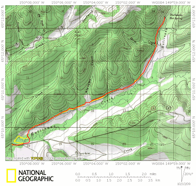
I have had plans to hike the Pinnell Mountain Trail as a day hike for most of the summer. This weekend things lined up and I headed off to hike it, joined by Tom. Alas, Remus had to stay home, as the trail heads are separated by about 20 miles required either two cars or a bike shuttle, and we opted for more fun but not dog friendly option of a bike shuttle.

Tom and I left town shortly after 7am in order to get a early start on what I expected to be a long day – 10 hours of hiking, 6 hours of driving round trip, and 2 hours of bike shuttle action. Fortunately the drive though coffee huts were open this early, which was a pleasant surprise and there was much rejoicing, hurrah!

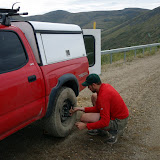
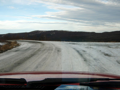
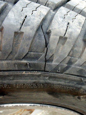
The drive to the trail head was pretty uneventful, though we got a flat near 12 mile summit. When we stopped to unload our bikes for the shuttle I though I could hear a whistling sound, which sounded like air escaping from one of the tires. I drove the car back and forth while Tom watched the tire in question but nothing out of the ordinary could be seen, so we pressed onwards, only to have the tire go flat in a couple of miles.

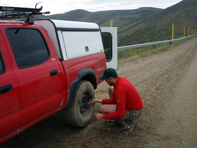
Amazingly, the folks I bought the tire from replaced the flat free of charge – which was quite nice of them, as the cut in the tire was pretty large. I was quite pleasantly surprised when they told me that as the cut was unrepairable, they would just give me a new tire.


Shortly after the tire change we reached Eagle Summit and began our hike. We ran into some other hikers right out of the parking lot. They appeared non-plussed by our fanny packs and lack of packs and my attempts to engage them in conversation were foiled by one word responses..

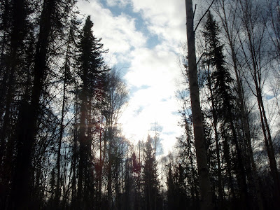
The weather from this point on was fantastic – the day started overcast and a bit gray, but the forecast was for it to clear and become quite warm. By the time we started hiking the clouds were pretty much gone, the was a slight breeze, and the sun was out – fine weather for a long day hike.

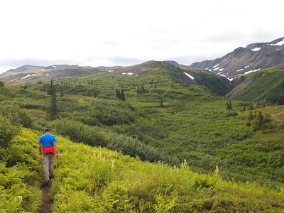
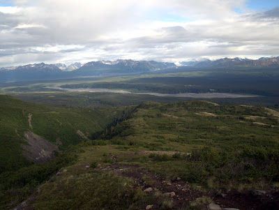
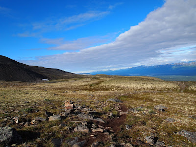
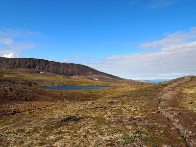
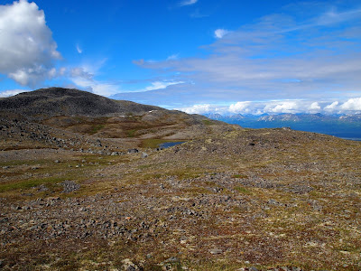
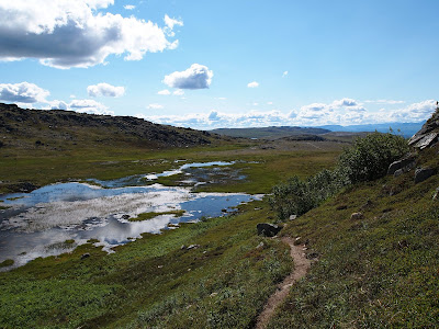
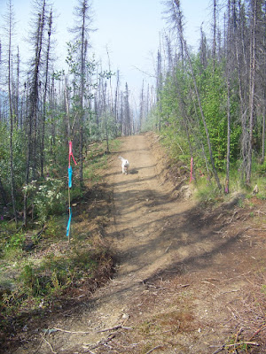
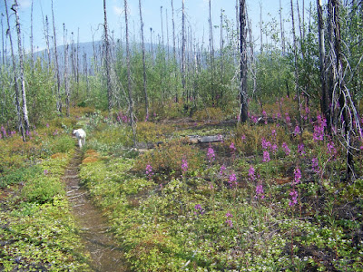
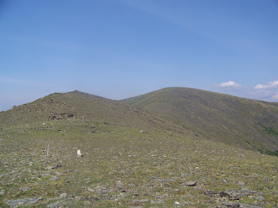
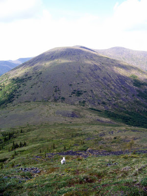
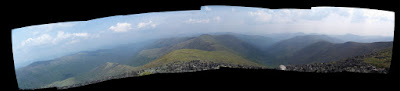
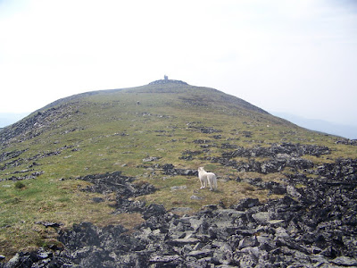
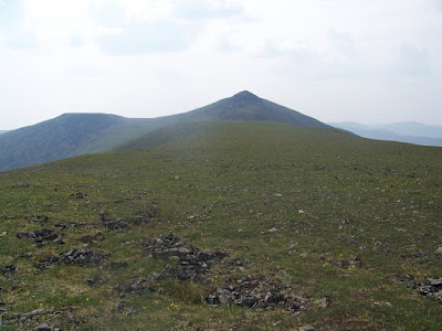
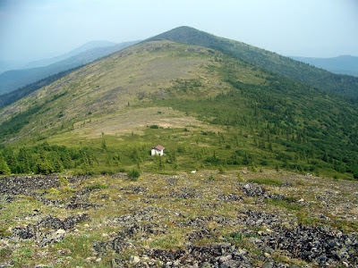
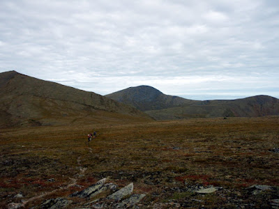
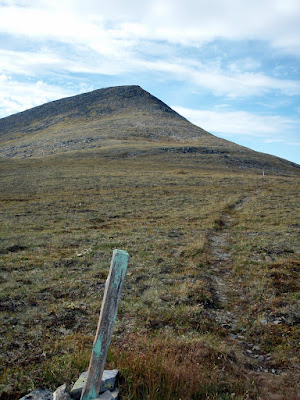
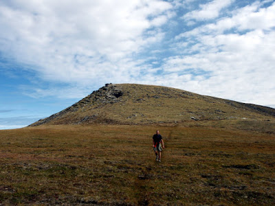
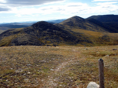
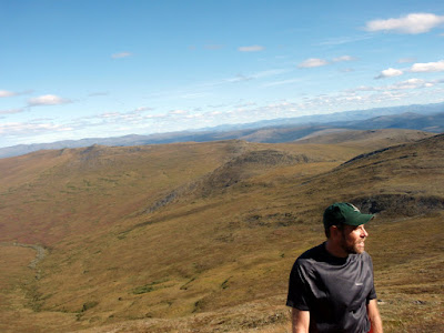
The Pinnell Mountain trail sticks mainly to a series of ridges and it winds around or and goes over a number of small mountains and domes. It has a number of climbs, and one moderately hard climb but nothing very difficult and the effort is rewarded by superb views.

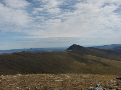
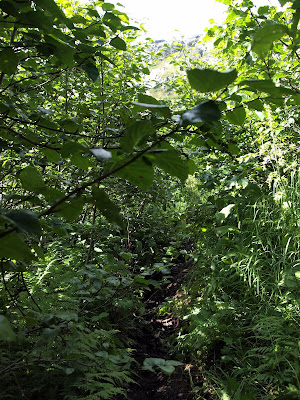
The hike is entirely above tree line with no brush at all and is normally quite dry.

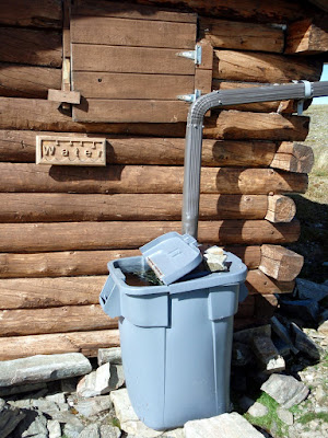
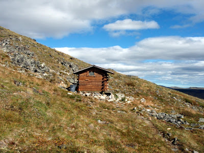
There are two small shelters on the trail. These shelters are pretty small but can be very welcome in harsh weather as the trail is pretty exposed.

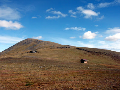
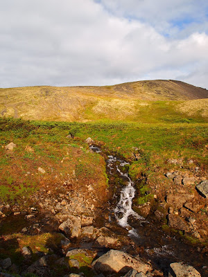
They also feature water catchment systems that made our hike much, much, easier, as we knew we could rely on water at the shelters.

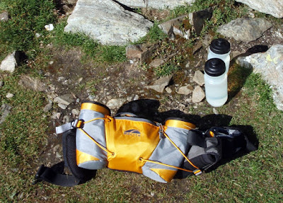
On this hike I experimented with using a very small fanny back and it worked great – there was just enough room to get the basics in (rain jacket, first aid kit,etc ), a handful of snacks., and two bike bottles. The small size definitely helps you cut down on what your are taking, as you really can not fit much in it.

At the first shelter it soon became clear that we were hiking a bit faster than expected and would finish well under my estimated 10 hours – this was good of course but a bit surprising.

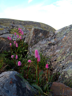
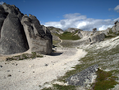
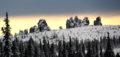
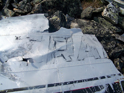
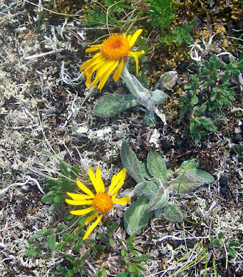
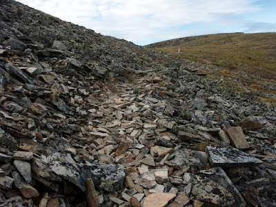
This trail features lots of interesting rock formations, including a rock shaped like a face.

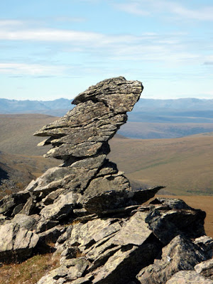
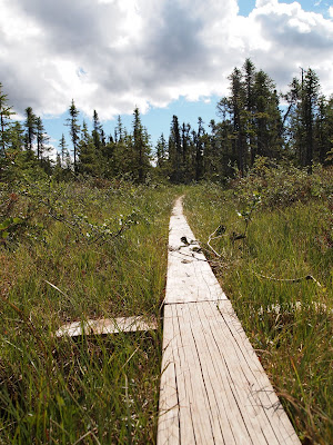
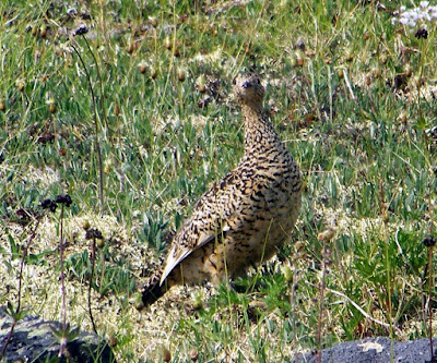
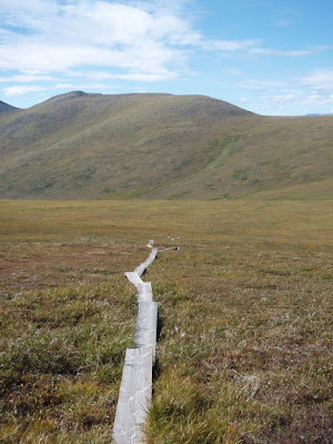
A little past the face rock we encountered the 4th and final hiker we would see on the trail. This guy was hiking the trail as a four day trip with his black lab and was busy scanning the valleys with binoculars when we encountered him. He had yet to see any wildlife but brightened up substantially when I mentioned that we had just seen a caribou around the corner. Near the middle of the the trail there is a long section of board walk along the low point of the trail. This section is called “Swamp Saddle” and even with the boardwalk can be a bit wet. The boardwalk is a mixed bag – when its nice weather the boardwalk makes for nice and dry travel, however near freezing it becomes very, very slippery and hard to walk on.

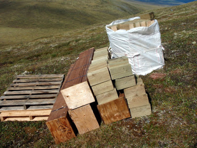
It appears that BLM is in the process of upgrading this section of trail, as there was a number of caches of building materials along this section of trail.

The boardwalk only lasts a mile or so, then its back to ridge hiking and nice views.

The second shelter at mile 18 is pretty much identical to the one at mile 10 – though it is a bit less exposed.

We filled up on water again and I chugged a extra bottle fun as a I was getting a bit deydrated at this point. The remaining 10 miles of trail went by pretty fast.

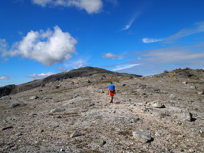
There is one moderately steep climb with a huge number of switchbacks after the second shelter, but otherwise the trail is fairly mellow, and after the steep climb the trail starts heading downhill, making for fast walking. We reached the bikes after 8 and a half hours of hiking, quite a bit less time than I expected. We only ran a very short section – Tom is training for the equinox marathon but I am alas not in that good of running shape currently so we only ran a short section. The trail is almost entirely runnable and would make a great, though long, trail run.
After reaching the 12 mile summit trail head, we gorged on snacks and then jumped on our bikes and headed off to Eagle Summit. As this point I was getting a little dehydrated and as it was now very hot and calm I was soon quite dehydrated. Tom zoomed ahead invigorated by the thought of biking uphill in the hot sun… Eventually I reached Eagle Summit and dove into the cooler in the back of the truck and enjoyed the cool sodas stashed away there. By the end of the day I had had 2 quarts of power aid, 8 20oz bike bottles of water, and 40 oz of pop – thats two and a quarter gallons of liquid! I was still not hydrated when I got home and had to drink several additional quarts of water before I started feeling reasonably hydrated.

The trip ended up taking a little under 6 hours of driving round trip, 8.5 hours of hiking, and 1.5 hours of biking – quite reasonable for a long day trip. My fanny pack setup worked great and forced me to pack a bit lighter than I normally do, which was good. The fanny pack setup also worked pretty well for the brief bit of running I did, so it might be a good option for trail runs in the future.

Pinnell Mountain trail is a classic interior hike and well worth doing. It has super fine views, the trail is in pretty good shape, the climbs are not very challenging, and the trail is amazingly brush free – all in all a fantastic hike. It can be done as a reasonable 2 day hike or mellow 3 day hike if long day hikes are not your thing. Its a spectacular hike!

More photos for this picture inclined: Dayhiking Pinnell Mountain Trail.

Hutlinana!

Wednesday, October 14th, 2009

On a sunny Monday morning, Marsh, Tom, and I headed out to Hutlinana Hot Springs for a day trip.  After a 3 hour or so drive up the Elliot Highway.  None of us had been out that way before and the plan was to scope it out as a destination for future winter trips, perhaps with the twins.

The drive out was uneventful though I had a winter driving reminder on some of the hills, as they were nice and icy in sections.

The references we found on where the Hutlinana Trail started said it starts at mile 130 of the Elliot.  We were somewhat confused when we arrived in the near by area and found the bridge over Hutlinana Creek was at a little past mile 129, and so mile 130 would be on the wrong side of the creek..  After a bit of searching we found a trail and started out.  Alas, the trail we found was not the right one, and we wondered around for a mile or so untill we hit the real trail.  Note the yellow line on the map – thats our route on the way in.  Once we found the correct trail we were off – it was in great shape and super fast walking.

Our side tracking in the begining involved a short stream crossing.  The “real” trail had a number of nice sweepers that made excelent bridges – alas our side trip did not.

The dogs had a wonderful time exploring.  Togiak, my older dog, sat this one out.  She is getting up there in years and longer trips are getting hard on her, especially on warmer days. It was a bit sad to keep her at home, but hopefully she will get some trips in once winter comes for good and the temperatures drop.

The main trail was marked by small socks for the first mile or so, which was a nice touch.  I expect there is a story there..

Once we hit the main trail we found it to be in fantastic shape and super easy to follow.  The trail winds though black spruce and the occasional stands of birches.  Near the hot springs the trail opens up and hits a beautiful large stand of poplars, tastefully decorated by a number of rusty 55 gallon drums.

We arrived at the hot springs after a little under three hours of hiking and were quite surprised by the fantastic shape we found them it.  I had been told they wash out occasionally and was not quite sure what to expect – it turned out previous visitors had constructed a wonderful rock pool that was deep, warm, and fairly free of hot springs funk.

The springs were quite warm and free of any sulfur smell.  It was quite refreshing to soak for a hour or so after the hike in.  The view from the pool was excellent!  Alas, this was a day trip so we headed back out to the car and a long drive home. 

On the way out we passed a couple hiking in – I was fairly surprised at the amount of traffic we encountered as we also passed a party on the way in.  I guess everyone was out enjoying the warm weather before the snow arrives in force. The walk out was uneventful, though we found a caved in cabin we missed on the way in.

The main trail back to the road was much faster than our side route.  There was some shenanigans when the dogs attempted to follow me across a sweeper and Remus attempted to pass Polar by crawling under him while he was walking the trunk of the tree.  This caused Polar to freeze up and get stuck in the middle of the stream on the log, leaving me to walk out to rescue him.

For future reference, the best trail head appears to be the 4th driveway or side road before the bridge on the right hand side heading towards Manley, including the parking area near the bridge. The trail is fairly obvious at that point – you will know you are on the right path if you see some very old junk cars near the start of the trail.

On the drive out we stopped to take a better look at a bus in the ditch – we passed a bus on its side just after the Tolovana trail head.  We stopped briefly on the way in, but keep going after it became obvious that no one was around.  The bus was quite out of place, as it appeared to be a military transport, though perhaps they are used for other purposes too.  We spent a bit of speculating as to what they were doing out this way on the drive back to Fairbanks. Hopefully no one was injured.


This was quite a fun trip and I was thinking about returning later in the year for a overnight ski trip as the trail looked like it would be wonderful skiing, or perhaps a spring ski trip with the twins.  All in all a very pleasent day trip, though a super long drive, alas.

Woofie and Bunny go Hiking

Wednesday, October 7th, 2009

On a brisk Sunday morning the family and I set out for a day hike. We had planned on hiking to Stiles Creek Cabin for a overnighter, but Lizzy had a low fever the day prior so we turned it into a day hike instead. Lizzy and Molly started off walking and after a hour or so switched to being carried. The hike was wonderful – we did this hike in 2006 with the kids and the first mile was an utter mess – huge ruts, massive muddle puddles, and other general “Lets drive our ATVs though a muddy swamp!” madness. It had been getting worse in the last couple of years, and was getting so bad it was actually starting to make winter skiing unpleasant as the ruts where not completely filled with snow even in spring. In the last couple of years (I think last 2 years) Alaska State Parks had been in the process of doing some sort of reroute of the first 2 miles of the trail to deal with the really bad sections, and it appears they finally finished or at least reached some stage of completeness. The trail is now completely different – its dry and mostly free of killer mud holes and ruts. In fact, it would have been great mountain biking. I am going to have to come back here in the spring and try it out. Go State Parks! Its really refreshing to see the state spend money on things like trail improvements. The skiing this winter should be much improved too, as the reroute is not quite as steep. Parts of the old trail can be a bit tricky on skis – steep, fast, and a not a lot of room to snow plow.

Lizzy and Molly started off walking and carrying Bunny and Woofie in their backpacks.  After a brief stop to stick Bunny’s and Woofie’s head out (“No, no, Bunny can’t see” – Molly) we where off.

As mentioned before, the re-route has dried stuff up a lot – this is a good example of what the new section looks like.

Contrast this with the old trail, circa fall 2005.

The dogs had fun running around and exploring. Soon the “exploring” part will stop and they will have to start pulling pulks when ski season starts.

Molly outfitted herself with hiking poles for a while.  It is really rewarding to see the twins enjoy hiking.  I hope it lasts, as many adventures await.

The walk was quite beautiful, with the fall colors giving way to the winter gray, black, and white. I love this time of year, as there are constant reminders that the best season is about to arrive, Winter!

Eventually the little trekkers wore out and it was nap time. They rode for the next couple of miles in the backpacks, wrapped up in lots of layers.  Its funny – now that I have started carrying the twins, it really puts backpack weights into perspective – when I put on a normal multi-day pack for a trip without kids I am surprised how little it weighs.

After nap time came snack time, when the passengers where treated to a delightful repast, artfully served in a small zip lock bag. 

Eventually we returned to the trail head where the girls played on some left over trail hardening material (also known as a pile of rocks).  This kept them busy for almost a hour, which was truly amazing.

Just before we left Molly found a small stick that was sort of shaped like a person, and after some help from Nancy, soon became more person shaped and was christened the “Tree Man”.

All in all it was quite a fun way to spend a day.  We even made it to Mias, where Nancy and the twins had Korean food, and I was treated to a fantastic burger!   I am looking forward to skiing this in a month (or less if all goes well – bring on the snow!), and biking it next summer.

Chena Dome in a day

Wednesday, July 8th, 2009

In honour of my switching to 3/4 time, I decided to use by first Monday off to do something interesting, like hike Chena Dome as a day hike. 12 hours (11 hours 35 minutes but whos counting anyway) and 6 quarts of water later I finished Chena Dome with sore feet but otherwise a fairly happy hiker. Chena Dome is one of the classic interior ridge hikes. Its quite a roller coaster of a hike, with lots of ups and downs, including some really steep sections. The reward for all this up and down is a fantastic alpine hike with spectacular views. The trail starts at 900ft above sea level and tops out at 4200ft asl, with 5 smaller ridge high points topping 3000ft.

The trail is a loop with the trail heads separated by a mile of walking on Chena Hotsprings road. The upper trail head had a bunch of Alaska DNR trail crew workings with Bobcats busy building a new trail out to Lower Angel Creek Cabin. The traditional trail had become increasingly trashed by summer ORV use, so DNR has decided to build a new trail on the hillside for summer use – hurray for DNR! The current Angel Creek trail has huge ruts in it and it now takes a lot of snow for it to be pleasant skiing. The new trail looks like it will make for superb summer biking and winter skiing. I am really looking forward to skiing it this winter!

The beginning of the trail winds through a several year old burn as it slowly makes it way up past tree line on the ridge. The fireweed was quite beautiful.

Just before the trail breaks out above tree line there is a huge batch of burls.

Once above tree line the trail becomes a ridge walk and follows a series of ridges. Great views abound.

The Chena Dome trail is a seldom flat – if you are not going up, you are going down.

Wildlife sightings were pretty limited. I saw a number of ptarmigan and song birds of various types.

My views from the trails were periodically cut off by smoke – there are lots of smaller fires burning in the interior and sometimes when the wind shifted I could hardly see the ridges next door. Occasionally it would clear up and the views would return.

At about mile 8 there is a 1950’s vintage military plane crash. I spent about a half wandering around looking at the wreckage.

Finally, the summit! There is a Alaska DNR communications hut on top, but otherwise there is nothing much too see. I did find a large pile of moose droppings, which seemed quite out of place.

Once over the summit I encountered one of the few places where the trail is flat. It was a little to rocky for good running but was a nice break from constant ups and downs.

Eventually the trail drops off the ridge into a saddle near mile 17 where there is a small shelter. The shelter has a water catchment which makes it a great place to camp or to for a break, as there are not a lot of water sources on the trail.

After a shortish break to refill my water bottles and have something to eat I was back on the trail. Remus was overheating for most of the trip, and greatly enjoyed wallowing in the tundra pools we passed.

After a couple of miles we started up the last hill, and then the long downhill to the parking lot. All in all this was quite fun as a day hike, though pretty long. It a lot of way it makes sense to do it as a day hike as you do you have to carry a heavy pack up and down the hills. Anyway, highly recommended!