To preface this post, when I wrote last year’s write up, it showed up as one of the top of the hits from Google for searches for the Alaska Wilderness Classic, which makes me feel a bit bad about it. This write up is just intended to convey my experience. I didn’t approach the event all that competitively, and I am a bit of an idiot (or a really big one if you believe my daughters) . Luc Mehl has a much better write up and Andrew Skurka has a very nice writeup on the 2009 race – I would start with those to get a better understanding of the event, rather than starting here. -Jay
Last year’s Wilderness Classic was an awesome experence for me. It had a lot of the fun of the Iditarod Trail Invitational (ITI) without being really cold, and it got me out to see an area that was new to me. Alas, we bailed at the first pass, and took a less optimal route that was way longer than what most of the rest of the folks did. This year I really wanted to stick to the original route, copied from Luc Mehl’s write up from 2016. I mapped out two other options around glaciers in the high passes that could be issues, but otherwise the plan was to stick to Luc’s route. I was a bit worried that Tom was going to be too busy to join me, but he was free and game, so it was on!
Late morning Saturday Tom and I headed out of town, joined by Nick from California, and drove up to Wiseman. Alas, the forecast was not hot and it rained on and off for most of the drive. We arrived in at the Arctic Getaway B&B in Wiseman, excited to see that Greg Mills was also there, so apparently the fun was going to happen — hurrah!
Eventually folks started arriving, and we soon had a group of 13. The group consisted of two Nicks (one from Anchorage, the other from San Francisco, California), two Jays (me, and a Jay from Anchorage – yay another Jay!), Greg, Matt, Kevin, Ken, Adam, Steph, and two 17-year-olds, Bremner and Leo. After a nice dinner (thanks Burni and Uta! ), we hit the sack on the lawn of the Arctic Getaway, and in the morning shuttled out to Galbraith Lake. And then we were off!
WC 2018 from JayC on Vimeo.
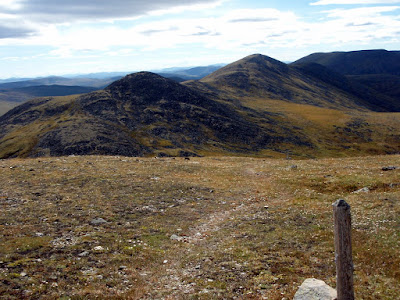
For the first few hours we were back and forth with a few of the other folks. Much like last year, the walking was great to the first pass.
We bounced around a bit with a few other folks, including Matt and Kevin from Anchorage, and Nick from California. Jay and Nick from Anchorage were doing the entire route on foot without a boat and were (barely) in sight until the first pass.
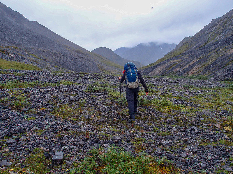
At the first pass we took a different route around the glacier that stymied us last year, and while it was work getting up, the walk down to the Atigun River valley was fast.
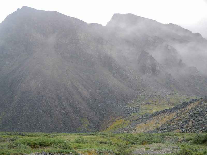
Photo compliments of Tom.
After the first pass we didn’t see anyone else until we finished at Wiseman.
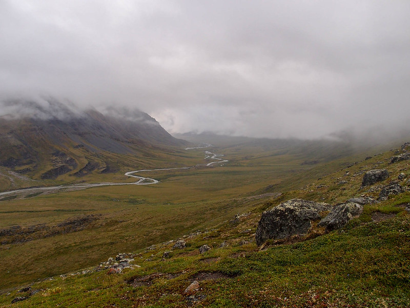
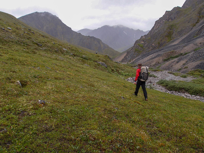
Alas, the Atigun River had a lot of water in it, and we had trouble crossing it until we were most of the way up into its headwaters, making for some less than awesome hiking. It was reasonably fast though, and we made pretty good time.
On the Atigun River we saw footprints, which I assumed were from California Nick as there appeared to be only one set. Anchorage Nick and Anchorage Jay were supposed to be ahead of us, but I (wrongly) assumed that since there was only one set of tracks it must be California Nick, the only person traveling alone near us, and concluded he was ahead of us. Later we were to learn that Anchorage Nick and Anchorage Jay had very similar shoes, and the tracks were from them. Anchorage Nick joked later that they “walked in each other’s tracks” to confuse us. They had a very ambitious route planned, going over several large passes that then took a ridge near Oolah Pass over to the Wiseman area.
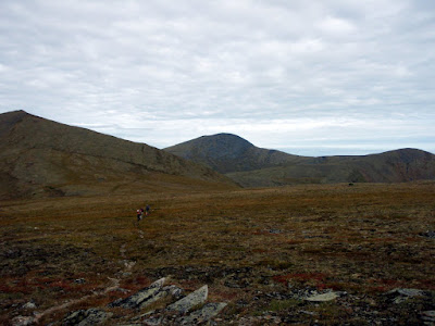
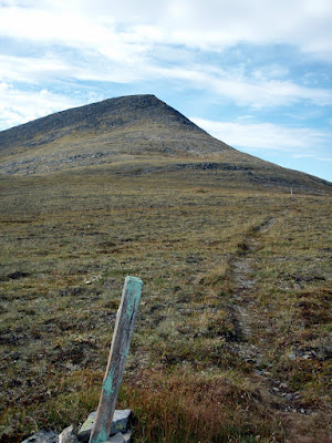
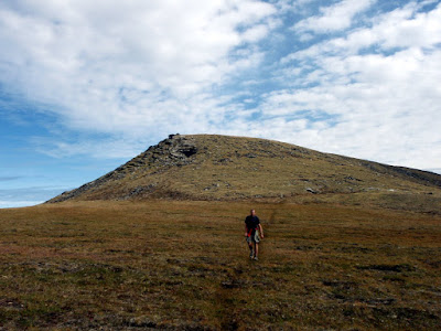
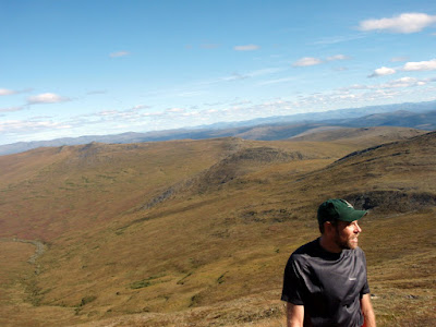
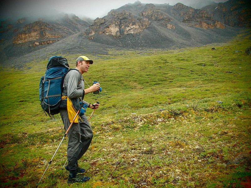
We climbed the next pass early in the morning in a bank of fog, and we came out of it into a beautiful valley, only to have to slog up to another pass, with steep slippery scree.
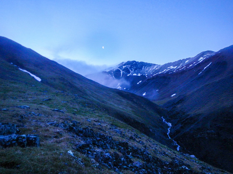
Photo compliments of Tom.
Alas, my camera’s battery died at this point, and I was too lazy to find the replacement battery in my pack, so I didn’t take any more photos for the rest of the trip.
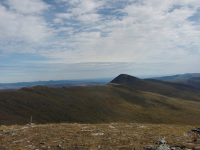
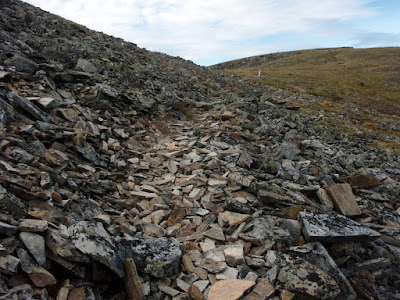
The third pass had an icy glaze that covered all the rocks, making it really hard to get a grip on anything. Initially I thought I had mud on the bottoms of my shoes that I somehow couldn’t get off – alas, it was just a layer of ice. I assume that overnight, warm wet air blew through, leaving a layer of moisture which froze on the rocks. Fortunately, the sun was soon out, and it warmed up enough that the rocks lost their slippery coating. The climb up to the top of the third pass was slow going, with lots of loose shale scree.
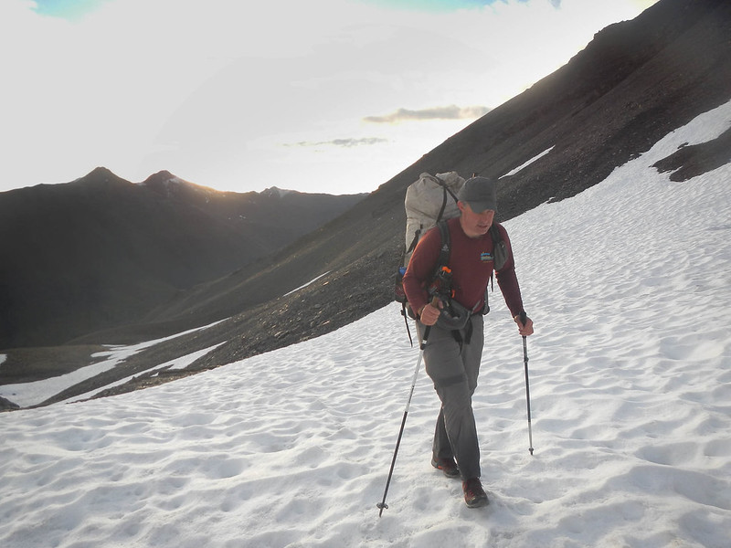
Photo compliments of Tom.
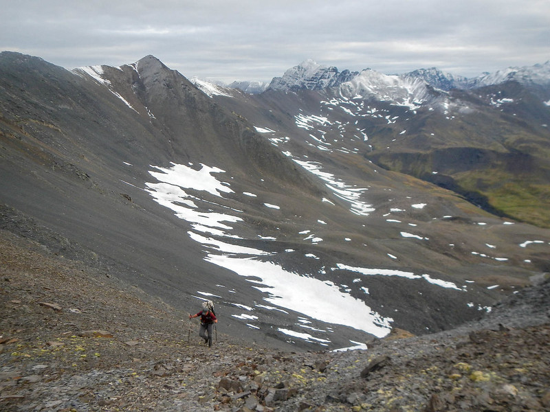
Photo compliments of Tom.
Once we were over the top it was a long glide down to Kuyuktuvuk Creek valley.
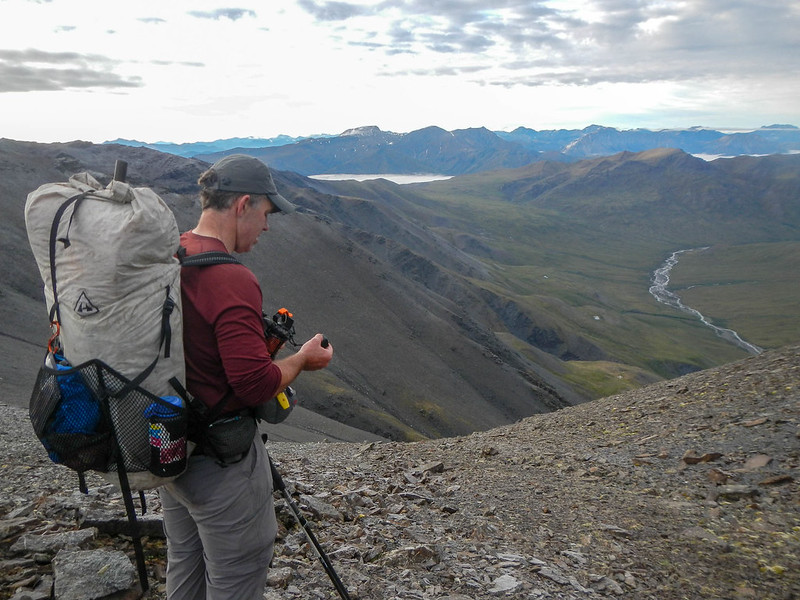
Photo compliments of Tom.
Kuyuktuvuk Creek was pumping, and our hopes of fast gravel bar walking were soon dashed by little cliffs and bluffs on the creeks banks. We ended up walking the benches above the creek, which were a bit brushy, but fortunately we were able to follow game trails (some good, some bad) for most of it. The creek looked like it would be fun packrafting, but perhaps a bit on the bouncy side, with big rocks and rock walls. We considered floating it, but the idea of floating a fast creek (it looked like it dropped around 150ft a mile, so a bit steep) while sleep deprived and without any beta seemed not quite worth it. Later we learned Nick from CA floated it, flipped, and swam, losing his boat and gear and ended up having to walk out to the Dalton Highway.
We turned off on an unnamed creek to hike over a lowish pass to Blarney Creek. The unnamed creek had a lot of water in it, and we crossed at the only spot we could find that looked passible. The creek was beautiful, with a wonderful waterfall emerging between two Lord of the Rings looking giant rocks.
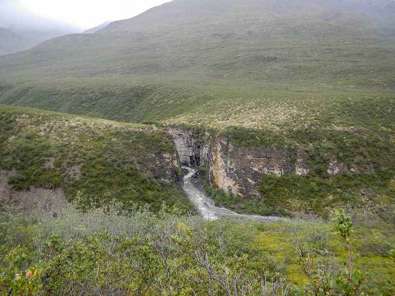
Photo compliments of Tom.
The hike up and over the pass was fast, and soon we were heading down Blarney Creek. We stayed up high on a bench on the right hand of the creek, worried we would get cliffed out, but eventually walked in the creek — only to get cliffed out. We had to climb up out of the creek, where we immediately found some awesome game trails. Alas, soon after that we encountered a bear trail — in some places bears walk so frequently on a trail they leave offset depressions. I have only seen these once before in the Brooks, but they are pretty common in Southeast Alaska where I grew up. I immediately went on full bear alert, and soon after that we saw a mid-sized dark colored brown bear on the other side of the creek. We then cut away and hiked directly over to the Hammond, where we inflated the boats and hopped in. Hurrah – the walking was over!
We floated until around 1:30 am or thereabouts, when it got a bit too dark for floating, then pulled over and made a fire. The fire wasn’t as big as I would have liked, but it was warm, and Tom and I got a bit of napping in while waiting for the sun to come back up. Eventually it got light enough to float again, and we were back to floating. Alas, the temperature had dropped a lot overnight, and it was cold enough that I had frost on the deck of the boat.
Fortunately the sun eventually hit the river, and mid morning we pulled over for a short nap in the sun, then floated down to the canyon. I was a bit worried about the “falls”, a rock slide in the canyon that isn’t runnable — at least in packrafts. A bit to my surprise there was some large rocks in the creek that created some bouncy rapids that were a bit more spicy than I expected, but fun. The canyon itself was pretty mellow, with beautiful rock walls and very slow current. The waterfall ended up being a narrow pinch with a shoot of water flowing between it onto a pile of rocks. It was possibly runnable in a kayak if one could get out beyond the pile of rocks, but who knows — I don’t kayak. Tom and I ended up deflating and portaging on river right, then inflating and floating the last 10 miles or so into Wiseman.
When we arrived at Wiseman we were greeted by both Nicks, Anchorage Jay, and the Hickers (Uta, Berni, and Julia ). Our total time was around 50 hours. The evening was spent waiting for other folks to come in, and eating a wonderful dinner compliments of the Hickers — thanks! In afternoon Matt and Kevin came in, and near midnight Steph came in. When we left Wiseman Bremer, Leo, and Greg were traveling together, and about to start floating the Hammond. California Nick, as mentioned, lost his boat and gear, and had hiked out to the Dalton Highway to be picked up. Anchorage Nick and Anchorage Jay had bailed near Oolah Pass, and had also hiked out to the Dalton to be picked up. Ken and Adam turned around on Atigun Creek and floated back to the road.
California Nick had a bit of a adventure – losing his boat and gear, but still made it out without (too) much drama – major kudos to him for pulling that off. His mishap made me think a bit about what gear I will keep on my person in the future – I think I might start carrying a lot more stuff on my person in case I lose my boat (and gear) like he did.
Bremner and Leo are I think 17, which makes them some of the youngest finishers of the ASWC. Wikipedia says Cody Dial did the 2004 Eureka to Talkeetna course when he was 17, so that is a select group. Congrats to Leo and Bremner for pulling it off, I am not sure I could have it at that age!
I would like to thank Tom for his company. You are a great adventure partner, Tom; thanks for joining me on this adventure! I would also like to give the Hickers a huge thank you for the awesome hosting. You guys rock. And of course thanks to my family for letting me disappear for a few days.
Alas, this is the last year of this route. Hopefully next year the course will be as awesome!
Things I need to do better:
- Keep a full set of survival gear and communications stuff on my person. I kept some gear on my body, but I didn’t keep my Inreach or other critical items on me. If I had lost my boat like California Nick did, I would have been in trouble.
- Use something besides a bivy, perhaps a tarp. I tried a very light bivy and it worked in light rain, but there was a brief spell of hard rain when I was trying to get an hour of sleep and it leaked. Some other option so I can get a few hours of sleep would be a good idea.
- I need to bring a “real” camera, or a tiny camera that doesn’t suck. I took an older camera (an Olympus-zx1), which normally works great, but the battery died almost immediately. I should have taken my mirrorless camera with the nice lens; it would have worked better, and I would have taken better photos.
- I need some sort of mount for the little Go-Pro (that doesn’t make me look like a bro getting ready to huck off a building – in other words looking like an idiot). I just carried it in my hand, and that was a bit of a pain — or in my mouth, which was more of a pain.
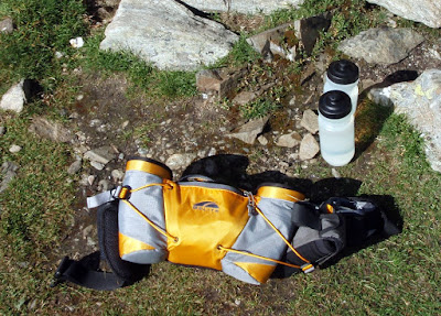
- The HMG pack – I am still a bit meh about the HMG pack. It is light, but it is a bit short of perfect, regardless of how much other folks seem to love theirs. The side pockets suck, and it is hard to get a water bottle out of them with the pack on.
- My pack was too heavy. I should pare it down a bit. Other folks seemed to be in the mid 20s, I was almost 30 lbs. I think I could cut it down a bit, and I finished with a fair bit of food.
- My food selection could use some work. I took too many protein bars, and not enough cheese. I took out a ⅔ of a pound brick of Gouda, but left in ⅓ of a pound of Wensleydale. The Wensleydale was great, but I should have packed a brick of smoked Cheddar as well. I also should have added in some dry crackers, perhaps pilot bread.
- As always, I need to be in much better shape. If I was 20 lbs lighter those hills would be a lot easier.
Things that worked well:
- This spring I purchased a new packraft meaning to get the zipper in the body to store gear. That system works great, and I can stuff my whole pack in there, which is great. I used a big bow bag to keep everything I needed accessible, and that also worked well.
- The shoes: I really like the old Montrail Mountain Masochist trail runners. I used a brand new set for this race, which I had never worn before, and didn’t have any blisters — hurrah! Alas, this is my last set; I don’t know what I will do once these wear out.
- I packed two freeze-dried meals, which were awesome, and fast to make.
- Leukotape: I pre-taped one foot with Leukotape and the other with some other brand of tape recommended for feet. The Leukotape lasted the entire race, while the other stuff fell off half way. I am not sure if the taping helped or not, but I didn’t get any blisters.
On the route:
I am not sure that this route is much faster than the option going over to the Oolah Valley, across to the North Fork of the Koyukuk, and though Kinnorutin Pass to the Hammond. I think that route is slightly longer (7-10 miles), but a lot flatter, and it has pretty good walking.
Besides all the climbing (and there was lots of climbing!), the route was pretty awesome. It would make a good trip, though having all the packrafting at the end might be a bit of a bummer.
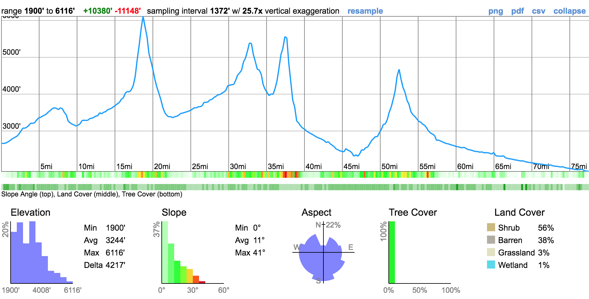
Stats for the route, minus most of the float:
I will probably update this post with details as I remember them.
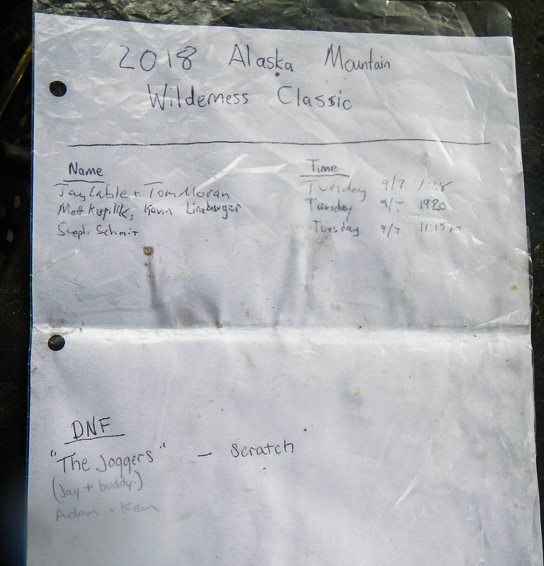
Photo compliments of Tom.
Our route: