Posts Tagged ‘hutlinana’

Alaska Cross 2020

Friday, June 19th, 2020

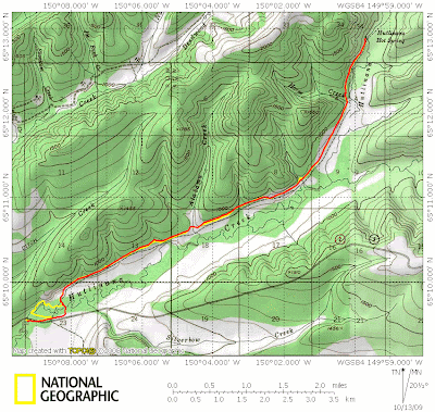
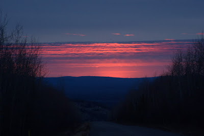
Alaska Cross is point to point semi-organized semi-race. It originally went from Chena Hot Springs to Circle Hot Springs, then branched out to several other destinations. In the latest incarnation it goes from Lost Creek (mile 6 of the Dalton Highway) to the Wild and Free headquarters at Eureka AK. I did it last year with Ned Rozell and had a great time. This time I was back, with Tom, and hoped to take a “better” route. It is about 46 miles in a straight line, but folks are free to take whatever route they want.

The start is pretty awkward as usual, though perhaps a bit more so with the “promoter” Mark Ross sending us off with some sort of late 90s music that I had not heard before.

Alaska Cross, Lost Creek to Eureka 2020

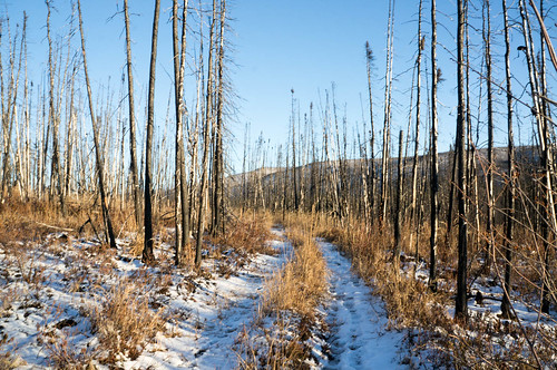
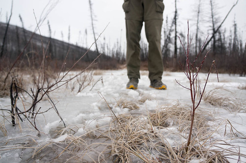
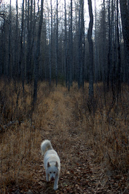
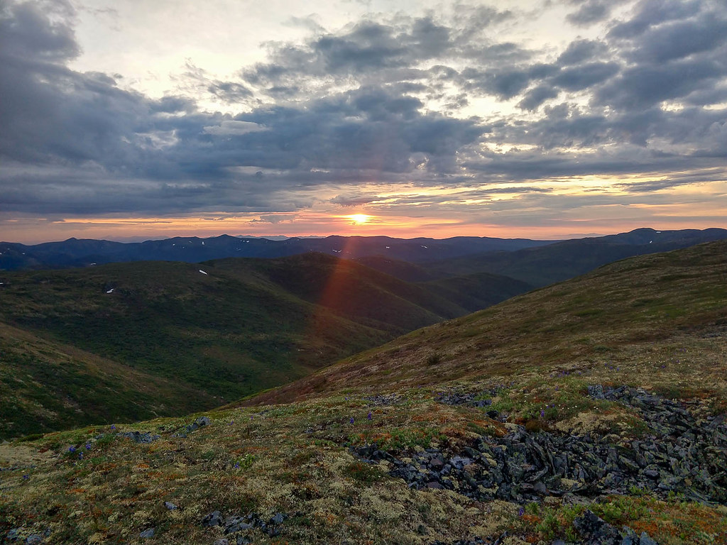
There are many route options, but almost everyone took an ATV trail for the first few miles, then groups started peeling off to take their own routes. Tom and I headed up to a ridge that extended for the first 28 miles.

Alaska Cross, Lost Creek to Eureka 2020

The next 20+ miles were a mix of okay walking and tussocks, with a bit of brush tossed in.

Alaska Cross, Lost Creek to Eureka 2020

When Tom and I first crested onto the ridge there were around 7 or so folks ahead of us, and gradually that thinned out to just one – Brent Sass of Wild and Free Mushing. We would see Brent on and off again ahead of us for rest of the race, always on the next ridge ahead of us.

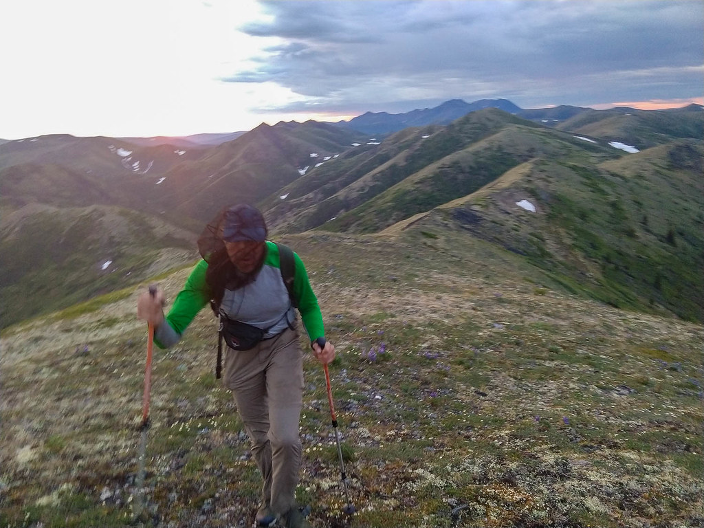
Alas, it was really hot, and there wasn’t much water on the ridge. By the time we started dropping off the ridge I was very dehydrated and starting to have trouble eating. Tom needed a quick break to adjust his shoes and I ducked behind some rocks to take an dehydrated emergency potty break (a number two) . Alas, just as I was finishing up when Matt (I think) passed by. I hope he didn’t see me and wasn’t traumatized for life. My apologies Matt!

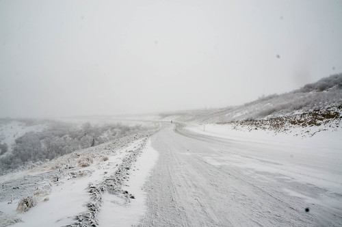
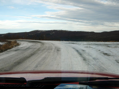
Once off the ridge we took an old road which varied from really great walking to a muddy and brushy atv track for a few miles before heading up to a ridge we would take most of the remaining distance to the finish.

We finally had good access to water and I drank three liters over the next few miles, and stocked up for the high and presumably dry ridge we were taking next. Alas, even after I was bloated with water I was still dehydrated.. too much, too late I guess.

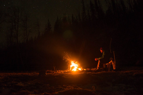
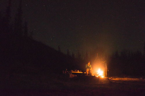
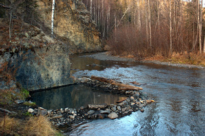
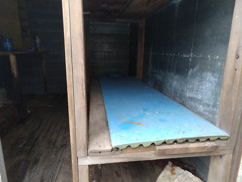
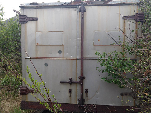
I did stop and take photos of the little shipping container shelter Ned and I peeked into last year. Last year Ned had said he was very tempted to take a nap in it, but I vetoed that idea thinking it was a moldy mess. In a little more daylight it looked a lot more inviting and not all covered by mold as it looked to me the year before, but fortunately it was only 8:30, way too early to take a nap.

Alaska Cross, Lost Creek to Eureka 2020 Alaska Cross, Lost Creek to Eureka 2020 Alaska Cross, Lost Creek to Eureka 2020

The climb up to the final ridge looked huge from below, but it didn’t take that long to hike up it. Alas, my stomach was feeling off from being dehydrated and I was having a hard time eating the food I bought. Next time, fewer Snickers and more cheese or other non-sweet high calorie items. Tom gave me his only cheese stick, for which I was very grateful – thanks Tom!

The ridge went on, and on. Up and down.. but the walking was great!

Alaska Cross, Lost Creek to Eureka 2020 Alaska Cross, Lost Creek to Eureka 2020 Alaska Cross, Lost Creek to Eureka 2020 Alaska Cross, Lost Creek to Eureka 2020

Eventually we left the nice ridge and headed down to the Hutlinana River. Just before we headed down I saw the rind of a tangerine or other small orange on the ground next to some footprints in some dry caribou moss. This ridge is pretty remote, so I can only assume it was from last year…

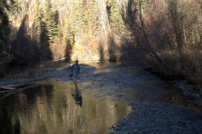
We headed down to the river in a nice brush free gulley, and quickly found a winter trail we took over to the Hutlinana hot springs trail. Alas the beavers had been very active, and several times the trail went into waist deep pools before we crossed the Hutlinana, and started the six mile walk to the finish just as the skies opened up and dumped rain on us..

Alaska Cross, Lost Creek to Eureka 2020

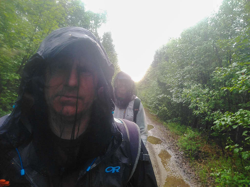
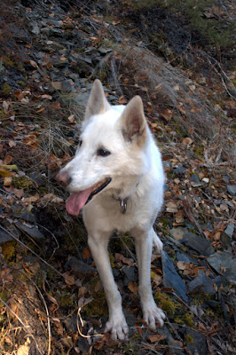
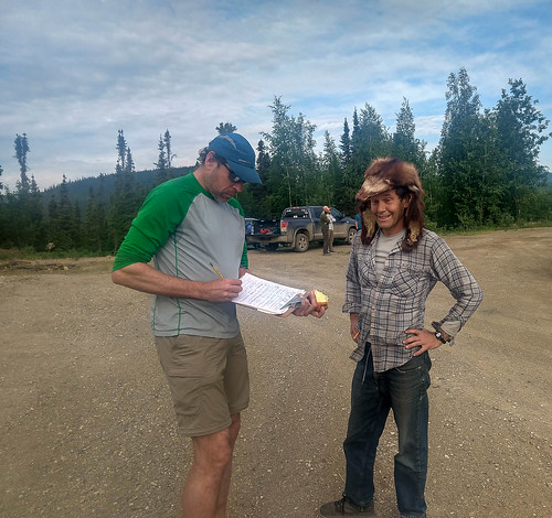
We arrived at the finish around 9am, just after the rain stopped and the sun came out. It was a very welcome relief to lie in the sun on the grass of the Wild and Free homestead, drinking cold pop from a cooler in my truck and listening to the dogs howl and watching them play. I was pleasantly surprised that only four people had finished ahead of us – Brian, Nick, Bob, and Brent. It seemed like we were going so slow I expected everyone to be ahead of us. Eventually we found everyone napping in the workshop and we headed in for a nap before driving back to the start.

What a great way to spend 24 hours, I had a blast. I will probably update this with some lessons learned and other information as I get a chance.

Thanks for the company Tom, and congrats to everyone who showed up for the long walk, and Brent and Ida for hosting us at the finish!

The results from Mark R, who likes the results listed from last to first:

 
AKX 2020, June 13, After-math:  

11.  Mike Fisher,  Brandon Wood    - Scratched at 25mi. returned to lost creek. 
10. Drew Harrington, Chris Miles   -   34hr. 43min.
9.  Tait Chandler, Todd Vorisek    -   30'  35"
8.  Mark Ross, WM*                 -   30'  27"
7.  Tracie Curry, Clinton Brown    -   28'  32"
6.  Matt Blood                     -   27'  14"
5.  Jacob Buller                   -   26'  53"
4.  Jay Cable, Tom Moran           -   22'  51"
3.  Brent Sass                     -   22'  21"
2.  Bob Gillis, WM*                -   22'  15"
1.  Nick Janssen, Brian Atkinson   -   21'  58"
   
*Wildermeister

Our route, and stats in Strava:

Some things that worked:

  • I am using new shoes – Inov8 Roclite 275. I love them – blister free
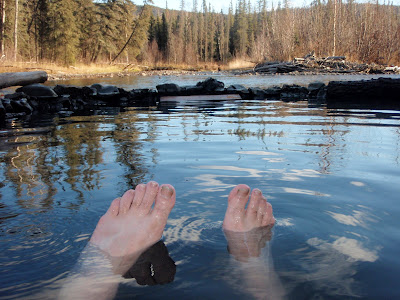
  • Foot-lube – I stopped briefly and re-lubed my feet at half way or so. That seemed to work great.
  • I didn’t run out of food – hurrah! I was definitely close last year.
  • Once again, using a cell phone for navigation rocked.
  • We really only stopped once for Tom to deal with his feet, and for me to go to the bathroom.
  • the last ridge was way nicer than the Elephant Mountain route I took with Ned last year.

Things that worked less well (fails!):

  • I got dehydrated – I should have brought more water carry capacity and started out with more water.
  • I overtreated some of the water I had with chlorine dioxide using aqua mira, which made my stomach feel a bit off, or made it worse.
  • I brought too much sweet foods, and the non-sweet foods I bought – mainly pistachios – were hard to digest. I ended up chewing a whole mouthful, then washing down the paste with a big gulp of water. Not ideal. Next time more cheese and similar stuff would be good I think, and less candy. I had a huge handful of sour patch kids at one point and that really sat in my tummy like a rock for hours.
  • I had chafing issues – I wore a belt and that had my pants a bit too high and I had some rubbing issues. Chamois Butt’r helped, but if this was longer it could have been an issue.

Hutlinana

Monday, October 19th, 2015

Several years ago Tom and I visited Hutlinana hotsprings, only to find the springs washed out and no hot water. I had been hoping to go back, and with a free Sunday and Monday, and Nancy’s permission, we headed out to check it out. The drive out was slow, due to the unusual freezing rainfall we had been having lately, but uneventful. The hike in was fantastic, and we arrived to a wonderfully not washed out hot springs, and enjoyed a night of soaking and mellowing out around a campfire – hurrah!

The dogs had a blast hiking in, and sleeping in my tent.

DSC01852DSC01862

DSC01885They were very envious of Tom’s salmon strips, but alas he didn’t share. DSC01846

The hot springs was a fantastic temperature, perfect for soaking.

In the evening when we are all soaked out we enjoyed mellowing out around the campfire. I also played with taking slow shutter pictures.. DSC01922

DSC01918

The steripen turned out to be pretty fun to photograph.. DSC01899

DSC01915

The hike out was very fast, though a bit icey… DSC01925

.. And the drive home was a bit faster, but still slow.

DSC01932

A Post Script – for folks looking for the “correct” entrance, take the pull off just before the blue “Adopt A Highway” sign, on the Fairbanks side of the bridge. Follow the atv trail to the river, cross the river, then look around for a big and well defined atv trail. That that upstream, and follow it to the hotsprings.

Hutlinana!

Wednesday, October 14th, 2009

On a sunny Monday morning, Marsh, Tom, and I headed out to Hutlinana Hot Springs for a day trip.  After a 3 hour or so drive up the Elliot Highway.  None of us had been out that way before and the plan was to scope it out as a destination for future winter trips, perhaps with the twins.

The drive out was uneventful though I had a winter driving reminder on some of the hills, as they were nice and icy in sections.

The references we found on where the Hutlinana Trail started said it starts at mile 130 of the Elliot.  We were somewhat confused when we arrived in the near by area and found the bridge over Hutlinana Creek was at a little past mile 129, and so mile 130 would be on the wrong side of the creek..  After a bit of searching we found a trail and started out.  Alas, the trail we found was not the right one, and we wondered around for a mile or so untill we hit the real trail.  Note the yellow line on the map – thats our route on the way in.  Once we found the correct trail we were off – it was in great shape and super fast walking.

Our side tracking in the begining involved a short stream crossing.  The “real” trail had a number of nice sweepers that made excelent bridges – alas our side trip did not.

The dogs had a wonderful time exploring.  Togiak, my older dog, sat this one out.  She is getting up there in years and longer trips are getting hard on her, especially on warmer days. It was a bit sad to keep her at home, but hopefully she will get some trips in once winter comes for good and the temperatures drop.

The main trail was marked by small socks for the first mile or so, which was a nice touch.  I expect there is a story there..

Once we hit the main trail we found it to be in fantastic shape and super easy to follow.  The trail winds though black spruce and the occasional stands of birches.  Near the hot springs the trail opens up and hits a beautiful large stand of poplars, tastefully decorated by a number of rusty 55 gallon drums.

We arrived at the hot springs after a little under three hours of hiking and were quite surprised by the fantastic shape we found them it.  I had been told they wash out occasionally and was not quite sure what to expect – it turned out previous visitors had constructed a wonderful rock pool that was deep, warm, and fairly free of hot springs funk.

The springs were quite warm and free of any sulfur smell.  It was quite refreshing to soak for a hour or so after the hike in.  The view from the pool was excellent!  Alas, this was a day trip so we headed back out to the car and a long drive home. 

On the way out we passed a couple hiking in – I was fairly surprised at the amount of traffic we encountered as we also passed a party on the way in.  I guess everyone was out enjoying the warm weather before the snow arrives in force. The walk out was uneventful, though we found a caved in cabin we missed on the way in.

The main trail back to the road was much faster than our side route.  There was some shenanigans when the dogs attempted to follow me across a sweeper and Remus attempted to pass Polar by crawling under him while he was walking the trunk of the tree.  This caused Polar to freeze up and get stuck in the middle of the stream on the log, leaving me to walk out to rescue him.

For future reference, the best trail head appears to be the 4th driveway or side road before the bridge on the right hand side heading towards Manley, including the parking area near the bridge. The trail is fairly obvious at that point – you will know you are on the right path if you see some very old junk cars near the start of the trail.

On the drive out we stopped to take a better look at a bus in the ditch – we passed a bus on its side just after the Tolovana trail head.  We stopped briefly on the way in, but keep going after it became obvious that no one was around.  The bus was quite out of place, as it appeared to be a military transport, though perhaps they are used for other purposes too.  We spent a bit of speculating as to what they were doing out this way on the drive back to Fairbanks. Hopefully no one was injured.


This was quite a fun trip and I was thinking about returning later in the year for a overnight ski trip as the trail looked like it would be wonderful skiing, or perhaps a spring ski trip with the twins.  All in all a very pleasent day trip, though a super long drive, alas.