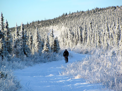
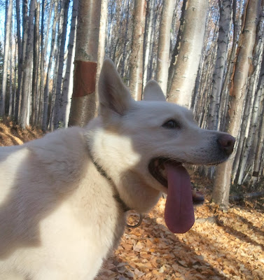
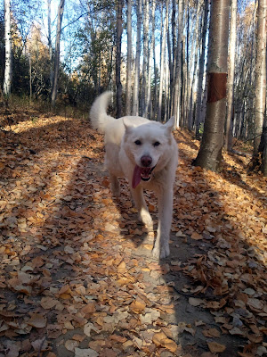
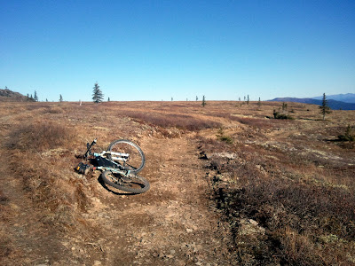
A mostly fun day, with some riding (good and bad) and some pushing (all bad).


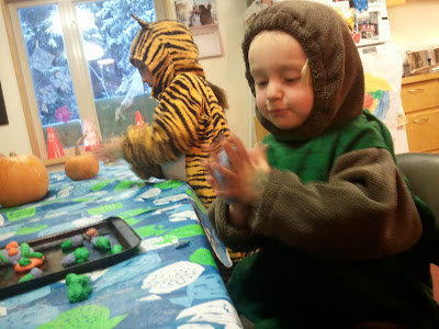
And I was back in time for this..
and this..
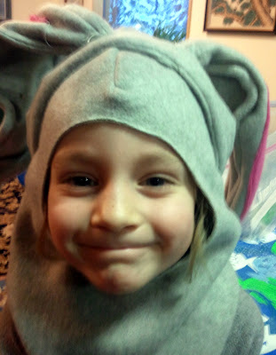
Happy Halloween !
JAY'S RANDOM MUTTERINGS ON THE THINGS TO DO OUTSIDE IN ALASKA, POORLY SPELLED.
A mostly fun day, with some riding (good and bad) and some pushing (all bad).
And I was back in time for this..
and this..
Happy Halloween !
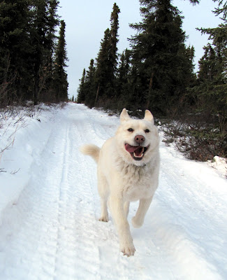
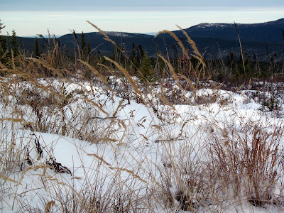
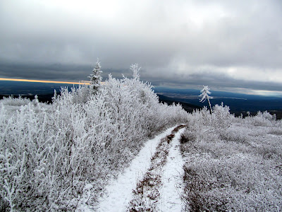
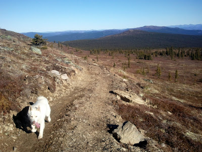
Snow has arrived in the Greater Fairbanks area and while its a little too grassy to ski on the trails around our house, I had high hopes for the trails up in the White Mountains. Remus and I headed out to the Mile 28 trail head to check out the trails.
The trails out of Mile 28 are a bit rocky but quite ski-able and fun in a rock-ski only sort of way.. so long as you don’t crash, as the snow cover is a bit thin. I didn’t head down to the low lands, but stayed on Trail Creek Trail and the skiing was pretty good. The biking would have been even better great – but alas I left the bike at home as I have yet to swap out the warm weather only front shock..
I skied several miles past Lee’s Cabin then turned around and headed back .
Winter is a great time in Fairbanks – there are so many winter trails to explore!
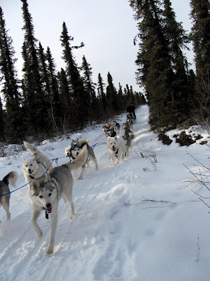
Fall has left us now and winter is rapidly approaching Fairbanks. Last year we made a mid October trip to Tolovana Hot Springs and had a great time. This time we brought a slightly larger group along with us and attempted to get several families to join us. Alas, one of the families was struck by colds just before we left for the trip and they had to stay home (much sadness – but we hear they recovered quickly) but we still managed to get six other folks including Ned, Kristen, the twin’s school friend Anna, Tom, Trusten, and Ms Marsh. We left town early Friday morning after meeting up at Alaska Coffee Roasters for a snack and much needed (for me anyway) coffee. Almost three hours later we arrived at the trail head, packed up, and headed down the trail.
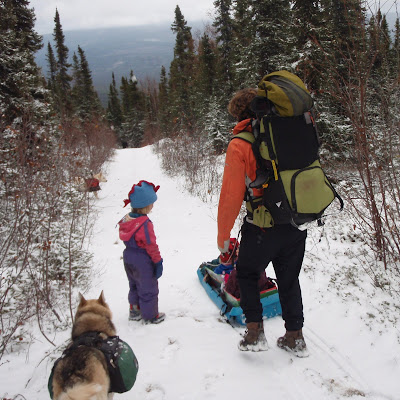
The hike in is about 10 miles or so, and is alas a little longer than our daughters can hike right now. The trail starts off at 2000ft or so, drops down to around 900ft, then climbs back up to a little over 2000ft again, before dropping down to 800ft to its final destination at the hot springs. We brought the kid-carrying backpacks to pack the kids in while they were not walking, and the Rozells had brought their Chariot to haul Anna when nap time arrived. As backup we also brought a plastic sled to give the kids a fun ride down the hills. The kids started off walking, then hitched a ride down the hill

The twins and Anna had a blast on the hike in and walked and sledded the first four miles or so, then napped for the next hour and half. The kids were quite the troopers – hiking along in the snow and having a blast. When nap time arrived the little ones were loaded up into their respective sleep-time carriers, and dozed while their parents got a workout.
After a hour or so nap time was finished and the twins were unloaded to hike on their own again, a little before the final summit. We tried to get the twins to hike as much as possible. After all, we have to train them up, as they soon will be too big for the backpacks.

I keep mentioning to the twins the idea that perhaps in a couple of years they could carry me in a backpack but they have yet to take me up on the offer, alas.
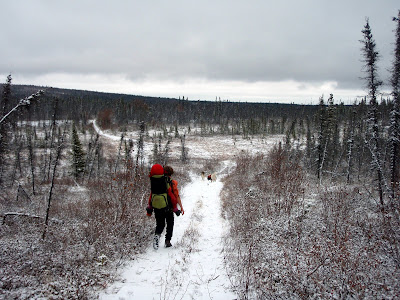
The kids were quite the troopers and hiked a fair distance. There were a few stoppages to admire the trees, look at the frozen berries or to play with the frost..


The trail into Tolovana is alway very scenic. It offers fantastic views down into the Tolovana River valley to the south and hills near the Yukon River to the north.
The final half mile or so to the hot springs was snow free and amazingly warm and pleasant.

When we arrived at the hotsprings, it was of course time to go soak. I was banned from the kids tub, as it was “Girls Only”, and was sent off to go soak in a different tub. Life is hard.

Very hard..
The next day we spent mellowing out, soaking in the hot tubs, and generally being slothful. Or at least I was – Ned and Tom actually went for a jog, while I just got out for a short stroll with the dogs before being pulled back by in by the lure of the hot water. It was a bit windy during my brief walk, and I was amazed by the “talking trees” as the standing burned black spruce popped and creaked in the wind.
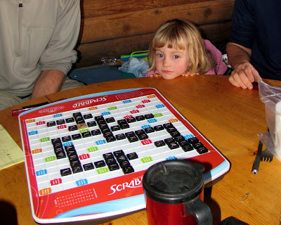
When people were not soaking, much fun was had. Tic-tac-toe was played by the younger generation…

And scrabble was played by some of the adults, except for those of us who could not spell, mainly me. Nancy and Tom, both hard core scrabble junkies, were practicably giddy when they discovered the “Diamond Edition” of scrabble, complete with rotating turntable, in one of the cabins.

Molly was enthralled by the viscious scrabble playing. I believe Nancy beat everyone by about 100 points in one of the games. I think it was her “Braille Fingers” in action, but Nancy of course denys it.
Other entertainments abounded – mainly eating.
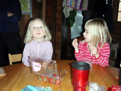
The kids did construct a fetching crown for “Poops” the dog.

Poops’s real name is Molly, and there were several “Molly No!” incidents that made the human Molly quite concerned that she would be banished outside. Nancy’s little bag of pipe cleaners provided endless amusement for the younger generation.

After two nights of non-stop eating and soaking we, alas, had to leave. On the second day the wind had picked up and by the second night the wind was really hauling. Tolovana is a very windy place, and there are lots of stories of failed trips and mishaps on the trails. Ned and Ms Marsh related several disaster stories involving Tolovana from trips in the past involving epic winds and snow. Tom had stories of the woodsman drinking all the syrup while we were sleeping and inflicting other terrors on unwary hikers but we all thought that was unlikely. I am blessed with no Tolovana disaster stories and have fervent hopes to keep it that way, and was thus happy to see that our trip out was pretty uneventful, though a bit windy. The kids hiked up the first mile or so until the snow started, then hitched a ride on the sled to the top, before beginning the cycle of hike and nap.

The hike out was pretty uneventful, but nice and scenic. Tom, Ms Marsh, and Trusten beat us out as they were not encumbered by little training weights, but had good hikes regardless. Our little training weights had a great time and really enjoyed having Anna with with them.

This was a fantastic trip and it was great to be out with another family with a daughter the same age as the twins. I think the twins had a immense amount of fun and hopefully others did as well… Hanging out at Tolovana with friends for a weekend is hard to beat – a big thanks to everyone who came along – I had a great time! Hopefully the family that was beset with the cold can come along on a future adventure.
A couple of notes about the trail to Tolovana. This year it received some upgrades compliments of the Boy Scouts – there are now mile markers on the trail..

As well as a shelter of sorts near the top. There has been a large water tank near the high point along the trail. I believe it was hauled out to replace one of the hot tubs, but it was dropped or some other accident befell it causing it to crack. It was then left there for a couple of years..
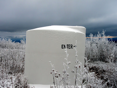
Someone has cut a small hole in the side of the tank creating a shelter of sorts inside.

Minimal shelter, but it would be welcomed by those in need I expect.
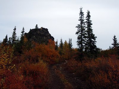
A couple of days ago I went for a ride and it was still Fall…

Then Winter arrived..
And is apparently here to stay.
Here’s to a fun and full winter! There is snow outside, go play in it and have fun!

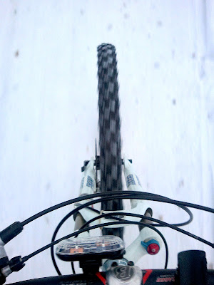
I recently decided to go check out the Ester Dome Single track, a new trail system off Ester Dome road. I had been avoiding this area as my perception of them were somewhat coloured by some conversations with some random strangers that made them sound like some sort of mini version of the North Shore of Vancouver trails, suitable for folks with 50lb fully suspended bikes and too much Mountain Dew. Much to my surprise, the trails are actually super fun single track winding though birch and spruce trees. Obviously I shouldn’t talk to strangers.. The trails are very smooth and not very technical but narrow enough to keep me on my toe. The winding banked turns are very, very fun. There is supposed to be a short half mile more technical loop, but I didn’t bump into it. Alas, I now feel bad I didn’t come to any of the trail maintenance sessions.
My photos don’t really do it justice, as I was too busy having fun.
Remus enjoyed it too.
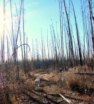
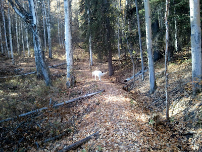
Summer is a bit hard on our dogs – the trails around our house are mainly winter trails and are pretty wet in the summer, so they don’t get as much exercise as they should. I have taken Remus, the youngest of the lot, on several mid/short length (20 mile or so) bike rides recently in an attempt to whip him into shape for the upcoming winter. Remus of course is very excited about this, as any excuse to go for a trip is fine with him.
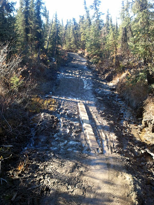
Remus and I headed out to the Mile 28 trailhead in the White Mountains NRA to go explore and get some outside time. I had intended to bike out the main trail, but headed up the Summit Trail instead. I had never really thought of this trail as bike-able, however it turned out to be excellent riding. A bit rocky in a couple of sections but mostly quite fun. The old board-walked area at around the one mile mark are getting more muddy… I miss the boardwalk..
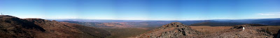
The ride up to the dome was amazingly pleasant. The view from the top was fantastic.
Once on top I noticed a new trail branching off to the side. It’s cut into the side of the ridge, and is dry and bike friendly, but alas not all that scenic.
The biking on the new trail is great.
Apparently BLM is working on hardening and reworking sections of the Summit trail, re-routing or otherwise dealing with the sections that are muddy. Its good to see BLM spending time on non-motorized trails. Hopefully it all works out. Remus and I continued until the new section appeared to stop, and turned around and headed back to the parking lot and then on the check out the main trail, and then headed home. Happy Monday everyone!
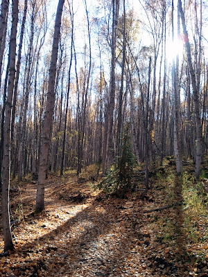
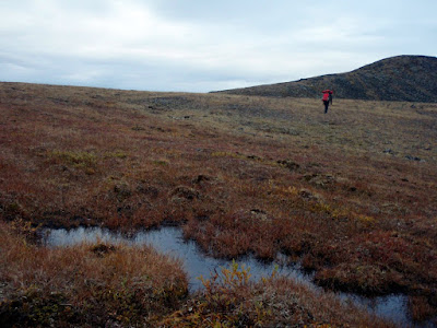
I had been thinking about pack rafting trips that might work in the upper area of the East or Middle fork of the Chena for most of the summer, and finally things came together. Our plan was to start from Chena Hotsprings, hike up to Far Mountain, then traverse down one of the many ridges down to the East Fork, then float out to Chena Hotsprings road and bike back to the hot springs. Ms Marsh, Tom, and I left the hot springs a little before lunch time and started hiking up the Far Mountain Trail towards Far Mountain. Alas, on our first try we missed the start of the trail and wandered around a bit before getting on the correct trail. The trail is surprisingly beautiful.
The trail started out on a ATV trail, but once it hits the ridge the ATV tracks die away and fine alpine hiking begins.
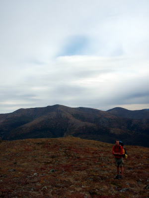
Weather was pretty nice for most of the first day, giving us superb views and wonderful hiking. The trail winds though some fairly recent burns and it was pretty neat to see how the alpine area was recovering.

We expected to have a pretty dry hike and had packed quite a bit of extra water so we had enough water to make dinner but we were quite excited to find some tundra pools a little after half way to Far Mountain on the first day.
Hiking was amazingly – nice dry ridges with wonderful views.

After we reached mile nine or so, just before Far Mountain, we called it a day and made camp. Dinner was provide by Ms Marsh, and was a fantastic boil in a bag soup meal.
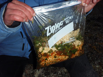
Lately my trips have switched to “just add hot water” meals which can be made plastic zip lock bags or by reusing the foil pouchs that freeze dried meals come in. It allows us to bring a smaller pot and saves fuel making for lighter packs. Light packs makes for happy packrafters!
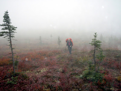
The next day the we awoke to less stellar views – it was totally socked in.
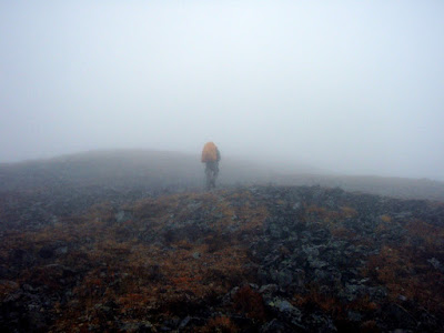
We spent most of the day hiking though the fog with limited visibility. Several of my last couple of trips had involved hiking though the fog in whiteout conditions, so I have been getting pretty good at it. This time I was quite prepared and had a route preloaded on the gps making it fairly easy to stay on course. I did get us circled around once and did a unnecessary horseshoe loop, but such is life.
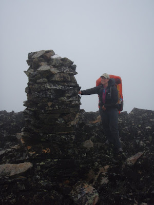
The view from the top of Far Mountain is supposed to be fantastic – alas we didn’t get to see much. There was an impressive cairn though, as well as a very large and loud communication complex on top though.
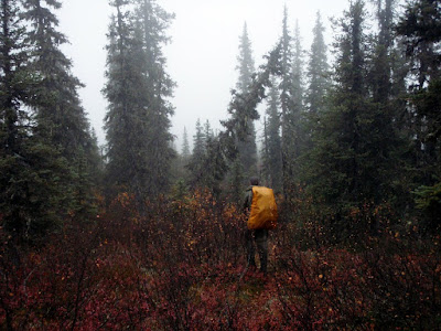
After going over Far Mountain we turned away from the trail and followed the borough boundary along a series of ridge tops heading down to the river. The hiking remained pretty good – lots of game trails and brush free hills.
I found two sets of caribou antlers that I picked up for the twins – I would have loved to have some antlers as a kid, and thought the twins would enjoy them. Alas, they were not the same size, so when I got back and handed them out, Molly noticed hers was smaller and immediately attempted to trade with Lizzy, who was having none of it.. Such is life…
Just before we reached the river we passed though a recent burn, perhaps from last year. It was very fast hiking and it was quite interesting to see the plants moving in after the fire. There were a couple of sections with impressively thick knee high grass.
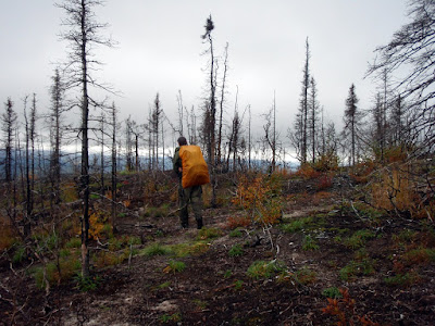
As we neared the river we also dropped below the clouds and the views opened back up, making route finding much easier. After the burn we hiked though a short section of fairly brushy black spruce forest, but eventually made it out to the river.
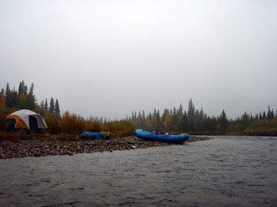
We made it to the East Fork at around 4pm, and were very, very happy to see it had lots of water and was going to be a good float. My big concern about this trip was the water levels on the East Fork – I had not been very far up it before and had no idea what to expect, and was a bit concerned we would hike all the way in just to discover it was too low to be float-able. Fortunately that was not the case – the water levels were great and made for great pack rafting. Since we arrived at the river mid afternoon we put in and floated for a couple of hours.
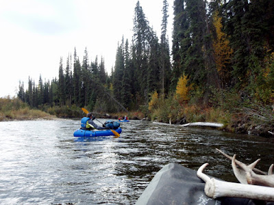
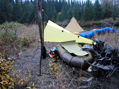
After two hours or so we called it a night and made camp. The East Fork was surprisingly scenic, with great views of the ridges hemming in the river and lots of interesting rock cliffs. The evening was fairly uneventful, besides the splashing beavers. We seemed to have set up camp near some sort of beaver meeting ground. On this trip I attempted to go without a tent, justing using a bivy and a tarp. It was mostly a success, though the bivy I used does not appear to breath all that well. On the second night, since I had my pack raft out and inflated I turned it over and slept on it – it was like heaven and very comfortable.
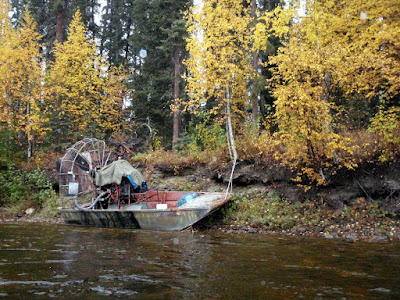
The next day we continued the float. Up to this point we had not seen any other floaters, but this changed about midday. We heard an air boat in the distance, and saw several pulled up on shore, as well as several parties of more traditional floaters with rafts and inflatable kayaks.
Strangely we saw lots of boats pulled up on shore but few people and no one on the river..
We passed one of the camps where a large jet boat was pulled up along with a jet ski and Ms Marsh talked to them a bit – they were completely flummoxed when they were told that we hiked in. One of them responded with a “Holy Sh**” and a completely incredulous look. More mind boggling for me was the jet ski – its fragile fiberglass bottom made it seem to me like the least useful motorized appliance ever for traveling in shallow rocky creeks.
We did stop and talk to a guy with one of the groups of non-motorized floaters. He said he was on “Camp Duty” while the rest of his party hunted. They were dropped off at the landing strip at Van Curlers Bar, a old placer mine on the upper reaches of the East Fork. Apparently mining of some sort is in progress and the landing strip is open and usable. Some interesting details can be found online about some of the folks who prospected in this area, including Van Curler. Excepting the air boats and jet boats, the float felt pretty remote considering how close it is to town – there were not a lot of signs of other travelers, besides a large number of cut out sweepers. In the lower sections of the river there are a number of very large log jams that have been cut out, so this is probably a good thing – some of those log jams were pretty immense and would have been a bit of a pain to portage around.
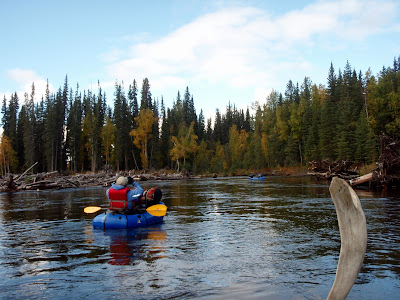
Eventually we arrived at our take out, where Tom and I got on bikes and biked back to the hotsprings while Ms Marsh guarded our packs and hunted for cranberries. The bike ride was very fast and fun and before I knew it we were back at the truck.
This hike, float, and bike is highly recommended – the hiking was fantastic, the floating pretty fun (though mellow), and has a very remote feel considering how close this is to town.
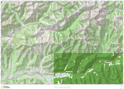
A Map.
More photos.
 |
| Far Mt – East fork of the Chena trip |