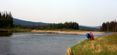
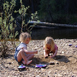
On a super hot and dry day, the twins and I set off for Nome Creek campground. The plan was for Nancy to bike the 80 miles or so to the Campground while the Twins and I would drive. Later in the day another family along with Tom and Ms Marsh would join us. The drive out was fantastic, with a little smoke near Fairbanks which quickly cleared out as we left town. The twins snoozed the ride away, and we passed Nancy biking along at mile 50 or so. After reaching the camp ground the woke the twins up, and after a little grumbling about the rude awaking, they set off to explore the nearby sandbars.

They had lots and lots of fun exploring the sand and gravel, throwing rocks in the water, and other fun games.

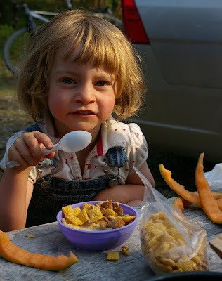
After a couple of hours Nancy arrived and we all spend the afternoon together hanging out on the sandbars enjoying the sun. Eventually we were joined by the additional family and we all hung out having fun and enjoying the fine afternoon. After a dinner of pasta and cheese (a favourite of the twins) everyone hit the sack. Late in the evening Ms Marsh and Tom arrived and joined our encampment. The next day was nice and clear, promising good weather for the float and hike I had planned for the next two days. The twins were quite excited to be camping and quickly got up to go play in the sandbar again, after having a quick breakfast.

The breakfast menu was melon and cereal – yum yum!
After a slow morning Ms Marsh, Tom, and I set off to float down Beaver Creek. leaving Nancy to drive home with the twins. Our plan was to hike out on the Summit Trail the following day.
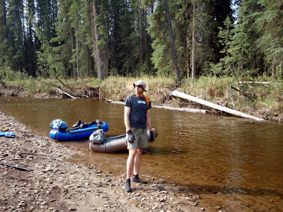
The water was pretty low – the Nome Creek gauge said 2 to 2.5 ft – which is a about a foot to two feet lower than the other time I floated it. I was not how the low water levels would effect stuff, but it turned out to be fine, though very slow.
Our first sign that something was different was when we reached the confluance of Nome and Beaver Creeks – last time we floated this section there was a nice and fun eddy line where the creeks came together. This time around there was no eddy at all, and the junction was hardly noticeable.
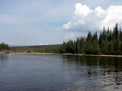
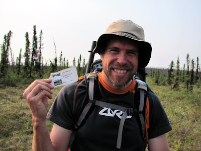
Beaver Creek was still float-able at these water levels, just a bit slow. Shortly after the confluence Ms Marsh found a very out of place trail sign that by the mile markers should have been just outside Windy Gap cabin. However we are well upstream of any trails heading to Windy Gap, and the only trail upstream of us is a dead end trail heading to Richards Cabin. Tom was quick to point out that it was also misspelled. How it got here was a mystery, so I decided to haul it out to Borealis and leave it there for BLM to ponder.
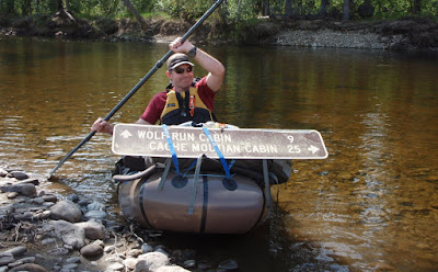
The sign had the added advantage of preventing Ms Marsh and Tom from playing bumper cars with me as they were quite worried about it’s not so sharp edges.
The float was quite a bit slower than when we did it last year – I think it took 9 hours total last year, and this year it took around 12, even though we took fewer breaks. There was quite a bit of mellow floating, bobbing along..

This was not all bad – I got to enjoy some mellow floating and enjoyed a fair bit of recliner time.

We ran into a few small rain storms and a fair bit of distant thunder, but nothing too intense.

We eventually reached Borealis, our takeout spot, and had dinner in the cabin and camped out nearby. In the morning we crossed Beaver Creek and started our hike out.
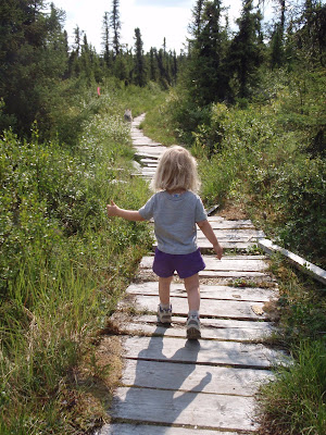
The hike begins on some very dilapidated board walk and then continues on the winter trail up to the summit trail. Last time I hiked this in the summer I noticed that the board walk appears to continue a ways after the winter trail turns off. I decided to check out the board walk and was surprised to see it continued for a fair bit and cut a bit of the tossuc slogging winter trail section of the hike.

Alas, after crossing the slue the board walk goes away and we were back walking on the tussocky winter trail.
On our hike up the Summit Trail Tom found several reminders of our winter adventures – he found a single stick of swix extra blue, and a White Mountains fuel tag.

After a shortish slog we reached the fine hiking of the Summit Trail – Tom was suitably excited.

The rest of the hike out was fantastic – the trail had great views and is in very good shape. the older sections of board walk had a large number of exposed nails which made things a bit treacherous at times.


The last section of trail was a bit of a mud fest. The trail used to look like this:
Now it looks like this:

Nancy, the twins, and I hiked it when BLM was revamping the trail with an assembly line of small bobcat like tractors.
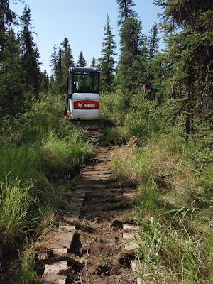
At the time I had stopped to talk to the trail crew for a while, and they said the plan was to use “ditch and elevate” to remove the board-walk and have the trail dry in the summer and groomable in the winter. Its looking like a bit of a failure, as its a bit of a muddy mess now, in the driest spring I have experienced. Hopefully BLM will get the trail sorted out and have it reach some sort of drier state.
Once past the mud things went by quickly and soon we were at the parking lot, and before we knew it at Hilltop having burgers. Yum! Yum! The hike was fantastic, as was the float, though it would be a bit better to have done it with slightly faster water. Camping with the twins added extra spice and added a bit of extra spice – and of course fun was had by all!
A map:

More photos:
 |
| Beaver Creek-Summit Trail float hike |
Tags: beaver creek, family, packrafting, summit trail, white mountains