Author Archive

A soggy saturday..

Sunday, September 2nd, 2012

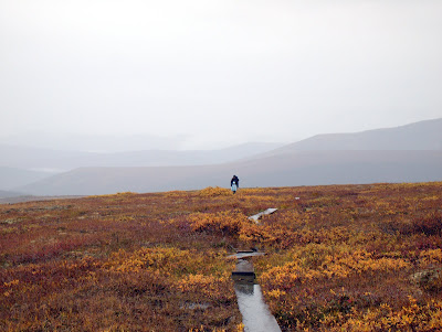
The twins, Nancy, and I had a overnight trip planned, but things didn’t work out as we intended. We arrived at the trail head to wind, poring rain, and temperatures in the lower 40 – not the best weather for the ten mile hike above tree line we had planned. Instead we decided to make a day hike of it, and explored the area around the trail head.

The fall colors were out in force, making for some beautiful but wet hiking.

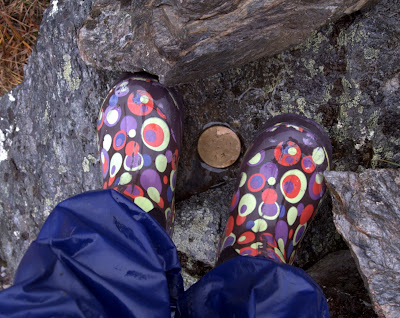
We spent several wet hours the wet and splashing around on the trails and near by hill sides.

The twins enjoyed snacks, and were excited to be introduced to Mike and Ikes. They did take a pass on my last minute gas station purchase, a “Uncle Al’s Stage Plank” . There was lots of passing of snacks while walking, to keep the little legs moving…

We spent a bit of time exploring before heading back..

The twins found a nice kid sized cave that they could walk around inside, much to their excitement. It was much to small for the adults, which I think added to their enjoyment. Molly made a point to tell me that it was much warmer in the cave, out of the wind and rain.

.

Not the trip we had planned, but fun none the less.

Anaktuvuk to Nolan..

Monday, August 20th, 2012

Several years ago Ms Marsh, Tom, and I did a wonderful trip out that started at the village of Anaktuvuk Pass, and headed down the John River. I had been thinking for a while about getting back in that neighborhood, and eventually the chance came. This time the plan was to head east out of Anaktuvuk, up the Anaktuvuk River, over to Ernie Pass and down Ernie Creek to the North Fork of the Koyokuk, and out to Nolan via Delay Pass. It looked like a fantastic route, and I was pumped to be back in that area! Folks with A.D.D. or are otherwise reading challenged can see a video highlight real here.

We arrived at Anaktuvuk, and after wandering around for a bit, and checking in on a friend of Ms Marsh’s, headed out of town.

We caught a ARGO trail leading to the Anaktuvuk River, and started hiking. The walking out of Anaktuvuk was wonderful, with great views, and we made good time, even with lots of stops to check out the sights.

I had a blast looking around for signs of how the locals use this area, exploring the antler piles, the hunting blinds, and the fire rings.

We camped the first night where a small stream dumped into the Anaktuvik River, and in the evening explored the canyon where the stream came from.

The next day we hiked up to Ernie Pass, and over the continental divide, following Ernie Creek.

Just before the divide we found an old broken up snow machine sled.

It’s hard to imagine what it would be like here in mid winter – probably amazingly cold and windy, with no cover. Right on the divide we were surprised to find a beach ball with a zip lock bag of maps and notes held down by a rock.

After we got back into town we discovered it was package airdropped for a swiss scouting club that was never retrieved.. It was a small package, but a bit of a bummer it was left behind… litter being what it is. Once over the pass we followed Ernie Creek down.

The canyon Ernie Creek flows through is surprisingly deep, so we stayed high up on the ridge.

We had hopes of floating Ernie Creek, but ended up just walking, as it didn’t have a lot of water in it, and the gradient was fairly steep. It would have been possible, but there would have been some dragging and a bit more excitement than were looking for at the moment. In a couple of spots it looked pretty hairy, with lots of large rocks with tight places. The walking was pretty fantastic, so we didn’t mind much.

The views were top notch, as Ernie Creek winds down between the peaks.

Eventually we reached the North Fork of the Koyokuk, and hopped into the boats.

The floating was pretty nice, though there was a fair bit of wood dodging required initially. Eventually we reached the confluence with Ernie Creek, and the water volume went up a lot, and the wood dropped off.

The area was amazingly scenic, as we floated down between the gates of the arctic, Boreal Mountain and Frigid Crags.

In the middle of the day, as we rounded a corner we started to smell smoke, and then bumped into a couple with an Ally Pack canoe camped on shore. We talked to them for a moment as the current carried us by, surprised to see anyone. Later in the day we bumped into them again, and it turns out they had emailed me the previous summer looking for advice on trips in the arctic. They are were up from Tennessee, spending part of the summer exploring Alaska, and were floating down to Bettles. It seemed like they were having a great time.

It is a very small world.. We saw them several other times that day, before they called it a day and camped. We only encountered one rapid of any note on the North Fork near Cladonia Creek. We scouted it, but it was fairly mellow and easy to navigate. We spent several days on the Koyokuk, enjoying the fast moving water and nice weather. The second day we camped on the confluence of the Tinayguk River. Tom and I messed around looking for cultural artifacts – I had been told there was the remains of a cabin near the confluence, but we didn’t find any. We did see lots of animals though, and were given quite a shock when a large owl swooped overhead while we smashed though the brush. Tom also spent some time sorting and counting his snacks, and was happy that he was not going to starve to death.

The final day on the river we floated until about mid morning, then took out and started hiking inland, planning on hitting the winter trail to Nolan.

Most of the hiking was pretty good, though there was some tussock hammering.

Eventually we reached Glacier Creek, where we crossed and started walking upstream. We started seeing more signs of civilization..

We ended up camping near an old abandoned runway. It was a beautiful calm night, and very peaceful. Alas, in the middle of the night we were hit by a massive wind gust that flattened both our tents, followed by a heavy downpour. I ended up having to get out and re-stake the tent while getting dumped on – all my own fault for not setting up my tent with firmer anchors. The next day it rained on and off, as we hiked up the stream, and over to Nolan on the winter trail.

The hiking was a mix of wonderful walking, and huge tussocks with waist deep holes around them – less than wonderful hiking. We eventually left the winter trail where it crossed a massive tussock field and headed up a ridge, leading to some wonderful hiking, and we managed to skirt most of the rest of the tussock fields.

A few more miles wet walking on the winter trail and we arrived at Tom’s car, parked near Nolan, where we gleefully dove into the bags of snacks and clean (and dry!) clothing.

Soon we were zooming back to Fairbanks, enjoying the heat and dryness of the car after a long wet day in the rain. Thanks to Tom and Ms Marsh for a wonderful trip, and of course a huge thank you to Nancy and the twins for allowing me the time. It was great fun, and a fantastic adventure!

Anaktuvuk Pass to Nolan, Fall 2012. from JayC on Vimeo.

(For the full HD monstrosity click here. )

Maps and more photos can be found here:

The Soggy Bottom

Sunday, August 5th, 2012

Last summer I heard about a 100 mile summer race, the Soggy Bottom, and followed it online. It looked like fun, so when the spring came I signed up. On a damp slightly morning, I lined up with about two dozen other bikers, and we were off.

The Soggy Bottom’s course is on the Resurrection Pass trail system (more details here, north and south). The route, in a nutshell, goes from Hope Alaska, over Resurrection Pass to Cooper Landing, then back to Hope with a side trip down and back on Devil’s Creek trail. It can be done solo, or as part of relay, with exchanges at Cooper Landing and Devil’s Creek. Apparently most people doing the race are from Anchorage, and have some sort of support crew in one form or another. The evening before the race, I talked a bit with the organizer, Carlos, who very kindly offered to take two drop bags to the exchanges for me, and I quickly filled two stuff sacks with snacks etc and handed them off.

The race started at a fairly mellow pace on several miles of road, with the fast guys and gals zooming off, and the rest of us tagging along at the rear.

Fortunately the section on the road was pretty short, and we were soon on the Resurrection Pass trail. The riding was fantastic single track in large trees and tall leafy green plants, including the ever popular Cow Parsnip.

At this point the riders had thinned out a fair bit, and I rode most of the way to cooper landing with two riders for Anchorage. Eventually I climbed up out of the green stuff and into the higher alpine terrain.

The trail continued to be pretty wonderful – fast and smooth riding single track.

Eventually I reached the top of the pass, and started heading down.

On one of the downhill sections I pinch flatted on a rock waterbar. Not a big deal, after a couple of minutes I was going again, but alas I had now used my only spare tube. While I was changing the flat three riders passed me. I caught up with two of them before Cooper Landing, the other guy stayed well ahead of me, and was to finish a hour or so before me.

Just before the flat I past a group of very classic looking hikers, including one guy hiking bare shirted in sweat pants with a mid sized boom box on his shoulder, playing old hair band rock. It was quite a scene, and made more so by the bare shirted man’s budda like physic.

About five miles or so before Cooper Landing I started running into the leaders heading back out. It was a nice twist to see most of them as I rode in, though it did require me to stay on my toes, as the trail was narrow in a couple of sections. Upon arriving at Cooper Landing I was a bit confused and had a bit of trouble locating water, but I eventually figured stuff out and got reloaded. I asked around for a spare tube, and one of the relay riders (Brian I think) from Anchorage set me up with two tubes and some CO2 cylinders, definitely adding to my peace of mind – thanks!. After fiddling around a bit too long I headed back out, heading back to Hope. The ride up to the pass was uneventful. I was caught by a relay rider, and I tried keeping up with her for a while, but eventually she pulled away. There was a brief bit of pushing up a short steep section, but otherwise it was all rideable, and very, very fun. Eventually I reached the Devil’s Creek trail, and headed back down. On the way down I passed some of the faster folks heading back up, but the really fast folks were already done with this section and on their way to Hope by the time I reached it. This section of trail was amazingly fun, with lots of fast riding with fairly long sight-lines so I could open it up and ride fast. There were periodic rocky sections that were wonderful at keeping me on my toes, and a bit of mud but nothing too bad.

The end of Devil’s creek trail ends in large parking lot, where there was a checkpoint with water and a lot of relay riders relaxing and having fun, having finished with their sections. I restocked and headed back out. The climb back up to the pass was almost as fun as riding down. Eventually I made it back up to the top, then enjoyed the 20 miles of mostly downhill riding back to Hope. I arrived in Hope just before dark, and was very happy to get a shower, a beer, and some pizza. The race ends just outside a bar, and there was live music playing, making for an interesting scene. After the beer I headed off to go to sleep, feeling a bit wiped.

I really was not sure what to expect from this race, but I was completely blown away by how fun it was. Fantastic single track, and a bit of mud, what more could someone ask for? I was pretty happy with my time, though I could have ridden a fair bit faster if I had done the trail before and knew what to expect. Running tubeless would have saved be a flat, as I pinched flatted on my rear while slamming over a rocky waterbar. It might have also saved me a spoke, as somewhere in the last 40 miles I broke a spoke on my rear wheel.

A major thanks to Carlos the organizer for putting on this wonderful event. Hopefully more Fairbanks folks will head down for the event next year, as it is well worth the drive. For folks interested in a fun but not super epic time, the relay looks like it would be a blast – the legs are all in the 35 mile range. My photos really don’t do the course justice, as they were taken on the move with a little point and shoot, but the trail system the race is on goes though some very beautiful territory. That area has some fantastic bike touring potential.

Hiking Kesugi..

Monday, July 16th, 2012

On the way back from the Fireweed, Tom and I decided to hike Kesugi Ridge, a wonderful ridge hike in Denali state park. It took us about 12 hours, and was a wonderful way to stretch the legs after all that time on the bike. The last bit of the trail is currently closed as a section of the trail has been washed out, so we only did the Little Coal Creek to Byers Lake section.

Things started with a climb..

But quickly transitioned to nice alpine hiking.


I had the camera out a lot, and I think it slowed us down a fair bit. The nice weather made it hard not to keep snapping photos..

It was a bit brushy at times.. but always manageable.

Near the middle of hike the trail climbed over some eroding granite outcrops – super scenic and very pretty.

Near the middle of the trail there was a mile or so with lots of downed trees. It looked like at least some of the trees had fallon this summer, and they were laying in the same direction. Perhaps a unusually hard windstorm? A mystery!

After the countless downed trees it was back to alpine hiking.

We ended the day with a short-ish (17mile) bike shuttle, and made it back to Fairbanks a little after 1am. This trail is fantastically beautiful, and well worth the drive.

There were several sets of tire tracks on the trail, making me wonder if it is a common bike route, and how fun it would be. It seemed like there would be a bit of pushing, and a fair bit of wonderful riding. Something for a future adventure I think…

East Fork of the Jack hike and float

Sunday, June 24th, 2012

Last fall Ed the packrafting God of the Interior told me about a trip he had done on the East fork of the Jack river, giving it a “5 stars!” rating. I had been thinking about doing a trip in that area, as it is supposed to be very scenic, and fairly accessible without a long shuttle. Tom, Ms Marsh, and I headed out of town early Saturday morning, and in late morning we were heading up a valley heading into the headwaters of the East fork of the Jack river.

The weather treated us well on the first day, though there was a brief hail storm, and late in the afternoon several thunder storms rolled by.

The hiking was fantastic..

Though things got a big harder once we headed over the pass, with a fair bit of side hilling.

Eventually we made it down from the pass and started heading down into the Jack.

We had been told there was a wonderful game trail the swapped sides of the creek but was wonderful walking. It turned out that the creek had a bit too much water in it for easy crossing.

The game trail was nice super highway for the sections we could follow it.

Eventually we decided the creek looked floatable enough to make it worth inflating the packrafts for, and made camp with plans to start floating in the morning. Morning came a bit earlier than some would have liked..

The floating on the jack was fast and fun. The creek was near bank full with all the runoff and the water was moving fast. Alas, there were not a lot of places to eddy out, so there was not a lot of time spent out of the boat.

Eventually we reached the main fork of the Jack. The water sped up a bit more, and the volume increased a fair bit.

There is a small canyon with a brief bit of (allegedly) class III-is water. Just as we were eddying out to go check on the canyon, one of us dumped and floated up to the rest of the group, requiring a throw bag rescue. It was decided that given the fast, high water it might be a good idea to just portage the canyon, so around we went. Fortunately, there was a fast hiking ATV trail that made for fast walking. This ATV trail could be picked up from the Denali Highway, and could be used to make this trip into a day trip, or to cut out the less exciting floating near the end (more later).

The rest of the float went by very fast. Once past the canyon things flattened out a lot, but the water remained fast. The last 20 minutes or so of floating had lots of fast moving water with lots of wood – not really all that fun, and we had to be on our toes to make sure we didn’t end up with some sweeper or snag related trama. We made to to our take out, and while Tom and Ms Marsh headed off to get some dinner I jumped on the bike and headed off to fetch the truck. I enjoyed a mellow 12 mile ride back to the truck. Biking that short section of the Denali Highway got me back into the mood to bike tour that road again.. Soon I was back at the truck, loaded up, retrieved Tom and Ms Marsh, and headed back to Fairbanks.

Five stars, indeed – this trip was fantastic and highly recommended. We did it during peak snowmelt driven water levels, so the floating was pretty fast, but I expect durring a more normal time of year the water would be a bit mellower. The hiking was great, the views spectacular, and the floating fun.

If I was to do this trip again I would probably take out after the canyon and hike out to the denali highway on the ATV trails, or take out as early as possible near Cantwell, as the last bit was the only bummer. Lots of cotton wood (Balsam Poplar) in the water, and not much to see, making all the wood dodging not all that rewarding. We took out where the old Parks Highway bridge used to be, but further upstream should be possible and a good idea.

This trip involves traveling a lot of land owned by AHTNA and requires a permit.


More mapping action here. and a GPX file here.

A Kanuti hike and float

Tuesday, June 12th, 2012

One of my favorite off the beaten path places to visit is Kanuti hot springs in the Kanuti national wildlife refuge. I have been in via skis and on foot, but wanted to try it as a packraft trip and see how it went. I had been warned by the god of interior packrafting that it could involve a lot of low water butt dragging, but our float had lots of water, and was wonderful.

I was a bit concerned it was going to be a long slow float, but the water moved at a nice pace, and there was a short section of class II that required a bit of maneuvering.

The hot springs was wonderful as usual. It is out of the way just enough that it does not get a lot of visitors, giving it a wonderful remote feel, even though it is fairly short hike in from the road.

The ground is wonderfully warm, and the soft warm grasses made for wonderful napping, only slightly spoiled by the mosquitos.

After a mellow evening of hanging around at the hotsprings, soaking and lolling about, we hit the sack. Our campsite was in a field of wild onions or chives, and was pleasantly fragrant.

In the morning, we had quick soaks, then started on our walk out.

The walk out was uneventful, but a bit windy at times.

It was a wonderful trip, thanks Tom and Ms Marsh for providing motivation. Its a fun trip, highly recommended, at least when the water is high.