Posts Tagged ‘arduous’

Hiking Kesugi..

Monday, July 16th, 2012

On the way back from the Fireweed, Tom and I decided to hike Kesugi Ridge, a wonderful ridge hike in Denali state park. It took us about 12 hours, and was a wonderful way to stretch the legs after all that time on the bike. The last bit of the trail is currently closed as a section of the trail has been washed out, so we only did the Little Coal Creek to Byers Lake section.

Things started with a climb..

But quickly transitioned to nice alpine hiking.


I had the camera out a lot, and I think it slowed us down a fair bit. The nice weather made it hard not to keep snapping photos..

It was a bit brushy at times.. but always manageable.

Near the middle of hike the trail climbed over some eroding granite outcrops – super scenic and very pretty.

Near the middle of the trail there was a mile or so with lots of downed trees. It looked like at least some of the trees had fallon this summer, and they were laying in the same direction. Perhaps a unusually hard windstorm? A mystery!

After the countless downed trees it was back to alpine hiking.

We ended the day with a short-ish (17mile) bike shuttle, and made it back to Fairbanks a little after 1am. This trail is fantastically beautiful, and well worth the drive.

There were several sets of tire tracks on the trail, making me wonder if it is a common bike route, and how fun it would be. It seemed like there would be a bit of pushing, and a fair bit of wonderful riding. Something for a future adventure I think…

90 out of 350..

Monday, April 9th, 2012

As folks who know me are already well aware I ended up scratching out of the ITI fairly early in the event, at about mile 90. It was pretty sad, as I had spent most of the winter thinking, planning, and training for this race, but it was a good call. Hopefully I will get another chance at the race next year, as I really want to finish this one!

I am afraid this write-up is a bit wordy, so here is a short summary: I scratched, pushing a bike in Neos sucks, and my feet hurt. Next year’s to-dos – don’t scratch, practice pushing, try some less crappy footwear, and bring less stuff.

Moving on…

The race starts on the edge of a small lake near the old town of Knik, at a small bar known as Knik Bar. I arrived early enough to get all my stuff arranged and ready to go on the bike, then spent a bit of time checking out other folks’ setups and buzzing on last minute pre-race stress.

Eventually everyone lined up, and we were off. I grabbed the wheel of someone who looked like he knew what he was doing, Sean Grady and tagged along though a series of trails that eventually lead to Point Mackenzie Road.

Sean knew where to go, and soon were zooming down the road in little posse of obese bikes with too much stuff in tow.

After 10 minutes or so on the road the “fast” guys passed us in a tight pack.

I expected I would never see them again until after the race..
Eventually the road riding ended and there was an abrupt transition from biking to walking.

The snow kept coming down and as the traffic died off as evening arrived the snow piled up deeper and deeper.

We passed several groups of snowmachines either on their way home or stopped on the side of the trail to mess with their machines. One group asked us where we were going, and upon hearing “McGrath”, stared at us blankly. One of them, as if addressing someone simpleminded, started telling us that McGrath was a long way away… as if it was not abundantly clear to someone 20 miles into a 350 mile event, pushing a bike at a little more than 2 miles an hour, that this was going to take a very long time. We trudged along on the long straight trail leading to Flathorn Lake. At this point the crowd had thinned out and I was now in the company of Sven, a teacher from Anchorage, and Sean, though we could occasionally see flashes from the headlights of racers behind us. At about 8pm we passed Jeff Oatley leaning on his bike as he waited for a couple of folks right behind us to catch up, and he let us know that the leaders were about 15 minutes ahead of us. At this point it was pretty clear that this was not going to be a “normal” event, as the fast people are normally much, much faster than I am, and my only sign of them is their in and out times in the log books at the checkpoints. We arrived at the edge of Flathorn Lake and were greeted by Craig Medrid of the Alaska Dispatch sitting on a snowmachine texting (tweeting I believe he said) on a sat phone.

He had apparently gone across the lake, was not able to find where the trail exited the lake, was soon stuck, and had a hard time extracting himself. He was strongly discouraging folks from heading out across the lake due to poor visibility from the blowing snow, though the two lead bikers had headed across. I took a peek out onto the lake, and all signs of any trail besides Craig’s snowmachine tracks were completely wiped clean by the wind and fresh snow. Sean and Sven decided to bivy and wait for morning. I decided to hang out for a couple of minutes, waiting for more folks to arrive, as it was only a little after 8pm, and I was way too excited to sleep anytime soon. In ten minutes or so Jeff, Heather Best, and Tim Stern arrived, and undetered by Craig’s statements of doom, headed out with me tagging along.

We soon caught up with the lead bikers, Pete Basinger and Tim Berntson, and begin a long, slow slog across the rest of Flathorn and Dismal Swamp. Soon more bikers and eventually walkers started catching up with us sharing in the trail breaking. This section of trail is very wide and it was fairly hard to locate the firm trail under two feet of fresh snow. When we got off the main trail we would start postholing up to our waists, making for really fun bike pushing. At this point I was starting to get pretty whooped, and was having a hard time lifting the front of my bike to push it though the fresh snow. Fortunately the “fast” guys were happy to charge away though the snow, and I just pushed along in their wake. The walkers were having a bit easier time and soon were a ways ahead of us, but their headlights were still visible flashing back and forth as they searched for the trail under the snow. Gradually the pack was thinning out, with bikers dropping off here and there to bivy under welcoming trees. Eventually we reached the bank of the Susitna River, which locals call the “Wall of Death” named for the 10 foot or so drop from the top of the bank to the river. All the walkers apparently responding to some sort of hidden signal peeled off to bivy under trees.

The lead bikers started building a fire to melt water, and since it looked like no one was going to be leaving anytime soon, I set up my bivy and went to sleep. I woke up a little before dawn as a walker, Tim Hewit, passed by. The leaders had left while I was sleeping, and were now long gone, probably off enjoying a long hard slog through the deep snow. I packed up and started pushing my bike down the trail, and after several minutes was surprised to see him again heading back towards me. Apparently this trail led to the cabin near the river, and not to the main trail. The lead bikers had apparently headed out this way, wandered around for a while, and gave up, headed back and found the right trail about 10 feet from where I bivied. Tim was very cheerful, and surprisingly bubbly as we chatted for a moment as I got off the trail to let him by, and then I followed him back up the trail to the turnoff for the main trail onto the river.

The Susitna river was covered in fresh snow, with a single “push” track the bikers and walkers had broken winding up the river.

This was quite a contrast to the last time I was on this section of river, when the trail was rock hard and about 100 feet wide.

I continued pushing my bike up river, mostly by myself at this point, occasionally getting passed by a walker or passing a biker. At about noon Craig zipped by on his snowmachine. I was hoping that the motorized traffic would pick up a bit when I reached the confluence with the Yenta River, which is the main route for most of the traffic. Alas, Craig was to be the only motorized traffic I was to encounter until late in the afternoon.

Eventually I was passed by several walkers and two skiers as I slowly made my way to Luce’s, a lodge on the Yentna River.

Just before Luce’s several snow machines passed by hauling sleds and waved as they zoomed by. I reached the lodge, where two walkers and the lead bikers were enjoying burgers, fries, and snacks. I ordered food, several pops, and booked a room, as I was pretty wiped. As I was enjoying my burger Jeff, Heather, Tim, and several more bikers arrived. It is hard to describe how surreal it was to be with the lead bikers at this point. I am not a fast biker, and normally I never see the fast guys more more than a minute or two once the race starts. Seeing the lead guys snarfing burgers while talking about how wiped they were really drove home this race was going to be a long slow slog. Two of the bikers left after eating and headed out for the official checkpoint, Yenta Station, which is 6 miles or so up river. Most of the rest of the bikers decided to get some sleep and head out in the morning at various versions of ungodly early.

In the not tremendously early a.m. I headed out with Jeff, Heather, and Tim. The trail firmed up a bit overnight, but not enough to be consistently rideable. It was rideable in short stretches, but not for any significant distance. It did appear the Tim, Phil, and Pete who left earlier than us road a fair bit more than we did. We arrived at Yenta Station, had some breakfast, and headed out again.

The trail upstream of Yenta Station was quite a bit softer, and it was back to pushing. Not show-stopping by any means, but I was starting to get worried about how much pushing I could actually pull off.

The temperatures remained much too warm for the trail to harden up, so the pushing continued for the rest of the day.

By this time my feet were starting to take a bit of a beating as the footwear I was using, Neos overboots with sorel liners and superfeet insoles, did not provide the sort of support and protection that my feet apparently need for this amount of pushing.

I was starting to get blisters on the ends of most of my toes, and was getting periodic sharp pains in the arch of my left foot, probably due to the soft soles of the Neos.

We ended up pushing all the way to Cindy Abbot’s place, also known as Slims. Cindy apparently enjoys the company of the racers enough to open her house to them, and lets folks crash on the floor of her guest cabins. By the time we reached it was a very welcome sight. After having some wonderful soup I spent a couple of hours sleeping on the floor of one of her guest cabins, then took off in the late evening for Skwentna. I will be forever grateful to Cindy and her husband-to-be Andy’s hospitality.

The trail had hardened up a bit and was semi rideable now. Jeff zoomed off, floating away, and was soon followed by Tim and Heather. They had a much easier time due to either their elite snow riding skills, or some other magic I have yet to posses. I ended up riding a bit, but there was still a lot of pushing. I arrived at Skwentna a bit beat, and a half hour behind them.

Upon arriving I learned that the lead bikers had left for Shell Lake 5 hours before. There was some talk that the trail might firm up, so I grabbed a bunk and snoozed until the morning.

In the morning the owner of Skwentna Roadhouse called the next place up the trail that folks would stop at, Shell Lake to how long it had taken Pete and Phil, and learned that they had yet to arrive. This was bad news, as it means they had taken about 12 hours to travel the 15 miles, meaning lots of slow pushing. At this point my feet where starting to show the mileage, and I was not sure that I could handle another 100 miles of pushing. I was to later learn the winner of the race, Pete Basinger, figured he rode about 40% of the 300-350 miles to McGrath.

After some talking with the other racers, and being told that from that point onward getting flown out was going to be increasing difficult, getting more expensive and possibly involving a fairly long wait, I decided to scratch and hopped on a plane to Anchorage. It was pretty sad, as it was clear I could have gone onward, and my feet might have held up for the rest of the pushing, but probably a good call. It definitely would have been a long, long slog, and I was not tremendously excited by the prospect of pushing my bike for another 5 or 6 days (or longer!). I ended up taking a flight out with Lue and Eric.

And so ended my attempt at the ITI. I learned a fair bit, and really want to come back next year and make another go at it, hopefully this time making it the full way.

Lessons Learned:

  • My footwear needs to be up for extended pushing. I had tested my setup by going for 6 mile walks and it worked great for that length of time, and had done overnight bike-packing trips with a fair bit of intermittent pushing, but it just was not up to extended bike pushing. The soles were a little too soft and all the pushing in the soft snow put some unusual stress on my feet causing some of the connective tissue on the bottom of my feet to start to hurt (perhaps hurt is an understatement – sharp stabbing pains would be a more apt description – yeah, yeah, HTFU). The other problem was the fit was too loose allowing my feet to move about a bit too much, giving me blisters. When I got back home I ended up spending a fair bit of time treating my blisters, leading my daughters to start playing blister treatment games. They even made a song in honor of one of the less happy toes, called “Pus-y Toe” – the meaning of which should be fairly obvious. I need to work on a footwear system that is good to -40f, and that I can push the bike in for extended periods.. It took about a two weeks before my feet were back to normal, without random pains when putting pressure on the arches of my feet. Next year I think will go on some overnight bike trips were I take the chain off my bike and just push it the whole way..
  • I need to pack a lot less stuff. A lighter bike would have been much easier to push through the soft snow. At several points my upper body was completely trashed from lifting my bike through deep snow and drifts. I never opened my stuff sack of extra clothing, so I think I could have pared it down a fair bit, though it was fairly warm. My bike looked obese when compared to some of the other setups at the race start.
  • I packed way too much food. I figured that I would need 4 days of food with me between drop bags worst case, and packed accordingly with 4k calories per day, plus some extra food. This turns out to be way too much even at my glacial pace, as there were ample places to resupply. When I scratched at Skwentna I still had two days or more of food. Eventually folks started to make fun of me for still having so much food..
  • I suck at soft snow riding. I just don’t get enough time practicing riding in soft snow with the hard trails we have here in Fairbanks, apparently.

A big thanks to Sean for leading me through the maze of trails in first 10 miles, and for Jeff, Heather, and Tim for letting me tag along in their wake, and the wonderful people at the checkpoints. A huge thank you to the folks who organize the race – Bill and Kathi Merchant. While I didn’t make it all that far, this event is nothing like anything I have ever done before, and is truly unique. I can see why folks seem to get addicted to it – a big thank you to Bill and Kathi for putting it on. And of course a big thanks to the twins and Nancy for being so supportive.

One final thank you to the wonderful folks at Speedway Cycles – they replaced my bike frame due to a cracked seat tube two days before the race, and were very tolerant of my last minute panicking. Amazing folks.. I can’t say how nice it was of them to make time for me durring all the pre-ITI hubbub.

Hopefully next year the weather will be more cooperative. Hmmm, next year..

A few more photos can be found here.

Chena Dome in a Day – the 2011 edition

Monday, August 29th, 2011

One of my favorite hikes in the greater Fairbanks area is Chena Dome. It is a wonderful 30 mile long ridge hike, with wonderful views and fantastic walking, and lots of climbing. I have made it a goal to hike it at least once a year. Lately I have been doing it as a long day hike, taking a little less than 12 hours to finish the loop. Doing it as a day hike means you don’t have to carry a heavy pack up and down all those hills. You can read about some of the other times I have hiked this trail with the family and as a day hike. It took us about 11.5 hours to hike the 30 miles and 8k to 14k feet of climbing (how much actual climbing there is is open to debate apparently) , which is about what it has taken me the other two times I have done it. Not nearly as fast as the rumored sub 7 hour times some of the local hot shot runners have done it in, but fast enough we got home at a reasonable hour.

My friend Tom, who joined me for this adventure, maintains that fall has yet to arrive, though I think the tree’s colorful display’s disagree with him.


The fireweed was in full color too.


The views from the ridges were, as always, fantastic.


Tom and I had fantastic weather for the hike for most of the day, though we had a brief and heavy rain storm while we were at the trail shelter at mile 17.


After the rain storm it appeared that a section of the ridge we had been on a hour or so before now a dusting of snow. It was nice to have missed that.


Near mile 8 there is a old plane crash.


The rubble and twisted plane parts has always been a pretty sad sight for me and a reminder of how dangerous air travel in Alaska was back in the day, and to some extent still is today. When I got back into town I decided to spend a bit of time looking for details on the crash. It appears the crash was a Curtiss C-46 operated by Transocean Airline on a flight from Umiat to Fairbanks. The plane crashed late in the evening on December 30, 1951. The details can be found here.

A photo of the plane, prior to the crash, complements of www.taloa.org .


I would love to know the full details of the crash if anyone has them. I found reference to a rescue attempt in -70f temperatures but was unable to find the CAB report on the accident – if anyone has it I would love to read it.

More photos can be found here.

Doing Far Mountain Trail in a Day

Monday, August 1st, 2011

Last year Tom, Ms Marsh, and I did a hike and float that included Far Mountain, and ever since then I have been very interested in doing the full loop as a day hike. Eventually I ended up with a free Monday and along with Tom found myself heading up the Far Mt. Trail. The trail starts near Chena Hotsprings parking lot (the actual start of the trail is a bit hard to find with a few side trails and roads that make things a bit confusing – check with the folks at the Chena Hotsprings activity center for a map if you have problems) and after crossing the bridge over Monument Creek the trail heads up a ridge and the climbing begins.

The Far Mountain trail loops around Monument Creek valley on a series of ridges. There are lots of ups and down, with between 8k and 14k feet of climbing, depending on who you ask (I measured around 8,000 feet of climbing – that is 8,000 feet of going up). The trail is a little less than 27 miles. The views from the high points on the ridges are fantastic.


There are also several interesting granite tor formations.


Far Mountain itself is a little underwhelming, as it has a large communication facility on top, complete with generators and a couple of large towers.


The majority of the trail is well above the tree and brush line making for wonderful alpine hiking, though there is a section of spruce forest near the end.


The day we hiked it it was was partly cloudy, but it can get quite socked in.
On a clear day:


On a foggy day:


The last mile or so is very muddy.


It appeared that the muddy section was in the middle of some trail work of some sort, however as it appeared the equipment had stirred the mud up into a froth and re-routed a small stream to run down the trail perhaps these repairs might do more harm than good…

This is a highly recommended long day hike. It took us a little less than 12 hours of walking at a brisk but not rushed pace. As an overnighter it is more challenging due to the limited water sources. There are tundra pools in several places around mile 7 or so, but after that there was not much water to be found.


My dog Remus was a bit dehydrated near the end, and I had to give him a some water from one of my bottles near the end of the day. Getting water would mean a long drop down to the one of the creeks at the bottom of the valleys.

The hike has a fairly remote feel, besides the stuff on top of Far Mountain. On the day we hiked it some military planes were out training and made a bit of noise, but otherwise it we didn’t see anyone on the trail.


One day or several, its a beautiful hike and well worth doing.

If you do this hike during berry season, the blueberries can be fantastic.


A map – like all the photos in this blog click it to see the image in greater detail. A better map can be found here. Kyle Jolly’s book Outside In the Interior has a chapter on this hike.


More photos can be found here. Sorry for the low word and high picture count – I have been a bit slow on the blog front lately, but more coming soon!

Biking the Haul Road – Deadhorse to Fairbanks

Sunday, July 24th, 2011

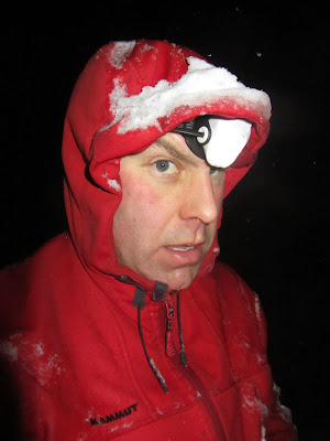
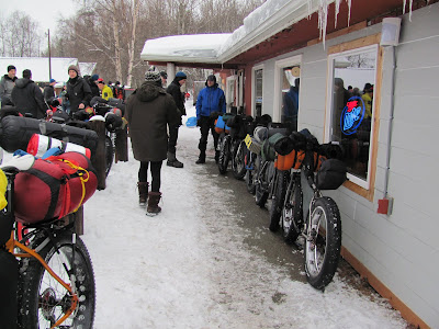
I have been thinking about biking the Dalton Highway for several years now. The road has a legendary reputation for long 13% grades, epic mud, windshield- and tire-destroying rocks, and headwinds of doom – all of which of course makes it a very attractive road to bike. Things came together this spring, and in mid July I found myself driving up the Haul Road with Tom on a grand adventure. Some friends of ours were on a long float trip that ends up on a village near the north coast of Alaska where they would then fly to Deadhorse and drive back to Fairbanks. Luckly for us, they needed someone to drive their vehicle up to Deadhorse, so early on a Tuesday morning we loaded up our bikes and headed out of town. It was a long, uneventful drive up to Deadhorse and took a little under 12 hours including a shortish stop at Coldfoot. We spend the night at Deadhorse at the aptly named Deadhorse Camp hotel. The hotel was composed of a main building made of stacked ATCO trailers, with a number of stand-alone trailers on skis pulled up around the main building.

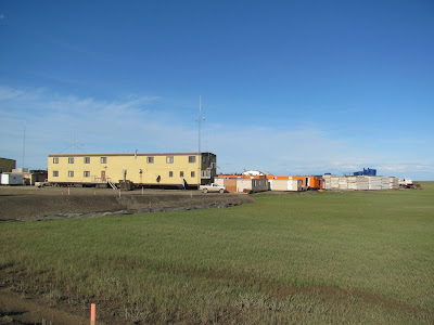
This is standard affair for Deadhorse – nearly every building not intended for equipment storage is composed of an ATCO trailer of one sort or another. Our room was in one of the trailers alongside the main building.

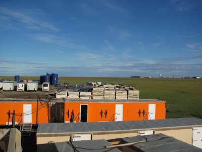
This was my first visit to Deadhorse in the summer. I had been here several times in the winter while passing though on the way to Barrow and things looked quite different when it’s not -40F with 50 mph winds.. Deadhorse is a strange place and fairly hard to describe. Its consists mainly of a immense series of gravel pads connected by gravel roads with all sorts of heavy equipment, oil exploration machinery, and trailers of all type parked in various stages of disarray, along with a couple of active oil and gas wells.

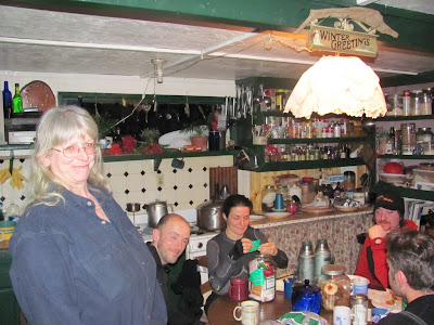
I stopped by the hardware store and picked up a set of tinted safety glasses, and then we headed out to find dinner. Most of the folks here are not full time residents and are here temporarily for work, either for short stints or on some sort of 2 weeks on, 1 week off rotation. This makes for some unusual living conventions, including the all-you-can-eat meal – all the restaurants in Deadhorse serve all-you-can-eat meals cafeteria style. The food is not bad, but not particularly exciting. We ended up eating at the Prudhoe Bay Hotel, and some of the clients definitely showed signs of the “all you can eat diet”. Eventually we pried ourselves away from the trough, though not before I made a to-go bag with a handful of pastries and headed back to our hotel to get some sleep.

In the morning we hopped on our bikes and were off!

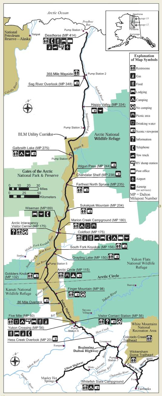
Our route was pretty simple as there is really only one road option to get back to Fairbanks. We were going to leave Deadhorse, bike on the Dalton until it ended and then take the Eliot Highway back to Fairbanks. Fairly simple.

Here is an interactive map of our route:

View Larger Map

Day 1
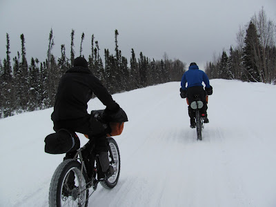
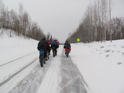
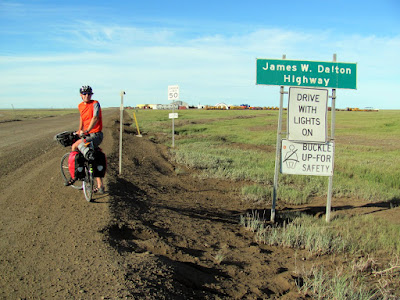
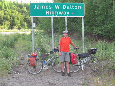
For the first mile or so we had to bike some local roads to get to the Dalton. There was a surprising amount of traffic, though the drivers were pretty well mannered.

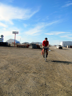
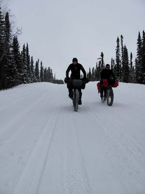
Eventually we reached the start of the Dalton, and our trip began!

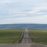
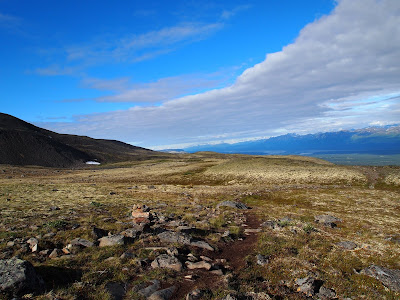
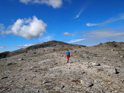
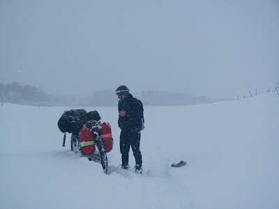
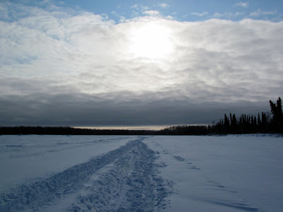
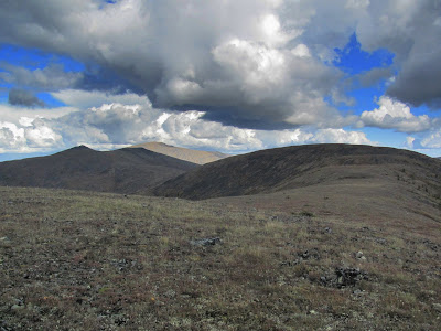
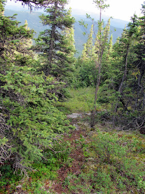
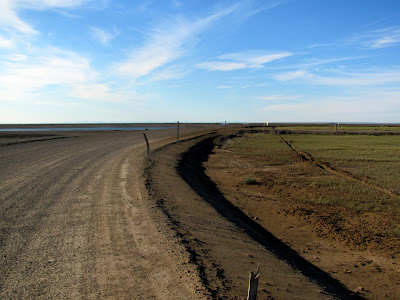
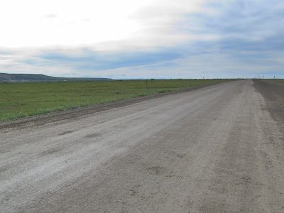
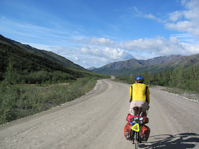
The first 60 miles or so of the Dalton are mind-numbingly flat, but quite scenic. It might go without saying, but this section of our trip was quite far north – in fact I think this might be the farthest north you can go by road in North America. There are no trees this far north, just small willow looking shrubs and things that look much like grasses (I am obviously not a biologist). We really lucked out weather-wise – it warmer than I expected. We had a wonderful 65F weather, which was quite a bit nicer than the 40F I was expecting. The road surface for the start of our trip was hard packed dirt with a fair bit of calcium chloride mixed in to harden the road surface and to keep the dust down.

I had been told that there was a good chance that we might see some Musk Ox, but alas we didn’t. We did see a lots of birds and were dive bombed briefly by some shockingly large terns. We also saw a fair number of fat arctic ground squirrels, of which there was a lot.

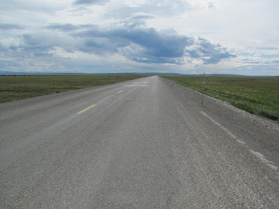
At around mile 53 or so the surface changed to chip and seal and we enjoyed a nice break from the gravel road for another 27 miles.


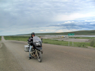
Eventually the road surface switched back to dirt near a collection of dreary looking buildings called “Happy Valley”.

Just past Happy Valley there was a motorcyclist stopped in the middle of the road. It was a bit of a strange place to stop so when I caught up with him I stopped and asked if he was ok.

We talked for a bit and apparently he had stopped to take pictures, and was completely unfazed that he was in the middle of a dirt road with large semi bearing down on him from behind. I talked to him for a couple of minutes, learning he had driven his motorcycle up from Georgia. We saw an amazing number of motorcycles. It appeared that there were more motorcycles than any other type of private traffic on the road… not what I expected.

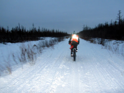
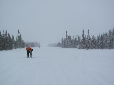
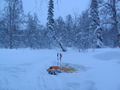
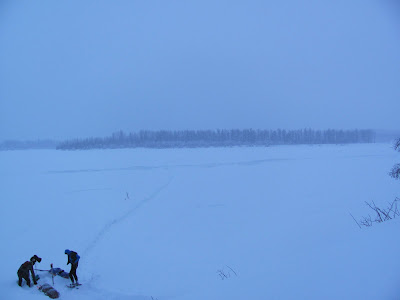
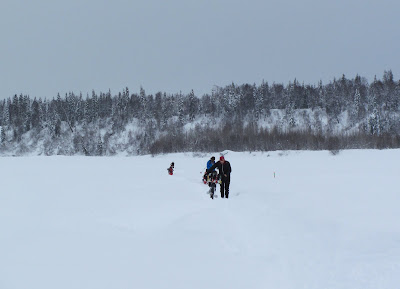
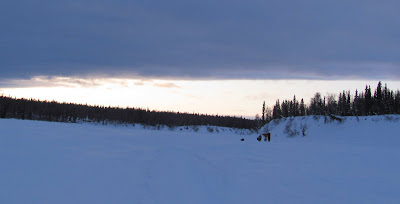
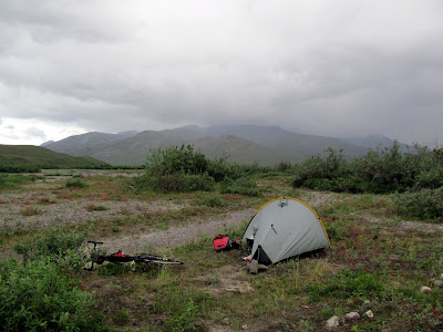
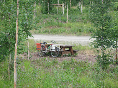
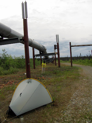
We continued biking until we reached the “Ice Cut”, a smallish hill where the road cuts through the a bluff and apparently exposed a large ice-lens, thus the name, and we called it a day. We camped on a pipeline access road that leads to the Sag River. The Dalton has lots and lots of wonderful campsites – at regular intervals there are side roads leading to the pipeline. The pipeline access roads are normally blocked by gates, but the gates are easy to get around or under with a bike, and as far as I know its fine to camp there so long as you do not block access.

Day 2

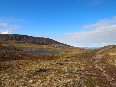
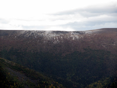
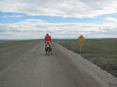
In the morning we continued, though the weather was a bit less sunny. We had brief rain showers for most the day, though it never rained very hard. For the first day the road was mostly very flat, with only an occasional small hill. As we traveled south we started hitting the foothills of the north side of the Brooks Range, and things became a bit less flat

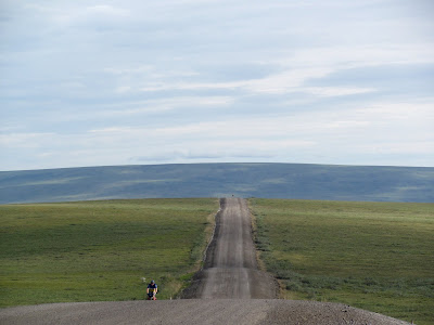
The hills continued to grow as we headed towards the Brooks Range and the high point of the trip, Atigun Pass.

We passed a number of construction and DOT camps, including one with an interesting sign.

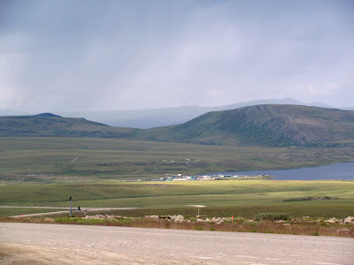
A little before we entered the Atigun River valley, we passed Toolik Field Station, where some neighbors of ours spend part of the summer studying the Arctic ecosystem.
.

After passing the side road to Toolik, we passed Galbraith lake where some sort of massive excavation appeared to be going on, and started up the Atigun River valley.

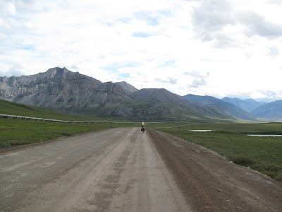
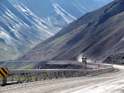
The views were starting to be pretty nice at this point, but alas we were also on the receiving end of a stiff headwind. We spotted several groups of sheep sunning themselves on the other side of the valley.

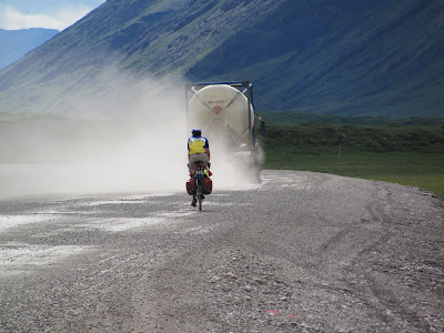
On this section of road the trucks raised a fair bit of dust – fortunately the wind kept it from hanging around very long.

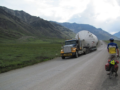
We did get to see some unusual cargo as the trucks drove by, including a rocket-shaped oversized load.

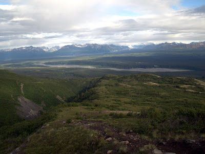
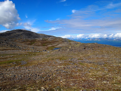
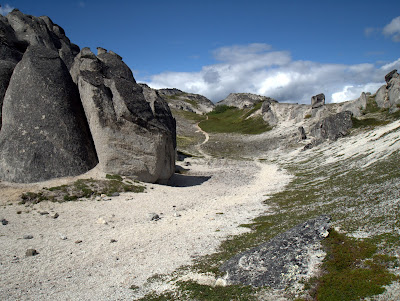
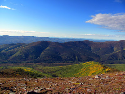
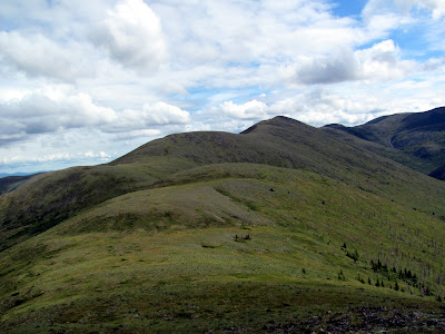
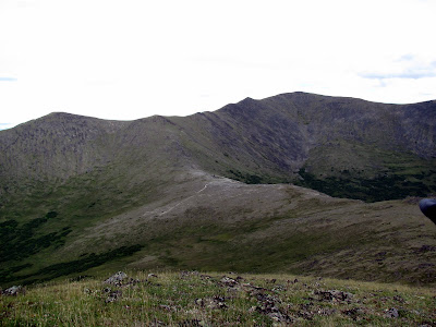
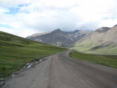
The Atigun River valley is quite beautiful and very scenic.

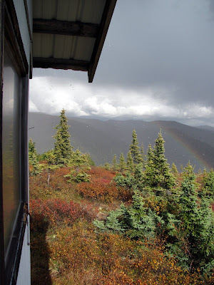
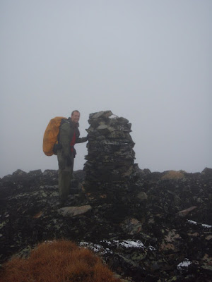
Eventually we reached the base of Atigun Pass, the only “big” climb of the trip, just in time for it to start raining in earnest.
Fortunately the rainstorm was short-lived, and by the time we were half way up the climb it had stopped raining.

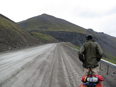
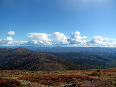
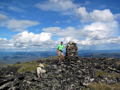
The climb up the pass was a lot less of a climb than I was expecting – it is fairly steep but it is not that long and was over fairly quickly. At the top of the pass we were rewarded by wonderful blue sky and fantastic views of the south side of the pass – hurray!

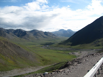
From the top of the pass it was a wonderful ride downhill to our campsite for the evening near the airstrip at Chandalar Station.

We camped near the runway, but well off the section used by planes so we didn’t get in the way. The runway appeared to used only infrequently. The campsite had wonderful views of the Chandalar Shelf and the start of the Dietrich River valley.

Day 3
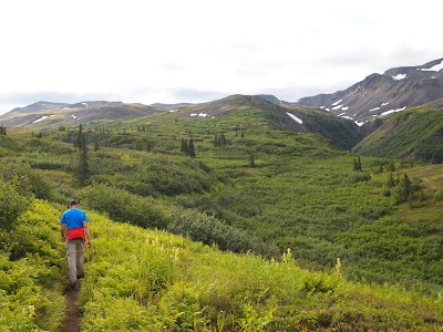
Our third day was pretty short, only a little over 50 miles and 4 hours of biking. We left pretty early, climbed up over Chandalar Shelf, and enjoyed a long downhill ride to Wiseman. We were starting to leave the Arctic and the vegetation was starting to change – we now had trees!

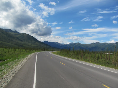
This section of the trip zoomed along, as it was mostly downhill with very few hills. About 10 miles or so before the turnoff for Wiseman the pavement started – nice new and fast pavement.
.
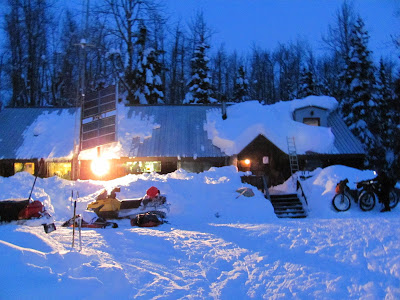
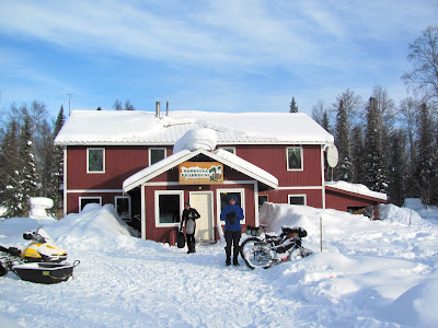
We arrived in Wiseman a little before 3pm, with lots of time to explore, shower, do laundry, and get other random tasks done. We stayed at the Boreal Lodge a nice little lodge in Wiseman proper. I explored Wiseman for a short time, seeing the museum and an old general store, and walked around town a bit. Eventually I headed back to the lodge and spent a bit of time relaxing in the sun, and enjoyed several ice cream bars.
(2021 Update – I now highly recommend The Arctic Getaway in Wiseman – they are great folks and are bikers. https://www.arcticgetaway.com/ )

Day 4
On the forth day we headed out of Wiseman early and zoomed off to Coldfoot in an attempt to arrive in time to make the all-you-can-eat breakfast offering. We arrived with 15 minutes to spare, and quickly grabbed our food. Just as we were sitting down to gorge ourselves, the folks we shuttled the car for arrived. They had finished their trip a bit early and were heading back to Fairbanks. We had a very large breakfast with them, and eventually hit the road again, powered up (or slowed down) by the massive quantity of food we had we had eaten. The road south of Coldfoot is paved and was fast riding. A little south of Coldfoot we ran into our first biker (while on bikes anyway – we saw several bikers on the drive up, but as we were driving it does not count) of the trip – Rucker.

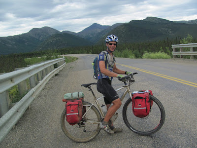
Rucker is from Ohio and is apparently friends with the cousin of one of my neighbors, who asked if we had seen him. Sometimes it is an amazingly small world.. We saw a handful of bikers on the drive up to Deadhorse, and two bikers on the bike ride back to Fairbanks, and Rucker was the only one who seemed to have things in order, and appeared to be carrying a reasonable amount of stuff.
The road south of Coldfoot is very scenic..

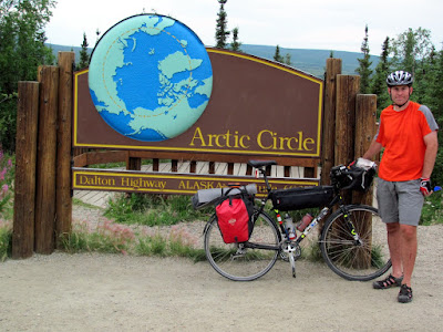
We stopped for at the Arctic Circle for a quick photo..

and made a quick pass though the campground looking for “bucket man”. On the drive up we passed a fellow biking in full bug gear with 5 gallon buckets instead of panniers. I thought about stopping to say hi and ask how the biking is, but since we ran into him around 10 miles or so outside Deadhorse I thought I would just catch up with him the next day. Alas, bucket man was hauling butt, while we kept an eye out for him we didn’t catch up with him until the Arctic Circle campground, where he was sleeping, so we didn’t get a chance to talk. I did admire his bike from a distance however.

The only major climb of the day was Beaver Slide.

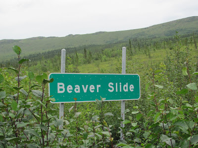
Beaver Slide is a 9% grade gravel hill that is about two miles long and very straight. As we approached it I saw huge white ghost-like shapes descending it in an ominous manner. Fortunately they turned out to be wide load trucks with huge white boxes on them.

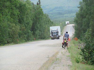
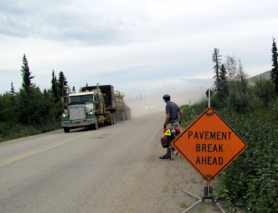
Climbing Beaver Slide turned out to be an amusing exercise in dust and bad driving. The truckers seem to take the hill pretty slowly, going up and down the hill at a reasonable rate. Alas, some of the private traffic seems to think this is a ideal place to pass, and we witnessed several very marginal passing maneuvers while climbing the hill. It was very dry when we were on this section of road, which ment it was very dusty. Fortunately it is only two miles long and it goes by fairly quickly.


The rest of the day went by fairly quickly. We biked until Dall creek, where we took a pipeline access road and camped under the pipeline.

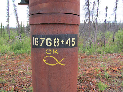
The pipeline was amusingly adorned by lots of notes and a few strange symbols.

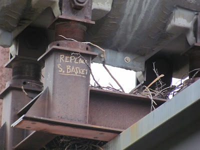
Disturbingly, one of the pipeline supports we camped under was labeled “Replace S Bracket”. We did survive the night.

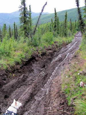
Day 5 – the day of Mud!
The next morning we awoke to a light rain. We packed up and headed with with plans of getting an early morning burger at Hot Spot, a burger joint several miles from the Yukon River. The road quickly turned to dirt again, but it was not a big deal as it was not raining all that hard. This was going to change however…

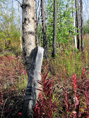
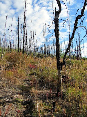
The section of road before the Yukon River is scenic with wonderful sections of fireweed in old burns – quite beautiful.

For most of the morning there was a light rain, and it was starting to make the road a bit muddy.

Eventually we arrived at Hot Spot and had some burgers. After the burgers we headed out. While we chowed burgers it had continued raining, and as a result the road was a bit more muddy..

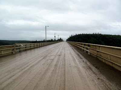
We stopped briefly at Yukon River camp and I grabbed two Dr Peppers and we then headed across the bridge over the Yukon River. The Yukon River bridge is pretty funky – it is the only bridge I have crossed with a definite slope to it. Biking up hill on a muddy wood decked bridge in the rain is an interesting experience.

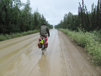
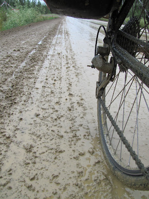
The mud got progressively worse…

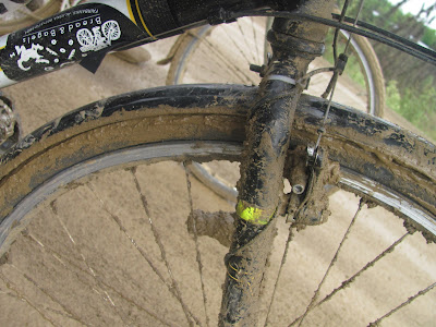
Fortunately we were saved by a brief bit of pavement after the bridge. While we were on the pavement we passed a fellow biker from Holland via Canada who was hauling a lot of stuff – a fully loaded B.O.B. and a full set of panniers, and was carrying food for full 14 days. It looked painful. Eventually the pavement ended and the mud began again. By this time the rain had stopped and things were drying out, but while the road was getting better the semi-dry mud was very sticky and our bikes required frequent de-mudding.

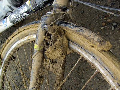
Eventually we had to stop at a creek and did a complete de-mudding and ate dinner while the road dried out. This worked wonderfully, as by the time we had finished and were ready to go the road was much dryer and almost mud free.

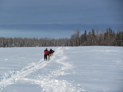
With about 10 miles left on the Dalton we ran into a fellow walking on the side of the road. We stopped and talked for a bit, and learned he was on day one of an attempt to Dalton Highway from the junction of the Elliott to Deadhorse. He was from Worcester, MA and was figuring on taking 18 days.

We biked the rest of the evening, and made it to the Elliott highway, which marked the end of the Dalton – hurrah!

We biked for another hour or so and made it to Fred Blixt cabin, which we had rented in case we wanted to spend the night there. It had been a bit of a long day and we were pretty happy to crash at the cabin.

Day 6 – the last day!
The final day was fairly short, but has a few hills. We got an early start and stopped at Joy, a small homestead and gift shop, grabbing a bite to eat. Several hours later we made it to Hill Top, a local truck stop at mile 5 of the Elliott, and dropped in for a (large) bite to eat. I had some pancakes and Tom enjoyed a burger. I was warned the pancakes were huge, but was not expecting the massive too-big-for-the-plate pancakes that I ended up with – alas I was only able to eat half of them. The rest of the trip was pretty mellow, though it was a bit hard to bike with so much food inside me. I made it back to my house at around 4 or so, just in time to meet up with my wife Nancy and the twins returning from picking up their veggies from the local CSA.

For those interested, here are our final stats for the trip:

  • Day 1, Deadhorse – Ice Cut: 92.5 miles, 8 hours
  • Day 2, Ice Cut to south side of Atigun Pass: 85.8 miles, 8 hours
  • Day 3, Atigun to Wiseman: 54.1 miles, 4 hours
  • Day 4, Wiseman to Dall Creek: 104 miles, 8:30 hours
  • Day 5, Dall Creek to Fred Blixt: 101.5 miles, 9:30 hours
  • Day 6, Fred Blixt to Tom’s house: 75.9 miles, 6 hours. +~3 miles for Jay.
  • Total, 513.8 miles, 44 hours

Notes for other folks interested in biking the Dalton Highway.

  • Food is available at several places along the road:
    • Yukon River Camp, MP 56
    • Hot Spot and 5 mile Camp, MP 60
    • Coldfoot, MP 175
    • Wiseman, MP 186
    • Deadhorse, MP 414
    • All these places (except Wiseman) have diner style food, and a selection of very basic snacks.
  • The Arctic Getaway in Wiseman is highly recommended as a place to stay in Wiseman – they are great folks and are bikers. https://www.arcticgetaway.com/
  • There is a post office in Coldfoot, so it is posssible to mail stuff there to be picked up, though the office hours are a bit strange – Mon,Wed,Fri 1:30-6:00pm
  • With all these options for food it’s silly to carry all the food for the entire trip with you the whole time. Unless you love hauling extra weight up and down the hills.
  • If you book a reservation with one of the places to stay along the road, its probably possible to mail them a food drop of some sort. Ask first of course.
  • There are quite a few hills – go as light as is reasonable.
  • Basic cross tires in the 32-40mm range with a little bit of tread are fine. Bigger tires will add more comfort but slower riding, smaller tires more suffering.
  • If the road is muddy and it looks like it might stop raining, take a break and let the road dry out. The road appears to dry pretty fast and the daylight hours are long. Go take a nap!
  • Fenders are a very good idea – not only for keeping you dry, but for keeping your drive train as clean (as possible anyway) of mud. If it rains there will be mud.
  • No bike repair stuff can be found on the Dalton, though there is a very well stocked hardware store in Deadhorse that might have some things (patch kits for example)
  • You can’t bike to the Arctic Ocean. You can take a tour there and listen to a talk about how clean and happy BP is, and splash in the ocean if you want, but you cannot bike there.
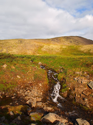
  • Bring at least one water treatment system! There is lots of water in streams and lakes along the road, but pretty much all of it needs treatment unless you want giardia or some other friendly gut nasties. We used an older model of the Steripen with backup chlorine dioxide pills and two part chlorine dioxide liquid. Treating water is fast and safe these days, there is no reason not to do it. The walker we ran into at mile 10 was planning on drinking untreated water for the most part, which I hope works for him, but for most people will end up with the “Giardia Weight Loss Plan” and an potentially aborted trip.

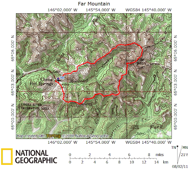
A simplified map of the route:

10700197_794370397275932_8195508289451319653_o

More Photos can be found Here.

The Summer 100 (non) race

Sunday, July 17th, 2011

For the last year or so there have been plans afoot to have a local 100-mile running or biking race. This summer one of the organizers of the White Mountains 100, Ann, got things going and set up a trial run of the non-race. “Non-race” as i, it was not an official, organized race, but more of a mass-start individual time trial. As soon as I heard about the idea I immediately knew I wanted to do it. We don’t have very many local off-road or trail-bike bike events. There is a 12 hour race on the Ester Dome single track, though that was canceled this year, and a mountain bike stage race, but that’s about all. Even more exciting was the fact the start was only four miles from my house, so I could bike to the start – wahoo! In the two months before the race, folks did informal Tuesday runs and ran most of the course in sections. I am not much of a runner these days. Biking has been my main focus, and its hard for me to get enough mental momentum to regularly bike and run in a semi-serious manner. I joined in for a handful of the runs and survived, but barely – running 8-12 miles at once is not a recipe for a happy run. It was pretty social, and it was interesting to talk to folks and meet some folks from the non-winter sports crowd. In the weeks leading up to the race I biked most of the course in a couple of sections to make sure I had an idea about what I was getting into and could prepare mentally for some of the tricky bits. Biking the course was a wonderful experience and exposed me to trails I would not know about otherwise, including some wonderful sections that are amazingly good biking. The course is a mix of dirt roads, single track, ATV trails, a brief section of the Alaska pipeline, a short bit of pavement, and several sections of tricky bits.

So, the “tricky bits”.. The course has several sections that are tricky biking for “normal” people (normal being not trials superstars like Danny MacAskill), and one section that could not be biked even by super-humans. The difficult sections consist of several shortish bits that have tight spaced roots, have lots of rocks, are very steep, or all three at once. I can, for the most part, bike these sections while fresh, but when tired it becomes a bit difficult – not the end of the world, just start pushing! There is one section that involves crossing Goldstream Creek, and is truly unbikable, though perhaps it could be done by winged monkeys. This section involves crossing Goldstream Creek, then crossing a swamp with a short deep section (deep as in more than chest, possibly over my head deep), then brush whacking though some alder for a mile or so. This is perhaps a bit different from what most folks might expect from a bike race, as the course will have fair bit of pushing, but in order to have a long course on trails, some sections of difficult or impossible biking are to be expected. Otherwise to link pieces of nice trail would require lots of sections (possibly pretty long ones) on paved or dirt roads. While these sections would zoom by on a bike, they would be miserably boring for the runners.

Hopefully this race becomes an annual event – it was a wonderful experience and a great fit for Fairbanks. Ann put a tremendous amount of work getting the trial run of the race going and deserves major credit for putting everything together – Go Ann!

Maps of the course of various sorts can be found here.

The rest of this involves my experience in the race – probably quite uninteresting to everyone but me so feel free to stop reading now, and go turn on the TV. Or go play outside!

On the day of the race I got up at 5:45, got dressed, had breakfast, drank several cups of coffee and left the house on the bike heading off to the race start. Just as I was leaving the sky opened up and started dumping epic quantities of rain. Hard rain, with big drops, and a stiff wind – a wonderful day for an epic bike ride! I had put aside two sets of rain gear the night before, and with the hard rain I grabbed the full-on waterproof jacket and pants, put them on, and headed out. The four miles to the starting point was mostly downhill and very wet. At one point the tracks worn in the road by studded tires were running with water like a small stream. I arrived about 20 minutes before the race started and ducked under an eve of one of the entrances to the UAF Patty Center, which was alas, not open, and watched the rain. It was showing no sign of letting up, and thunder could be heard in the distance – it was going to be an interesting day.


Twenty minutes early was apparently a bit too early, as no one else seemed to be around. Eventually other folks arrived and started splashing around in the rain getting ready to go.


It appeared there were going to be 18 or so people enjoying the fun. My friend Tom arrived pushing his bike up to the Patty Center – he apparently had massive chain-suck issues on the way to the start and his chain was wrapped around the bottom bracket in a difficult to extract manner. Several of the bikers attempted to extract the chain to no avail – eventually one of the runners, Rick, pulled the crank off, got the chain unstuck, and put things back to together for Tom. Just before the start two of the bikers headed back home to get more warm clothes and real rain gear. One of them was up from Anchorage and was pretty bemused by the rain, say something like “Isn’t it supposed to be sunny and dry here – this is Anchorage weather!” 7am came upon us and the non-racers lined up in the field outside the Patty, someone gave a count down, and we were off. The course starts on a similar route to the Equinox Marathon, and immediately heads up a small hill. The rain had turned the trail up the hill into a bit of a slippery mess – some of the bikers were already pushing and it was only a quarter of a mile in. The first miles of the course were on a mix of UAF trails and the Equinox, then onto the Sheep Creek bike path, and over to St Patrick’s. I was surprised to see Tom just before the Sheep Creek bike path – apparently he had a return of his chain suck issues on the muddy first hill and decided that was a sign to call it quits. That was a good call, as the mud was quite a bit worse later on. The rest of the morning was spent riding over to Ester, climbing Ester Dome, and riding down the back side of the dome to Goldstream Creek. Two guys had started several hours early in an attempt to get to mile 50 or so before one of them had to make a wedding in the afternoon, and for most of the morning I followed their footprints in the mud and rain-softened trails. Surprisingly, I was in the lead, and would stay in the lead for the rest of the race. When I reached the top of Ester Dome the place had an unearthly feel to it – it was very foggy and socked in with perhaps 50ft visibility at a couple of points, with the wind blowing though the transmission towers on top of the dome making some freaky howling noises. It was a strange experience.. On the ride down to the creek I passed a cheerful man working away on the road with a fairly large bulldozer. He seemed fairly surprised to see me but waved me by in a friendly manner. I bet he was amused and perplexed by the rest of the crew passing him thoughout the day.. The mud on the ride down was pretty intense, but my wheels and gears kept going, and I kept moving.


Crossing the creek was a bit tricky – the log across the creek was wet and slippery, but it was uneventful, though a bit nerve racking. I would later hear that one of the participants dropped his bike in the creek and had to fish it out.


(Photo is not from race day, but a pre-ride. Note the sunny weather..)

It was probably better to drop your bike than to fall in – getting out would have been a pain! After the creek crossing came the swamp, which was a bit of an adventure. There was a path marked though the swamp, and I stuck to it, but alas, I think the path was more intended for the runners as it moved in and out of the brush and though some pretty tight sections that were hard to carry a bike through. Not the end of the world, but there was a fair bit of chest-deep water, and lots of waist-deep water, and a short section separated by floating mats where I could not touch bottom. The short deep section I just left the bike on the floating mats, swam/flopped across, then grabbed the bike and yanked it across the open section. No one appeared to be near me which was good, as there was quite a bit of yelling and swearing as I floundered around. Soon after the marshes I hit the first checkpoint, and my drop bag of clean clothes. I grabbed my stuff, changed into dry clothing, and hopped back on the bike and was off. Later when I was washing my gear from this section I was really surprised to see that everything smelled like swamp – no sweat, no dirt, no mud, just swamp. The folks manning the checkpoint were very cheerful and happy, and understanding of my manic stripping and dressing while (very) partially concealed by some parked cars.


I should probably point out now that photo taking and racing don’t really fit together all that well. Stopping to get the camera out slows things down and slowing down is not how one goes fast. I am not very fast though, so I bring a camera and take pictures, figuring if I am too busy to take pictures and enjoy my self I should just go home as its not worth it. Alas, for lots of reasons I didn’t take the camera out all that much, but I did attempt to get pictures of all the checkpoints and the checkpoint staffers. The checkpoints are like little bubbles of joy in longer races like this one, filled with friendly people, food, and water. Sometimes nirvana is as simple as a can of coke and handful of potato chips.. Anyway, since checkpoints in winter races photograph poorly (because its dark, cameras coming in from the cold fog up instantly, among other reasons) and this was the first long summer bike race I have done, I made an attempt to get photos of them.

Just after leaving the checkpoint I passed the runner Mark, who was cheerfully running along.


The next section was on dirt roads of various sorts and sped by on the bike. Soon after the first checkpoint I had my first bike problem and broke a spoke on my rear wheel and soon things were a bit more wobbly and loose than I would have liked. After riding another half an hour I grabbed my cell phone, called Tom, unfortunately waking him up, and he amiably agreed to pick up a wheel I had on my porch and bring it by Ivory Jacks. I eventually passed Steve the runner, the second person to start early. He seemed to be having a wonderful time and had a huge smile on his face when I rode past. There is a brief out-and-back section where I passed a biker (Andi I think) headed the other way who seemed be having a good time and had a huge grin on his face. Soon I was riding on dirt roads which made for fairly fast but uninteresting biking. Eventually I reached the second checkpoint, an unofficial one staffed by a former co-worker of mine, Jen, and a fellow I had met once before but alas forget his name.


They were cheerfully enjoying a calm afternoon under a nice dry tent and seemed to be having a great time. I refilled my water and took off. The next section to Ivory Jack’s was very, very fun, with lots of fun biking on a mix of narrow dirt roads, ATV trails, and some single track. I really enjoyed this section, though alas someone had taken down the course markings here – bummer. This section features a wonderful downhill bit with lots of water bars that are ever so fun to hop over and a very steep, straight downhill though some birch trees – pure fun! I arrived at Ivory Jacks a bit later than I anticipated but was greeted by Nancy and the twins, and Tom with my replacement wheel – Thanks Tom!


I had a bit to eat, refilled my water, swapped out my wheel with the broken spoke, and was off.


Now with life like hand foo action!

Before I left Lizzy said to Nancy, “When is Daddy going to start biking again?” Obviously I was being a big slacker and should get my butt in gear! The next section was a mix of tricky biking (so more pushing than biking) and some wonderfully fun riding. At one point while on Cranberry Ridge I encountered a lady running who stopped to give me a lecture on how bikes damage trails. She might have had a point, but at the time I was pushing my bike though a rooty section after deciding that the constant pounding and effort required to ride the roots was making my neck and head hurt. She continued her run and I continued pushing my bike though the roots. Alas, at this point my neck was killing me, and my feet were numb and getting a bit sore. My shoes are regular mt bike clipless Shimano bike shoes. They are a bit short on grip, and the cushioning is nonexistent. After the event I had nice and tender forefeet for several days. Once I was past the roots the trail transformed into fun riding and I started to enjoy myself again. Just before reaching Hilltop the course follows the pipeline down a hill which provided some of the fastest biking of the course. At Hilltop I stopped briefly and chatted with the fellow at the checkpoint there, Andy, and snarfed down some snacks.


I had a bike bag blowout somewhere along the way and had lost my bike tools and my chain oil. Andy was super prepared and even had chain oil, ending the squeaking of my tortured chain. The riding from Hilltop to the final checkpoint was fantastic, though I had the funny encounter with someone who had a car breakdown. About halfway between Hilltop and the Skiland checkpoint someone started shouting from the bushes behind me. I stopped and waited a bit nervously for the fellow to catch up with me. It turns out he had driven his new VW Bug up to Pedro Dome Road, had hit a rock, and ruptured his oil pan, leaving him stranded. When I encountered him he was attempting to walk down to the Steese Highway – apparently his car’s GPS told him that it was close by, so he decided to just bush-whack down to it. It’s pretty close, as such things go, but a long steep drop down a brushy hillside. He apparently thought better of it, and was coming back to his car when he saw me and tried to get my attention. He borrowed my cell phone to call a friend to pick him up, and after making sure he was going to be ok, I took off.
A little while later, my phone rang. I dug it out of my backpack, and answered it – it turned out that his friend had gotten lost and needed directions. I guided him via phone to the right road and within sight of his lost friend, and I was back on my way. I made a brief stop at the Skiland checkpoint, getting a bite to eat, and said hi to the cheerful checkpoint staffers.


The final section is mostly downhill and was refreshingly nice riding, though by this time my legs were pretty hammered and I could barely bike up the hills. I rolled into the finish at 15 hours and 24 minutes, very happy to be off the bike. John Estle was at the finish line and did a quick video interview with me and I am afraid I was a bit incoherent and silly.


Soon after I arrived the two bikers who started late came in. They started about 20 minutes late and finished 10 minutes behind me and would have finished ahead of me if they had started with everyone else.

Hopefully this race will be an annual event – it was an amazing experience and a complete blast. With luck this race will be become a summer ritual! Thanks again to Ann and all the other volunteers – you guys made it possible and fun!

The finishing times for the finishers in the trial run of the race were:

  • Bikers
    • Jay Cable 15:24
    • John Shook 15:33
    • Chris Wrobel 15:33
    • Rocky Reifenstuhl 16:38
    • T. Herriott 16:38
    • Andy Sterns 19:43
  • Runners
    • Rork Peterson 21:47
    • Ann Farris 26:40
    • Rick Johnson 28:02
    • Anne VerHoef 28:08

There was also some coverage in the News Miner.

More photos from the race
Course pre-ride photos.