Posts Tagged ‘chena_rec_area’

The twins go to Stiles Creek Cabin

Monday, December 7th, 2009

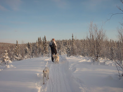
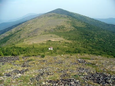
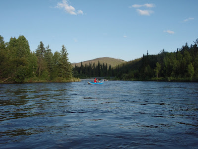
On a unnaturally warm Saturday, the family and I headed off to Stiles Creek cabin in the Chena River SRA. Molly and Lizzy got to ride in a sled hauled by the dogs and napped most of the way. It must be strange to go on ski trips by going to sleep as you leave the parking lot and wake up in at your destination..  We loaded up in the parking lot, strapped the girls (and Chicken, Lizzys latest stuffed animal friend) into the sled and took off.

The taking off part took longer than one would expect – getting the twins settled in, three dogs harnessed, and two adults onto skis takes a while, alas.

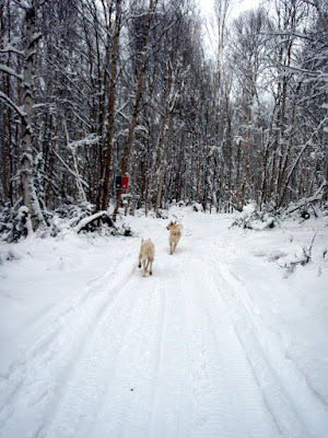
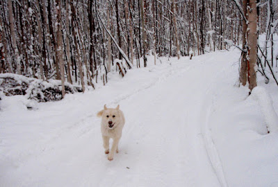
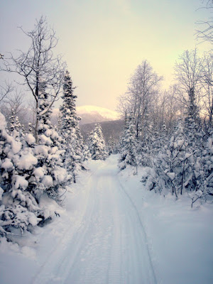
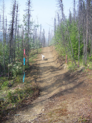
The Stiles Creek trail has been rerouted in the last year and has lots of switchbacks which slowed things down to a crawl occasionally as the sled tried to cut the switchbacks.  Eventually we made it past the switchbacks and things sped up a lot.

After a two hour nap, the twins woke up and demanded snacks.  Soon they were snacking on granola bars and dried pears while zipping along..  Ahh the luxury! 

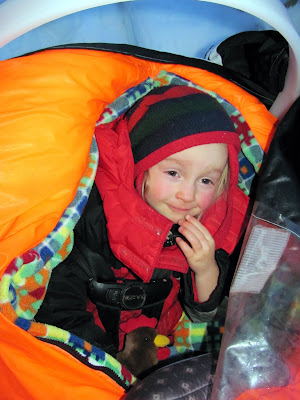
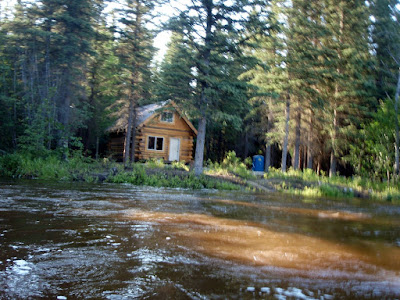
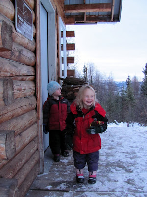
Soon we arrived at the cabin, and the twins were taken out of their warm sled compartment and they got to help find wood, get the stove started, and of course more snacking. 

`
After snacking came playing outside, even more wood gathering, and finally dinner, followed by more snacking (also known as desert).  We were joined in the cabin by Margaret and Trusten and their daughter Robin.  Robin and Trusten came via snow machine, and Margret via skis.

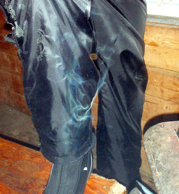
I had made a trip to this cabin as a day trip several weeks earlier and after a half hour I had the inside of the cabin above 0f, thanks to the plentiful quality of fire retardant wood (green birch and alder burn oh so well) left by the previous visitors.  We had left a plentifully supply of wood that one could actually burn, but to be prepared, I skied down the last hill dragging a nice dry spruce log.

Dinner was a tasty selection of mixed pasta and Parmesan cheese for the younger generation and Indian food and pasta with spicy peanut sause for the adults.  Yum, yum!

 The younger crowd  got endless fun out of the cabins loft.  The stairs were a big hit, as were the glow sticks.
[youtube=http://www.youtube.com/watch?v=4jMeWF3d80Q]
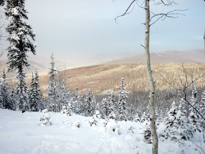
After a night of goofing off and mellowing out, morning came and we had to pack up and head out.  The trail heads up a steep hill right out of the cabin, so we headed off on foot.  Lizzy and Molly were quite the troopers, and made it to the top of the hill unassisted (if you don’t count several rations of grandma’s fruit leather and a granola bar each as assistance).
.
Robin and Trusten zipped away on their snowmachine, while we walked up the hill. Robin dropped a kitkat on the way out, which was very nice of her, as I was quite hungry.

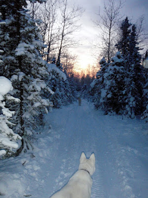
Once up the hill the twins hopped into the sled and we zoomed off down the trail.

It was a little too hot for the dogs and they were less than happy going up one of the hills, but otherwise it was a uneventful ride out.

Stiles Creek Trail day ski

Thursday, November 19th, 2009

On a nippy Monday morning Tom and I set off for a day ski out to Stiles Creek Cabin in the Chena River SRA. It was fairly cold (-20f according to the thermometer at Pleasant Valley Store) but otherwise quite an excellent ski.

The Stiles Creek Trail had undergone some re-routing and we were looking forward to skiing the new sections.  The re-route made for some fantastic skiing.  Before the reroute the trail dropped off the final hill and descended steeply.  The new sections cut back and forth though the old trail and make the steep sections (once described to me by a fairly good skier as “the most terrifying thing I have ever skied”) very ski-able and quite fun.    This was quite a contrast to the original trail which could be quite terrifyingly fast.

Polar and Remus had a wonderful time running around and enjoying the smells.

Once we reached the top we were treated with fantastic views of the nearby ridges.    Once of the nice things about this trail is that it crosses a wide variety of the forest types that the greater Fairbanks area offers – it goes though birch groves, poplar trees, black spruce forest swamp, white spruce stands, and a small section of alpine ridge top.

The trail has a lot of climbing on the way into the cabin but the reward for this is a fair number of fun downhill sections on the way out.

After 8 miles or so we reached Stiles Creek cabin and ducked inside to warm up.  After about 30 minutes we had the cabin above freezing..  Which was enough to start drying off Toms pants.

The rest of the ski out was quite fun and much faster as there is a lot of downhill.
As mentioned earlier, the reroute makes for much more fun skiing. There were two sections on the old trail that were quite unpleasant. On the way in the drop off the ridge to the cabin was pretty hairy – it was steep and the trail was canted downhill which when combined together made for less than fun skiing. On the way out the final drop off the ridge was very steep and fast, with mistakes potentially rewarded by the trunks of large birch trees – this also made for less than fun skiing. Both these issues are fixed with the reroutes – the final decent to the cabin was rerouted with enough switch backs such that it is easily ski-able and the drop off the main ridge on the way out was also rerouted such that it is a lot less steep and with wide enough turns for easy skiing. Hurray! Major kudos to DNR for improving this trail!

More pictures follow, for the photo inclined.

The trail at the its high point.


Afternoon sun.

The sunset as we skied out.  We skied the last couple of miles in the dark, alas.

Fun with Packrafts on Angel Rocks and the Middle Fork

Thursday, July 16th, 2009

On a beautiful monday Marsh and I decided to hike the Angel Rocks to Chena Hotsprings Trail in the Chena Recreation Area and about midway along the trail drop down to the middle fork of the Chena River and float back to Chena Hotsprings Road, then bike back to the trail head. I anticipated it taking 3 hours of walking, and 2 hours of floating. It turns out I was right about the floating section, but off by more than a hour on the hiking end. Such is life – I am getting a reputation for being way off on the time estimates.

The hike up Angel Rocks is always very scenic, with wonderful granite tors and outcrops. Luckly for us the blueberries were out and a few were even ripe. Yum, yum!

Once we reached the highpoint of the trail, we dropped down to another ridge we intended to follow to the Middle fork. Much to our surprise there was a established winter trail following the ridge all the way down to the river.

The trail is marked with cut up Alaska DOT roadsigns, which is quite unusual – in fact I have never see that done before, and its definitely not standard Alaska state parks signage.

The trail is in beautiful shape and is completely clear of brush with not a drop of mud or tussocks to be seen. It is very nice hiking! The trail is quite strange though, as it appears to get only winter traffic. Besides the redneck signage the array of lost items on the trail was quite amazing. We found several piles of traps dropped in the middle of the trail, two coolers, one shovels, a blue glove, and several dinner plates.

Alas, the trail did not head all the way to the river, but parallels it for a ways, so we took a more direct route though the tussocky swamp. The wet and squishy walking had begun.

Fortunately we only had to pound though a very limited section of tussocks before hitting the river. The river was very underwhelming. I had to look at it very carefully to detect any current at all – it was not what I anticipated and if it was like this the whole way we where in for a major slow paddling slog. We inflated our boats, put in and where off. After a couple of hundred feet, and one ox bow later we where much happier. It turns out where we in a slough of the main river which was dammed up by beavers.

There was much rejoicing when we hit the main channel, as the middle fork had lots of water in it and it looked like we had a nice fun float ahead of use. There was also a eagle, which turned out to be the sole non-beaver animal sighting.

The rest of the float was quite mellow, with a couple of shallow spots and a number of sweepers but nothing tremendously exciting.

The fireweed was in full bloom and made for some beautiful vistas.


When we hit the confluence of the main chena and the middle fork a beautiful cloud of fog was drifting out of a slough. It was very neat looking and a big improvement clouds of mosquitoes and white socks we where running into earlier.

Finally we hit our take out point, where Marsh snapped a photo of me jumping around like a mad man.

All in all a wonderful packrafting day trip. The hiking distance is 8 to 9 miles, with one mile off trail, and the float is under 2 hours in the moderately dry conditions we did it in. Higher water would make for a faster and more interesting float. Very recommended!

Chena Dome in a day

Wednesday, July 8th, 2009

In honour of my switching to 3/4 time, I decided to use by first Monday off to do something interesting, like hike Chena Dome as a day hike. 12 hours (11 hours 35 minutes but whos counting anyway) and 6 quarts of water later I finished Chena Dome with sore feet but otherwise a fairly happy hiker. Chena Dome is one of the classic interior ridge hikes. Its quite a roller coaster of a hike, with lots of ups and downs, including some really steep sections. The reward for all this up and down is a fantastic alpine hike with spectacular views. The trail starts at 900ft above sea level and tops out at 4200ft asl, with 5 smaller ridge high points topping 3000ft.

The trail is a loop with the trail heads separated by a mile of walking on Chena Hotsprings road. The upper trail head had a bunch of Alaska DNR trail crew workings with Bobcats busy building a new trail out to Lower Angel Creek Cabin. The traditional trail had become increasingly trashed by summer ORV use, so DNR has decided to build a new trail on the hillside for summer use – hurray for DNR! The current Angel Creek trail has huge ruts in it and it now takes a lot of snow for it to be pleasant skiing. The new trail looks like it will make for superb summer biking and winter skiing. I am really looking forward to skiing it this winter!

The beginning of the trail winds through a several year old burn as it slowly makes it way up past tree line on the ridge. The fireweed was quite beautiful.

Just before the trail breaks out above tree line there is a huge batch of burls.

Once above tree line the trail becomes a ridge walk and follows a series of ridges. Great views abound.

The Chena Dome trail is a seldom flat – if you are not going up, you are going down.

Wildlife sightings were pretty limited. I saw a number of ptarmigan and song birds of various types.

My views from the trails were periodically cut off by smoke – there are lots of smaller fires burning in the interior and sometimes when the wind shifted I could hardly see the ridges next door. Occasionally it would clear up and the views would return.

At about mile 8 there is a 1950’s vintage military plane crash. I spent about a half wandering around looking at the wreckage.

Finally, the summit! There is a Alaska DNR communications hut on top, but otherwise there is nothing much too see. I did find a large pile of moose droppings, which seemed quite out of place.

Once over the summit I encountered one of the few places where the trail is flat. It was a little to rocky for good running but was a nice break from constant ups and downs.

Eventually the trail drops off the ridge into a saddle near mile 17 where there is a small shelter. The shelter has a water catchment which makes it a great place to camp or to for a break, as there are not a lot of water sources on the trail.

After a shortish break to refill my water bottles and have something to eat I was back on the trail. Remus was overheating for most of the trip, and greatly enjoyed wallowing in the tundra pools we passed.

After a couple of miles we started up the last hill, and then the long downhill to the parking lot. All in all this was quite fun as a day hike, though pretty long. It a lot of way it makes sense to do it as a day hike as you do you have to carry a heavy pack up and down the hills. Anyway, highly recommended!

High water on the Chena

Friday, June 26th, 2009

Tom and I decided to take advantage of the recent rain and float the Chena from approximately mile 45 to first bridge. The Chena was quite high – according to the National Weather service it was the 8th highest they have recorded for the 40 mile bridge. In any case, it was a wonderful float and quite a bit more fun than it is at normal water levels.

The float was approximately 8 miles, with a 5 mile bike shuttle.

The river was full bank to bank for the entire float.

The new Hunt Memorial Cabin .

There was a bit of wood, but nothing very serous. The sweepers were easily avoidable with all the extra water.

With an average flow rate of approximately 10 km/hour, paddling was not really needed.

The bridge near the Granite Tors trail head.


Near our takeout we ran into a several floaters out enjoying the high waters like us.

Hiking the Granite Tors with the twins

Saturday, June 13th, 2009

Saturday Nancy, the twins, and I set off to hike the Granite Tors as a overnight. The Granite Tors is a nice day hike (without additional encumbrances, like for example two three year olds), or a easy over night trip. It is a very beautiful hike which wanders though black spruce bogs, recovering burns, and high alpine meadows. There is a bit of elevation gain, but nothing too extreme, and the views are spectacular. The hike is about 15 miles long, with a starting elevation of approximately 750ft and a high point approaching 3000ft.

It was a beautiful hike, and the girls where very excited to be out hiking.

The dogs, Togiak, Polar, and Remus where also excited to be out and about.

Nancy and I carry the girls in Sherpani Rumbas. They work well, but are not really designed for two parents carrying twins – there is just not enough space to carry gear for overnighters.

The beginning and end of the trail winds though a low lying black spruce forest, which is board walked. The board walk made for fast pleasant hiking. We saw a lot of unripe blue berries – this will be a very good berry picking area this fall.

The twins are big fans of the board walk which is pleasant hiking for short legs.

Eventually the boardwalk ends and the trail starts heading up. The next couple of miles of trail slowly wind up the ridge until it reaches tree line near the first tor. This area is recovering from a fire that occurred several years ago and it is quite interesting to see the vegetation coming back.

There are a large number of burls leading us to an extraneous burl picture.

The twins where quite excited by the cairns which Molly starting calling “rock trees”.

Eventually we made it up to the top, referred to by some locals as the “Plain of Monuments” and we camped at the base a set of tors. It was a wonderful camp site with enough breeze to keep the mosquitoes away.

After a couple of stories we all hit the sack. The hike out was a little less fun, as it was raining pretty hard for the first hour. Molly and Lizzy where unfazed though, and enjoyed their ride out in the covered comfort of the kid carriers.

On the way out we ran into some friends on the board walk and enjoyed their company for the rest of the hike out. The trail on the way out was almost entirely down hill and very fast walking. Perhaps too fast – at one point I almost fell and was told by Lizzy to “go slow on the hard parts”. The way out heads down from the plain and passes a number of large tors before descending though a burn for a couple of miles, then hits board walk which lasts for most of the remaining couple of miles of trail.

On the way out we stopped by Mia’s and got dinner. This time the croad was a bit more adventuresome and ordered some of the Korean options from the menu, which turned out to be a good call, as they are quite good.