Posts Tagged ‘mondays’

Skiing a Section of the Yukon Quest Trail

Tuesday, February 9th, 2010

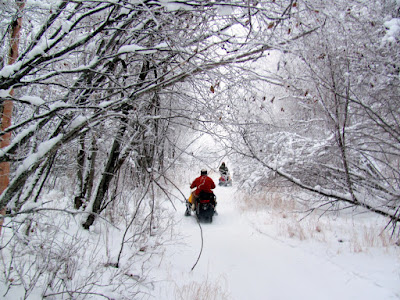
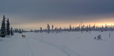
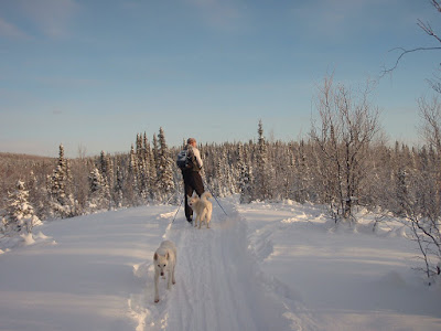
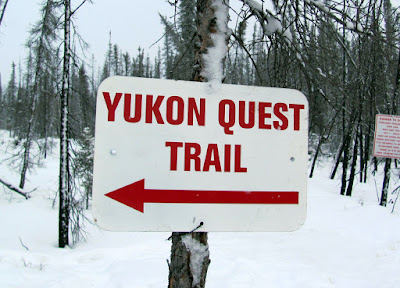
On a snowy Monday Tom, Remus, and I headed off to Chena Hotsprings to ski a section of the Yukon Quest trail. The quest had passed though this section of trail two days prior, and the “mini quest”, the Yukon Quest 300, had passed though the day before, so we anticipated the trail to be in pretty good shape and decided today would be a wonderful day to explore it. We skied about 23 miles, in about 8 hours or so including breaks. Not a parciularlly fast showing, as we were slowed by fresh snow and lots of overflow.
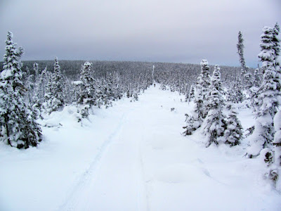
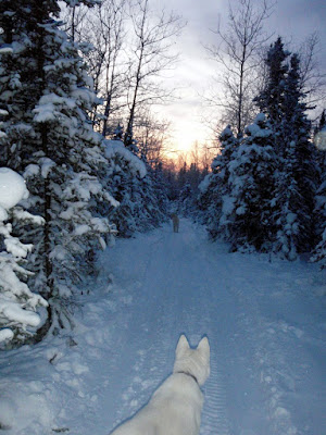
We joined the Yukon Quest trail where it leaves Chena Hotsprings road, and heads up the North Fork of the Chena River. In the first mile or so we skied past a number of small houses and vacation cabins and eventually the trail lost its road like feel.
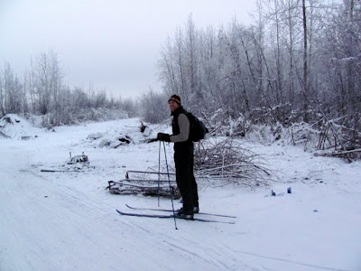
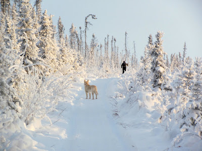
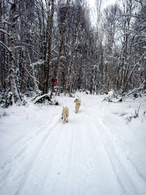
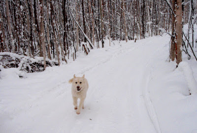
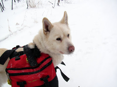
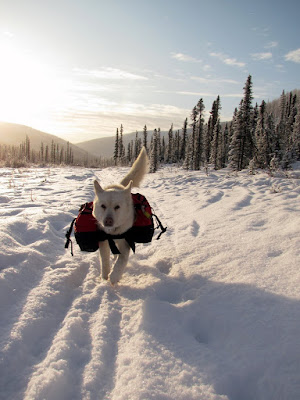
Remus was happy to be joining us, and today I attempted to slow him down a bit by having him carry my down jacket and pants.

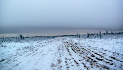
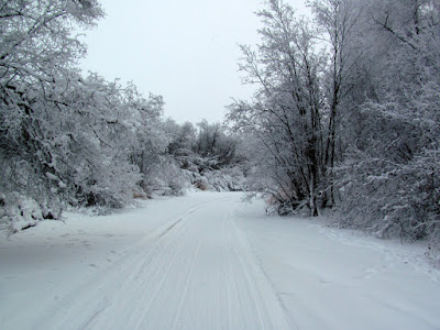
The trail had received about a inch to a inch and a half of fresh snow over night, and we were the first to travel the trail since the snow.

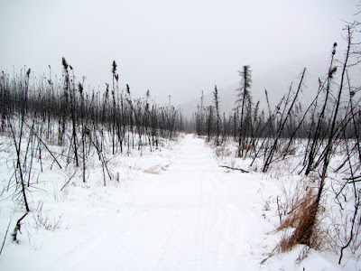
The fresh snow slowed us down a bit, but made for a smoother trail. The trail was a bit rough in sections, with a couple of large rocks fully exposed by the low snowfall. We need more snow pretty bad..

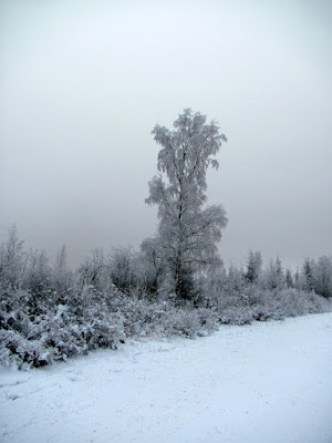
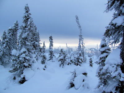
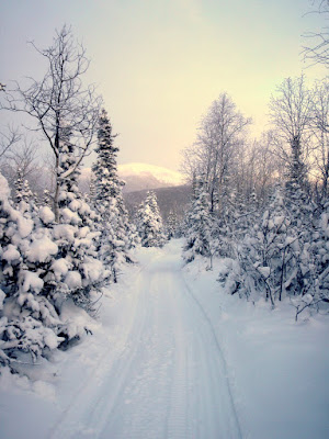
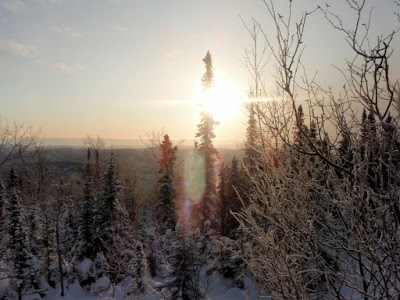
The day started snowy, gray, and overcast.

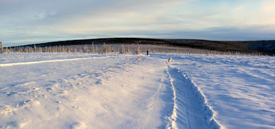
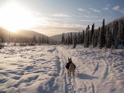
The day ended bright and sunny with a nice blue sky – quite a change.

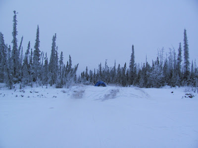
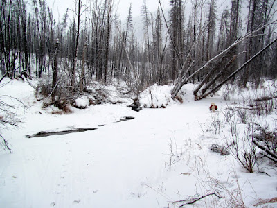
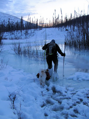
There was quite a bit of wet overflow on the trail, which slowed us down a lot. We had two options – ski across, which keeps you pretty dry and is pretty fast but requires de-icing the skis after words, or to walk across, which is a bit risky as its hard to tell how hard the crust on the overflow is and if it can support your weight.

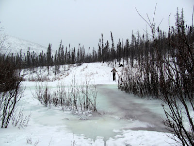
If the ice crust on the overflow is not strong enough to hold your weight, then you can end up plunging though and a bit wet – I stepped into overflow almost up to my knees twice. It was not all that cold, so having wet feet was not that big of a deal.

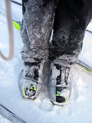
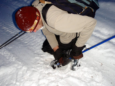
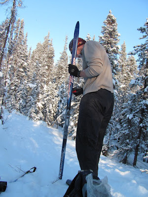
Walking though overflow also requires extensive boot de-icing efforts to get the toe bar free enough of ice to put the skis back on.

I tried wearing pellet bags on my feet and just walking across..

.. But quickly learned that its hard to hold up bags while carrying skis.  An obvious lesson, for sure.

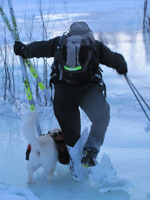
The other option, to just ski straight across, is faster initially but frequently requires you to stop and de-ice your skis.  When the wet skis hit the nice dry snow, the snow generally sticks to your skis making them heavy and robbing them of any glide.   If you actually break though the crust with skis on, extricating yourself can be quite difficult.  On a trip last year Tom broke though some overflow and spent quite a bit of time standing in almost knee deep water trying to get out, and after finding he was trapped by skis getting suck under the ice, spent even more time trying to get them off.  Not pleasant…  I had not brought a ice scraper to de-ice my skis, and was forced to scrape ice off the bottom of my skis with a wax scraper, which was less than ideal.

This was a wonderful overflow refresher course for Tom and I, as the White Mountains 100 goes though several sections that can have large amounts of overflow.   In the past I have carried some light-ish Neos Overboots, which make overflow a snap – take your skis off, put the overboots on, and walk across.   I have not been bringing them of late, as they are light-ish, but not actually “light” – at around 2lbs they are almost as heavy as my sleeping bag.

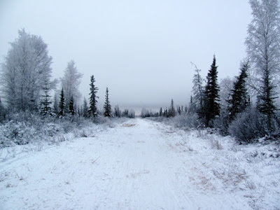
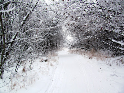
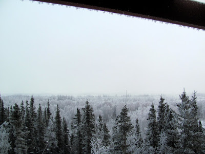
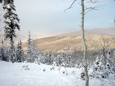
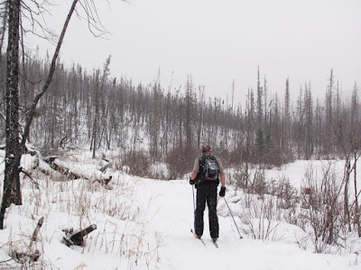
The rest of the trail was quite fantasic – lots of wonderful views of the near by hills, and when the snow stopped, clear blue skies.  The trail is on a road for the first mile or so, then slowly winds up the North Fork of the Chena, passing numerous small cabins and inholdings, eventually reaching Rosebud summit.  We stopped a mile or so short of the base of the climb to the summit.

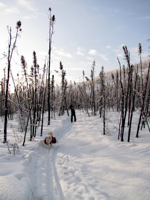
This area burned in the 2004 fire season, and most of the forest the trail passed though had been completely burned. We passed only a couple of sections where we passed though stands of unburned trees.

It was quite a fun way to spend a day (leaving out the overflow), and is enjoyable if you do not mind overflow all that much.

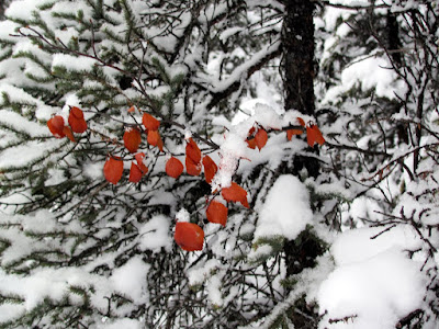
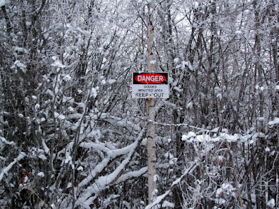
There were a number of interesting sights to see along the trail, including a “tree face”.

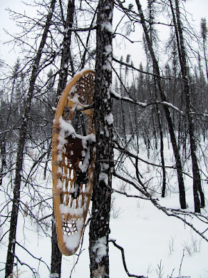
And a single snow shoe.   Hopefully the owner is not going to require it. Currently in this area snow shoes would be overkill, as the snow is not that deep, and one can get back by just walking though it.
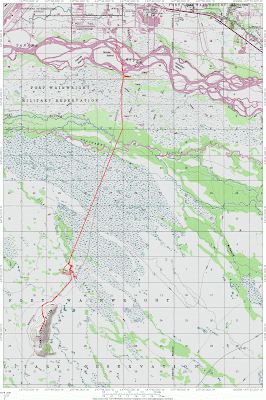
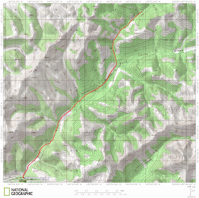
A map of the route.

For more photos, please see my gallery:

Skiing a Section of the Quest trail

Exploring the Bonnifield Trail

Monday, February 1st, 2010

Tom and I decided to spend a Monday exploring the Bonnifield Trail. The Bonnifield Trail is rumored to head south from Fairbanks to foothills of the Alaska Range and possibly to Blair Lakes and other interesting destinations. We where only interested in a fairly short ski, perhaps 30 miles or so out and back, so we set our goal on a small hill called Clear Creek Butte.
Our ski started at the end of South Cushman and I had more than a little trepidation leaving my truck there.. But things appear to have been cleaned up significantly since I was last in that area, and there was only one burned out car. There was still signs of the old times, including a burned up set of box springs and a number of appliances with a goodly number of bullet holes.. Hopefully the truck would be ok.. I stopped at a classic south cushman spot, complete with a burned and rusting box springs, broken bottle luminaries, and spent shell casings, for a couple of photos.

We skied out to the Tanana, then wandered around for a bit looking for the start of the trail. We ignored the most obvious starting point, the a wide trail blocked by a yellow gate with a blue tent in the middle, but eventually decided that must be it, and started down it.

The start of the Bonnifield was not what I expected – it is about 20 feet wide and straight.

Unfortunately there was not enough snow to cover all the grass, so the skiing was a bit slow.

For the first 7 miles the trail alternated between swamp and birch and poplar groves, but not to put too fine of a point on it, it was a little boring.

To liven up the trip, the military kindly left surprises in the woods for us, in the form of “Dudded Impacted Area” warning signs.

Tom was quite put out by the sign’s poor grammer and the use of “dudded” as a word. Never mind that the area is apparently littered with unexploded ordinance.
The only wildlife we saw was a moose with a large calf and a huge flock of ravens.

Eventually we came to a large intersection, where the trail headed off east off at an angle, and continued straight on. We elected to continue straight on, as the USGS topos have the trail continuing on straight, but a the trail heading off to the east had a large amount of traffic – perhaps a trail to explore in the future. The branch of the trail we continued had a much more promising character.

At this point, we ran into our only other trail users of the day, a posse of military contractors off on some mission of great importance. I chatted with them for a bit, and they told me about a tower on top of clear creek butte, which I was told, right ahead of me. Hmm, I was a bit confused at this point, as we had yet to cross Clear Creek, which is several miles before the butte. They zoomed off on their mission of great important, and we continued on our ski.

It turned out they where confusing Clear Creek Butte with a small hill right next to Clear Creek. Alas, they also confused left and right, and gave us instructions that got us a bit sidetracked for a while, but not too big of a deal, as it gave us some fun skiing on Clear Creek.

Once back on the trail, we headed up to the top of the small hill, and took at look at the tower.

The view from the tower would have been quite fantastic, given a clear day, but alas it was cloudy and overcast, so the view was somewhat limited.

The tower was quite interesting, and I am very curious what it was used for. The climb up was a bit hairy, especially when I realized the top rung of the ladder was held on by parashoot cord.
We wandered around for a while before getting back on the correct trail, as there are a lot of side trails heading off into the flats. Once back on the trail we headed off and skied a couple of more miles before arriving at Clear Creek Butte. The butte was a little anticlimactic, as we didn’t find any tower on it, or anything else interesting, but such is life. After a snack we headed back, and made it back out to the car before dark, hurray! I was very happy to see my truck was intact and without bullet holes and not on fire..

If anyone has any idea where the major side trail heading off to the east goes, or where all the traffic heading up and down clear creek goes to, I would love to know about it.

This area is definitely worth exploring, as it so close to town. With a bit more snow it would provide fantastic skiing. I think I would recommend parking someplace other than the end of South Cushman, if only for your peace of mind. It would add probably 6 miles each way to leave from the Pump House or Pikes, or 4 miles from the Chena Pump boat launch.

It is not a dog friendly ski, as there are lots of traps in the area, including ground sets, so keep the dogs at home!

A training day..

Tuesday, November 24th, 2009

On a fine Monday morning Tom and I headed off for a 32 mile day trip, an out-and-back to Moose Creek Cabin in the White Mountains NRA. We are considering doing the White Mountains 100 and thought it would be a good idea to get some longish day ski trips in as training. It was a great day for a long ski – fairly warm and relatively calm by white mountains standards.
The area received a dump of snow the week prior and the trails were much improved.  The first 8 miles or so were quite well beaten down and after that the the trail was a bit narrow for fun skiing on the downhills but otherwise was in great shape. 

The final quarter of a mile or so to moose creek cabin was quite windy – this section of trail crosses a large open field and always provides a fantastic view.

We stopped at Moose Creek cabin for a bite to eat and got a little more excitement that we anticipated.  After we had been at the cabin for 15 minutes or so two snow machiners who had passed us earlier rushed up and joined us in the cabin.  One of the riders had hit a stump while riding in the 12″ of powder and was thrown off his machine, apparently breaking his wrist in the progress.  We helped him wrap up his wrist, gave him some ibuprofen,  and Tom loaned him a much larger mitten so he could keep his enlarged wrist warm..  He turned down my suggestions for splinting his wrist and headed back out to ride back to the mile 28 parking lot one handed.   I expect that was a supremely unpleasant ride out.


Our ski out was, on the other hand, fairly pleasant, but tiring of course.  As Tom put it, “I think I have earned a huge dinner and a nice lie down.”

According to our gps we had a moving average of 4.8 miles per hour and we beat my prevous personal best of 3 and a half hours into Moose Creek cabin, which was quite rewarding and a fantasic first training ski.

Stiles Creek Trail day ski

Thursday, November 19th, 2009

On a nippy Monday morning Tom and I set off for a day ski out to Stiles Creek Cabin in the Chena River SRA. It was fairly cold (-20f according to the thermometer at Pleasant Valley Store) but otherwise quite an excellent ski.

The Stiles Creek Trail had undergone some re-routing and we were looking forward to skiing the new sections.  The re-route made for some fantastic skiing.  Before the reroute the trail dropped off the final hill and descended steeply.  The new sections cut back and forth though the old trail and make the steep sections (once described to me by a fairly good skier as “the most terrifying thing I have ever skied”) very ski-able and quite fun.    This was quite a contrast to the original trail which could be quite terrifyingly fast.

Polar and Remus had a wonderful time running around and enjoying the smells.

Once we reached the top we were treated with fantastic views of the nearby ridges.    Once of the nice things about this trail is that it crosses a wide variety of the forest types that the greater Fairbanks area offers – it goes though birch groves, poplar trees, black spruce forest swamp, white spruce stands, and a small section of alpine ridge top.

The trail has a lot of climbing on the way into the cabin but the reward for this is a fair number of fun downhill sections on the way out.

After 8 miles or so we reached Stiles Creek cabin and ducked inside to warm up.  After about 30 minutes we had the cabin above freezing..  Which was enough to start drying off Toms pants.

The rest of the ski out was quite fun and much faster as there is a lot of downhill.
As mentioned earlier, the reroute makes for much more fun skiing. There were two sections on the old trail that were quite unpleasant. On the way in the drop off the ridge to the cabin was pretty hairy – it was steep and the trail was canted downhill which when combined together made for less than fun skiing. On the way out the final drop off the ridge was very steep and fast, with mistakes potentially rewarded by the trunks of large birch trees – this also made for less than fun skiing. Both these issues are fixed with the reroutes – the final decent to the cabin was rerouted with enough switch backs such that it is easily ski-able and the drop off the main ridge on the way out was also rerouted such that it is a lot less steep and with wide enough turns for easy skiing. Hurray! Major kudos to DNR for improving this trail!

More pictures follow, for the photo inclined.

The trail at the its high point.


Afternoon sun.

The sunset as we skied out.  We skied the last couple of miles in the dark, alas.