Tom and I decided to spend a Monday exploring the Bonnifield Trail. The Bonnifield Trail is rumored to head south from Fairbanks to foothills of the Alaska Range and possibly to Blair Lakes and other interesting destinations. We where only interested in a fairly short ski, perhaps 30 miles or so out and back, so we set our goal on a small hill called Clear Creek Butte.
Our ski started at the end of South Cushman and I had more than a little trepidation leaving my truck there.. But things appear to have been cleaned up significantly since I was last in that area, and there was only one burned out car. There was still signs of the old times, including a burned up set of box springs and a number of appliances with a goodly number of bullet holes.. Hopefully the truck would be ok.. I stopped at a classic south cushman spot, complete with a burned and rusting box springs, broken bottle luminaries, and spent shell casings, for a couple of photos. 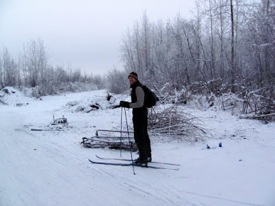
We skied out to the Tanana, then wandered around for a bit looking for the start of the trail. We ignored the most obvious starting point, the a wide trail blocked by a yellow gate with a blue tent in the middle, but eventually decided that must be it, and started down it.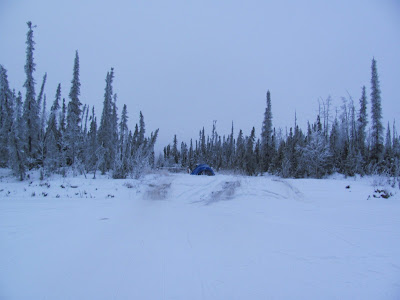
The start of the Bonnifield was not what I expected – it is about 20 feet wide and straight.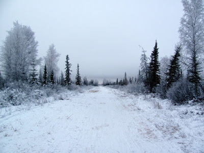
Unfortunately there was not enough snow to cover all the grass, so the skiing was a bit slow.
For the first 7 miles the trail alternated between swamp and birch and poplar groves, but not to put too fine of a point on it, it was a little boring.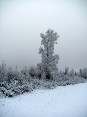
To liven up the trip, the military kindly left surprises in the woods for us, in the form of “Dudded Impacted Area” warning signs.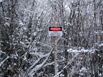
Tom was quite put out by the sign’s poor grammer and the use of “dudded” as a word. Never mind that the area is apparently littered with unexploded ordinance.
The only wildlife we saw was a moose with a large calf and a huge flock of ravens. 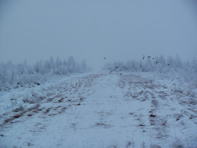
Eventually we came to a large intersection, where the trail headed off east off at an angle, and continued straight on. We elected to continue straight on, as the USGS topos have the trail continuing on straight, but a the trail heading off to the east had a large amount of traffic – perhaps a trail to explore in the future. The branch of the trail we continued had a much more promising character.
At this point, we ran into our only other trail users of the day, a posse of military contractors off on some mission of great importance. I chatted with them for a bit, and they told me about a tower on top of clear creek butte, which I was told, right ahead of me. Hmm, I was a bit confused at this point, as we had yet to cross Clear Creek, which is several miles before the butte. They zoomed off on their mission of great important, and we continued on our ski.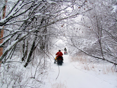
It turned out they where confusing Clear Creek Butte with a small hill right next to Clear Creek. Alas, they also confused left and right, and gave us instructions that got us a bit sidetracked for a while, but not too big of a deal, as it gave us some fun skiing on Clear Creek.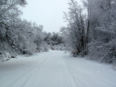
Once back on the trail, we headed up to the top of the small hill, and took at look at the tower. 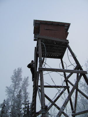
The view from the tower would have been quite fantastic, given a clear day, but alas it was cloudy and overcast, so the view was somewhat limited. 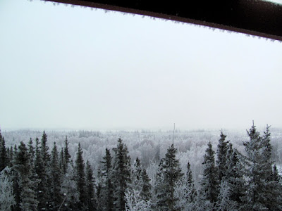
The tower was quite interesting, and I am very curious what it was used for. The climb up was a bit hairy, especially when I realized the top rung of the ladder was held on by parashoot cord.
We wandered around for a while before getting back on the correct trail, as there are a lot of side trails heading off into the flats. Once back on the trail we headed off and skied a couple of more miles before arriving at Clear Creek Butte. The butte was a little anticlimactic, as we didn’t find any tower on it, or anything else interesting, but such is life. After a snack we headed back, and made it back out to the car before dark, hurray! I was very happy to see my truck was intact and without bullet holes and not on fire..
If anyone has any idea where the major side trail heading off to the east goes, or where all the traffic heading up and down clear creek goes to, I would love to know about it.
This area is definitely worth exploring, as it so close to town. With a bit more snow it would provide fantastic skiing. I think I would recommend parking someplace other than the end of South Cushman, if only for your peace of mind. It would add probably 6 miles each way to leave from the Pump House or Pikes, or 4 miles from the Chena Pump boat launch.
It is not a dog friendly ski, as there are lots of traps in the area, including ground sets, so keep the dogs at home!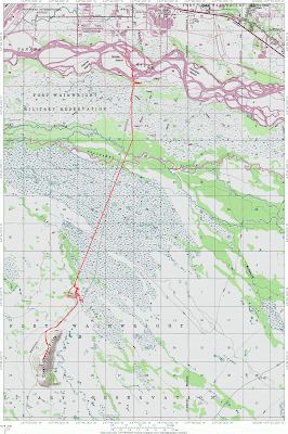
Tags: mondays, skiing, wandering around