Author Archive

Fun on Carlo Creek

Wednesday, October 21st, 2009

I should preface this post by saying this is written by a guest, my wife Nancy. Thus, there are probably no spelling errors, all the words are used correctly, and it makes more sense than usual. But don’t worry – the spelling and grammar mistakes will return in the next post!

Nancy here… I decided to write up a great trip from this summer, in part to show that Jay really does stay home with the kids sometimes while I have adventures. Alas, some of those “adventures” are business trips for work, but this one was spectacular enough to help make up for that.
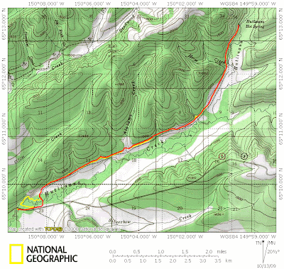
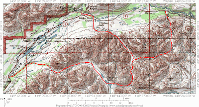
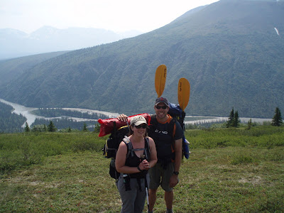
We (Tom, Marsh, and I – note that I have joint custody of our friends) blatantly borrowed our itinerary from Ed Plumb’s blog Who could resist a trip named the Coffee and Pizza Traverse? The trip was a hike up the Carlo Creek drainage, starting at Milepost 224 on the Parks Highway, crossing over a high pass, dropping down to the Nenana River, and packrafting back to the starting trip. It sounded too good to pass up – and for the most part, it was.
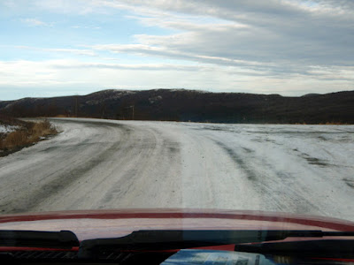
We were grateful that parking at Panorama Pizza turned out to be ok with the owner, although he was most definitely not serving coffee mid-morning when we showed up. However, our exploration of river access proved to be more challenging. The folks at the private lodge across the road clearly remembered chasing the most recent pack-rafters off their property, and were most emphatically having no more of that, no matter how quiet and low-impact the trespassers might be. So we scouted an alternate takeout a couple of miles south.
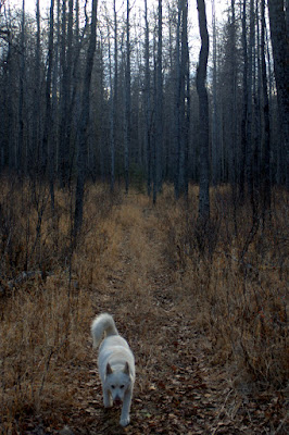
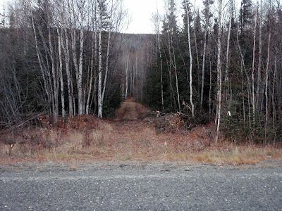
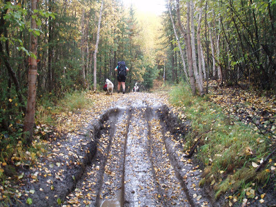
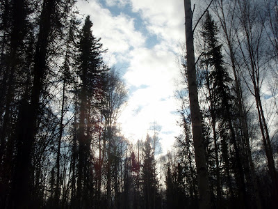
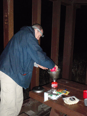
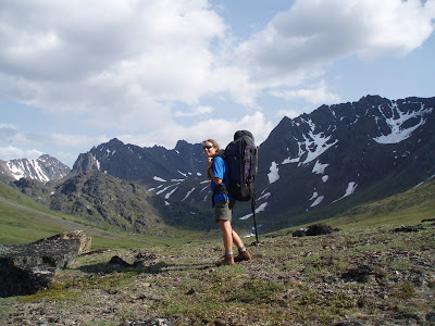
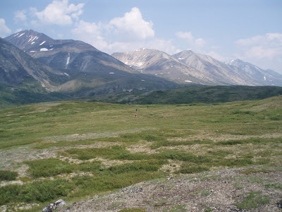
The hike itself was everything promised, and more. An ATV trail provided easy access to the meadows above treeline. There were, miraculously, no bugs, perhaps due to the hot July sun. We followed the creek as it gradually grew smaller and smaller, and made a couple of crossings that were probably unnecessary, but overall found easy walking. That first night, we camped right at the top of the drainage, comfortable in soft grass, but surrounded by imposing peaks and ridges.


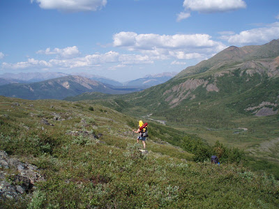
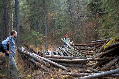
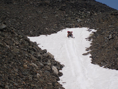
The next morning we hiked up the pass. It was steep, with a large lingering snowfield, but still generally easy going. A caribou was even kind enough to pose for us. It was when we reached the top that we faced the biggest challenge of the trip. Ed had described the descent as “steep and rocky” with “serious scrambling.” He wasn’t kidding. The boulder fields were almost vertical, and all seemingly poised on the point of creating massive rock avalanches. Unencumbered, the scrambling might have been fun. With a fairly massive pack, it was less than fun for me, and downright scary for Marsh, who doesn’t like heights. It was also extremely slow. Still, we eventually made it down to easier ground, and enjoyed more ambling over grassy hill slopes on our way to the Nenana.

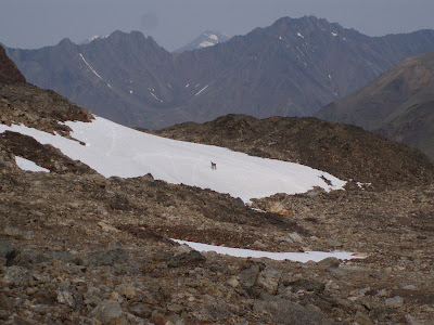
The very last part of the descent was also very steep, but not at all scary, since it was densely forested. We sang loudly (and badly) to the bears as we did a sort of controlled fall through the underbrush.


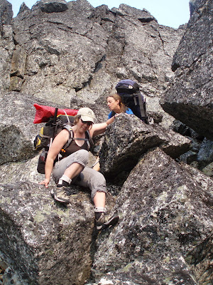
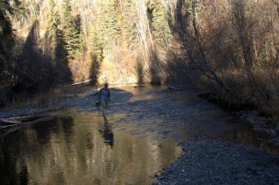
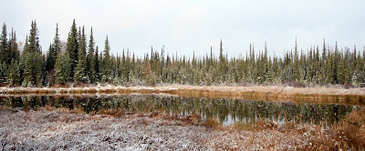
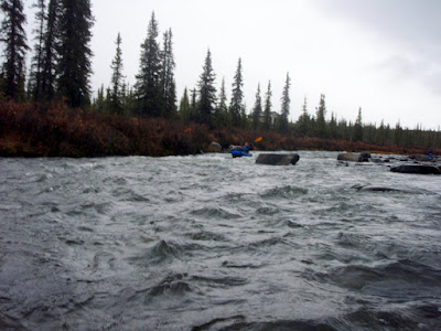
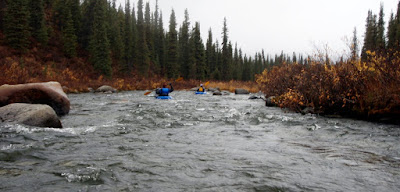
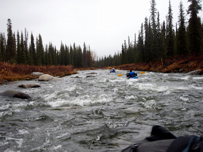
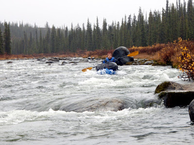
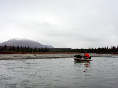
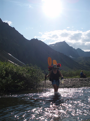
The bugs were fierce at the river, but we got underway quickly, and happily floated for about an hour and a half in the calm and relatively swift waters to the Parks Highway. At this point, it was getting late, and our stomachs were calling for pizza. The wind was coming up, too, and the water ahead was reputed to be choppy to start with. We decided to take out and hitch the last few miles back. I was the designated female for this role (Tom resents this, but a 6-foot-5 male just doesn’t get rides) and quickly retrieved the car.

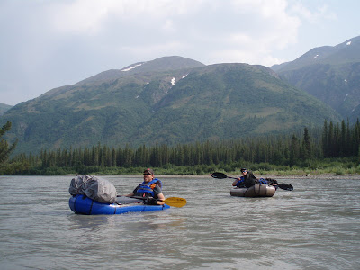
The pizza? Delicious, but the slowest service known to mankind. Still, we were very grateful for the free parking, and for an incredible trip.

Hutlinana!

Wednesday, October 14th, 2009

On a sunny Monday morning, Marsh, Tom, and I headed out to Hutlinana Hot Springs for a day trip.  After a 3 hour or so drive up the Elliot Highway.  None of us had been out that way before and the plan was to scope it out as a destination for future winter trips, perhaps with the twins.

The drive out was uneventful though I had a winter driving reminder on some of the hills, as they were nice and icy in sections.

The references we found on where the Hutlinana Trail started said it starts at mile 130 of the Elliot.  We were somewhat confused when we arrived in the near by area and found the bridge over Hutlinana Creek was at a little past mile 129, and so mile 130 would be on the wrong side of the creek..  After a bit of searching we found a trail and started out.  Alas, the trail we found was not the right one, and we wondered around for a mile or so untill we hit the real trail.  Note the yellow line on the map – thats our route on the way in.  Once we found the correct trail we were off – it was in great shape and super fast walking.

Our side tracking in the begining involved a short stream crossing.  The “real” trail had a number of nice sweepers that made excelent bridges – alas our side trip did not.

The dogs had a wonderful time exploring.  Togiak, my older dog, sat this one out.  She is getting up there in years and longer trips are getting hard on her, especially on warmer days. It was a bit sad to keep her at home, but hopefully she will get some trips in once winter comes for good and the temperatures drop.

The main trail was marked by small socks for the first mile or so, which was a nice touch.  I expect there is a story there..

Once we hit the main trail we found it to be in fantastic shape and super easy to follow.  The trail winds though black spruce and the occasional stands of birches.  Near the hot springs the trail opens up and hits a beautiful large stand of poplars, tastefully decorated by a number of rusty 55 gallon drums.

We arrived at the hot springs after a little under three hours of hiking and were quite surprised by the fantastic shape we found them it.  I had been told they wash out occasionally and was not quite sure what to expect – it turned out previous visitors had constructed a wonderful rock pool that was deep, warm, and fairly free of hot springs funk.

The springs were quite warm and free of any sulfur smell.  It was quite refreshing to soak for a hour or so after the hike in.  The view from the pool was excellent!  Alas, this was a day trip so we headed back out to the car and a long drive home. 

On the way out we passed a couple hiking in – I was fairly surprised at the amount of traffic we encountered as we also passed a party on the way in.  I guess everyone was out enjoying the warm weather before the snow arrives in force. The walk out was uneventful, though we found a caved in cabin we missed on the way in.

The main trail back to the road was much faster than our side route.  There was some shenanigans when the dogs attempted to follow me across a sweeper and Remus attempted to pass Polar by crawling under him while he was walking the trunk of the tree.  This caused Polar to freeze up and get stuck in the middle of the stream on the log, leaving me to walk out to rescue him.

For future reference, the best trail head appears to be the 4th driveway or side road before the bridge on the right hand side heading towards Manley, including the parking area near the bridge. The trail is fairly obvious at that point – you will know you are on the right path if you see some very old junk cars near the start of the trail.

On the drive out we stopped to take a better look at a bus in the ditch – we passed a bus on its side just after the Tolovana trail head.  We stopped briefly on the way in, but keep going after it became obvious that no one was around.  The bus was quite out of place, as it appeared to be a military transport, though perhaps they are used for other purposes too.  We spent a bit of speculating as to what they were doing out this way on the drive back to Fairbanks. Hopefully no one was injured.


This was quite a fun trip and I was thinking about returning later in the year for a overnight ski trip as the trail looked like it would be wonderful skiing, or perhaps a spring ski trip with the twins.  All in all a very pleasent day trip, though a super long drive, alas.

Woofie and Bunny go Hiking

Wednesday, October 7th, 2009

On a brisk Sunday morning the family and I set out for a day hike. We had planned on hiking to Stiles Creek Cabin for a overnighter, but Lizzy had a low fever the day prior so we turned it into a day hike instead. Lizzy and Molly started off walking and after a hour or so switched to being carried. The hike was wonderful – we did this hike in 2006 with the kids and the first mile was an utter mess – huge ruts, massive muddle puddles, and other general “Lets drive our ATVs though a muddy swamp!” madness. It had been getting worse in the last couple of years, and was getting so bad it was actually starting to make winter skiing unpleasant as the ruts where not completely filled with snow even in spring. In the last couple of years (I think last 2 years) Alaska State Parks had been in the process of doing some sort of reroute of the first 2 miles of the trail to deal with the really bad sections, and it appears they finally finished or at least reached some stage of completeness. The trail is now completely different – its dry and mostly free of killer mud holes and ruts. In fact, it would have been great mountain biking. I am going to have to come back here in the spring and try it out. Go State Parks! Its really refreshing to see the state spend money on things like trail improvements. The skiing this winter should be much improved too, as the reroute is not quite as steep. Parts of the old trail can be a bit tricky on skis – steep, fast, and a not a lot of room to snow plow.

Lizzy and Molly started off walking and carrying Bunny and Woofie in their backpacks.  After a brief stop to stick Bunny’s and Woofie’s head out (“No, no, Bunny can’t see” – Molly) we where off.

As mentioned before, the re-route has dried stuff up a lot – this is a good example of what the new section looks like.

Contrast this with the old trail, circa fall 2005.

The dogs had fun running around and exploring. Soon the “exploring” part will stop and they will have to start pulling pulks when ski season starts.

Molly outfitted herself with hiking poles for a while.  It is really rewarding to see the twins enjoy hiking.  I hope it lasts, as many adventures await.

The walk was quite beautiful, with the fall colors giving way to the winter gray, black, and white. I love this time of year, as there are constant reminders that the best season is about to arrive, Winter!

Eventually the little trekkers wore out and it was nap time. They rode for the next couple of miles in the backpacks, wrapped up in lots of layers.  Its funny – now that I have started carrying the twins, it really puts backpack weights into perspective – when I put on a normal multi-day pack for a trip without kids I am surprised how little it weighs.

After nap time came snack time, when the passengers where treated to a delightful repast, artfully served in a small zip lock bag. 

Eventually we returned to the trail head where the girls played on some left over trail hardening material (also known as a pile of rocks).  This kept them busy for almost a hour, which was truly amazing.

Just before we left Molly found a small stick that was sort of shaped like a person, and after some help from Nancy, soon became more person shaped and was christened the “Tree Man”.

All in all it was quite a fun way to spend a day.  We even made it to Mias, where Nancy and the twins had Korean food, and I was treated to a fantastic burger!   I am looking forward to skiing this in a month (or less if all goes well – bring on the snow!), and biking it next summer.

Trips For Next Summer..

Thursday, October 1st, 2009

While coming back from a day float on Brushkana Creek, I noticed that the hills above the Denali Highway in that area looked quite hikable.

Earlier this summer I had asked someone about how interesting Brushkana was to float, and was distracted with stories about how beautiful the upper Jack River is.  It appears it would be a easy 2 day or hard 1 day hike into the the upper Jack River from the Denali Highway, from which one could packraft down the Jack River or continue hiking over to Carabou Pass and packraft down the Chutlitna River.  

The End of Autumn and the Beginning of Winter

Wednesday, September 30th, 2009

Winter is descending on Fairbanks.  We have our first snow and it appears to be sticking until spring.  Time to put away the packrafts and get the skis out.  

The first snow is a exciting time for the dogs.  They know that soon ski season will arrive and with it lots and lots of dog trips!

Tom and I went on a 2 hour bike ride around part of the Scarland Ski trail with a side trip to KUAC tower.  The Scarland trail is OK riding but a bit “rooty” in some sections, but makes up for it with the fast narrow sections with are quite a blast on a bike.  This was the first time in about 6 years I have biked the Scarland trail – its normally something I only do on skis, and it whet my appetite for skiing.  Hopefully in a month I can do it again on skis.. More snow! 

A lazy float on the Brushkana

Tuesday, September 22nd, 2009

On a rainy overcast Sunday afternoon Tom, Marsh, and I headed down to the Brushkana Creek off of the Denali Highway to camp out and in the morning hopefully go for a pack rafting day trip. The Alpacka forums had a post about the Brushkana Creek, and it seemed it might have the ideal combination of fairly low volume interesting whitewater that would be fun to practice on. In the ideal world there would be a lowish volume class III in my backyard here in Fairbanks to splash around in, but alas, life is not perfect.

Our basic plan was to cache our bikes along one of the many ATV trails that lead from the Denali Highway to the Nenana and camp at the Brushkana Creek campground. In the morning we would float the Brushkana down to the Nenana, hike back to the road, cache our gear, and bike back to the campground.

The drive down to Cantwell from Fairbanks was uneventful and 3 hours or so later we arrived at BLM’s Brushkana Creek campground and setup tents just as the daylight left. After a quick supper and several beers we hit the sack – oh the joys of car camping!

After a nice and quite night we woke to a fairly nice day, and breakfast and were off! Tom had not adjusted well to the whole car camping idea and ate his cereal out of a bag, super lightweight style. He did take me up of my offer of the cold frappachino though.

The Brushkana was quite fun right off the bat with a small rapids right next to the campground. The first 45 minutes or so was constant class II fun – lots of dodging rocks and a few smallish drops. The river guides I found online suggested it was class II+. It seemed very similar to Windy Creek in difficulty which most folks seem to think is class II, so the “+” bit was lost on me. Perhaps at higher water levels it might be harder. There are no stream gauges in the direct vicinity, but the gauge at Healy on the Nenana said a little over 9ft. A bit more water would have smoothed out some of the shallower spots but all in all it was quite fun.

The bouncing and splashing continued pretty much no stop until near where the creek joined the Monohan.

The creek was an wonderful confidence builder, as the water is not very deep and there was a constant barrage of things to maneuver around.

Its hard to tell from these photos but there is quite a nice game trail along the bank. Its possible to walk back up stream to re-float any of the particularly interesting sections.

The colors where quite beautiful.

We appeared to be on the tail end of moose hunting season, and as a result did no see much wildlife of any sort.

In the last mile or so before Brushkana hits the Monohan the river slows down a lot.

Once we hit the Monohan we it became a classic boreal forest float, complete with sweepers.

After bobbing around for a while the Monohan joined the Nenana and our nice clear water was replaced by silty gray water. The current was a bit faster on the Nenana but we could have used a bit more water as it was quite shallow in sections. The Nenana was quite beautiful and if we had more time it would have been nice to extend the float on it.

Just before our take out we surprised a small flock of swans which flew right over head. Except for an owl this was our sole wild life sighting.

We reached our take out after floating around 3 and a half hours. Tom was very happy to put his new floating jacket’s snack storage system though its paces. We found a very well used ATV trail and headed back to where we cached our bikes.

The walk back to the road was surprisingly pleasant, and wonderful hiking. In berry season it appeared this area has wonderful blue berries, as I saw a huge number of blueberry bushes. Alas, it was well past the ideal berry picking time, and they were too soft.

After a quick mile or so hike we were back at the road, cached our packs, hopped on our bikes, and zipped back to the campground and the truck. The total distance was round 14 miles, 5 or so of which were on the road, with a round trip time of 5 to 6 hours including the bike shuttle, making for a excellent half day float. If we where to do it again I think I would
have walked up stream of the Denali Highway a ways and then put in to extent the fun bits. All in all a highly recommended float, with lots of bouncy rock dodging but nothing super hard. If one was super lazy one could just do the rapids right near the campground and have quite a bit of fun, as the trails along the bank seemed to be very good walking.

This is the last float of the year for me, I think. Now, if only it would snow more I could start skiing!