Posts Tagged ‘day trip’

Doing Far Mountain Trail in a Day

Monday, August 1st, 2011

Last year Tom, Ms Marsh, and I did a hike and float that included Far Mountain, and ever since then I have been very interested in doing the full loop as a day hike. Eventually I ended up with a free Monday and along with Tom found myself heading up the Far Mt. Trail. The trail starts near Chena Hotsprings parking lot (the actual start of the trail is a bit hard to find with a few side trails and roads that make things a bit confusing – check with the folks at the Chena Hotsprings activity center for a map if you have problems) and after crossing the bridge over Monument Creek the trail heads up a ridge and the climbing begins.

The Far Mountain trail loops around Monument Creek valley on a series of ridges. There are lots of ups and down, with between 8k and 14k feet of climbing, depending on who you ask (I measured around 8,000 feet of climbing – that is 8,000 feet of going up). The trail is a little less than 27 miles. The views from the high points on the ridges are fantastic.


There are also several interesting granite tor formations.


Far Mountain itself is a little underwhelming, as it has a large communication facility on top, complete with generators and a couple of large towers.


The majority of the trail is well above the tree and brush line making for wonderful alpine hiking, though there is a section of spruce forest near the end.


The day we hiked it it was was partly cloudy, but it can get quite socked in.
On a clear day:


On a foggy day:


The last mile or so is very muddy.


It appeared that the muddy section was in the middle of some trail work of some sort, however as it appeared the equipment had stirred the mud up into a froth and re-routed a small stream to run down the trail perhaps these repairs might do more harm than good…

This is a highly recommended long day hike. It took us a little less than 12 hours of walking at a brisk but not rushed pace. As an overnighter it is more challenging due to the limited water sources. There are tundra pools in several places around mile 7 or so, but after that there was not much water to be found.


My dog Remus was a bit dehydrated near the end, and I had to give him a some water from one of my bottles near the end of the day. Getting water would mean a long drop down to the one of the creeks at the bottom of the valleys.

The hike has a fairly remote feel, besides the stuff on top of Far Mountain. On the day we hiked it some military planes were out training and made a bit of noise, but otherwise it we didn’t see anyone on the trail.


One day or several, its a beautiful hike and well worth doing.

If you do this hike during berry season, the blueberries can be fantastic.


A map – like all the photos in this blog click it to see the image in greater detail. A better map can be found here. Kyle Jolly’s book Outside In the Interior has a chapter on this hike.


More photos can be found here. Sorry for the low word and high picture count – I have been a bit slow on the blog front lately, but more coming soon!

Snow!

Sunday, November 21st, 2010

Ms Marsh, Tom, and I spent the day enjoying a mellow ski out in the White Mountains NRA. The greater Fairbanks area received a lot of snow in the last couple of days, and in the Whites that resulted in about two feet of snow on the ground. Thats about as much snow as we had at the end of the year – Wow!

The skiing was fast and fun. With the warm mid 20’s weather it was strange to see only five snow machines and three parties of skiers, but it was nice to see people out enjoying the snow.

Pinnell In a day

Sunday, August 15th, 2010

I have had plans to hike the Pinnell Mountain Trail as a day hike for most of the summer. This weekend things lined up and I headed off to hike it, joined by Tom. Alas, Remus had to stay home, as the trail heads are separated by about 20 miles required either two cars or a bike shuttle, and we opted for more fun but not dog friendly option of a bike shuttle.

Tom and I left town shortly after 7am in order to get a early start on what I expected to be a long day – 10 hours of hiking, 6 hours of driving round trip, and 2 hours of bike shuttle action. Fortunately the drive though coffee huts were open this early, which was a pleasant surprise and there was much rejoicing, hurrah!

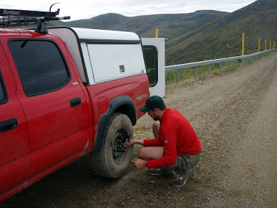
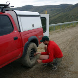
The drive to the trail head was pretty uneventful, though we got a flat near 12 mile summit. When we stopped to unload our bikes for the shuttle I though I could hear a whistling sound, which sounded like air escaping from one of the tires. I drove the car back and forth while Tom watched the tire in question but nothing out of the ordinary could be seen, so we pressed onwards, only to have the tire go flat in a couple of miles.
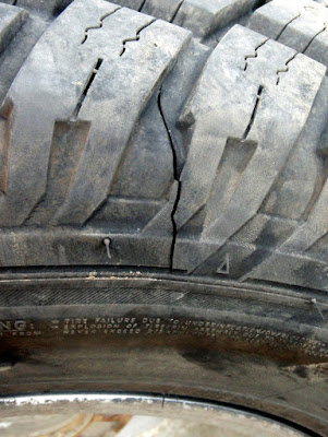
Amazingly, the folks I bought the tire from replaced the flat free of charge – which was quite nice of them, as the cut in the tire was pretty large. I was quite pleasantly surprised when they told me that as the cut was unrepairable, they would just give me a new tire.

Shortly after the tire change we reached Eagle Summit and began our hike. We ran into some other hikers right out of the parking lot. They appeared non-plussed by our fanny packs and lack of packs and my attempts to engage them in conversation were foiled by one word responses..
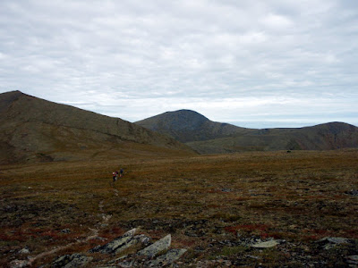
The weather from this point on was fantastic – the day started overcast and a bit gray, but the forecast was for it to clear and become quite warm. By the time we started hiking the clouds were pretty much gone, the was a slight breeze, and the sun was out – fine weather for a long day hike.

The Pinnell Mountain trail sticks mainly to a series of ridges and it winds around or and goes over a number of small mountains and domes. It has a number of climbs, and one moderately hard climb but nothing very difficult and the effort is rewarded by superb views.
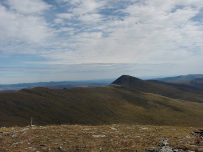
The hike is entirely above tree line with no brush at all and is normally quite dry.
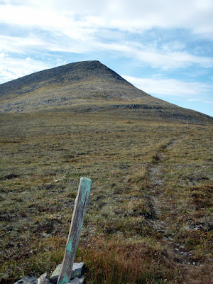
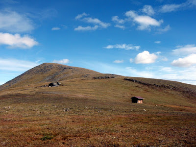
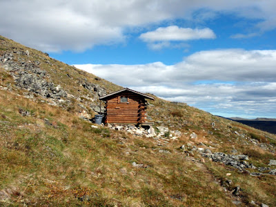
There are two small shelters on the trail. These shelters are pretty small but can be very welcome in harsh weather as the trail is pretty exposed.
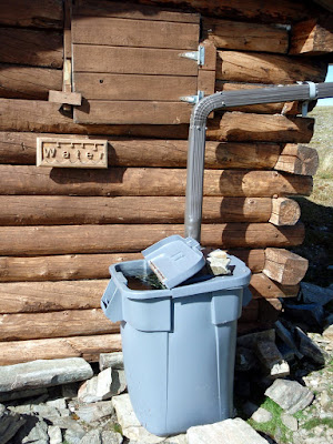
They also feature water catchment systems that made our hike much, much, easier, as we knew we could rely on water at the shelters.
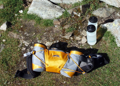
On this hike I experimented with using a very small fanny back and it worked great – there was just enough room to get the basics in (rain jacket, first aid kit,etc ), a handful of snacks., and two bike bottles. The small size definitely helps you cut down on what your are taking, as you really can not fit much in it.
At the first shelter it soon became clear that we were hiking a bit faster than expected and would finish well under my estimated 10 hours – this was good of course but a bit surprising.

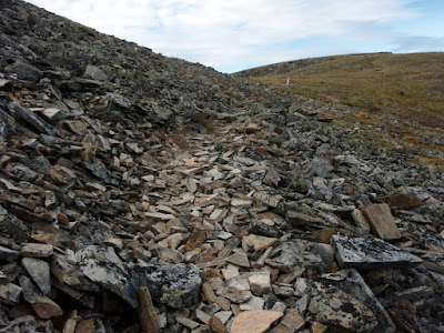
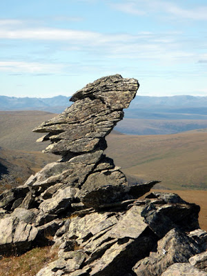
This trail features lots of interesting rock formations, including a rock shaped like a face.
A little past the face rock we encountered the 4th and final hiker we would see on the trail. This guy was hiking the trail as a four day trip with his black lab and was busy scanning the valleys with binoculars when we encountered him. He had yet to see any wildlife but brightened up substantially when I mentioned that we had just seen a caribou around the corner. Near the middle of the the trail there is a long section of board walk along the low point of the trail. This section is called “Swamp Saddle” and even with the boardwalk can be a bit wet. The boardwalk is a mixed bag – when its nice weather the boardwalk makes for nice and dry travel, however near freezing it becomes very, very slippery and hard to walk on.
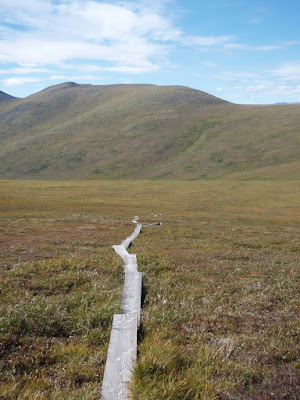
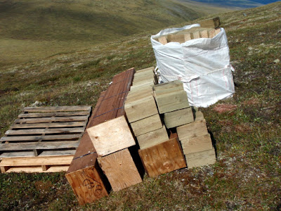
It appears that BLM is in the process of upgrading this section of trail, as there was a number of caches of building materials along this section of trail.
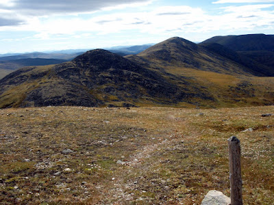
The boardwalk only lasts a mile or so, then its back to ridge hiking and nice views.
The second shelter at mile 18 is pretty much identical to the one at mile 10 – though it is a bit less exposed.
We filled up on water again and I chugged a extra bottle fun as a I was getting a bit deydrated at this point. The remaining 10 miles of trail went by pretty fast.
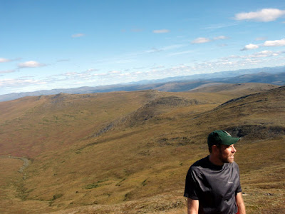
There is one moderately steep climb with a huge number of switchbacks after the second shelter, but otherwise the trail is fairly mellow, and after the steep climb the trail starts heading downhill, making for fast walking. We reached the bikes after 8 and a half hours of hiking, quite a bit less time than I expected. We only ran a very short section – Tom is training for the equinox marathon but I am alas not in that good of running shape currently so we only ran a short section. The trail is almost entirely runnable and would make a great, though long, trail run.
After reaching the 12 mile summit trail head, we gorged on snacks and then jumped on our bikes and headed off to Eagle Summit. As this point I was getting a little dehydrated and as it was now very hot and calm I was soon quite dehydrated. Tom zoomed ahead invigorated by the thought of biking uphill in the hot sun… Eventually I reached Eagle Summit and dove into the cooler in the back of the truck and enjoyed the cool sodas stashed away there. By the end of the day I had had 2 quarts of power aid, 8 20oz bike bottles of water, and 40 oz of pop – thats two and a quarter gallons of liquid! I was still not hydrated when I got home and had to drink several additional quarts of water before I started feeling reasonably hydrated.

The trip ended up taking a little under 6 hours of driving round trip, 8.5 hours of hiking, and 1.5 hours of biking – quite reasonable for a long day trip. My fanny pack setup worked great and forced me to pack a bit lighter than I normally do, which was good. The fanny pack setup also worked pretty well for the brief bit of running I did, so it might be a good option for trail runs in the future.

Pinnell Mountain trail is a classic interior hike and well worth doing. It has super fine views, the trail is in pretty good shape, the climbs are not very challenging, and the trail is amazingly brush free – all in all a fantastic hike. It can be done as a reasonable 2 day hike or mellow 3 day hike if long day hikes are not your thing. Its a spectacular hike!
More photos for this picture inclined: Dayhiking Pinnell Mountain Trail.

A Beautiful Day…

Monday, August 2nd, 2010

Remus and I escaped this afternoon to go hike Granite Tors..
It was a great after noon, hot and sunny – a fantastic day for a hike, and for reflecting on life the universe and everything. Time well spent.

We found berries..

And more berries..

And even more berries..

Blueberry season appears to be on us.. Get your picking in now before Remus and I eat them all!

A Cast of Thousands on Riley Creek

Monday, July 12th, 2010

The king of pack rafters (at least Interior ones), Ed Plumb organized a trip down to Riley Creek near the Denali Park entrance. This creek is very accessible and is rumored to have some nice class II boating with at least one class III drop. It was supposed to be a short 1-2 mile hike followed by a several hour float. Ed recruited a very large posse (13 people total) for this adventure – I guess the short nature of the trip and the potential fun floating made it pretty attractive.

I was unfazed by the unlucky number 13, as my morning coffee was filled with good signs.

After meeting up at Lulu’s we all left town shortly after 9 and were on the trail hiking at a little before 1 in the afternoon.

The hike was fantastic – the trail is in great shape and very fast walking. We had a major train of people –

I was pretty bouncy from the latte and probably annoyed everyone around me with my endless babbling.

Fortunately people shifted around a bit and thus I got to spread my annoyance around.

Eventually we left the trail and dropped down to the creek.

Where we put in on the creek the water was moving moderately fast with more water than I expected – it looked pretty fun.

This creek has quite a bit of character – at the water levels we floated it at there were quite a few nice rocky sections with fun obstacles to maneuver around.

There are a couple of sections where the creek runs along smallish rock walls, but nothing too exciting.

The forum post that spawned this trip, circa 2007, mentioned a rope across the creek near a cable. Well, it turned out that there is still a rope across the creek under a cable, near a foot bridge.

It appeared the rope was used to haul stuff back and forth across the cable, but its seemed that having it dangle just above the water was unnecessary, especially since there is a foot bridge just near by. NPS’s legendary safety paranoia seems to be a bit missing here..

Shortly after the footbridge we encountered the rail road bridge and a brief exciting section. This bit could be a bit tricky – at the water levels we floated it at it was fairly fun and not too tricky. We took out just after the parks highway bridge and made our way back to the cars.

Quite a fun day trip and highly recommended. Its very similar to windy creek, but at the water levels we floated it slightly harder with a few sections that are a bit more challenging. The total time for the hike and float was around 5 hours so it makes for a nice mellow day trip hike-and-float. It was pretty fun to float in such a large group. There was quite a selection of paddles, different sorts of boats, and several generations of spray skirts all of which it was fun to see in action. There was also a wide range of gear folks were taking. One of the pack rafters sported a neat helmet cam made from a gorilla pod and also going super lightweight style with no pack – just strapping his pfd to his life vest – most impressive! Hopefully some of the videos he took will get passed around, as they might make interesting viewing.

More photos here:

Riley Creek Packrafing trip

A short trip on the Chulitna

Monday, June 7th, 2010

On the way back from the packrafting class, Tom, Ms Marsh, and I stopped to do a quick hike/float on the East Fork of the Chulitna River. The river was supposed to be class II with a fair number of large rocks for eddy play, so I was looking forward to it. We started at the East Fork rest stop on the Parks Highway, and hiked back out from just below the confluence of Honolulu Creek. This section of river is super fun – just like I was told there are quite a few nice large rocks to play around. I had a great time practicing entering and exiting the eddies using the “stab and jab” technique from the packrafting class. Perhaps a bit too much fun, as I flipped while exiting a eddy with a nearby pore over – but no big deal I was back in pretty quickly and my “nearly dry” suit combo kept me dry.

The float is pretty scenic and in a couple of places the river goes by some interesting cliffs.

The hike out was fairly short and fast – it took about 20 to 30 minutes.

There is a more direct way with via a trail, but it ends up in someone’s driveway complete with a ton of “No Trespassing” signs, so we just bushwhacked directly out to the road.

This section of the river is super fun and makes a great day trip to breakup the drive from Anchorage to Fairbanks.

The pack rafting class has really changed the way I see rivers – I spent this float playing in eddies trying to hit and catch as many as possible, something I would have never done prior to the class. We need more rivers like this in the Fairbanks area!

A Map:

Pictures:

East Fork of the Chulitna day float/pack