Posts Tagged ‘hiking’

Far Mountain Float and Hike

Monday, September 6th, 2010

I had been thinking about pack rafting trips that might work in the upper area of the East or Middle fork of the Chena for most of the summer, and finally things came together. Our plan was to start from Chena Hotsprings, hike up to Far Mountain, then traverse down one of the many ridges down to the East Fork, then float out to Chena Hotsprings road and bike back to the hot springs. Ms Marsh, Tom, and I left the hot springs a little before lunch time and started hiking up the Far Mountain Trail towards Far Mountain. Alas, on our first try we missed the start of the trail and wandered around a bit before getting on the correct trail. The trail is surprisingly beautiful.

The trail started out on a ATV trail, but once it hits the ridge the ATV tracks die away and fine alpine hiking begins.

Weather was pretty nice for most of the first day, giving us superb views and wonderful hiking. The trail winds though some fairly recent burns and it was pretty neat to see how the alpine area was recovering.

We expected to have a pretty dry hike and had packed quite a bit of extra water so we had enough water to make dinner but we were quite excited to find some tundra pools a little after half way to Far Mountain on the first day.

Hiking was amazingly – nice dry ridges with wonderful views.

After we reached mile nine or so, just before Far Mountain, we called it a day and made camp. Dinner was provide by Ms Marsh, and was a fantastic boil in a bag soup meal.

Lately my trips have switched to “just add hot water” meals which can be made plastic zip lock bags or by reusing the foil pouchs that freeze dried meals come in. It allows us to bring a smaller pot and saves fuel making for lighter packs. Light packs makes for happy packrafters!

The next day the we awoke to less stellar views – it was totally socked in.

We spent most of the day hiking though the fog with limited visibility. Several of my last couple of trips had involved hiking though the fog in whiteout conditions, so I have been getting pretty good at it. This time I was quite prepared and had a route preloaded on the gps making it fairly easy to stay on course. I did get us circled around once and did a unnecessary horseshoe loop, but such is life.

The view from the top of Far Mountain is supposed to be fantastic – alas we didn’t get to see much. There was an impressive cairn though, as well as a very large and loud communication complex on top though.

After going over Far Mountain we turned away from the trail and followed the borough boundary along a series of ridge tops heading down to the river. The hiking remained pretty good – lots of game trails and brush free hills.

I found two sets of caribou antlers that I picked up for the twins – I would have loved to have some antlers as a kid, and thought the twins would enjoy them. Alas, they were not the same size, so when I got back and handed them out, Molly noticed hers was smaller and immediately attempted to trade with Lizzy, who was having none of it.. Such is life…
Just before we reached the river we passed though a recent burn, perhaps from last year. It was very fast hiking and it was quite interesting to see the plants moving in after the fire. There were a couple of sections with impressively thick knee high grass.

As we neared the river we also dropped below the clouds and the views opened back up, making route finding much easier. After the burn we hiked though a short section of fairly brushy black spruce forest, but eventually made it out to the river.

We made it to the East Fork at around 4pm, and were very, very happy to see it had lots of water and was going to be a good float. My big concern about this trip was the water levels on the East Fork – I had not been very far up it before and had no idea what to expect, and was a bit concerned we would hike all the way in just to discover it was too low to be float-able. Fortunately that was not the case – the water levels were great and made for great pack rafting. Since we arrived at the river mid afternoon we put in and floated for a couple of hours.

After two hours or so we called it a night and made camp. The East Fork was surprisingly scenic, with great views of the ridges hemming in the river and lots of interesting rock cliffs. The evening was fairly uneventful, besides the splashing beavers. We seemed to have set up camp near some sort of beaver meeting ground. On this trip I attempted to go without a tent, justing using a bivy and a tarp. It was mostly a success, though the bivy I used does not appear to breath all that well. On the second night, since I had my pack raft out and inflated I turned it over and slept on it – it was like heaven and very comfortable.

The next day we continued the float. Up to this point we had not seen any other floaters, but this changed about midday. We heard an air boat in the distance, and saw several pulled up on shore, as well as several parties of more traditional floaters with rafts and inflatable kayaks.

Strangely we saw lots of boats pulled up on shore but few people and no one on the river..

We passed one of the camps where a large jet boat was pulled up along with a jet ski and Ms Marsh talked to them a bit – they were completely flummoxed when they were told that we hiked in. One of them responded with a “Holy Sh**” and a completely incredulous look. More mind boggling for me was the jet ski – its fragile fiberglass bottom made it seem to me like the least useful motorized appliance ever for traveling in shallow rocky creeks.
We did stop and talk to a guy with one of the groups of non-motorized floaters. He said he was on “Camp Duty” while the rest of his party hunted. They were dropped off at the landing strip at Van Curlers Bar, a old placer mine on the upper reaches of the East Fork. Apparently mining of some sort is in progress and the landing strip is open and usable. Some interesting details can be found online about some of the folks who prospected in this area, including Van Curler. Excepting the air boats and jet boats, the float felt pretty remote considering how close it is to town – there were not a lot of signs of other travelers, besides a large number of cut out sweepers. In the lower sections of the river there are a number of very large log jams that have been cut out, so this is probably a good thing – some of those log jams were pretty immense and would have been a bit of a pain to portage around.

Eventually we arrived at our take out, where Tom and I got on bikes and biked back to the hotsprings while Ms Marsh guarded our packs and hunted for cranberries. The bike ride was very fast and fun and before I knew it we were back at the truck.

This hike, float, and bike is highly recommended – the hiking was fantastic, the floating pretty fun (though mellow), and has a very remote feel considering how close this is to town.

A Map.

More photos.

Far Mt – East fork of the Chena trip

Three generations having fun on the Chilkoot

Sunday, August 29th, 2010

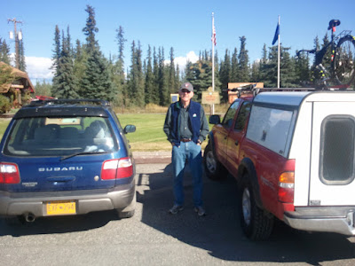
In the spring Nancy and I had made plans to hike the Chilkoot with the twins and possibly joined by my dad. My dad was the chief ranger at Klondike Gold Rush Park and as a kid I hiked the Chilkoot trail several times. I have pretty fond memories of hiking the trail with my dad and was looking forward to sharing the experience with the twins – while they are much younger than I was when I first hiked the trail, I figured that they would still enjoy it. Our adventure started early Saturday morning, as we left Fairbanks on the long drive to Skagway. Our plan was to spend two days driving to Skagway, five days hiking the Chilkoot, then two days driving back. My dad decided to join us, so we planned to rendezvous with him in Tok (he would be driving from Wasilla), and he would join us for the rest of the drive. We left town bright and early Saturday morning, and after several hours, arrived in Tok and meet up with my Dad.

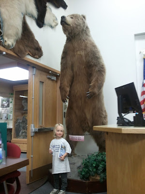
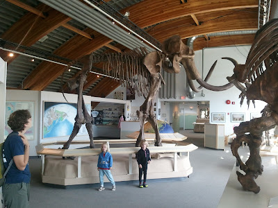
The twins got out of the car to be de-wiggled – fortunately Tok features two visitor centers complete with taxidermied mega fauna and large lawns to run around in – ideal places for the twins to explore and burn off energy.

One of the visitor centers also included a place to play hop scotch.

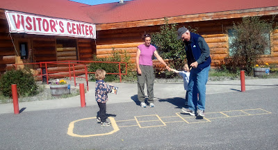
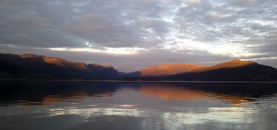
After lots of running around, the twins (and my Dad) got most of their wiggles out and we got back in the car to drive to Congdon Creek Campground in the Yukon Territories. Campgrounds in the Yukon always seem to be in great shape – clean and well maintained. Congdon Creek campground is on Kluane Lake and is very scenic.

The twins spent the evening building small boats and sending them off into the lake, while Nancy and I watched. My dad is an early to bed and early to rise sort of guy, and retreated to his tent soon after we got our camp site arranged. The next day we zoomed off down the road towards Skagway and just before Whitehorse, we made a side trip to Takhini Hotsprings. I spent a lot of time at Takhini as a kid. Whitehorse was the nearest city of any size (possibly the only one) accessible from Skagway by road, and so my folks made regular trips to Whitehorse to do grocery shopping. These trips would often involve dropping the older Cable kids off at the hot springs to splash around while my folks did their shopping.. Spending the day at the hot springs was much more fun than helping my folks shop for groceries, so I have fond memories of the place. The twins had a blast splashing around in the warm water.

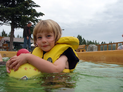
The hot springs were only slightly changed from when I was a kid – they are a bit cleaner now and have a few extra bells and whistles but otherwise it’s pretty much just like when I was a kid. After spending two hours or so the twins (and to some extent their parents ) were wore out and we got back in the truck for the final 100 miles or so to Skagway.

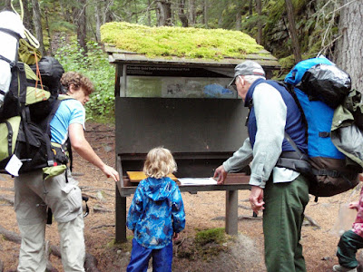
Upon arriving in Skagway we dropped by the park office to get our official “talking to” about hiking the Chilkoot trail (like most pre-hiking lectures it mostly could be summarized in three words – “Don’t be stupid”), got our official permits, and then we were good to go. We spent a bit of time wandering around Skagway..

The character of the town has changed quite a bit from the town I grew up in – there are lots of new houses, lots of new summer-only shop fronts.. After seeing the sights we stashed my bike in an out-of-the way bike rack and headed out of town to Dyea to camp for the evening. The morning soon arrived and off we went, starting the hiking section of our adventure.

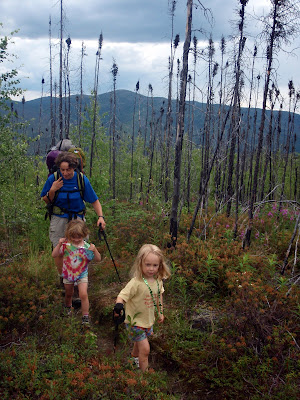
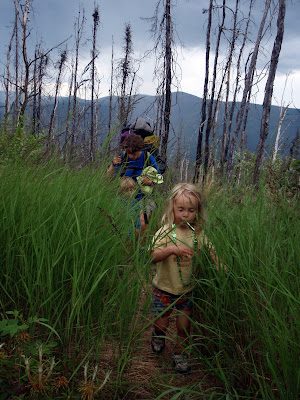
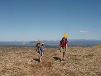
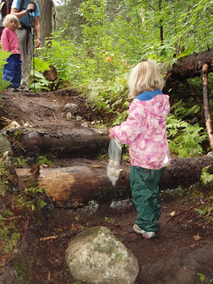
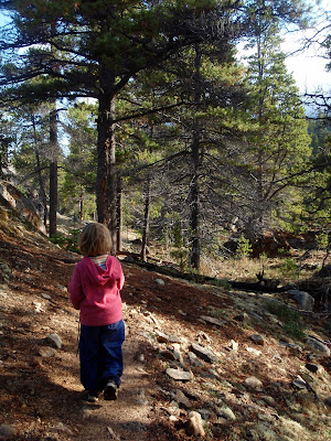
The twins started out hiking..

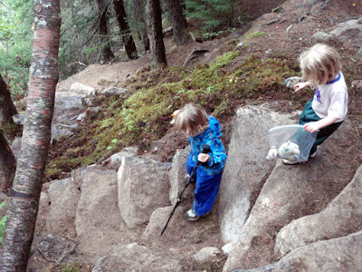
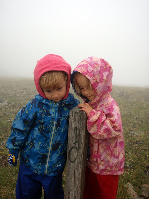
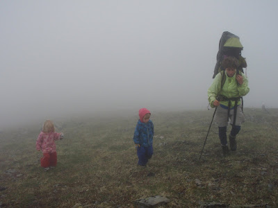
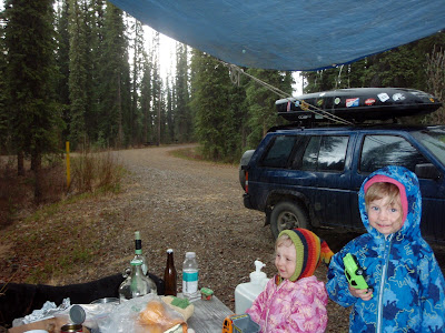
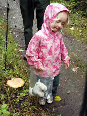
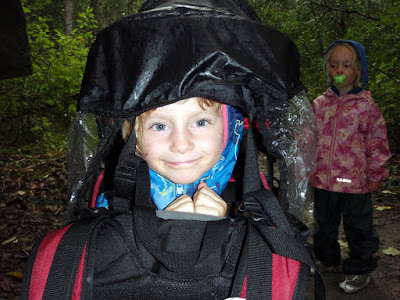
The first day was a standard Skagway day – mostly cloudy and damp. It rained lightly on and off.. fortunately we were well prepared, and had rain coats for everyone, including the stuffed animals.

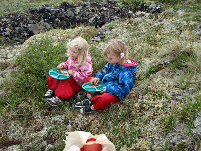
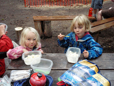
Hiking is of course hard work, and requires lots and lots of snacking.

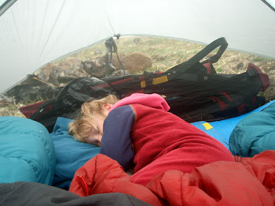
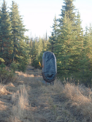
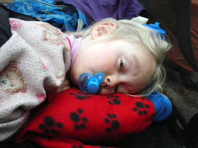
After three miles or so, the twins started slowing down and nap time arrived. The twins then were bundled up and stuffed into the backpacks for the most of the remaining hiking for the day.

This pattern continued throughout the rest of the trip – the twins start off hiking, they hike until nap time, then get a ride during nap time, and finish the day hiking, except for the day where we went over the pass (more on that later).
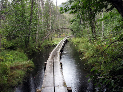
Our first day of hiking was super mellow – our destination for the evening was Finnegan’s Point, which is around five miles from the starting point. The Chilkoot trail is in great shape. There is a long section with boardwalk that crosses a set of beaver dams that was a pretty interesting.

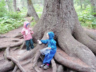
When we arrived at the Finnegan’s Point campsite, we found we had the place to ourselves. Finnegan is the first campground and an easy walk from the trail head, so most folks press on to Canyon City or beyond. Klondyke National Park now requires folks to “book” each of the campsites, so we picked Finnegan’s since we did not know when we would be heading down the trail.. since we starting hiking mid-morning we had a short day. This left us with quite a bit of time to goof off with at the first campground and the twins made the best of it by exploring! The big spruce trees were something quite new to them, and they had quite a bit of fun playing around the with the exposed roots.

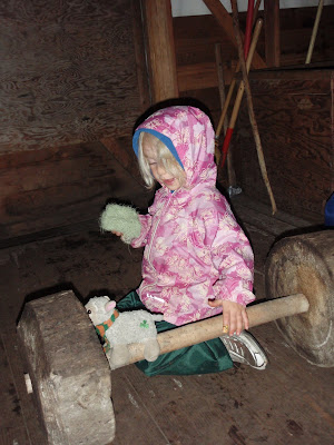
On the American side the campsites had warming shelters with wood stoves – which was a new experience for me. It was nice to have a dry place to hang out in, though the wall tents are pretty dark and gloomy. The first warming tent had some very neat wooden dumbbells that I expect the trail crew had fun constructing.

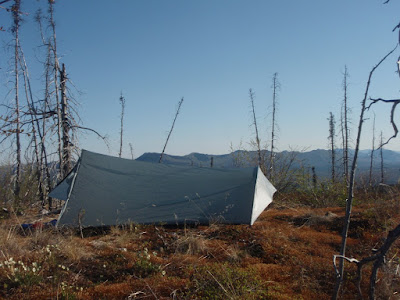
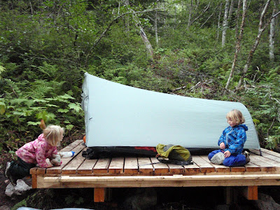
Another interesting feature that had been added in the last ten years since I hike the trail was that every site had tent platforms, which made finding a level, dry spot a lot simpler than in the past. Alas, my tarptent was a bit longer than I think they expected tents using the platforms to be but it all worked out.

The next day we headed off to Sheep Camp. My dad took off early and zoomed ahead, making it to Sheep Camp in time to get a nice afternoon nap. The rest of us walked Twin speed to Canyon City. Hiking speeds are a bit slower when your legs are only a foot and a half long.

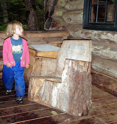
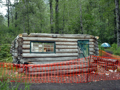
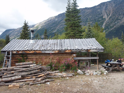
Canyon City was much like I remember from visits as a kid, though the shelter cabin had undergone renovation and had a new floor, roof, and wood stove.

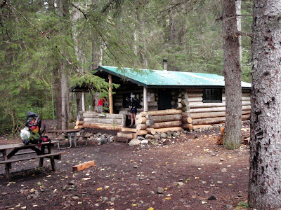
I have very strong memories of some rocking chairs carved from stumps by chainsaws by some locals who used the cabin as a base of operations for trapping during the winter, and was excited to see they were still there.

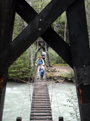
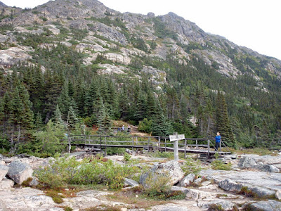
After a brief stop at Canyon City, we headed off down the trail to Sheep Camp. We stopped briefly at the old Canyon City town site, and the girls had fun crossing the very bouncy suspension bridge.

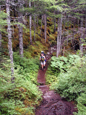
Soon after Sheep Camp we reached the twin’s nap time and they got loaded up and snoozed most of the way to Sheep Camp. The trail past Canyon City winds though drier fir forest and has wonderful views of the Nourse River.

Just before we reached Sheep Camp, we encountered a huge posse working away making the last mile or so of trail before the campground at Sheep Camp more pleasant. The girls were awake by this time and were mellowing out in the backpacks and were very impressed by all the activity.

Sheep Camp has changed a lot since I last visited – the shelter cabin was missing its roof..

Several warming huts had been installed..

And there were a abundance of dry tent platforms (quite a luxury!).

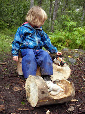
The warming huts had wood stoves and much to my amusement these stoves were burning pieces of the old shelter cabins roof supports. The girls quickly pressed the firewood into an alternate use – mainly furniture for their stuffed animal friends.

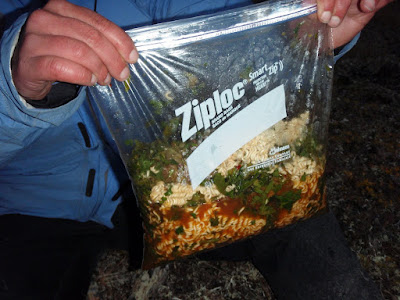
Sheep Camp was the first campground we shared with other campers, and since it was near full, there were a lot of people. Much to my surprise I bumped into an old boss of my who was hiking the trail with some other folks from Fairbanks – its a very small world! We enjoyed a fine dinner of cheesy rice, and then went to bed in order to get a good start in the morning.

The next day we would be going over the pass, which is the only challenging day on the trail. Our plan was to get an early start and to carry the twins to the base of the steep climb, then have the twins hike up the golden stairs to the top of the pass. The base of the climb is called the “Scales”, as it is where the packers in the old days would re-weigh their loads and charge extra. We got a fairly early start the next day and were on the trail by 7. The twins were a little nonplussed by the early wakeup but didn’t complain too much as they did get to ride in the backpacks rather than having to start hiking right away.

My Dad zoomed off before we were awake and moving – 20 years of commuting 45 minutes one way have made him a perennially early riser, so he was up at 5:30 and off by 6 or so in the morning.

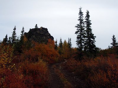
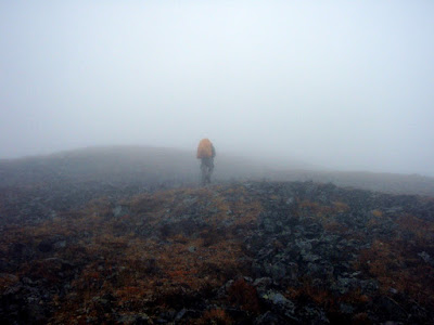
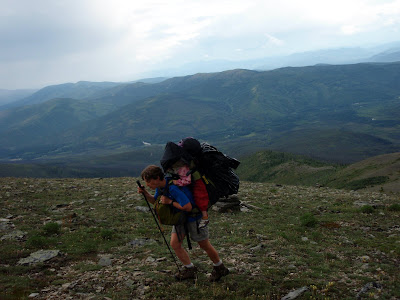
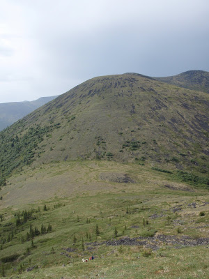
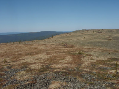
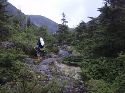
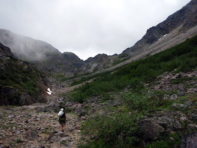
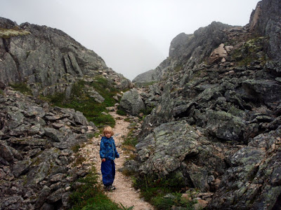
The first four miles or so before the scales are fairly mellow but definitely uphill. As we climbed up to the start of the pass, we gradually left the trees behind and were rewarded by constantly improving views of the surrounding hills.

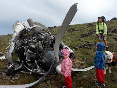
The general quality of the artifacts has definitely gone downhill since I last hiked the trail, and this is most noticeable in the pass. The old wooden structures and the tramway tower were in quite a bit worse shape – I guess over 100 years of being exposed in a windy, snowy pass have taken their toll.

Eventually we reached the Scales and the twins were unloaded. Without the twins in them, the backpacks seemed almost impossibly light.

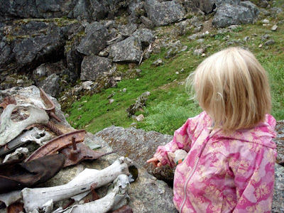
The twins really enjoyed this section of trail – there are artifacts everywhere, and lots of things to see. The girls seemed most impressed by the boot soles (there are lots, and lots of boot soles along the Chilkoot Trail) and the horse bones.

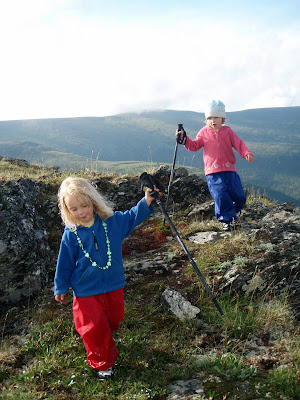
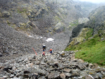
After the Scales came the golden stairs. The golden stairs is the area that shows up in the classic photos of the Chilkoot. The twins really enjoyed climbing the pass – there was lots of scrambling and climbing.

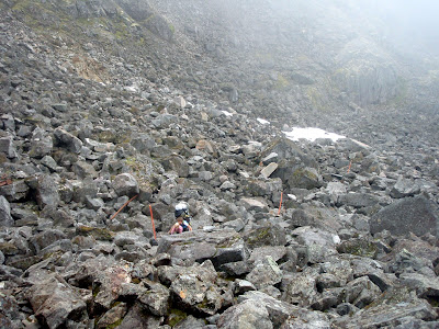
Strangely the twins seemed to hike up the pass at about the same rate as some of the adults… which is amazing as adults’ legs are around a three times longer…

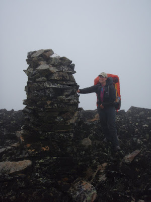
Eventually we made it over the pass and into Canada. Molly and I were the first over and were met by a very friendly warden (the Parks Canada equivalent of a ranger) who was very impressed by the twins and kept offering me coffee and tea. He knew my Dad from way back and apparently had spent the entire morning chatting away and drinking coffee with him. Dad was the first person over the pass that morning, at a little before 9, and apparently had left the wardens’ hut at around 11 – a hour or so before we arrived. After a brief stop at the hut we headed off in a hurry to get to the easy walking trail past Stone Crib. Stone Crib is a large area just below the pass on the Canadian side that is filled with artifacts of all sorts. After Stone Crib the trail becomes pretty tame and easy walking. The twins were quite overdue for their naps and we loaded them up into the packs and they were soon asleep. After several hours of travel we arrived at the first campsite on the Canadian side – Happy Camp.
I had never really stopped at Happy Camp before – in the past I just blew though these sections of trail and went from Sheep Camp to Lindemen in one day, but it was a surprisingly nice campsite. There is an enclosed shelter with no stove that is quite pleasant, and lots of raised tent platforms. The twins enjoyed Happy Camp immensely.

Amazingly Happy Camp is situated in the middle of a huge patch of blueberries, and much to my surprise, no one was picking them. I spend most of the afternoon picking and eating blueberries, occasionally with the help of the twins – yum, yum. The twins generated some interesting interactions with our fellow Happy Campers – twice some small parties of manly-men were sitting around discussing the trail and how hard it was, only to notice the kids and then have their bubble burst when it was confirmed that the twins did in fact walk up the pass under their own power. Ah, life is hard.
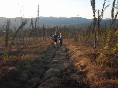
In the morning we left Happy Camp and started on our way to Bare Loon Lake.

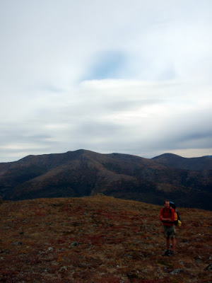
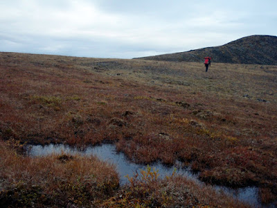
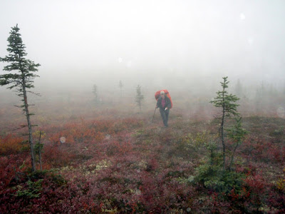
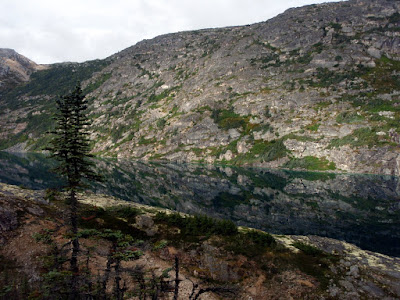
This section of trail is beautiful, with wonderful high alpine hiking, scenic lakes, and wonderful hills.

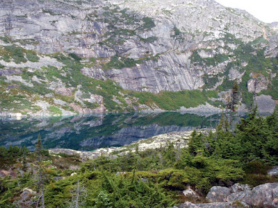
Long Lake was particularly beautiful..

The twins walked from Happy Camp to Deep Lake and made fairly good progress for little folks.

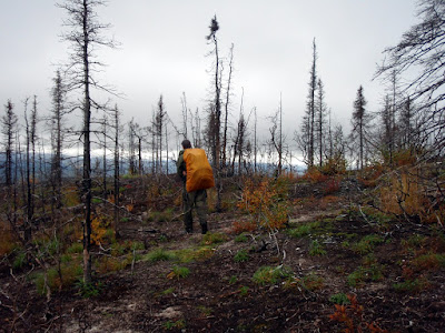
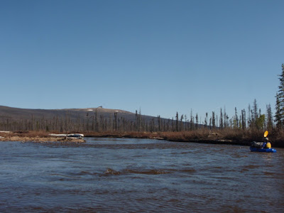
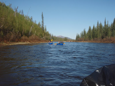
At Deep Lake the twins loaded up in the the backpacks and started snoozing while we zoomed down the trail. After Deep Lake the trail parallels a very scenic canyon that alas did not look very pack-raftable. After Deep Lake the trail heads back into forest, starting with spruce forest, then turning into mixed spruce and pine, and finally into pine forest – its quite a interesting couple of miles.
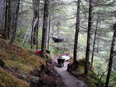
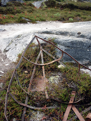
There are a couple of interesting artifacts along this section of trail, including a very neat boat frame.

This section of trail was always exciting for me as a kid. The pine forests seemed almost magical, all long needles and dryness, quite a change from the constant damp of the coastal rain forests I was used to around Skagway. Eventually we arrived at Lindeman.

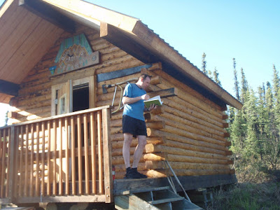
We spend a hour or so exploring Lindeman. Dad attempted to hunt down some more Wardens to chat with while the twins and I explored the exhibits. Lindeman has a tent with books about the gold rush and photos from that era. Lindemen had not changed much since I was a kid – it still looks and feels the same. After spending about an hour looking around we headed out for our destination for the evening – Bare Loon Lake.

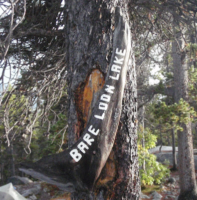
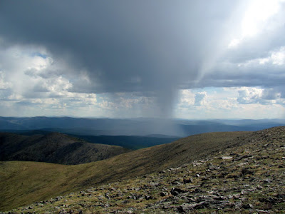
Bare Loon Lake is a scenic campsite near a shallow lake (thus the name – oh so tricky) nestled among large pine trees. It was our final evening on the trail and the twins enjoyed it immensely. The weather was quite nice except for a very brief storm during which everyone hovered inside the cooking shelter.

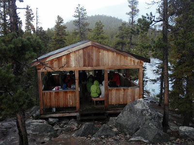
The fine weather brought everyone out of their tents and I got to see a lot more of our fellow campers. It was pretty amazing the stuff some of the folks brought – Fifths of fancy single-malts with the original metal sleeves and glass containers, propane stoves.. some of it was quite boggling. The next day we headed out to hike the final three miles or so to Bennett. The twins were not particularly excited to be rousted out of their sleeping bags..

But eventually we got going.

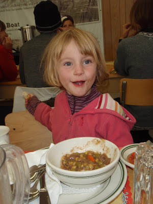
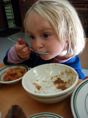
We arrived at Bennett well before the train arrived, and after poking around, stuck our heads inside the train depot to check on lunch. Lunch turned out to be all you can eat soup, bread, and pie – yum yum!


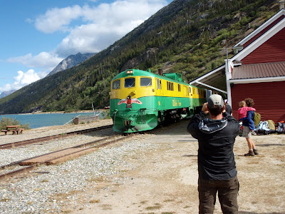
After lunch we watched the train arrive, then got on board.

The train ride was mostly uneventful, except for the very over the top narration by an invisible guide. Soon we were back in Skagway and off to get clean and have a dinner of surprisingly good Indian food. The next morning we headed back to Fairbanks. On the way back though Whitehorse we stopped at the Yukon Beringia Interpretive Centre , which was surprisingly good.

We spend the night at a campground just outside Tok, and were back in Fairbanks the following day before 1pm, with more than enough time for the kids to attend one of their classmates’ birthday celebrations.

This was a fantastic trip, and highly recommended. We did it in slow mode, but it could be done as a two night, three day trip quite easily without much hurrying. The hike is fairly remote feeling, but expect lots of people – this is not a hike to escape the madding crowds or for the antisocial. I have not done it as a day hike before, but I expect its a great long day hike. Doing it as day hike is also a great way to get out of the permitting complications – apparently only overnight users require permits. The record time is apparently around five and a half hours – in case one wants to run it.

Fun on the 4th – Hiking Chena Dome with the Family

Tuesday, July 6th, 2010

Chena Dome is one of the classic hikes of the interior. It is 30 miles long, with lots of ups and downs, but these are rewarded by great views and wonderful alpine hiking with very little brush or mud. Nancy and I decided this spring it would be a grand adventure to hike it with the Twins and see how well they handle it. As they are only four years old, they were not going to hike the whole thing and we expected to carry them at least two thirds of the time. The hike started off on a fine Saturday morning, though rain was in the forecast. As we started hiking up the trail, we were passed by someone hiking the other way. I talked to him a bit, and quickly learned that he had gone three miles and turned back because he “didn’t want to get wet” and turned back at the sight of black clouds moving in. This was somewhat ominous, but we pressed onwards. We were soon passed by two other parties, including a family with a six year old who was going to hike the whole trail without any help. This made quite an impression on our four year olds – hiking whole trail all by him self! The six year olds apparent lack of any whining made a more of an impression on Nancy and I – only six and already hard core! The twins walked the first three miles or so before being loaded up into the backpacks for nap time.


Alas, at about nap time the grade increased making for some fun uphills.

The first day of hiking was quite beautiful – while some very ominous black clouds blew though with a bit of thunder, the weather was quite nice.

After reaching mile seven or so the twins were pried out of their comfortable backpacks and started hiking again.

At a little after mile eight there is an airplane wreck, which provided a bit of excitement for the twins.

The airplane crash site is always a bit depressing, at least to me. Near the engine in the photo is the steering wheel – all smashed and bent.. it seems unlikely that anyone survived the crash. We camped in the next saddle.

Everyone enjoyed a fine dinner of rice, dried veggies, and cashew nuts. Yum, yum!

After dinner the twins and I wandered around, looking at the flowers…

And building some rock cairns.

During the cairn building processes Lizzy was very excited to find a rock shaped like the number one. The joys of being four..

The next morning things were a bit different – we awoke to a gentle rain on the tent.


When we finally made it outside, we found the ridge completely socked in, with about 100ft of visibility. The rest of the day the visibility ranged from 50ft to 1/4 mile until things cleared up in the evening. This made route finding a bit of a chore. In nice weather its it often feels like there are rock cairns every 10ft – in bad weather it feels like they are 10 miles apart. We never lost the trail, but it was quite hard to stay on the trail at several points.

The girls were quite the little troopers, and didn’t whine all that much, even though they spent most of the day wandering around in a white out in the rain.

They spent a bit more time in the backpack (must be nice to be able to retreat to the comfort of a rain proof covered self motorized transport that also provides food and drink on command) but otherwise seemed to enjoy themselves. Several times while Nancy and I were looking for the next cairn Lizzy would inject helpful advice like “You should look at the map” or “you didn’t loose the map did you”.
We also played the ever popular “Is that cairn taller than you?” game, in which the twins guessed if the next cairn would be shorter or taller then them. That game was a major hit.

Nancy also recited a version of Dorothy and the Wizard of Oz, the Hungry Caterpillar, and James and the Giant Peach from memory as hiking as rainy fog distractions.

Eventually we made it to the train shelter, were we made dinner and enjoyed some dryness.

The family with the six year old caught up with us at that point and we hung out for a while out of the rain. Eventually we took off and heading back out into the rain which was by this point slacking off and slowly turning into a partially cloudy evening.

The dogs enjoyed this section of the hike immensely – we were now out of the barren alpine rock fields and into mixed dwarf birch which they seem to enjoy a lot more. We took all three dogs, which included two 13 year olds and a 6 year old. The 13 year old dogs, Togiak and Polar, were quite the troopers, even though Togiak has a bit of arthritis.

By the end of the day the weather was quite nice, and the twins got some quality hiking time in.

We made camp just above a small saddle and eventually made it to bed when all the sugar the twins consumed wore off. The next morning arrived with a bit of rain but that quickly cleared off. Rain always sounds worse while in the tent.

Our final day turned out to be quite nice – the sun came out and it actually got reasonably hot and sunny.
The twins had a great time hiking in the fine weather.

With the nice weather, our little flying friends game out, alas.

Fortunately the hiking on the final day was a fairly fast 12 miles, and we made it out by 6, well in time to make it to Mia’s Cafe. The twins enjoyed vegetable yakisoba.


Mia’s food is always good. That little cafe is quite amazing – the burgers are great and at least the vegetable yakisoba is very good (better than any place in town actually). I am now hard pressed to decide weather to order a burger or noodles these days.. Life is hard!

Everyone had a great time on this trip, even though the weather is less than optimal. This bodes well for our Chilkoot plans later this summer, as the Chilkoot is a less strenuous hike (it has about half as much climbing).

Hope everyone is enjoying the summer!

Chena Dome In a Day

Thursday, May 27th, 2010

Last year I did Chena Dome as a day hike, and it was fun enough that I decided it should be a yearly ritual. This year it was hotter, dryer, and slightly slower. The trail is pretty dry right now, with a couple of tundra pools that had water but otherwise was very dry.

After about 1 pm (mile 9 or so) a thunder storm moved though the area, making this ridge hike a bit iffy. Storms blew though sporadically for the rest of the day, making things a bit fun.

Twice I felt a bit of static electricity that caused the hairs on my arms to feel funny, but this could be my imagination – regardless it let me to several mad “get off this ridge” dashes.

It was super hot, with highs in the mid 80’s. I drank a little over 2 gallons of water on the trail and was still quite dehydrated when I finished. My total time was a little under 12 hours.

This hike is fantastic and is well worth doing. Its a lot of work – there are only a couple of short flat sections, so you are either climbing or descending, but it makes up for this with superb views and wonderful ridge hiking. Its a bit mentally challenging at times as you are always either looking at the hill you are climbing or going down and looking at the climb you will be doing next. Such is life – trails this beautiful must have a price to pay in one form or another. Chena Dome does not get a lot of traffic – I seldom encounter other folks while hiking it.

I am going to try something a bit new with this trip – I took lots of pictures, geo-tagged them, and put in them in a Picasa Album so folks can get a feel for what the trail is like. You can find a click-able google map bellow with images – zoom in and click on one of the photos to get an idea what the trail is like at that point. Hopefully folks fine this useful – enjoy!


View Larger Map

Fun on Beaver Creek

Tuesday, May 26th, 2009

As new owners of Alpacka pack rafts, Marsh, Tom and I decided to do our first “real” pack rafting trip. Our plan was to float down Beaver Creek and walk out the Summit Trail in the White Mountains National Recreation Area. While I spend a lot of time in this area in the winter, this will have been the first time I had visited this area in the summer, and I was really looking forward to exploring it without snow. I have had done the summit trail several times before, but had never gone all the way out to Beaver Creek.

We started the trip at the Ophir Creek Campground on Nome Creek with a large group – my wife and the twins plus two additional family. We overnighted at the campground, which was surprising pleasant and uncrowded for Memorial Day weekend. The evening’s heavy thunderstorm and rain shower was not very auspicious.

The next morning was super nice though, and so I said good by to Nancy and the twins and we headed down Nome Creek. Nome Creek was a very pleasant float – it was quite mellow, with hardly any interesting water action at all. We had to avoid several sweepers in the 6 miles until we hit Beaver Creek, but otherwise this section was pleasantly uneventful.

There where lots of spectacular views from Nome Creek, including some wonderful views of Sled Dog Rocks, a rock formation that looks like a dog sled and dog team.

After hitting Beaver Creek, we then floated approximately 26 miles before we hit our take out point. Beaver Creek is a very mellow class I float, with a small number of sweepers, the rare rock to be avoided, and a view sections with interesting eddy currents – otherwise it could probably be done while sleeping. Ok, perhaps I am exaggerating, but it is a very mellow float.

Once we hit our take out point, we stopped and took a look at Borealis-LeFevre Cabin. It was amazing how different this area is in the summer. The cabin was barely visible from the river, yet in the winter the cabin can be seen quite clearly. We saw from the log book Ed Plumb had stopped here 2 days prior on a grand adventure – we where instantly envious.

After getting a bite to eat we crossed the river and headed up Wickersham Creek trail on our way to the Summit Trail. After a mile or so we would have to cross Wickersham Creek, and since we where uncertain how large it would be, we carried the rafts to the creek in case it required floating. In the winter the creek looks fairly large and can have quite a bit of overflow on it. The creek turned out to be easy fordable by the taller members of our group, and the remaining member quickly floated across.

We then headed up the the Wickersham Creek Trail until it hit the Summit Trail. This was the most unpleasant walking of the trip – the trail is mainly a winter trail but had been used by ORVs in the past. It was quite muddy and a true tussock fest.

Once we hit the Summit Trial we walked for a couple of miles and then called it a day. We camped in a old burn which was spectacularly beautiful. I got to use my new tent for the first time and it was quite a success.

The next day we headed out and had a wonderful day of hiking. The weather was great with nice clear views and pleasant walking.

This a highly recommended easy pack rafting trip – its very accessible, a fun float, and a great hike out.