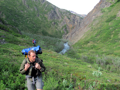
It was early morning and Tom and I were walking up Yacko Creek, with 40 or so miles to go. The valley was covered in low lush green grass, the sky was clear and blue, and the walking was great. After rushing by a mining camp guarded by a friendly looking black lab, and a much less friendly pit bull mix, we were happy to be away from people again. Off in the distance, some dark shapes were moving around in the grass. Ravens maybe, I wondered? We got closer, and Tom and I started wondering aloud what they were.. Soon we were close enough to see it was a small wolf pack, with the younger members bouncing around like puppies while the older ones lay in the sun. I grabbed a rock, readied my trusty anti bear air horn, and told Tom to get the bear spray. About the time we figured out what they were, they noticed us, and after giving us brief consideration, they headed off into the neighboring hills. I could see them occasionally as they weaved in and out of the dwarf birch covering the hillside before disappearing. Tom and I sped up a bit, feeling their eyes on us as we walked up Yacko Creek in the morning sun.

The Alaska Mountain Wilderness Classic is a point-to-point semi-organized event that has been held since the early 80s. The route changes every three years, with the current route going from the Cantwell area to Sheep Mountain Lodge near Eureka. My normal partner for these sort of adventures, Tom, and I had done a shorter version of this twice, but didn’t do it in 2019 due to a schedule conflict. Fortunately this year due to Covid we had lots of free time and we were in. The current route is much longer than the one we had done before, though – instead of nearly two days, we were looking at possibly six days. It was a daunting prospect!
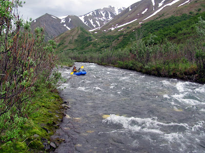
In the leadup to the event we studied maps, and talked gear, and generally obsessed too much (or at least I did), eventually settling on a route hitting the ATV trails in the Nelchena area. Hopefully we would be able to take 50+ miles of ATV trails to the finish, avoid any huge climbs, and enjoy some great walking. We also decided to take only one boat, a two person packraft, hoping to use it only to cross the Susitna. We had been warned about giant beaver swamps and slow walking on Tsusena Creek, but we were hoping the lighter packs would make up for it.
The day before the race, Amanda (Tom’s partner) drove us down to Cantwell, graciously driving us to the start for a brief pre race meeting, followed by pizza.

A highly trained and very bouncy young dog who was apparently trained as a search and rescue dog at Barry Switzer’s Ground Zero Emergency Training Center. The owner was unimpressed that I didn’t know who Barry Switzer was, but the puppy could fetch tennis balls like a champ!
In the morning Amanda dropped us off at the start (thanks Amanda, you rock!!). Alaska outdoor superstar Luc Mehl was there and said hi, but I’d had way too much caffeine and was so worked up I think I came across as either insane, on meth (or crack), or both. Which is sort of funny, as the only other time I have met him in real life was on the iditarod trail 200+ miles into the ITI with less than 6 hours of sleep, and I was pretty manic. After a slightly awkward (but not nearly as much so as AlaskaCross ) start we were off.


The first 30 miles or so were great walking, as we walked up the Jack River, and over to the Tsusena. We had two groups ahead of us, plus a random person with a white pack we saw just as we reached Caribou Lakes. The Tsusena was great walking, until it wasn’t, as we hit some huge lakes created by beavers, followed by brush. Eventually it got too dark and we called it good, setting up our tiny tent and getting 4 hours of sleep.
Our schedule of making camp just as it became hard to see and getting four hours or so of sleep, plus maybe two more hours of fiddling and setting up and taking down camp continued for the rest of the trip. We had a freeze-dried meal each just before going to bed. Alas, the first night I woke up with hunger pains and had to scarf down some nuts, then again later some cheese. (Tom says the cheese part happened the night after.) Apparently “Night Cheese” is some sort of 30 Rock in-joke, and Tom made fun of me a lot for it, though I should point out I never saw 30 Rock.

After that I made sure to supplement my freeze-dried meals with nuts and coconut oil for more calories.
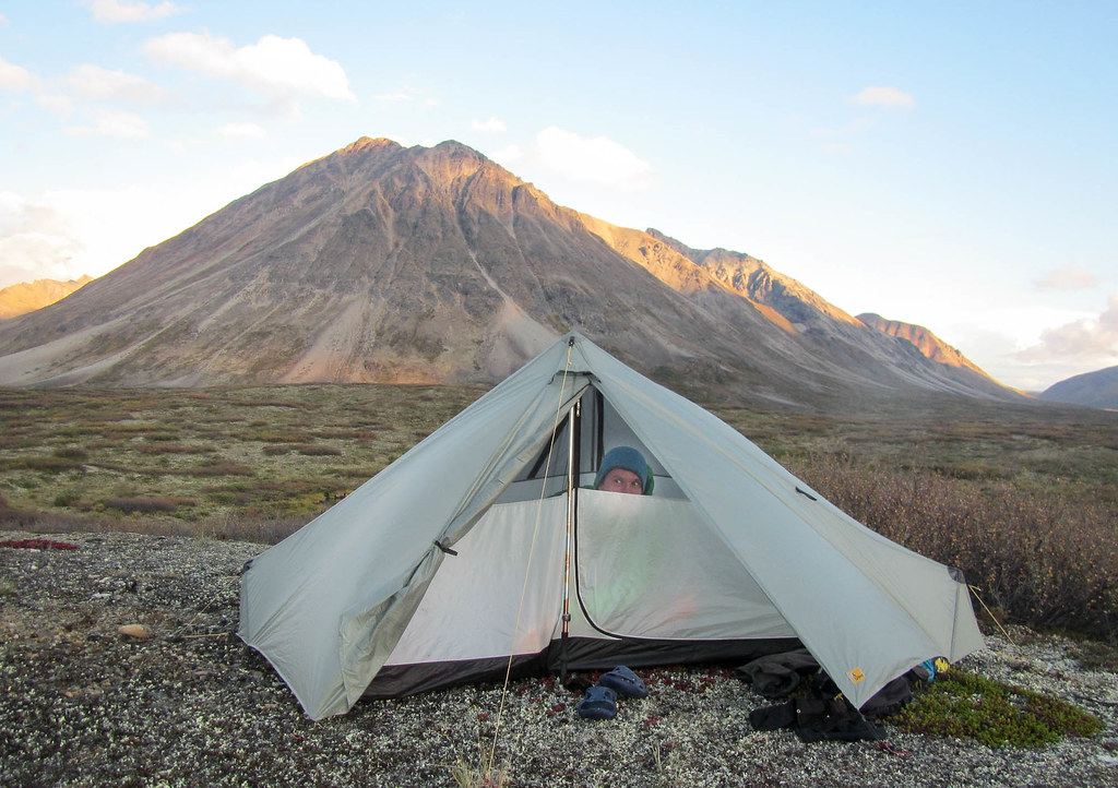
Our campsite for the evening..
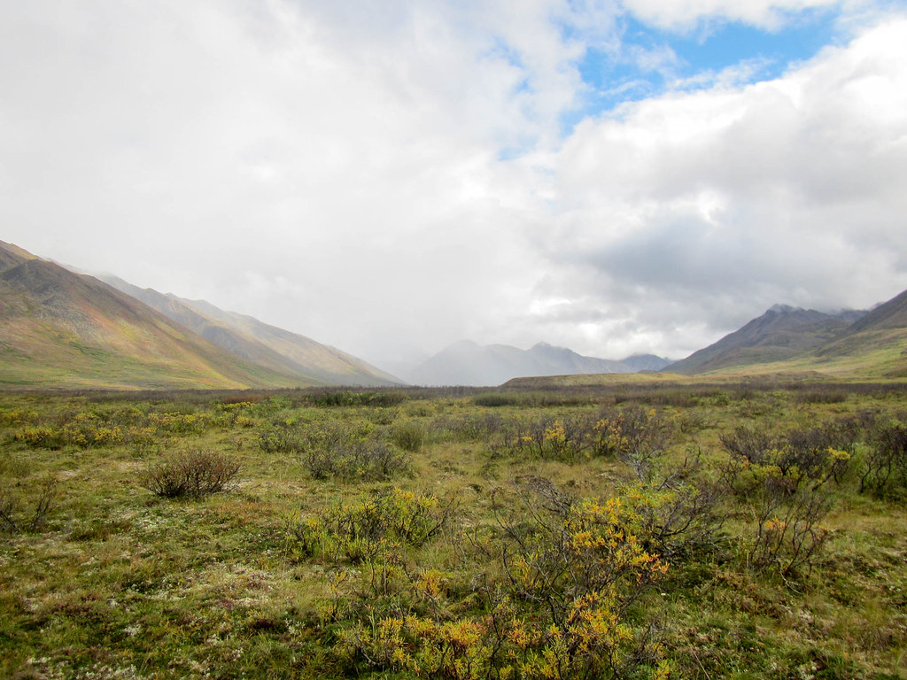
In the morning we continued down the creek, occasionally seeing the flash of a paddle through the brush along the creek as seemingly everyone floated by. The walking was never horrible, but in places it wasn’t very fast. We did find several miles of old trapline that was occasionally flagged and ended at a tree stand and a short airstrip that provided several miles of great walking.

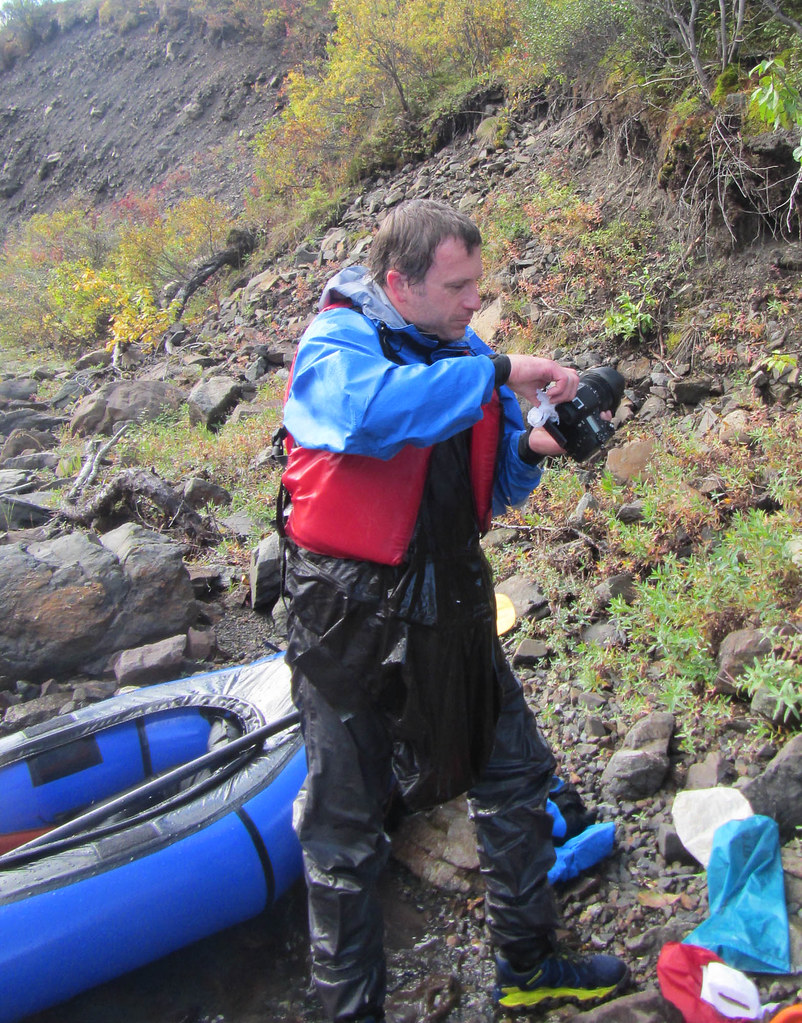
Eventually we crossed to the other side of the creek, and I dunked my “nice” camera when I misjudged how deep the creek was – it was so clear it was several feet deeper and a lost faster than I expected. Alas, that was the end of the good photos, and I had to rely on my phone for photos after that. The camera survived though; the lens just had some moisture in it. Good thing I didn’t bring the good lens, but instead my junker lens!
We finally reached some ATV trails, which we took to the lakes near Tsusena Bluff, which we followed over to Deadman Creek. We saw a huge tripod in the distance, and were surprised to eventually walk right up to it. It turns out it was an artificial eagle nest installed in the early 80s – neat!


 An eagle’s nest!!
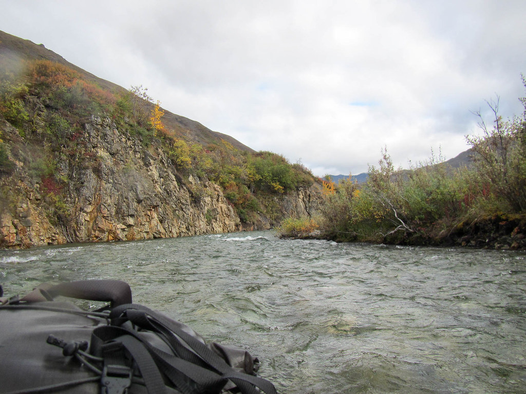
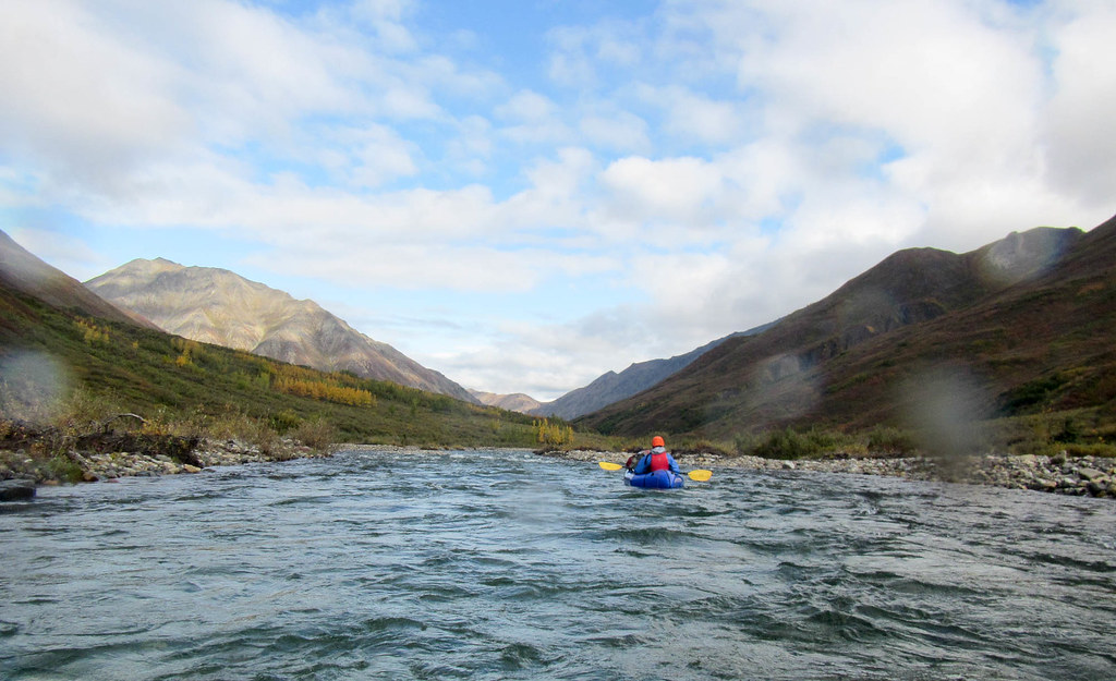
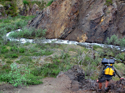
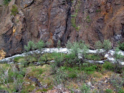
From Deadman we walked a mile or so up the Susitna to a small creek which we took down to the river.
We made a very uneventful crossing, and slowly climbed up to the Fog Lakes.

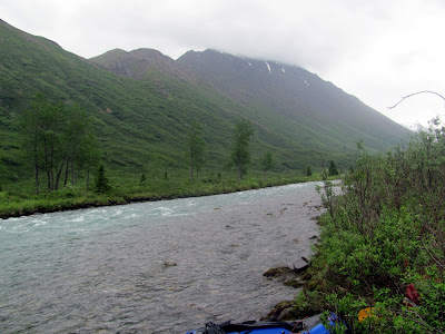
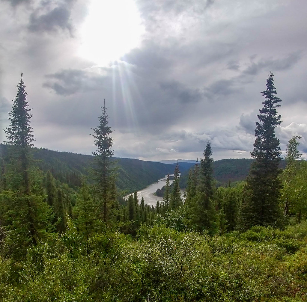 The Susitna!
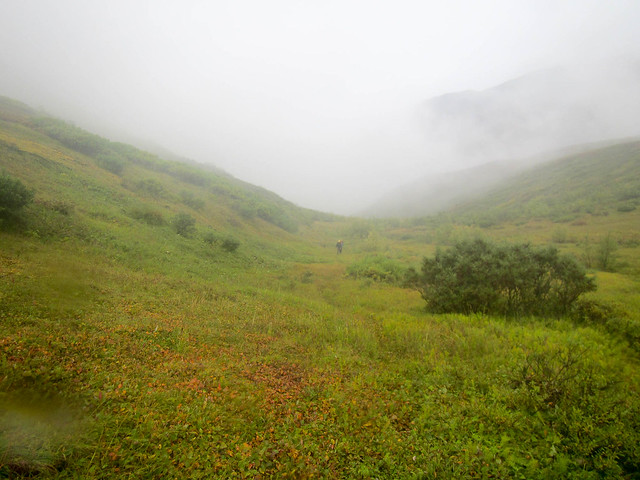
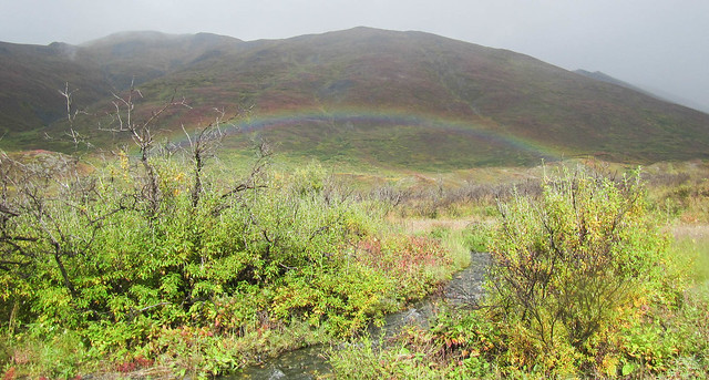
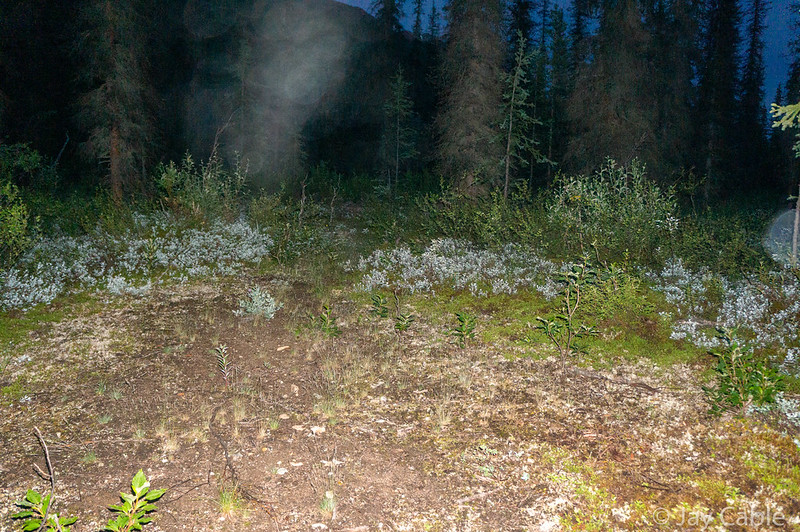
We crossed Fog Lakes as a rainstorm slowly blew in, climbing up over a small hill, to camp in the rain on an unnamed creek as it got dark.
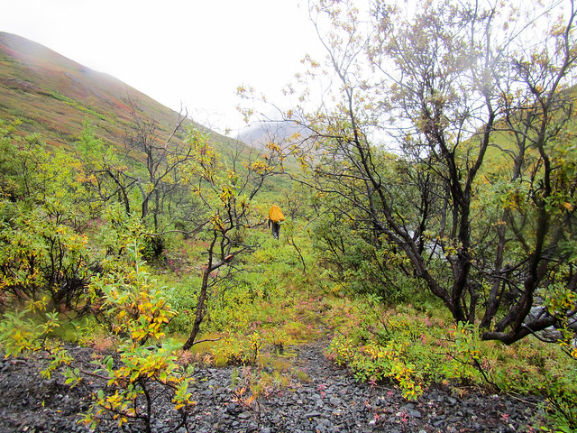
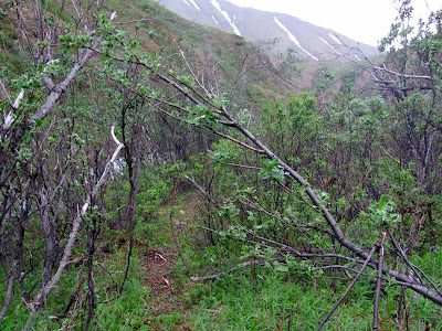
In the morning it was dry and sunny, and we hiked up into Tsisi Creek, over to Kotsina Creek, and camped near darkness at the divide between George and Goose Creeks.

Heading down to Kotsina Creek

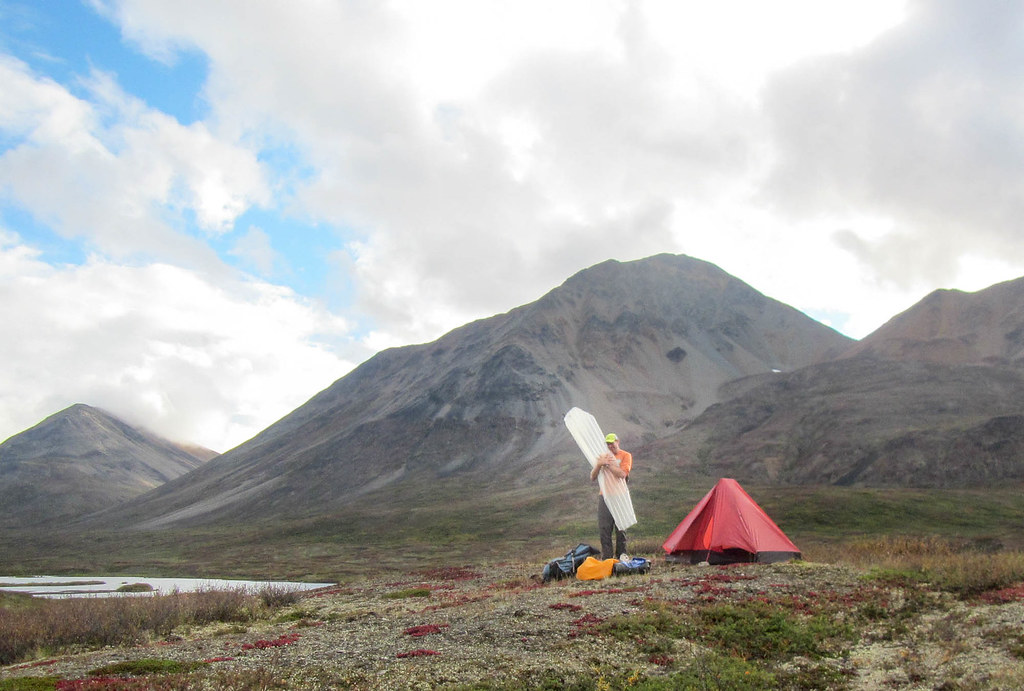
Camping between George and Goose Creeks
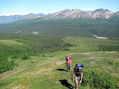
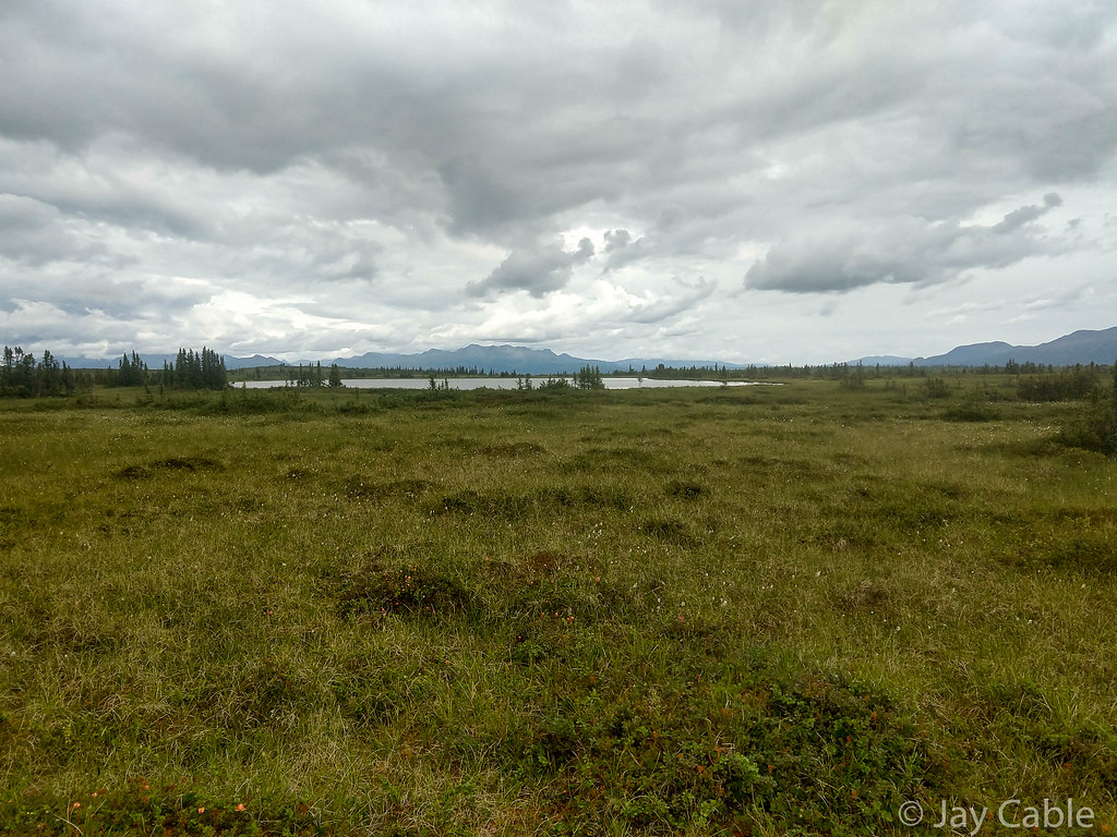
The walking was mostly great, and I enjoyed the sun, briefly hiking in my underpants to let my pants dry. We went to sleep to clear skies, and woke 4 hours later to an icy tent. Hiking on Goose Creek was great, but alas it turned away from our destination and we had to head up into the dwarf birch near Busch Creek on some small hills leading to the Black River. Shortly after crossing Busch Creek we had our first bear encounter as we startled a medium sized brown bear who took off bounding up the hill like we were the devil incarnate. Tom and I both wished we could run uphill that fast; that bear flew. By midday we hit the start of the ATV trails, which turned out to be a small road that started semi randomly in a huge open swamp.

Civilization!
Near the swamp we had our second bear encounter as a mother bear and two large cubs saw us way in the distance on the other side of the swamp and again ran away at top speed. Hurrah for well behaved bears!
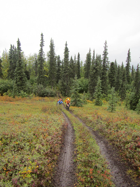
A few miles down the road we ran into some footprints. Later we were to learn Matt K, Brian P, and John P had taken this trail over to and up the Little Oshentna, crossing over Horse Pasture and into Caribou Creek.
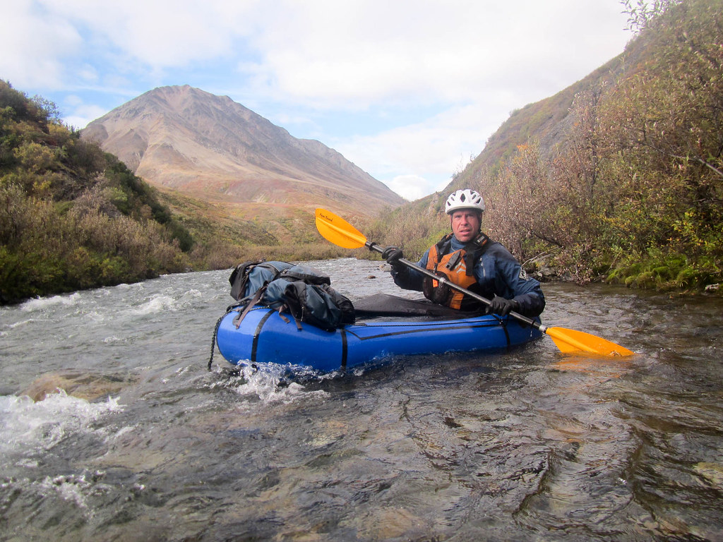
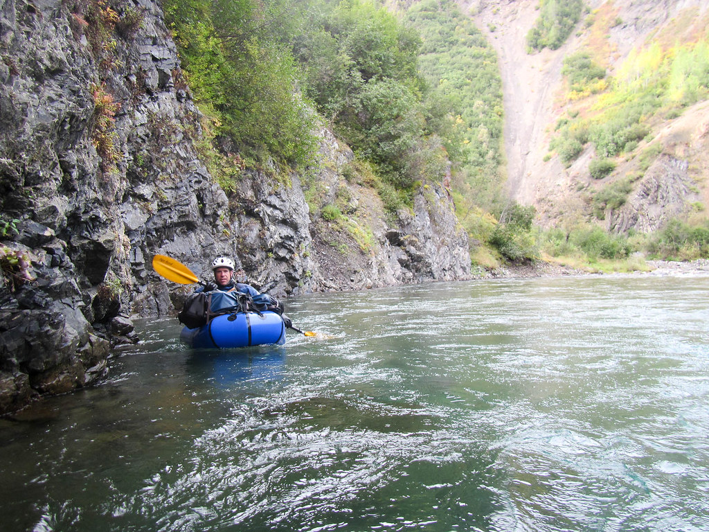
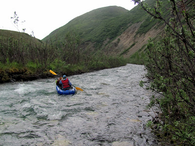
The trail ( actually a dirt road) was great walking, and soon we zoomed to the Black River, where we had to inflate and cross one at a time. I had brought 100ft of p-cord to shuttle the raft back and forth, but alas, that much p-cord turned out to be a big pain to manage, and after several attempts and one huge mess of tangled lines we managed to both get across.
Several hours later we had to cross the Oshentna, but this time we just both got in the boat at the same time. Alas, after deflating we learned there was another channel to cross. Sigh. Soon we were across, and were back on the fast walking mini-road, only to take a wrong turn and end up at the Oshentna again, headed in the wrong direction.

With some backtracking we made it to the correct trail, which alas became a bit of a muddy mess.
In the evening we camped at the intersection of two ATV trails in a little pass, on a wonderfully clear and beautiful evening.
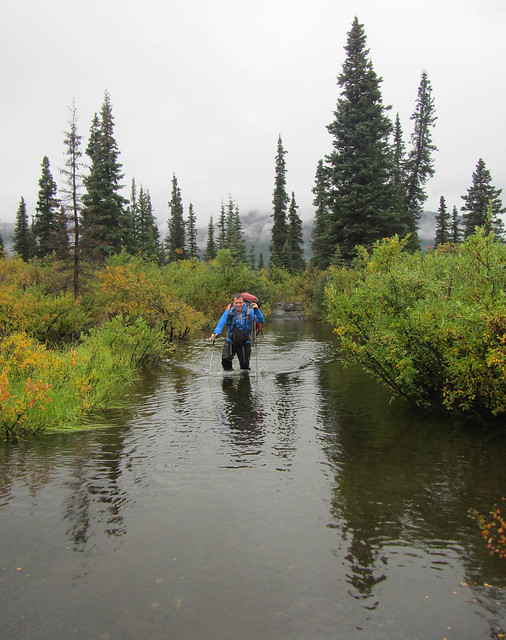
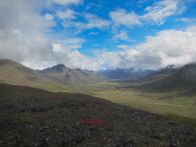
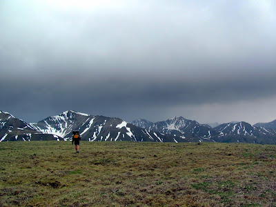
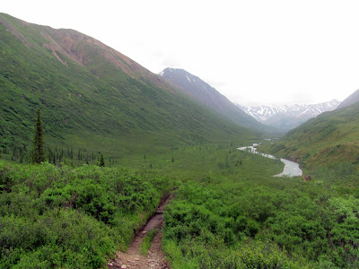
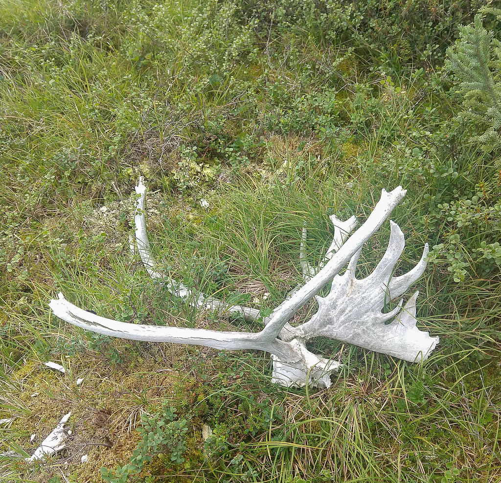
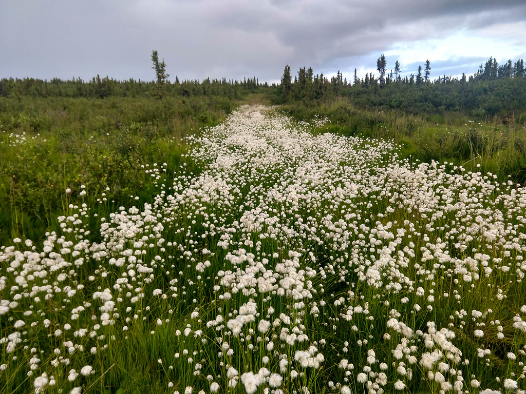
In the morning we awoke to a hard frost with chunks of ice on the tent, and clear skies. We zoomed along attempting to stay warm until the sun hit us. We followed Yacko Creek though some mines, passing some old mining equipment, through some much more active mines, and eventually out into a beautiful green valley where we surprised a small pack of wolves enjoying the morning sunshine. Our plan at this point was just to push though and hopefully finish in the early morning, ideally making good time on the great ATV trails.


Tom drying stuff out winter classic style.. but more dusty
Fortunately the trails remained great, but it was oh so hilly, hot, and dusty. My feet were not enjoying the hard surface. We had two biggish climbs, then topped out at “Monument”, before descending to Crooked Creek. From the top of Monument we had cell service, so I called my wife Nancy and my daughters to say “Hi” – the joys of modern life! From there we had intended to take the Crooked Creek trail, but alas, we wasted several hours trying to find the trail before bailing and walking around it to Belanger Pass trail, swacking though dwarf birch in the almost dark before hitting the trail. In honor of getting back on the “easy walking” we had a freeze dried meal each, then walked in the dim light up a thousand feet or so vertically, to descend down a wide road to a muddy and mindlessly straight Squaw Creek trail.

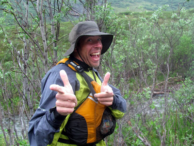
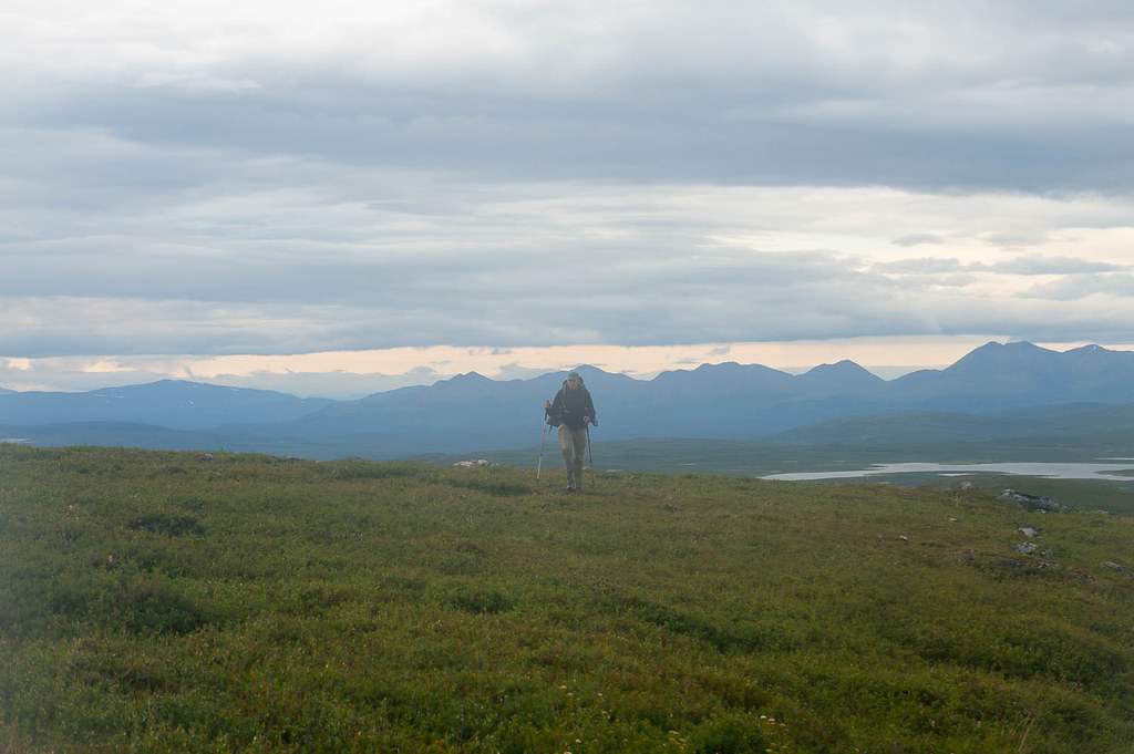
Early morning manic Belanger Pass trail selfie..
It was surprisingly warm up high, and more surprisingly, pretty cold after we descended.

Squaw Creek trail, in one of the less muddy sections.. so straight, so boring!
Squaw Creek Trail was a blur of mud and mist in the distance that ended finally at 6am when we turned off to bump into some folks I had talked to at the start eating handfuls of donuts. Now minus the donuts they were huddled around a fire, looking warm but glued in place. Apparently there was yet another beaver swamp and one of their group had fallen in at 3am, getting completely soaked and resulting in a nice big fire and naps for the lot of them.
The donut guys, in happier, drier times.
I moved on quickly, as otherwise the lure of the warm fire would suck me in, and soon it would be me napping.

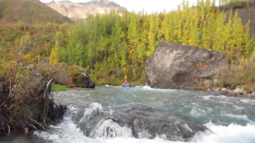
We inflated to cross the beaver swamp, only to find it was actually very shallow for the most part, too shallow to paddle, and only deep in one narrow section dug by ATV traffic. Then it was up and over the side of Gunsite mountain, then down to an abandoned section of the Glenn Highway, where we pounded out several miles of pavement, followed by a few more miles of sleep-deprived wandering on social trails before finally reaching the finish at Sheep Mountain lodge.


Lifelike pavement walking action!
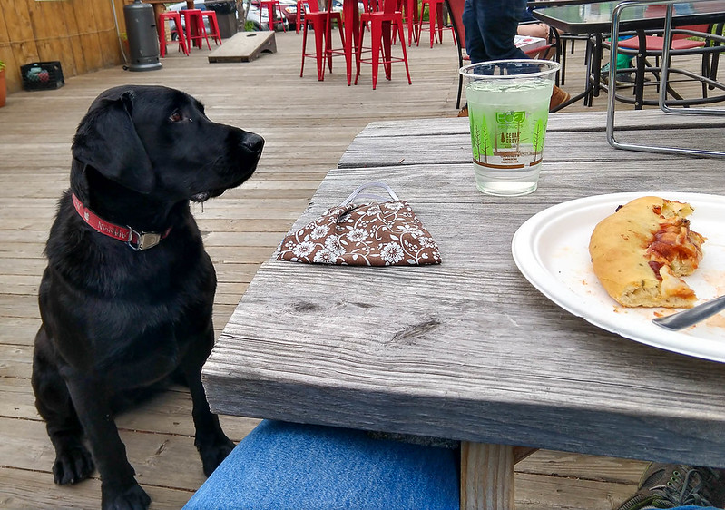
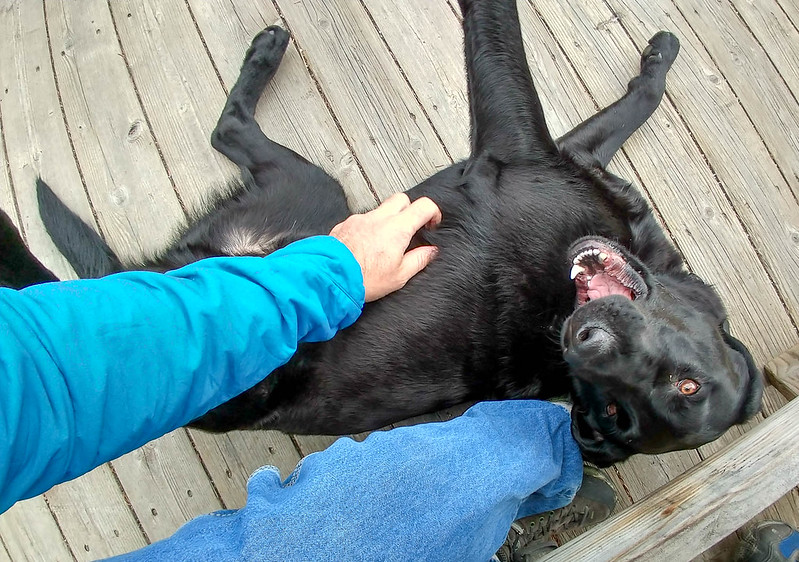
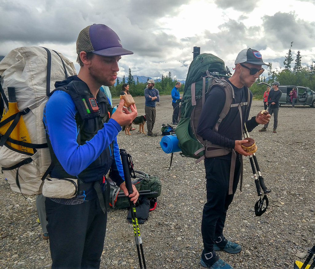
Amanda was there to meet us with Professor the Black Lab, and we were back in civilization, with food, showers, and all the comforts of life. Hurrah! As we signed in, I was surprised to see just two groups (four people) finished ahead of us.
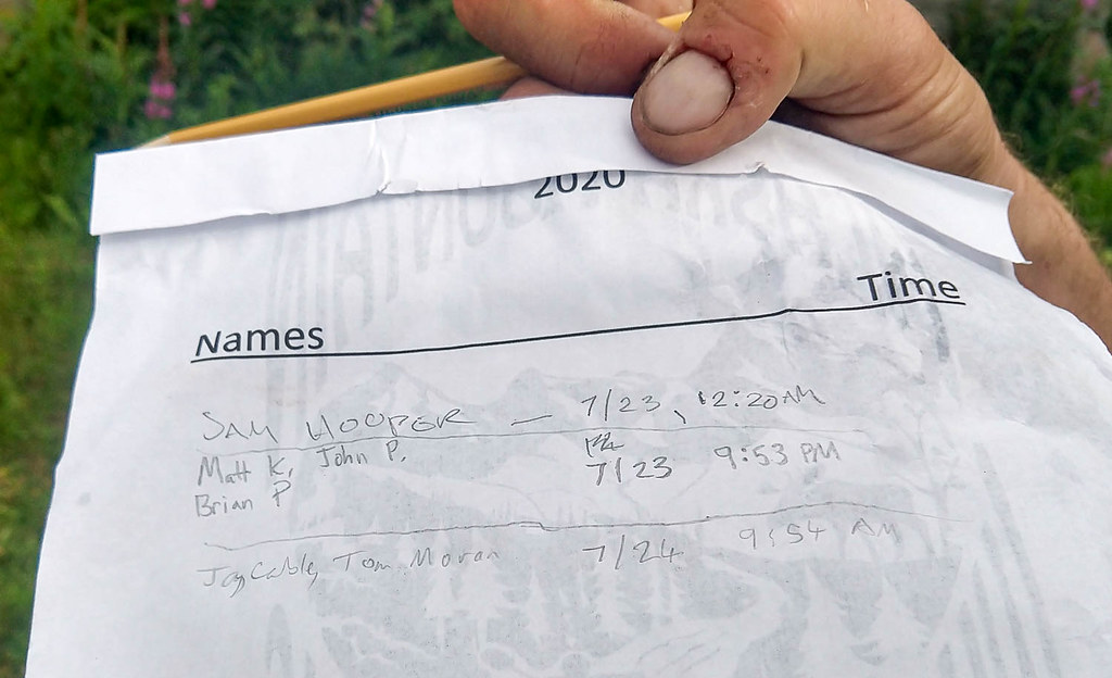
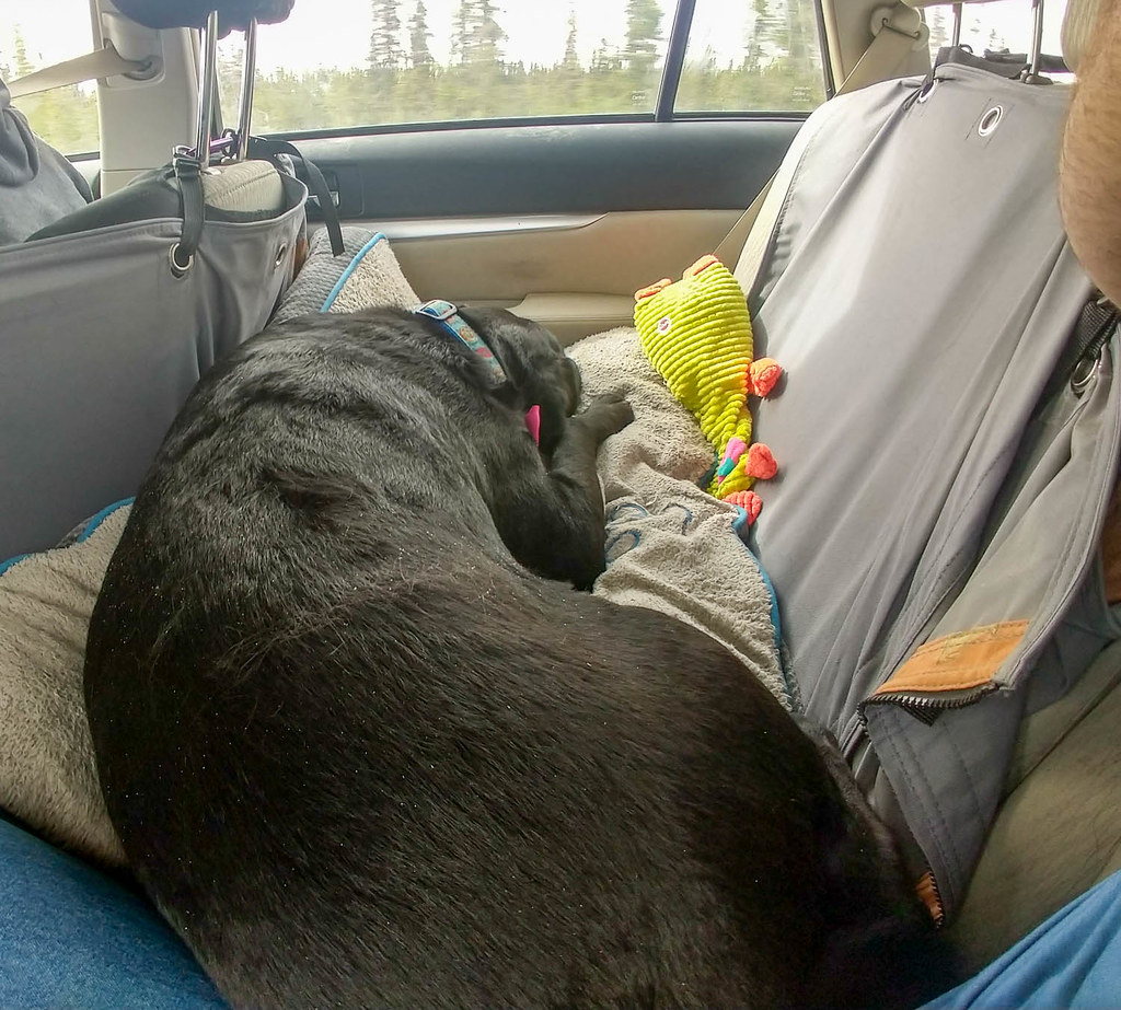
Amanda, being the wonderful person she is, had booked us rooms (I even got my own, double yay!), and had food for us – triple yay! After a nap, we hung out with the other groups who finished. Alas, the winner and new record holder and master packer (his pack was tiny!!) Sam Hooper was already long gone, but Matt, Brian, and John were there and we chatted a bit. Then we took naps before meeting the next group coming in: Luc Mehl, Lee Helzer, and Alan Rogers. Then it was dinner, and more sleeping before the long drive back to Fairbanks, chauffeured by Amanda while I sat in the back seat petting ‘Fessor.
We made a brief stop in Delta for weird Russian foods from the IGA for my daughter Lizzy, and a burger for Tom, before finally making it back to Fairbanks.
Квас!
Gear
We took a single packraft. That was a mistake, probably, as we didn’t get any breaks for our feet. If I do it again, I will take my own boat.
We took a small 3lb tent, a Tarptent Rainshadow. It is a great tent, but too small for two adults to sit up and do things like fix their feet. This slowed things down a bit. I would take a different tent, or at least a tent that two people can sit up in at the same time. Perhaps a mid, as the bugs were almost non-existent for the most part.
We both brought sleeping bags and closed cell foam pads. I brought a 30 degree bag I originally got for my daughter lizzy. It worked great.
We took an older MSR Pocket Rocket and a biggish titanium pot that is the lightest pot I own. I would have taken my MSR Reactor, but it is on the fritz and takes forever to boil. In retrospect, I would have taken a Jet Boil or something that boils water faster. We had a freeze dried meal every evening, which is the only time the stove was used.
Foot stuff – we brought ¾ of a roll of Lukotape, and used it almost completely up, and lots of a homemade hydropel replacement that our friend Beat made. I also had a small amount of Sportslick. The hydropel replacement works great, much better than anything I have used before (at besides hydropel 🙂 ). Next time I will bring lots more.
We both brough trekking poles. Well worth it for the creek crossings, of which there were lots.
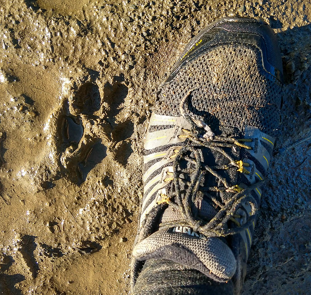
Shoes – I used inov-8 Roclite G 275 and they mostly worked great, until they didn’t. They have weird non-eyelet things for the laces, and they were almost completely destroyed by the end, and I had to cut up a sleeping pad to cushion the front of my shoes for the last 30 miles. I wore a thin liner sock and a thick outer sock. Mostly I was happy, I just wish those shoes’ lacing system was a lot more durable. I would use something else next time.


Not impressed by the lacing system..
I took a HMG 4400 pack. I have a love hate relationship with that pack. At the upper 30lbs of weight I had in it, floppy and uncomfortable would be the best words to describe it. After 25 miles I had to stop and repack as it was so uncomfortable. Also, I wish it was made out of VX style fabric rather than dyneema as it seems to be aging really fast. However, it is light, and it is laid out well, with good pockets. And my other pack of a similar size is around 1lb heavier. I don’t think I will take it on trips where I am carrying more than 30 lbs again. Maybe I am just a wimp.
Navigation – we had print maps of the route, made with Caltopo, and the route loaded on two cell phones, with a Garmin etrex 30 as a backup. Next time I might just leave the etrex at home, as cell phones are much easier to use than the etrex is. The print maps were great for route discussion.
Food
I took about 16 lbs of food, hopefully enough for 6 days, plus 1200 calories of “emergency chocolate” That works out to be a little more than 2.5 lbs a day, and included a freeze dried meal. I bought two of the Expedition Foods (https://expeditionfoods.com/ ) 1k calorie meals and those rocked – they tasted good, and were noticeably more filling with no need to wake up in the middle of the night for a snack. Alas, they are expensive and they have no US outlet and are based in the U.K. The Thai curry was particularly delicious. For the “normal” calorie meals I brought macadamia nuts and little packets of coconut oil to add calories, which seemed to work great. I had about 8oz of either cheese or pepperoni per day, which was great. Next time I might bring twice that. The rest of the 2.5lbs per day was mostly candy bars (mars bars, snickers, m&ms, a few granola bars). This was a mistake – I bought too many candy bars and not enough nuts and simple carbs. I was probably short of protein. Next time I think I will bring some powdered recovery beverages, instant breakfast mixes, or something similar – something I can just add to a Nalgene of water and drink. I had brought several packets of chai mix which was wonderful just added to cold water in my Nalgene. I had some electrolyte tablets but didn’t use them. I should have; my feet swelled up huge the last day, possibly due to a lack of protein or electrolytes.
Nancy suggested I add some pilot bread, which was great. Next time I will bring a lot more simple carbs in an easy to digest form like that, possibly with other crackers or chips like Fritos.
My daughter Molly (kids are useful for something!) vacuum sealed each day of food individually, and that worked well.
I finished with a day and half to two days worth of food. Since it took us about 5 days that seems to be about right.
Route
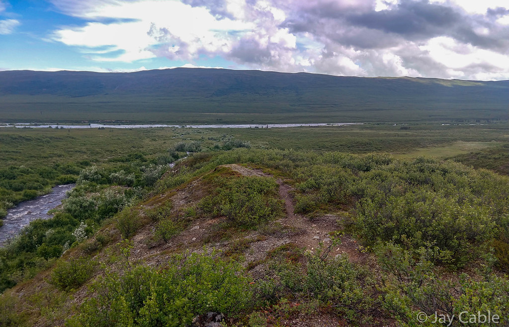
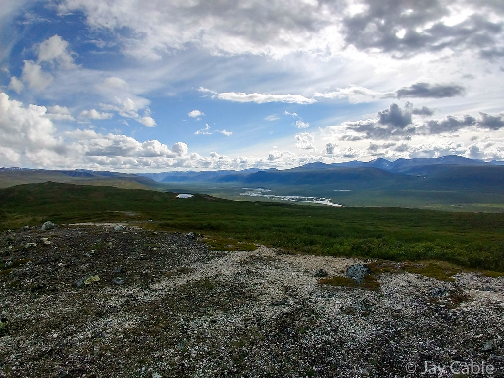
Our route was a mixed bag. The walking was mostly good, besides Tsusena Creek and some of the muddier ATV trails. The ATV trails got boring quickly, though, and it would have been nice to see some of the higher country. Not floating was a bummer, as it meant we were always on our feet while traveling. Next time I think I would try to do more floating, which could be hard if Caribou Creek and Tsusena are both running high. It sounded like Tsusena Creek was continuous class II+/III last year, which might have been more than we were willing to do.
What would I do again?
- Sleeping 4 hours a night was good – we were mostly functional and made pretty good time. It also let our feet heal up and dry off.
- A freeze dried meal a day worked great – some sort-of-real food was very nice
- A tent – a tent was excellent, as it rained a fair bit.
- Trekking poles – I almost didn’t bring them, as they weigh slightly over a lb – like half day of food!
- Leukotaping my feet two days before, completely covering the heel and the front and using tape adherent (tincture of iodine) worked perfectly. The original tape stayed on for most of the trip.
What would I change?
- I would bring a different tent, possibly bigger, maybe without netting, so two adults could sit up at the same time to treat their feet and do other tasks. Perhaps a mid. A HMG mid if I won the lottery.
- Different food.
- Different shoes that didn’t have the lacing system fall apart.
- More foot lube.
- More leukotape – we almost ran out!
- Bring a boat per person!
- Possibly a different pack
- Leave the etrex at home, possibly bring another usb battery instead, maybe a AA powered charger.
- Cut more weight out – my pack was too heavy.
- bring compression socks – my feet swelled up a bit the last day, and got really big when I finished!
- carry my “good” camera in a waterproof bag!
- Probably lots of other things I am forgetting.
After Affects
My feet swelled up huge, but otherwise I was mostly fine. I had two small blister on my feet, and one blister on my hand.

My feet though..
Finally
I would like to give a huge thank you to Amanda for driving us around, picking us up, getting me a room at the finish, providing food, and everything else – thanks Amanda!!!
Thanks Tom for accompanying me – it was fantastic traveling with you!
I would like to thank Nancy and the twins for letting me disappear on this harebrained adventure. Thanks, I love you guys so much, and really appreciate your willingness to let me disappear for a week (or several) occasionally.
I will probably update this post as I remember more things as I remember them.
Luc posted a wonderful write-up here, with as always better words and photos. Plus he made a video!!
2020 Alaska Mountain Wilderness Classic: Talkeetna Mountains from Luc Mehl on Vimeo.
Thanks for reading!
Map