AlaskAcross 2019

June 25th, 2019

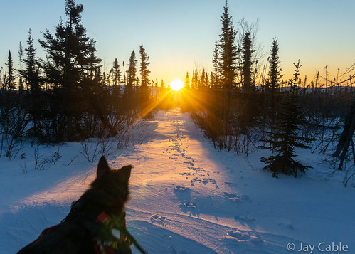
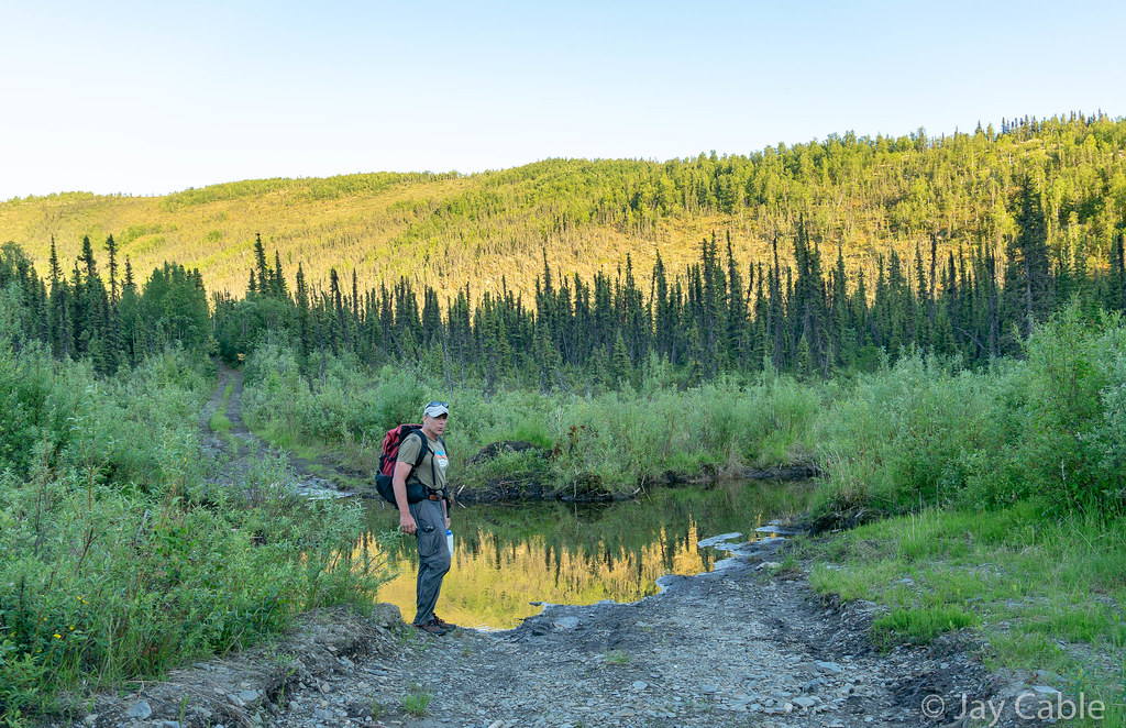
It was near midnight, and Ned and I had just dropped down to an old road, flanked by huge thickets of alder.  It was like walking in a tunnel, but I was oh so excited to finally be walking on a firm surface again after hours of tundra and tussock walking.   As we made our way through the leafy tunnel I could just barely pick out an old camping trailer that has been taken over by the brush. As we got closer I noticed a weird grunting groan was coming from it.  

I was starting to panic, thinking it was a bear huffing at us.  I started shouting in an attempt to scare it off, and grabbed some rocks to start chucking in case something came rushing out.  Ned, perhaps more wisely, shouted “Mark, is that you?”, thinking that perhaps Mark Ross, the AlaskAcross “promoter” who had taken a route around this patch of brush, was playing a practical joke on us.  After a long minute of looking in the brush, and realizing the noise wasn’t changing regardless of our shouting or a rock or two chucked, I moved around until I could peer into the trailer. Inside, a big porcupine was chewing on the floor in a loud but very non-threatening way.   Crisis averted, we headed down the trail with an extra adrenaline powered skip in our step. 


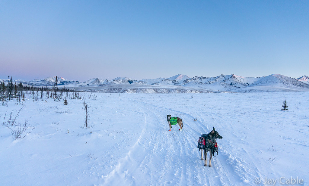
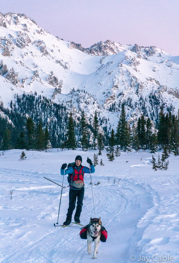
AlaskAcross is a local point-to-point human powered unofficial “race”.  It was traditionally from Chena Hot Springs to Circle Hot Springs, but Mark Ross has been experimenting with other routes.  This year’s route was from mile five of the Dalton Highway to the Wild and Free homestead in Eureka.  In a straight line it was about 46 miles, but unlike the classic route, there were no floating options (that I was aware of, anyway), so it was all walking.   I had marked out a route sticking mainly to ridges, which I hoped would have good waking. Given that it was around 60 miles, I expected we were looking at 30 hours of walking.   My default partner for these events, Tom, was away in Valdez so I emailed Ned Rozell to see if he was interested, and he emailed me right back saying he was in.  Hurrah! Ned is a calm, steady walker who has done some amazing things in Alaska’s backcountry, including walking the entire length of the pipeline twice. 


The morning of the event, Ned and I drove out to the Dalton, where we met up with a few other folks, including Mark Ross, the “promoter” as he likes to be called.  Mark was in fine form, wearing a hat that appeared to be a wolverine hide that he called “wolfie”. 

Alaska Cross 2019

Mark always comes off as slightly crazed, and he was in fine form.  Something can be said for the craziness, as he has been rallying folks for these long walks since at least 2007 – that is more than a dozen years of folks wandering through the wilderness getting a bit out of their comfort zone. 

Alaska Cross 2019 Alaska Cross 2019

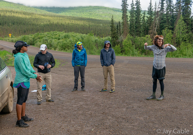
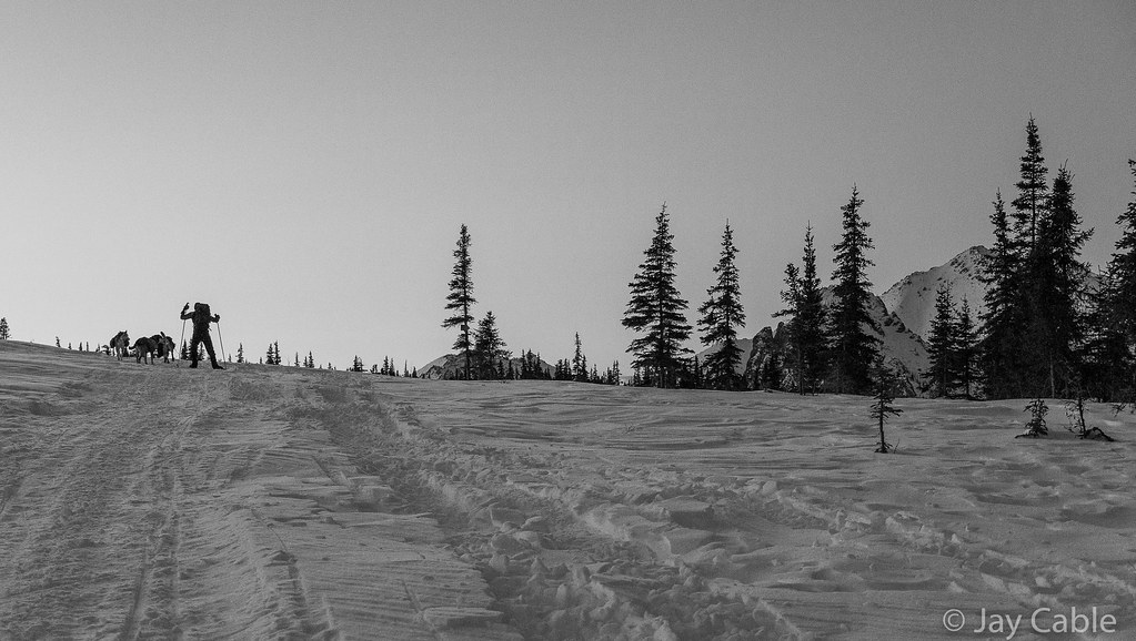
After a bit of futzing around, the eight of us took off. 

Alaska Cross 2019

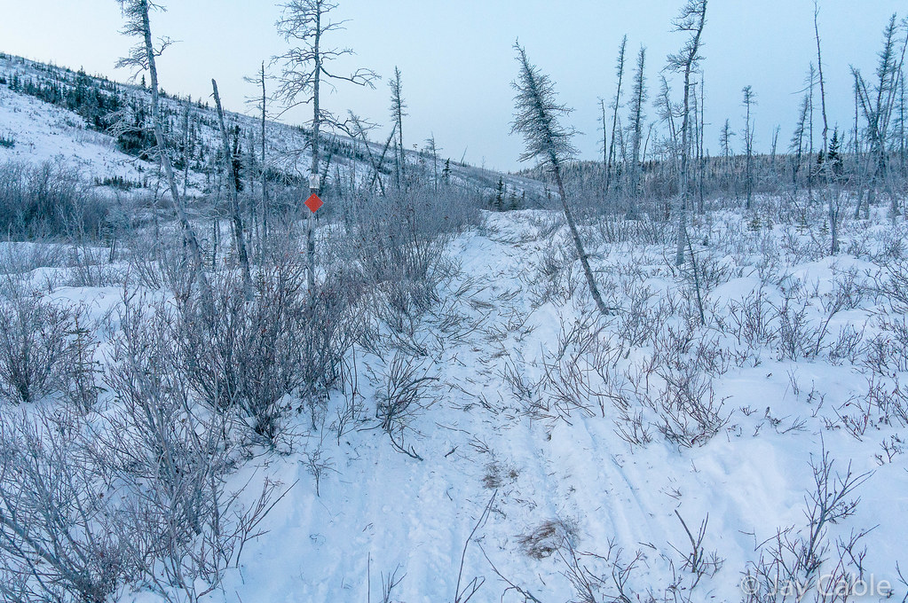
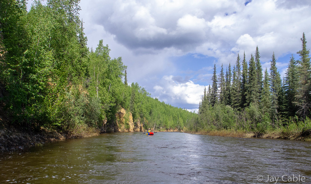
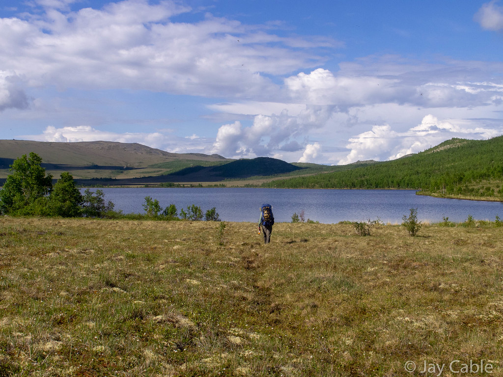
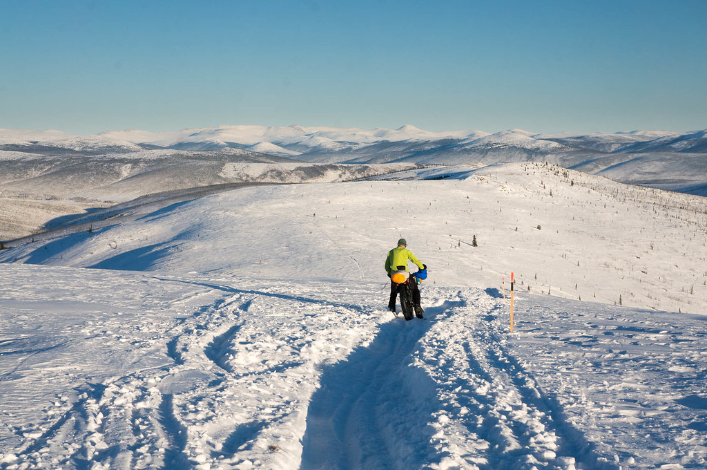
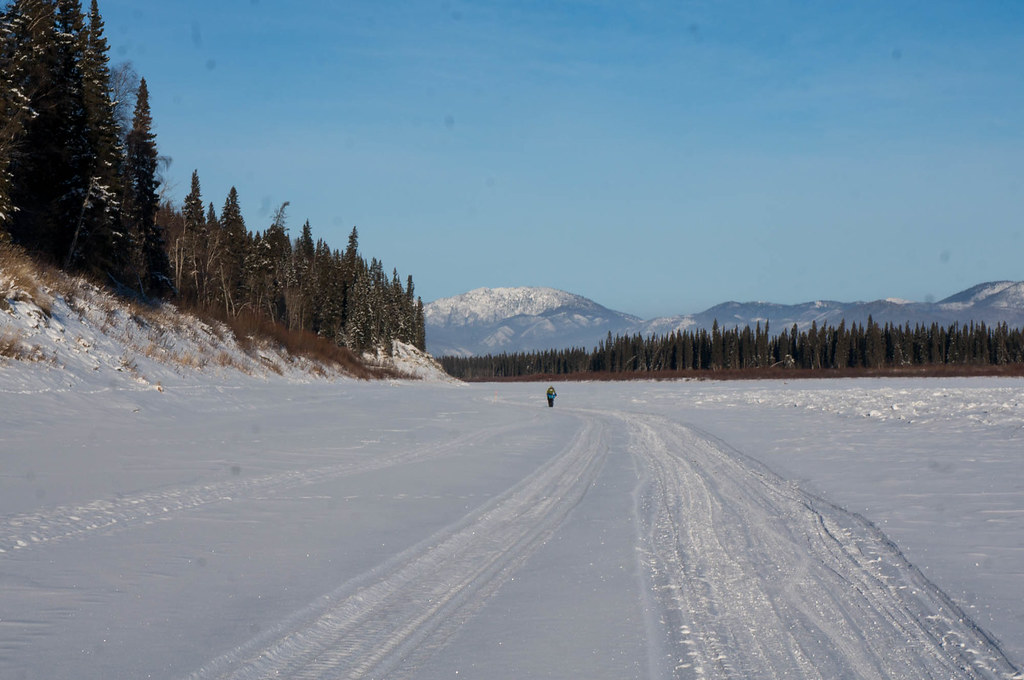
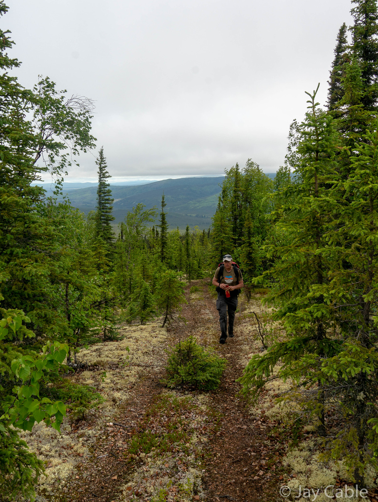
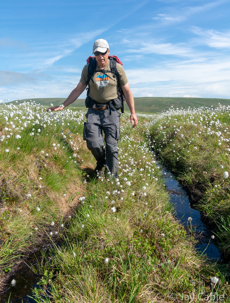
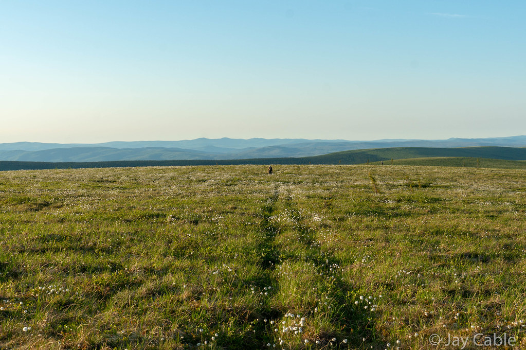
Everyone headed down a narrow ATV trail, winding through the lowland and up to a ridge that we would take for nearly 25 miles. Gradually the pack broke up, and Ned and I were by ourselves, except for the distant dots that were Tracie and Brian, the eventual winners.   The hike up the ridge was pretty good, but the ridge quickly turned into endless tussocks and cotton grass.

Alaska Cross 2019 Alaska Cross 2019 Alaska Cross 2019 Alaska Cross 2019

I am not sure what the proper name is for the white flowering plant that grows on the tussocks [multiple species of the genus Eriophorum — Editor], but it was everywhere.

Alaska Cross 2019

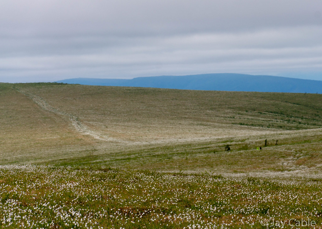
  Fortunately, the walking wasn’t bad, as there was a nice ATV trail along the ridge, except for a few miles that were, alas, very brushy.   It was very tussocky though, and would have been truly miserable if the ATVs had not flattened out the tussocks.

Alaska Cross 2019 Alaska Cross 2019

Twelve miles or so in Mark Ross appeared out of nowhere and joined us for the next 20 miles. 

Alaska Cross 2019

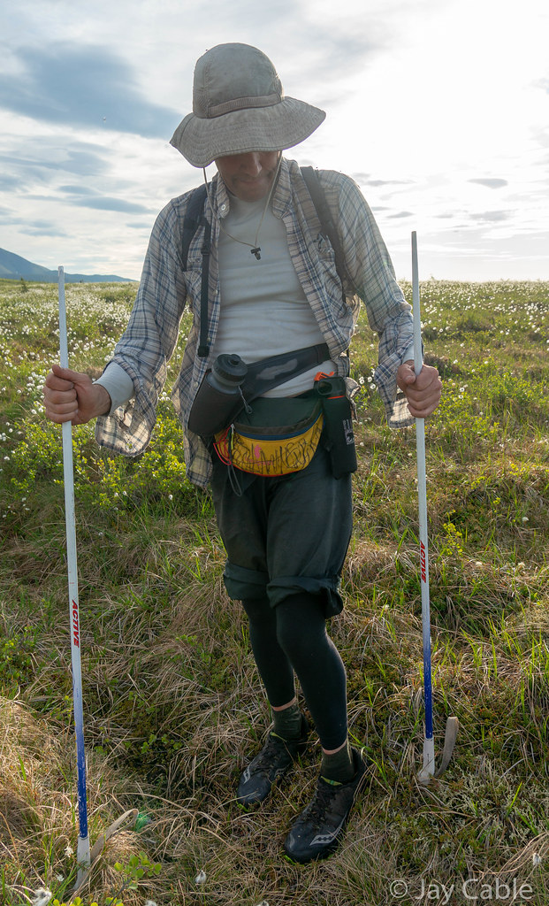
Apparently he had found what he thought was a great route, which included a different way up to the ridge.  He was pretty surprised to see us and was irritated to know that everyone was ahead of us. Mark added to the adventure, as his “real” job is as a naturalist at Creamer’s Field, and he has a wealth of information on animal life in the boreal forest.   At one point in the late evening he and Ned stopped to measure the active layer [meaning the depth of the thawed soil above frozen ground, if you’re not from around here — Editor] with his hiking poles in and out of the ATV trail.  Mark had tactically removed the baskets from some ski poles and was using them as trekking poles, which made them easy to sink into the soft tundra and great for measuring the active layer, but not great for walking, so Mark was using them upside down or in “Tundra Mode” as Mark called it.  

Alaska Cross 2019

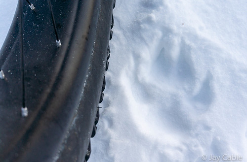
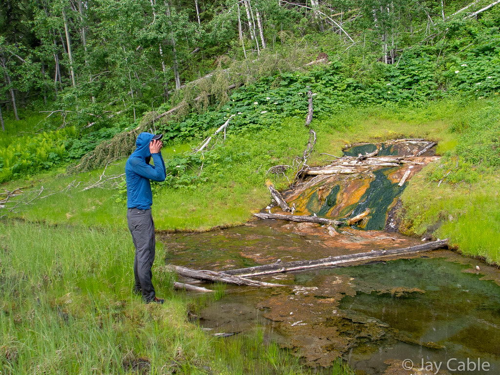
Later, when passing a small thermokarst [I’ll let you look this one up — Editor] pond, I stepped over a small frog, and pointed it out to Ned, who was excited enough to take a photo. 

Alaska Cross 2019

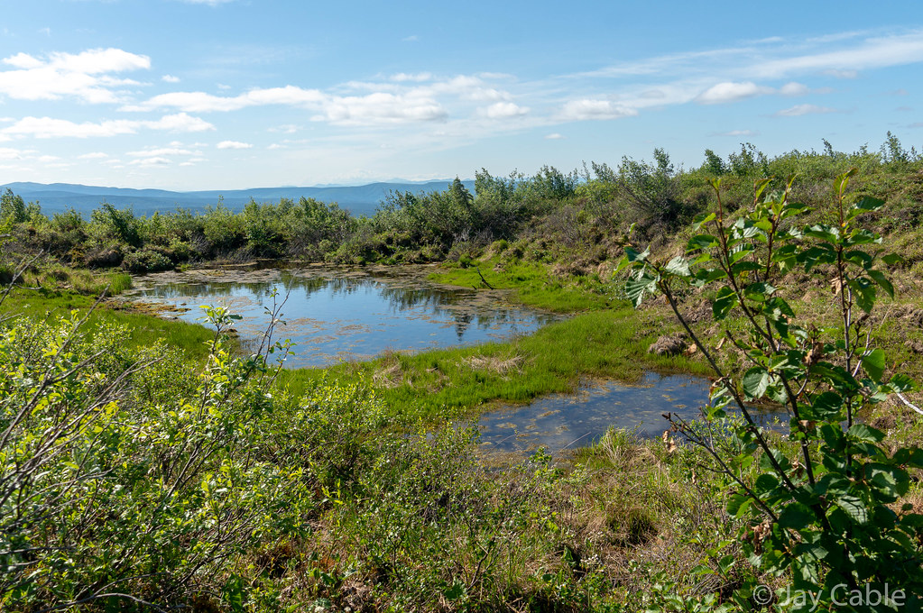
I guess wood frogs are not very common at 3.5k feet, well above treeline. There was then an extended conversation on how the frog could survive, with Mark providing a timeline of the exact terminal temperatures the frogs could survive, and how scientific thinking has evolved over the last 30 years, and how they can survive body temperatures down to 0°F.  Life must be harsh as a frog on a ridge covered in snow for six` months.. 

Alaska Cross 2019

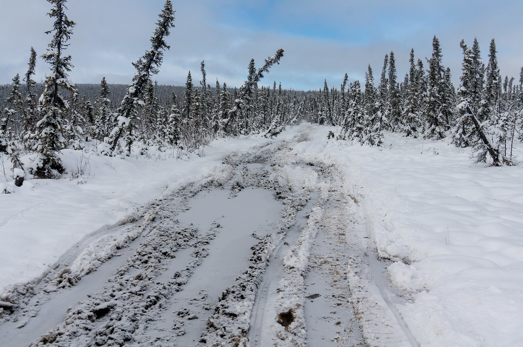
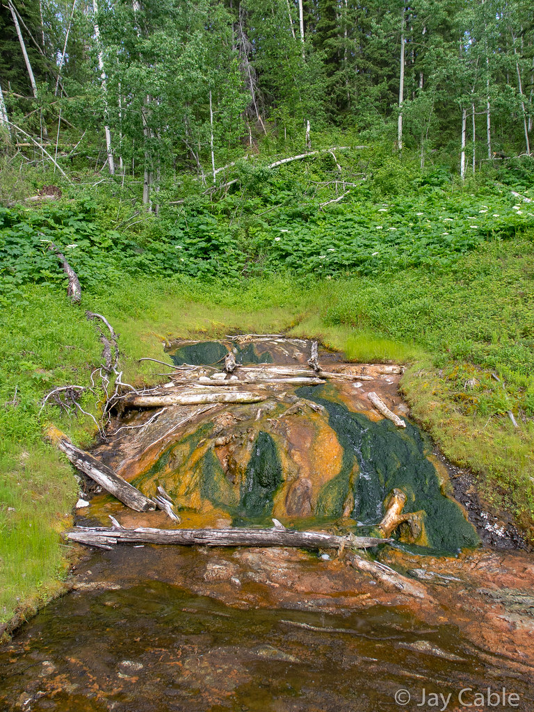
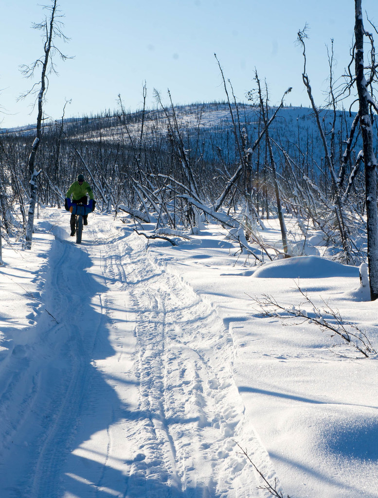
Eventually we dropped off the ridge onto the “Chocolate Creek Trail” which I had been told was nice enough to ride a bike on.  It turned out to be an old road, probably put in to an antimony mine on Sawtooth Mountain, a ridge above us. Our first few minutes of enjoying the fine walking were marred only by the terrifying porcupine. 

Alaska Cross 2019

In the 1950s and 1960s, Joseph E. Vogler and the Killions hauled 500 tons of antimony out of the mine before the market collapsed overnight, and they left it semi-intact. Apparently at the top of the mine there are tons of antimony ore in rusty barrels still sitting there.   Joe Vogler was a political figure in Alaska in my youth, and the leader of the Alaska Independence Party, which had seceding from the U.S. as part of its platform. He was killed when I was in college, and his body wasn’t found for several years, before showing up in a gravel pit north of town.   Conspiracy nuts still think the CIA killed him to prevent Alaska from leaving the union. Walking the old mining roads made me feel like I was walking part of Alaska’s history – I was walking the roads that gave Joe Vogler his first start.

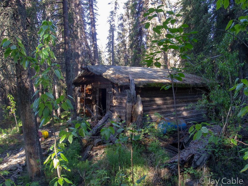
All that was left was an old road, a very overgrown runway, and a very creepy looking shipping container on wheels set up with bunk beds.  We poked our heads inside the container, and I was surprised to see the door still latched. When I opened it, a huge cloud of bugs swarmed out. Alas, it was dark with no windows, and looked like it had a thick layer of mildew all over everything, so my motivation to poke around more and take photos was very limited.  

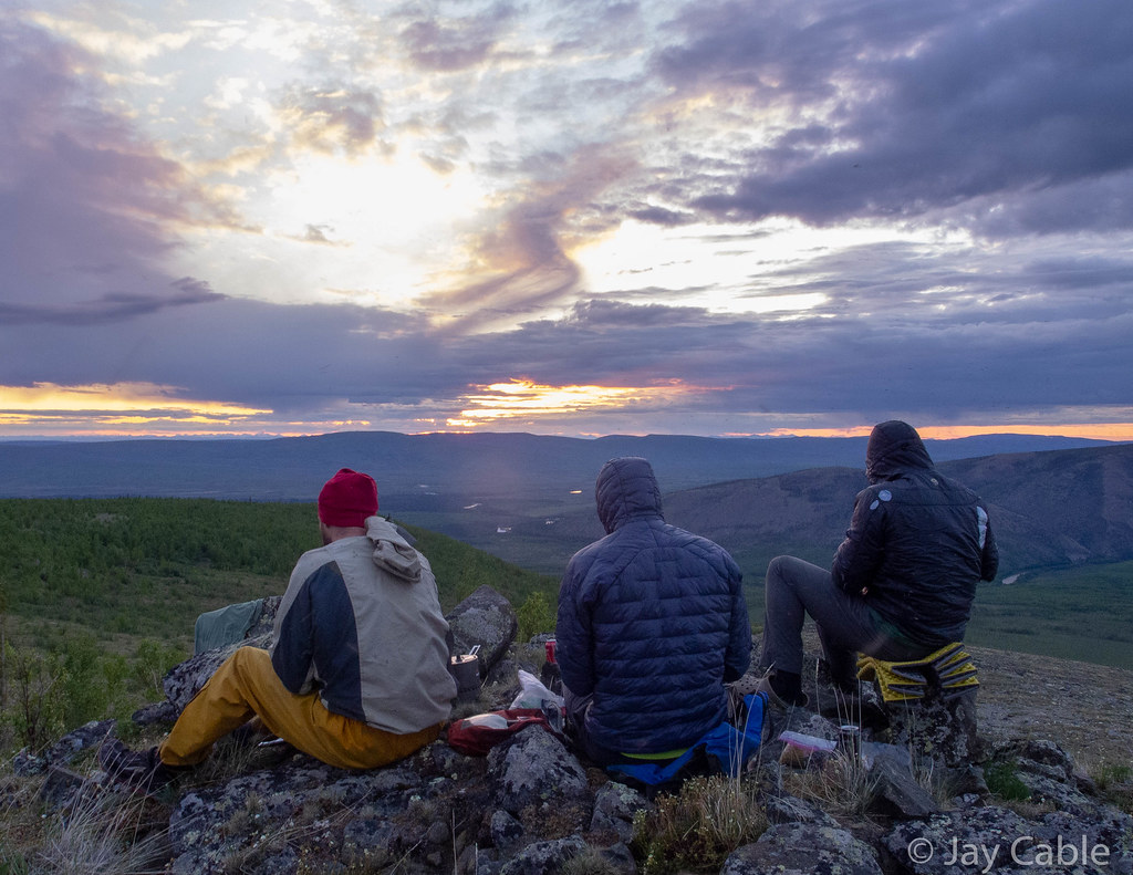
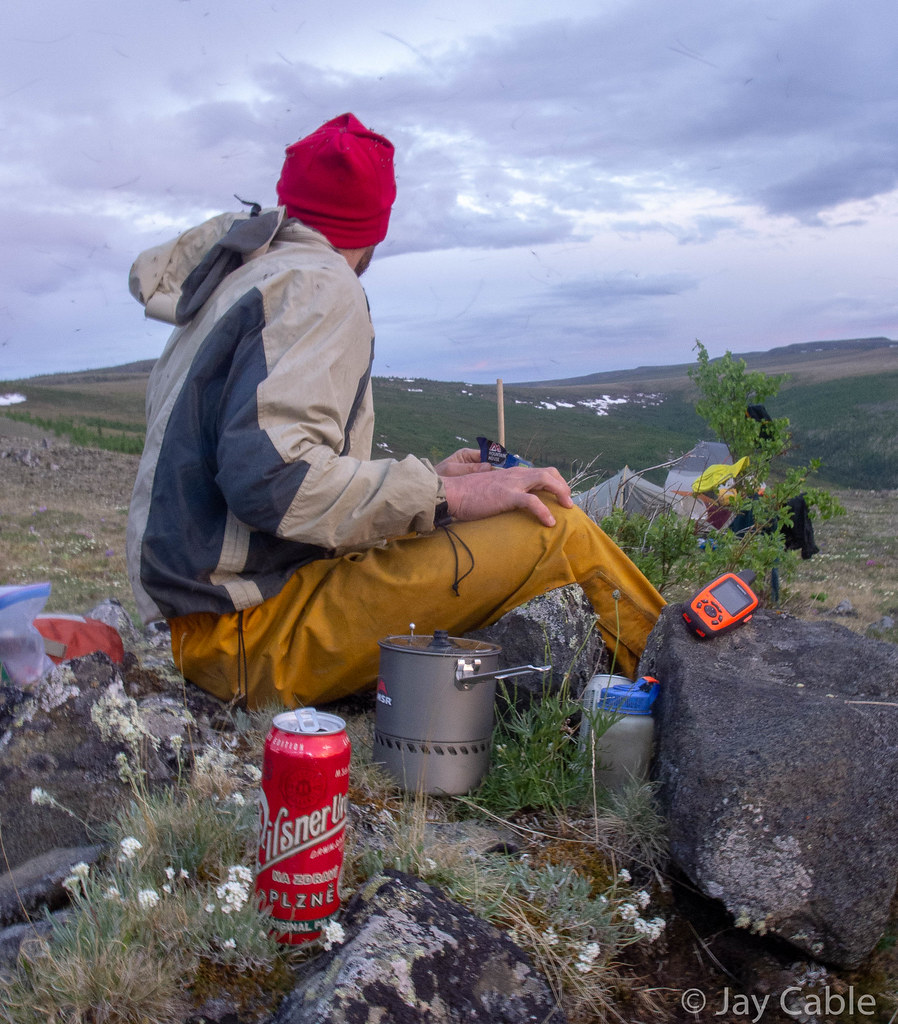
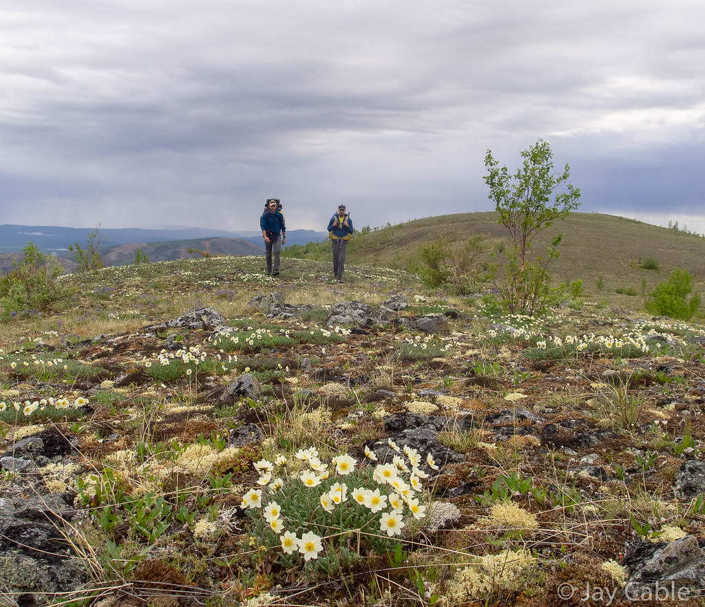
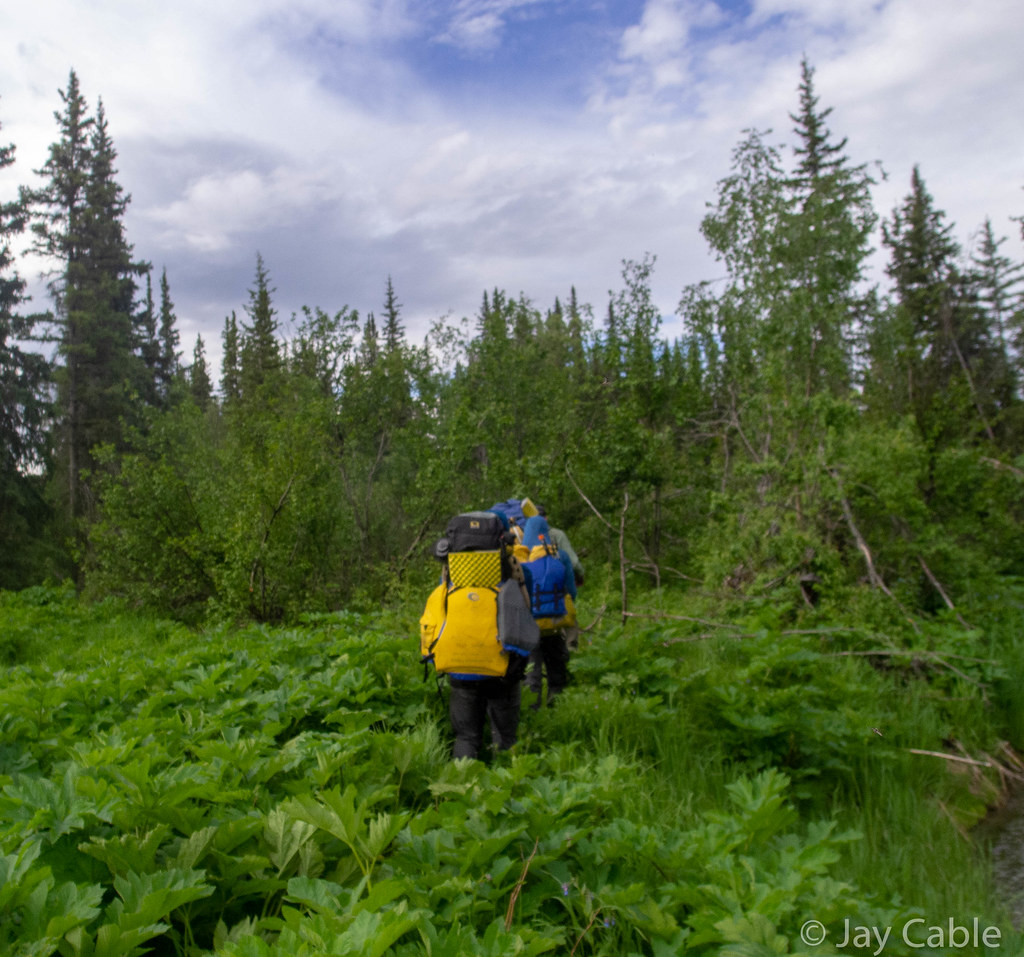
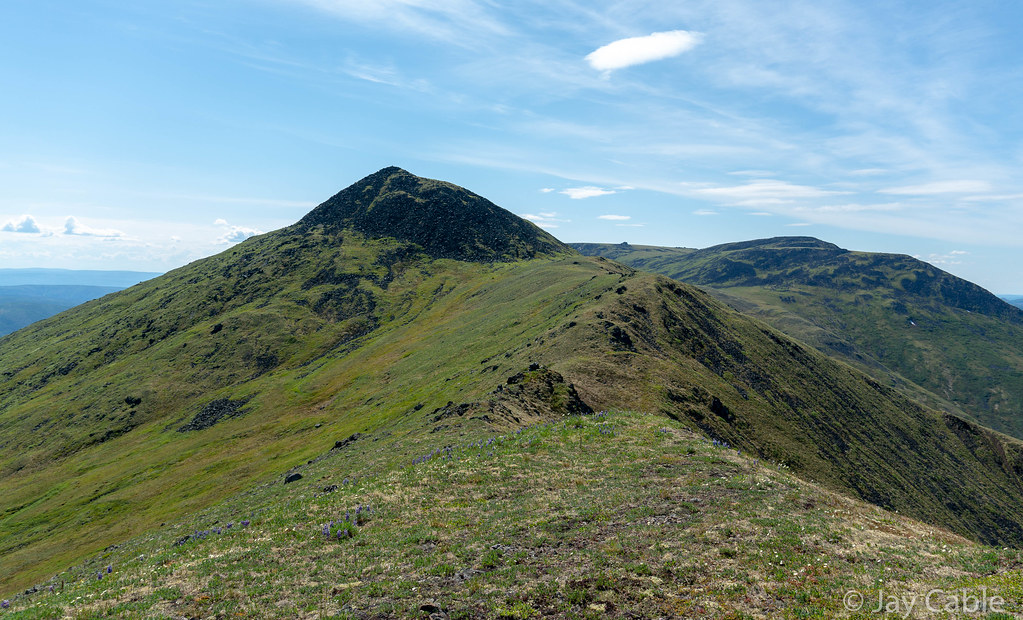
A few hours later, Mark dropped off after pulling on a balaclava and saying he was going to take a nap.   Ned and I trudged onwards, eventually ending up near Quail Creek, and after a bit of route-finding confusion we found ourselves walking through a quiet mine at 7am.  It was very tempting to go knock on the bunkhouse doors and ask about the best route into Eureka, and maybe even get a cup of coffee, but we resisted, We walked through the silent equipment, eventually finding an ATV trail heading up Quail Creek, but alas it petered out.  Soon we were bushwacking and skipping from game trail to trail, working our way up Thirteen Pup Creek. Pup is apparently a miner’s term for a very small branch valley or creek. Eventually we reached our final ridge, Elephant Mountain, a series of little peaks that are connected together.  I was nearly out of food at this point – apparently my plan of 3000 calories of energy bars plus three monster cookies from Bun on the Run was not going to work. Climbing up the ridge was hard work on our slow legs, but we made it.

Alaska Cross 2019 Alaska Cross 2019

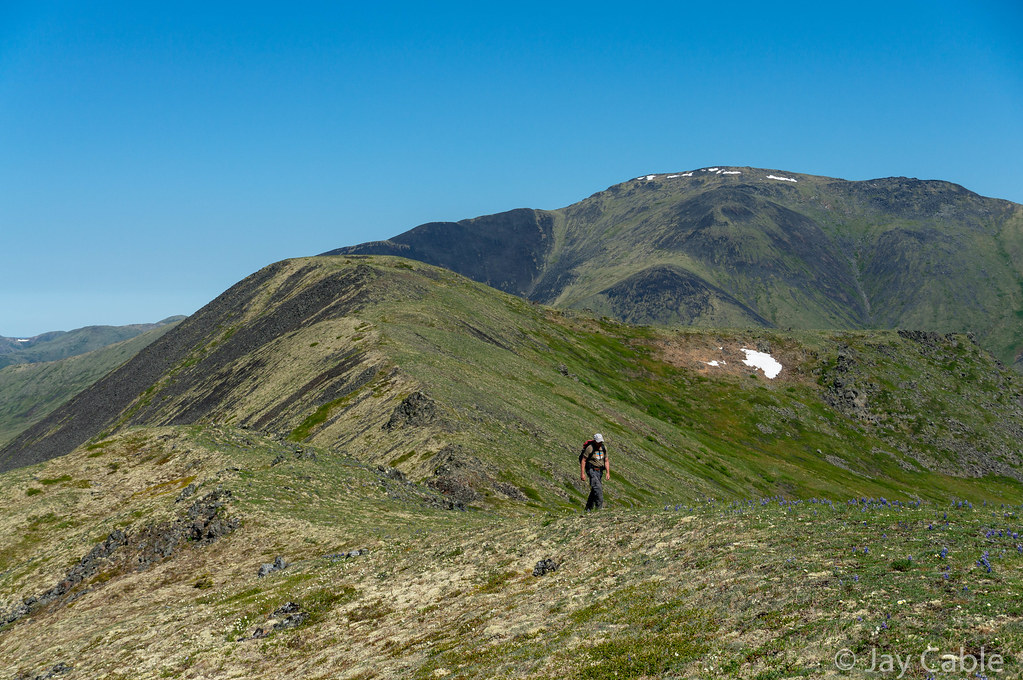
I was pretty confused about why Elephant Mountain was called what it is – when looking at it on a map it doesn’t look anything like an elephant.  Stupid miners! Ned pointed out at one point that the northern ridges that are all exposed rocks had lots of little Elephant faces in them, thus probably the name.  Silly miners, actually looking around them at the rocks instead of trudging head down though the tussocks!   

Alaska Cross 2019


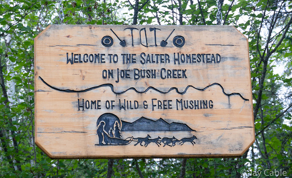
On the first ridge of Elephant Mountain I inreached Nancy (my wife) to let her know that we were six hours out.  Alas, those six hours included two half-mile-long tussock fields, a bushwack though alders thick enough I couldn’t see the sky at several points, and a winding spruce forest that seemed to never end before finally hitting a dirt road that led us to Eureka and the Wild and Free homestead.  

AlaskaCross

My friend Trusten was there to meet us, and I was so excited to see him. And he had pizza! After a few minutes of hanging out, we packed up and drove down the road to the Tolovana trailhead where we camped until morning, then finished up the drive home. Thanks Trusten! 

Alaska Cross 2019

A huge congratulations are due to Brian and Tracie, who came in 12 hours before us and rocked the course! 

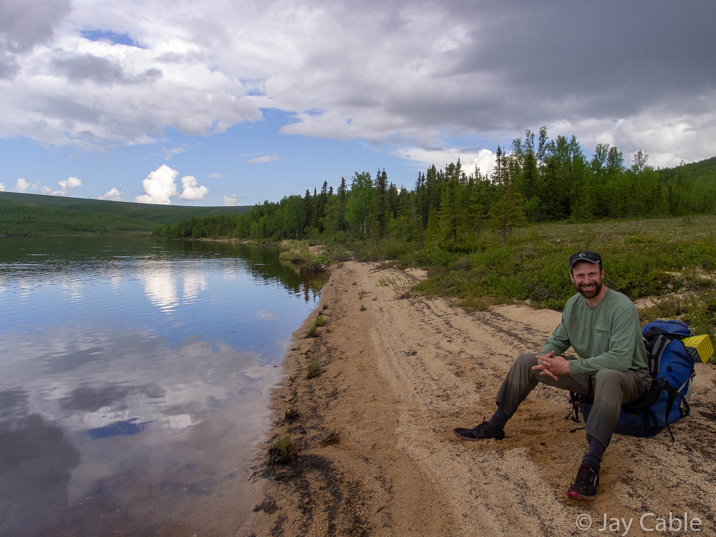
A huge thanks to Ned for his company on this long walk – you rock Ned, I couldn’t have asked for a better traveling companion. 

1.) Brian Atkinson & Tracie Curry            26hr 38min

2.) Drew Harrington & Chris Miles          29hr 13min

3.) Mark D. Ross                                      35hr 59min

4.) Jay Cable & Ned Rozell                      37hr 18min

5.) Scott Brucker & Steve Duby      (bailed to Elliot Hwy mi108)

Things that worked: 

  • I carried a bike bottle and a small ¾ liter water bottle.  There was lots of water around, so that was more than enough.  Perhaps later in the season that would have been a problem. 
  • My shoes – I have some “special” Montrail Mountain Masochist II shoes that I love.  I love them so much I bought three pairs when they looked like they were changing the model.  Alas, the model was changed, and these are my last pair of them. So sad. About 65 miles, and no blisters! 
  • Smartphone navigation – I had print maps, as had Ned, but mostly we navigated off an old smartphone of mine with the Lotus Maps app.  It worked great, and kept us on course for the most part. I think the end of the specialized GPS is pretty much here – the apps like Lotus work so much better. 
  • A “real” camera – I brought my Sony Nex-6 with a 12-105 lens.  That camera rocks, and takes much better photos than I can do justice to with my limited skills. 
  • My feet and body held up for the extended walking just fine.  I had been pretty worried that without riding to Nome or doing anything else epic had dropped enough I couldn’t pull something like this. 

Things that I should have done differently:

  • I should have brought more food.  I was going to bring a large bag of Fritos, but alas, my little pack was stuffed completely full.  I should have added an extra 2000 calories at least, as I was rationing my food for the last 12 hours.  It wasn’t the end of the world, but I should have brought more food. 
  • I needed to have brought a slightly bigger pack so I could pack more food (see above).   I was using a small 12 liter pack, and once it had my “minimal” safety gear (small puffy, long underwear bottoms, shell, fire starter, first aid, water treatment, maps, phone) it didn’t leave a lot of room for things like food. I either need to use something bigger or pack better. 
  • I should have taken more photos (shipping container – I am talking about you!!) 

Iditarod Trail, 2018 part 3

September 21st, 2018
Topkok.. Photo complements of Kevin Breitenbach

Phil H. was stopped in the middle of the trail.  We were two miles past the Topkok shelter cabin, in the notorious “blowhole”, a windy section of trail near the coast, 30 miles or so outside of Nome.   It was several hours before sunrise, and a bit windy, with blowing snow across the trail. As I rode up to him, he asked me “Where is the musher?” We had been passed a while back by a musher who was having trouble finding the trail, and I was confused about who Phil was talking about.  

Phil then pointed to a dog sled, sitting on the side of the trail.  Soon after I noticed it, I realized there was a whole team stretched out there in the snow, the dogs curled up in little balls to protect themselves from the wind.

But no musher.

Uh-oh.


This is the third and final part of my write up on the 2018 Iditarod Trail Invitational (ITI).  The first part can be found here.

Kevin and I arrived at Shageluk at 10 am, and after we’d wandered around town a bit, someone directed us to the Lee’s house, where we had sent drop bags and might be spending the night.  We arrived in town happy to be back in civilization, and the first thing I did was use a flush toilet — hurrah! Shageluk is a small town of around 100 people situated with a range of hills on one side and vast open lowland on the other side.  Our plan was to resupply then head on to Anvik, but alas, a light dusting of snow made the trail nearly impossible to find in the flats outside Shageluk.

ITI 2018

The trail leaves Shageluk, follows the Innoko river briefly, then heads out across a series of open swamps before dropping back onto the Innoko, before crossing a few more wide open swamps, then though some mixed swamps and forest before crossing the Yukon and heading into Anvik.  

DSC09667

Alas, the dusting of snow and the very flat light made the swamps really hard to navigate, especially since we didn’t know where we were going.

ITI 2018
Markers in the fog..

I had a tracklog from 2013, but that was 5 years ago. I had no idea of the trail had changed or not. Three times we left Shageluk only to be turned back in the swamps. On the upside, we were well rested and enjoyed some of Lee’s great cooking, and were able to do our laundry and take showers.   Eventually a party that was supposed to be heading to Anvik passed though, and we followed their tracks out of town, only to have them take a wrong turn and head to Grayling instead.

We pressed on, and got a bit stuck near the halfway point, where we just hunkered down for the Iditarod Trail Breakers.  We had been told they would be by that evening, but we bivied in a nice grove of trees for 18 hours, and there was still no sign of them.  The bivy was cozy, but slightly wet. We had picked up blue tarps at the store in Shageluk, and were very happy to have them, as it was near freezing and lightly snowing — almost raining.   When I got hungry I was too lazy to find real food, and just grabbed whatever was in the top of my bike bag, which turned out to be a one pound block of cheddar, which I nibbled on for a few hours, slowly eating the entire thing.  It was delicious, but hours later I woke up with “cheese sweats” – all those calories were making their way through my system. At one point I woke up Kevin by loudly complaining I was bored – which I truly was. After 12 hours it became pretty clear that even I could get sick of sleeping.  Eventually we gave up and pressed on, making it a few more miles before the trail breakers passed us.

ITI 2018

Kevin and I were very happy to see them – finally a trail! The lead trail breaker stopped and chatted with us a bit. He remembered Kevin from last year when he stayed with them in Kaltag, and seemed honestly pretty excited to have us out there.   Not as excited as we were, though. Finally we would have a trail again!

The rest of the ride into Anvik was much faster and pretty fun, though the trail on the Yukon was very punchy.

ITI 2018

Just outside Anvik a snowmachiner came up and introduced himself — it was Jay from Anvik!   

ITI 2018

Jay is apparently dating a coworker of my wife, Nancy: Malinda. Alaska at times is a very small place. Jay told us we would be welcome to warm up at the tribal hall, which was also going to be the Iditarod checkpoint, and pointed us to the two stores in town.  One shopping trip later Kevin and I were busy munching away on heated-up frozen burritos, and in my case chugging down a half gallon of chocolate milk in the comfort of the tribal hall’s kitchen. Then it was off to ride on to Grayling.

The ride into Grayling was flat and very fast.  The trail was firmest we had seen in a while and looked like it got lots of traffic, and by the evening we were wandering around Grayling looking for Shirley’s.  Shirley runs a beautiful bed and breakfast in Grayling. Kevin had called her from Anvik, and she had mentioned over the phone she was going to put on steak. When we finally found her house (Grayling turned out to be much larger than I expected; Kevin and I got the scenic tour), we found her cooking away, making huge steaks, homemade french fries, and carrot cake with carrots from her garden.  It was truly awesome! Her home is a work of art, constructed of all kinds of random odds and ends, with musk ox pelts and a mammoth tusk taking center stage. One shower later I was tucked into bed, getting the best night’s sleep I’d had in a long while.

In the morning we were treated again to a wonderful breakfast, and packed up our bikes for the long, long trudge up the Yukon to Kaltag.   Judging from the slow progress Phil was making, the trail was pretty bad, and we expected we might have to walk most of the way, so loaded up with extra food. As we were leaving, Shirley got a phone call from the Iditasport, wondering if Jan Kriska was there.  We hadn’t seen him, but on the way out of town we stopped by the Iditarod checkpoint, and lo and behold his sled was there! We ducked inside, and found Jan dozing on the floor, but he popped up right when we came in and said hi. It was great to see Jan, and to see him in such good spirits.  He had a really hard race last year, and it ended for him in Ruby with damaged hands. This year he was having a great race, and was making good time.

The trip up the Yukon was a mix of good riding and slow walking.  I had been told the wind blows down the Yukon, but it seemed like it was mostly crosswinds that would blow in the trail.  Whenever the wind wasn’t blowing across the trail it was generally very rideable. In a few sections it was even fast riding.    The first night on the Yukon, Kevin and I bivied off the edge of the trail, and a few hours later I was woken up by the crunching and whirring of dog feet and runners on snow as the leaders passed us in the dark.  In the morning we woke up to a nicer trail, and quicky rode to Eagle Island, the iditarod checkpoint.

ITI 2018

Eagle Island had a reputation of being very unwelcoming to the ITI racers, but since the trail went up into the checkpoint, and there wasn’t a good way around we headed up into the checkpoint.  Fortunately they were pretty friendly and offered us hot water and we chatted a bit, then it was back on the trail.

Alas, the Yukon dragged on, and on, with a bit of walking, and lots of slow riding.

ITI 2018

A few fast sections gave me hope that the trail would firm up, only to be dashed by more soft and windy trail.   

ITI 2018 ITI 2018

In a few of these faster sections Kevin rode really strongly, and I just about gave up on keeping up with him, but the trail turned soft again and my slightly bigger tires allowed me to keep up.  

ITI 2018
Joar Leifseth Ulsom, the eventual winner of teh 2018 Iditarod
ITI 2018
DSC09745
Motivational lath..

As we neared Kaltag, the main body of the mushing field caught up with us, and mushers were passing us regularly, as well as the occasionally snowmachine. We also started seeing our first signs of the riders ahead of us since just outside Ophir, with the occasional tire track showing up.  

We arrived at Kaltag early in the morning, and headed to the school, where we unpacked our stuff, dried out, and chatted with other travelers.  In the smaller communities along the Iditarod trail the schools let travels stay in them for a small fee, as there are no other options. The Kaltag school was packed – there was a big group traveling by snowmachine, and a film crew making a documentary on Lars Monsen , a Norwegen dog musher.  When they introduced themselves I was confused, as there was another Norwegen musher, Joar Leifseth Ulsom, who was in the lead, and I didn’t know who Lars Monsen was.  Apparently he is very famous in Norway, and one of the film crew tried to correct my ignorance, filling me in with the details of his life. It was a bit of a shock to go from just Kevin and I, to lots of chatty people, though they soon left us alone, and I ended up just talking with the two guides accompanying them.  One of them operates a lodge on the Ivishak River in the Brooks Range, and we chatted a bit about summer adventures, which seemed a world away.   

Eventually we packed up our bikes and headed out, hoping to make it to Unalakleet.  

ITI 2018

The trail from Kaltag to Unalakleet is beautiful, but it tends to be slow. We were hitting it late morning, and there was a lot of snowmachine and mushing traffic, making it soft and a bit of a slog.   

ITI 2018
ITI 2018
ITI 2018

Kevin and I yo-yoed back and forth, each going at our own pace as the trail conditions changed. We stopped for dinner at the first shelter cabin, Tripod flats, where we were joined by some locals on their way back from Unalakleet.  We spent an hour or so talking, then headed on to Old Woman Cabin.

DSC09775

The trail was firming up at this point, and I was able to ride pretty fast, and was soon tailgating Hugh Neff. I was pretty hesitant to pass him, as I had passed him two years before when he was finishing the Yukon Quest and his dogs went from going six miles an hour to nearly eight, and I had to pedal like mad to stay ahead of them.  I didn’t want to repeat that, and ended up just riding slower, and staying a couple hundred feet behind him. Eventually we both pulled into Old Woman Cabin, which was warm and welcoming. I apologised for tailgating him, and he waved it off and started feeding his dogs, while I headed into the cabin to make dinner. Then he joined Kevin and I , and we talked for a hour or so. That hour was one of the highlights of the race for me: listening to Hugh Neff tell stories had me pretty spellbound.  

After the hour was up he headed out to press on to Unalakleet and we went to sleep for a few hours.  In the early morning hours Kevin and I headed out, and I was ever so happy to find the trail had set up and was really fast.  Kevin soon disappeared, riding like lightning, and I rode the 30 or so miles into town by myself, enjoying the near calm and misty night sky.  The sun was coming up just as I arrived in town, and I was disappointed to find Peace On Earth closed — no pizza!! Fortunately Kevin had arrived a good twenty minutes earlier than I and  spent that time wisely, tracking down the owner and he was going to fire up the oven and make us some pizza.

We ended up spending way too much time at Peace on Earth, eating and socializing, and soon were joined by Julian Schroder  and a few other Fairbanks folks who were in town.  I called Nancy and said hi, and then noticed that the ITI’s race tracker said Phil was still in town.  Hmm.. I was a bit worried Phil had scratched, but was distracted by pizza and people. Eventually Kevin and I pried ourselves away from the food and company, and after restocking our bikes with food headed out of town.   

Alas, the trail out of town that the Iditarod used was very punchy, and nearly unrideable.  The trail leaving town heads across a bunch of small ponds, and these ponds had soft crunchy snow covering them, with a bit of salt water overflow to top it off.   Kevin and I debated taking the road but ended up staying on the marked trail, which was a mistake, as it took forever to cross the ponds. When we finally hit the road that we should have taken, we found Phil waiting for us.   

ITI 2018

He’d had a pretty rough time on the Yukon, and by the time he had arrived in Unalakleet he was pretty wiped out. Jay P was just arriving at Nome at this point, and there was zero chance of catching him, so Phil decided to wait, rest up, and ride the rest of the way to Nome with Kevin and me.  It was great to see him, and I was glad he hadn’t scratched. Our plan was to make it to Shaktoolik, and that seemed pretty reasonable until we reached the Blueberry Hills shelter cabin and called ahead only to find out it was blowing really hard, with dog teams getting turned around, and other chaos.   Deciding it was better to wait and hope the wind died down, we crashed in the cabin, then headed out, as usual in the early a.m. hours to ride to Shaktoolik and hopefully Koyuk.


Shaktoolik is a small town on a little spit of land that juts out into Norton Bay and the wide open wetlands that surround it.    The trail into town drops about a thousand feet down to the wetlands on the inland side of a narrow strip of land, and is normally icy and windy.  I was a bit worried I was going to be in trouble, as I didn’t have studded tires, but while there were a few patches of ice, it was mostly snow covered, and pretty windy.   It seemed like it took forever to get from the base of the hill to the town, but after lots of slow riding and walking we pulled into town, and headed to the school. The wind was howling, and much to my disappointment, it was blowing from Koyok.  We were going to have a big headwind all the way to Koyuk..

ITI 2018
ITI 2018
Morning pizza outside Shaktoolik

Shaktoolik is in “civilization” and I had 4g cell reception, and checking the weather report quickly confirmed that it was blowing pretty hard.  The news reports had mushers getting lost going across the bay to Koyuk.. But on the upside, the forecast was that by midnight the wind was supposed to die down.  A few mushers were taking an extra eight hour layover in Shaktoolik to avoid the wind, and after a quick discussion, we told the folks at the school we were going to stay there for the day, and made ourselves comfortable.   There is a small village store right across the street from the school, so I headed over and picked up breakfast, lunch, and dinner: two boxes of pudding packs, some Ensure, cream cheese, a bag of bagels, two microwave burritos, and a two quarts of chocolate milk — heaven!

At midnight we headed across, and hurrah, the wind had died down, and we had a bit of a tailwind!  The ride from Shaktoolik to Koyok is always a bit stressful, as the trail goes out across a shallow bay and lots of little swamps, with minimal cover.   

ITI 2018

At night you can see Koyok from a long way before you arrive, as it is on a hillside, taunting you as it never seems to get much closer, Fortunately we arrived in daylight, but it still taunted us as we could see the town in all its glory hours before we arrived.   Just outside of Koyuk, Andy Pohl, a biking acquaintance, and Kristy Berington passed with their dogs, mushing into Kokuk. At the start weeks ago (it seemed like a year ago), Andy had joked that we would meet up at Old Woman Cabin, and I had said I would be happy if it was at Eagle Island.  Koyuk was inconceivable.

We arrived in the early morning, got a bit of sleep in the school, then headed out again.  Just as we were leaving town, Andy and Kristy passed us, zooming up the hills with all that dog power.  

ITI 2018

Speaking of hills, this year the trail from Koyok was routed overland, which meant a lot of extra hills and soft trail.

DSC09790
DSC09787

Up, down, up, down.. Eventually we made it to the main trail, and it got faster again, and we arrived in Elim in the middle of the night, a bit too late to find anyone to let us into the school unfortunately.   Peeking in the window I could see a bike in the library, and bike tracks outside the school, so I was pretty sure someone was in there sleeping, but they didn’t wake up to let us in. Eventually someone, perhaps a bit tipsy, noticed our plight and let us into the school after finding the janitor, and we crashed in the cafeteria, then headed out in the morning.  I never met the group staying in the library, but Kevin bumped into one of them while using the bathroom.

ITI 2018
Phil, enjoying a heathy breakfast..

The ride from Elim to White Mountain was awesome as always, scenic, but oh so hilly.

ITI 2018

This year the trail stayed overland when leaving Ellim, and went up and down, and up and down..

ITI 2018
ITI 2018

When I’d passed though Golovin the year before I’d noticed a coffee shop with an open sign that I almost stopped at, but I didn’t. I’d spent the next few hours sad that I hadn’t got some coffee, so this time I was pumped to check it out.  Alas, it was closed when we passed through, with a note saying the owners were on vacation. Poor timing — I should have gotten that coffee last year!

ITI 2018

The rest of the ride into White Mountain was fast, and we arrived at Jack and Joanne’s, where we were greeted by their sons Liam and Cha, and soon Jack. Joanne was away attending her mother’s wake in Pilot Station. Jack and Joanne are wonderful people, and I am always excited to arrive at their house.  White Mountain is also a bit milestone, as Nome is only 70 (ish) miles away. After a bit of sleep, I ate a big plate of eggs: the second pile of scrambled eggs I have had in the last 20 years. While I refuse to admit it to my daughters, eggs are not nearly as bad as I remembered. We headed out, Nome-bound at about midnight.

On the way into Golovin we had been passed by several dog teams, including one where the musher was sitting down smoking while making pretty good time up the hills, and another with a jacket saying the “Mushing Mortician”.   Leaving White Mountain I noticed there were several dog teams staked out at the Iditarod checkpoint, but it didn’t look like any were about to leave. The trail out of White Mountain starts flat, then after a dozen miles or so starts going up and down. On the hills were we passed by several mushers, all of whom were making much better time that we were.  Those hills are steep! We arrived at Topkok, which is at the bottom of a big hill and marks the start of the long, flat, and generally pretty windy ride to Safety.

As was to be expected, it was pretty windy, but there is a fairly big shelter cabin, and we ducked inside to get all ready for the push across the windy flats.  This area has the “blowhole”, an area where the wind is funneled into a channel, and it can be amazingly windy. I had never been through this area when it was truly windy, just windy, but we had Phil along with us, and he lives in Nome and was very used to the wind, and is very familiar with this area.   Supposedly the blowhole is pretty narrow, and if you just keep going you will come out on the other side. Tim Hewitt had told me a story of walking through the blow hole, and it was blowing so hard his sled was flying in the wind off the ground flapping around with all his gear on it. He said when he came out the other side he looked for something in his pocket and freaked out to discover there was a human hand in his pocket!  A hand that turned out to be his glove, blown full of snow.

Phil thought it would be windy, but didn’t think it would be a big deal.  At about 5:30 am we left Topkok. Almost immediately we were passed by a musher, then ran into him (or her — it was dark and windy) again, as he was zig-zagging back and forth across the trail.

ITI 2018

 Phil talked to him, and apparently he wanted to know how to find the trail. I could see Phill stomping his foot on the ground trying to convince him to look down, follow the snowmachine tracks, and stay on the hard pack.  Perhaps it is harder for mushers as maybe all the dog bodies block the view of the trail, but on a bike it is very obvious, even in the blowing snow and wind we had. While the trail is well marked with lots of reflectors, you can just look down and follow the skid and scrape marks from all the snowmachine traffic.   The musher must have gotten the gist, as he zoomed off and we didn’t see him again.

ITI 2018 – blowhole from JayC on Vimeo.

It was very windy, but we could still ride our bikes for the most part, though the trail had lots of little drifts in it and some of those were too big to ride though.  A few miles from Topkok Phil stopped suddenly in front of me and asked me “Where is the musher?” I was pretty confused — what musher was he talking about, the one that passed us a while back?  Phil pointed to something, which I quickly made out was a sled. Panic set in when we realized there was a dog team attached to it. We dropped our bikes and started looking around. Almost immediately we found another sled and dog team, and behind it huddling in the lee of it were two figures, both bundled up.  One had a facemask on, and it was impossible to see if he was conscious, but he wasn’t moving. The other was talking. Phil, Kevin, and I converged around them and tried to figure out what was going on.

The one who was talking told us that “Jim” had gotten his dog team stuck, and ran into trouble, and was now too tired to move, and he wasn’t going to leave him.  We asked him what we could do, and he said to get help, his hands were too cold, we needed to find Jim’s SPOT beacon and activate the SOS. We looked over the two sleds, and eventually located one SPOT beacon, and after triple checking with the musher who was talking (we later learned he was Scott Jansen) that he really wanted us to activate it, pushed the SOS button.  

The red lights started blinking, and it looked like it was working, so we put it aside, and asked how else we could help.  Scott asked us to find his satellite phone, which he said was in his pocket, so he could call and confirm someone was going to come out to rescue him.  He was dressed in some sort of snowmachine suit, with lots of pockets, and figuring the sat phone had to be pretty big I somewhat awkwardly patted him down.  There was no phone to be found. Kevin, Phil, and I then set out to find it, figuring it had to be someplace. Phil ended up finding it in his sled bag, and Phil placed a call for him to his wife, who much to my confusion seemed to be arguing with him about something.  At that point hopefully help was going to arrive, and we asked if there was anything we could do. Kevin was at this point pretty cold, and he needed to move, so Phil and I told him to head to the next shelter cabin, while we tried to see if there was anything we could do.  Scott seemed to be ok, just had cold hands, but he turned down my offers of hand warmers.

At that point it seemed like we had done all we could do.  Phil and I discussed getting out a sleeping bag, but those things are big, and we figured they would just blow away or immediately fill full of snow.  We checked with Scott, and it sounded like we had helped him as much as we could, so we set off to catch up with Kevin, and hopefully use my Inreach to contact Phil’s wife in Nome to call the troopers and confirm a rescue was in progress.  

Phil and I then headed out to catch up with Kevin.

Craig Medrid has a really good breakdown of the timeline on his website.

We arrived at the shelter cabin to find it the entry full of snow and nearly impossible to get into.  I was intent on texting Phil’s wife though, so I dove though a little hole in the snow drift blocking the door, and smashed down into some chairs as I slid down the other side of it into the first room of the cabin.   From there I text-ed Phil’s wife Sarah to call the troopers and please let us know if there was a rescue in progress, and if not, get one going! Sarah, being the awesome person she is, immediately texted me back letting me know that she got it, and was calling.  I climbed back out the little hole I had slid down, and fell out back into the wind, and we continued trudging towards Nome. I was feeling like a huge failure at this point, worried Jim was dead, and that we hadn’t done enough for them. So many second thoughts, so much thinking about what I could have done that would have made a difference.

Ten minutes later or so Sarah texted me back saying a rescue was in progress, the troopers were aware they needed to be rescued and help was on the way.  That was huge load off my mind, but we were a pretty sad group as we slowly trudge towards Safety. At some point a big wide track machine came very slowly up to us, and Phil talked to the driver, who was apparently out to check on the two mushers.  Later we were to learn she was Jessie Royer, a musher who had finished, then snow machined to Safety to see a friend pass though, and headed out to check on the mushers when it looked like they might be stuck. Phil told her where they were, and we continued on, only to see another group of snowmachines, this time big racing sleds come zooming up.  Phil talked to them and they zoomed off. After they were gone Phil explained they were with Nome search and rescue, heading out to find the mushers and bring them back to the Safety. A while later they came zooming back by, this time with the two mushers on the back of the sled. One of them, Jim I guess, was flopping around like a rag doll, and they stopped right in front of us as he had nearly fell off the back of the sled.   I was feeling a bit better now , as now they were at least alive and on their way to help. Hours later we pulled into Safety, the last checkpoint before the finish in Nome, and learned that both mushers were ok, which was a huge weight off my mind. Apparently after warming up in the Safety Roadhouse they were fine, and were flown to Nome.

After a few Cokes, at least one microwave “burger”, and a bit of chatting with the checkpoint volunteers, we headed out.   Everyone talks about the burgers at Safety, and the first time I was disappointed to find it was a microwave frozen burger-like thing.  Food, but not awesome food. They have Coke though, and that is like heaven.

Photo complements of Kevin Breitenbach

The last twenty miles into Nome were a bit of a slog, with slow trail chewed up by lots of snowmachine traffic, but eventually we hit the road, and zoomed into town.  I could barely keep up with Kevin and Phil, but they took pity on me and slowed down so I could keep up. There was a big group of folks waiting for us at the finish — I guess finishing with a Nome local has its perks!   Sue and Glenn, some (former) Fairbanks friends meet us at the finish, as well as Steve Cannon , and Kathi, the organizer of the ITI.  

Photo complements of Kevin Breitenbach

A few days of hanging out in Nome with Sue, Glen, and their dogs, and I headed home.

After an event like this I have a huge list of folks to thank.

First, I need to thank my family: Nancy, Molly, and Lizzy.  Thanks for your understanding and support; it means the world to me.  

Second, I need to thank everyone who helped me on the trail.  It is a huge list: the Petruskas, Tracy and Peter Schneiderheinze in McGrath, the folks in Iditarod, Lee in Shageluk, Jay in Anvik, Shirley in Grayling, the schools in Shaktoolik, Koyok, Ellim, and Kaltag, Joanna, Jack and their family in White Mountain..  Thanks ever so much!

I would also like to thank everyone I traveled with on the way to Nome this year: Nina, on the way to McGrath, and Kevin and Phil on the way to Nome.  Thanks for putting up with me, and for your company on the trail!


Finally, I really need to thank Sue and Glenn in Nome.  You guys have hosted me for the last three years in Nome, and I really look forward to the welcome.  Thanks ever so much for your hospitality!

I also would like to congratulate Jay Petervary on setting a new record and having a great race – congratulations!  Jay was so fast I think he was back home in Idaho playing with his dogs after several days of sleep when we finished.  

I will put up a follow up post with some details on the route, gear, what worked and what didn’t, etc.

[AFG_gallery id=’2′]

Iditarod Trail, 2018 part 2

September 8th, 2018

Owooooo!

ITI 2018

It was 12 a.m., and Kevin and I had just left the Big Yentna Crossing cabin.  I was rolling along after Kevin down a narrow trail with dense black spruce on both sides while admiring some really large and fresh wolf tracks in the trail, when I was suddenly surrounded by an amazingly loud noise.  At first I thought it was a snowmachine, come upon me all of sudden, until my brain finally processed it as wolves howling on each side of the trail, very close and very loud. Kevin later described it as biking into a big mushing dog yard — howling all around us, loud and close.  


“Kevin don’t leave me!!” I yelled, high-pitched and panicked, having visions of the wolves, judging me to be the slow fat one, picking me off as Kevin zoomed off.  Fortunately Kevin slowed down, turned around, and waited for me. After lots of yelling, the howling moved further away. I think the wolves were as surprised as we were, and freaked out when we biked by their cozy, snug sleeping spots along the trail.    It was possible Kevin was more worried about my shrieking than about the wolves.. On the upside, I didn’t need coffee for the rest of the night.

This is the second part of a three part post – the first one can be found here

The Iditarod Trail Invitational (ITI), at least for the Nome-bound folks anyway, has two parts: the “short” race to McGrath, followed by the “long” race to Nome.  McGrath is always a bit of a madhouse. Tracy and Peter open up their home, serving endless quantities of yummy food. People are constantly finishing, and at times every surface is covered people either sleeping or eating.  For the folks heading to Nome, it can be really hard to get organized enough to leave, and then actually leave. Heading out and leaving all that company, food, and comfort behind is pretty hard. The last two years I have been in a big hurry to escape from McGrath and hit the trail, both to escape the vortex of comfort Tracy’s and Peter’s house is, and to get on the trail before wind and snow erase it.

This year things were a bit different.  “Traditionally” — that is what the old timers say — the Southern Route doesn’t get any traffic before the Iditarod trail-breakers pass though.  Alas, when I finished in McGrath the dog race hadn’t even started yet, so the trail-breakers were days away from coming through. So, I was working on the assumption there wasn’t any trail between Ophir and Shageluk.  

When I arrived in McGrath, Jay P, Phil H, and Kevin B were all there, thinking about heading out on the trail to Nome.   Local trail info was a bit mixed. Apparently some “Antler Traders” had passed through a week before, and a month or so prior, the trail-breakers had done a bunch of work on the trail, so there was a chance of a trail after Ophir.  Billy Koitzsch of the Iditasport (a similar race held a week earlier) was planning on breaking trail for his group, but it didn’t sound like his group was heading out immediately.

After getting some sleep, Kevin and I wandered around McGrath, chatting with locals and trying to figure out the trail situation.   We ended up chatting a bunch with Billy, and it was great to get some background on his event, and to learn more about his vision for his event.  

While looking for Billy we bumped into Jan Kriska, the walker whose sled I had followed for so many miles from the Innoko river to Ruby.  Jan is a great guy, and it was wonderful to meet him finally. Jan had a really hard race last year, and had to end his race in Ruby, short of Nome, but was back at it again this year, hoping to make it to Nome.  

We got a lot of mixed info, and when we headed back to Tracy’s and Peter’s it was clear we were not going to get any real details on what the trail was like.   Fortunately, Jay P was all fired up to head out, and was trying to roust the rest of the Nome-bound folks to head out. I felt a bit bad, but I tried to make it very clear I wasn’t in a huge hurry to push my bike all the way to Shageluk, then up the Yukon.  Phil seemed game though, and in the morning he and Jay P headed out.

Later I headed out to check on their trail, and was amused that they both took a wrong turn right out of the town.  By afternoon it was pretty clear they had a trail all the way to Ophir, and by evening it looked like they were making good time after that, so Kevin and I decided to head out early in the am.  I got all packed up, and ready to go, and in not so early am we headed out.

The race in McGrath was in a bit of a panic when we left; a foot racer’s gear had been seen minus the racer, and everyone was trying madly to figure out how to rescue him.  It was hard leaving on such a down note, and I didn’t find out what happened to the racer until Graying.

It felt awesome to leave town.  Kevin and I headed out together, and slowly made our way to the small town of Takotna.   Just outside town, Kevin stopped to answer the call of nature, and I continued on to give him a bit of privacy, but soon bumped into a Takotna local heading to McGrath to replace a shock on his snowmachine.  I chatted with him for a bit, talking about life, then mentioned that Kevin was using the bushes a little ways down the trail. He found that pretty funny, and shouted “Hurry up”, to which a faint “I am trying!” came back up the trail from Kevin.

ITI 2018

The trail past Takotna was pretty good, and got a bit better just outside Ophir.  

ITI 2018
ITI 2018

We stopped and chatted a bit with some folks at the Iditarod checkpoint, then continued on.  At the Ophir runway a Super Cub landed, taxied over to us, then powered down, and the pilot got out to chat.  It turns out it was “Manny”, a pilot from McGrath flying our drop bags out to Iditarod, who saw us and stopped to say hi and see how we were doing.  

ITI 2018

Alas, it looked like Phil and Jay might be outriding their drop bags. We rode into the night to arrive at the first shelter cabin on the Southern Route.  It was fantastic to be on new trail, and it was finally starting to feel like I was on a real adventure, heading out into the unknown — hurrah!

ITI 2018

Kevin and I spent the night at the Tolstoi Headwaters Safety Cabin, an awesome little White Mountains-esque cabin.  In the early morning we headed out, hoping to make it to Iditarod, where we hoped we could spend the night.

ITI 2018

This section of the Southern Route was awesome: huge views, beautiful valleys, and trail that was mostly in pretty good shape.   I had been told the Iditarod folks refer to this section as “the desert” — devoid of life and empty. I found it scenic and beautiful, though. Near one of the open sections I found a piece of lath from the last Iditarod race, in 2013.

DSC09569

It is amazing a little piece of lath could survive 5 years!

ITI 2018 ITI 2018 ITI 2018

At Dishna Creek we saw our first signs of human use since Ophir, besides a few martin sets along the trail.  There was a new-looking steel cable stretched across the creek, about 10ft up in the air, and the trail diverged a bit, with tracks going up river and down river.  The main trail was easy to follow, though.

ITI 2018


Coming down the one of hills into First Chance Creek, the trail went from awesome to complete churned mashed potatoes.  It looked like a big herd of caribou or bison (Kevin’s theory) had run down it, tearing the trail to shreds. After a mile or so the how and why became clear: some wolves had chased them down the trail, hoping to pick off one of them for dinner.  The animal tracks were over Phil and Jay’s tracks and still pretty soft, meaning it had happened fairly recently. A good reminder we were not alone out there and this “desert” wasn’t as empty as we had been told.

We arrived at the Moose Creek shelter cabin, 17 miles or so before Iditarod, after a couple of hours of post-holing around a huge open field.  

The folks making the trail appeared to have gotten lost, and veered away from the Iditarod trail markers into a wide open area with deep snow, making loops until winding back up to the actual trail and to the cabin.  The cabin was in great shape, and Kevin and I enjoyed an early dinner before heading down the trail again. Alas, it soon started snowing, the wind picked up, and the trail got very punchy, so the last few miles took forever.  

ITI 2018 ITI 2018


We arrived at Iditarod at near midnight, and quickly found our drop bags near the trail, then tried to see if we could find a place to crash in the cabins at Iditarod.  Alas, we ended up waking up some of the Iditarod checkpoint staff, but they seemed friendly, and quickly got us settled in the “mushers” cabin, and in the morning they made us breakfast.  It turned out the older fellow in charge had met Kevin at a party in Unalakleet the year before, after he had scratched, and had convinced Kevin to do it again rather than just riding the section he had missed.  We ended up talking a lot longer than we probably should have, and much to my amusement they started trying to recruit us to volunteer to staff the checkpoint next year. Initially I thought they were joking, but then one of them came and found us just before we headed out and got our contact info, so I think they were quite serious.  I felt pretty guilty; we had woken some of them up in the middle of the night, and then we had eaten their food, and yet somehow they still decided we would make good checkpoint helpers.

Leaving Iditarod, I was pumped up on a full belly and positive vibes from the cheerful Iditarod folks.  

ITI 2018

The next section of trail was awesome fun. The trail wound through a surprisingly thick spruce forest, over big open ridgetops, and across a few small creeks.

ITI 2018

ITI 2018

ITI 2018

A few of the high ridges were blown completely in, and finding the trail was a bit tricky, but doable.

ITI 2018

ITI 2018

ITI 2018

ITI 2018

Kevin and I arrived at the Big Yentna shelter cabin at around 7pm, and I suggested we crash there and head out at midnight, so we could arrive into the next town, Shageluk, at a reasonable hour.  Kevin agreed, and we crashed in the cabin, enjoying a few hours of sleep before heading out into the dark. The Big Yentna cabin was my favorite cabin on the southern route. It seemed a bit bigger, and has a huge barrel stove that heated the cabin up quickly.  It also had a radio, which I turned on, excited to hear about the outside world. The Russian language newscast that came out was a big surprise though, and I quickly turned it off, heading to bed with visions of a Russian sleeper cell hanging out in the cabin, waiting to pull off some epic caper.  

In the morning we headed out, Kevin riding a bit in front of me.  It had snowed a quarter inch or so, just a dusting of snow, and there was a set of big wolf tracks heading down the trail as it wound through a dense spruce forest.

“Hmm, those look fresh,” I thought to myself as we rode down the trail.  Shortly after that, there was a tremendous noise all around us, and it took a while for my brain to register it was wolves howling.   I think we had just biked into a pack of wolves bedded down on each side of the trail, and they were not happy to be woken up. I freaked out, and screamed like a little girl, worried Kevin would bolt down the trail, leaving me to be devoured by grumpy hungry wolves.  

Fortunately Kevin is a nice guy and waited for me, and we started yelling, and the howling quickly drifted further off.   Eventually we could tell they were a ridge away, safely away, and we continued down the trail, pumped up on the excitement of the wolf encounter.   

Nearing Shageluk we could see the lights of town, taunting us, but the trail dumped us out onto some bare ice on the Innoko river a few miles out of town, and finding the right trail into town took a while.  Soon, though, we made it to town, and were soon biking on firm packed trails, wandering through town trying to find Lee Wolvershine, who runs a small bed and breakfast and who we were hoping to stay with. Folks were friendly though, and quickly pointed us to her house, and we were back in civilization again — hurrah!  

Next up, Nome! 


Iditarod Trail, 2018 part 1

August 22nd, 2018
Photo compliments of Gary Baumgartner

The evening was getting on – it was getting dark, a bit of snow was falling, and the wind was picking up, blowing snow around.     Nina G and I were pushing up a little hill just before Low Lake around 20 miles from Rohn and 50 miles from Nicolia. It was the middle of nowhere, probably the remotest section of the Iditarod Trail before McGrath.  As I pushed up the hill, I noticed some new looking boot tracks, that looked a lot like bunny boots. “Thats odd.” , I thought to myself, who could that be? As I reached the top of the hill, someone popped out of the woods and said “Hi Jay, would you like some coffee?!” .    It took me a few moments to realize it was Gary Baumgartner, a Fairbanks area biker. I think Nina thought we were crazy – in the middle of nowhere someone pops out of the woods and knows who I am, and offers us coffee. Alas, we were in too big of a hurry, and passed on the coffee.   I still regret not stopping longer to chat and enjoy that coffee..

First, some background..  The Iditarod Trail Invitational (ITI) is a race on the Iditarod trail from Knik (a small town, if one can even call it that outside Wasilla), to McGrath and Nome.  The “Short” race ends at McGrath, and the “Long” race ends in Nome.   The race starts a week before the Iditarod dog race starts, and while it is on the same basic course as the dog race, it isn’t affiliated with the dog race in any way.  

I went into this year’s ITI with very mixed thoughts.   The race had a few major shakeups. Bill Merchant is no longer involved with race, and there seemed to be more than the normal level of friction with some of the stops along the way, including not staying at the Petruska’s in Nikolai.  To top it off, I was having a hard time getting excited about the first 300 miles to McGrath. There are lots of people, and the “fun” parts from Puntilla Lake to the Farewell Burn are book-ended by trail that is a bit ho-hum.

I drove down to Anchorage with a Fairbanks local, Lindsey, whom I met at last year’s Wilderness Classic.  I was a bit stressed out by the race, and I think talked her to death on the way down, but it was neat to hear her talk about the race, and see the race again from the perspective of someone new.  

Race day came, and my brother dropped me off at the race start (thanks John!), where I bounced around talking to people.  It was great seeing Bill Fleming — one of the original minds behind 9zero7 bikes — who towed me into the finish during my first ride to Nome!  I chatted with a few other people, including Andy P who had switched from his bike to mushing. Andy and I joked that we would run into each other on the trail.  Andy said Old Woman Cabin, and I said Grayling. It turned out neither of us were right..

Soon the race started, and everyone channeled their energy into pedalling (or walking if you are crazy, or skiing in the case of Lindsey). As usual, the fast group hit the road, and I didn’t see them again, zooming away at high speed, while I chugged along at a slower pace.  Eventually I hit the gas line, then Flat Horn Lake, and it felt like things were starting. The trail conditions were not awesome, but not that bad either. Eventually Yentna Station arrived, where I got the standard grilled cheese and soup, then headed out again for Skwentna.   The trail was now fast, and I zoomed along, going perhaps a bit harder than I needed to. I arrived at Skwentna a bit after Kevin B, Kyle D, and Phil H, and well after Jay P, the other Nome-bound racers ahead of me. This was the start of the pattern to McGrath: I would arrive someplace a little after Kevin and Phil, and they would leave a bit before me.  The McGrath-bound racers in the fast pack were all long gone. (Calling the race to McGrath “the “shorter race” has gotten me in trouble before.)

Skwentna is one of the few places I have found that I can get a good night sleep, besides Puntilla Lake, sometimes Rohn, and the Petruska’s in Nikoli, so I always try to get a nap there.  I have found I need at least 4 hours of sleep a day to keep things together and to stay motivated. I can do less, but for the 20 or so days it could take me to get to Nome, I have found that it is hard to stay motivated and functional if I get less. Cindy, the owner of Skwentna, is always friendly, and the last few years seems to get me confused with Tim Stern, from 2012, which amuses me to no end.   I got dinner, and headed up to find a bunk, only to find the room I was supposed to be in had a bleary looking Jay P in it, just waking up from a nap. Jay headed out, and I tucked myself in, and tried to get 4 or so hours of sleep.

In the morning I got a bit more to eat, and headed out, hoping to possibly grab lunch or breakfast at Shell Lake as I passed by.  The Shell hills are always slow for me, as I just suck at biking uphill, but I eventually arrived at Shell Lake. Nearing the lodge, I was surprised to see a bunch of signs announcing that the lodge wasn’t an ITI checkpoint, and that ITI racers were not welcome.  Yikes! The trail goes right by the lodge, so with a bit of trepidation I approached, and as I neared the lodge someone saw me, and invited me for breakfast. I sat down, enjoyed some pancakes, bacon, and a few cokes, and talked a bit with the folks helping out Zoe, the owner.  It was a pretty interesting conversation, a short summary being that fat bikers were once a novelty, but now are commonplace, and folks are getting sick of the ITI racers. Apparently the racers have become a pain, and the business they bring isn’t offsetting the nuisance they are becoming: waking the owners up at odd hours, leaving messes, breaking into their buildings, sleeping in random places, etc.  This made me pretty sad. I was left with the impression that a chunk of the ITI racers are not doing a good job of balancing their competitive drive with the need to be decent human beings on the trail. This doesn’t bode well for the long term, and I hope this changes.

The ITI isn’t a traditional race, with checkpoints staffed by the event and a closed course.  Only Rohn is staffed by the ITI; the rest are private businesses, or people’s homes. The trail is shared by lots of other users, all of whom have just as much right ot be there as we do.


Eventually I headed out, and enjoyed a nice ride to Finger Lake, and then on to Puntilla.  It was a bit windy, and some of the lakes before Puntilla were windy enough I had to walk sections, adding a bit to the experience.   Eventually Puntilla arrived, and I hit the sack, enjoying a few hours of sleep before heading over the pass with Nina G. It was a bit slow up to the pass, with a bit of riding, and lots of walking, but we hit the top at around noon, and were soon zooming down to Rohn.   

ITI 2018

It looked like someone had taken the Iron Dog route, rather than turning and heading up into Rainy Pass. Later I was to learn that Jussi Karjalainen had taken the Iron Dog route when in 4th place, and had slowly made his way across the pass until a plane dropped a note saying he was off course.  That must have been crushing.

ITI 2018


It was midday, but I lay down for a bit of a nap after eating a brat and chatting a bit with Adrian.  Kevin, Phil, and Aaron Gardner were also there, and headed out a bit before my nap finished.

After my nap, Nina and I headed out.  I had hopes of making it to Nikolai by early morning, but alas that turned out to be a bit optimistic.  The trail leaving Rohn was in great shape, and we made good time, but as we passed through the “new burn” the snow got deeper, and the riding got slower.  Near Farewell Lakes there are a bunch of rollers, where the trail goes up and down as it passes over a bunch of little lakes. On one of these hills I noticed what looked like bunny boot prints, and soon after that someone came out of the woods and said hi.  It took a few minutes for me to recognize Gary Baumgartner, a Fairbanks area biker. He offered us coffee and said hi. I passed on the coffee, and soon moved on. I was kicking myself later for not staying and hanging out with Gary a bit longer — sorry Gary!  He looked like he was in a comfortable spot, tucked away with an Arctic Oven and his Supercub on a little lake.

The trail soon degraded.  It was rideable in the treed areas, but in the open areas it was blown in, requiring a lot of pushing.   Eventually, in the early a.m., Nina and I made it to Bear Creek cabin, where we soon had a fire going, and hit the sack.   In the morning we headed out, just as Kevin arrived to warm up and dry out. The trail was much nicer from the turnoff to the cabin to Nikolai, and we made fairly good time.   The Nikolai checkpoint had moved from the Petruska’s house to the village community center, which was a bit sad for me, since the Petruskas had always been a very welcoming place to me. And it was sad to know that Nick wouldn’t be there with a warm welcome. Alas…   


The community center was easy to find, and Stephanie Petruska was there along with two ITI volunteers whose names I don’t remember.  After a burger I crashed under a table to sleep for a few more hours. There was a bit of a group there: Kevin B., Arron G., Nina, and briefly Phil H., who left soon after arriving.   In the early a.m., Nina, Arron, and I set out. It was a bit cold, slightly below zero, but the trail was fast and we made good time to the Big River junction, where the only trail in was the “overland” route.    Billy Koitzsch’s race, the Iditasport, had an Arctic Oven set up near the junction, and there was a bike and several sleds pulled out outside it. I was tempted to say hi, but I expect Billy would not have been happy to get woken up.

Last year  the miners in Ophir told me to take the “overland” route at Big River, as that is what all the locals use.  Other folks had told me it was hit or miss — sometimes it was in only half way, leading folks to spend a lot of time wandering around in deep snow trying to find a trail.  I was excited to get to try out the new route! Fortunately, the trail was in, and in great shape. At this point Kevin had caught up with us, and was zooming. Unfortunately, he zoomed ahead and took several wrong turns.  I think Billy had put in some big loops to turn around his snowmachine and Kevin explored several of them, only to come out near where he started. Soon the trail was back in woods and lakes, the side trails disappeared, and Nina and I slowly made our way into McGrath.   We arrived in McGrath in mid-morning, to a full house at the Tracy and Peter Schneiderheinze house.   It was great to sit down, eat, talk, and take a brief break from the trail.   Leaving McGrath is always hard, but there wasn’t a big hurry this year. The southern route doesn’t get much traffic (or so says common wisdom), so I wasn’t expecting a trail until the Iditarod trail-breakers came though.

I had been dreading the ride to McGrath.  I have done it five other times now, and it is sort of old hat.  The trail feels mostly the same from year to year, and I am always in a rush to stay ahead of the crowd.   This year was a bit different though, and I got to see some new faces. I was pretty impressed by Aaron Gardner in particular; he had a very good race as a “rookie”, and I loved following his “line” — that is, the tracks of his tires from Bear Creek Cabin to Nikolai.  He seemed to be always riding a fast line, and it wasn’t always the obvious one. He also bivied solo on the edge of one of the Farewell Lakes in windy, snowy conditions, which is not something a lot of rookies do.  It was also great riding with Nina Gaessler, and meeting some of the other new faces like Neil Beltchenko.

I am sorry for the high word to picture content.  I didn’t take a lot of photos, and this write-up grew longer than I expected it would be.

Next the southern route!

Alaska Summer Wilderness Classic 2018

August 18th, 2018

To preface this post, when I wrote last year’s write up, it showed up as one of the top of the hits from Google for searches for the Alaska Wilderness Classic, which makes me feel a bit bad about it. This write up is just intended to convey my experience. I didn’t approach the event all that competitively, and I am a bit of an idiot (or a really big one if you believe my daughters) . Luc Mehl has a much better write up and Andrew Skurka has a very nice writeup on the 2009 race – I would start with those to get a better understanding of the event, rather than starting here.  -Jay

Last year’s Wilderness Classic was an awesome experence for me. It had a lot of the fun of the Iditarod Trail Invitational (ITI) without being really cold, and it got me out to see an area that was new to me. Alas, we bailed at the first pass, and took a less optimal route that was way longer than what most of the rest of the folks did. This year I really wanted to stick to the original route, copied from Luc Mehl’s write up from 2016. I mapped out two other options around glaciers in the high passes that could be issues, but otherwise the plan was to stick to Luc’s route. I was a bit worried that Tom was going to be too busy to join me, but he was free and game, so it was on!

Late morning Saturday Tom and I headed out of town, joined by Nick from California, and drove up to Wiseman. Alas, the forecast was not hot and it rained on and off for most of the drive. We arrived in at the Arctic Getaway B&B in Wiseman, excited to see that Greg Mills was also there, so apparently the fun was going to happen — hurrah!

Eventually folks started arriving, and we soon had a group of 13. The group consisted of two Nicks (one from Anchorage, the other from San Francisco, California), two Jays (me, and a Jay from Anchorage – yay another Jay!), Greg, Matt, Kevin, Ken, Adam, Steph, and two 17-year-olds, Bremner and Leo. After a nice dinner (thanks Burni and Uta! ), we hit the sack on the lawn of the Arctic Getaway, and in the morning shuttled out to Galbraith Lake. And then we were off!


WC 2018 from JayC on Vimeo.

For the first few hours we were back and forth with a few of the other folks. Much like last year, the walking was great to the first pass.


AWMC 2018

We bounced around a bit with a few other folks, including Matt and Kevin from Anchorage, and Nick from California. Jay and Nick from Anchorage were doing the entire route on foot without a boat and were (barely) in sight until the first pass.


AWMC 2018


AWMC 2018

At the first pass we took a different route around the glacier that stymied us last year, and while it was work getting up, the walk down to the Atigun River valley was fast.


WC2018 - Tom's
Photo compliments of Tom.

After the first pass we didn’t see anyone else until we finished at Wiseman.


AWMC 2018

Alas, the Atigun River had a lot of water in it, and we had trouble crossing it until we were most of the way up into its headwaters, making for some less than awesome hiking. It was reasonably fast though, and we made pretty good time.

On the Atigun River we saw footprints, which I assumed were from California Nick as there appeared to be only one set. Anchorage Nick and Anchorage Jay were supposed to be ahead of us, but I (wrongly) assumed that since there was only one set of tracks it must be California Nick, the only person traveling alone near us, and concluded he was ahead of us. Later we were to learn that Anchorage Nick and Anchorage Jay had very similar shoes, and the tracks were from them. Anchorage Nick joked later that they “walked in each other’s tracks” to confuse us. They had a very ambitious route planned, going over several large passes that then took a ridge near Oolah Pass over to the Wiseman area.

We climbed the next pass early in the morning in a bank of fog, and we came out of it into a beautiful valley, only to have to slog up to another pass, with steep slippery scree.


WC2018 - Tom's
Photo compliments of Tom.

Alas, my camera’s battery died at this point, and I was too lazy to find the replacement battery in my pack, so I didn’t take any more photos for the rest of the trip.

The third pass had an icy glaze that covered all the rocks, making it really hard to get a grip on anything. Initially I thought I had mud on the bottoms of my shoes that I somehow couldn’t get off – alas, it was just a layer of ice. I assume that overnight, warm wet air blew through, leaving a layer of moisture which froze on the rocks. Fortunately, the sun was soon out, and it warmed up enough that the rocks lost their slippery coating. The climb up to the top of the third pass was slow going, with lots of loose shale scree.


WC2018 - Tom's
Photo compliments of Tom.
WC2018 - Tom's
Photo compliments of Tom.

Once we were over the top it was a long glide down to Kuyuktuvuk Creek valley.


WC2018 - Tom's
Photo compliments of Tom.

Kuyuktuvuk Creek was pumping, and our hopes of fast gravel bar walking were soon dashed by little cliffs and bluffs on the creeks banks. We ended up walking the benches above the creek, which were a bit brushy, but fortunately we were able to follow game trails (some good, some bad) for most of it. The creek looked like it would be fun packrafting, but perhaps a bit on the bouncy side, with big rocks and rock walls. We considered floating it, but the idea of floating a fast creek (it looked like it dropped around 150ft a mile, so a bit steep) while sleep deprived and without any beta seemed not quite worth it. Later we learned Nick from CA floated it, flipped, and swam, losing his boat and gear and ended up having to walk out to the Dalton Highway.

We turned off on an unnamed creek to hike over a lowish pass to Blarney Creek. The unnamed creek had a lot of water in it, and we crossed at the only spot we could find that looked passible. The creek was beautiful, with a wonderful waterfall emerging between two Lord of the Rings looking giant rocks.


WC2018 - Tom's
Photo compliments of Tom.

The hike up and over the pass was fast, and soon we were heading down Blarney Creek. We stayed up high on a bench on the right hand of the creek, worried we would get cliffed out, but eventually walked in the creek — only to get cliffed out. We had to climb up out of the creek, where we immediately found some awesome game trails. Alas, soon after that we encountered a bear trail — in some places bears walk so frequently on a trail they leave offset depressions. I have only seen these once before in the Brooks, but they are pretty common in Southeast Alaska where I grew up. I immediately went on full bear alert, and soon after that we saw a mid-sized dark colored brown bear on the other side of the creek. We then cut away and hiked directly over to the Hammond, where we inflated the boats and hopped in. Hurrah – the walking was over!

We floated until around 1:30 am or thereabouts, when it got a bit too dark for floating, then pulled over and made a fire. The fire wasn’t as big as I would have liked, but it was warm, and Tom and I got a bit of napping in while waiting for the sun to come back up. Eventually it got light enough to float again, and we were back to floating. Alas, the temperature had dropped a lot overnight, and it was cold enough that I had frost on the deck of the boat.

Fortunately the sun eventually hit the river, and mid morning we pulled over for a short nap in the sun, then floated down to the canyon. I was a bit worried about the “falls”, a rock slide in the canyon that isn’t runnable — at least in packrafts. A bit to my surprise there was some large rocks in the creek that created some bouncy rapids that were a bit more spicy than I expected, but fun. The canyon itself was pretty mellow, with beautiful rock walls and very slow current. The waterfall ended up being a narrow pinch with a shoot of water flowing between it onto a pile of rocks. It was possibly runnable in a kayak if one could get out beyond the pile of rocks, but who knows — I don’t kayak. Tom and I ended up deflating and portaging on river right, then inflating and floating the last 10 miles or so into Wiseman.

When we arrived at Wiseman we were greeted by both Nicks, Anchorage Jay, and the Hickers (Uta, Berni, and Julia ). Our total time was around 50 hours. The evening was spent waiting for other folks to come in, and eating a wonderful dinner compliments of the Hickers — thanks! In afternoon Matt and Kevin came in, and near midnight Steph came in. When we left Wiseman Bremer, Leo, and Greg were traveling together, and about to start floating the Hammond. California Nick, as mentioned, lost his boat and gear, and had hiked out to the Dalton Highway to be picked up. Anchorage Nick and Anchorage Jay had bailed near Oolah Pass, and had also hiked out to the Dalton to be picked up. Ken and Adam turned around on Atigun Creek and floated back to the road.

California Nick had a bit of a adventure – losing his boat and gear, but still made it out without (too) much drama – major kudos to him for pulling that off. His mishap made me think a bit about what gear I will keep on my person in the future – I think I might start carrying a lot more stuff on my person in case I lose my boat (and gear) like he did.

Bremner and Leo are I think 17, which makes them some of the youngest finishers of the ASWC. Wikipedia says Cody Dial did the 2004 Eureka to Talkeetna course when he was 17, so that is a select group. Congrats to Leo and Bremner for pulling it off, I am not sure I could have it at that age!

I would like to thank Tom for his company. You are a great adventure partner, Tom; thanks for joining me on this adventure! I would also like to give the Hickers a huge thank you for the awesome hosting. You guys rock. And of course thanks to my family for letting me disappear for a few days.

Alas, this is the last year of this route. Hopefully next year the course will be as awesome!

Things I need to do better:

  • Keep a full set of survival gear and communications stuff on my person. I kept some gear on my body, but I didn’t keep my Inreach or other critical items on me. If I had lost my boat like California Nick did, I would have been in trouble.
  • Use something besides a bivy, perhaps a tarp. I tried a very light bivy and it worked in light rain, but there was a brief spell of hard rain when I was trying to get an hour of sleep and it leaked. Some other option so I can get a few hours of sleep would be a good idea.
  • I need to bring a “real” camera, or a tiny camera that doesn’t suck. I took an older camera (an Olympus-zx1), which normally works great, but the battery died almost immediately. I should have taken my mirrorless camera with the nice lens; it would have worked better, and I would have taken better photos.
  • I need some sort of mount for the little Go-Pro (that doesn’t make me look like a bro getting ready to huck off a building – in other words looking like an idiot). I just carried it in my hand, and that was a bit of a pain — or in my mouth, which was more of a pain.
  • The HMG pack – I am still a bit meh about the HMG pack. It is light, but it is a bit short of perfect, regardless of how much other folks seem to love theirs. The side pockets suck, and it is hard to get a water bottle out of them with the pack on.
  • My pack was too heavy. I should pare it down a bit. Other folks seemed to be in the mid 20s, I was almost 30 lbs. I think I could cut it down a bit, and I finished with a fair bit of food.
  • My food selection could use some work. I took too many protein bars, and not enough cheese. I took out a ⅔ of a pound brick of Gouda, but left in ⅓ of a pound of Wensleydale. The Wensleydale was great, but I should have packed a brick of smoked Cheddar as well. I also should have added in some dry crackers, perhaps pilot bread.
  • As always, I need to be in much better shape. If I was 20 lbs lighter those hills would be a lot easier.

Things that worked well:

  • This spring I purchased a new packraft meaning to get the zipper in the body to store gear. That system works great, and I can stuff my whole pack in there, which is great. I used a big bow bag to keep everything I needed accessible, and that also worked well.
  • The shoes: I really like the old Montrail Mountain Masochist trail runners. I used a brand new set for this race, which I had never worn before, and didn’t have any blisters — hurrah! Alas, this is my last set; I don’t know what I will do once these wear out.
  • I packed two freeze-dried meals, which were awesome, and fast to make.
  • Leukotape: I pre-taped one foot with Leukotape and the other with some other brand of tape recommended for feet. The Leukotape lasted the entire race, while the other stuff fell off half way. I am not sure if the taping helped or not, but I didn’t get any blisters.

On the route:
I am not sure that this route is much faster than the option going over to the Oolah Valley, across to the North Fork of the Koyukuk, and though Kinnorutin Pass to the Hammond. I think that route is slightly longer (7-10 miles), but a lot flatter, and it has pretty good walking.
Besides all the climbing (and there was lots of climbing!), the route was pretty awesome. It would make a good trip, though having all the packrafting at the end might be a bit of a bummer.

Stats for the route, minus most of the float:

I will probably update this post with details as I remember them.


WC2018 - Tom's
Photo compliments of Tom.

Our route:

Bike rafting Manley to Rampart and back

June 7th, 2018

[AFG_gallery id=’1′]

A year or so ago my friend Tom suggested doing some sort of loop using packrafts and bikes involving the new “pioneer” road to Tanana. Eventually a route was worked out, starting in Manley, taking the Eliot highway over to Eureka, then taking an old road to Rampart, floating down the Yukon to the new Tanana road, and taking that back to Manley. The basic idea was pretty awesome – a loop, involving bikes, pack-rafts, two new (to me) roads, and a new (to me) section of the Yukon river. Hurrah!

Details on the road to Eureka to Rampart were a bit spotty, but I was told by a musher based in Eureka it should be fine except for a few “wet” spots.

The trip started after work, when Tom, Heath, and I loaded up into Heath’s truck and headed to Manley. Manley is small town with a nearby privately owned hotsprings and a small roadhouse. Alas, the roadhouse was closed, but we wandered the town a bit, seeing the sights.


Manley Loop, via Rampart and the Yukon

(Tom and Heath, peering into the abandoned Alaska Commercial Company’s old building)

In the morning we headed out on the Eliot Highway to Eureka. Eureka was once a gold rush town, but now appears to be mostly inhabited by a few mushers and some smaller gold mining operations.


Manley Loop, via Rampart and the Yukon

Manley Loop, via Rampart and the Yukon

After Eureka we slowly climbed up and over a pass, heading down to Minook Creek, which we were to follow all the way to Rampart. The “road” was in great shape and we had high hopes of zooming off to Rampart.

DSC00124

Manley Loop, via Rampart and the Yukon

Alas, the road turned into a muddy trail ended near Granite Creek, and things slowed down.


Manley Loop, via Rampart and the Yukon

Manley Loop, via Rampart and the Yukon

Manley Loop, via Rampart and the Yukon

Five hours, four deepish stream crossings, and around 10 miles later we neared Rampart, and were finally back on fast, firm roads again.


Manley Loop, via Rampart and the Yukon

Manley Loop, via Rampart and the Yukon

Manley Loop, via Rampart and the Yukon

Manley Loop, via Rampart and the Yukon

Manley Loop, via Rampart and the Yukon

We did a short tour of Rampart, which was a very quiet town, talked to a few locals who were a bit surprised to see someone arriving on bikes, then camped on a out of the way gravel bar.

The next morning we loaded up onto our boats, and headed down the Yukon.


Manley Loop, via Rampart and the Yukon

Manley Loop, via Rampart and the Yukon

Manley Loop, via Rampart and the Yukon

I was a bit worried about the “bike rafting” part of this trip, as I had only done one short test float with a bike on my boat, but it turned out to be much easier than I expected. We spent the rest of the day floating down the Yukon, until mid afternoon, when the wind picked up, and camped just before the “Rampart Rapids”, a short section of faster water about halfway to our takeout point. I had been told it was only a rapid in name, and was just some slightly faster water. Our campsite was on a little fresh water creek named Bear Creek, and was a great spot except for a swarm of stink bugs that found our tents and Heath’s gloves fascinating.


Manley Loop, via Rampart and the Yukon

The next day we continued down the Yukon, bobbing down the Yukon until we arrived at the Tanana road.

Manley Loop, via Rampart and the Yukon

The Yukon was much more scenic than I expected, with beautiful bluffs and big hills in the distance.


Manley Loop, via Rampart and the Yukon

Manley Loop, via Rampart and the Yukon

Manley Loop, via Rampart and the Yukon

Manley Loop, via Rampart and the Yukon

We arrived at the Tanana road early afternoon, and switched back into biking mode.


Manley Loop, via Rampart and the Yukon

Alas, the Tanana road ends at the Yukon, about 8 miles or so upstream of Tanana on the other side of the Yukon, so we didn’t visit the village, instead biked 13 or so miles and camped in a wonderful mossy spot on a hill. While we were sitting in camp that evening Heath and I had a bit of a panic after we convinced ourselves the maps we had contour intervals in meters, and noticed we had a handful of bigger than 500 meter climbs on the way to Manley. Fortunately we figured out our mistake, mainly that they were actually in feet, and went to bed happy we didn’t have thousands of feet of climbing ahead of us.

The Tanana road was in great shape for biking, but maybe a bit rough for vehicle traffic.


Manley Loop, via Rampart and the Yukon

Most of it was in great shape, but it was very soft in a few spots, and the surface had lots of the sort of gravel and rock pieces that are hard on car tires.

The next morning we rode the remaining 30 ish miles into Manley, enjoying a few hot climbs (that were not thousands of feet tall) and dusty downhills.


Manley Loop, via Rampart and the Yukon

We arrived in Manley dusty and dirty, to learn one of us (probably me – duh!) had left an interior light on, and had drained the battery. Fortunately someone gave us a jump, and we on our way back home.


Manley Loop, via Rampart and the Yukon

This trip was pretty fun, but folks interested in replicating it should be aware that there is a lot of muddy soft trail after Granite Creek (mile 12 or so of the road/trail from Eureka to Rampart).

Gear wise, I did this trip with my Surly Ice Cream truck with some “normal” wheels with three inch tires. It worked great, but I was a bit surprised how little extra grip on got on the mud, and by how much the air pressure varied as we passed though cold creeks and hot sun. Tom’s boat has the “cargo fly”, zippers that let him store stuff inside the boat, which worked fantastic. I was jealous, and I think I have one of those in my future.