I have had plans to hike the Pinnell Mountain Trail as a day hike for most of the summer. This weekend things lined up and I headed off to hike it, joined by Tom. Alas, Remus had to stay home, as the trail heads are separated by about 20 miles required either two cars or a bike shuttle, and we opted for more fun but not dog friendly option of a bike shuttle.
Tom and I left town shortly after 7am in order to get a early start on what I expected to be a long day – 10 hours of hiking, 6 hours of driving round trip, and 2 hours of bike shuttle action. Fortunately the drive though coffee huts were open this early, which was a pleasant surprise and there was much rejoicing, hurrah!
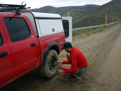
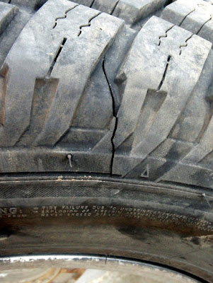
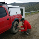
The drive to the trail head was pretty uneventful, though we got a flat near 12 mile summit. When we stopped to unload our bikes for the shuttle I though I could hear a whistling sound, which sounded like air escaping from one of the tires. I drove the car back and forth while Tom watched the tire in question but nothing out of the ordinary could be seen, so we pressed onwards, only to have the tire go flat in a couple of miles.
Amazingly, the folks I bought the tire from replaced the flat free of charge – which was quite nice of them, as the cut in the tire was pretty large. I was quite pleasantly surprised when they told me that as the cut was unrepairable, they would just give me a new tire.
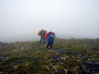
Shortly after the tire change we reached Eagle Summit and began our hike. We ran into some other hikers right out of the parking lot. They appeared non-plussed by our fanny packs and lack of packs and my attempts to engage them in conversation were foiled by one word responses..
The weather from this point on was fantastic – the day started overcast and a bit gray, but the forecast was for it to clear and become quite warm. By the time we started hiking the clouds were pretty much gone, the was a slight breeze, and the sun was out – fine weather for a long day hike.
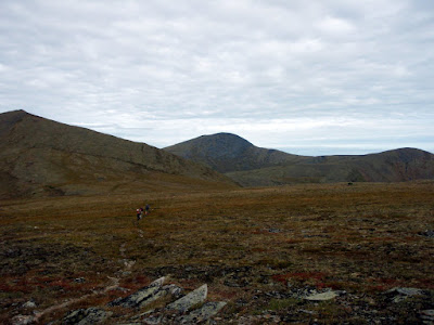
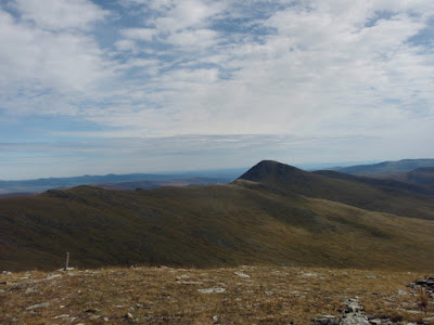
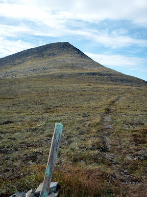
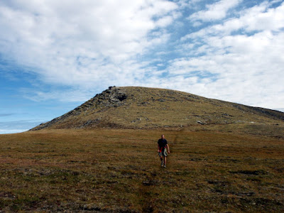
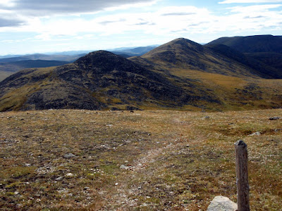
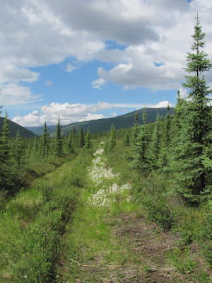
The Pinnell Mountain trail sticks mainly to a series of ridges and it winds around or and goes over a number of small mountains and domes. It has a number of climbs, and one moderately hard climb but nothing very difficult and the effort is rewarded by superb views.
The hike is entirely above tree line with no brush at all and is normally quite dry.
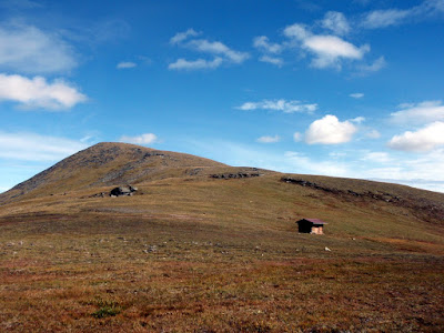
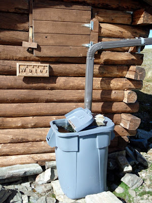
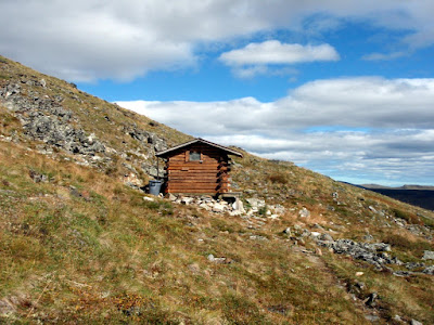
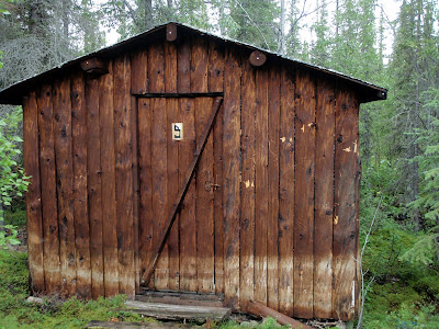
There are two small shelters on the trail. These shelters are pretty small but can be very welcome in harsh weather as the trail is pretty exposed.
They also feature water catchment systems that made our hike much, much, easier, as we knew we could rely on water at the shelters.
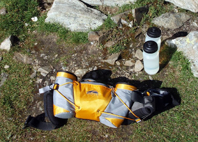
On this hike I experimented with using a very small fanny back and it worked great – there was just enough room to get the basics in (rain jacket, first aid kit,etc ), a handful of snacks., and two bike bottles. The small size definitely helps you cut down on what your are taking, as you really can not fit much in it.
At the first shelter it soon became clear that we were hiking a bit faster than expected and would finish well under my estimated 10 hours – this was good of course but a bit surprising.
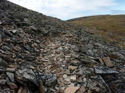
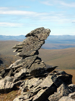
This trail features lots of interesting rock formations, including a rock shaped like a face.
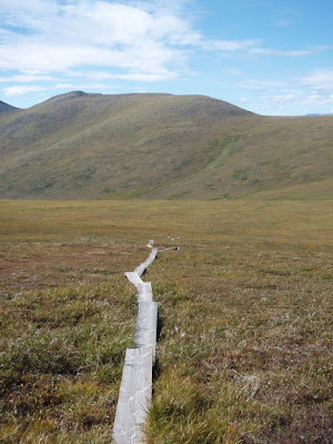
A little past the face rock we encountered the 4th and final hiker we would see on the trail. This guy was hiking the trail as a four day trip with his black lab and was busy scanning the valleys with binoculars when we encountered him. He had yet to see any wildlife but brightened up substantially when I mentioned that we had just seen a caribou around the corner. Near the middle of the the trail there is a long section of board walk along the low point of the trail. This section is called “Swamp Saddle” and even with the boardwalk can be a bit wet. The boardwalk is a mixed bag – when its nice weather the boardwalk makes for nice and dry travel, however near freezing it becomes very, very slippery and hard to walk on.
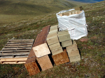
It appears that BLM is in the process of upgrading this section of trail, as there was a number of caches of building materials along this section of trail.
The boardwalk only lasts a mile or so, then its back to ridge hiking and nice views.
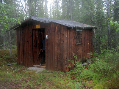
The second shelter at mile 18 is pretty much identical to the one at mile 10 – though it is a bit less exposed.
We filled up on water again and I chugged a extra bottle fun as a I was getting a bit deydrated at this point. The remaining 10 miles of trail went by pretty fast.
There is one moderately steep climb with a huge number of switchbacks after the second shelter, but otherwise the trail is fairly mellow, and after the steep climb the trail starts heading downhill, making for fast walking. We reached the bikes after 8 and a half hours of hiking, quite a bit less time than I expected. We only ran a very short section – Tom is training for the equinox marathon but I am alas not in that good of running shape currently so we only ran a short section. The trail is almost entirely runnable and would make a great, though long, trail run.
After reaching the 12 mile summit trail head, we gorged on snacks and then jumped on our bikes and headed off to Eagle Summit. As this point I was getting a little dehydrated and as it was now very hot and calm I was soon quite dehydrated. Tom zoomed ahead invigorated by the thought of biking uphill in the hot sun… Eventually I reached Eagle Summit and dove into the cooler in the back of the truck and enjoyed the cool sodas stashed away there. By the end of the day I had had 2 quarts of power aid, 8 20oz bike bottles of water, and 40 oz of pop – thats two and a quarter gallons of liquid! I was still not hydrated when I got home and had to drink several additional quarts of water before I started feeling reasonably hydrated.
The trip ended up taking a little under 6 hours of driving round trip, 8.5 hours of hiking, and 1.5 hours of biking – quite reasonable for a long day trip. My fanny pack setup worked great and forced me to pack a bit lighter than I normally do, which was good. The fanny pack setup also worked pretty well for the brief bit of running I did, so it might be a good option for trail runs in the future.
Pinnell Mountain trail is a classic interior hike and well worth doing. It has super fine views, the trail is in pretty good shape, the climbs are not very challenging, and the trail is amazingly brush free – all in all a fantastic hike. It can be done as a reasonable 2 day hike or mellow 3 day hike if long day hikes are not your thing. Its a spectacular hike!
Note: Someone asked me about this trip, and alas, the photo site I was using (the old google photos) doesn’t work anymore – jump to the end, I added a link to a flickr gallery with the full resolution photos to see any of the photos in more detail. -Jay, Summer of 2018
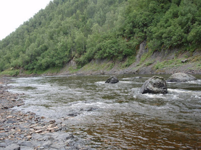
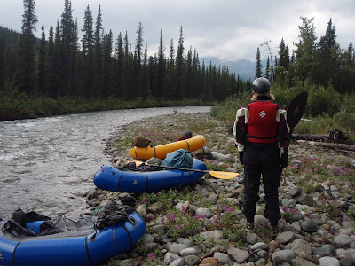
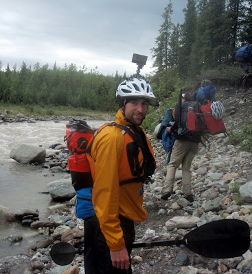
Last year Ed Plumb and crew did a pack rafting trip out to Melozi Hotsprings, about 30 miles away from Ruby. It looked like a very fantastic trip, so Ms Marsh, Tom, and I decided to do a version of it, though at a bit slower pace. Our plan was to fly to Ruby, take a boat ride up the Yukon to Horner hotsprings 30 miles or so upstream, take a dip in the waters, then hike 25 miles or so Melozi, chill for a day, then float out.
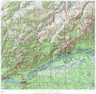
Here was our route.
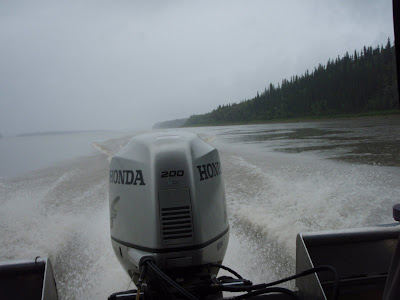
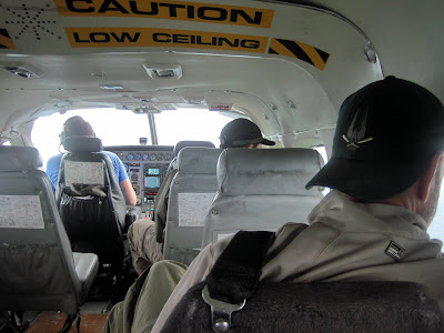
Our trip started on a overcast and damp looking Sunday as we boarded a flight to Ruby – little did we know that “damp” was going to be the theme of the trip. In Ruby we meet up with Jim from the Yukon River Lodge just upstream of Ruby, who gave us a boat ride up the Yukon to the start of our hike.
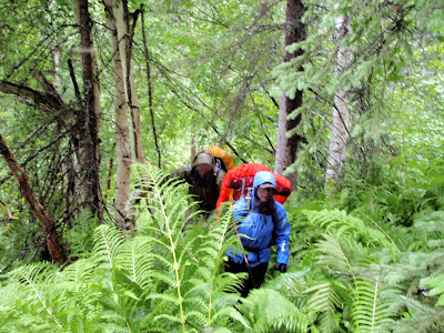
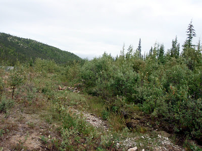
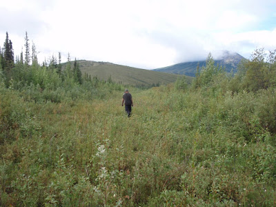
We started the hike a mile or so from Horner Hotsprings. Horner was once the site of a busy lodge, but its now just a simple hotsprings in a dense thicket of brush. The brush on the hike in brought back memories of south east – hiking in the rain in dense green foliage. Fortunately there was no devils club!
The bugs were out in full force though – by the time we hiked the mile or so to the hotsprings we had collected quite a fan club of mosquitos. The hotsprings at Horner are a pretty simple affair – just a tarped rock pool, but the water was nice and refreshing.
We had the place to ourselves, excepting the bugs and some other small hot springs aficionados.
Alas, I was the only one who got in, as the bugs were pretty intense.
After a quick soak (having folks stare at you like you are insane tends to speed one up) we continued on our hike. The first day we planned to hike 6 to 8 miles and camp around an alpine lake. The hike out of the small valley the hotsprings resides was pretty interesting – we hiked though dense green brush..
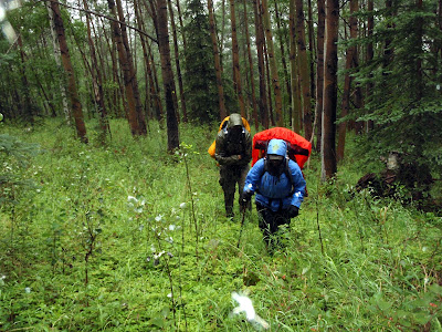
Then into a Aspen forest..
And finally onto a alpine ridge above tree line.
The view from the ridge was not so hot – we had under 100m visibility with occasional brief batches of less then 10 meters visibility.. Not the best day to hike to a small lake on top a ride surrounded by steep drop offs… All went well though and we made it intact to the lake, though we arrived a bit wetter than we would have liked.
The view from the lake was a bit limited.
After a night of rain and wind, which my Tarptent survived intact, which was good news as this was by far the windiest I have every used that tent in. We spent the next day hiking on more ridges in near whiteout conditions. The hiking was a bit slower than we planned on due to rock fields and the poor weather, so we deviated from Ed’s route a bit. By the end of the day the weather was starting to clear up, but it was still raining intermittently with periodic low visibility sections as clouds blew though. The next morning arrived a lot dryier than the preceding two days – it was mostly cloudy without any rain – quite change. We also were treated to our first scenic vistas (beside fog that is) of the trip. After a couple of hours of hiking we soon were approaching the hotsprings, and got our first glimpse of the airstrip from a hill overlooking Hot springs Creek.
From the distance the airstrip looked pretty impressive – super long though a bit brushy.
As we dropped down off the hill, we followed the creek and soon were walking on the airstrip. The airstrip was fast walking, but didn’t look to be all that good of a landing place – the middle two thirds is washed out with moderately deep ruts in it.
The section near the lodge is in better shape, but is quite brushy with moderately tall alder. Its also a bit short.. I am not a pilot but it looked pretty tricky to me.
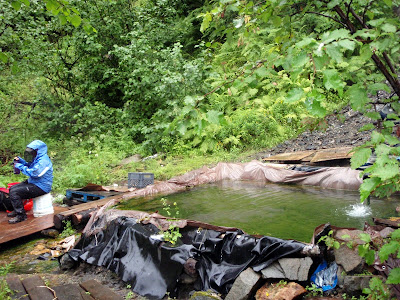
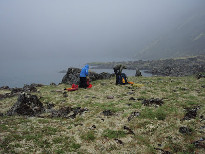
After we arrived we quickly dropped off our stuff at the main lodge after checking that no one was around and visited the hotsprings. I had checked with BLM’s online land status system before visiting to make sure the lodge is not currently leased and that it is public land, but I was still surprised that no one was there.
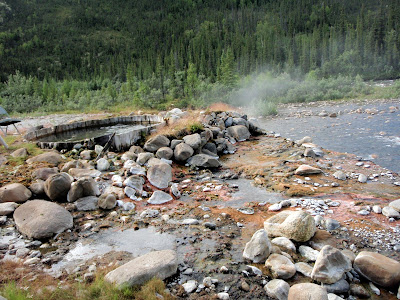
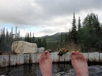
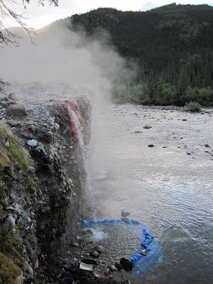
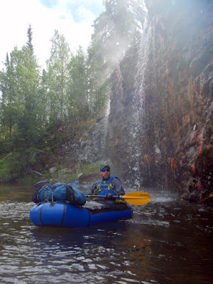
When we first arrived the main hot tube was a nice temperature and one could actually get in it.
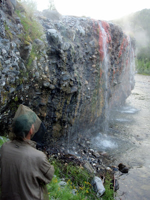
By the end of the day it was pretty hot, and by the next day the tube was unbearably hot. It appears the main tub is not actually a hot tub per say, but more of a hot water holding tank for the lodges piped hot water during the lodges hay day. Perhaps all that rain cooled it down enough so it was bearable for the first day… The hot spring is situated on top of a little rock bluff, and the hot water flows over the bluff making a hot water fall that cascades down into Hotsprings Creek. After the first day we attempted to stand under the hot water falls, but that was a bit unpleasant – the falls are very hot, and the creek very cold, leaving your upper body scorched and your feet cold.
Never fear – we rearranged the rocks at the base of the falls and created a small pool with some random tarps laying around, making a little hot water pool right in the creek. This worked great, as regulating the temperature is pretty easy – all you have to do to cool things down is let in more cold water, to heat things up let in less cold water – very, very nice! (Ms Marsh photo)
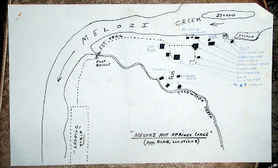
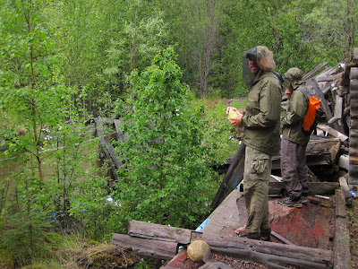
After a bit of soaking, we decided to so explore. The lodge complex is pretty extensive. We found a map in a filing cabinet with the general layout of the lodge.
A fair number of the buildings are in pretty good shape. The pool, alas, is has completely collapsed and is returning to the forest. (Ms Marsh photo)
On the last day of the trip while waiting in Ruby for our flight out we talked to a local who remembered visiting the lodge in the late 70s and remembered the pool – apparently it had pretty hot water in it, and that it “had a deep end and a shallow end, just like the ones in Fairbanks”, as he put it. It must have been quite a novelty – a warm pool in such a remote setting.
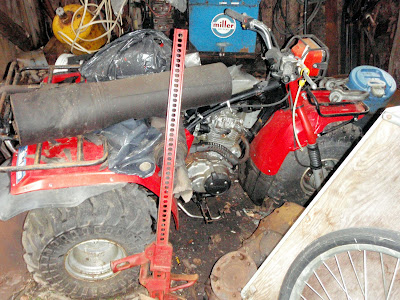
The shop is in marginal shape – one side is open to the elements and the roof leaks. Amazingly the tools inside it seem to be in pretty good shape -there is a partially disabled three wheeler – a “Big Red” – the classic child crushing model that got three wheelers banned in the US..
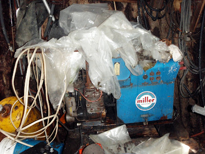
A gas powered welder, several generations of chain saws, a weed wacker, and lots and lots of random hand tools and spare parts.
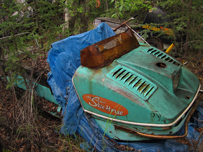
Outside the shop was a collection of very old snow machines, most missing engines, tracks, and other parts. The late sixties or early seventies vintage Johnson Skee-Horse was pretty entertaining (it was supposed to have a 14 horse engine – wow!), as was the ton of random old yellow Skidoo parts lying around. .
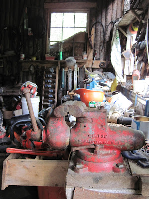
The shop had a pretty nice selection of hand tools which were in surprisingly good shape.
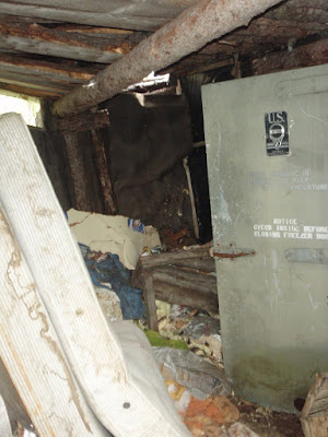
The cold celler was a scary mess and I was afraid to look inside it.
The numbered guest cabins were in pretty good shape, though only one was suitable for staying in the winter.
Cabin number 5..
Cabin number 3..
The “Reindeer Cabin”, apparently named after the reindeer hearers who were the original residents and the first users of the hotsprings.
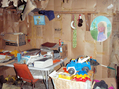
Apparently in the 1900-1910 time frame reindeer were raised up stream 15 miles or so of the hotsprings to feed miners in the greater Ruby area. The herders would come down occasionally and soak apparently, and eventually built a cabin to make things more comfortable. The Reindeer cabin is were the lodge complex really started feeling creepy – it looked like the last residents just up and disappeared. It contains chests of knitting, children’s toys, books, painting supplies, even the former residents prescription medicine – all left as if the former residents just decided to go away for a weekend, and ever came back. Its pretty creepy and a very depressing sight – it came across to me like the cabin of broken dreams..
Toys in the entryway..
A desk..
Drawings on the bedroom wall..
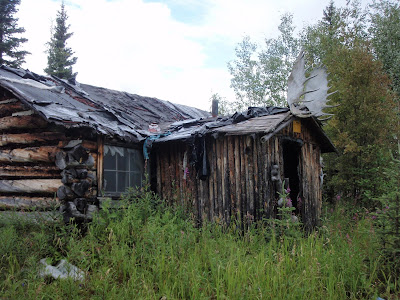
The main lodge building is in great shape and doesn’t really feel like it has been abandoned all that recently, until you start looking around..
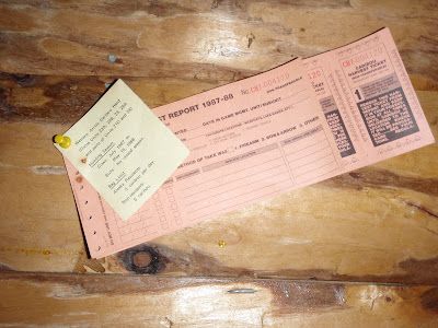
Old caribou tags..
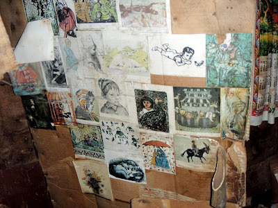
And the reading material all point to a mid 80s and early 90s abandonment.
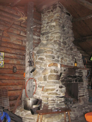
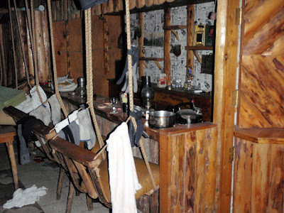
The main lodge has radiators along the walls and under the floor and it appears that in its prime it was heated by the hotsprings. The building has a wood cook stove with a rusty stovepipe with holes, and a large rock fireplace, so it might be a bit hard to heat in the winter.
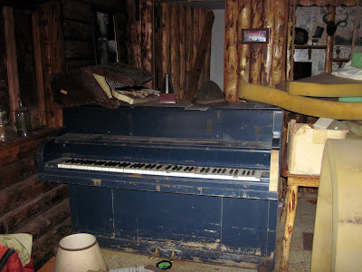
The lodge has a full size piano and an accordion. The piano still functions though a lot of the keys are sticky. Alas the accordion is pretty far gone and I didn’t have the heart to attempt to play it and break it.
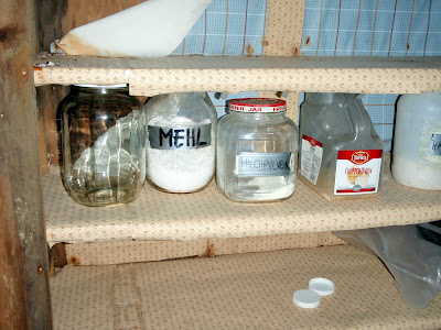
Strangely the kitchen in the main lodge building had a mix of very old food stuff..
And some newer stuff labeled in what appeared to be German:
When we got back in town we were able to find these folks online – apparently they spent a week or so at the hotsprings in 2003. It was pretty fun to decipher one of the mysteries of the place.. Alas, lots of mysteries remain – its really hard to imagine why the place is abandoned. The hot springs are great, the surrounding country beautiful, and the fishing appears to be top notch, at least for grayling.. so why was it abandoned? It would seem to be quite a viable lodge.. perhaps not for hunting as we didn’t see much in the way of wildlife, but as a hot springs or scenic destination its nice. Lots of other lodges seem to get by with quite a bit worse setups. According to BLM’s online land status website, the lease expired in 1996, though the reason it expired are pretty unclear – did they forget to pay it, did it get revoked, or did something else entirely occure.. there are so many mysteries about this place.
The main building is pretty bug proof, and was great to hang out in for the day and a half we spent at the hot springs. Soon after arriving we had the place festooned with our drying belongings.
Having a place to dry our stuff and to hang out in a dry place was very nice after 2 days of rain.
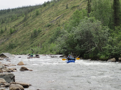
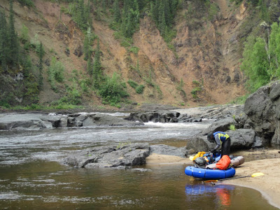
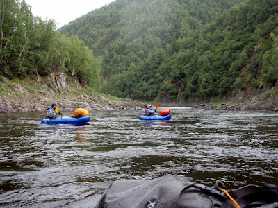
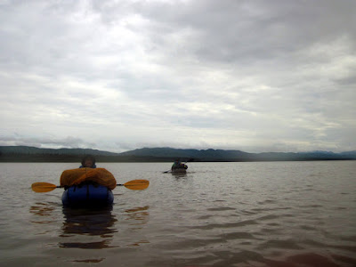
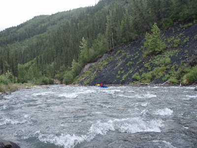
After a day and half of hanging out at the hotsprings, we had to get a move on and start moving again, and so we inflated our packrafts and started floating.
Hotsprings Creek had quite a bit of water in it and the floating was pretty fun – lots of small splashy class II rapids.
We put in next to the waterfall and it was really fun to float by a hot water waterfall in a packraft.
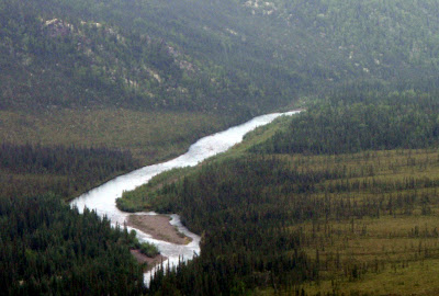
The float out to the Melozitna River was quite fun.
We camped shortly after the confluence with the Melozitna. The Melozitna is a wide, slow moving and surprisingly warm river.
The daytime air temperatures during our float were in the mid 50s and it appeared the water in the Melozitna was slightly warmer – its pretty strange to be able to stick your hands in the water to warm them up.
The next day the Melozitna became a bit more scenic as we approached the Melozi Canyon. We camped 10 miles or so above the first rapids in the Melozi Canyon. Late in the evening three jet boats zoomed by, which was a bit of a surprise, as it was rumored that the rapids blocked off jet boats.
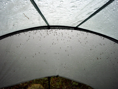
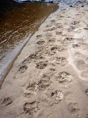
In the evening I was joined by a large number of small guests, who alas had to stay outside.
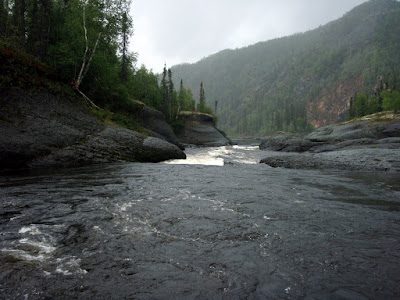
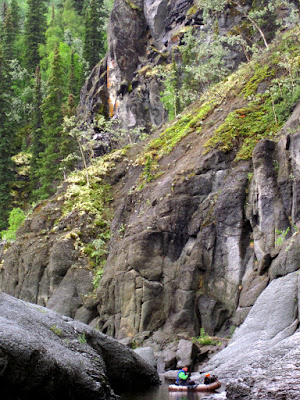
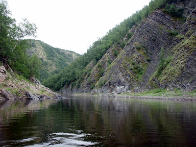
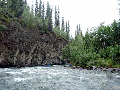
Next next day we passed though the Melozi Canyon, which probably the most interesting section of river we passed though. The Melozitna River has two short class III rapid sections that we portaged – they didn’t look all that hard but it was not really the sort of weather that makes one interested in getting we – we portaged the rapids.
The first rapid
The second rapid, as seen from below
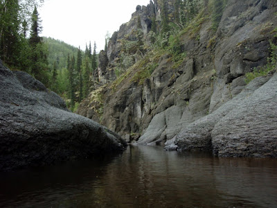
The canyon is pretty interesting, with wonderful smooth water sculpted rocks.
The first rapid has a wonderful little side channel that goes around on the side, skipping the hard section.
This section would have made fantastic camping, alas it was the middle of the day when we went though and we had a lot more distance to cover, so we pressed onwards. The area looked to have a fair bit of wildlife traffic and would be a interesting place to watch and see what walked by.
Bellow the second rapid there was a number of small boulder gardens, but nothing too exciting.
Once past the rock gardens then it was back to mellow flat water floating.
The rest of the canyon is pretty scenic.
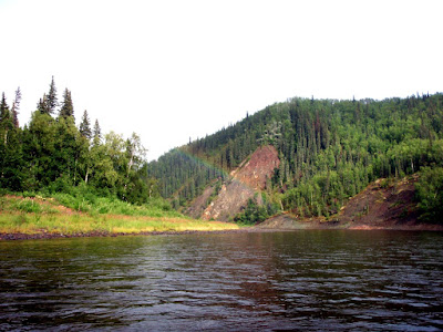
After the canyon the river drops into a flat plane and becomes fairly wide before arriving at the Yukon.
We camped fairly near the Yukon so we could get to Ruby before any afternoon winds kicked up and so we could make our afternoon flight.
The Yukon was surprising mellow – large and flat with a fairly tame current. (Ms Marsh photo)
Soon we arrived at Ruby, had our rafts packed up, and I was enjoying a trashy book while waiting for the plane. Ruby has a nice picnic area near the water that we spend a hour or so hanging out it. There was also a three person crew that staying in the picnic area that was working on a small hydroelectric test bed project that aims to eventually provide Ruby with hydroelectric power during the summer months. After a bit of waiting we were soon on a plane back to Fairbanks. (Ms Marsh photo)
A hour a bit later we arrived in Fairbanks to nice clear skies and Nancy and the twins – it was very, very nice to be home!
This was a super fun trip and highly recommended. A word of warning – the lodge appears to be open for leasing from BLM pending some site appraisal, so it might fall back into private hands – if you plan to visit please double check with BLM first to make sure it is still off lease before setting off. The airstrip is pretty marginal – perhaps it goes without saying, but only land if you are sure you can do it safely as it is pretty remote and its a long, long walk out.
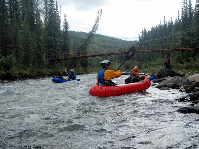
The king of pack rafters (at least Interior ones), Ed Plumb organized a trip down to Riley Creek near the Denali Park entrance. This creek is very accessible and is rumored to have some nice class II boating with at least one class III drop. It was supposed to be a short 1-2 mile hike followed by a several hour float. Ed recruited a very large posse (13 people total) for this adventure – I guess the short nature of the trip and the potential fun floating made it pretty attractive.
I was unfazed by the unlucky number 13, as my morning coffee was filled with good signs.
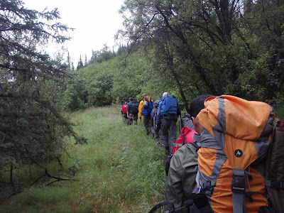
After meeting up at Lulu’s we all left town shortly after 9 and were on the trail hiking at a little before 1 in the afternoon.
The hike was fantastic – the trail is in great shape and very fast walking. We had a major train of people –
I was pretty bouncy from the latte and probably annoyed everyone around me with my endless babbling.
Fortunately people shifted around a bit and thus I got to spread my annoyance around.
Eventually we left the trail and dropped down to the creek.
Where we put in on the creek the water was moving moderately fast with more water than I expected – it looked pretty fun.
This creek has quite a bit of character – at the water levels we floated it at there were quite a few nice rocky sections with fun obstacles to maneuver around.
There are a couple of sections where the creek runs along smallish rock walls, but nothing too exciting.
The forum post that spawned this trip, circa 2007, mentioned a rope across the creek near a cable. Well, it turned out that there is still a rope across the creek under a cable, near a foot bridge.
It appeared the rope was used to haul stuff back and forth across the cable, but its seemed that having it dangle just above the water was unnecessary, especially since there is a foot bridge just near by. NPS’s legendary safety paranoia seems to be a bit missing here..
Shortly after the footbridge we encountered the rail road bridge and a brief exciting section. This bit could be a bit tricky – at the water levels we floated it at it was fairly fun and not too tricky. We took out just after the parks highway bridge and made our way back to the cars.
Quite a fun day trip and highly recommended. Its very similar to windy creek, but at the water levels we floated it slightly harder with a few sections that are a bit more challenging. The total time for the hike and float was around 5 hours so it makes for a nice mellow day trip hike-and-float. It was pretty fun to float in such a large group. There was quite a selection of paddles, different sorts of boats, and several generations of spray skirts all of which it was fun to see in action. There was also a wide range of gear folks were taking. One of the pack rafters sported a neat helmet cam made from a gorilla pod and also going super lightweight style with no pack – just strapping his pfd to his life vest – most impressive! Hopefully some of the videos he took will get passed around, as they might make interesting viewing.
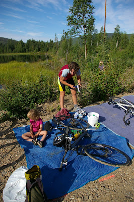
Nancy has been training all spring and sumer for a local half ironman called the Sourdough Triathlon. The twins and I spent most of Saturday watching Nancy do her swim, bike, and run and she appeared to have a great time.
The twins had a great time helping Nancy set stuff up for the race.
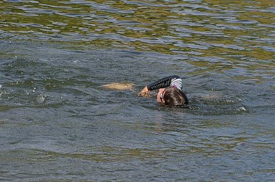
Good enough of a time I am almost considering learning to swim just to do it next year. Perhaps not though – the swim section
looked decidedly unpleasant. Nancy seemed to enjoy it though.
Nancy had a fantastic race, and came in at about 6 hours 30 minutes. She had the definitely moral victory of racing on a low tech (but quite nice – it was her birthday present last year) hybrid bike, not a fancy road bike, and she did not walk any of the run. Hurray for Nancy!
The twins and I watched most of the race (there was a short break for nap time), and amazingly the twins had a really good time watching the racers go back and forth (the run and bike sections are out-and-back-and-out-and-back sort of affairs). I was very impressed by the Twins race watching stamina!
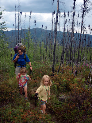
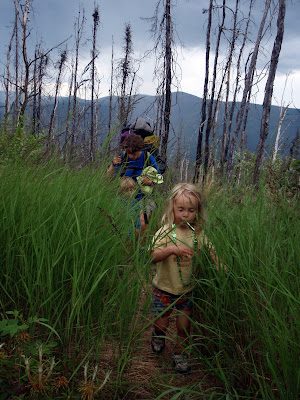
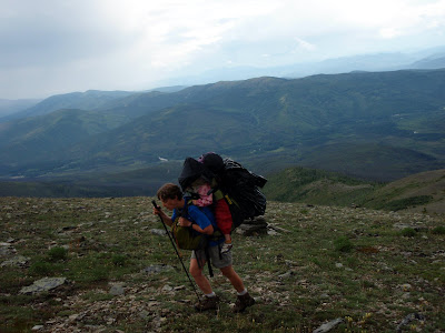
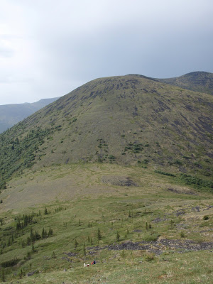
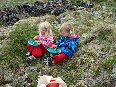
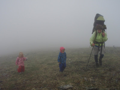
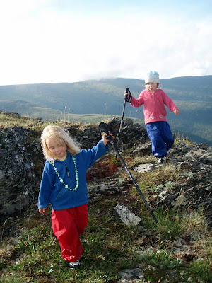
Chena Dome is one of the classic hikes of the interior. It is 30 miles long, with lots of ups and downs, but these are rewarded by great views and wonderful alpine hiking with very little brush or mud. Nancy and I decided this spring it would be a grand adventure to hike it with the Twins and see how well they handle it. As they are only four years old, they were not going to hike the whole thing and we expected to carry them at least two thirds of the time. The hike started off on a fine Saturday morning, though rain was in the forecast. As we started hiking up the trail, we were passed by someone hiking the other way. I talked to him a bit, and quickly learned that he had gone three miles and turned back because he “didn’t want to get wet” and turned back at the sight of black clouds moving in. This was somewhat ominous, but we pressed onwards. We were soon passed by two other parties, including a family with a six year old who was going to hike the whole trail without any help. This made quite an impression on our four year olds – hiking whole trail all by him self! The six year olds apparent lack of any whining made a more of an impression on Nancy and I – only six and already hard core! The twins walked the first three miles or so before being loaded up into the backpacks for nap time.
Alas, at about nap time the grade increased making for some fun uphills.
The first day of hiking was quite beautiful – while some very ominous black clouds blew though with a bit of thunder, the weather was quite nice.
After reaching mile seven or so the twins were pried out of their comfortable backpacks and started hiking again.
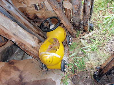
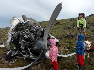
At a little after mile eight there is an airplane wreck, which provided a bit of excitement for the twins.
The airplane crash site is always a bit depressing, at least to me. Near the engine in the photo is the steering wheel – all smashed and bent.. it seems unlikely that anyone survived the crash. We camped in the next saddle.
Everyone enjoyed a fine dinner of rice, dried veggies, and cashew nuts. Yum, yum!
After dinner the twins and I wandered around, looking at the flowers…
And building some rock cairns.
During the cairn building processes Lizzy was very excited to find a rock shaped like the number one. The joys of being four..
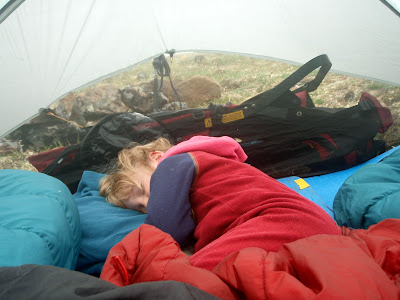
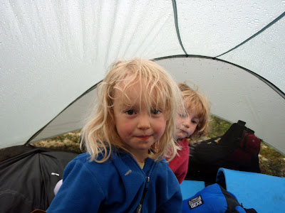
The next morning things were a bit different – we awoke to a gentle rain on the tent.
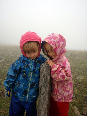
When we finally made it outside, we found the ridge completely socked in, with about 100ft of visibility. The rest of the day the visibility ranged from 50ft to 1/4 mile until things cleared up in the evening. This made route finding a bit of a chore. In nice weather its it often feels like there are rock cairns every 10ft – in bad weather it feels like they are 10 miles apart. We never lost the trail, but it was quite hard to stay on the trail at several points.
The girls were quite the little troopers, and didn’t whine all that much, even though they spent most of the day wandering around in a white out in the rain.
They spent a bit more time in the backpack (must be nice to be able to retreat to the comfort of a rain proof covered self motorized transport that also provides food and drink on command) but otherwise seemed to enjoy themselves. Several times while Nancy and I were looking for the next cairn Lizzy would inject helpful advice like “You should look at the map” or “you didn’t loose the map did you”.
We also played the ever popular “Is that cairn taller than you?” game, in which the twins guessed if the next cairn would be shorter or taller then them. That game was a major hit.
Nancy also recited a version of Dorothy and the Wizard of Oz, the Hungry Caterpillar, and James and the Giant Peach from memory as hiking as rainy fog distractions.
Eventually we made it to the train shelter, were we made dinner and enjoyed some dryness.
The family with the six year old caught up with us at that point and we hung out for a while out of the rain. Eventually we took off and heading back out into the rain which was by this point slacking off and slowly turning into a partially cloudy evening.
The dogs enjoyed this section of the hike immensely – we were now out of the barren alpine rock fields and into mixed dwarf birch which they seem to enjoy a lot more. We took all three dogs, which included two 13 year olds and a 6 year old. The 13 year old dogs, Togiak and Polar, were quite the troopers, even though Togiak has a bit of arthritis.
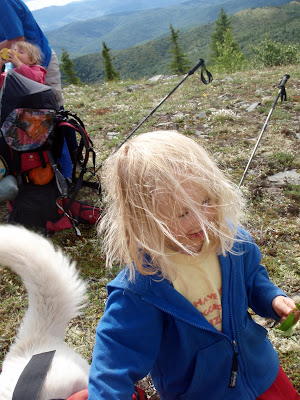
By the end of the day the weather was quite nice, and the twins got some quality hiking time in.
We made camp just above a small saddle and eventually made it to bed when all the sugar the twins consumed wore off. The next morning arrived with a bit of rain but that quickly cleared off. Rain always sounds worse while in the tent.
Our final day turned out to be quite nice – the sun came out and it actually got reasonably hot and sunny.
The twins had a great time hiking in the fine weather.
With the nice weather, our little flying friends game out, alas.
Fortunately the hiking on the final day was a fairly fast 12 miles, and we made it out by 6, well in time to make it to Mia’s Cafe. The twins enjoyed vegetable yakisoba.
Mia’s food is always good. That little cafe is quite amazing – the burgers are great and at least the vegetable yakisoba is very good (better than any place in town actually). I am now hard pressed to decide weather to order a burger or noodles these days.. Life is hard!
Everyone had a great time on this trip, even though the weather is less than optimal. This bodes well for our Chilkoot plans later this summer, as the Chilkoot is a less strenuous hike (it has about half as much climbing).
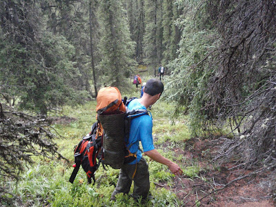
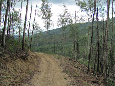
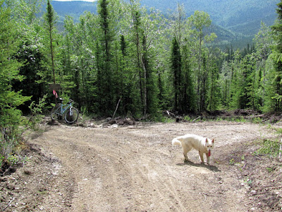
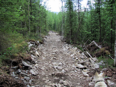
Last year I noticed that a new trail was being put in the Angel Creek valley in the Chena River SRA. This trail is supposed to replace the very rutted existing trail that runs along the base of the valley. The existing trail is pretty wet and really only passable during the winter. Impassible unless you have an ATV, apparently, judging from the ruts. The new trail is routed up high and is supposed to side-hill up the valley, making for a durable, dry trail. Anyway, as I had nothing to do on this fine Monday I decided to go check it out on my bike. While I was out there I also intended to bike into Stiles Creek Cabin and see how that trail is in the summer.
The new trail to Lower Angel Creek cabin is great and makes for fantastic biking. It starts off with a nice climb that offers great views:
It then side hills up the valley for 5 miles or so, then hits an intersection where you can drop down to Lower Angel Creek cabin, or continue on for a hundred feet or so.
The developed trail dead ends at this point, but it appears that it will continue on as its cleared and flagged for quite a distance, so it looks like State Parks plans to extend it to the upper cabin.
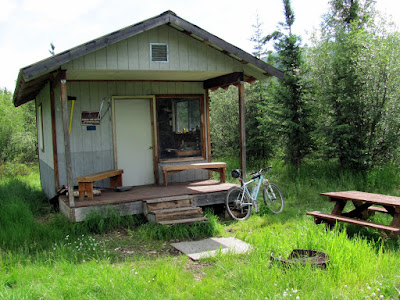
I stopped by the lower cabin and checked out the log book – a party of bikers had just been by the day before so it looks like this trail will be pretty popular in the future.
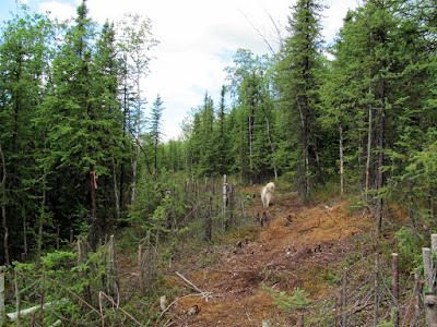
The winter trail past the lower cabin heading out to the upper cabin was marked as closed to motorized vehicles, but alas there was fresh tracks on it from some large ATVs.. The trail did have a very pretty display of some white flowers that appeared to be only growing on the trail, not off the trail, making for a nice effect.
The trail is really fun on a bike – its dry, free of ruts, and has lots of nice mellow climbs followed by short descents as it works its way around the valley. Alas, its a bit short, being only a little over 10 miles round trip, but hopefully it will get extended to the upper cabin, making for a longer ride. There are only a couple of tricky parts where crushed rock was brought in to fill in some muddy sections. These sections are very passable, but require a little care – no big deal.
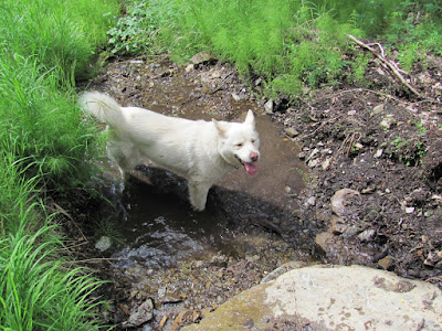
There is one nice small pool of water off the side of the trail, which Remus enjoyed, and a couple of dry pools.
I am looking forward to skiing this trail this winter – it should make for a fantastic loop when combined with the old trail!
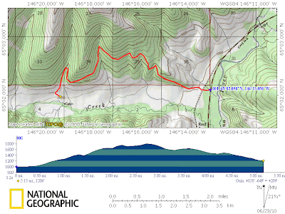
A map:
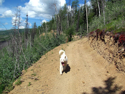
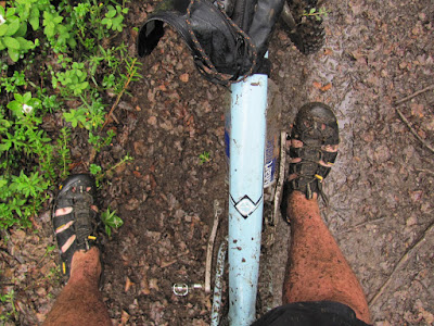
On the way back I stopped by Stiles Creek Trail and biked into Stiles Creek Cabin. This was a pretty fun ride that is a little under 8 miles one way. By the time we were half way to the cabin Remus was a bit beat – it was hot and he is a little out of shape, as alas am I. Fortunately, at least for Remus, it started raining shortly after the half way point and he cooled off in the downpour. I, on the other hand, got nice and muddy.
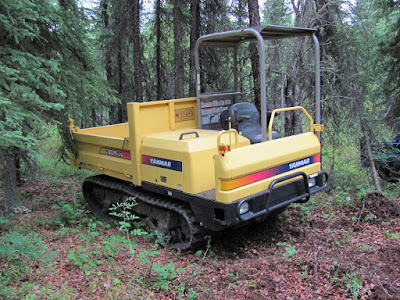
DNR has been making lots of improvements to this trail. They re-routed the first several miles of trail to get around a massively muddy section, which has made the trail a very fun summer bike ride. DNR is apparently still working on it – they had some tracked equipment near the start of the trail:
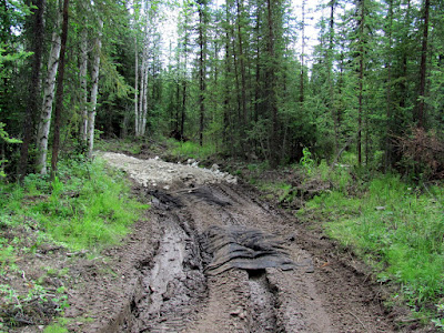
And some signs of trail hardening still in progress – you can tell where the trail work stopped:
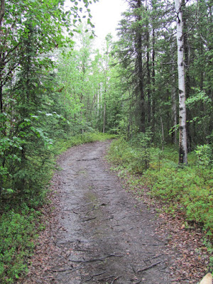
This is the first time I had been on this trail on a bike in the summer and it is very, very fun! The trail winds though mixed deciduous and spruce forest and is very scenic.
Alas, the rain hampered by picture taking, so I didn’t get any pictures good enough to do justice to the route.
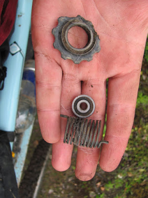
On the way out I stopped to toss bits of a broken tequila bottle off the trail and was surprised to find a bunch of parts from a rear derailer.
After making it out to the parking lot, Remus jumped into the back of the truck and went right to sleep – I think I wore the guy out! Alas – no sleep for me as I had to drive home.
Both these trails are highly recommended bike rides and are very worth the hour drive from Fairbanks.
As a side note, I have really been enjoying my new bike, a 2008 Gary Fischer Paragon. I picked it up last fall at Goldstream Sports and have really been enjoying it. It is an amazing transition from my old Kona 96 vintage Aa. It rides wonderfully and is a nicer bike than I need these days – life is tough!