Archive for the ‘trip reports’ Category

Fun in the mountains – a hike and float on the East Fork of the Susitna

Saturday, June 26th, 2010

Tom, Marsh, and I decided to spend a couple of days doing a version of Ed Plumb’s East Fork of the Susitna Trip . The trip was a blast and very fun.
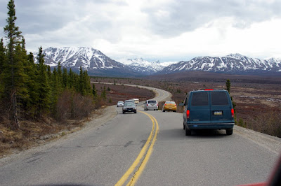
We started off by leaving town at an moderately early hour and after 4 hours or so neared our destination.

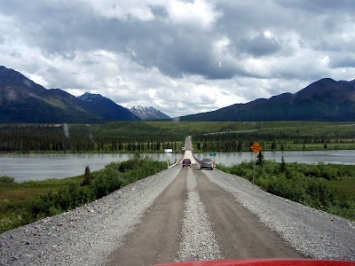
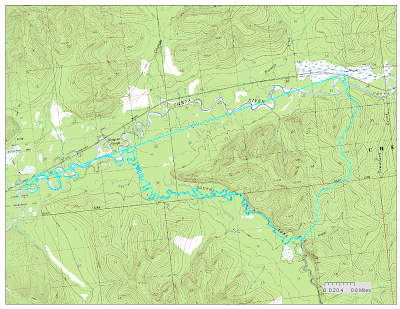
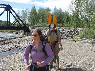
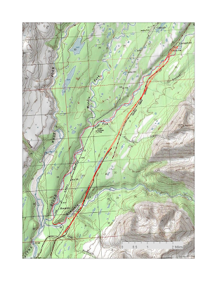
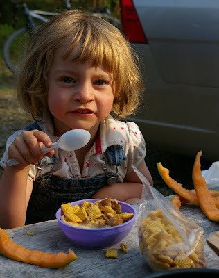
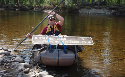
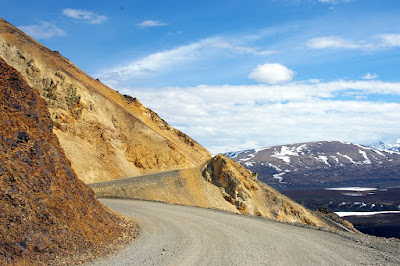
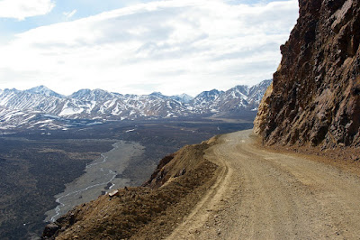
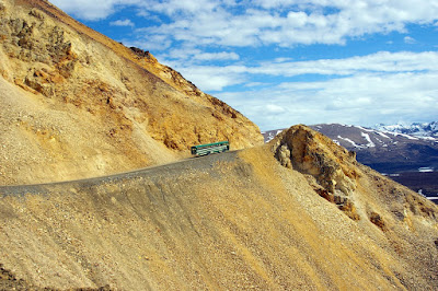
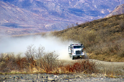
Our plan was to drive up Valdez Creek road until it stopped paralleling the Susitna River, then drop off on of the trucks, and continue driving up the road as far as was reasonable, the hike over to the East Fork of the Su, and finally float out back to the truck. We ended up driving about 2 miles down the road and left Ms Marsh’s truck at a pull out, then continued down the road for 8 miles or so when the deepish creek crossing convinced me to park the car and get start hiking. The first day of hiking was mostly on an atv trail that followed a small stream.

The first mile or so of hiking passed though some active gold mining claims. At one point we surprised a large family out gold panning – the kids in the family seemed very, very confused by our life jackets and paddles, but apparent lack of boats.. I am sure we generated lots of discussion after we got out of ear shot.
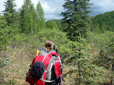
The hiking was pretty fast and easy – atv trails are not very scenic but make for nice walking!
The trail crossed the stream quite a few times.. no dry feet here.

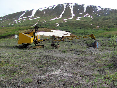
We passed a number of old mining camps, but besides the activity around Lucky Creek everything else was pretty quiet – just rusty machines lying around and boarded up shacks.

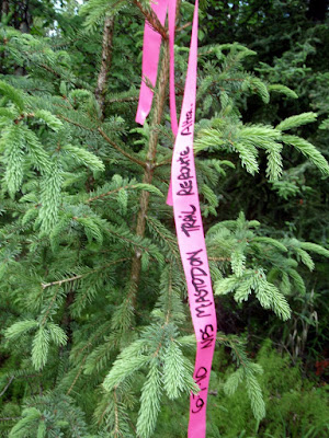
Eventually the ATV trail dead-ended at a bluff and we ended up side hilling to Grog Lake where we camped for the night.

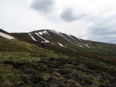
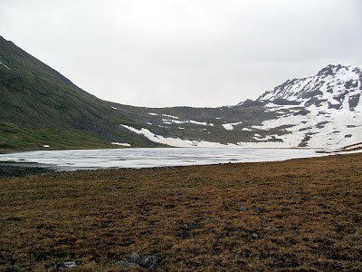
Grog Lake is in a very beautiful little bowl, but summer had yet to fully arrive here – it was mostly still frozen.


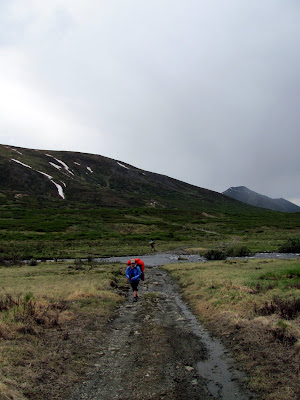
After a fine dinner we hit the sacks and after a good nights sleep, we set off in the morning a little after 10, with plans to head out to the hills overlooking the East Fork of the Susitna. The morning it was raining – when I woke up it was poring pretty hard and the view from my tent was not all that inspiring.

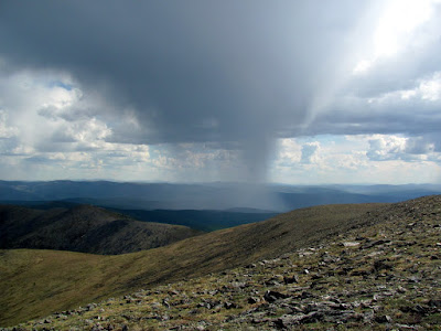
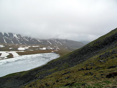
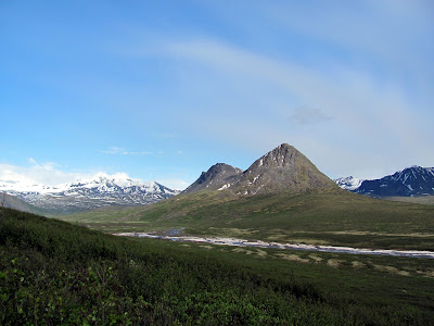
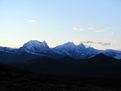
The rain tapered off pretty quickly though and the morning ended up being fairly rain free, though a bit cloudy with a random fog patches blowing though. The view from the first pass was pretty spectacular.

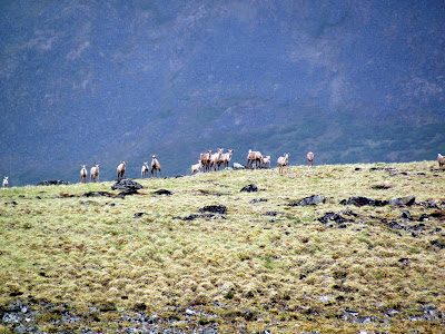
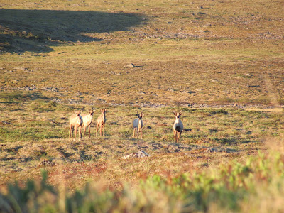
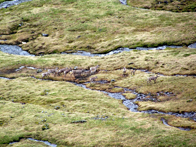
After crossing the next pass we ran into a small herd of caribou who were fairly nonplussed with our intrusion. We ended up seeing numerous small herds for the rest of the trip.

At this point we deviated from Ed’s route – the pass Ed had used was still pretty snowed in and we ended up taking a slightly different route, which took us to the East Fork a bit lower down, but also gave us some snow free and scree free hiking. We did get to walk a bit on some nice overflow on Boulder Creek.

We debated floating Boulder Creek as it looked to be fairly float able but decided not too. This was probably for the best, as Boulder Creek plunges though a canyon of doom just before reaching the East Fork, and the waterfalls and rapids were loud enough we could hear them several miles away as we floated by on the last day of the trip.
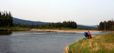
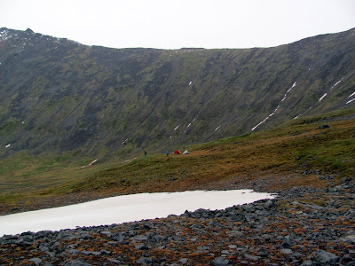
After crossing the creek we headed up to make camp near a strange circular lake with a island in the middle on top of a flat ridge.

The second and final camp-site turned out to be fairly scenic.

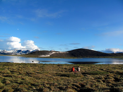
The lake had a huge number of birds nesting around it and their cries provided a nice backdrop in the evening.

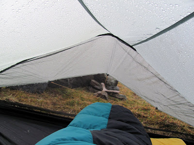
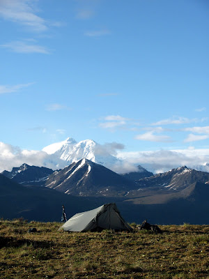
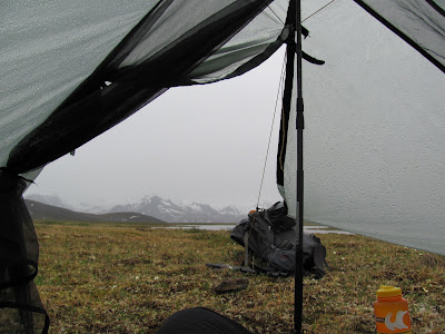
While packing for the trip I had taken out the “extra” poles for my tent, intending to replace them with my trekking poles. Alas, I took out the wrong pole, and had to jerry rig something, but it all worked out in the end.   I really like this tent – its about 2 lbs, has lots of space, and seems to tolerate the wind pretty well.  This of course leads to a gratuitous tent and mountains shot:

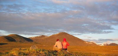
In the evening we had wonderful views of the Alaska Range. It was fun to see the Alaska Range from the south side rather than the northern view that I normally get.

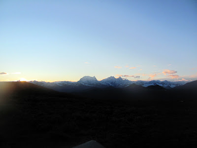
Mount Hess and Deborah were very visible and nicely lit.

The next morning was once again nice and rainy. I took advantage of my no-cook meal (on summer trips these days I just eat granola bars for breakfast – it hardly seems worthwhile to start the stove and cook something) and enjoyed my breakfast while sitting in the tent, away from the rain.

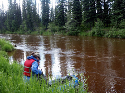
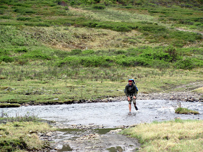
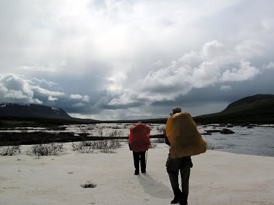
Things quickly cleared off once again and we set off hiking the last 3 miles or so to the East Fork. There was a bit of brushwacking, but it was fairly short, and soon we were floating on the East fork – hurrah!

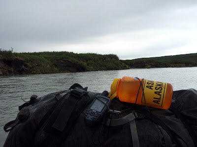
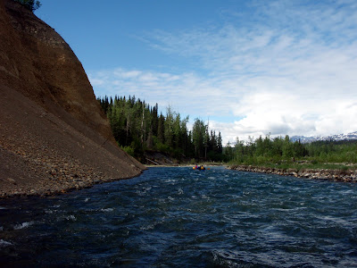
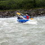
The river was pretty mellow to start with, but there was a short section with some rapids. The first section was a bit bumpy, but otherwise uneventful.

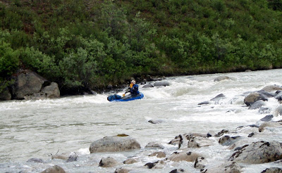
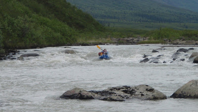
The next section we scouted was more eventful – I scouted it briefly, thought it was no big deal, and after running a small drop, ended up flipping in a hole right after the drop. It was a bit silly, but not a big deal – I was not expecting the drop to have a strong recirculating current in it, and didn’t hit it hard enough and got pulled back into the drop and flipped. No harm done – after a short swim I was back on shore and we walked the next section, then put in again as things mellowed out. I am getting pretty good at flipping now.. We did walk one other section – there was a huge boulder up on river right with barely enough room for a packraft on one side, and a huge pore-over on the other – we walked that section, as it was not clear a pack-raft could get by on the right hand side of the rock without getting stuck. Last year one of the teams on the Wilderness Classic dumped (see this for more details) in these rapids. One of the racers lost his shoe and had to duck tape a bit of his pfd to his foot as a replacement. At the time they ran this section one of these rapids was in the class IV range and had a hole large enough both people dumped in it and got stuck.. we didn’t see anything too scary (besides the rock of doom – but that was easily avoidable) but folks should keep this in mind if they run this section at higher water levels – so be careful folks!
On the upside, besides the rock of doom and the drop, the rapids was all fun class II wave trains and splashing.

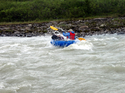
I avoided the wave trains for the most part – the water was glacial and very hard to see though so the wave trains could conceal rocks or other strange stuff, so I generally just skirt stuff that looks funky.

After the rapids the river widened out a lot and mellowed.

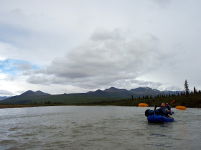
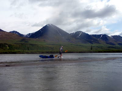
In some places it mellowed too much – the river is pretty silty and often the middle was so shallow that we could not float it, and were forced to get out and walk. Walking in the middle of a large river like this is a pretty funny experience.

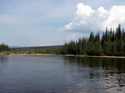
Eventually the East Fork was joined by the West Fork, and the river changed character – the silty shallows went away and the river sped up to 5 to 6 miles per hour. This led to some mellow floating – as we just zoomed along with no effort.

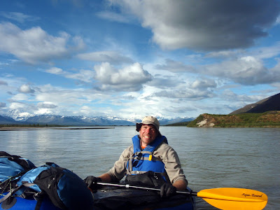
Once the two forks joined the Su is really wide and fast – quite an impressive river.

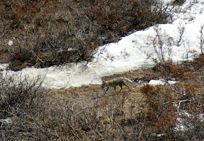
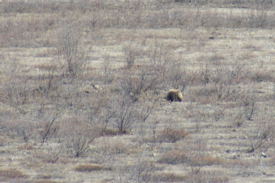
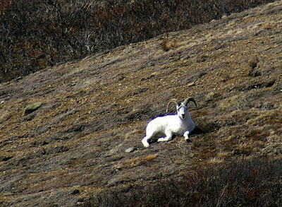
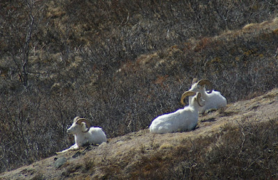
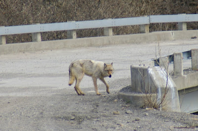
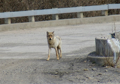
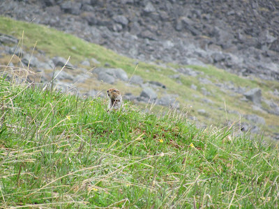
We had quite a few wildlife sightings during the trip – alas no wolverines, but lots of other critters.
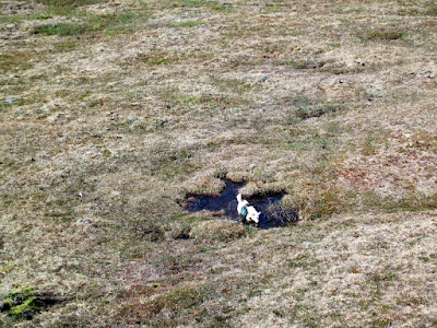
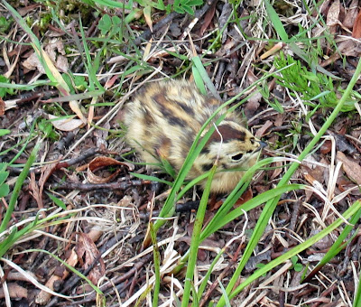
Baby Ptarmigan

Lots of Caribou:


And the ever present ground squirrel – oh so exciting! (Just joking.)

Our mileages for the trip was:
day 1: 9.31 miles
day 2: 11.66 miles
day 3: 2.75 miles hiking, 25.25 miles floating.

All the days except for the last one (it was a long float) were moderate length days and nothing very extreme.

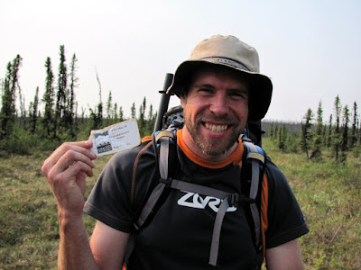
This trip is highly recommended  – its a great trip and well worth the 8 hours or so of round trip driving from Fairbanks.
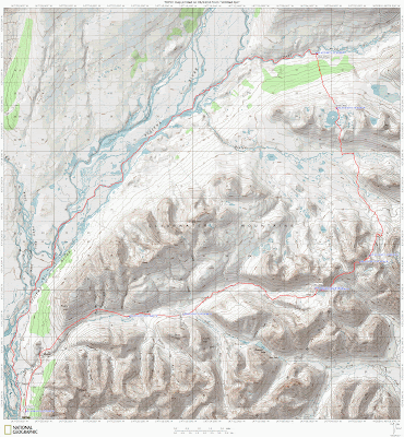
A Map:

East Fork of the Susitna Hike and Float – More pictures than you could possibly imagine!

A Nugget Creek Repeat!

Tuesday, June 15th, 2010

Tom, Ms Marsh, and I did a repeat of a trip Tom and I did last year – a hike, float. bike loop that visits Nugget Creek Cabin in the Chena River State Receration Area. This time we did it when the Chena was pretty high, and it was a much more fun float – the water was fast and there was no low water dragging at all. The river guadge at 40 mile was reading about 17.14 ft during the middle of the day. This is a wonderful high water float – there are sweepers but nothing really dangerous so long as you are paying attention, and the south fork flows a lot faster during high water making the float quite a bit more fun.

The river at Nugget Creek Cabin was almost bank full.

State Parks is in the process of putting in a new trail that will start somewhere around 1st bridge – this should make this a “instant classic” easy water pack rafting route.

They also improved the marking substantially – which is super as parts of the existing trail are very hard to follow. Wahoo!

The hike is a little under 6 miles, and the float is about 20 miles from Nugget Creek Cabin to the Rosehip campground.


A Map:

More pictures here:

Nugget Creek Hike Float, 2010

A short trip on the Chulitna

Monday, June 7th, 2010

On the way back from the packrafting class, Tom, Ms Marsh, and I stopped to do a quick hike/float on the East Fork of the Chulitna River. The river was supposed to be class II with a fair number of large rocks for eddy play, so I was looking forward to it. We started at the East Fork rest stop on the Parks Highway, and hiked back out from just below the confluence of Honolulu Creek. This section of river is super fun – just like I was told there are quite a few nice large rocks to play around. I had a great time practicing entering and exiting the eddies using the “stab and jab” technique from the packrafting class. Perhaps a bit too much fun, as I flipped while exiting a eddy with a nearby pore over – but no big deal I was back in pretty quickly and my “nearly dry” suit combo kept me dry.

The float is pretty scenic and in a couple of places the river goes by some interesting cliffs.

The hike out was fairly short and fast – it took about 20 to 30 minutes.

There is a more direct way with via a trail, but it ends up in someone’s driveway complete with a ton of “No Trespassing” signs, so we just bushwhacked directly out to the road.

This section of the river is super fun and makes a great day trip to breakup the drive from Anchorage to Fairbanks.

The pack rafting class has really changed the way I see rivers – I spent this float playing in eddies trying to hit and catch as many as possible, something I would have never done prior to the class. We need more rivers like this in the Fairbanks area!

A Map:

Pictures:

East Fork of the Chulitna day float/pack

A weekend with the family with a hike and float

Sunday, May 30th, 2010

On a super hot and dry day, the twins and I set off for Nome Creek campground. The plan was for Nancy to bike the 80 miles or so to the Campground while the Twins and I would drive. Later in the day another family along with Tom and Ms Marsh would join us. The drive out was fantastic, with a little smoke near Fairbanks which quickly cleared out as we left town. The twins snoozed the ride away, and we passed Nancy biking along at mile 50 or so. After reaching the camp ground the woke the twins up, and after a little grumbling about the rude awaking, they set off to explore the nearby sandbars.

They had lots and lots of fun exploring the sand and gravel, throwing rocks in the water, and other fun games.

After a couple of hours Nancy arrived and we all spend the afternoon together hanging out on the sandbars enjoying the sun. Eventually we were joined by the additional family and we all hung out having fun and enjoying the fine afternoon. After a dinner of pasta and cheese (a favourite of the twins) everyone hit the sack. Late in the evening Ms Marsh and Tom arrived and joined our encampment. The next day was nice and clear, promising good weather for the float and hike I had planned for the next two days. The twins were quite excited to be camping and quickly got up to go play in the sandbar again, after having a quick breakfast.


The breakfast menu was melon and cereal – yum yum!

After a slow morning Ms Marsh, Tom, and I set off to float down Beaver Creek. leaving Nancy to drive home with the twins. Our plan was to hike out on the Summit Trail the following day.

The water was pretty low – the Nome Creek gauge said 2 to 2.5 ft – which is a about a foot to two feet lower than the other time I floated it. I was not how the low water levels would effect stuff, but it turned out to be fine, though very slow.

Our first sign that something was different was when we reached the confluance of Nome and Beaver Creeks – last time we floated this section there was a nice and fun eddy line where the creeks came together. This time around there was no eddy at all, and the junction was hardly noticeable.

Beaver Creek was still float-able at these water levels, just a bit slow. Shortly after the confluence Ms Marsh found a very out of place trail sign that by the mile markers should have been just outside Windy Gap cabin. However we are well upstream of any trails heading to Windy Gap, and the only trail upstream of us is a dead end trail heading to Richards Cabin. Tom was quick to point out that it was also misspelled. How it got here was a mystery, so I decided to haul it out to Borealis and leave it there for BLM to ponder.

The sign had the added advantage of preventing Ms Marsh and Tom from playing bumper cars with me as they were quite worried about it’s not so sharp edges.

The float was quite a bit slower than when we did it last year – I think it took 9 hours total last year, and this year it took around 12, even though we took fewer breaks. There was quite a bit of mellow floating, bobbing along..

This was not all bad – I got to enjoy some mellow floating and enjoyed a fair bit of recliner time.

We ran into a few small rain storms and a fair bit of distant thunder, but nothing too intense.

We eventually reached Borealis, our takeout spot, and had dinner in the cabin and camped out nearby. In the morning we crossed Beaver Creek and started our hike out.

The hike begins on some very dilapidated board walk and then continues on the winter trail up to the summit trail. Last time I hiked this in the summer I noticed that the board walk appears to continue a ways after the winter trail turns off. I decided to check out the board walk and was surprised to see it continued for a fair bit and cut a bit of the tossuc slogging winter trail section of the hike.

Alas, after crossing the slue the board walk goes away and we were back walking on the tussocky winter trail.
On our hike up the Summit Trail Tom found several reminders of our winter adventures – he found a single stick of swix extra blue, and a White Mountains fuel tag.

After a shortish slog we reached the fine hiking of the Summit Trail – Tom was suitably excited.

The rest of the hike out was fantastic – the trail had great views and is in very good shape. the older sections of board walk had a large number of exposed nails which made things a bit treacherous at times.

The last section of trail was a bit of a mud fest. The trail used to look like this:

Now it looks like this:

Nancy, the twins, and I hiked it when BLM was revamping the trail with an assembly line of small bobcat like tractors.

At the time I had stopped to talk to the trail crew for a while, and they said the plan was to use “ditch and elevate” to remove the board-walk and have the trail dry in the summer and groomable in the winter. Its looking like a bit of a failure, as its a bit of a muddy mess now, in the driest spring I have experienced. Hopefully BLM will get the trail sorted out and have it reach some sort of drier state.

Once past the mud things went by quickly and soon we were at the parking lot, and before we knew it at Hilltop having burgers. Yum! Yum! The hike was fantastic, as was the float, though it would be a bit better to have done it with slightly faster water. Camping with the twins added extra spice and added a bit of extra spice – and of course fun was had by all!


A map:

More photos:

Beaver Creek-Summit Trail float hike

Chena Dome In a Day

Thursday, May 27th, 2010

Last year I did Chena Dome as a day hike, and it was fun enough that I decided it should be a yearly ritual. This year it was hotter, dryer, and slightly slower. The trail is pretty dry right now, with a couple of tundra pools that had water but otherwise was very dry.

After about 1 pm (mile 9 or so) a thunder storm moved though the area, making this ridge hike a bit iffy. Storms blew though sporadically for the rest of the day, making things a bit fun.

Twice I felt a bit of static electricity that caused the hairs on my arms to feel funny, but this could be my imagination – regardless it let me to several mad “get off this ridge” dashes.

It was super hot, with highs in the mid 80’s. I drank a little over 2 gallons of water on the trail and was still quite dehydrated when I finished. My total time was a little under 12 hours.

This hike is fantastic and is well worth doing. Its a lot of work – there are only a couple of short flat sections, so you are either climbing or descending, but it makes up for this with superb views and wonderful ridge hiking. Its a bit mentally challenging at times as you are always either looking at the hill you are climbing or going down and looking at the climb you will be doing next. Such is life – trails this beautiful must have a price to pay in one form or another. Chena Dome does not get a lot of traffic – I seldom encounter other folks while hiking it.

I am going to try something a bit new with this trip – I took lots of pictures, geo-tagged them, and put in them in a Picasa Album so folks can get a feel for what the trail is like. You can find a click-able google map bellow with images – zoom in and click on one of the photos to get an idea what the trail is like at that point. Hopefully folks fine this useful – enjoy!


View Larger Map

A short spin on the Denali Park Road

Saturday, May 22nd, 2010

Because of some work day shuffling I ended up with a Wednesday free with nothing to do and decided that it would be a good day to bike a section of the Denali Park road. Wednesday would be the last day of the spring when the public can drive the first 30 miles of the park road, allowing me to skip biking the first 30 miles, which are not quite as interesting as the rest of the road. I left two at 8am, and got to the Denali park entrance a little after 10, and made it to the Teklanika camp-ground at a little after 11.. there was a surprising large amount of traffic on the park road which made travel a bit slow.. I was on my bike at 11:30, and the fun began. The park road is truly a great bike ride – its normally in fairly good shape, the drivers are all very nice, the views are interesting, and occasionally you get to see wildlife up close and personal. This time there was tons of wild life – I saw more wildlife than I expected and in some cases saw it a bit closer than I wanted too. It started off with a fox chasing a hare across the road in front of me.

The next wildlife sighting was a sow bear with two cubs hanging out on some gravel bars on the East Fork of the Toklat River. I spent a bit of time watching them, but quickly lost interest – they were too far away to enjoy and I have seen lots of bears before, so the novelty wore off quickly.

While climbing up the road into Polychrome Pass, I was surprised to see a sheep hanging grazing right next to the road.


Near the top of the pass I encountered a small group of rams hanging out right next to the road, sun bathing.

I spent 15 minutes or so watching them.. they didn’t seem at all traumatized by the traffic on the road or the party of wildlife paparazzi taking pictures of them.

On the way back I had my most interesting animal encounter. While climbing up into Sable Pass I came around a corner and there was a smallish wolf sniffing around a bridge. I watched the wolf for a while, and it either didn’t notice me (the wind was blowing fairly hard at this point and I was down wind of him) or he didn’t care. Once he was finished inspecting and marking the bridge he then headed right at me at a fast trot.. this caused me a fair bit of surprise, as I was expecting it to bolt off as soon as I was noticed – that is what normally happens anyway.

My other wolf encounters had involved me madly digging out my camera while the wolf in question zooms off at great speed after noticing me. In this case the wolf saw me, then apparently decided to run up to me and check me out. Alas this plan was foiled by my surprised high pitched girlish yelp and my quick grap for a nice rock to chuck at it – I am afraid I reverted to my dog defence mode and yelled while grabbing for a rock to bean it with if it got too close. Fortunately the wolf was surprised by my antics and veered off of the road and into the bushes instead of charging me. Which was probably good, as I expect pelting the wildlife with rocks is not approved Denali Park visitor behaviour.

This encounter gave me a nice adrenaline boost and I zoomed up Sable pass and was back at the car much, much faster than I expected – it took about a third of the time to bike out as it did biking in, in part probably due to my picture taking and other goofing off, but it was still quite surprising. I was back in Fairbanks at 7pm.

The park road is a super scenic bike ride. Polychrome Pass is particularly dramatic as the road is cut into the side of the mountains and offers great views.

In some places the the below the road is a un-interrupted steep scree slope dropping of over a thousand feet.. It feels very dramatic.

This is my favourite section of the road, and should not be missed if one is to spend any time biking the park road.

The surface of the park road is all dirt (besides the first 15 miles which are paved) and varies a lot depending on the conditions. There are a fair number of climbs but nothing too difficult – everything is fairly easily climbing in granny gear while spinning. This time the road surface was super dry and a bit dusty, though some of the other times it was pretty muddy – this is obviously weather dependant.

The dust was not too bad though, and the drivers tend to be super nice and slow down so you are not completely dusted out.

On the way out I encountered one of the road hazards of park road – animal caused traffic jams. In this case everyone was queued up to watch some caribou way off in the distance.