Posts Tagged ‘beaver creek’

A Summer Loop in the Whites, v2

Tuesday, July 7th, 2015

Several years ago a group of us packrafted and hiked a loop in the White Mountains. That trip was very fun, however I had been meaning to do something similar again, this time taking a slightly different route and hiking up though the Limestone Jags, over Cache Mountain, and back to the Nome Creek put-in. So, on a fine summer weekend Seth, Tom, and I headed off to Nome Creek, with Seth’s dogs Dorsel and Echo in tow.

The float down Beaver Creek was uneventful, scenic and mellow. Watching the dog’s antics added a extra bit of fun to the float. Echo’s lack of excitement about swimming or running along the bank was almost comical, as was her complete lack of excitement about getting a ride in Seth’s boat.

IMG_0135

Eventually Echo was convinced to climb into Seth’s packraft and hitch a ride, though she was very unexcited about it.

IMG_0196

Dorsel on the other hand, had a great time, running along the bank, jumping though the bushes, and bouncing around like a rubber ball thrown by a nine year old. Eventually Dorsel started begging for rides as she got sick of swimming from bank to bank to find good doggie walking or crossing sloughs. Eventually she got perhaps a bit too comfortable, jumping in and out of the boats whenever her little A.D.D. doggy brain decided the time was right.

IMG_0176

IMG_0164

IMG_0151

Nothing bad, just added a extra topping of fun to the float. Our day ended at Borealis cabin, where we crashed for the night.

IMG_0192

The next day we floated down to near where Fossil Gap trail crosses Beaver Creek, and hiked up into the Jags.

IMG_0225

IMG_0227

The hiking was fantastic, and the views amazing.

IMG_0235

IMG_0238

If we had an extra day, spending extra time here would have been worthwhile,
as there are lots of interesting rock formations to explore.

IMG_0250

IMG_0253

IMG_0267

We camped near where the Jags look out over the winter trail between Windy Gap and Caribou Bluff.

The next day we crossed Fossil Creek and hiked up to Cache Mt.

IMG_0297

Where we crossed Fossil Creek there was a huge log jam.

We bailed on our initial plan of hiking up and over Cache Mt as there was still a lot of snow on the ridge we planned on hiking up, and instead crossed over a connected side ridge, and hike down to the winter trail and then on to Cache Mountain Cabin.

IMG_0306

IMG_0307

It was great to see the cabin in the summer, and the winter trail wasn’t nearly as bad as I expected – minimal mud, though a bit wet.

IMG_0322

Outside the cabin there was the normal level of random junk that is hidden from the winter visitors by a thick layer of snow – dog booties, etc, and the entire skeleton of what appeared to be a martin.

IMG_0327

The next day we headed across obrien creek. I had read online there was great game trails heading down the creeks to beaver creek, but we didn’t see any. The hiking though the burn was fantastic though – no brush, fairly good footing, and great walking. A few hours of hiking up and over two small ridges had us back at the intersection of Nome and Beaver Creek, and we started following Nome Creek back up to the put-in.

IMG_0344

We got turned around a bit hiking along Nome Creek in the big trees, but eventually we found the game trails following the creek and enjoyed fast walking back to my truck.

IMG_0348

This trip reminded me how much I enjoy the Whites – it is close to town, and yet there is a huge area that doesn’t see much use, with lots of interesting places to explore.

During the trip, Seth and I talked a bunch about turning some variation on this loop into a longer, hiking only trail, connecting it to the Pinnel Mountain trail, and create a route from Eagle Summit to Wickersham Dome. That seems like it would be a fantastic trail, heading from Eagle Summit, over to 12 mile Summit via the Pinnel Mountain Trail, then taking the ridge over to the Mount Prindle area, then the ridges (or worse case Nome Creek Road) over to the Richards Cabin area, then on to Cache Mt divide, over to the Caribou Bluff via the jags, and finally taking the ridge abutting big bend over to Borealis and finishing on the Summit Trail. This has the potential to be a world class 100 (ish) mile trail, hitting all the highlights. Maybe someday it would happen.

Thanks for joining me Tom and Seth!

Seth’s writeup on the trip can be found here (he takes much better photos!).

Details on our route can be found on CalTopo here and more photos here.

On a random gear note, my shoes exploded half way into the trip, with the sole splitting completely in half. I was a bit worried that a stick would poke though and jab me in the foot, but fortunately nothing made it though. A bummer – I really liked the fit and feel of these inov8 shoes!
IMG_0352

A Summer Loop in the Whites

Tuesday, June 14th, 2011

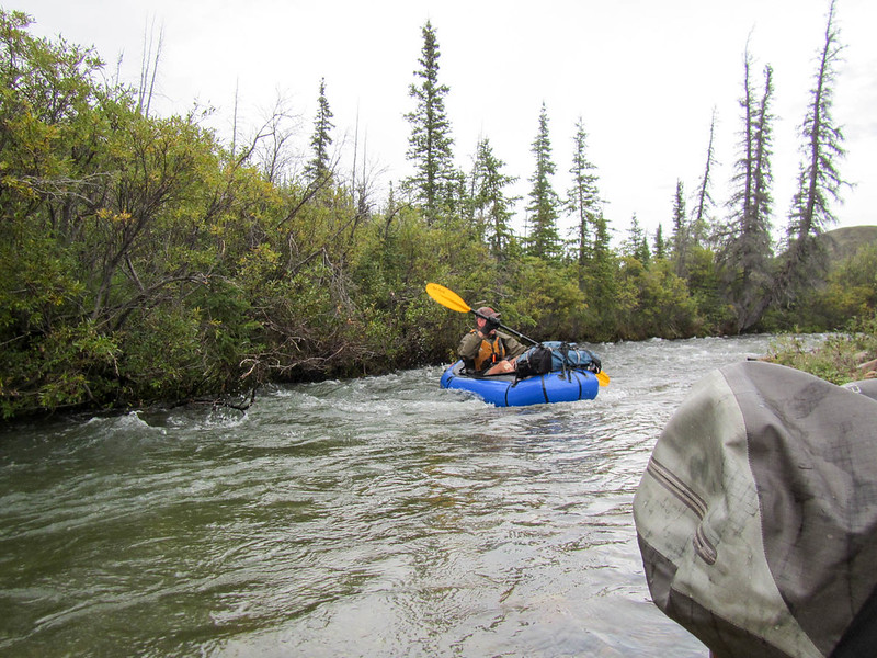
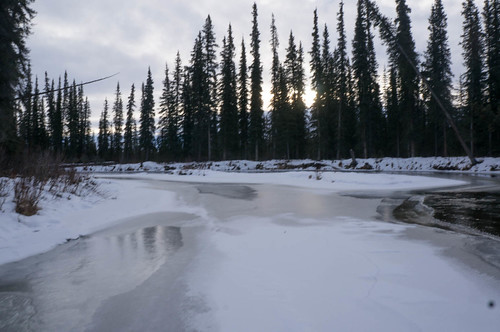
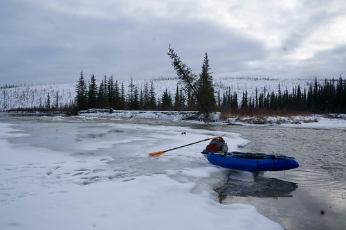
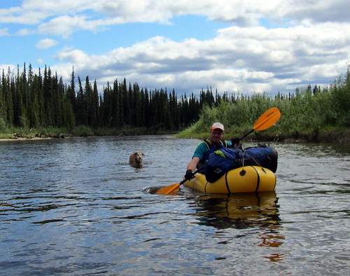
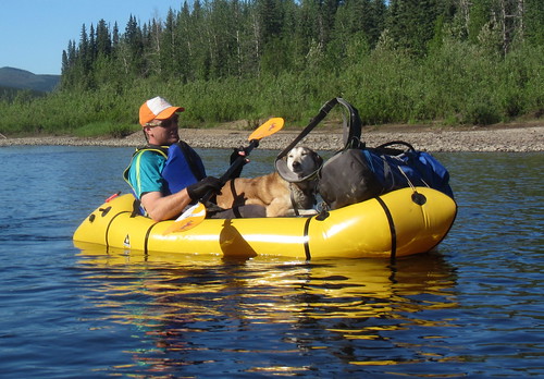
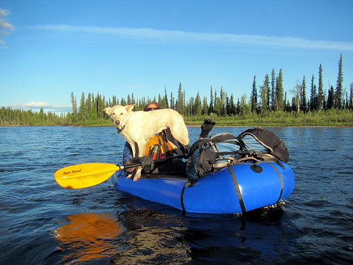
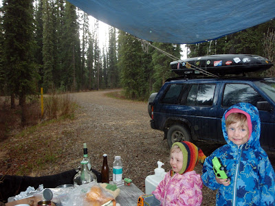
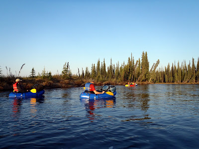
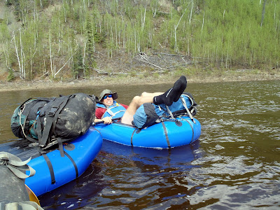
For the last several years I have being hoping to do a version of a pack rafting trip Roman Dial did in the White Mountains, floating down Beaver Creek, then hiking back to the put-in. This spring everything came together and one evening I found myself floating down Beaver Creek with Ms Marsh, Tom, Andrea, and John, on the start of the loop.

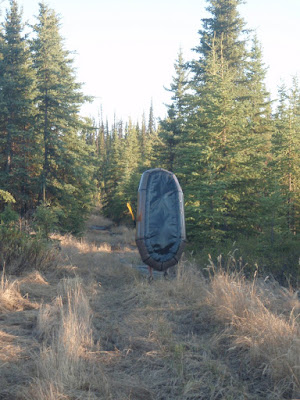
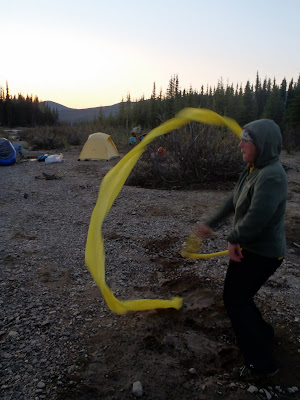
We left town late Thursday afternoon, intending to have a mellow couple of hours of floating on Beaver Creek before camping along the river. After several hours of mellow floating, we camped on a gravel bar and called it a night. Just before we all turned in a single caribou gave us a bit of a start when she splashed loudly across the river to investigate us, and took off once she determined we were not fellow lichen-eaters. There were are number of strangely colored patches on the hill across from our campsite, and on a lark I took off to go check them out. It turned out they were crape paper streamers weighted with sand on one end.

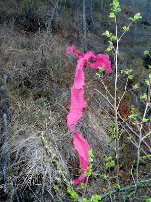
I was pretty baffled by the discovery as this spot is a bit out of the way. Perhaps they were dropped by plane to mark something, though they were lots of them and they were all over the hillside, so they would not be very effective as a marker.. If anyone knows what the deal is I would love to hear how they got there and what purpose they have (beside being litter that is).
Ms Marsh did get some fine streamer twirling in though.

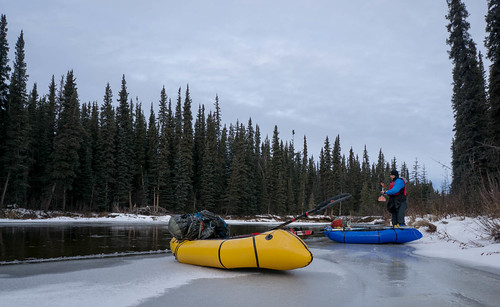
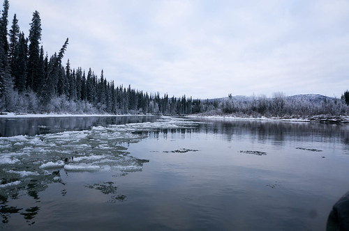
The next morning we continued floating. The weather was fantastic – hot and sunny, excellent for a long mellow float.


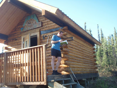
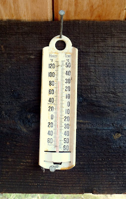
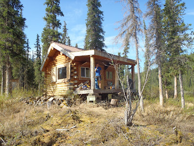
We stopped briefly at Boreali to stretch our legs, check out the cabin, and write a note in the logbook. The thermometer on the side of the cabin agreed it was hot.

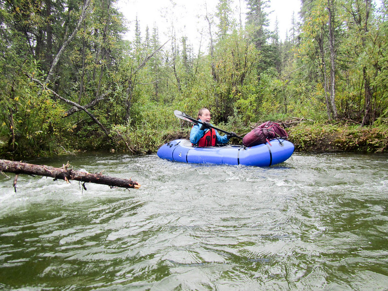
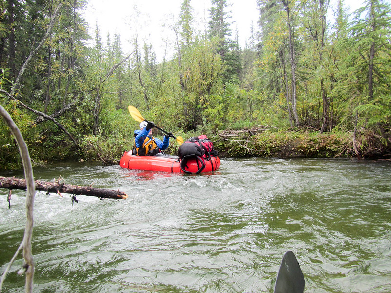
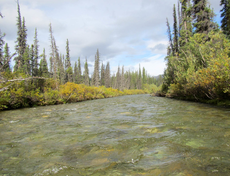
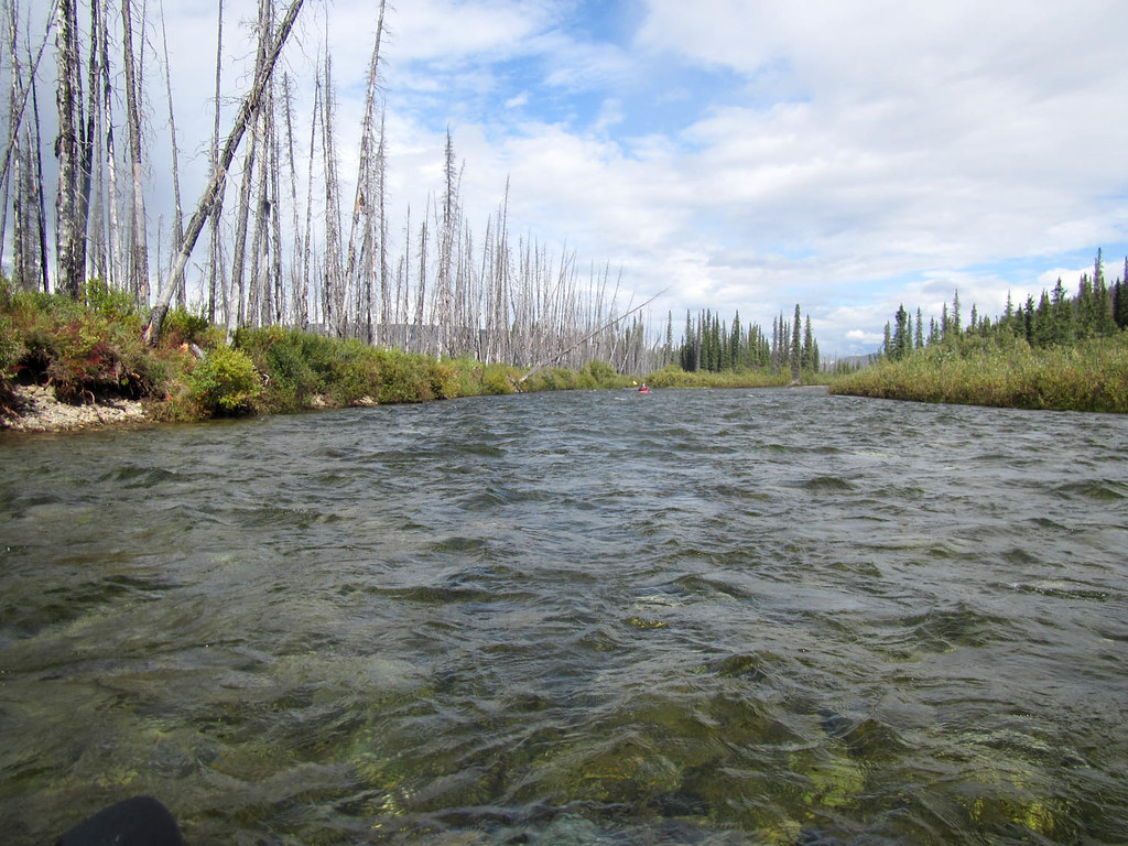
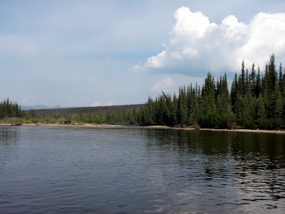
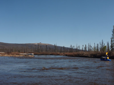
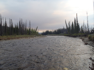
The first half of our float was on a section of river that I had been on several times before and I was quite excited to get to the section that was new to me, downriver of Borealis Cabin. This section of Beaver Creek is pretty fantastic, with wonderful views of Big Bend, a massive limestone hill that juts out into Beaver Creek.


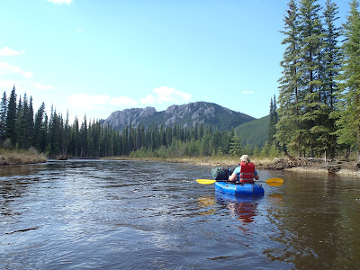
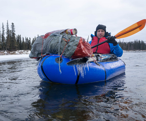
My pictures don’t really do it justice – the scenery on this section of river is pretty wonderful.

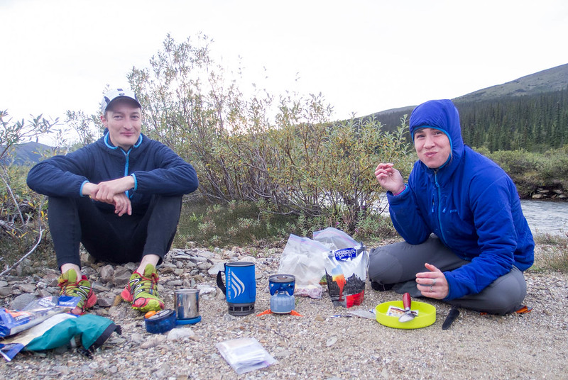
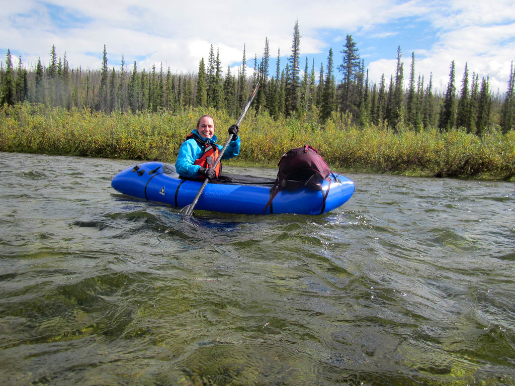
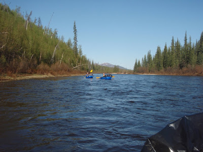
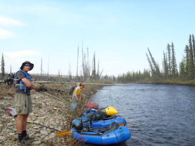
Floating Beaver Creek with John the biologist, Amy, and Andrea was a constant lesson in bird identification. They were on constant lookout for various types of birds and always pointing out new and interesting bird sightings, and listening to bird calls.

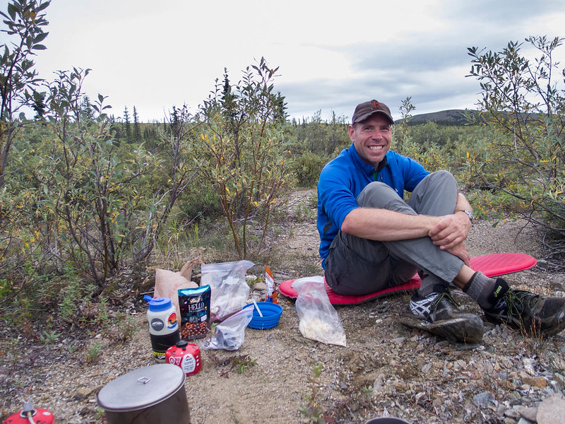
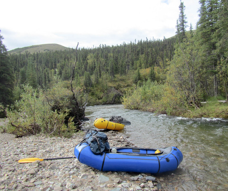
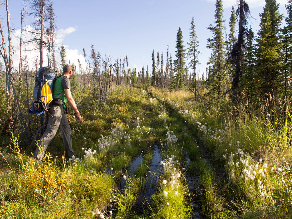
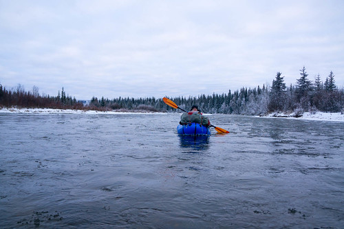
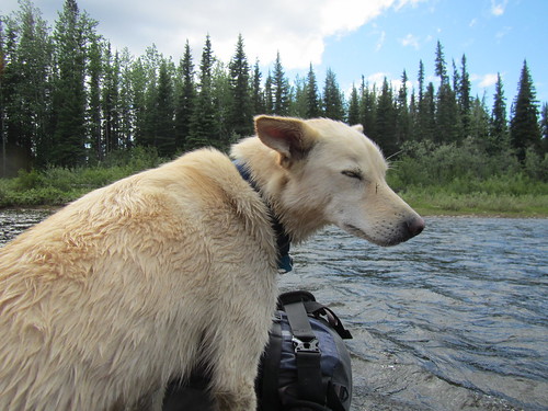
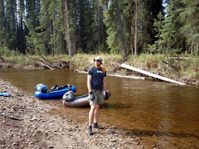
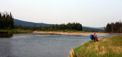
After a full day of floating we camped on a brushy gravel bar near where we would start hiking. The good camping spots were a bit rare on in the last several miles of river we floated, with all the nice gravel bars covered in dense brush.

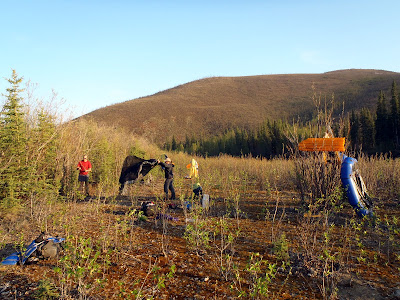
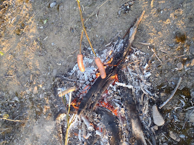
We spent the evening enjoying brats cooked over a campfire and finished the last of the PBR.

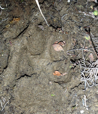
Our campsite had a pretty good view of the surrounding hills and it was interesting to see an area I have only been to in the winter. I have spent a hours slowly skiing this section of trail without much to do but look at the hills along the river, and so it was neat to get a different perspective. The river banks had lots of wolf prints, but surprisingly few bear prints. We saw only limited bear scat and only a few prints. I had been told this area has a fairly high concentration of bears, so I was a bit surprised by the infrequent signs of their passage.

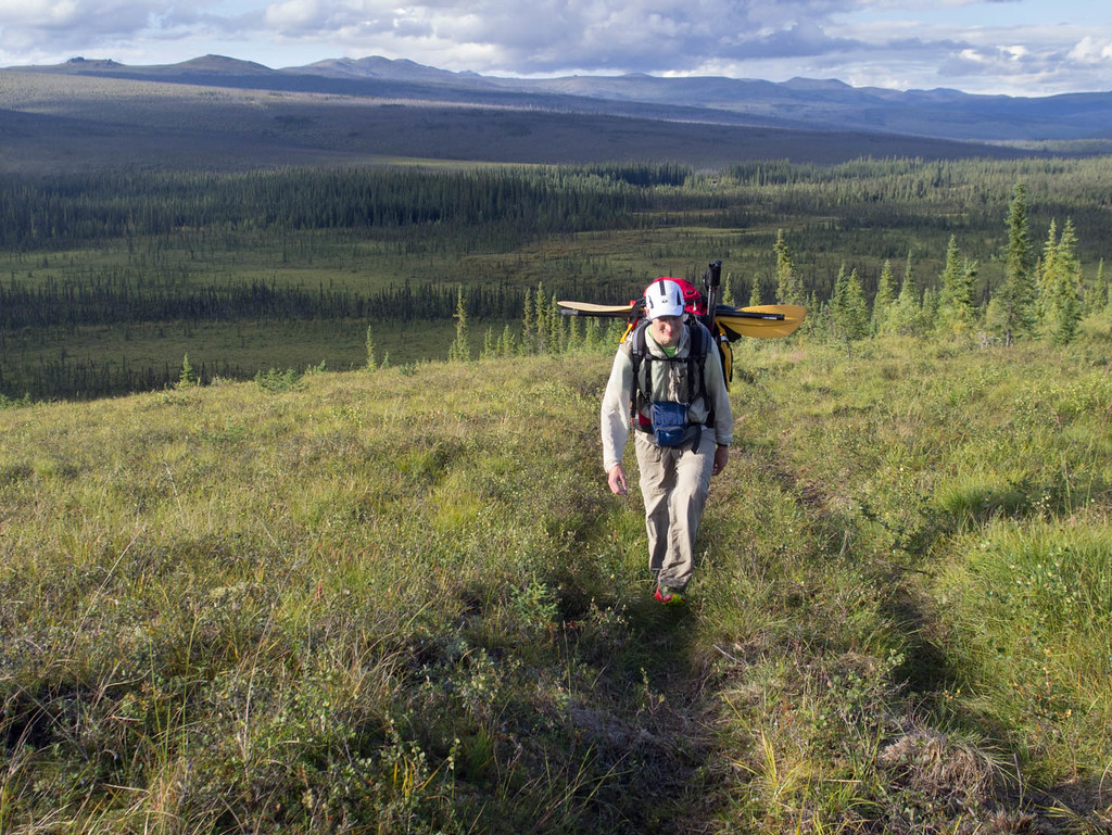
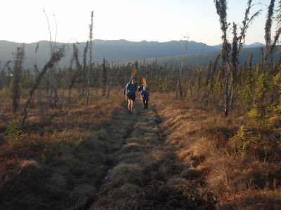
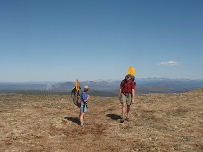
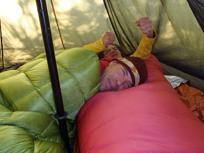
In the morning we headed up the hill on the start of our hike. Waking up was difficult for some of us..

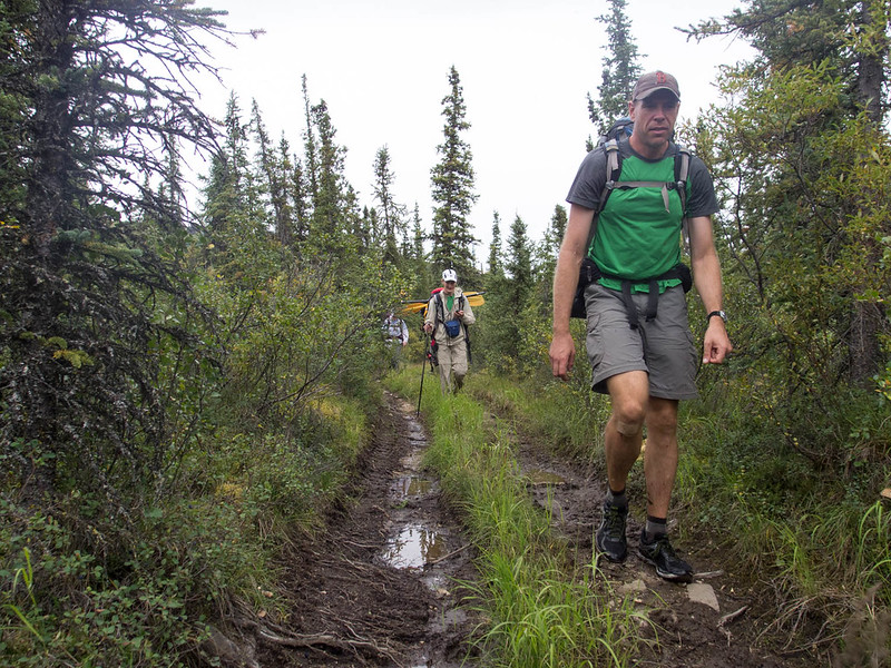
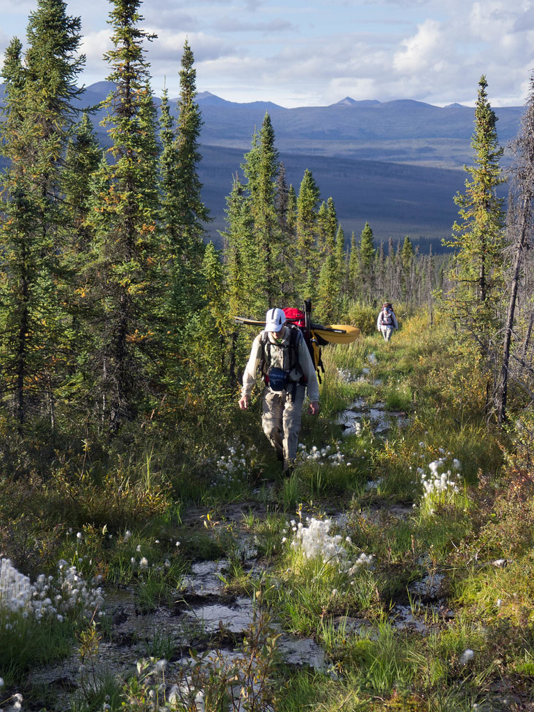
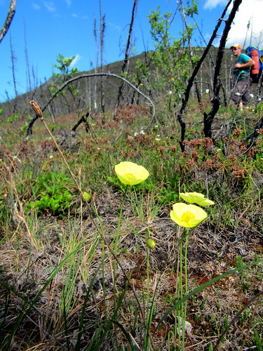
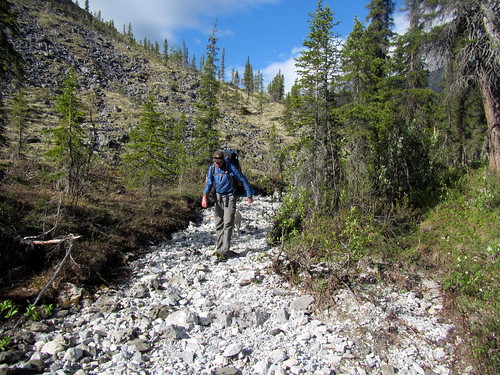
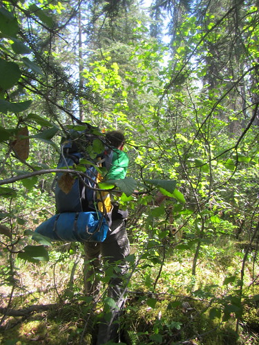
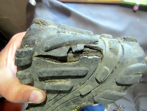
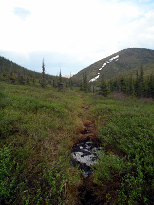
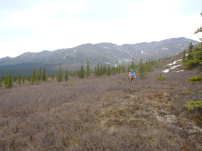
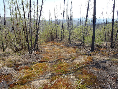
The first several miles of the hiking were a bit challenging as we hiked up though a section of riparian forrest that burned in 2004.

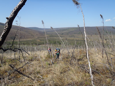
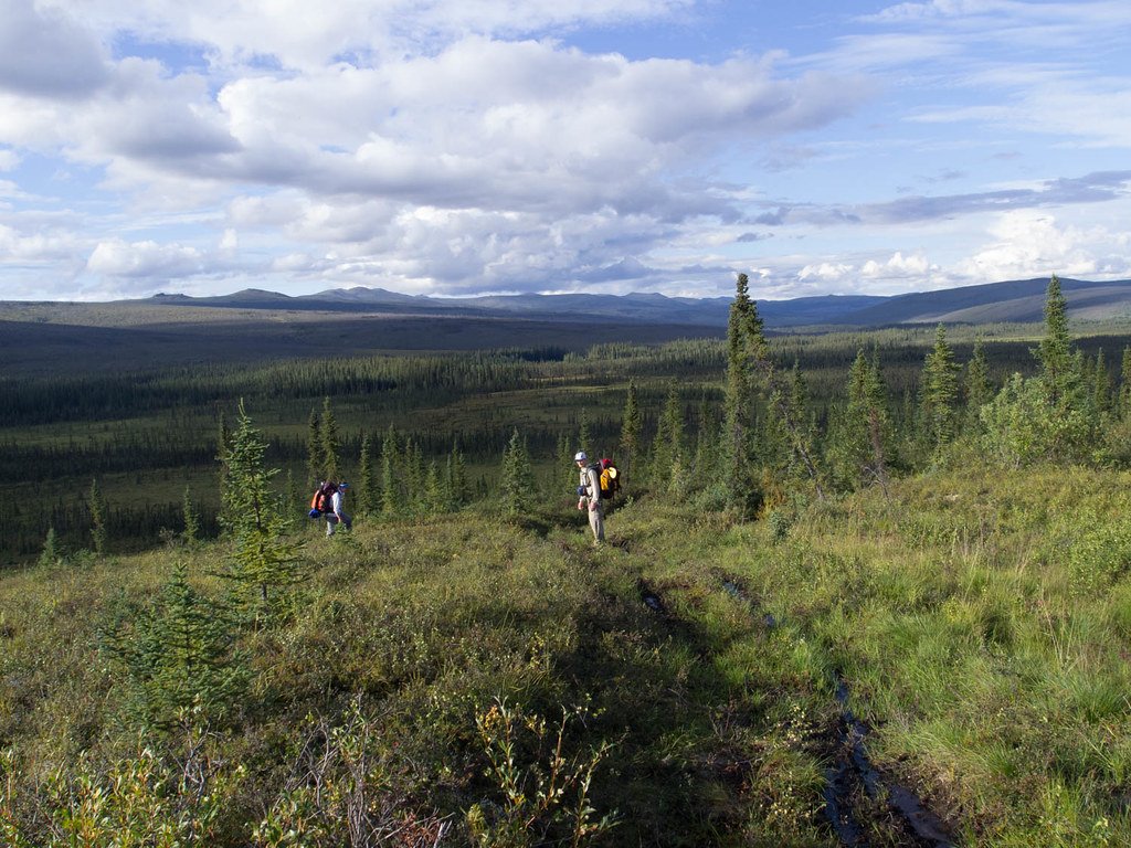
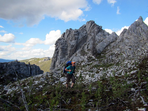
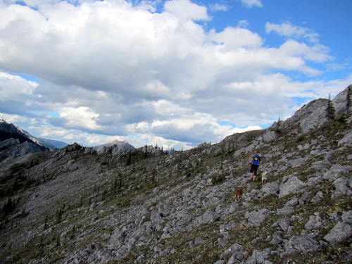
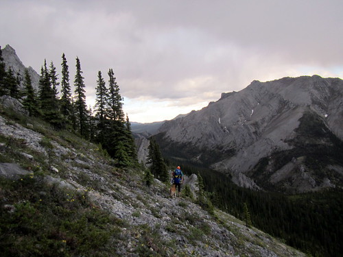
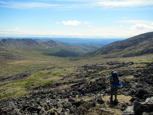
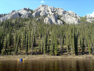
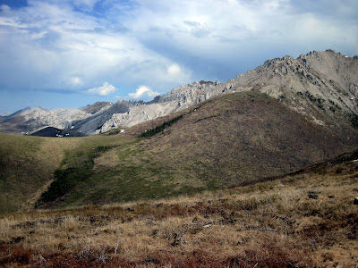
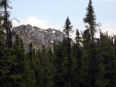
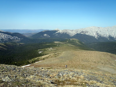
Eventually we climbed past all the burnt sticks and reached the ridgelines. The rest of the day was spent hiking up and down many small ridges as we hiked along the Limestone Jags that form the central ridge of the White Mountains. There was quite a bit of climbing and descending but the brush-free and tussock-free walking, along with the views, made it all worth while.

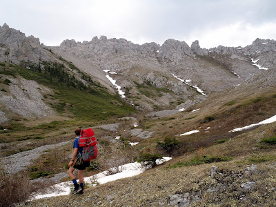
The massive limestone crags are spectacular.

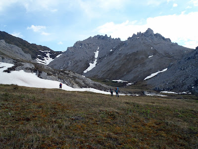
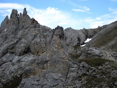
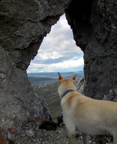
We saw several groups of sheep hanging out on the cliff faces watching us from above. Summer is a good time to be a sheep. Alas, I expect this area is pretty harsh in the winter time.

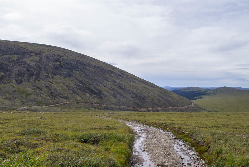
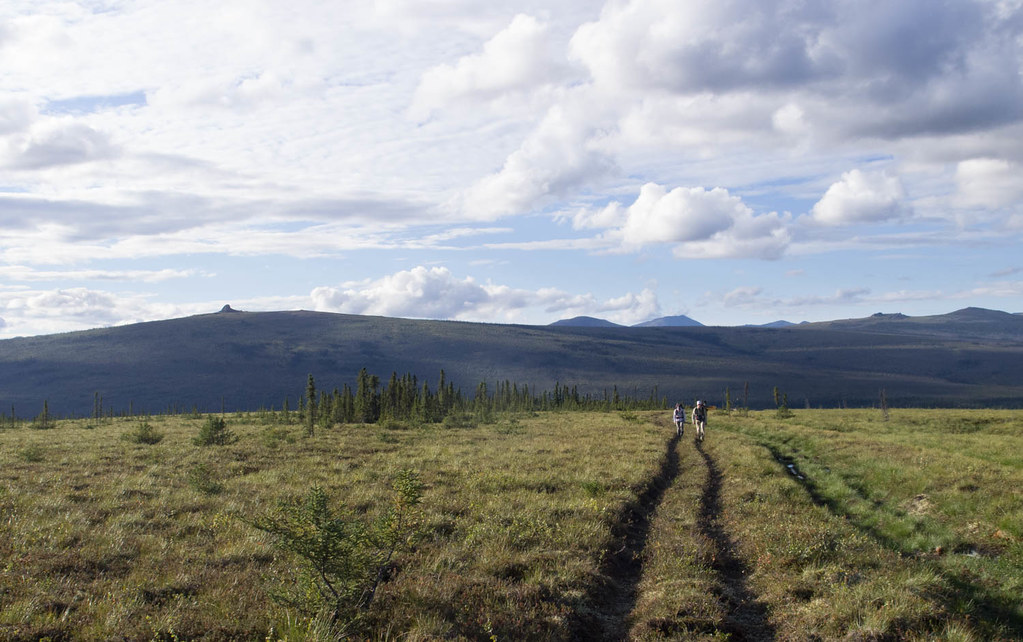
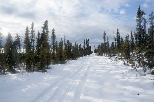
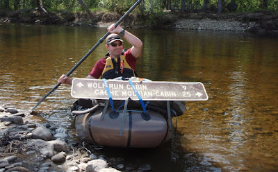
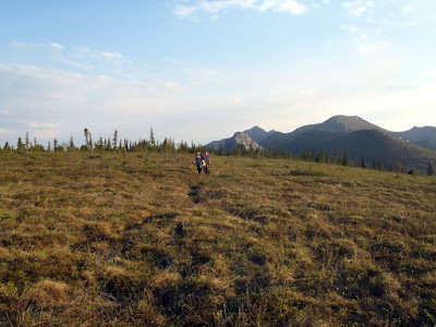
Eventually we tired of yo-yoing up and down, and descended to the winter trail that leads from Wolf Run Cabin to the Windy Gap area. The trail had surprisingly good walking and it appeared that the only traffic the trail sees in the summer is from the wildlife.

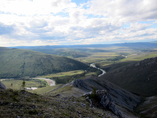
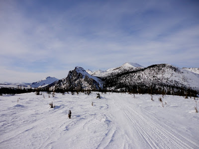
We made wonderful time on the winter trail, zooming down the trail while checking out the wonderful views of the valley. I have skied though this area many times, but it takes on a completely different character in the summer. Many sections that were slow slogs on skis zoomed by while waking, and several sections that are very fast (one decent is a bit too fast) seemed to drag on forever while walking. We made a brief stop to gawk at Windy Arch, a natural limestone arch in the ridge face as we walked past it.

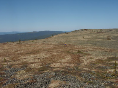
Just before the drop down Fossil Creek we traversed a long flat ridge that offers great views.

In the winter I often spent a couple of minutes enjoying the view, and the contrast between summer and winter is pretty interesting.

Eventually we descended to Fossil Creek. Several years ago I had nearly ran over a wolverine while coming down this section of trail in a snow storm. The thought of seeing a wolverine gave Ms Marsh some extra boost and powered her down the hill as she raced to be the first one though the wolverine sighting zone. John helped out, offering his professional biolologest advice on finding wolverines, including a rendition of the wolverine alarm call, which sounded suspiciously like “Help, help!”.
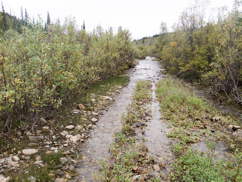
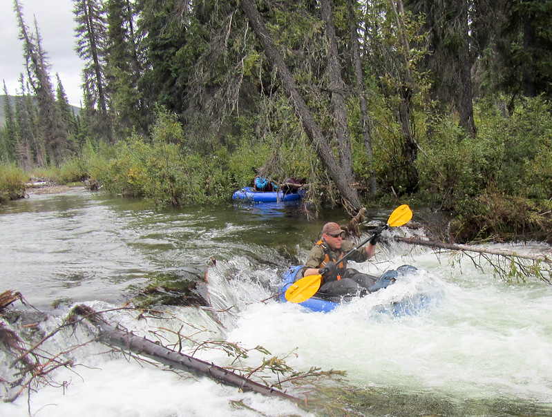
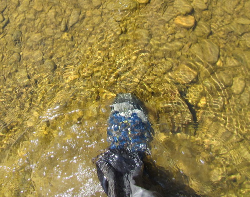
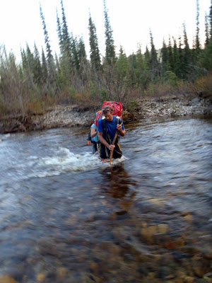
Eventually we reached Fossil Creek and much to our surprise, found it to be a fairly deep swift moving stream. It had enough water to make it (potentially) packraftable. After watching the giant of the group, Tom, ford the stream where the winter trail crosses and go up to his waist in fast moving water, we decided to spend a bit of time exploring possible crossing places that were hopefully not as deep and fast. We eventually found a point were it was passible and forded across.

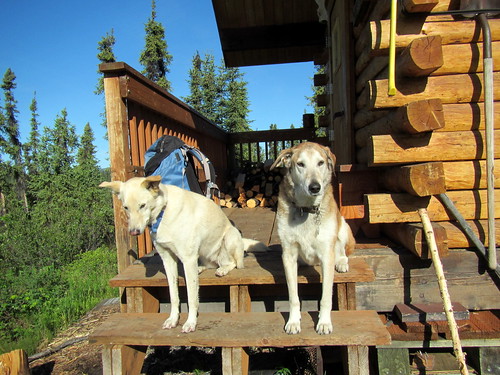
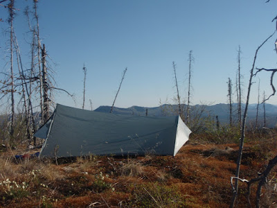
We then pushed on to Windy Gap Cabin.

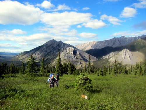
We explored the cabin for a while, checking the log book for other visitors, and relaxed in the little bubble of bug free heaven. We then camped in vicinity of the cabin, enjoying the fantastic views. In the morning we packed up and headed up a ridge leading towards Cache Mt.

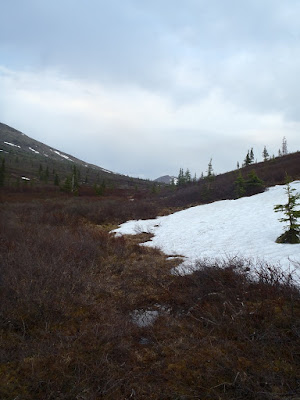
For most of the morning we climbed up a series of ridges to a pass near the base of Cache Mt. A week before I noticed while looking for some satellite imagery of a wildfire nearby that the entire Cache Mountain area was still quite snow covered. So far on the trip the hiking had been pretty good and snow-free. As we reached the pass and peered over we learned that things were about to change.

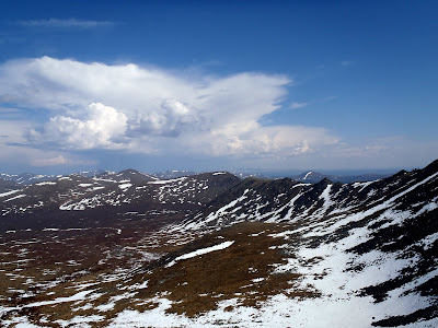
The valley over the pass was still well covered with snow, and as we descended we learned the valley was flooded with freshly melted snow water, making for cold and wet hiking. Eventually we made it past the cold and splashy valley and headed down to the winter trail that connects Windy Gap and Cache Mt Cabin.

Once we reached the winter trail the hiking became much more pleasant.


This section of trail is so remote it appears to get no summer vehicle traffic, and it appeared the only users were on four legs – mainly wolves and moose from the tracks.

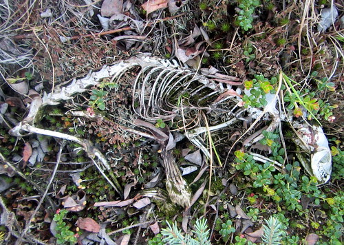
We also started seeing some interesting trail finds..

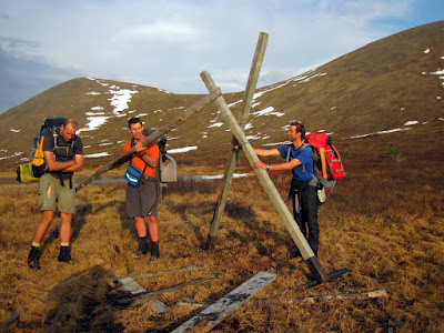
We followed the trail to the divide, enjoying the fast walking and the completely different experience of traveling this area in the summer. I have been on this trail on skis and by bike in the winter, in weather that ranged from tee shirt warm, to well below zero in howling winds. It was absolutely amazing to see it in the summer and it was really eye opening how different it is. There were constant reminders of the winter season here, with a huge number of tripods lying flat on the ground, and a steady stream of sled dog booties. We were not in a major hurry so we spent a bit of time righting the fallen tripods – if they stay up the trail will be a lot better marked.

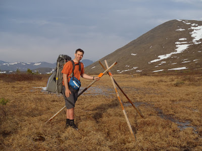
Upon reaching the divide we found a very beat up trail sign marking the divide that had long ago fallen to the ground and was lost to winter travelers. We also righted a massive tripod made from old sign parts.

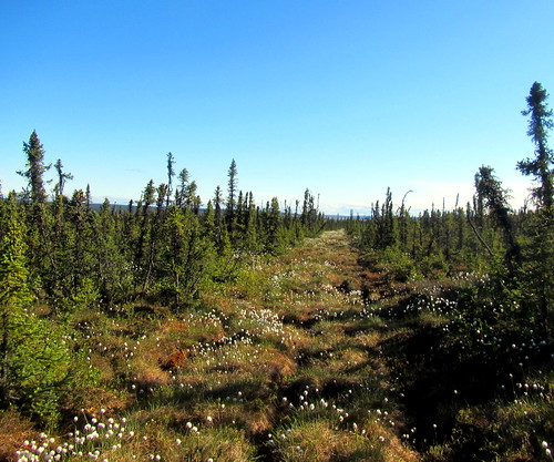
The divide was covered in knee high grass, but as we headed down the other side the vegetation quickly changed into a wonderful spruce forrest with large white spruce.

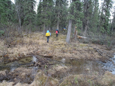
After several more miles of hiking along the trail we headed away from the trail and camped near O’Brian Creek. Since we had a long final day planned, we all hit the sack and made an early start. The morning started with a steep climb up though another burn, this time one from 2005.

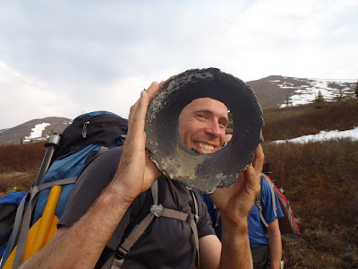
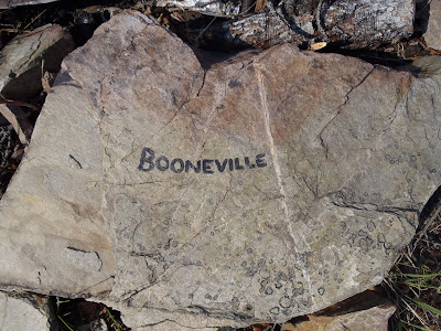
After climbing up and down several ridges we made it to the home stretch where we could see Bear Creek, which would take us most of the way back to the parking lot. The hike down the last ridge was made a bit more exciting by a chance encounter with a moose. John had just finished telling a story about how a female moose had found him inexplicably attractive and had chased him around and around a tree until he was forced to jab her with a stick, when surprise, surprise, a small female moose appeared and expressed interest in John. Eventually we managed to drive it off with John’s honor intact and we continued to Bear Creek hiking though mixed tundra and some occasional dense brush. Eventually we encountered a small rise with what looked to be a small hunting camp and a four wheeler trail leading down to the river from it. The hunting camp had some interesting rocks…

Leading away from the camp was a ATV trail that appeared to provide pretty good brush-free walking. It was a welcome sight.

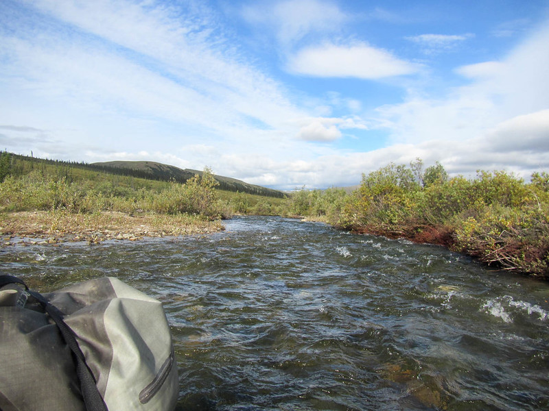
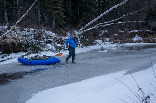
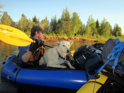
We zoomed down the trail to the river, where the trail continued on following the river. We ditched the trail, inflated our rafts, and began the short float out to Beaver Creek.

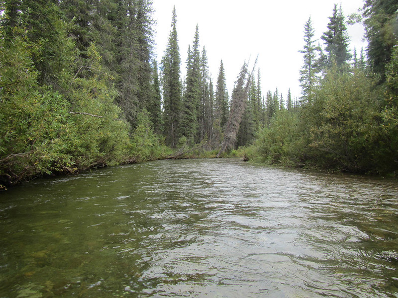
Bear Creek is a fun fast-flowing little creek that provided a wonderful way to finish the day.

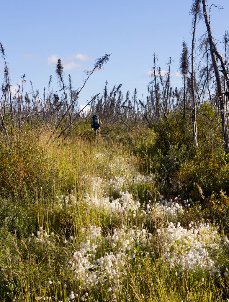
It is one of the two creeks that eventually come together to create Beaver Creek, the other creek being Champion Creek. The water was moving at a pretty good clip and we zoomed along enjoying the scenery and resting our feet. Bear Creek has a massive log jam that completely blocks the river, but there is a nice dry side channel that provides wonderful walking so we portaged around the jam until we reached Champion Creek, where we put back in and floated down to the confluence of Bear and Champion Creek. After another half hour or so of floating we reached our takeout. Alas, from our takeout we had to hike a mile or so though rather large tussocks to reach Nome Creek Road and our vehicle. It was not fantastic hiking, but not truly awful either. The views were pretty nice though, with the tussocks decorated with lots of little white flowers. Unfortunately a fire near Fairbanks brought a lot of smoke late in the day, so the visibility dropped quite a bit.

Eventually we reached the car, where we loaded up and headed back to town. Everyone was back to their respective abodes by 1am, which was not too bad.

This was a wonderful trip, and well worth repeating. There is something really fun visiting a place you normally see in a different season, and it provided a wonderfully different perspective on a place I really enjoy. The White Mountains are a pretty neat place in all seasons, and I think the pack rafting potential is largely untapped – so get out and have some fun!

A big thanks to John, Andrea, Ms Marsh, and Tom for making this trip possible!

The loop was about 90 miles, with 48 miles floating on Beaver Creek, 34 miles hiking from Beaver Creek to Bear Creek, and the remaining 8 miles a mix of floating on Bear Creek, and hiking from Beaver Creek to our car.

A map:

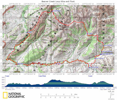
A larger 63k scale map can be found here.

More Photos Here!

A weekend with the family with a hike and float

Sunday, May 30th, 2010

On a super hot and dry day, the twins and I set off for Nome Creek campground. The plan was for Nancy to bike the 80 miles or so to the Campground while the Twins and I would drive. Later in the day another family along with Tom and Ms Marsh would join us. The drive out was fantastic, with a little smoke near Fairbanks which quickly cleared out as we left town. The twins snoozed the ride away, and we passed Nancy biking along at mile 50 or so. After reaching the camp ground the woke the twins up, and after a little grumbling about the rude awaking, they set off to explore the nearby sandbars.

They had lots and lots of fun exploring the sand and gravel, throwing rocks in the water, and other fun games.

After a couple of hours Nancy arrived and we all spend the afternoon together hanging out on the sandbars enjoying the sun. Eventually we were joined by the additional family and we all hung out having fun and enjoying the fine afternoon. After a dinner of pasta and cheese (a favourite of the twins) everyone hit the sack. Late in the evening Ms Marsh and Tom arrived and joined our encampment. The next day was nice and clear, promising good weather for the float and hike I had planned for the next two days. The twins were quite excited to be camping and quickly got up to go play in the sandbar again, after having a quick breakfast.


The breakfast menu was melon and cereal – yum yum!

After a slow morning Ms Marsh, Tom, and I set off to float down Beaver Creek. leaving Nancy to drive home with the twins. Our plan was to hike out on the Summit Trail the following day.

The water was pretty low – the Nome Creek gauge said 2 to 2.5 ft – which is a about a foot to two feet lower than the other time I floated it. I was not how the low water levels would effect stuff, but it turned out to be fine, though very slow.

Our first sign that something was different was when we reached the confluance of Nome and Beaver Creeks – last time we floated this section there was a nice and fun eddy line where the creeks came together. This time around there was no eddy at all, and the junction was hardly noticeable.

Beaver Creek was still float-able at these water levels, just a bit slow. Shortly after the confluence Ms Marsh found a very out of place trail sign that by the mile markers should have been just outside Windy Gap cabin. However we are well upstream of any trails heading to Windy Gap, and the only trail upstream of us is a dead end trail heading to Richards Cabin. Tom was quick to point out that it was also misspelled. How it got here was a mystery, so I decided to haul it out to Borealis and leave it there for BLM to ponder.

The sign had the added advantage of preventing Ms Marsh and Tom from playing bumper cars with me as they were quite worried about it’s not so sharp edges.

The float was quite a bit slower than when we did it last year – I think it took 9 hours total last year, and this year it took around 12, even though we took fewer breaks. There was quite a bit of mellow floating, bobbing along..

This was not all bad – I got to enjoy some mellow floating and enjoyed a fair bit of recliner time.

We ran into a few small rain storms and a fair bit of distant thunder, but nothing too intense.

We eventually reached Borealis, our takeout spot, and had dinner in the cabin and camped out nearby. In the morning we crossed Beaver Creek and started our hike out.

The hike begins on some very dilapidated board walk and then continues on the winter trail up to the summit trail. Last time I hiked this in the summer I noticed that the board walk appears to continue a ways after the winter trail turns off. I decided to check out the board walk and was surprised to see it continued for a fair bit and cut a bit of the tossuc slogging winter trail section of the hike.

Alas, after crossing the slue the board walk goes away and we were back walking on the tussocky winter trail.
On our hike up the Summit Trail Tom found several reminders of our winter adventures – he found a single stick of swix extra blue, and a White Mountains fuel tag.

After a shortish slog we reached the fine hiking of the Summit Trail – Tom was suitably excited.

The rest of the hike out was fantastic – the trail had great views and is in very good shape. the older sections of board walk had a large number of exposed nails which made things a bit treacherous at times.

The last section of trail was a bit of a mud fest. The trail used to look like this:

Now it looks like this:

Nancy, the twins, and I hiked it when BLM was revamping the trail with an assembly line of small bobcat like tractors.

At the time I had stopped to talk to the trail crew for a while, and they said the plan was to use “ditch and elevate” to remove the board-walk and have the trail dry in the summer and groomable in the winter. Its looking like a bit of a failure, as its a bit of a muddy mess now, in the driest spring I have experienced. Hopefully BLM will get the trail sorted out and have it reach some sort of drier state.

Once past the mud things went by quickly and soon we were at the parking lot, and before we knew it at Hilltop having burgers. Yum! Yum! The hike was fantastic, as was the float, though it would be a bit better to have done it with slightly faster water. Camping with the twins added extra spice and added a bit of extra spice – and of course fun was had by all!


A map:

More photos:

Beaver Creek-Summit Trail float hike

Fun on Beaver Creek

Tuesday, May 26th, 2009

As new owners of Alpacka pack rafts, Marsh, Tom and I decided to do our first “real” pack rafting trip. Our plan was to float down Beaver Creek and walk out the Summit Trail in the White Mountains National Recreation Area. While I spend a lot of time in this area in the winter, this will have been the first time I had visited this area in the summer, and I was really looking forward to exploring it without snow. I have had done the summit trail several times before, but had never gone all the way out to Beaver Creek.

We started the trip at the Ophir Creek Campground on Nome Creek with a large group – my wife and the twins plus two additional family. We overnighted at the campground, which was surprising pleasant and uncrowded for Memorial Day weekend. The evening’s heavy thunderstorm and rain shower was not very auspicious.

The next morning was super nice though, and so I said good by to Nancy and the twins and we headed down Nome Creek. Nome Creek was a very pleasant float – it was quite mellow, with hardly any interesting water action at all. We had to avoid several sweepers in the 6 miles until we hit Beaver Creek, but otherwise this section was pleasantly uneventful.

There where lots of spectacular views from Nome Creek, including some wonderful views of Sled Dog Rocks, a rock formation that looks like a dog sled and dog team.

After hitting Beaver Creek, we then floated approximately 26 miles before we hit our take out point. Beaver Creek is a very mellow class I float, with a small number of sweepers, the rare rock to be avoided, and a view sections with interesting eddy currents – otherwise it could probably be done while sleeping. Ok, perhaps I am exaggerating, but it is a very mellow float.

Once we hit our take out point, we stopped and took a look at Borealis-LeFevre Cabin. It was amazing how different this area is in the summer. The cabin was barely visible from the river, yet in the winter the cabin can be seen quite clearly. We saw from the log book Ed Plumb had stopped here 2 days prior on a grand adventure – we where instantly envious.

After getting a bite to eat we crossed the river and headed up Wickersham Creek trail on our way to the Summit Trail. After a mile or so we would have to cross Wickersham Creek, and since we where uncertain how large it would be, we carried the rafts to the creek in case it required floating. In the winter the creek looks fairly large and can have quite a bit of overflow on it. The creek turned out to be easy fordable by the taller members of our group, and the remaining member quickly floated across.

We then headed up the the Wickersham Creek Trail until it hit the Summit Trail. This was the most unpleasant walking of the trip – the trail is mainly a winter trail but had been used by ORVs in the past. It was quite muddy and a true tussock fest.

Once we hit the Summit Trial we walked for a couple of miles and then called it a day. We camped in a old burn which was spectacularly beautiful. I got to use my new tent for the first time and it was quite a success.

The next day we headed out and had a wonderful day of hiking. The weather was great with nice clear views and pleasant walking.

This a highly recommended easy pack rafting trip – its very accessible, a fun float, and a great hike out.