Posts Tagged ‘packrafting’

A trip to Melozi Hotsprings – like the Shining, only with hot water

Wednesday, July 28th, 2010

Note: Someone asked me about this trip, and alas, the photo site I was using (the old google photos) doesn’t work anymore – jump to the end, I added a link to a flickr gallery with the full resolution photos to see any of the photos in more detail. -Jay, Summer of 2018

Last year Ed Plumb and crew did a pack rafting trip out to Melozi Hotsprings, about 30 miles away from Ruby. It looked like a very fantastic trip, so Ms Marsh, Tom, and I decided to do a version of it, though at a bit slower pace. Our plan was to fly to Ruby, take a boat ride up the Yukon to Horner hotsprings 30 miles or so upstream, take a dip in the waters, then hike 25 miles or so Melozi, chill for a day, then float out.
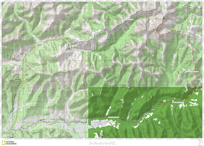
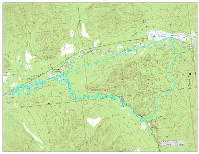
Here was our route.

Our trip started on a overcast and damp looking Sunday as we boarded a flight to Ruby – little did we know that “damp” was going to be the theme of the trip. In Ruby we meet up with Jim from the Yukon River Lodge just upstream of Ruby, who gave us a boat ride up the Yukon to the start of our hike.

We started the hike a mile or so from Horner Hotsprings. Horner was once the site of a busy lodge, but its now just a simple hotsprings in a dense thicket of brush. The brush on the hike in brought back memories of south east – hiking in the rain in dense green foliage. Fortunately there was no devils club!

The bugs were out in full force though – by the time we hiked the mile or so to the hotsprings we had collected quite a fan club of mosquitos. The hotsprings at Horner are a pretty simple affair – just a tarped rock pool, but the water was nice and refreshing.

We had the place to ourselves, excepting the bugs and some other small hot springs aficionados.

Alas, I was the only one who got in, as the bugs were pretty intense.

After a quick soak (having folks stare at you like you are insane tends to speed one up) we continued on our hike. The first day we planned to hike 6 to 8 miles and camp around an alpine lake. The hike out of the small valley the hotsprings resides was pretty interesting – we hiked though dense green brush..

Then into a Aspen forest..

And finally onto a alpine ridge above tree line.

The view from the ridge was not so hot – we had under 100m visibility with occasional brief batches of less then 10 meters visibility.. Not the best day to hike to a small lake on top a ride surrounded by steep drop offs… All went well though and we made it intact to the lake, though we arrived a bit wetter than we would have liked.
The view from the lake was a bit limited.

After a night of rain and wind, which my Tarptent survived intact, which was good news as this was by far the windiest I have every used that tent in. We spent the next day hiking on more ridges in near whiteout conditions. The hiking was a bit slower than we planned on due to rock fields and the poor weather, so we deviated from Ed’s route a bit. By the end of the day the weather was starting to clear up, but it was still raining intermittently with periodic low visibility sections as clouds blew though. The next morning arrived a lot dryier than the preceding two days – it was mostly cloudy without any rain – quite change. We also were treated to our first scenic vistas (beside fog that is) of the trip. After a couple of hours of hiking we soon were approaching the hotsprings, and got our first glimpse of the airstrip from a hill overlooking Hot springs Creek.

From the distance the airstrip looked pretty impressive – super long though a bit brushy.
As we dropped down off the hill, we followed the creek and soon were walking on the airstrip. The airstrip was fast walking, but didn’t look to be all that good of a landing place – the middle two thirds is washed out with moderately deep ruts in it.

The section near the lodge is in better shape, but is quite brushy with moderately tall alder. Its also a bit short.. I am not a pilot but it looked pretty tricky to me.

After we arrived we quickly dropped off our stuff at the main lodge after checking that no one was around and visited the hotsprings. I had checked with BLM’s online land status system before visiting to make sure the lodge is not currently leased and that it is public land, but I was still surprised that no one was there.

When we first arrived the main hot tube was a nice temperature and one could actually get in it.

By the end of the day it was pretty hot, and by the next day the tube was unbearably hot. It appears the main tub is not actually a hot tub per say, but more of a hot water holding tank for the lodges piped hot water during the lodges hay day. Perhaps all that rain cooled it down enough so it was bearable for the first day… The hot spring is situated on top of a little rock bluff, and the hot water flows over the bluff making a hot water fall that cascades down into Hotsprings Creek. After the first day we attempted to stand under the hot water falls, but that was a bit unpleasant – the falls are very hot, and the creek very cold, leaving your upper body scorched and your feet cold.

Never fear – we rearranged the rocks at the base of the falls and created a small pool with some random tarps laying around, making a little hot water pool right in the creek. This worked great, as regulating the temperature is pretty easy – all you have to do to cool things down is let in more cold water, to heat things up let in less cold water – very, very nice!

(Ms Marsh photo)
After a bit of soaking, we decided to so explore. The lodge complex is pretty extensive. We found a map in a filing cabinet with the general layout of the lodge.

A fair number of the buildings are in pretty good shape. The pool, alas, is has completely collapsed and is returning to the forest.

(Ms Marsh photo)
On the last day of the trip while waiting in Ruby for our flight out we talked to a local who remembered visiting the lodge in the late 70s and remembered the pool – apparently it had pretty hot water in it, and that it “had a deep end and a shallow end, just like the ones in Fairbanks”, as he put it. It must have been quite a novelty – a warm pool in such a remote setting.
The shop is in marginal shape – one side is open to the elements and the roof leaks. Amazingly the tools inside it seem to be in pretty good shape -there is a partially disabled three wheeler – a “Big Red” – the classic child crushing model that got three wheelers banned in the US..

A gas powered welder, several generations of chain saws, a weed wacker, and lots and lots of random hand tools and spare parts.

Outside the shop was a collection of very old snow machines, most missing engines, tracks, and other parts. The late sixties or early seventies vintage Johnson Skee-Horse was pretty entertaining (it was supposed to have a 14 horse engine – wow!), as was the ton of random old yellow Skidoo parts lying around.
.
The shop had a pretty nice selection of hand tools which were in surprisingly good shape.

The cold celler was a scary mess and I was afraid to look inside it.

The numbered guest cabins were in pretty good shape, though only one was suitable for staying in the winter.
Cabin number 5..

Cabin number 3..

The “Reindeer Cabin”, apparently named after the reindeer hearers who were the original residents and the first users of the hotsprings.

Apparently in the 1900-1910 time frame reindeer were raised up stream 15 miles or so of the hotsprings to feed miners in the greater Ruby area. The herders would come down occasionally and soak apparently, and eventually built a cabin to make things more comfortable. The Reindeer cabin is were the lodge complex really started feeling creepy – it looked like the last residents just up and disappeared. It contains chests of knitting, children’s toys, books, painting supplies, even the former residents prescription medicine – all left as if the former residents just decided to go away for a weekend, and ever came back. Its pretty creepy and a very depressing sight – it came across to me like the cabin of broken dreams..
Toys in the entryway..

A desk..

Drawings on the bedroom wall..

The main lodge building is in great shape and doesn’t really feel like it has been abandoned all that recently, until you start looking around..
Old caribou tags..

And the reading material all point to a mid 80s and early 90s abandonment.

The main lodge has radiators along the walls and under the floor and it appears that in its prime it was heated by the hotsprings. The building has a wood cook stove with a rusty stovepipe with holes, and a large rock fireplace, so it might be a bit hard to heat in the winter.

The lodge has a full size piano and an accordion. The piano still functions though a lot of the keys are sticky. Alas the accordion is pretty far gone and I didn’t have the heart to attempt to play it and break it.

Strangely the kitchen in the main lodge building had a mix of very old food stuff..

And some newer stuff labeled in what appeared to be German:

When we got back in town we were able to find these folks online – apparently they spent a week or so at the hotsprings in 2003. It was pretty fun to decipher one of the mysteries of the place.. Alas, lots of mysteries remain – its really hard to imagine why the place is abandoned. The hot springs are great, the surrounding country beautiful, and the fishing appears to be top notch, at least for grayling.. so why was it abandoned? It would seem to be quite a viable lodge.. perhaps not for hunting as we didn’t see much in the way of wildlife, but as a hot springs or scenic destination its nice. Lots of other lodges seem to get by with quite a bit worse setups. According to BLM’s online land status website, the lease expired in 1996, though the reason it expired are pretty unclear – did they forget to pay it, did it get revoked, or did something else entirely occure.. there are so many mysteries about this place.

The main building is pretty bug proof, and was great to hang out in for the day and a half we spent at the hot springs. Soon after arriving we had the place festooned with our drying belongings.

Having a place to dry our stuff and to hang out in a dry place was very nice after 2 days of rain.

After a day and half of hanging out at the hotsprings, we had to get a move on and start moving again, and so we inflated our packrafts and started floating.

Hotsprings Creek had quite a bit of water in it and the floating was pretty fun – lots of small splashy class II rapids.
We put in next to the waterfall and it was really fun to float by a hot water waterfall in a packraft.

The float out to the Melozitna River was quite fun.

We camped shortly after the confluence with the Melozitna. The Melozitna is a wide, slow moving and surprisingly warm river.

The daytime air temperatures during our float were in the mid 50s and it appeared the water in the Melozitna was slightly warmer – its pretty strange to be able to stick your hands in the water to warm them up.
The next day the Melozitna became a bit more scenic as we approached the Melozi Canyon. We camped 10 miles or so above the first rapids in the Melozi Canyon. Late in the evening three jet boats zoomed by, which was a bit of a surprise, as it was rumored that the rapids blocked off jet boats.

In the evening I was joined by a large number of small guests, who alas had to stay outside.

Next next day we passed though the Melozi Canyon, which probably the most interesting section of river we passed though. The Melozitna River has two short class III rapid sections that we portaged – they didn’t look all that hard but it was not really the sort of weather that makes one interested in getting we – we portaged the rapids.

The first rapid

The second rapid, as seen from below

The canyon is pretty interesting, with wonderful smooth water sculpted rocks.

The first rapid has a wonderful little side channel that goes around on the side, skipping the hard section.

This section would have made fantastic camping, alas it was the middle of the day when we went though and we had a lot more distance to cover, so we pressed onwards. The area looked to have a fair bit of wildlife traffic and would be a interesting place to watch and see what walked by.

Bellow the second rapid there was a number of small boulder gardens, but nothing too exciting.

Once past the rock gardens then it was back to mellow flat water floating.

The rest of the canyon is pretty scenic.

After the canyon the river drops into a flat plane and becomes fairly wide before arriving at the Yukon.

We camped fairly near the Yukon so we could get to Ruby before any afternoon winds kicked up and so we could make our afternoon flight.
The Yukon was surprising mellow – large and flat with a fairly tame current.

(Ms Marsh photo)
Soon we arrived at Ruby, had our rafts packed up, and I was enjoying a trashy book while waiting for the plane. Ruby has a nice picnic area near the water that we spend a hour or so hanging out it. There was also a three person crew that staying in the picnic area that was working on a small hydroelectric test bed project that aims to eventually provide Ruby with hydroelectric power during the summer months. After a bit of waiting we were soon on a plane back to Fairbanks.

(Ms Marsh photo)
A hour a bit later we arrived in Fairbanks to nice clear skies and Nancy and the twins – it was very, very nice to be home!

This was a super fun trip and highly recommended. A word of warning – the lodge appears to be open for leasing from BLM pending some site appraisal, so it might fall back into private hands – if you plan to visit please double check with BLM first to make sure it is still off lease before setting off. The airstrip is pretty marginal – perhaps it goes without saying, but only land if you are sure you can do it safely as it is pretty remote and its a long, long walk out.

More photos can be found here.

A Cast of Thousands on Riley Creek

Monday, July 12th, 2010

The king of pack rafters (at least Interior ones), Ed Plumb organized a trip down to Riley Creek near the Denali Park entrance. This creek is very accessible and is rumored to have some nice class II boating with at least one class III drop. It was supposed to be a short 1-2 mile hike followed by a several hour float. Ed recruited a very large posse (13 people total) for this adventure – I guess the short nature of the trip and the potential fun floating made it pretty attractive.

I was unfazed by the unlucky number 13, as my morning coffee was filled with good signs.

After meeting up at Lulu’s we all left town shortly after 9 and were on the trail hiking at a little before 1 in the afternoon.

The hike was fantastic – the trail is in great shape and very fast walking. We had a major train of people –

I was pretty bouncy from the latte and probably annoyed everyone around me with my endless babbling.

Fortunately people shifted around a bit and thus I got to spread my annoyance around.

Eventually we left the trail and dropped down to the creek.

Where we put in on the creek the water was moving moderately fast with more water than I expected – it looked pretty fun.

This creek has quite a bit of character – at the water levels we floated it at there were quite a few nice rocky sections with fun obstacles to maneuver around.

There are a couple of sections where the creek runs along smallish rock walls, but nothing too exciting.

The forum post that spawned this trip, circa 2007, mentioned a rope across the creek near a cable. Well, it turned out that there is still a rope across the creek under a cable, near a foot bridge.

It appeared the rope was used to haul stuff back and forth across the cable, but its seemed that having it dangle just above the water was unnecessary, especially since there is a foot bridge just near by. NPS’s legendary safety paranoia seems to be a bit missing here..

Shortly after the footbridge we encountered the rail road bridge and a brief exciting section. This bit could be a bit tricky – at the water levels we floated it at it was fairly fun and not too tricky. We took out just after the parks highway bridge and made our way back to the cars.

Quite a fun day trip and highly recommended. Its very similar to windy creek, but at the water levels we floated it slightly harder with a few sections that are a bit more challenging. The total time for the hike and float was around 5 hours so it makes for a nice mellow day trip hike-and-float. It was pretty fun to float in such a large group. There was quite a selection of paddles, different sorts of boats, and several generations of spray skirts all of which it was fun to see in action. There was also a wide range of gear folks were taking. One of the pack rafters sported a neat helmet cam made from a gorilla pod and also going super lightweight style with no pack – just strapping his pfd to his life vest – most impressive! Hopefully some of the videos he took will get passed around, as they might make interesting viewing.

More photos here:

Riley Creek Packrafing trip

Fun in the mountains – a hike and float on the East Fork of the Susitna

Saturday, June 26th, 2010

Tom, Marsh, and I decided to spend a couple of days doing a version of Ed Plumb’s East Fork of the Susitna Trip . The trip was a blast and very fun.
We started off by leaving town at an moderately early hour and after 4 hours or so neared our destination.

Our plan was to drive up Valdez Creek road until it stopped paralleling the Susitna River, then drop off on of the trucks, and continue driving up the road as far as was reasonable, the hike over to the East Fork of the Su, and finally float out back to the truck. We ended up driving about 2 miles down the road and left Ms Marsh’s truck at a pull out, then continued down the road for 8 miles or so when the deepish creek crossing convinced me to park the car and get start hiking. The first day of hiking was mostly on an atv trail that followed a small stream.

The first mile or so of hiking passed though some active gold mining claims. At one point we surprised a large family out gold panning – the kids in the family seemed very, very confused by our life jackets and paddles, but apparent lack of boats.. I am sure we generated lots of discussion after we got out of ear shot.
The hiking was pretty fast and easy – atv trails are not very scenic but make for nice walking!
The trail crossed the stream quite a few times.. no dry feet here.

We passed a number of old mining camps, but besides the activity around Lucky Creek everything else was pretty quiet – just rusty machines lying around and boarded up shacks.

Eventually the ATV trail dead-ended at a bluff and we ended up side hilling to Grog Lake where we camped for the night.

Grog Lake is in a very beautiful little bowl, but summer had yet to fully arrive here – it was mostly still frozen.


After a fine dinner we hit the sacks and after a good nights sleep, we set off in the morning a little after 10, with plans to head out to the hills overlooking the East Fork of the Susitna. The morning it was raining – when I woke up it was poring pretty hard and the view from my tent was not all that inspiring.

The rain tapered off pretty quickly though and the morning ended up being fairly rain free, though a bit cloudy with a random fog patches blowing though. The view from the first pass was pretty spectacular.

After crossing the next pass we ran into a small herd of caribou who were fairly nonplussed with our intrusion. We ended up seeing numerous small herds for the rest of the trip.

At this point we deviated from Ed’s route – the pass Ed had used was still pretty snowed in and we ended up taking a slightly different route, which took us to the East Fork a bit lower down, but also gave us some snow free and scree free hiking. We did get to walk a bit on some nice overflow on Boulder Creek.

We debated floating Boulder Creek as it looked to be fairly float able but decided not too. This was probably for the best, as Boulder Creek plunges though a canyon of doom just before reaching the East Fork, and the waterfalls and rapids were loud enough we could hear them several miles away as we floated by on the last day of the trip.
After crossing the creek we headed up to make camp near a strange circular lake with a island in the middle on top of a flat ridge.

The second and final camp-site turned out to be fairly scenic.

The lake had a huge number of birds nesting around it and their cries provided a nice backdrop in the evening.

While packing for the trip I had taken out the “extra” poles for my tent, intending to replace them with my trekking poles. Alas, I took out the wrong pole, and had to jerry rig something, but it all worked out in the end.   I really like this tent – its about 2 lbs, has lots of space, and seems to tolerate the wind pretty well.  This of course leads to a gratuitous tent and mountains shot:

In the evening we had wonderful views of the Alaska Range. It was fun to see the Alaska Range from the south side rather than the northern view that I normally get.

Mount Hess and Deborah were very visible and nicely lit.

The next morning was once again nice and rainy. I took advantage of my no-cook meal (on summer trips these days I just eat granola bars for breakfast – it hardly seems worthwhile to start the stove and cook something) and enjoyed my breakfast while sitting in the tent, away from the rain.

Things quickly cleared off once again and we set off hiking the last 3 miles or so to the East Fork. There was a bit of brushwacking, but it was fairly short, and soon we were floating on the East fork – hurrah!

The river was pretty mellow to start with, but there was a short section with some rapids. The first section was a bit bumpy, but otherwise uneventful.

The next section we scouted was more eventful – I scouted it briefly, thought it was no big deal, and after running a small drop, ended up flipping in a hole right after the drop. It was a bit silly, but not a big deal – I was not expecting the drop to have a strong recirculating current in it, and didn’t hit it hard enough and got pulled back into the drop and flipped. No harm done – after a short swim I was back on shore and we walked the next section, then put in again as things mellowed out. I am getting pretty good at flipping now.. We did walk one other section – there was a huge boulder up on river right with barely enough room for a packraft on one side, and a huge pore-over on the other – we walked that section, as it was not clear a pack-raft could get by on the right hand side of the rock without getting stuck. Last year one of the teams on the Wilderness Classic dumped (see this for more details) in these rapids. One of the racers lost his shoe and had to duck tape a bit of his pfd to his foot as a replacement. At the time they ran this section one of these rapids was in the class IV range and had a hole large enough both people dumped in it and got stuck.. we didn’t see anything too scary (besides the rock of doom – but that was easily avoidable) but folks should keep this in mind if they run this section at higher water levels – so be careful folks!
On the upside, besides the rock of doom and the drop, the rapids was all fun class II wave trains and splashing.

I avoided the wave trains for the most part – the water was glacial and very hard to see though so the wave trains could conceal rocks or other strange stuff, so I generally just skirt stuff that looks funky.

After the rapids the river widened out a lot and mellowed.

In some places it mellowed too much – the river is pretty silty and often the middle was so shallow that we could not float it, and were forced to get out and walk. Walking in the middle of a large river like this is a pretty funny experience.

Eventually the East Fork was joined by the West Fork, and the river changed character – the silty shallows went away and the river sped up to 5 to 6 miles per hour. This led to some mellow floating – as we just zoomed along with no effort.

Once the two forks joined the Su is really wide and fast – quite an impressive river.

We had quite a few wildlife sightings during the trip – alas no wolverines, but lots of other critters.
Baby Ptarmigan

Lots of Caribou:


And the ever present ground squirrel – oh so exciting! (Just joking.)

Our mileages for the trip was:
day 1: 9.31 miles
day 2: 11.66 miles
day 3: 2.75 miles hiking, 25.25 miles floating.

All the days except for the last one (it was a long float) were moderate length days and nothing very extreme.

This trip is highly recommended  – its a great trip and well worth the 8 hours or so of round trip driving from Fairbanks.

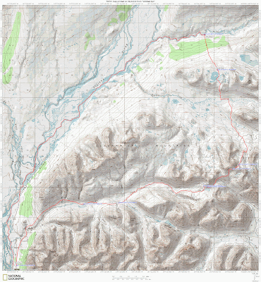
A Map:

East Fork of the Susitna Hike and Float – More pictures than you could possibly imagine!

A Nugget Creek Repeat!

Tuesday, June 15th, 2010

Tom, Ms Marsh, and I did a repeat of a trip Tom and I did last year – a hike, float. bike loop that visits Nugget Creek Cabin in the Chena River State Receration Area. This time we did it when the Chena was pretty high, and it was a much more fun float – the water was fast and there was no low water dragging at all. The river guadge at 40 mile was reading about 17.14 ft during the middle of the day. This is a wonderful high water float – there are sweepers but nothing really dangerous so long as you are paying attention, and the south fork flows a lot faster during high water making the float quite a bit more fun.

The river at Nugget Creek Cabin was almost bank full.

State Parks is in the process of putting in a new trail that will start somewhere around 1st bridge – this should make this a “instant classic” easy water pack rafting route.

They also improved the marking substantially – which is super as parts of the existing trail are very hard to follow. Wahoo!

The hike is a little under 6 miles, and the float is about 20 miles from Nugget Creek Cabin to the Rosehip campground.


A Map:

More pictures here:

Nugget Creek Hike Float, 2010

A short trip on the Chulitna

Monday, June 7th, 2010

On the way back from the packrafting class, Tom, Ms Marsh, and I stopped to do a quick hike/float on the East Fork of the Chulitna River. The river was supposed to be class II with a fair number of large rocks for eddy play, so I was looking forward to it. We started at the East Fork rest stop on the Parks Highway, and hiked back out from just below the confluence of Honolulu Creek. This section of river is super fun – just like I was told there are quite a few nice large rocks to play around. I had a great time practicing entering and exiting the eddies using the “stab and jab” technique from the packrafting class. Perhaps a bit too much fun, as I flipped while exiting a eddy with a nearby pore over – but no big deal I was back in pretty quickly and my “nearly dry” suit combo kept me dry.

The float is pretty scenic and in a couple of places the river goes by some interesting cliffs.

The hike out was fairly short and fast – it took about 20 to 30 minutes.

There is a more direct way with via a trail, but it ends up in someone’s driveway complete with a ton of “No Trespassing” signs, so we just bushwhacked directly out to the road.

This section of the river is super fun and makes a great day trip to breakup the drive from Anchorage to Fairbanks.

The pack rafting class has really changed the way I see rivers – I spent this float playing in eddies trying to hit and catch as many as possible, something I would have never done prior to the class. We need more rivers like this in the Fairbanks area!

A Map:

Pictures:

East Fork of the Chulitna day float/pack

Dumping is fun, and other lessons learned in a pack rafting safety class

Sunday, June 6th, 2010

A bunch of us from Fairbanks headed down to the Willow area last weekend to take a pack rafting safety class from Jim Gonski of the Alaska Kayak Academy. The class is highly recommended – I learned a lot.

Some of the things that I learned, in no particular order:

  • Flipping is no big deal – we spent quite a bit of time in the water, which made me quite a bit more comfortable in moving water out of the boat. I also had the experience of being the only student who flipped accidentally – hurrah for me! Amazingly it was while everyone was watching too – success! The end result was that I learned that flipping was not a big deal.
  • Getting back in after flipping is also not a  big deal – we spent a bit of time on getting back into the packrafts after flipping – it was a lot easier than I expected.
  • Throwbags and helmets are a good idea in any sort of harder water. After watching another student having a bit of trouble getting out of a flipped packraft it was pretty clear that head protection of some sort is a really good idea. On the second day as we got ready to float we had to toss a throw bag some random packrafter who had dumped just upstream of our put in. Alas, my throwbag is about 1lb dry, and lots more wet – I think a future sewing project will be to sew a slightly lighter throw bag made of less absorbent material that still allows the rope to dry. More to come on this subject..
  • Eddies are fun – I knew intellectually how eddies can be used to slow down and reposition, but this class really brought out their usefulness. I need to find a section of river with some good eddies to practice with (or perhaps play?)  the greater Fairbanks area!
  • Those extra strokes – I had learned the sculling and draw strokes, and to some extent learned when to use them. They appear to be quite a bit more useful than I initially expected..
  • Even day one should pack the minimum set of backup gear – in the class one of the students lost her valve cap, leading to sudden deflation excitement. One one had a backup cap, a inflation cap, or even a patch kit.. This drove home the point that even on short day pack raft trips I should carry the minimum set of emergency gear.
  • River ratings are very subjective – the hardest section of Willow Creek we did was according to the instructor, rated class III. It felt much more like class II stuff though, so I guess ratings must vary a lot and are perhaps subjective.
  • Rigging – I have a line all the way around my boat – a “fun-rail” as Roman Dial calls it. My boat was used for the classe’s test flips, and no one got tangled up in them or lost hold of the boat, so I guess this was a success.

    The instructor’s boat was rigged like this:

    • View of the “fun-rail”
    • The grab line on the bow

    Some of the interesting thing to note – he had the full around rail, a daisy chained line on the bow, and a “flip line” made of webbing which is supposed to help you flip the boat over after an upset. He also had a whiffle ball attached to the spray skirt’s release tab – alas I have no pictures of that.

Alas, I am afraid I was not the best student – I had a hard time paying attention with all the river noise, my packraft ADD, and the hockey helmets we had on. I also regret not taking some extra runs Saturday evening, as we had dry suits and Willow Creek was very, very fun.

I think I will take it again next year – especially if Jim G. offers a class that is the “next step” up in difficulty.  I might also take the full on swift water rescue class, though all the rigging drills sound less than useful.

In any case, this class is highly recommended – everyone who packrafts and has the free time should take it.