Posts Tagged ‘packrafting’

Quartz Creek hike and float

Wednesday, August 10th, 2016

A while back I floated Bear Creek, one of the creeks that eventually forms Beaver Creek, with my friend Tom. I had been meaning to get back there, and with permission from the family to spend a Sunday and Monday away, and water levels very high, I decided to give it a try again. This time Tom and I were joined by Beth and Constantine. The route is a big loop, and involves leaving a car near the end of US Creek Road, biking over to Quartz Creek trail, then taking Quartz Creek trail for 12 miles, cutting over to Bear Creek, and floating down, eventually leaving Beaver Creek to hike back to the road.

Things got off to a bit of a rough start when near the end of the bike shuttle I got a flat, and like an idiot, stashed the bike and walked to the trailhead, thinking it as only a short distance, only to find out the “short” distance was more like 3 miles. I ended up running half of it or so before reaching the trail head. We headed down the trail, hurrying to catch Beth and Constantine, who had skipped the shuttle and had hiked ahead, planning on going at a mellow pace. Quartz Creek trail is a wonderful ATV trail, with lots of fantastic views…

P8071633

Unfortunately, Tom and I cut a switchback, walking right past Beth and Constantine while they mellowed out in the sun. We started to get nervous when we passed an ATVer who mentioned passing them, but not seeing them again… Oh-oh! Eventually we neared where we would cut off to the river, and started to get worried… but eventually they caught up with us, leaving Tom and me quite chagrined about passing them on a switchback.

After a bit of discussion, we bailed on our original plan of hiking over to the river, and headed to end of Quartz Creek trail to hike over to the river. I was a bit skeptical, but figured if nothing else we could just hike back to the higher county. The last mile or so of Quartz Creek trail is a bit muddy..

P8071635

and a bit wet..
P8071641

I was pleasantly surprised to see a lot of water in Quartz Creek… enough to float!
IMG_0511

After 45 minutes of floating we set up camp, mellowed out and enjoyed dinner..
P8071642

P8071645

And eventually hit the sack, after enjoying a fire on the river. I used my Inreach to send some knock-knock jokes to my daughters before they went to bed..

“Knock, knock. Who’s there? Wooden shoe. Wooden shoe who? Wooden shoe like to hear another joke?”

The joys of technology!

[The Editor could insert an Editor’s Note here. The Editor will refrain.]

The rest of the float was a blast, though perhaps a bit too fun for Beth and Constantine at times, as this was their second time in packrafts. They were good sports though, and quickly figured out how things work.

IMG_0522

IMG_0523

Quartz Creek was beautiful – crystal clear water, with neat bluffs and rocks.

IMG_0507

IMG_0514

IMG_0517

IMG_0520

Just after we hit the confluence with Bear Creek, we hit a blown out beaver dam, with a small section remaining that Tom ran. It looked fun..

IMG_0524

The rest of the float on Beaver Creek was uneventful, though very scenic and fun.
IMG_0533

IMG_0534

After a short stop to check out Richard’s cabin, where I scored a giant package of Twizzlers – I was running a bit short of snacks and it was a godsend – we soon reached our take-out. We hiked back to the car via Bear Creek trail. The last mile or so was a bit muddy, but nothing epic.

P8081655

P8081657

P8081662

P8081664

P8081668

P8081672

Folks wanting to repicate this trip should be aware that Quartz Creek might normally be quite a bit lower. When Tom and I did this trip in 2009, the water was much, much lower and Bear Creek was only barely floatable. The Nome Creek stream gauge read just under 4 ft. Much lower and Quartz Creek would hardly be floatable.

noca2_hg

At the end of the trip I had only a half of a Bear Creek Pemmican bar left – I think I need to start being better about bringing more food!

Thanks Beth, Constantine, and Tom for the company and motivation!

Nabesna To McCarthy

Sunday, July 17th, 2016

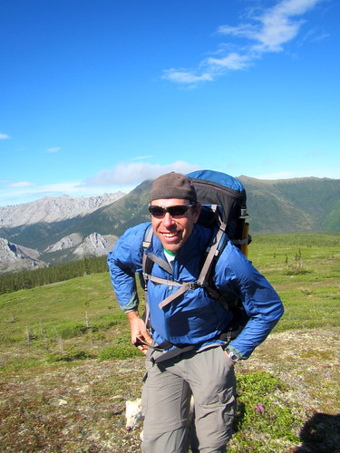
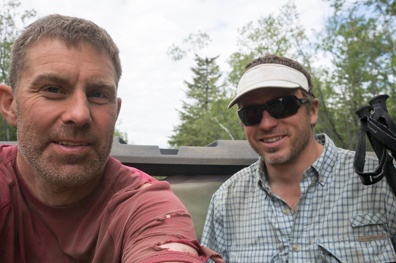
A long time ago, in the late 1800s and early 1900s, gold miners hauled supplies from McCarthy to Chisana and Nabesna. I have always wanted to visit the area, and when Heath suggested hiking and packrafting it, I jumped at the oppotunity! The “original” route folks used went from McCarthy to Chisana and the Nabesna/Slana area, but we planned to reverse the route so we could float a bit. The route has a pretty storied history – it was a wilderness classic route in the late 80s, and folks have even taken bikes on it. I was beyond excited for this trip! Another major bonus was that Heath did all the planning, making this the first trip in a long time I didn’t need to think about all that much – hurrah!

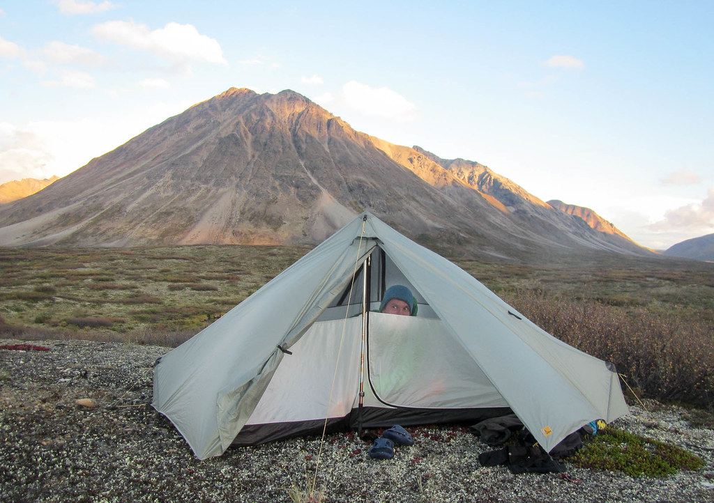
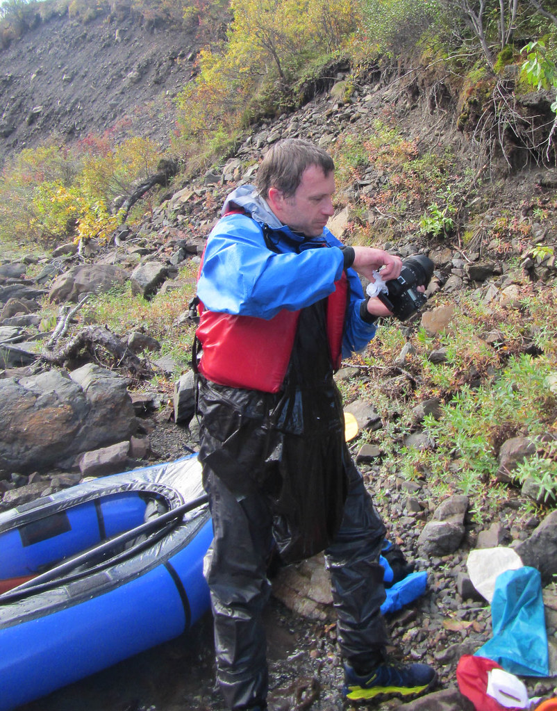
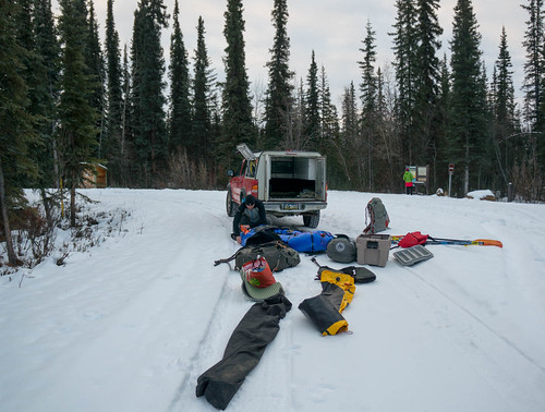
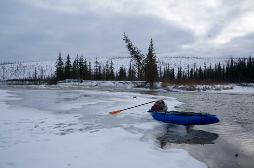
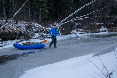
We headed out of town midday for the 5 hour drive to Nabesna. Nabesna is on the end of a 40 mile dirt road, and the trip got off to a bit of a rough start when, after passing a couple of small wash-outs on we came to a much deeper one – one that I wasn’t brave enough to drive across. It was a beautiful blue sky day, but apparently it had been raining earlier. We parked the truck safe from the water coming down the wash-out, and after checking out the nearby Jack River, decided to start the float a bit early.

DSC06721

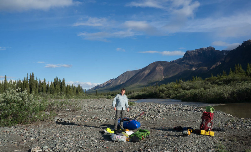
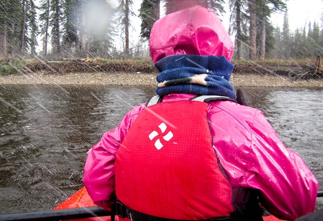
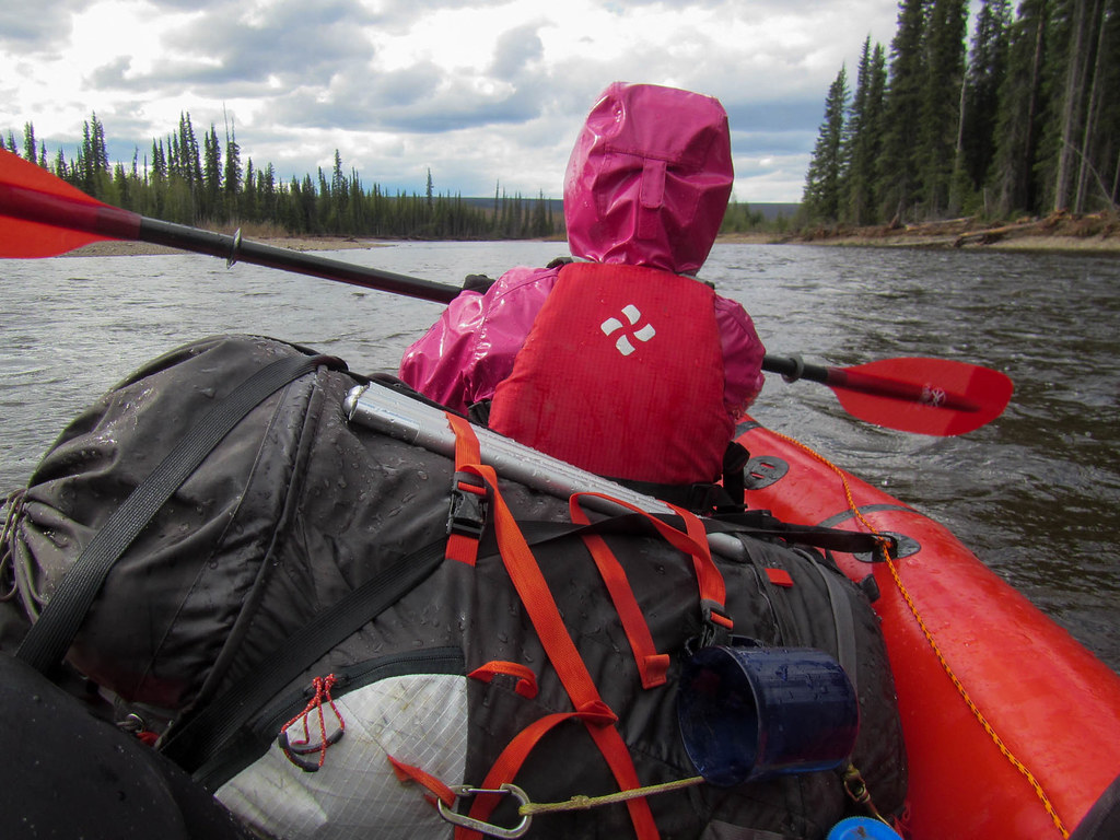
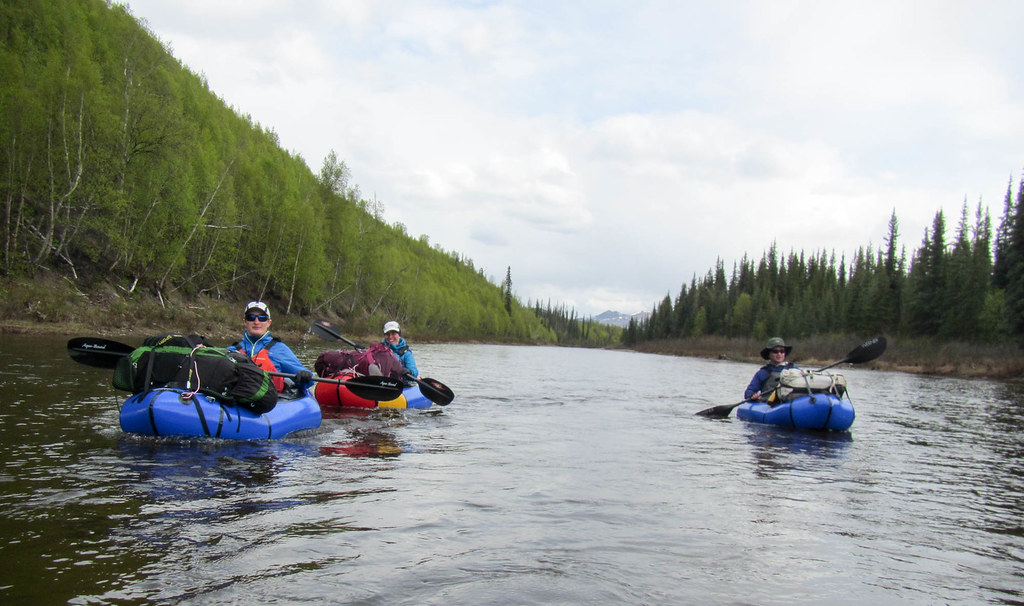
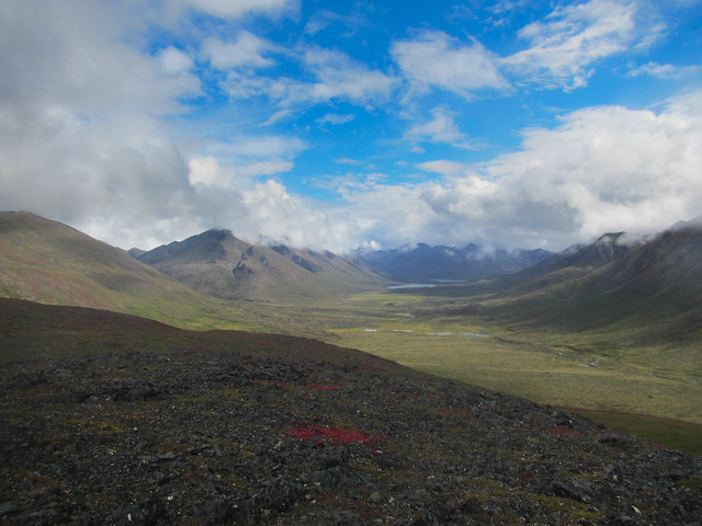
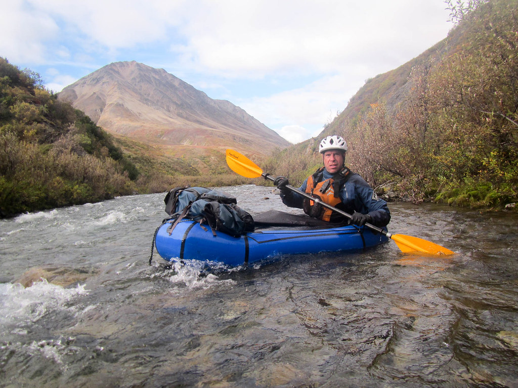
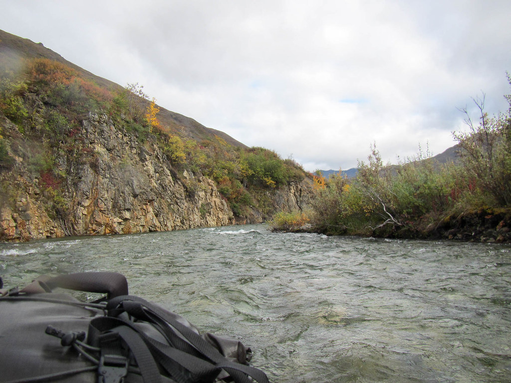
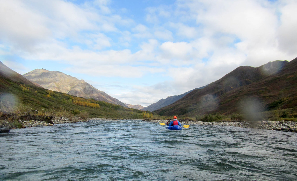
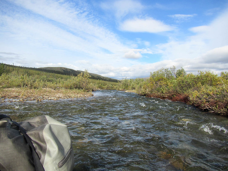
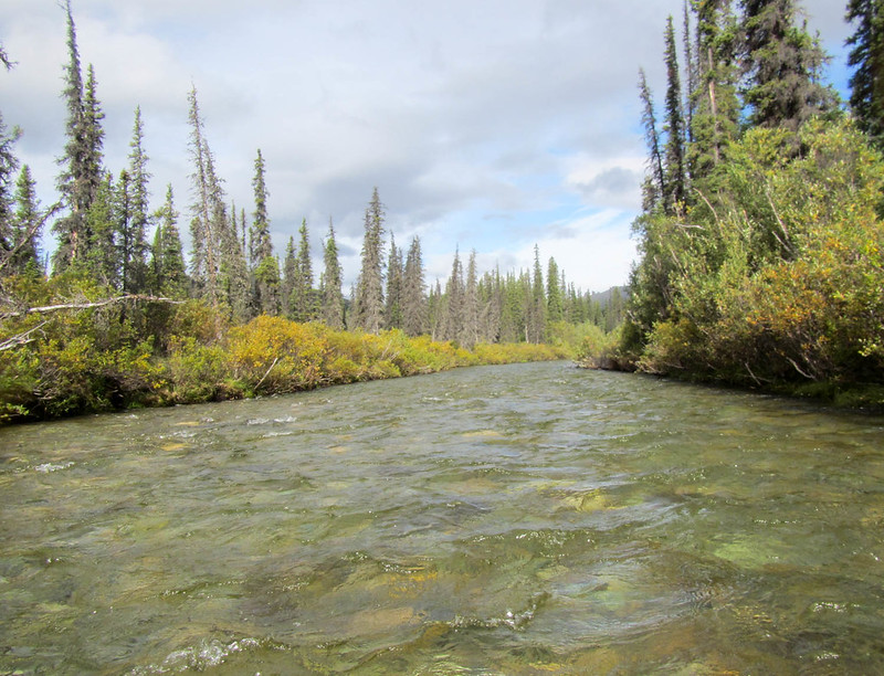
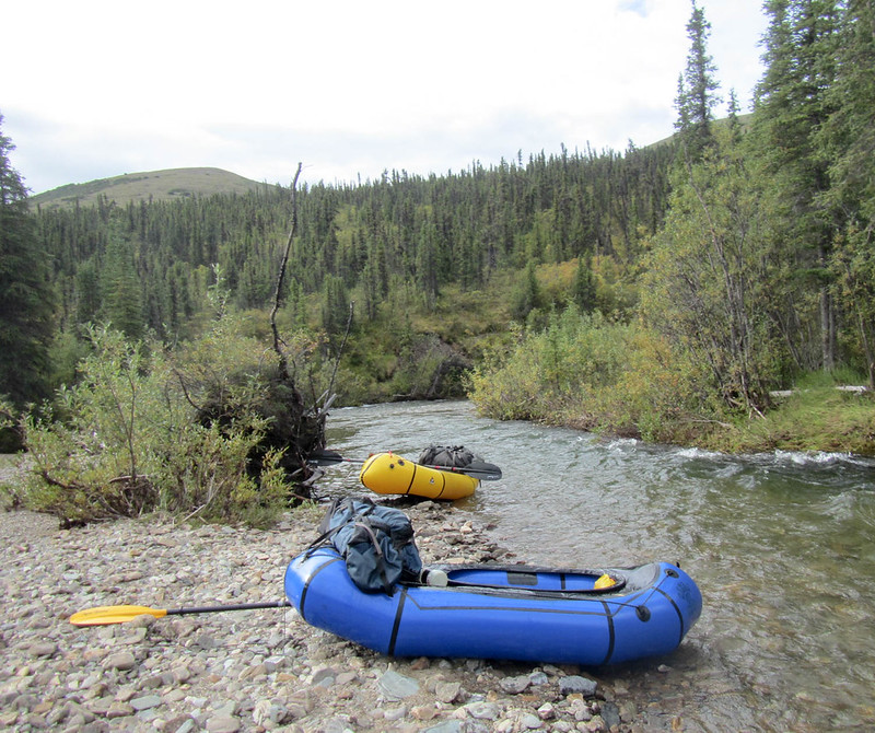
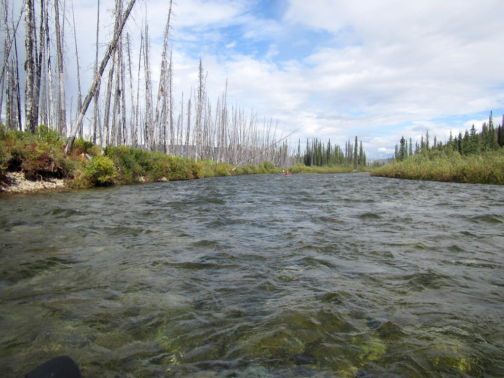
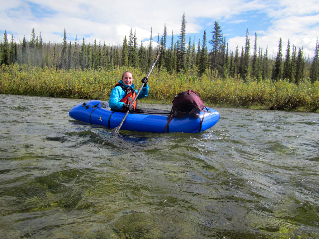
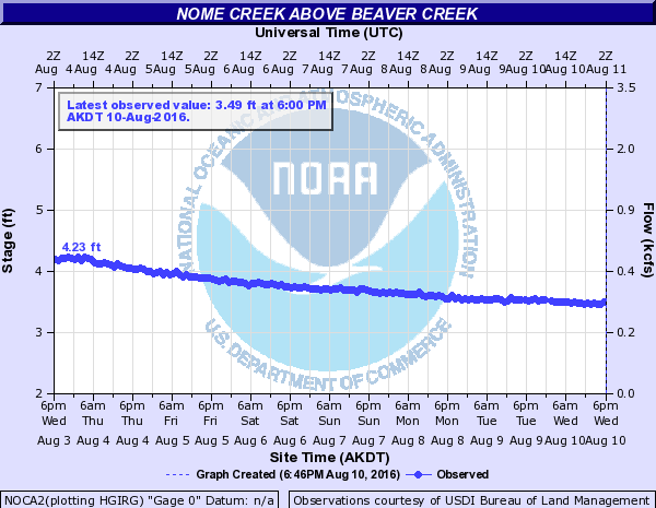
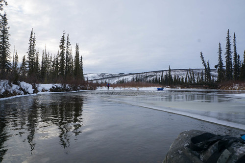
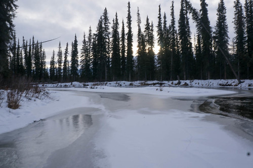
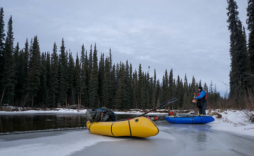
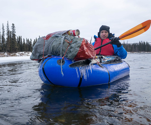
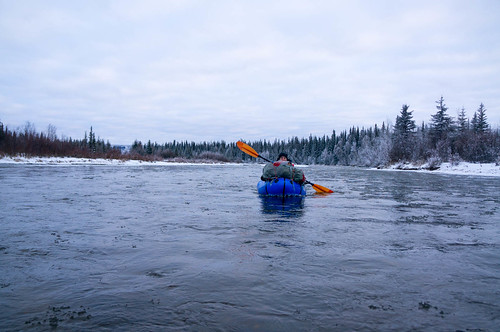
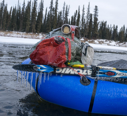
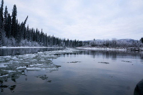
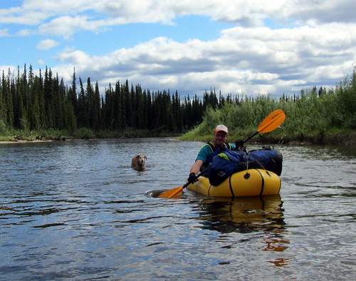
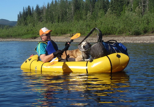
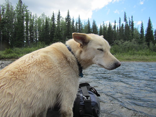
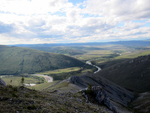
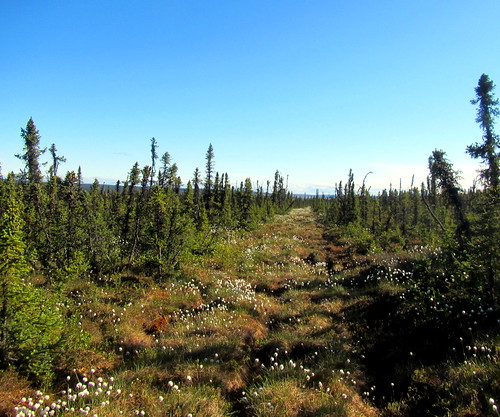
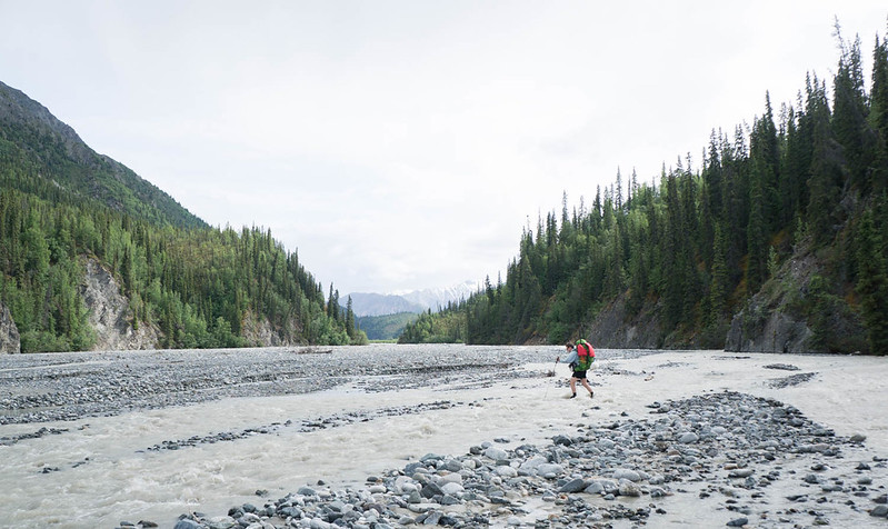
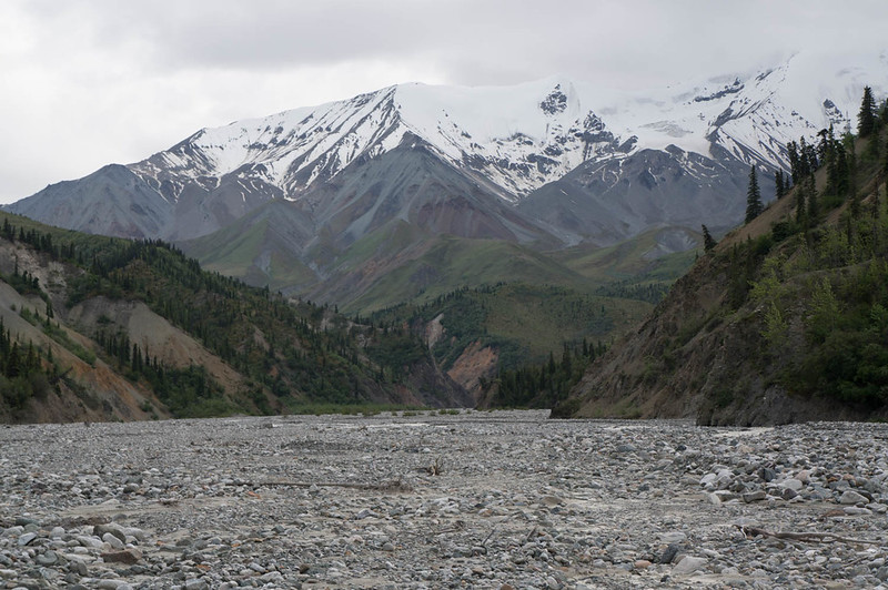
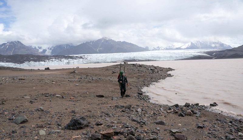
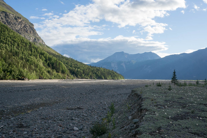
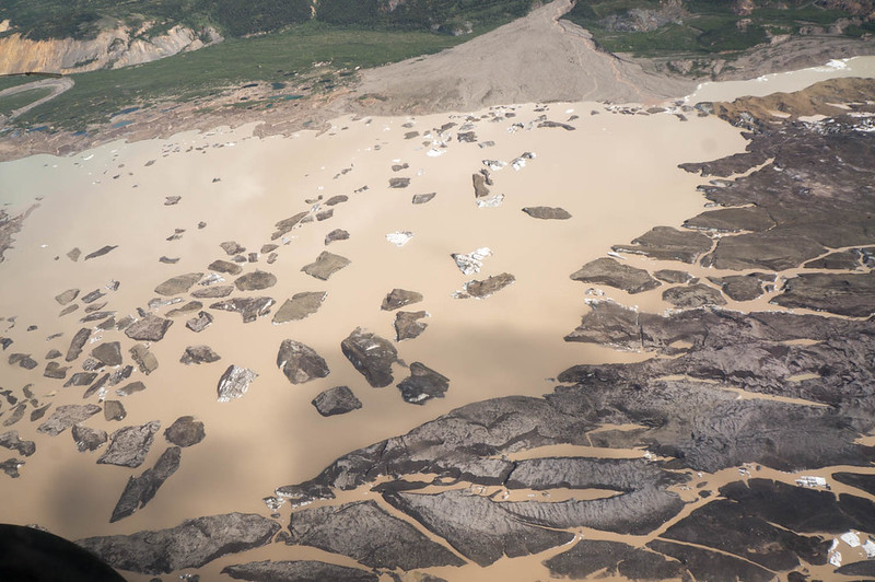
The Jack was near bank-full, and had enough water to be fun, but not too exciting. Besides a bit of wood, the floating was fun. We eventually camped at 11pm or so, a few miles short of our planned put-in spot. In the morning we awoke to clear skies and continued floating, eventually reaching the Nabesna River. The Jack was very scenic, and had a wonderful rock wall section that was pretty amazing. Alas, the water had a lot of sediment in it, and wasn’t clear, but still a fun float. The Nabesna was huge, much bigger than I expected. There were a few big boils and eddy lines that while no big deal, still got my heart racing. On the upside, the water was moving fast, averaging almost 10 mph (I think), and we quickly reached our take-out, near Cooper Creek.

DSC06728

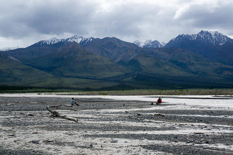
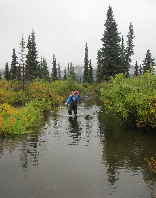
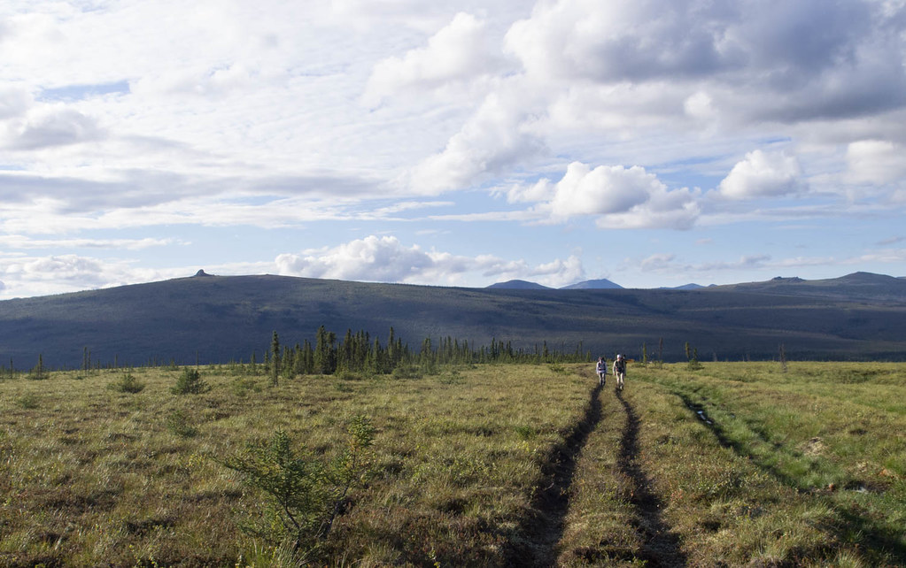
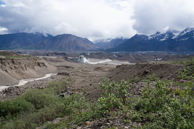
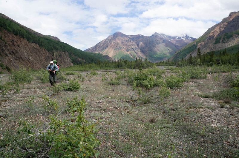
The wash plain of the Nabesna was super wide here, and while we were on the bank of the river, Cooper Creek was still over a half mile away – it is pretty amazing how wide the floodplain is for these large glacial rivers. As we were transitioning from floating to hiking mode I noticed a small plane parked in the distance. The pilot noticed us, and walked over to talk. After a brief conversation shouted over a side channel of the river, we discovered he worked for NPS, and had flown some rangers out to retrieve some equipment, and they were using packrafts. Hmm, perhaps we had packed up the boats too early. We headed out only to discover the rangers were using the boats to float a side channel of the Nabesna that ran right near the far side of the floodplain, and quickly determined it was too deep to ford… and out came the boats again.

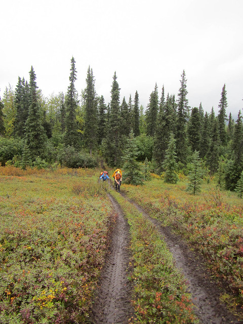
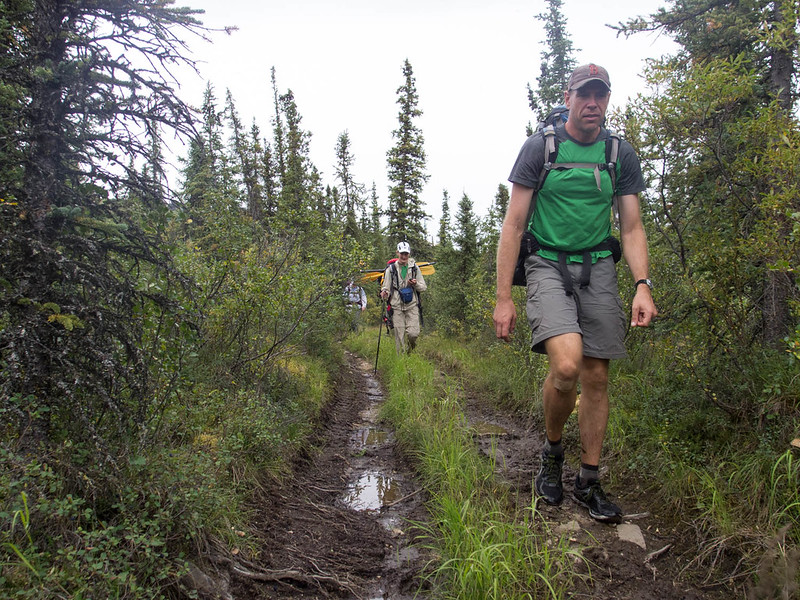
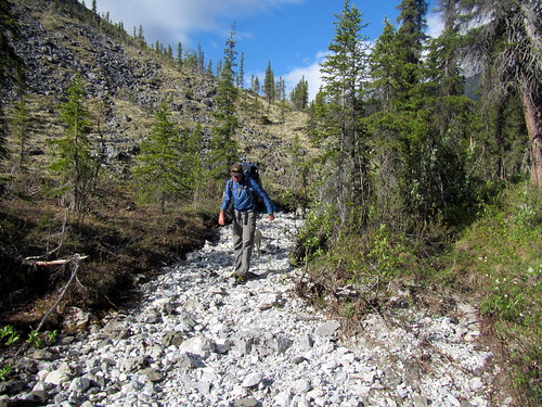
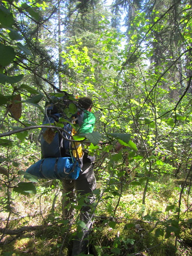
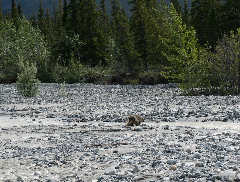
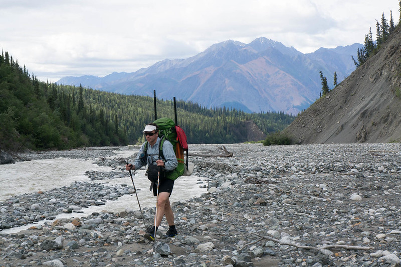
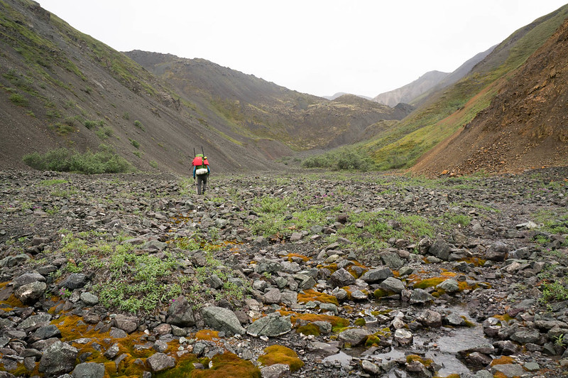
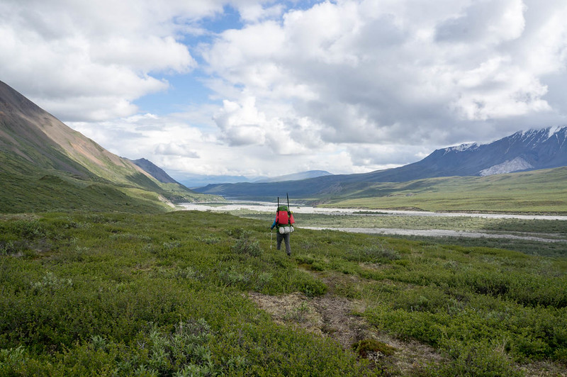
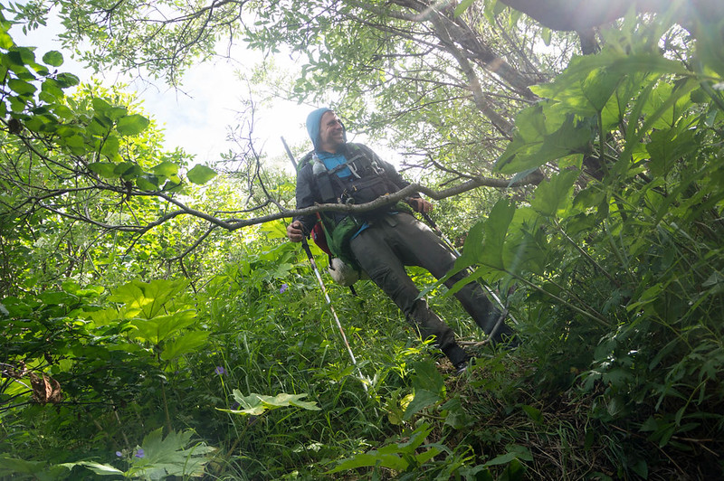
Eventually we made it across, and started heading up Cooper Creek. The walking was fantastic, though a bit cobbly. A mile or so up the creek we ran into a porcupine, which appeared to really want to cross the creek, but didn’t want to get wet.

DSC06737

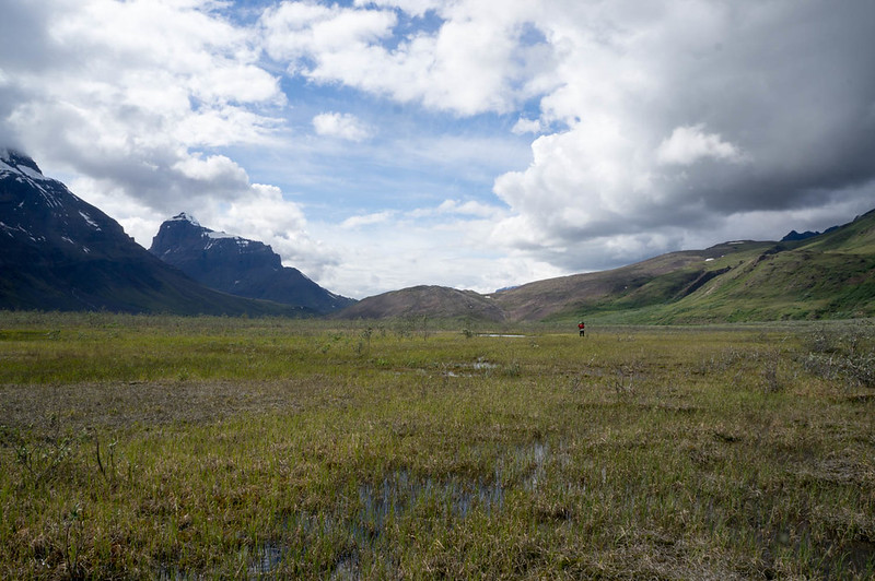
We watched it a bit, as it slowly walked down the creek, checking occasionally to see if the creek had gone away yet or not. Not the brightest creatures. We also saw a small black bear, but managed to skirt around it without it noticing us. The rest of the day we hiked up Cooper Creek, bouncing from bank to bank, and eventually camped near the confluence of nine mile creek.

DSC06756

DSC06759

DSC06771

DSC06787

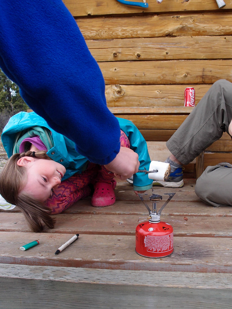
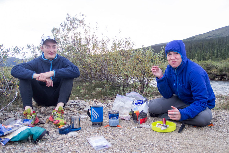
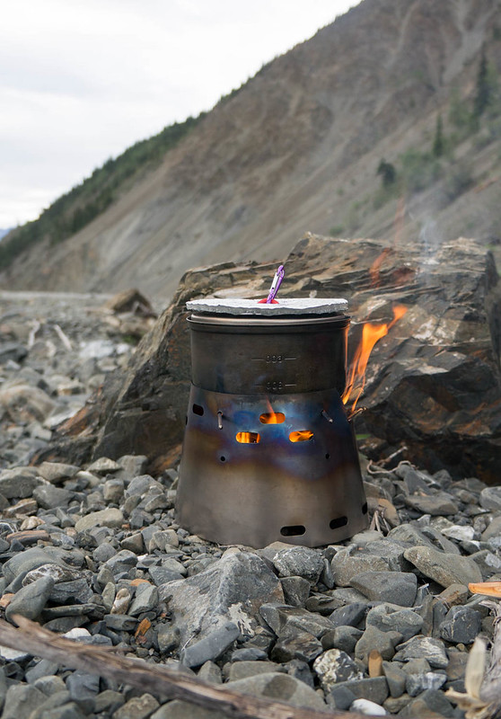
Heath had brought a little wood burning stove, which we had fun using. It was a bit slower than a traditional setup, but the ideal of unlimited hot water was pretty tempting..

DSC06795

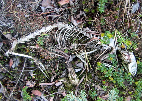
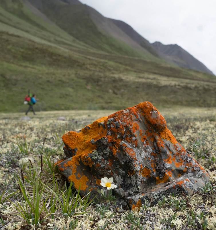
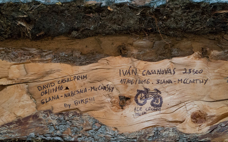
In the morning we kept heading up the creek, and I was excited to find my first artifact – hurrah!

DSC06816

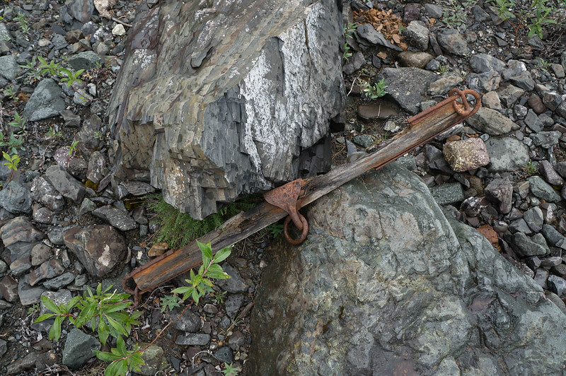
I love bits of history that show how places have been used historically and currently. Finding “rusty bits” became a running joke for the rest of the trip.

DSC06830

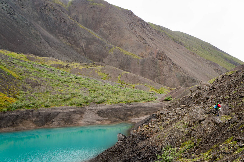
Eventually we topped out at a little pass, hitting Blue Lake, a wonderful little lake that would have been an awesome camping site, but alas, we had to get the mileage on.

DSC06849

DSC06872

DSC06876

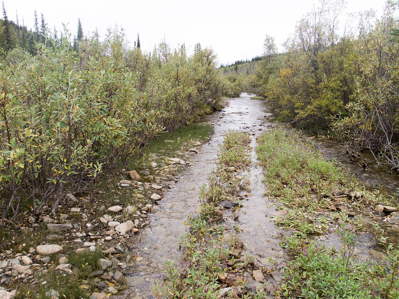
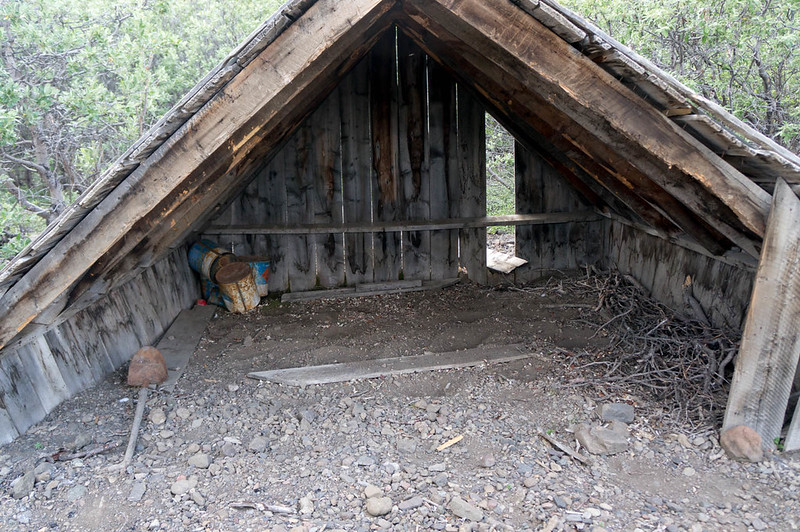
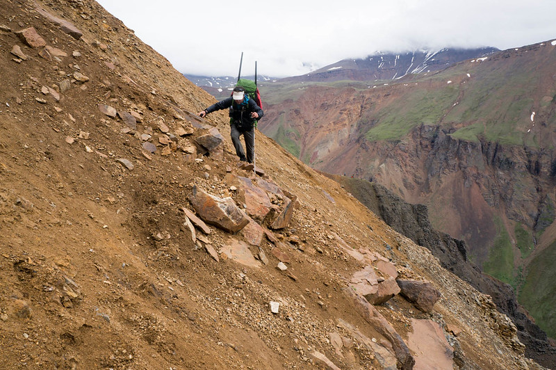
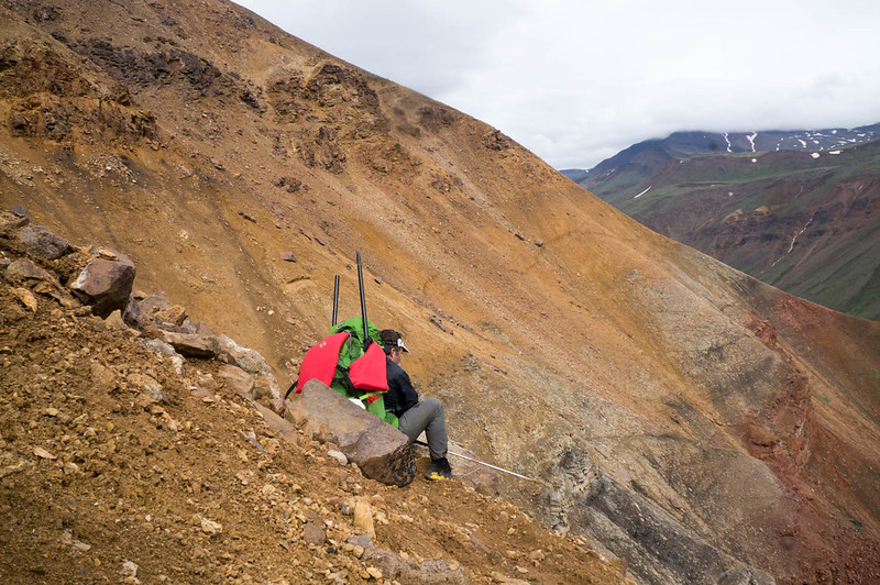
We headed over Cooper Pass, and down to Notch Creek, where I found an old collapsed cabin filled with more rusty bits. Notch Creek was pretty shallow, bumpy, and steep, so we walked down it, enjoying more fine cobble walking. Much to my surprise, I saw a set of fat bike tires on the creek bed – it appeared there were some bikers ahead of us!

DSC06882

DSC06887

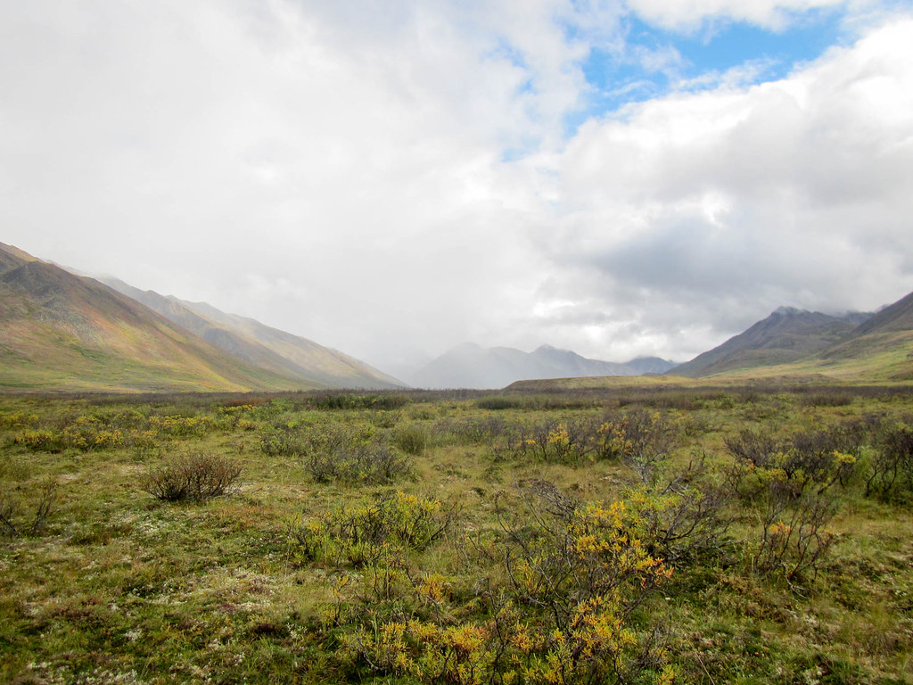
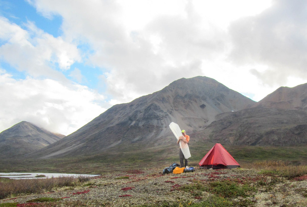
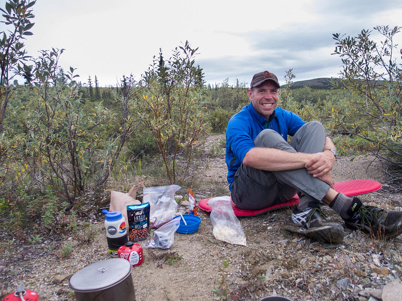
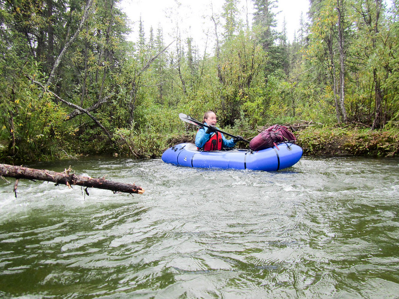
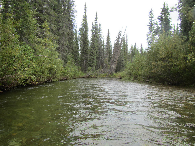
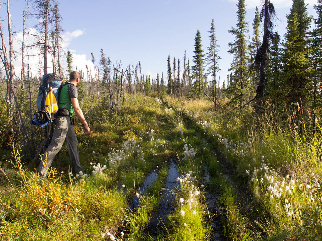
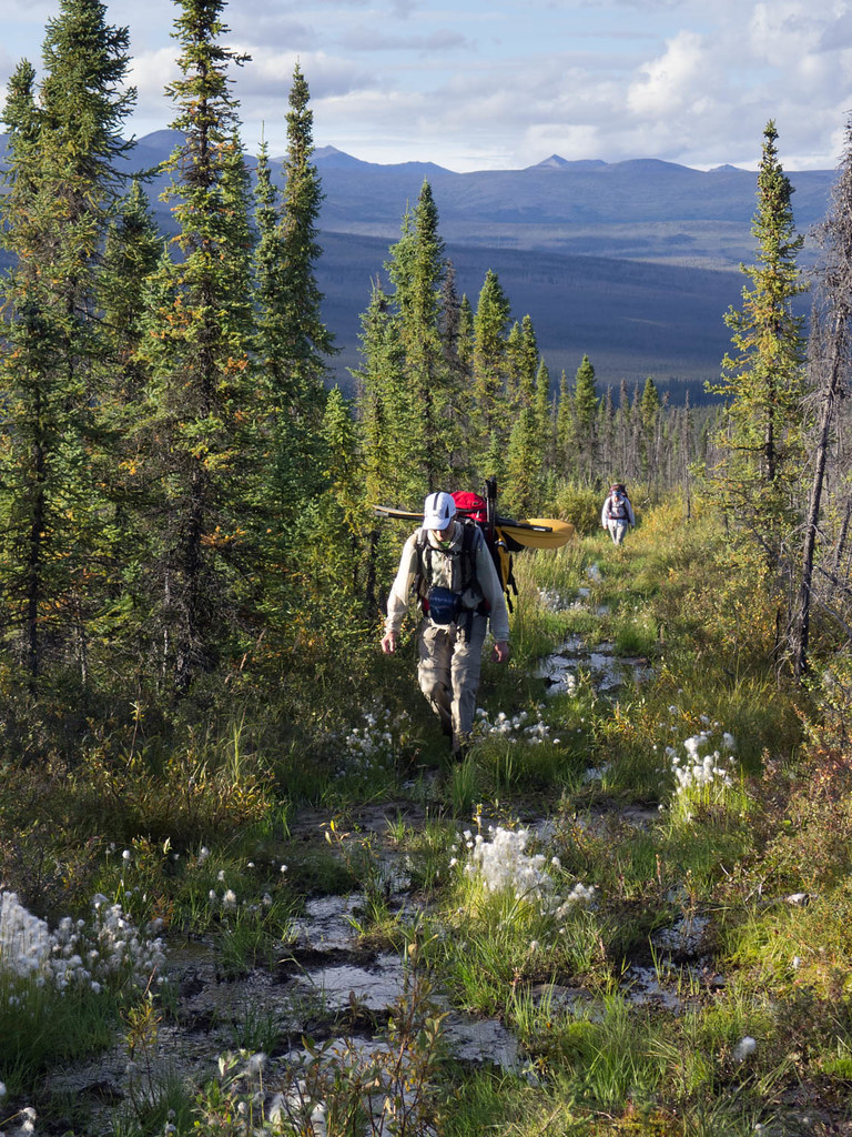
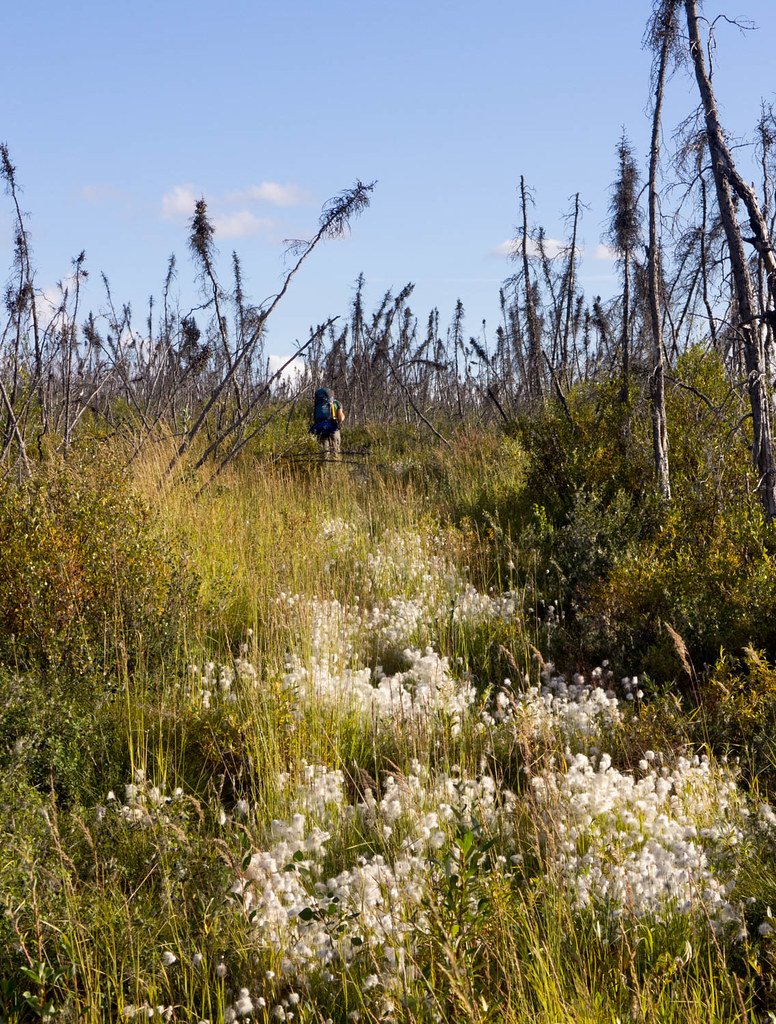
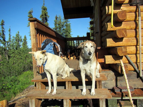
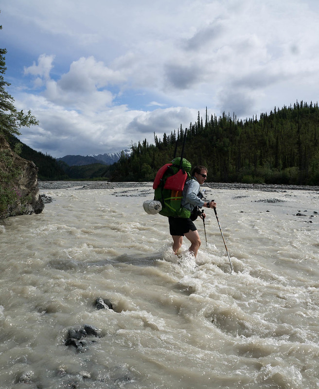
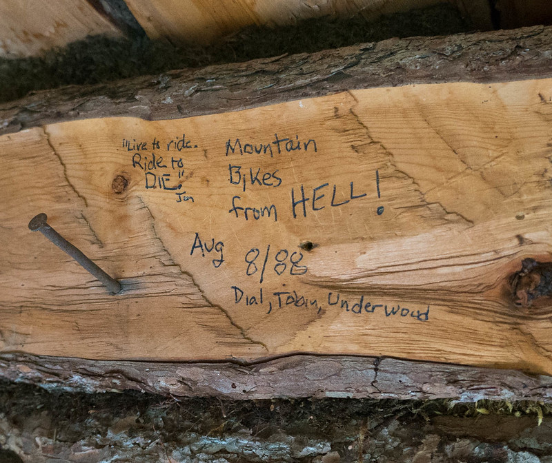
We camped near William Creek, hoping to float in the morning. We camped right next to a small clear stream. I enjoyed an experimental dinner of ramen noodles, dried coconut milk, peanut sauce, and coconut oil. Heath was a bit skeptical – “That is a lot of coconut oil.” was his take on it. I fell asleep to the sound of the water… only to be woken up when my pad deflated at 2am. Morning came two more rounds of inflation later, and my stomach was not happy. Apparently, while dinner was delicious, it did in fact have too much oil in it. I packed up camp and inflated my boat while trying not to be sick. The floating was fun, when Notch Creek had enough water. It bounced between wide braids and a single channel. When it was floatable, it was super fast and fun. Eventually we reached Cross Creek, where everything spread out and got too shallow, so we packed up our boats and headed off for the overland crossing to Chisana. Alas, I discovered that I was so distracted by not getting sick I had left my camera in a pouch on my pack, and it had gotten wet, and much to my disappointment, didn’t want to take photos – sadness! We forded Cross Creek, and headed overland to Chisana. We quickly found a marked trail, and were surprised to see horse prints – apparently folks use pack horses in this area – and we followed the horse trail over to the Chisana River. Alas, the Chisana river was too deep to ford, and so we inflated again, and floated across, then hiked over to Chisana. After hiking seemingly forever across the floodplain, we ran into a small pack of horses who seemed pretty scared of us, and who quickly ran off into the trees. We followed them, finding an ATV trail, that led us to a big complex, where the horses were waiting for us. They couldn’t seem to decide if we were something to be interested in, or scared of, so we carefully headed around them, and walked into town. We had discussed crashing at the public use cabin in Chisana, but we found it occupied by a couple touring Alaska by plane, so we headed out. After several false starts we found the trail heading out of town, eventually passing a clear(ish) stream near town that Heath said would be fantastic camping. I pressed to keep going, as there was another stream, Geohenda Creek, that was only a few miles away. Heath was very unamused to find Geohenda was thick with mud and far from the perfect campsite. We setup camp just as a huge thunderstorm passed by, just getting tents up before the deluge. The rain stopped fast though, and a bit of searching found some clear water, and soon we had dinner cooking, and enjoyed a nice bonfire on a dry channel of the creek. The next day we hiked up the creek, enjoying yet more cobbles and many muddy crossings of Geohenda. Gradually the water level dropped as we headed up into the higher country, and eventually we passed the source of the mud, a tiny creek coming in from a glacier. The country up high was beautiful, and very, very scenic. Our destination for the evening was Solo Mt. Cabin, a small historic cabin near Solo Mountain. A mile or so before the cabin we passed a huge grizzly munching away on the hillside, and I was very happy to reach the cabin just as a rainstorm arrived. I was a bit surprised to see shape the cabin was in – it is obvious at some point the NPS spent some time fixing it up – it looked like the foundation had been replaced, but having the door held shut by baling wire seemed a bit sad. We hung out in the cabin, and after collecting a bunch of dry alder from a nearby creek bed, we enjoyed a nice warm evening with the rain intermittently ringing off the roof. I had a great time reading the “log book” graffiti on the cabin walls, which was sort of a who’s who of all the crazy endurance folks and adventures in Alaska.

DSC06890

DSC06893

The morning came, and with it sunshine, and my camera was sort of working after an evening of sitting next to the fire – hurrah! Alas, sort of working meant that while it took pictures, the display wasn’t working, so it was hard to frame photos.

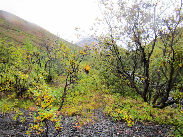
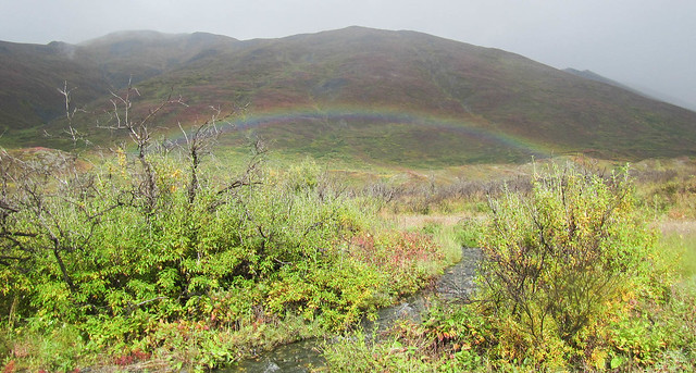
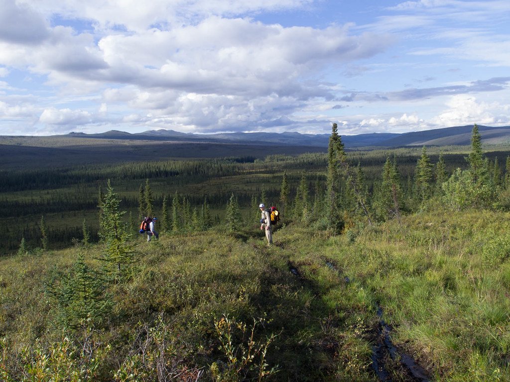
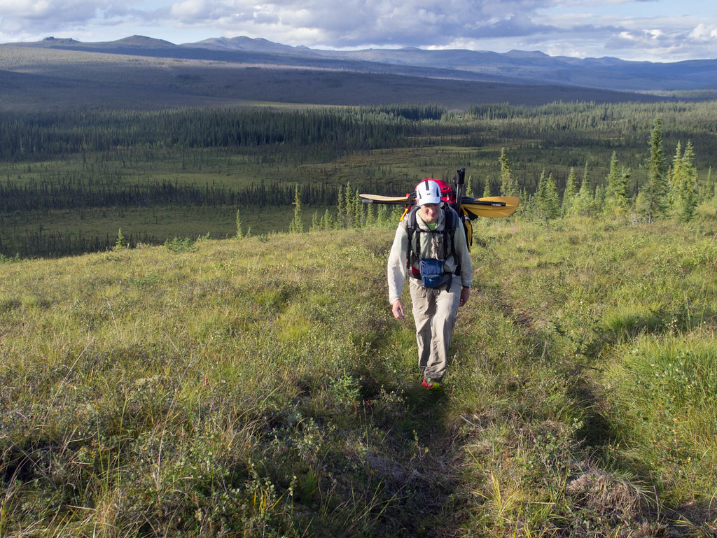
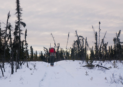
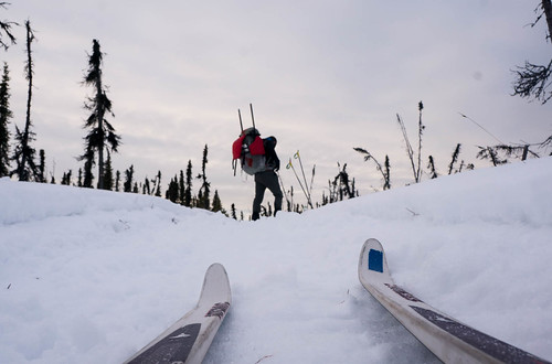
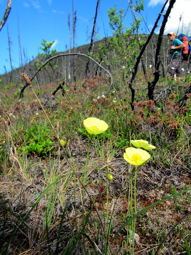
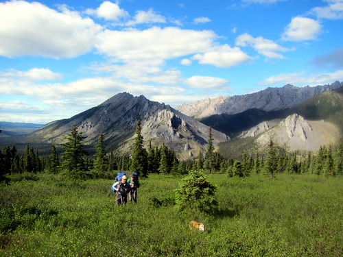
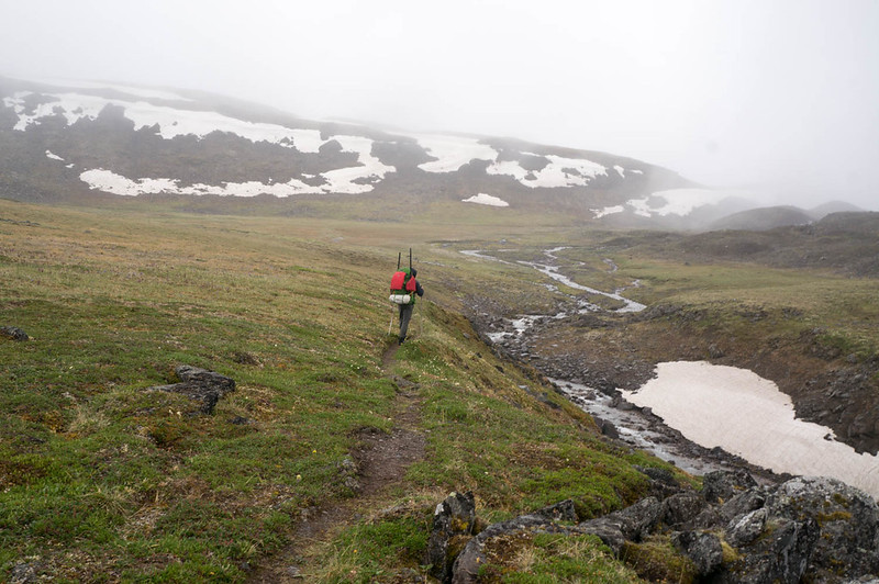
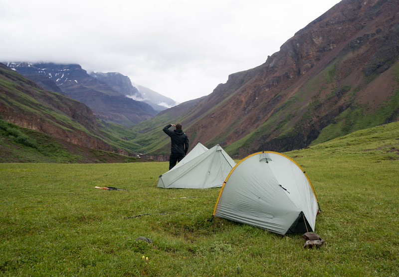
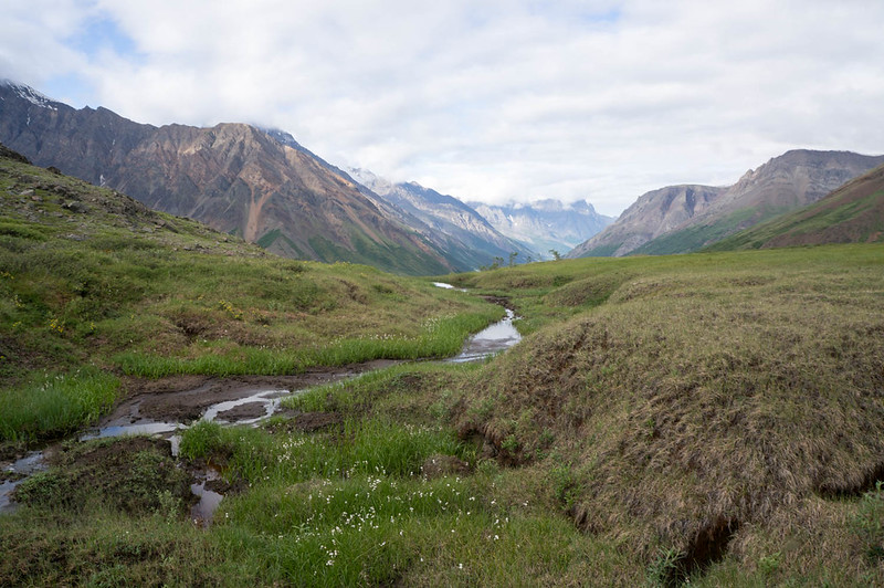
We hiked across to the wash plain of the White River, and were surprised to see trail markers, leading to a pretty well used winter and horse trail, that eventually turned into an ATV trail that appeared to head to a cabin complex on Solo Creek. We turned off the ATV trail onto an old game trail, as it was heading in the wrong direction, only to find an even bigger one headed in just the right direction. Just as we reached Lime Creek we saw a large herd of horses grazing on the floodplain. I really felt like I had stepped into the old west. Lime Creek was a bit too big to ford though, so we had to inflate to cross it. Once across we hiked a few more miles, then camped. Heath declared it the perfect campsite, with yellow flowers on one side, and purple on the other.

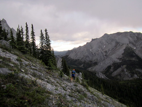
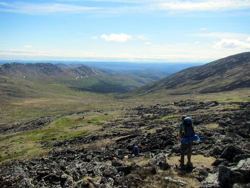
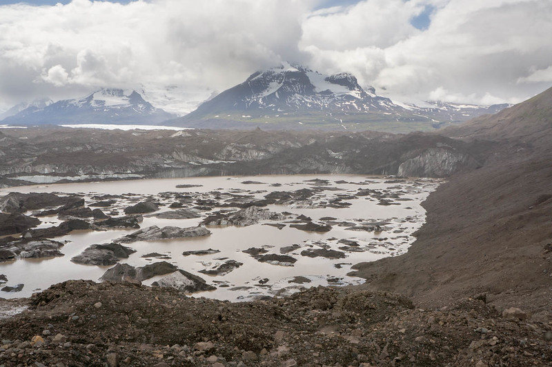
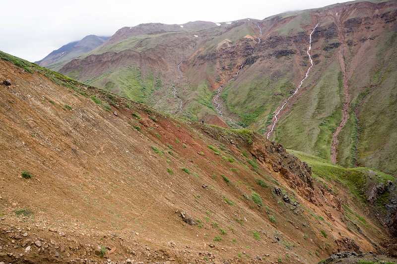
In the morning we headed up into Skolai pass, skirting the Russell Glacier, and slowly working over to upper Skolai Lake.

DSC06921

DSC06925

DSC06946

It was fantastically scenic. We worked our way across and over to Skolai Lake, eventually
camping near the headwaters of Skolai Creek. The valley the creek originates from is a neat place, wide and marshy, with lots of standing dead willow.

DSC06951

DSC06979

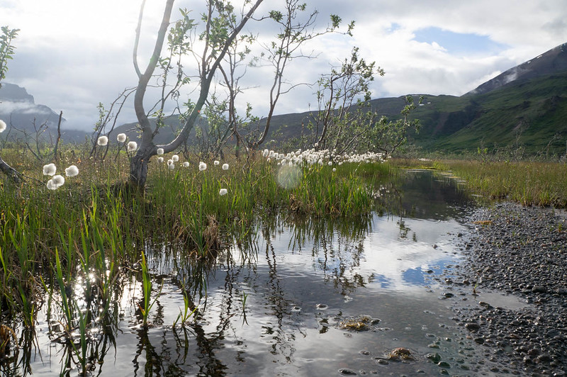
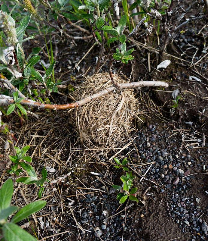
In some willows I found a round ball of grass, which turned out to be a birds nest of some sort – very neat..

DSC06972

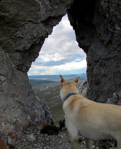
I spent an hour or so exploring the valley, and checked out the “cabin” marked on the map, which was more of a three-sided shack.

DSC06963

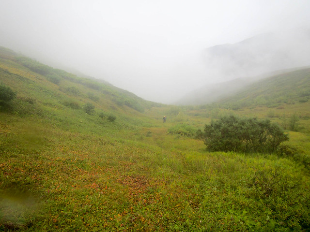
In the morning we headed up to Chitistone Pass, where it was a near complete white-out.

DSC06987

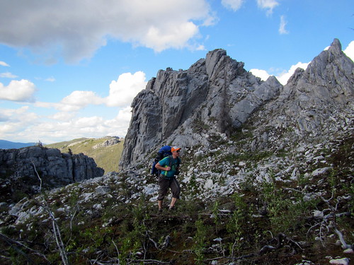
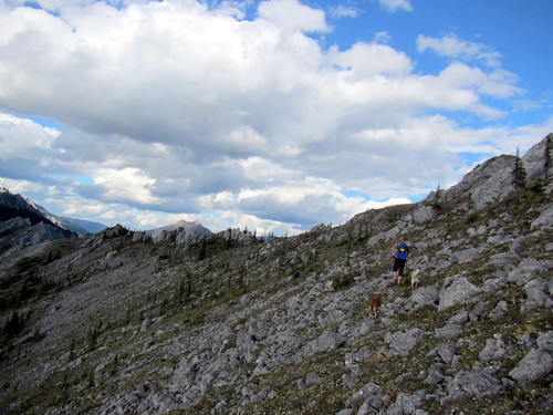
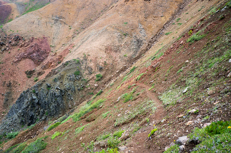
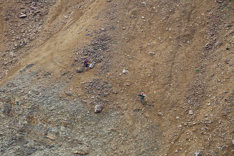
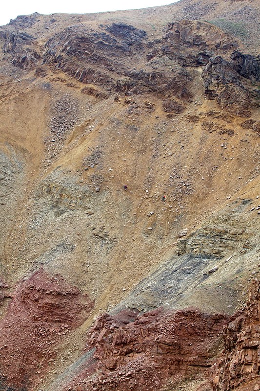
We also ran into the first people we had seen since Chisana, two hikers wandering around in the rain and mist near their tent who refused to return our waves – a bit creepy. Fortunately, we dropped out of the mist, and enjoyed some fantastic walking along the Chitistone River. We eventually saw another party ahead of us, and shortly after that startled a little brown bear who headed off at high speed. We eventually overtook the party, and learned it was Nate and Krista who are also from Fairbanks, and much to my surprise – Krista works with my wife Nancy, and knows my daughters Molly and Lizzy. It is a very small world. Soon we were at the crux of the trip – the legendary scree of the goat trail!

DSC07007

DSC07011
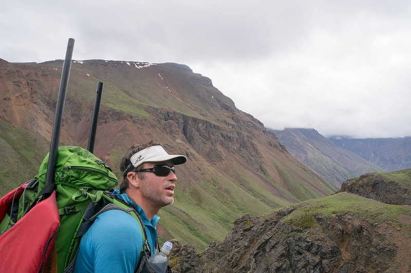
(Heath, checking out the goat trail..)

DSC07015

I had been told everything from it was a fairly tame walk across a scree slope, to it was a scary walk along a rock wall above a huge drop, separated by the “gorge of death”. It turned out to be a mostly tame scree walk. I think it could have been possible to fall to your doom, but mostly I think you would have just rolled to a stop before any doom, with lots of bruises and scrapes. I didn’t test this idea though..

We stuck to the “yellow band”, as most folks seem to recommend, and came out without any issues.

Skolai, hole, to Nazina 306
(Photo compliments of Krista Heeringa)

Skolai, hole, to Nazina 304
(Photo compliments of Krista Heeringa)
Skolai, hole, to Nazina 235
(Photo compliments of Krista Heeringa)

DSC07059

DSC07060

DSC07065

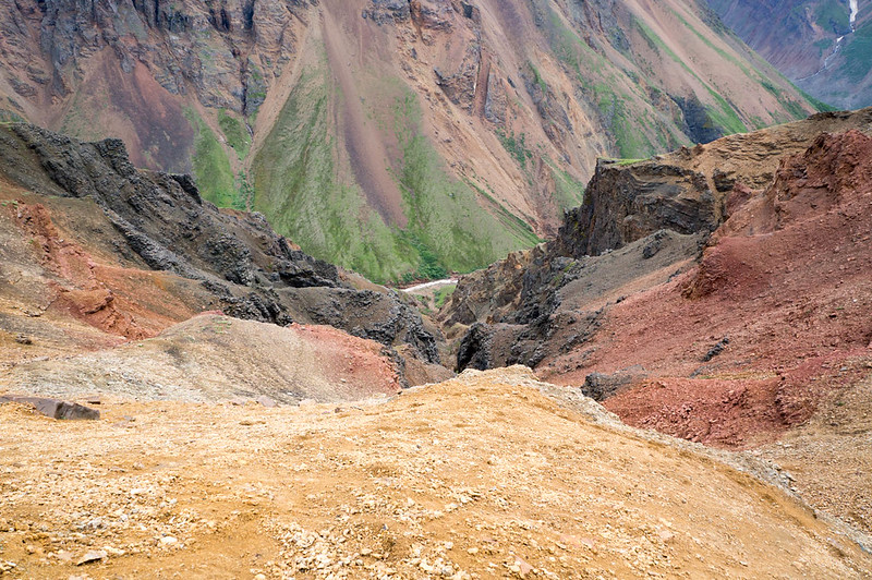
Nate and Krista took a completely different route, going quite a bit higher than us, so perhaps we did it wrong. Regardless, it was a super scenic walk, with waterfalls everywhere! After the scree slopes it was just mellow downhill alpine walking, complete with a huge herd of sheep grazing on the hillside in the last valley we passed.

In the evening we camped on a nice bluff, in sight of a glacier and Chitistone Falls – best campsite ever!

DSC07094

DSC07110

In the morning we hiked down to the Chitistone, inflated and crossed the creek when we found we couldn’t get across, and started hiking downriver.

DSC07114

DSC07122

The hiking was mostly pretty fantastic, besides a mile or so of willow thickets that Heath just breezed though, and I had to smash though like a ogre, getting constantly stuck. Very helpful for my self-image…
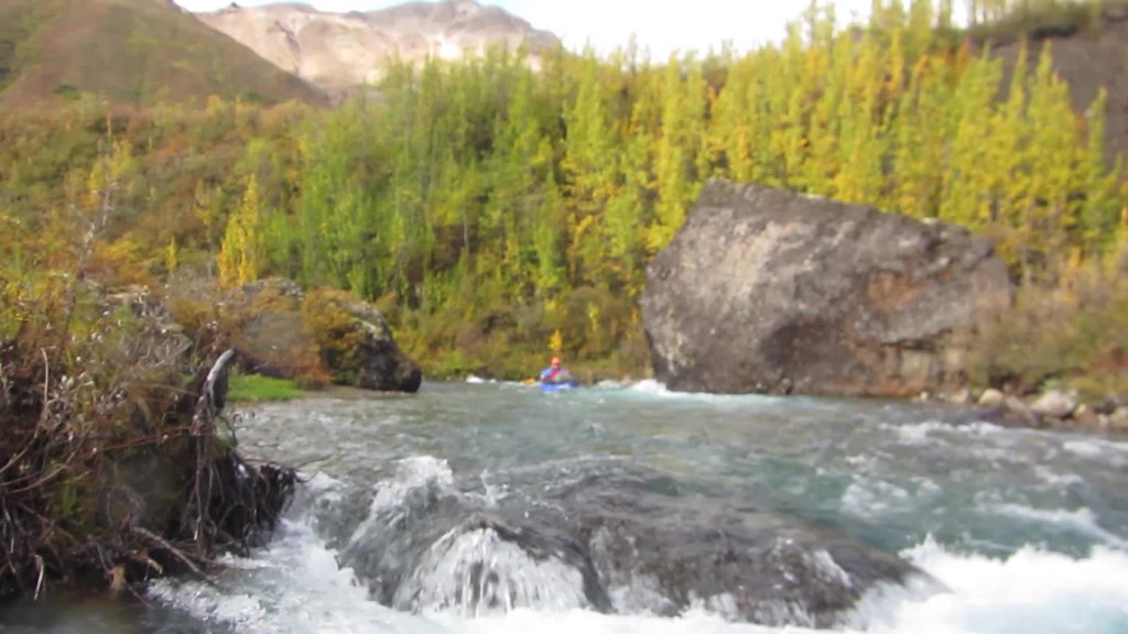
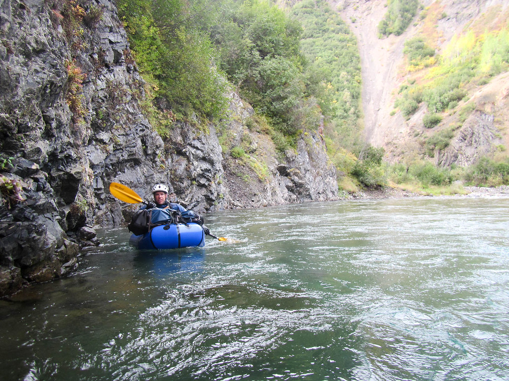
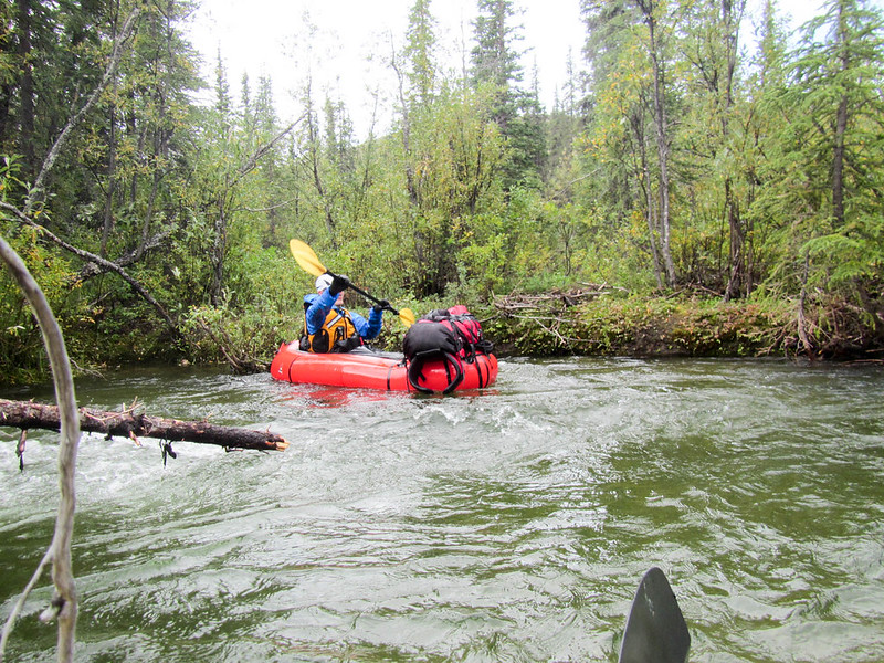
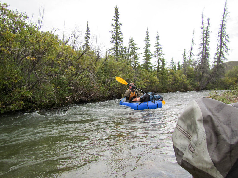
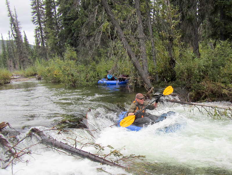
We eventually made it to Glacier Creek, where we planned to float. The weather had been very warm, and the Chitistone was now running very fast and a bit high, so we put in with a bit of trepidation, but it worked out – the creek was fun, splashy, and fast. After a hour or so we pulled out and camped, as at this rate we would be at the final takeout before we knew it. The evening was spent mellowing out and exploring the Chitistones floodplain.

DSC07131

In the evening we were buzzed by a Supercub. Later we learned someone in a wing-suit had flown over us, and had been picked up by the plane. In the morning we packed up and floated the last of the Chitistone, taking a side channel around a new section of river where the river is chewing into a forest. We floated the Nizna to May Creek road, where we packed up and hiked into town.

DSC07141

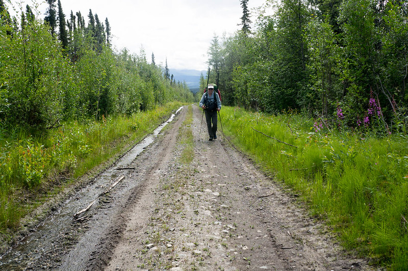
Fortunately the really long and boring road hike was shortened when we hitched a ride with Greg from Kennicott Guides on a double-wide ATV.

DSC07144

McCarthy was as charming as ever, with folks stopping to talk to us nearly constantly. The upcoming packrafting festival appeared to be the talk of the town. Heath and I grabbed lunch, then caught a slightly earlier flight back with McCarthy Air to Devil’s Mountain lodge.
DSC07150

DSC07178

We jogged back to the truck, and Heath joked that with my very holey shirt, it looked like I was “A homeless guy chasing a yuppie.” After nearly 6 miles of running, we made it to the truck, drove back to get our stuff, then headed back to Fairbanks – hurrah!

A couple of notes:

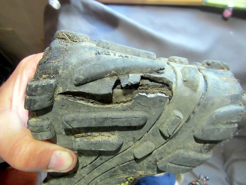
  • Don’t use Thermarest with stupid patches. My pad kept deflating, and I was up to two inflations a night before I taped over the patch with duck tape.
  • This route has lots of tricky water crossings. Folks thinking of replicating it should make sure they are ok with big-ish stream crossing, and budget extra time in case some of the creeks (like flood creek, or lime creek) are running high.
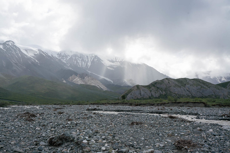
  • The Chitistone was flowing pretty big when we did it, and above Glacier Creek it looks pretty burly – lots of water moving fast. Below Glacier Creek it was class II with a few big obstacles, and near the Nizana, lots of wood. Very manageable though. Some bikers from Spain flipped someplace in the Chitistone, and one of them lost his gear, making the last few days of their trip pretty epic.
  • There are several re-supply options – the solo creek runway, skolei runway, and Chisana. I was told by McCarthy air that if they had other flights going that way, a small drop bag would be $100, which seems like a fairly good deal.
  • I should have brought a fair bit more food – I lost around 6lbs on this trip.
  • At the last minute, I brought a dry suit. That was, I think, a good call, but added a few pounds of extra weight. YMMV.
  • I am done with non-waterproof packs for packrafting. I have an old Arcteryx pack, that while nearly 4lbs empty, is completely waterproof. Alas, the hip belt is coming off, and the suspension sucks, so I replaced it with a big osprey pack. I was happy with the pack, but wasn’t happy with how much water it sucked up, all the extra zippers it had, and how many dry bags I brought with me. A pack made of some sort of waterproof material is on my list. It looks like mt hardware makes several, as does HMG. Alas, HMG’s packs are not as big as I would like. To bad all the newer arcteryx packs have so many gizmos – the one I have from them is a very simple affair, just a big single compartment body and a top lid.
  • I really love my Inreach – it was fantastic to txt Nancy and the twins at the end of the day and check in with them, and kept me feeling connected with them. Alas, the last day I swapped out the batteries, and didn’t notice the shell wasn’t completely dry, and got water in it.. and it stopped working. Duh! Hopefully it will come back to life.
  • Smart phones are now a nearly complete gps replacement – Heath did all his gps stuff using his phone, and it seemed to work very well. I brought a standard garmin etrex 30, which worked fine, but occasionally fired up Backcountry Navigator. Andrew Skurka has a discussion of the various options that is worth reading. On the flight back I noticed that the pilot used an android tablet running a mapping app rather than the specialized garmin aircraft nav widget I am used to seeing. The end of the stand alone gps?
  • I should have brought a better system for quick and easy access water, and some electrolyte drink mix. I was dehydrated a lot of the trip.
  • I sunburned my lips (!!) something I wasn’t even aware was possible. Next time I will bring some lip balm with sunscreen.
  • Heath found the birding to be awesome, with lots and lots of different species. Adding a few days just to birdwatch might be a good idea, if you are a birding sort of person.
  • Trust the Maps – I was getting pretty antsy near the end, as a write up I read said it was 35 miles from Skolia landing strip to Glacier Creek, and was thinking we didn’t have enough time for that. It turned out to be much less than that, more like 20. I should have mellowed out and trusted the maps – sorry Heath!
  • I can’t think of anything else at the moment.. will add anything else that comes to mind later.

I would like to thank Nancy and the twins for allowing me to disappear for 10 days, and Heath for doing all of the planning for this trip. Normally it is my job to do a lot of the trip planning, it was awesome to have someone else do that – hurrah!

Heath’s writeup can be found here, and is filled with truly awesome photos.

A interactive map of our route can be found here.

A few more photos can be found here:
Nabesna to McCarthy

A Packraft and Ski Trip on Beaver Creek

Saturday, October 24th, 2015

Winter has finally arrived here in Fairbanks, and while we now have enough snow to ski in some areas, the water levels on the rivers has been unusually high, probably due to all our late season rain. After some discussion, Heath, and I hatched a plan to float Beaver Creek from Nome Creek to Borealis Cabin, then to hike out to the Wickersham Dome mile 28. A few days before the trip we received word that the winter trail had enough snow to ski, and that snowmachines had been out on the trails, and so we switched up our plans and added skis in the mix. I was pretty worried about Nome Creek road, but fortunately I was able to get in touch with a musher to lives in the area, who said the road was still drivable. Hoping for the best, we headed out early in the morning, hoping to make it in without major trouble. The road turned out to in okay shape, with only a few sketchy sections, and Heath’s wife Audrey dropped us uneventfully. A huge thank you to Audrey for helping with the car shuttle!

DSC01938

The water levels on Nome Creek were about what I expected, given the gauge was reading 2.7-ish, though there was a lot more shore ice than I was expected – uh-oh! We left Audrey to drive back to town, and headed down the creek.

DSC01939

DSC01946

I was very excited to do my first “seal launch” in a packraft – sliding into the water from ice was super cool!

DSC01949

Pretty soon we had to portage around a section of the creek with ice all the way across, but otherwise the floating was fun, and the contrast of the snow with the dark water and trees was amazing. After a few more portages we made it to confluence with Nome Creek, where, alas, the volume of water coming in from the main channel was less that I would have liked to see. It wasn’t the end of the world though, and the floating was still pretty fast. Heath is a pretty consistent paddler, so we spent much of the float paddling away.

DSC01977

DSC01986

I did learn I made a serous tactical error when picking my gloves. I have a pair of three fingered diving gloves, but I couldn’t find them, and so resorted to using some thinner neoprene gloves I could actually find. Alas, they were not warm enough, and I spent most of the float dealing with cold fingers – my own fault for not being more prepared! I did discover that I could make my hands much warmer by moving the cuff of my dry suit past my wrist, which did wonders for keeping my hands warm.

DSC01962

DSC01969

DSC01975

We saw a fairly diverse amount of wildlife, including 4 moose, a beaver, ducks, lots of grayling, and at fairly close range, a bear. The bear encounter was pretty funny.  We came around a bend, and Heath was up front.  Just as he came up on a stand of trees, I noticed a very large brown bear leaning out over the bank, appearing from my point of view to be looking down at Heath, getting ready to jump at him. Heath was digging around in his deck bag, and for a few seconds I thought he was digging out his camera to get a photo, then decided he hadn’t seen it and shouted something silly like “Heath – bear!” Heath then turned around, with a sandwich in his hand and we both started “Hey Bearing”. Fortunately, after one short growl, the bear took off and we didn’t see it again. It definitely provided a nice adrenaline boost!

The float was a very interesting experience. As the day progressed, we started seeing more and more ice, and by the end of the day the river was at times packed with small pieces of ice, and a few larger bits.

DSC01978

Occasionally it was hard to paddle, as there wasn’t always room get your paddle into the water. Fortunately Beaver Creek is pretty mellow and there are not any rapids of note, and wide enough that there were few sweepers. It was an awesome experience, listening to the hiss of the ice bumping around as we floated along. We did have to portage one small ice jam, which fortunately wasn’t a big deal. Ice built up on our packs and our paddles, but didn’t seem to stick to the boats at all. I was a bit worried that my boat would be punctured by a sharp piece of ice, but that didn’t happen, and eventually I just started plowing though the ice. Alas, we spent the last few hours on the river in the dark, which made for a bit of a stressful end to the float. I was very happy to see Borealis cabin! On the upside, while trying to see how deep the water was I saw a huge grayling just off the edge of the shore ice. After looking around, it soon became apparent there were grayling everywhere, and by the light of our headlamps they stood out in the water like ghosts – an amazing sight!

We arrived at Borealis, and I was very happy to take my dry suit off and enjoy a nice warm, dry cabin. I had brought an InReach gadget that allows (supposedly!) two way texting using satellites, but alas, after two hours of fiddling I couldn’t get it to receive texts, just to send them.

DSC01984

I have had it work great in the past, but this time I couldn’t for the life of me get it to stay connected to my smartphone, which was a huge bummer as we were pretty worried about Audrey making the drive back out on Nome Creek road, and I was sort of counting on it to arrange a ride back with my friend Tom. Fortunately the tracking feature was working, however the messaging part was a bust. YMMV. I am not sure I am taking it on any more trips..

The next morning we headed out, crossed the creek in the pack rafts, and started over to the winter trail. There is a little creek that is often not very well frozen a half mile or so from the main river, so we dragged our pack rafts behind us like sleds, which worked great. Pack rafts apparently make pretty good sleds!

DSC01993

The creek turned out to be frozen, but I was excited to see snowmachine tracks on the other side – the trail was broken out! We packed up, put on skis, and enjoyed a fantastic ski out. The snow was fast, and the skiing was great, considering there was only 10″ of snow.

DSC01998

We zoomed out, enjoying the fast snow.

DSC02003

DSC02008

I was annoyed to find out that my packrafting pack, a older Arc’teryx waterproof pack, is moderately horrible for skiing – its skinny tall shape and minimal suspension made it very tipsy and it was constantly trying to tip me over. I survived though, and really enjoyed the ski out. At about halfway Heath got enough cell signal to receive emails and to learn Audrey made it out safely, and I called our ride, Tom, to make sure he was still going to pick us up, and that he knew the skiing was fantastic, and should come early and get some skiing in. Tom said he was on his way, and we ran into him about 3 miles from the parking lot, out for his second ski of the year. The remainder of the ski was uneventful, though I did have a crash right in front of Lance Mackey who was training his dog team with a 4-wheeler. I think he was amused, but I felt pretty self conscious trying to get up with a heavy pack while he was waiting for me to get out of the way.

A huge thank you to Audrey and Tom for providing rides – this trip wouldn’t have been possible without you guys, and major kudos to Heath for coming up with the original idea and making the trip possible!

Heath said several times this trip is definitely something to do again, and I 100% agree – it was a fantastic experience.

I think I would do a few things differently:

  • I would bring “real gloves” or something a lot warmer than the thin gloves I brought. If anyone has suggestions I would love to hear them.
  • I would bring something to help get out of the water and onto the ice.  I think a several foot board with a leash with some 16d nails in it would be very handy, or perhaps the small ice picks like ice fisherman use.  The board could probably be burned once the floating was done, and the nails salvaged.
  • I debated bringing my dry suit, and ended up bringing it, and was very happy I did.  It made this trip possible, and more importantly fun – it would have been fairly miserable without it unless I was very, very careful to stay dry.
  • Heath used Alpacka’s semi-dry suit, and loved it.  I think I have one of those in my future!
  • I would leave earlier so the end of the day floating in the dark wouldn’t be necessary.  I might try camping at the put in to get an early start, or breaking the float up into two days.
  • Other versions of this trip abound: coming out to the Colorado creek trailhead, to mile 28 via Crowberry, or back to Nome Creek would be fun and possible.  I expect the winter trail would be skiable in the more remote areas, but of course it wouldn’t be broken out.
  • I wouldn’t do this trip if there were lots of ice at the put-in, it is a long way out via any of the reasonable bail-out points.
  • I need to rework my pack attachment system for winter floats. I use two straps with “ladder buckles”, but they iced up and were very hard to undo.  Heath used P-cord and it seemed like he had fewer problems.
  • I used Surly junk straps to attach the skis to my boat; that was a mistake, as they took forever to get off, because they were so iced up.

Sorry for such a long post — this trip was fabulous and I thought it deserved enough words to do it justice!

A Summer Loop in the Whites, v2

Tuesday, July 7th, 2015

Several years ago a group of us packrafted and hiked a loop in the White Mountains. That trip was very fun, however I had been meaning to do something similar again, this time taking a slightly different route and hiking up though the Limestone Jags, over Cache Mountain, and back to the Nome Creek put-in. So, on a fine summer weekend Seth, Tom, and I headed off to Nome Creek, with Seth’s dogs Dorsel and Echo in tow.

The float down Beaver Creek was uneventful, scenic and mellow. Watching the dog’s antics added a extra bit of fun to the float. Echo’s lack of excitement about swimming or running along the bank was almost comical, as was her complete lack of excitement about getting a ride in Seth’s boat.

IMG_0135

Eventually Echo was convinced to climb into Seth’s packraft and hitch a ride, though she was very unexcited about it.

IMG_0196

Dorsel on the other hand, had a great time, running along the bank, jumping though the bushes, and bouncing around like a rubber ball thrown by a nine year old. Eventually Dorsel started begging for rides as she got sick of swimming from bank to bank to find good doggie walking or crossing sloughs. Eventually she got perhaps a bit too comfortable, jumping in and out of the boats whenever her little A.D.D. doggy brain decided the time was right.

IMG_0176

IMG_0164

IMG_0151

Nothing bad, just added a extra topping of fun to the float. Our day ended at Borealis cabin, where we crashed for the night.

IMG_0192

The next day we floated down to near where Fossil Gap trail crosses Beaver Creek, and hiked up into the Jags.

IMG_0225

IMG_0227

The hiking was fantastic, and the views amazing.

IMG_0235

IMG_0238

If we had an extra day, spending extra time here would have been worthwhile,
as there are lots of interesting rock formations to explore.

IMG_0250

IMG_0253

IMG_0267

We camped near where the Jags look out over the winter trail between Windy Gap and Caribou Bluff.

The next day we crossed Fossil Creek and hiked up to Cache Mt.

IMG_0297

Where we crossed Fossil Creek there was a huge log jam.

We bailed on our initial plan of hiking up and over Cache Mt as there was still a lot of snow on the ridge we planned on hiking up, and instead crossed over a connected side ridge, and hike down to the winter trail and then on to Cache Mountain Cabin.

IMG_0306

IMG_0307

It was great to see the cabin in the summer, and the winter trail wasn’t nearly as bad as I expected – minimal mud, though a bit wet.

IMG_0322

Outside the cabin there was the normal level of random junk that is hidden from the winter visitors by a thick layer of snow – dog booties, etc, and the entire skeleton of what appeared to be a martin.

IMG_0327

The next day we headed across obrien creek. I had read online there was great game trails heading down the creeks to beaver creek, but we didn’t see any. The hiking though the burn was fantastic though – no brush, fairly good footing, and great walking. A few hours of hiking up and over two small ridges had us back at the intersection of Nome and Beaver Creek, and we started following Nome Creek back up to the put-in.

IMG_0344

We got turned around a bit hiking along Nome Creek in the big trees, but eventually we found the game trails following the creek and enjoyed fast walking back to my truck.

IMG_0348

This trip reminded me how much I enjoy the Whites – it is close to town, and yet there is a huge area that doesn’t see much use, with lots of interesting places to explore.

During the trip, Seth and I talked a bunch about turning some variation on this loop into a longer, hiking only trail, connecting it to the Pinnel Mountain trail, and create a route from Eagle Summit to Wickersham Dome. That seems like it would be a fantastic trail, heading from Eagle Summit, over to 12 mile Summit via the Pinnel Mountain Trail, then taking the ridge over to the Mount Prindle area, then the ridges (or worse case Nome Creek Road) over to the Richards Cabin area, then on to Cache Mt divide, over to the Caribou Bluff via the jags, and finally taking the ridge abutting big bend over to Borealis and finishing on the Summit Trail. This has the potential to be a world class 100 (ish) mile trail, hitting all the highlights. Maybe someday it would happen.

Thanks for joining me Tom and Seth!

Seth’s writeup on the trip can be found here (he takes much better photos!).

Details on our route can be found on CalTopo here and more photos here.

On a random gear note, my shoes exploded half way into the trip, with the sole splitting completely in half. I was a bit worried that a stick would poke though and jab me in the foot, but fortunately nothing made it though. A bummer – I really liked the fit and feel of these inov8 shoes!
IMG_0352

Savage-Sanctuary..

Friday, July 18th, 2014

Last year Tom, Joel, and I floated the classic Savage-Sanctuary loop in Denali NP, and had a great time, though it was super wet. I had been hoping to do that loop again, and finding myself with a Sunday free of commitments, headed to Denali to do it again, with Erica, Heike, Joel, and Tom. In a nutshell, the plan was to do the loop as a ~12 hour day trip, camping at the Denali NP entrance so we could get an early start, driving in to mile 10 or so and parking at the Mountain View trailhead, hiking up Savage River, crossing over to the Sanctuary River, floating to the park road, and hopefully hit the 7pm bus back. The day started out looking a bit wet, but as we drove down the park road to start our trip the rain held off, and we managed to avoid the rain. The hike up Savage River and over to Sanctuary was fantastic – great walking..

P7130889

P7130882

P7130957

P7131012

P7131007

P7130985

.. Lots of flowers…

P7130974

P7130963

P7130961

P7130958

We didn’t see much wildlife, just some birds, including an very irritated raptor/hawk, a few ground squirrels, and a couple of moose seen from the bus and the road. I caught a brief glimps of a caribou as it crossed the stream behind us, but everyone else was a bit too slow to turn around and missed it – and thus was accused of imagining it. We did see lots of remains, though, and the first sheep horn set I have seen in the wild.

P7130991

Eventually we reached the Sanctuary River, inflated, and headed back to the park road. The water was fairly high, and we had a huge tail wind blowing us downriver. This section of the Sanctuary River is pretty mellow, with a few rocks, and as we got closer to the road, a tiny bit of wood – pretty mellow for the most part, but nice and scenic.

P7130198

P7130231

P7130223

P7130213

I think the total distance was 16 miles of hiking, and 14 miles of floating. We made it out for the 6:30 bus back to the Mountain View trailhead, with ample time to enjoy burgers at the 49th state brewery.

The is a fantastic trip, and highly recommended. We did it as a ~11hour day trip, with a fairly mellow hiking pace, and high and fast water on Sanctuary River. It could take more or less time, depending on water conditions and how fast one walks. It is also possible to do it as an overnight, but it requires a backcountry permit, which is hit and miss. That would be a great option if you don’t mind all the extra work overnighting in Denali entails, and don’t mind doing something else if the units are full up.

A huge thanks to Heike, Tom, Joel, and Erica for making this trip happen, it was fantastic fun!

On a gear note, I snagged a slightly beat up Olympus XZ-1 off ebay, and have been really happy with the images coming off it. It takes the same batteries as my waterproof Olympus point and shoot, is small, lightweight, has a relatively fast lens, and it takes wonderful pictures – yay!

I hope everyone is enjoying a great summer!

Here is map from when I did it in 2013. The hiking is better going up Sanctuary on the west side of the river (river left) – cross over if you can just as you enter the valley, there are great game trails on the west side.

A few more photos can be found

Anaktuvuk to Nolan..

Monday, August 20th, 2012

Several years ago Ms Marsh, Tom, and I did a wonderful trip out that started at the village of Anaktuvuk Pass, and headed down the John River. I had been thinking for a while about getting back in that neighborhood, and eventually the chance came. This time the plan was to head east out of Anaktuvuk, up the Anaktuvuk River, over to Ernie Pass and down Ernie Creek to the North Fork of the Koyokuk, and out to Nolan via Delay Pass. It looked like a fantastic route, and I was pumped to be back in that area! Folks with A.D.D. or are otherwise reading challenged can see a video highlight real here.

We arrived at Anaktuvuk, and after wandering around for a bit, and checking in on a friend of Ms Marsh’s, headed out of town.

We caught a ARGO trail leading to the Anaktuvuk River, and started hiking. The walking out of Anaktuvuk was wonderful, with great views, and we made good time, even with lots of stops to check out the sights.

I had a blast looking around for signs of how the locals use this area, exploring the antler piles, the hunting blinds, and the fire rings.

We camped the first night where a small stream dumped into the Anaktuvik River, and in the evening explored the canyon where the stream came from.

The next day we hiked up to Ernie Pass, and over the continental divide, following Ernie Creek.

Just before the divide we found an old broken up snow machine sled.

It’s hard to imagine what it would be like here in mid winter – probably amazingly cold and windy, with no cover. Right on the divide we were surprised to find a beach ball with a zip lock bag of maps and notes held down by a rock.

After we got back into town we discovered it was package airdropped for a swiss scouting club that was never retrieved.. It was a small package, but a bit of a bummer it was left behind… litter being what it is. Once over the pass we followed Ernie Creek down.

The canyon Ernie Creek flows through is surprisingly deep, so we stayed high up on the ridge.

We had hopes of floating Ernie Creek, but ended up just walking, as it didn’t have a lot of water in it, and the gradient was fairly steep. It would have been possible, but there would have been some dragging and a bit more excitement than were looking for at the moment. In a couple of spots it looked pretty hairy, with lots of large rocks with tight places. The walking was pretty fantastic, so we didn’t mind much.

The views were top notch, as Ernie Creek winds down between the peaks.

Eventually we reached the North Fork of the Koyokuk, and hopped into the boats.

The floating was pretty nice, though there was a fair bit of wood dodging required initially. Eventually we reached the confluence with Ernie Creek, and the water volume went up a lot, and the wood dropped off.

The area was amazingly scenic, as we floated down between the gates of the arctic, Boreal Mountain and Frigid Crags.

In the middle of the day, as we rounded a corner we started to smell smoke, and then bumped into a couple with an Ally Pack canoe camped on shore. We talked to them for a moment as the current carried us by, surprised to see anyone. Later in the day we bumped into them again, and it turns out they had emailed me the previous summer looking for advice on trips in the arctic. They are were up from Tennessee, spending part of the summer exploring Alaska, and were floating down to Bettles. It seemed like they were having a great time.

It is a very small world.. We saw them several other times that day, before they called it a day and camped. We only encountered one rapid of any note on the North Fork near Cladonia Creek. We scouted it, but it was fairly mellow and easy to navigate. We spent several days on the Koyokuk, enjoying the fast moving water and nice weather. The second day we camped on the confluence of the Tinayguk River. Tom and I messed around looking for cultural artifacts – I had been told there was the remains of a cabin near the confluence, but we didn’t find any. We did see lots of animals though, and were given quite a shock when a large owl swooped overhead while we smashed though the brush. Tom also spent some time sorting and counting his snacks, and was happy that he was not going to starve to death.

The final day on the river we floated until about mid morning, then took out and started hiking inland, planning on hitting the winter trail to Nolan.

Most of the hiking was pretty good, though there was some tussock hammering.

Eventually we reached Glacier Creek, where we crossed and started walking upstream. We started seeing more signs of civilization..

We ended up camping near an old abandoned runway. It was a beautiful calm night, and very peaceful. Alas, in the middle of the night we were hit by a massive wind gust that flattened both our tents, followed by a heavy downpour. I ended up having to get out and re-stake the tent while getting dumped on – all my own fault for not setting up my tent with firmer anchors. The next day it rained on and off, as we hiked up the stream, and over to Nolan on the winter trail.

The hiking was a mix of wonderful walking, and huge tussocks with waist deep holes around them – less than wonderful hiking. We eventually left the winter trail where it crossed a massive tussock field and headed up a ridge, leading to some wonderful hiking, and we managed to skirt most of the rest of the tussock fields.

A few more miles wet walking on the winter trail and we arrived at Tom’s car, parked near Nolan, where we gleefully dove into the bags of snacks and clean (and dry!) clothing.

Soon we were zooming back to Fairbanks, enjoying the heat and dryness of the car after a long wet day in the rain. Thanks to Tom and Ms Marsh for a wonderful trip, and of course a huge thank you to Nancy and the twins for allowing me the time. It was great fun, and a fantastic adventure!

Anaktuvuk Pass to Nolan, Fall 2012. from JayC on Vimeo.

(For the full HD monstrosity click here. )

Maps and more photos can be found here: